Malpaso and Mercadel – one hike – two mountains
The Malpaso with its 1500 meters is the highest elevation on the smallest Canarian island El Hierro. The Mercadel, which you can also climb on this tour, still has 1253 metres of altitude difference. I already went some hiking tours on El Hierro and was several times on the Malpaso. But so far I haven’t managed to publish hiking tours from El Hierro here on the blog. That will change today.
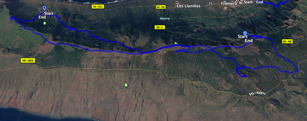
Map
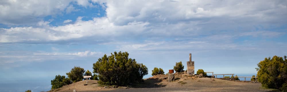
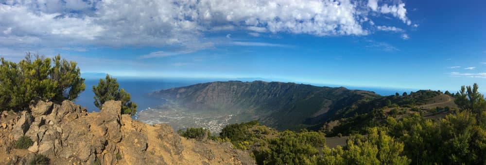
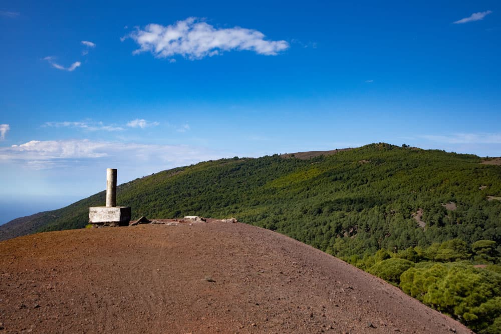
Surveying column at the summit of Malpaso - Panorama
I start with this beautiful round tour, which takes you from the northwest side of the island uphill to the plateau of El Hierro. On the other side of the ridge you climb southeast first through pine forest downhill to the well-known camping and resting place Hoya del Morcillo. From there it continues on the circular path uphill again to the ridge with the edge to the valley El Golfo. On the way you can climb the Mercadel and later the Malpaso. Back from Malpaso you follow the edge of the Camino de la Virgin with wonderful views of the wide valley around La Frontera.
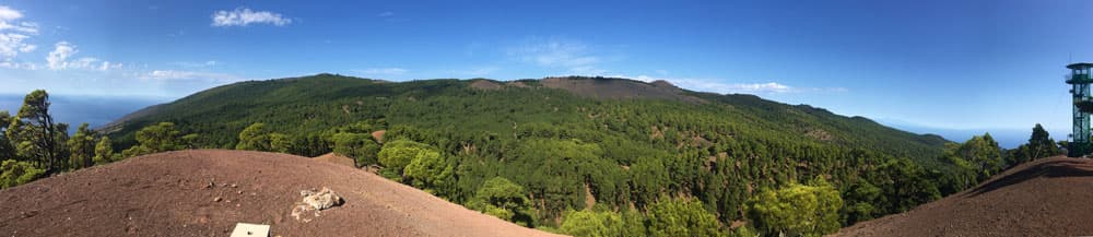
Panorama Mercandel
Camino Virgen - hinking path over the Cumbre
Malpaso and Mercadel with fascinating views
Since you first walk past the Mercadel on this tour, you have the opportunity to look up to the mountains on the plateau from there. On the other side you can see La Gomera and Tenerife in the distance. Also large parts of the wide steep east coast are at your feet. From Malpaso you have a fantastic panoramic view. Besides La Gomera and Tenerife you will also see La Palma in front of you.
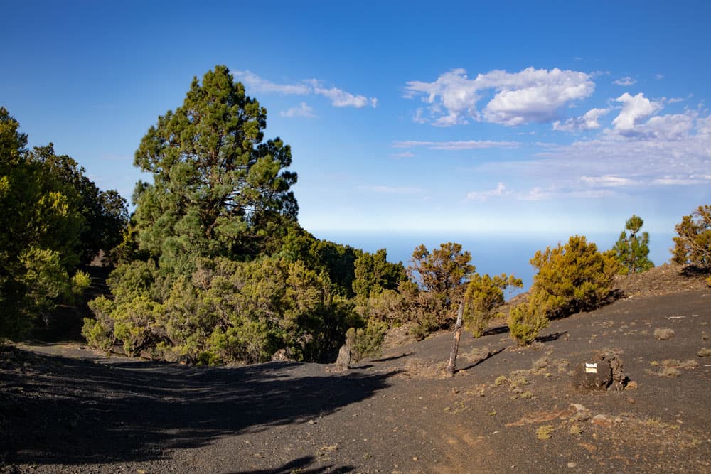
along bushes and stones - hiking way in the hight
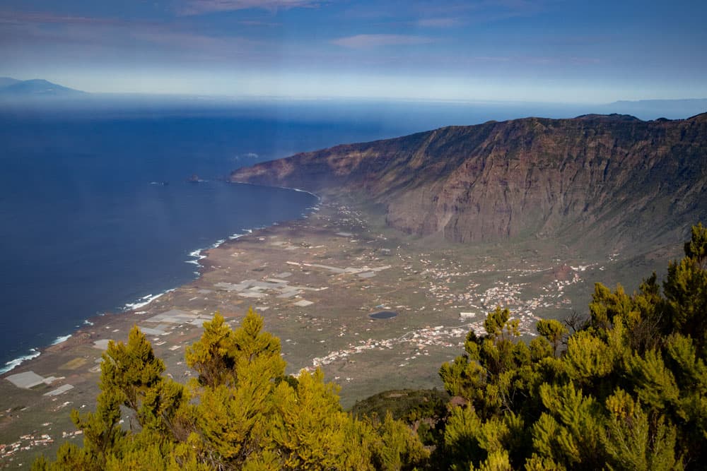
But especially impressive is the immediate view into the depth. Because at the Malpaso summit you stand practically directly at the abort edge to the El Golfo valley. Deep below you is the western plain around La Frontera. However, the ridge is also often cloudy, as the centre of El Hierro forms a kind of weather divide. However, as the clouds often only come up during the day, you have a better chance of getting a good view early in the morning. But you will not only meet hikers up there, there is also a road to Malpaso.
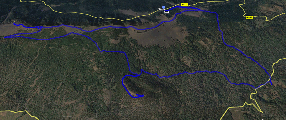
Track circular hike Mercandel - Malpaso
General information about the circular hike Mercadel Malpaso
Starting point and approach
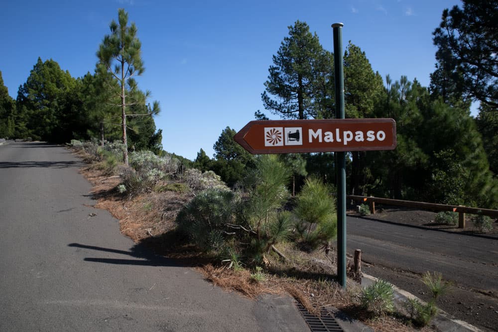
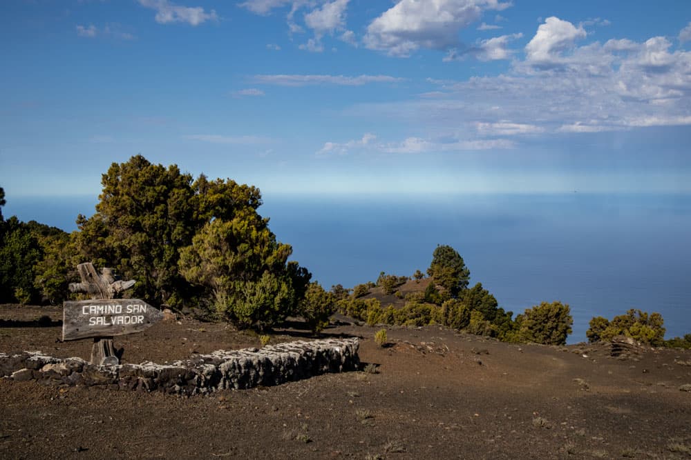
The starting point of the itinerary is the small car park on the HI-1 (road from La Frontera towards Valverde) at km 17, where there is a large wooden sign indicating the Camino de San Salvador.
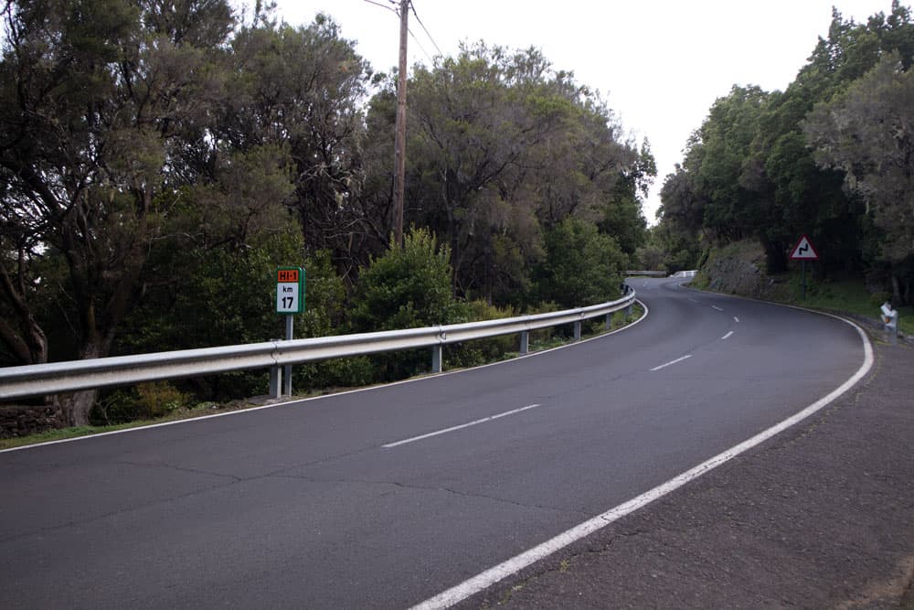
Starting point HI-1 KM 17
Access by car
By car you can easily drive from La Frontera on the HI-1. From the centre or north of the island, you can also take the HI-1 via the small island capital of Valverde and the town of San Andrés, then head towards El Golfo La Frontera. The small car park for hikers is big enough for some cars.
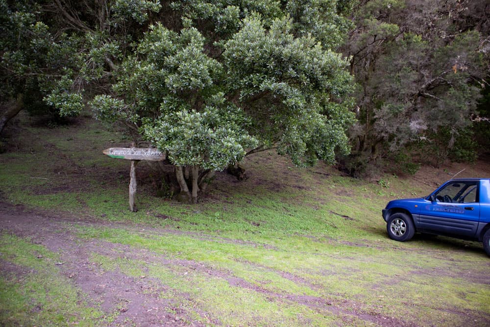
Camino San Salvador - parking at the starting point
Arrival by bus
There are some bus connections on El Hierro. But from La Frontera over the HI-1 direction Valverde there is no bus. So that you are dependent for this tour actually on a car or on a taxi.
Time
I don’t like to give general time information for hiking tours, as the times are very individual. For this quite big round tour I needed with some long breaks on the summits nevertheless nearly 6 hours.
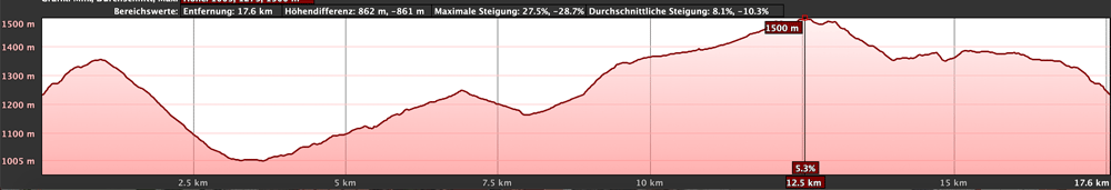
elevation profile circular hike Merendel - Malpaso
Difference in altitude and distance
The gross difference in altitude is a little less than 800 metres. And the distance is about 19 kilometres long.
Article summary and large selection of GPS hiking tracks
Sign up for my newsletter now and get exclusive access to my collected GPS tracks as well as all the brief information about my articles.
Sign up nowRequirement
Basically it is a simple hiking tour on very good hiking trails. But because of the length and some meters of altitude, a quite good condition is a prerequisite.
Refreshment
There are no places to stop for refreshments along the entire route. However, you will pass a waterhole at the foot of the Mercandel. Further water points are between Mercandel and Malpaso and at the Camino de la Virgin. Nevertheless, take enough water and food with you.
track circular hike Sabinosa - Malpaso and on the right this circular hike
Variants
This tour can be combined well with various other hiking and circular walks in the vicinity. A tour from Sabinosa to Malpaso is worth mentioning. I will publish this tour here as well. It is the counterpart to today’s round tour, as you hike large distances through the northwestern forest during the Sabinosa Tour.
Today’s tour can also be made a little smaller if necessary. You can skip one of the two mountain peaks (Mercadel or Malpaso). This will save you a lot of altitude difference and shorten the hike.
A further possibility of reduction is not to descend completely to the camping and resting place Hoya del Morcillo. Approximately 20 minutes before the campsite, a large crosswalk crosses the road. If you follow it to the right, you will come back to the circular path near the Mercandel. This will save you a little distance and a few metres of ascent and descent.
Further you can save a little distance by climbing up to Malpaso on the way back via the Camino de la Virgen described here. The path on the road (here the way out) is considerably longer.
view from the Malpaso down to the El Golfo valley
Circular hike with ascent of Mercadel and Malpaso
Hiking car park on the HI-1 up to the HI-45 driveway
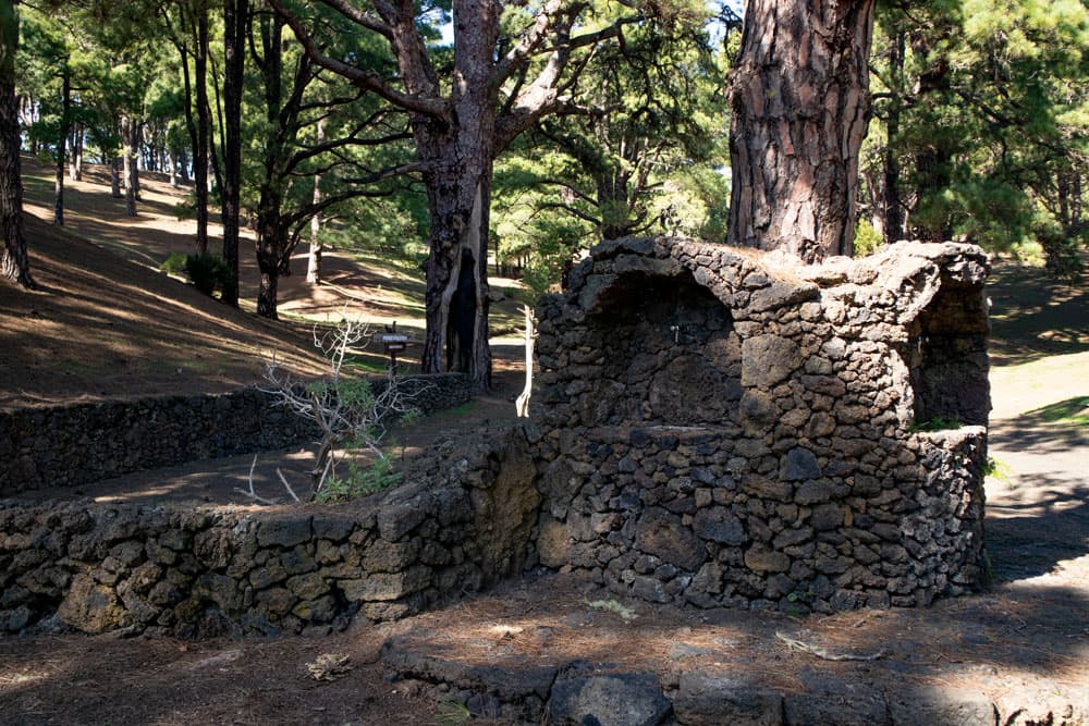
You will start your hike at the above-mentioned car park on the HI-1 at km 17. A large wooden sign indicates the Camino de San Salvador. This path comes from the bottom of the El Golfo valley. It runs between Tigaday and the Ermita de San Salvador. At your start you are already at an altitude of 1220 metres. So you follow the narrow steep path uphill through the forest. After a short time you will pass a small chapel. Very quickly you leave the forest and hike on dark volcanic soil.
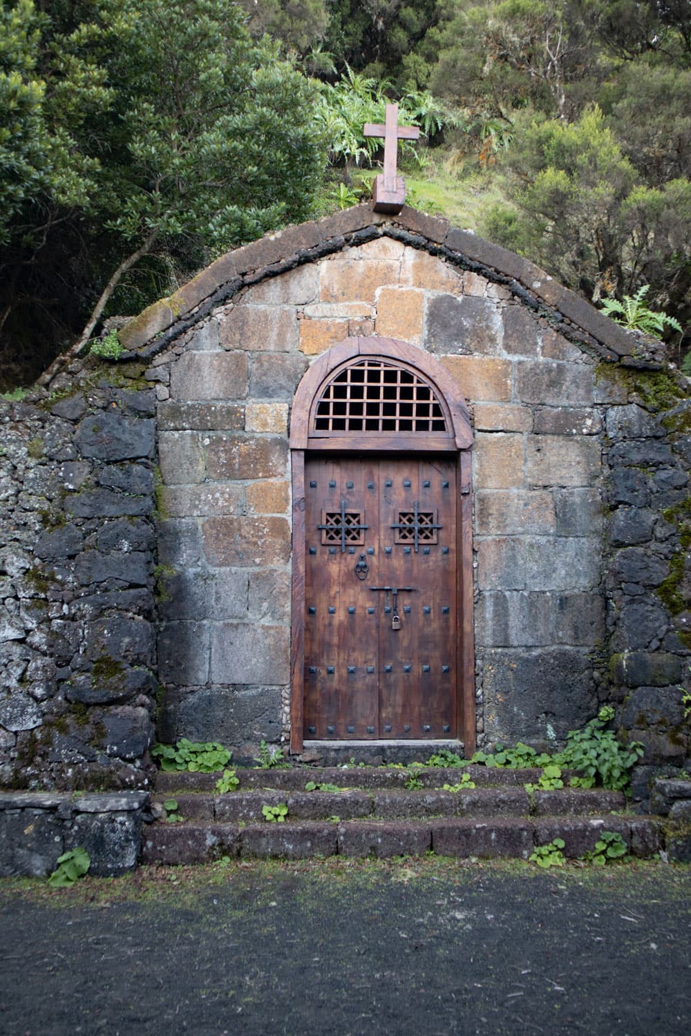
chapel at the hiking trail
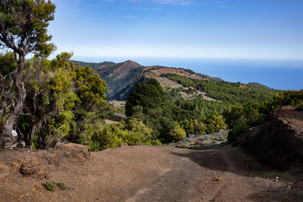
The path is well marked with stones and cannot be missed. At about 1350m you have reached the first small ascent and are already on the El Hierro plateau. The path joins the HI-45 road, parallel to which runs the Camino de la Virgen, which runs across the island from Ermita de Los Reyes to Valverde. On this road you will come back from the right. But now you cross the road and go straight ahead on the opposite side.
hiking path up to the break-off edge through pine woods
Circular Hike with Ascent Mercadel and Malpaso
Section of road HI-45 to Hoya del Morcillo
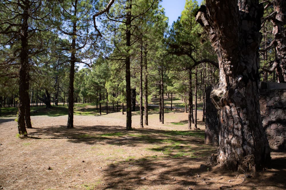
On the other side of the road and the ridge, the path takes you back to the forest on the other side of the slope after a short time. On a wide and partly washed out hiking trail you go downhill through the pine forest towards El Pinar. Over 300 metres of altitude difference you will go almost straight down through the forest for quite a while. From time to time crossways cross the main path. You ignore them. Unless you want to make the circular path a little smaller (look at the variants). Then you can follow a big crossway and come back to the roundway at the Mercandel.
Camping- and resting area Hoya del Morcillo
For all others it goes down to approx. 1000 meters altitude to the big camping and resting place Hoya del Morcillo. There you can rest a little before the long ascent. Hoya del Morcillo is on HI-40. From the point where you meet HI-40, follow the road to the right. After about 100 metres, there is a not-to-be-missed hiking trail to the right of the mountain. Follow this path.
Barbecue at the rest area Hoya del Morcillo
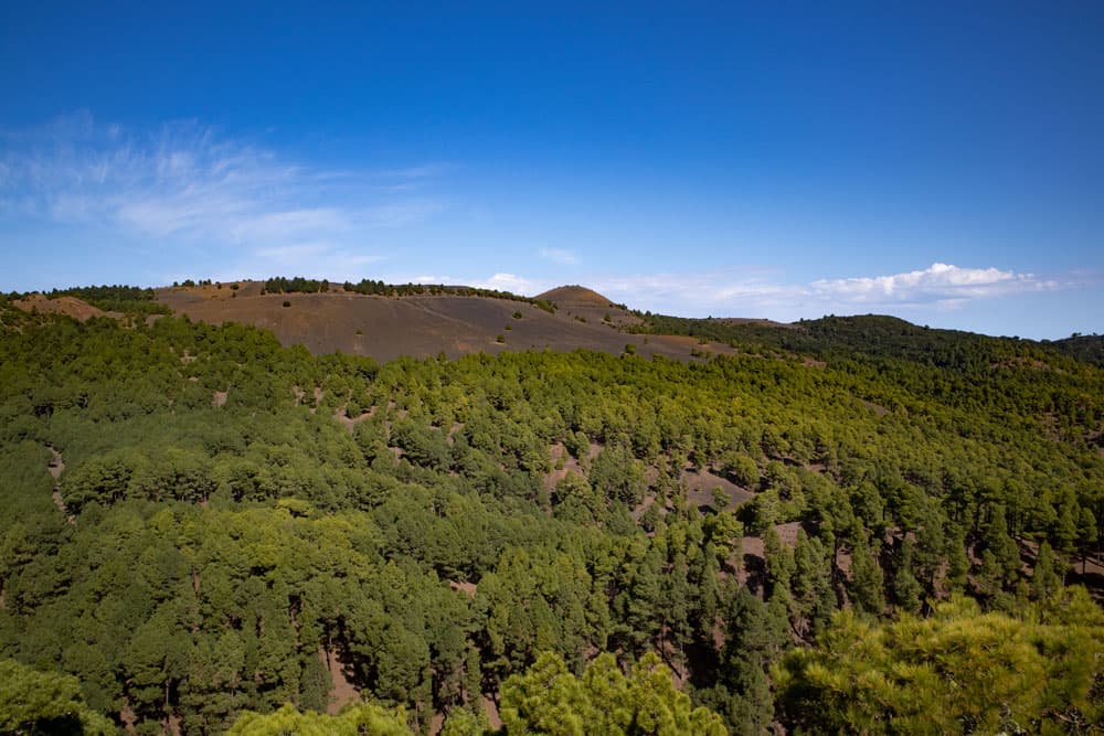
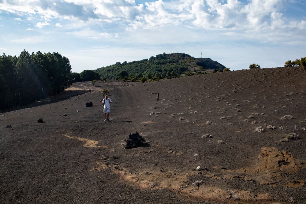
The hiking trail, which now leads you uphill again, is a wide hiking trail that cannot be missed. After a short time it meets the white and yellow marked hiking trail PR EH 1. Follow it to the left and continue uphill. For a long time it is easy to go uphill again on this path in the pine forest. At a larger fork, follow the road to the left. It goes uphill and after some time you can already see the Mercadel with the fire tower lying in front of you.
view from Mercandel to the hight with the break-off edge
Article summary and large selection of GPS hiking tracks
Sign up for my newsletter now and get exclusive access to my collected GPS tracks as well as all the brief information about my articles.
Sign up nowThe trail goes past the Cueva El Mocán. The path continues steeply uphill on the forest track. From the right, after some time, a dirt road leads into the path. Keep going straight and you will come to a waterhole where you can take water. To the right, the main road passes the waterhole and continues in the direction of Malpaso. But if you want to climb the Mercadel, go straight on.
summit column on the Mercandel
The way to the Mercadel leads you in a large long arc around the whole mountain. The path climbs and ends at the summit. Here you can walk past the fire tower to the surveying column on the ridge. From up there you have a fantastic view of the surroundings and especially of the southeast coast of El Hierro. There is also a small picnic up there.
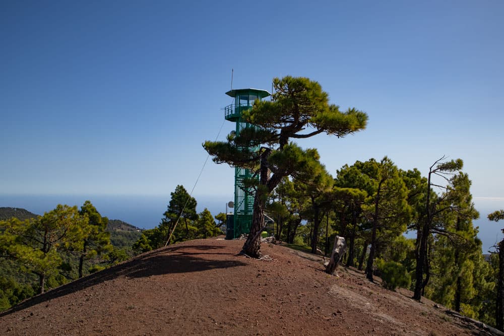
firetower on the Mercandel
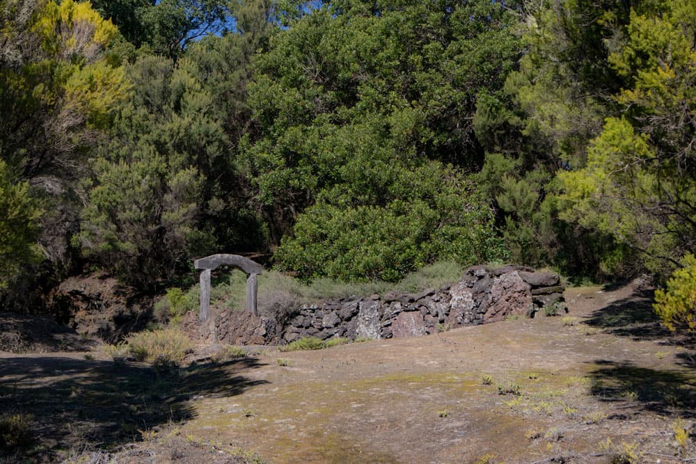
To get back to the hiking trail, take the same path around the Mercadel back to the crossroads. Now follow the trail to the left. This rises quite steeply in the next time. The trail leads you up on well marked paths in the pine forest. At an altitude of 1210 metres you reach the Fuentes del Julan (stone terrace with spring) in a left turn. From here, follow the wider road to the right.
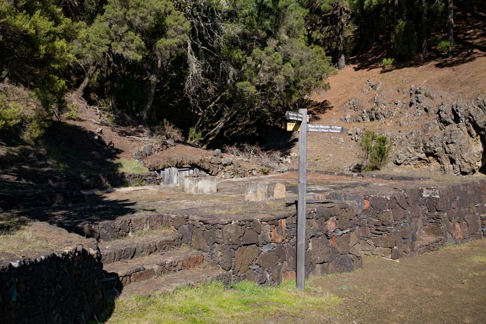
Fuentes de Julan
Fuentes del Julan section to Malpaso peak
Also this way is very washed out. But after a short time you turn left on a smaller path into the forest. After a few minutes you come to another fork. Here you also go half left and after some time you reach the picnic place Fuente de Los Reyes (1330 m altitude). There you can find water. You cross the big wide place and come back to the HI-45.
washed out roads through pine forests
There are two ways to get to Malpaso. The first option is to choose the shorter ascent via the descent route from Malpaso described here. But since I wanted a circular route, I first walked left on the road (almost no traffic). You follow the road 1-2 kilometers through pine forest. Then the road turns sharp right to Malpaso. You can follow the serpentines uphill and meet the Camino de la Virgen in the height at the edge to the El Golfo valley. Whether on the barely frequented road or the Camino – turn left uphill and you will finally reach the summit of Malpaso (1500 metres above sea level).
roadway to Malpaso
Section summit of Malpaso to Cruz de Los Reyes
At the summit of Malpaso you should take a break and enjoy the magnificent view down into the El Golfo valley. If you don’t like to follow the road uphill like I do, you can also use the return route described here for the ascent. Back from the top of Malpaso, on the Camino de la Virgen, on the plateau, you always go parallel to the edge of the abyss. At the same time you have impressive views of the surrounding area, the neighbouring islands, such as La Palma and down into the El Golfo valley.
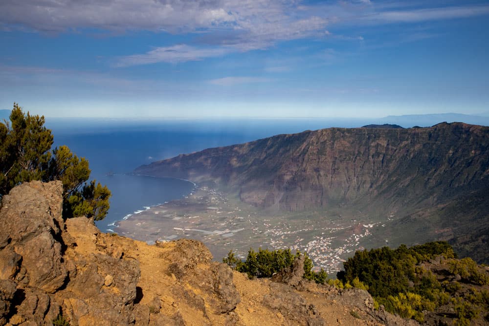
View on the El Golfo valley from the Malpaso - in the background La Palma
From Malpaso with the radio mast and the measuring station we first take the road to the next small elevation. Follow the path along the ridge and then descend steeply to meet the HI-45 again after a while. If you want to avoid the long road on the way there, you can also start your ascent to Malpaso here. Then keep to the right instead of the left for a short time and follow the Camino de la Virgin until you reach the top. Now on the way back, turn left for a short time until you reach Cruz de Los Reyes (1360m).
hiking path over the Cumbre - Camino Virgin
Cruz de Los Reyes section to behind Tenerista
The cross with altar at the Cruz de Los Reyes is unmissable. Here the path turns left again uphill (signposted Camino de la Virgin) from the HI-45. If you don’t want to follow the uphill and downhill Camino de la Virgin, you can also simply continue on the HI-45, where hardly any cars drive. At the end of the hike, you will have to walk a few more meters up and down.
Mirador Dos Hermanas - in the background La Palma
The road runs far below you. After a few ascents and descents, the path takes you around the Tenerista volcano (1417m) on the right. If you haven’t had enough, you can also climb the Tenerista on a path that branches off to the left. After bypassing Tenerista, the path descends and shortly afterwards returns to HI-45, which you follow to the left.
Camino San Salvador with dark ways
Section Tenerista to hiking car park
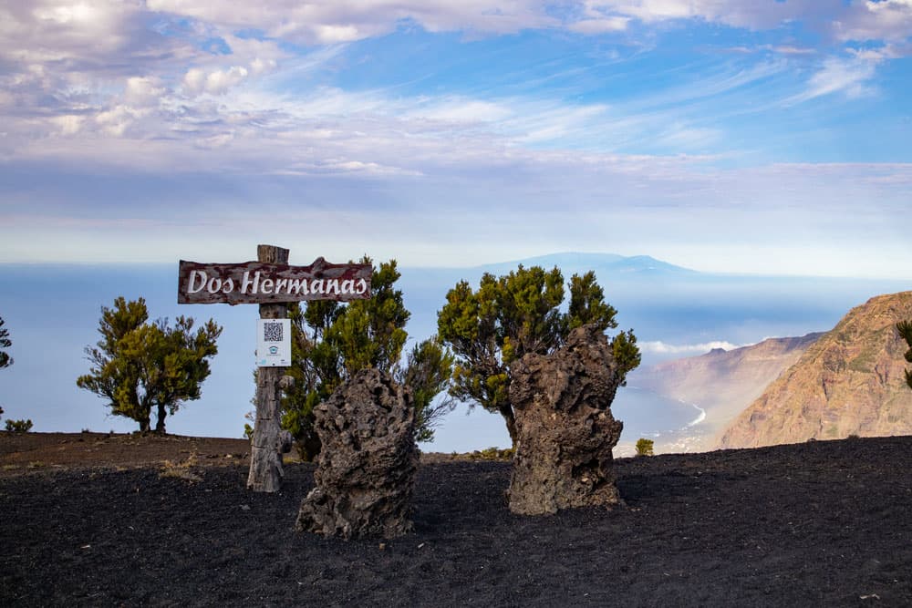
After a short time you will find a kind of small resting place with benches along the road. Here are two stones (Dos Hermanas). There is the last chance to rest in the height and enjoy the fantastic view. A little further straight ahead you will come to the spot where you hit the road from the left. Now simply follow the Camino de San Salvador down to the left again. After a short time this will take you back to your starting point, the hiking car park.
hiking path over the Cumbre from Malpaso direction North
And finally
I hope you enjoyed this great circular walk on the small island of El Hierro. If the tour is too big for you, just check out the variations to see how you can make it a bit smaller and adapt it to you. Have fun hiking,
Dagmar von SiebenInseln