El Hierro in numbers
The small island of El Hierro is the westernmost of the Canary Islands. It is also called the quiet alternative because of its remoteness. It is almost 1500 kilometres away from the Spanish mainland. There are about 10500 inhabitants and the area is 278 km². The highest elevation of the island is the Malpaso with its 1500 meters. Since the year 2000 El Hierro is a UNESCO biosphere reserve. The wish was that all energy of the island should be generated completely self-sufficient from own wind power. However, only one third of this expectation has been fulfilled so far.
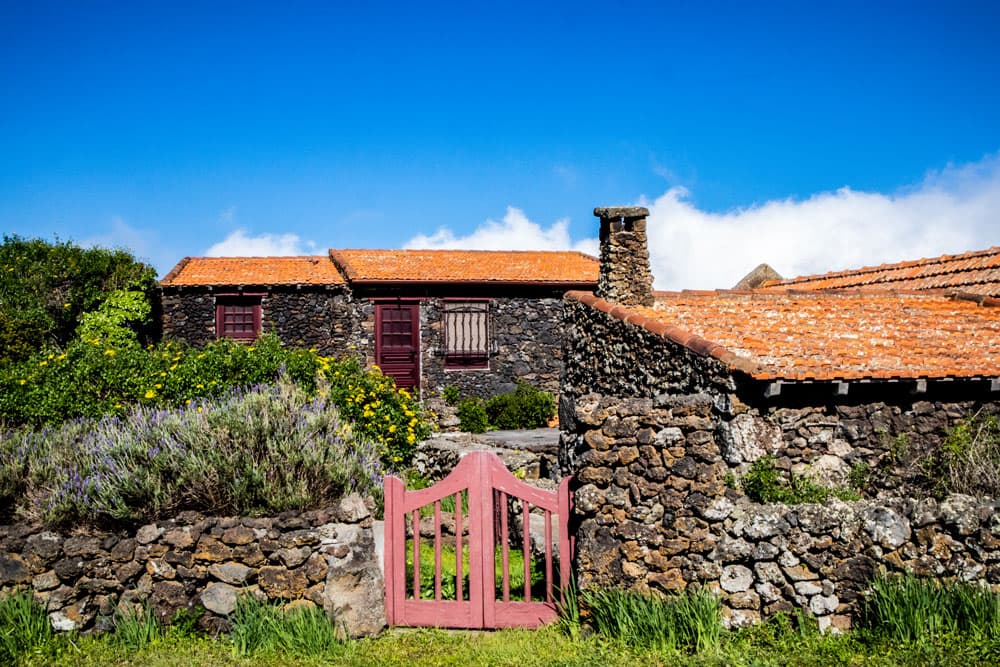
El Hierro - San André - Isora
Since 2014, however, El Hierro has been allowed to call itself a UNESCO Geopark. El Hierro is still quite young compared to the other islands with its 2 million years. The small mountain resort Villa de Valverde is the capital of the island. El Hierro is divided into the three municipalities Valverde, La Frontera and El Pinar. The harbour Puerto de la Estaca is located below the mountain village at the coast.
El Hierro - Las Puntas
Landscape and climate
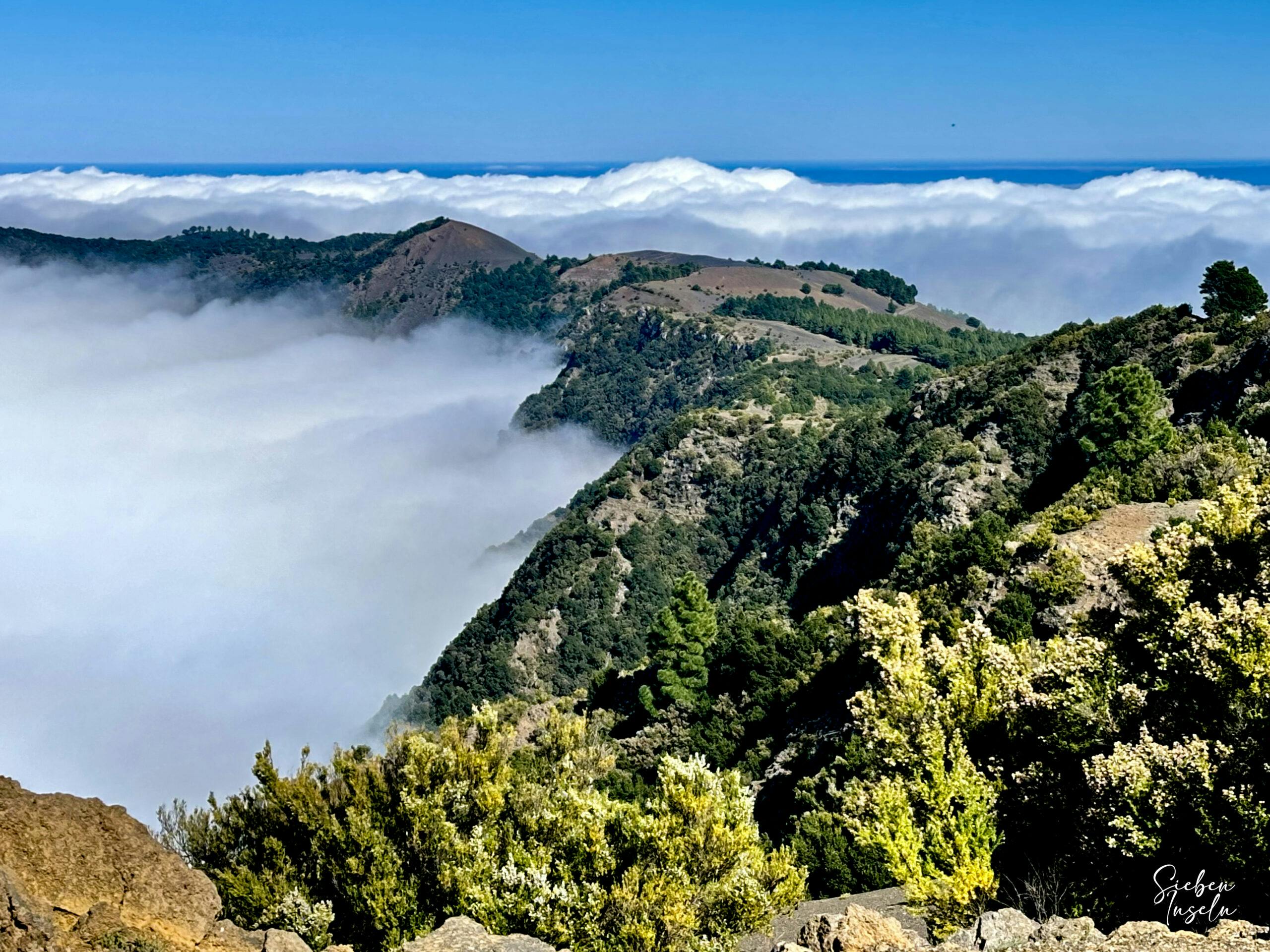
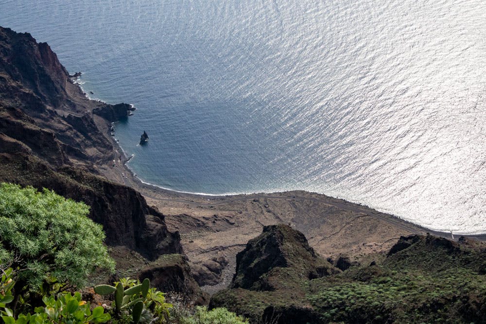
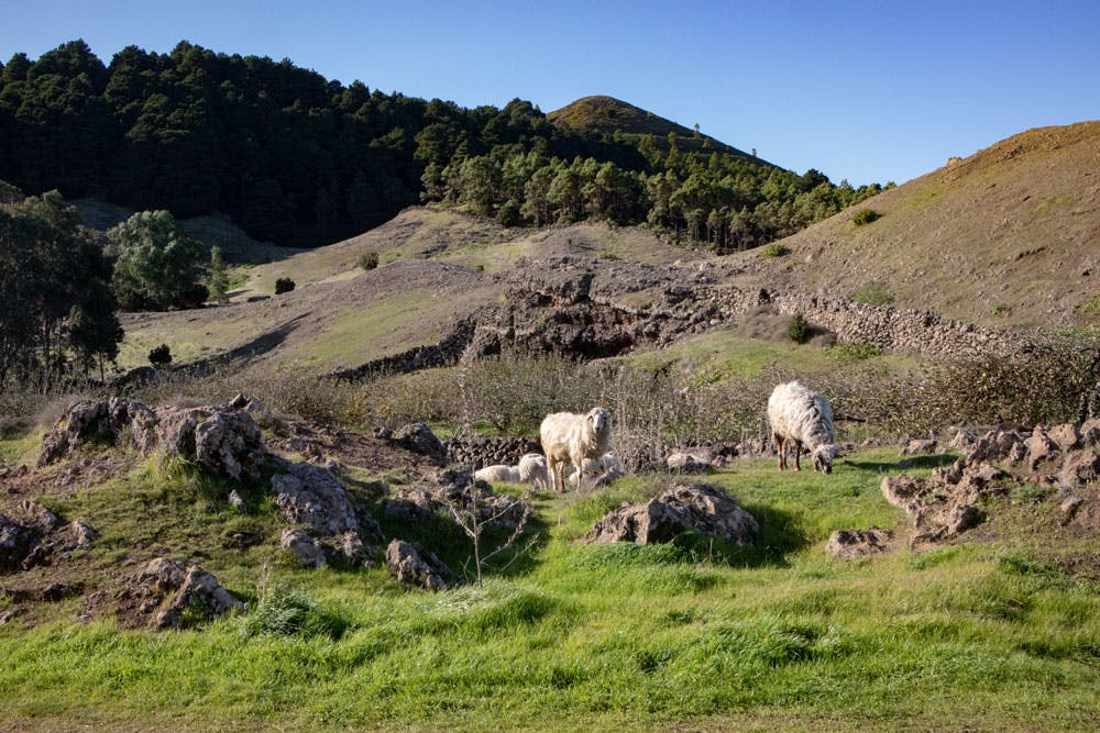
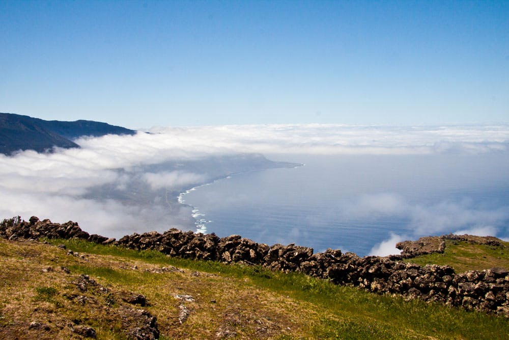
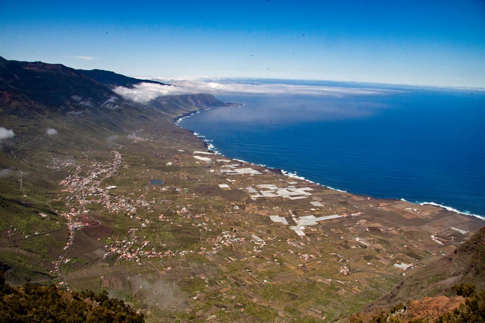
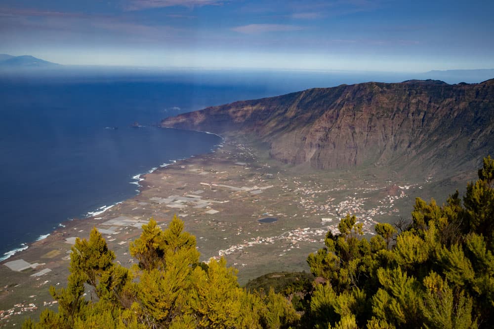
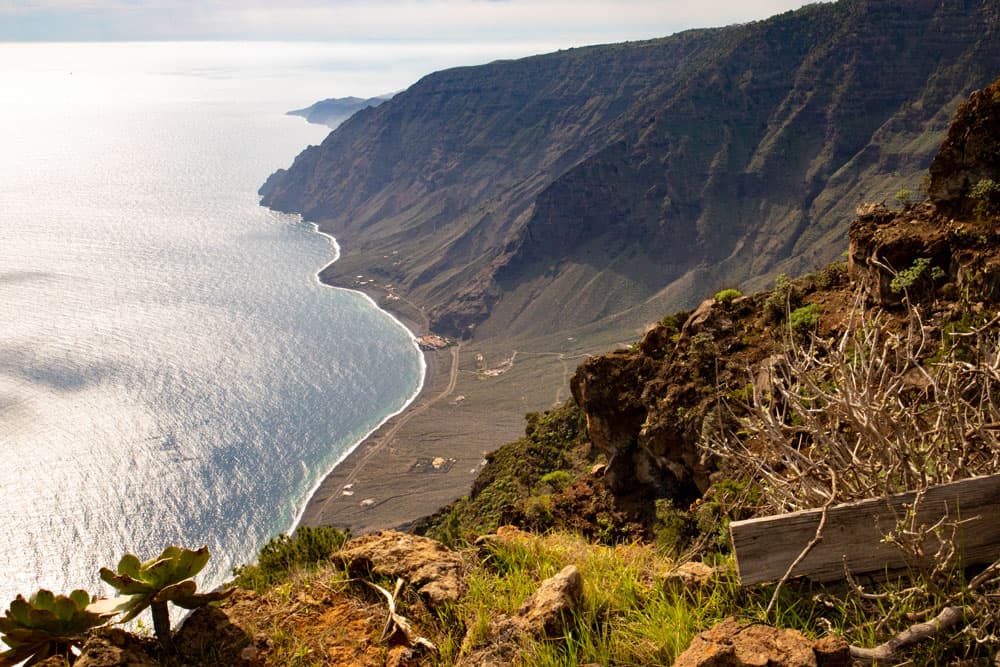
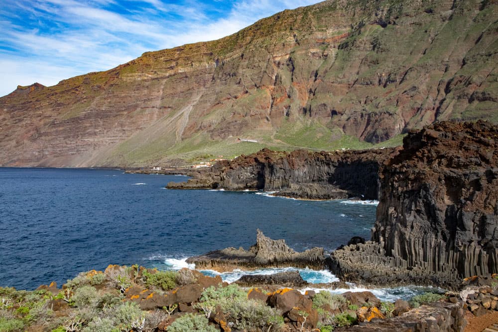
The shape of the island can be traced back to landslides, which more than 150,000 years ago caused large parts of the island's flanks to sink into the sea. The island of El Hierro has very few gorges, in contrast to the other neighbouring Canary Islands. El Hierro can be divided into the three landscapes of the plateau in the northeast, the El Golfo valley and the sloping area in the southwest of the island. And El Hierro has steep cliffs and a very fertile green highland, which is intensively used for agriculture.
Although El Hierro is so small, there is cloud forest, pine forest, large lava areas, plantations and a lot of green pastures. To the west, in the Sabinosa area, there used to be a large juniper forest. The soil in the Golfo Valley is also fertile and the climate is favourable for cultural landscapes. The northeast trade wind is the prevailing wind. It overcomes the mountains El Hierros and rains therefore preferably on the northeast side of the island. On the southwest side of the island the clouds mostly do not arrive, so that the southwest is very dry and hot. The often cloudy Cumbre acts as a kind of weather divide.
El Hierro Garoé
Transport and tourism
El Hierro is connected to the world by a regular service from Naviera Armas to Los Christianos (Tenerife) and its small island airport (flights to Tenerife and Gran Canaria). The airport and ferry port on El Hierro can be easily reached by bus or taxi. Also the roads on the small island are well developed. Since the year 2003 the new road tunnel makes the trip to the El Golfo valley much easier. Nevertheless, there is only moderate traffic on the island, so that driving a car and even hiking on the roads is really possible everywhere without stress.
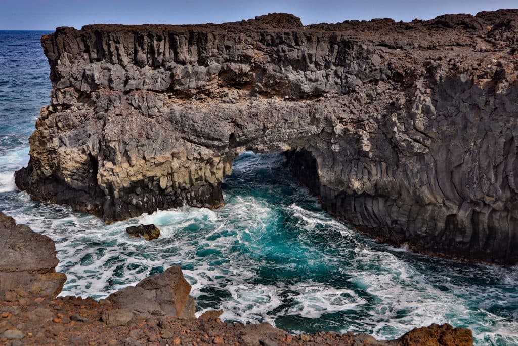
El Hierro has only a few beaches and some natural sea pools. In the south of the island near Restinga there is a well known diving area. Thus the island is largely unattractive for the all-inclusive mass tourism. But it is a paradise for hikers and those looking for peace and quiet. There are several nicely arranged view points, like the Mirador de la Peña designed by César Manrique. In the small place Las Puntas, there is the Hotel Punta Grande, that was formerly called the smallest hotel. At the steep coast of San Julian, there are old rock engravings (Los Letreros de Julan).
El Hierro Mirador Pena
History
Like the other Canary Islands, El Hierro was inhabited by ancient Canarians before the Portuguese and Spanish reached the island. Parts of the old Herreños are called Bimbacher. They could have come originally from North Africa or over Tenerife to El Hierro. Everywhere on the island there are still the council and meeting places (stone circles) of the old Canarians to see. After the Portuguese, the Spanish conquerors reached El Hierro at the beginning of the 15th century. Then the Stone Age pastoral culture was lost. But some elements, such as the type of cattle breeding, have remained until today.
Christopher Columbus also spent a few days at El Hierro at the end of the 15th century "filling up with water". In the 19th century Spain banished uncomfortable politicians to the island. El Hierro became a penal island. In the middle of the 20th century there were large waves of emigration mainly in the direction of South America due to droughts, epidemics and famines. Since the end of the 20th century, the population of El Hierro has been fighting massively against plans by the Spanish government to install civilian rocket bases or radar systems on the island.
El Hierro - Maceta
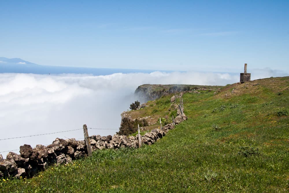
Hiking on El Hierro
More than half of the area of El Hierro is designated as a nature reserve or landscape conservation area. In order to get to know the small island capital Villa de Valverde, there are numerous walks on the plateau, but also from Valverde to the coast. In the central green highland, the Meseta de Nisdafe, there are countless hikes for every taste and in every length. You can walk gently up and down between the green meadows to the edge of the El Golfo valley. Or you can follow the old paths, which are often surrounded by walls and connect the small villages on the plateau.
In the area around El Pinar you can walk through pine forests to the Cumbre, Mercandel or Malpaso. The cliffs at El Julan or near Isora are also impressive. The volcanic area is around La Dehesa and the Restinga area. From the El Golfo valley there are wonderful hikes up to the Cumbre. If you don't want to go so far, you can take beautiful coastal walks along the partly completely new coastline at Las Puntas.

El Hierro Garoé
Also a website with many hiking tours needs its time. But little by little many more El Hierro hikes will appear here.