The Mirador de La Peña
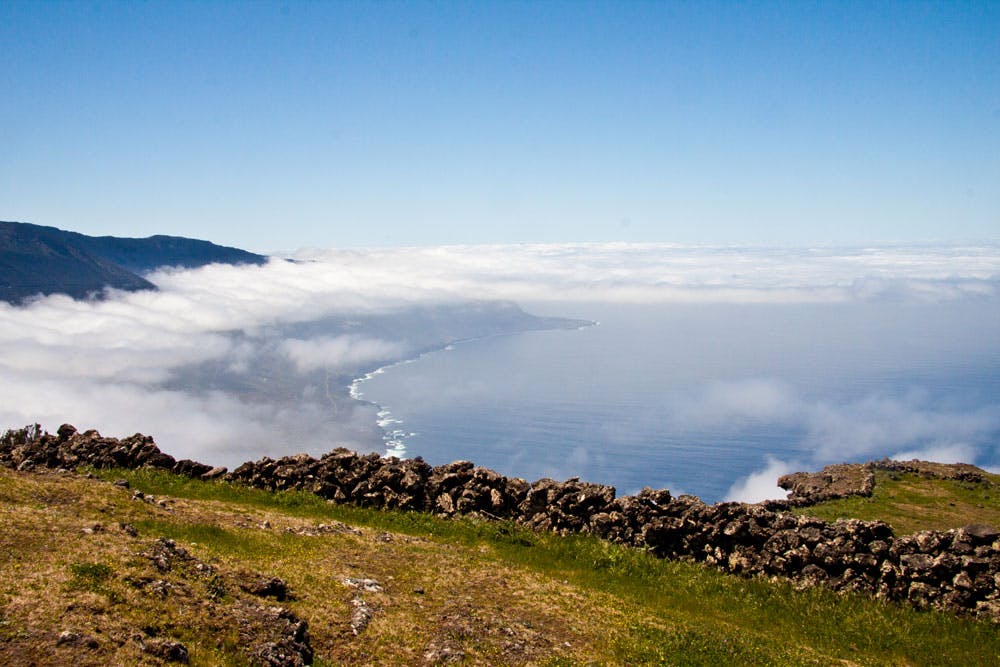
The Mirador de La Peña lies in an impressive position at 642 metres above sea level above the El Golfo valley on El Hierro. It is located near the small hamlet of Guarazoca. From up there you have a fantastic view of the wide valley deep below you.
Map

gardens around the Mirador de La Peña
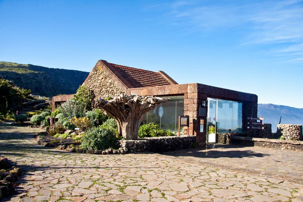
But not only the view is worth seeing. Also the whole beautiful complex of the Mirador de La Peña is worth a visit. The building with the beautiful surrounding was built by the Canarian architect César Manrique.
Mirador de La Peña
At the beginning of the eighties, he was commissioned to design the building and the gardens. In 2001, the Canary Islands government declared the Mirador a cultural monument. In designing the interiors and exteriors, Manrique placed great emphasis on incorporating his work into the landscape and surrounding nature in traditional architecture. The building consists of two floors adapted to the slope of El Risco de El Golfo.

Mirador de La Peña
Hiking on the Camino de la Peña
The Camino de la Peña of the same name also starts here at the Mirador de La Peña. This circular hike takes you on a great round trip over the Meseta de Nisdafe plateau. You walk from the Mirador de La Peña through green meadows towards San Andrés. This part of the hike takes you slowly uphill. From San Andrés you continue to the Mirador de Jinama. There you also have an overwhelming view of the El Golfo valley.
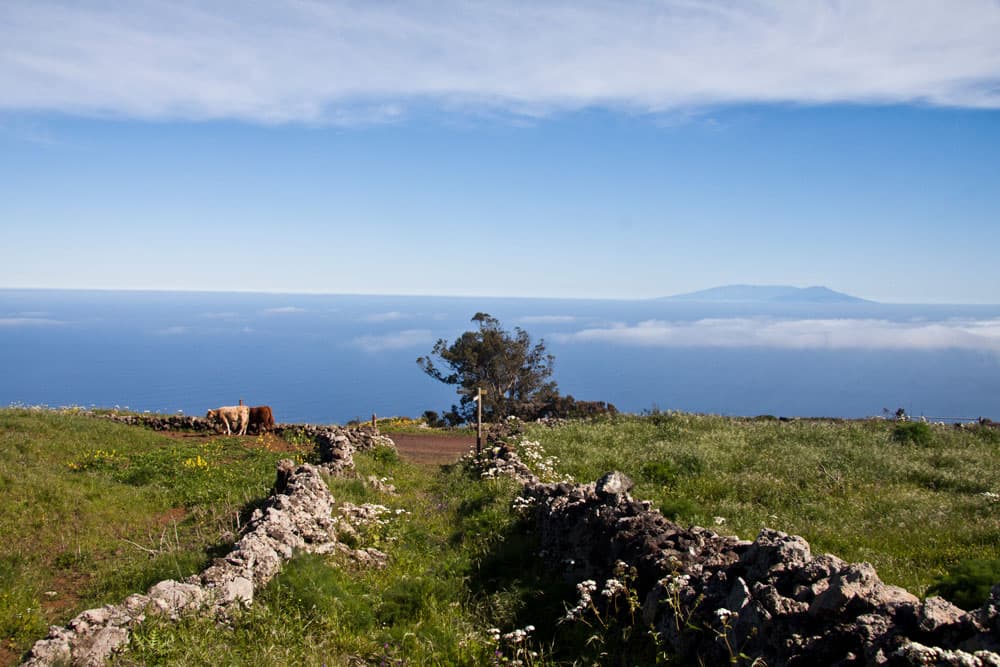
green plateau with stone walls and hiking trails
From Mirador de Jinama you slowly descend towards Mirador de La Peña. Now it gets a little more airy on the path, which often runs very close to the edge of the abyss. You can admire the El Golfo valley and the Atlantic Ocean in the depths – as long as there are no clouds – with an excellent view and close to the abyss.

Track circular hike on the Camino de la Peña
General information on the circular hike from Mirador de La Peña
Starting point and approach
Parking at the Mirador de La Peña near the village Guarazoca
Arrival by car
If you are coming from the capital Valverde or from El Golfo Valley, take the HI-5. Then take the HI-10 exit behind (coming from Valverde) or in front of Mocanal (coming from El Golfo) towards Guarazoca. Continue and pass through Guarazoca. Shortly after Guarazoca there is a sign to the Mirador de La Peña.
Coming from San Andrés, take the HI-10 towards Guarazoca, which passes the Mirador de La Peña.
Arrival by bus
Bus 05 stops directly at the Mirador de La Peña. Details can be found on the homepage. Time
I don’t like to give general time information for hiking tours, because the times are very individual. For this tour we needed a little more than 5,5 hours.
Article summary and large selection of GPS hiking tracks
Sign up for my newsletter now and get exclusive access to my collected GPS tracks as well as all the brief information about my articles.
Sign up now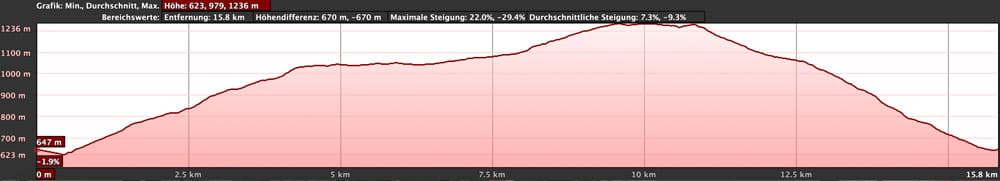
elevation profile Camino de La Peña and further on
Difference in altitude and distance
The difference in altitude is approx. 600 metres and 750 metres gross. The route is about 16 kilometres long.
Requirement and warning
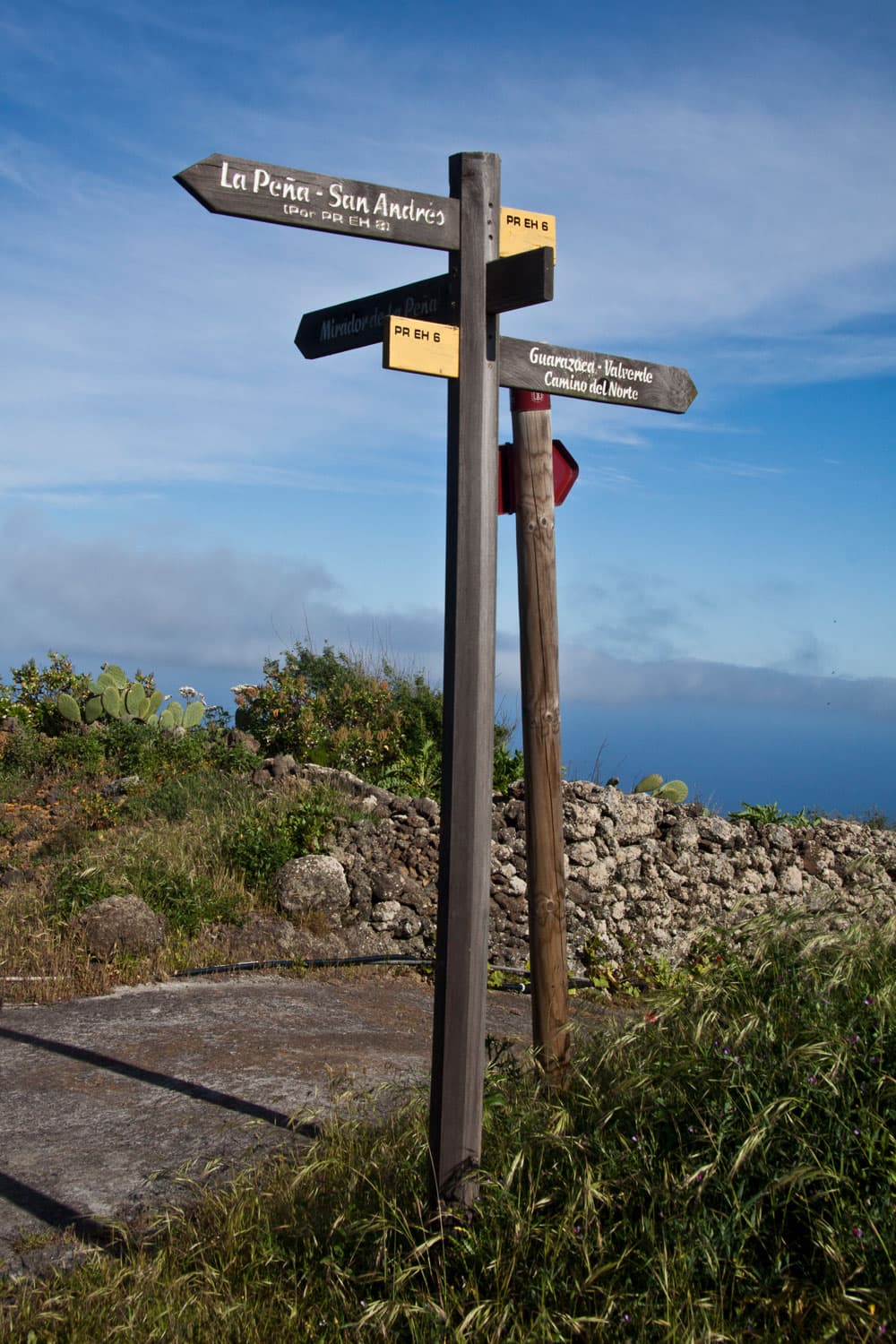
signposts PR EH 6 La Peña
The first part of the walk between Mirador de La Peña and San Andrés is an easy walk on well signposted paths. The same applies to the hike to Mirador Jinama. Necessary because of the length and the ascent, however, a little physical condition. But the part from Mirador Jinama to Mirador de La Peña is difficult. Often the way is hard to find. In addition, it goes quite close to the abort edge along.
When I went there in the year 2015, there were also many holes in the ground that have to be paid attention to. I have been told that the edge of the abutment has been severely undercut, so you should be extremely careful on this section of the walk. If the weather is bad, do not walk this section. In addition, some airy passages require a head for heights and sure-footedness. If you want to avoid this section, you can combine this tour with many other round tours in the vicinity (see variants).
Refreshment
There are restaurants and bars in San Andrés and at the Mirador de La Peña. Therefore, take enough water and food with you when you go.
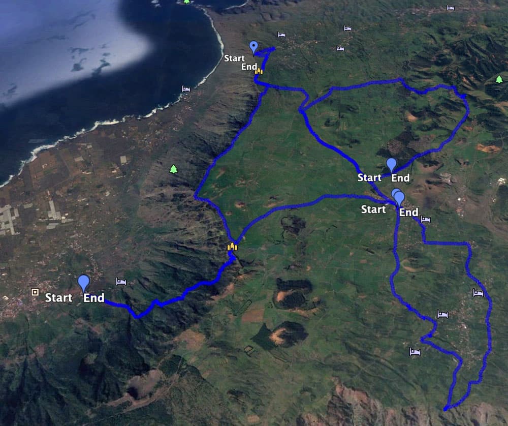
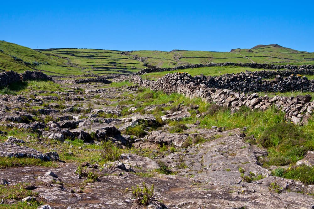
Tracks plateau El Hierro around Mirador de La Peña
Variants
This tour can be combined well with various other hiking and circular walks in the vicinity. Of course, you can also start in San Andrés or at the Mirador Jinama. Here you can find a tour from El Golfo Valley to Mirador Jinama, which you can also combine with this round tour. As you can see on the picture with other tracks, there are some more round trips on the Meseta de Nisdafe plateau, which you can combine with this tour. Especially in the small village San Andrés many beautiful hikes start. There is the circular hike on the Meseta de Nisdafe to the Arbol Garoé and the circular hike from San Andrés across the Azofa plateau. If you are unsure because of the section at the edge of the abort, you better choose a nice variant on the plateau.
white yellow sign for the hiking path
Circular walk on the Meseta de Nisdafe plateau on the Camino de La Peña
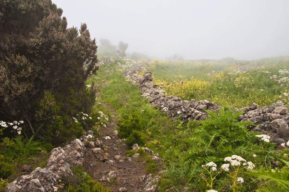
hiking path in the clouds direction La Peña
Section Mirador de La Peña to Barranco Rinne
You start your circular walk at the Mirador de La Peña. Here you should take your time before or after the hike and pay the Mirador a detailed visit. Follow the road to the right passing the Mirador. This is the Carretera del Mirador a Guarazoca. After a short time you will come to a crossroads. Here you turn right onto the Camino de Medina or Camino de La Peña. Follow it straight ahead for a very long time. You will pass a small church. Shortly after, the path turns left.
view to Tenerife from the plateau
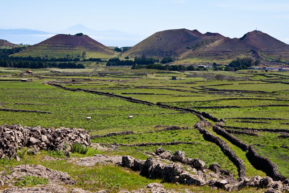
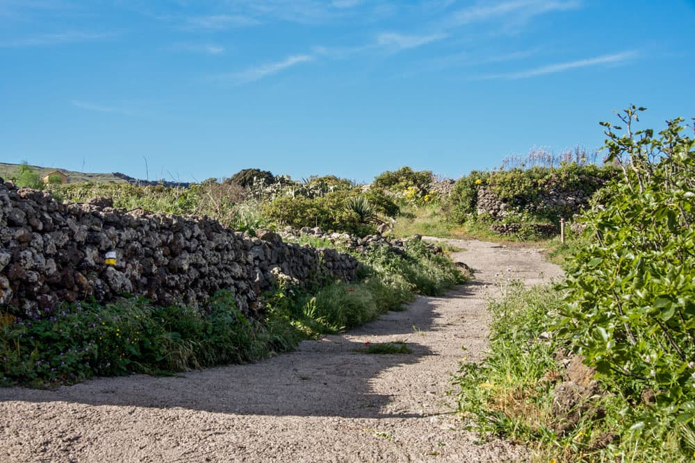
On the right side you pass your later way back. You will stay on the road for some time. Then the hiking trail branches off to the right of the road. You walk past erosion gullies. In front of a large silo, turn left on the hiking trail. Then cross a road (HI-120). Now it continues to go uphill, mostly slightly. You walk on pretty paths through a green landscape. The paths are often bordered with small dark stone walls. After some time you reach a small rocky Barranco Gully.
the green plateau from El Hierro - walls from stone
Section Barranco Gully to San Andrés
You go into the Barranco Gully, keep to the right for a short while and climb up again on the left side. The path climbs further in this green landscape, which can also remind you of Ireland. The trail later leads into a driveway. Then it joins the HI-121. But don’t worry. There is not much traffic. On El Hierro you can still walk along the road in peace and quiet. The HI-121 crosses the HI-10 and then you are already in San Andrés.
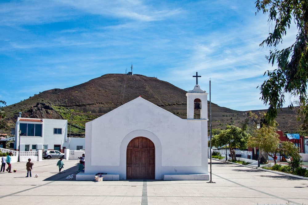
church with square in San Andrés
Article summary and large selection of GPS hiking tracks
Sign up for my newsletter now and get exclusive access to my collected GPS tracks as well as all the brief information about my articles.
Sign up nowVia Calle La Iglesia you reach the village. If you like, you can visit the village or take a break on the tranquil church square. And if you feel like it, thirsty or hungry, San Andrés also has a bar or restaurant. If you want to visit San Andrés, go back to the intersection at HI-10.

hiking path on lonely roads
Section San Andrés to Mirador Jinama
From here you do not follow a road, but turn right onto the PR EH 8 hiking trail. You walk up the path until it meets the large GR 131 hiking trail. Walk very briefly around to the left on this path. After a few metres you leave it again and keep to the right. From there you can’t miss the path anymore. You continue uphill through green meadows and fields and can enjoy the Meseta de Nisdafe plateau.

Mirador Jinama
Finally you meet the road HI-120, which leads to the Mirador Jinama. You turn left. From there you only need a short time to reach the edge of the El Golfo valley and the Mirador Jinama. From here a nice hiking trail leads down to the valley to La Frontera. You can find this route here. You can rest here and have a picnic with a fantastic view. There is also a small chapel, the Ermita de la Caridad.
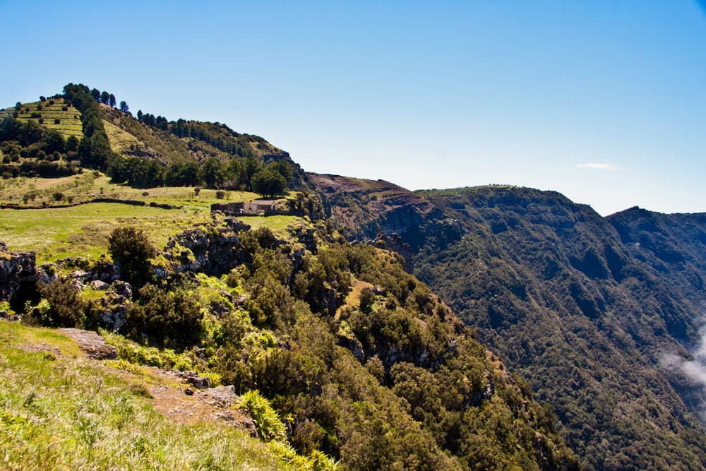
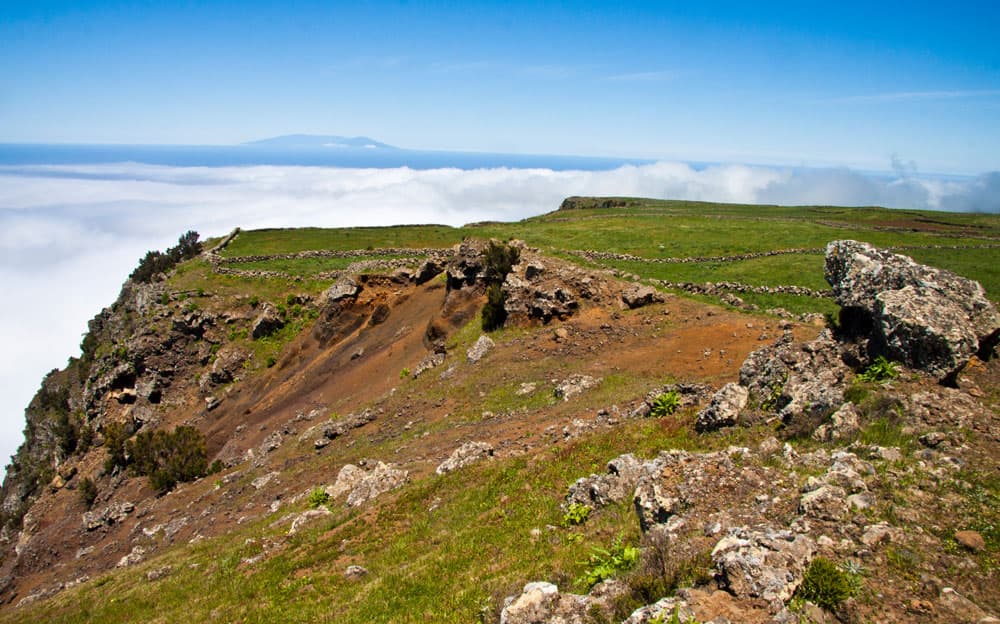
The break-off edge to the El Golfo Valley
Section Mirador Jinama to Mirador Izique
If you want to go back to the Mirador de La Peña at the edge of the abort, now comes the difficult part of the hike. You go back on the road you came on about 100 meters. Then turn left onto a road that runs right along the edge of the road. After some time this path ends at a wall. You climb over the wall and can continue to follow the path on the other side parallel to the edge.
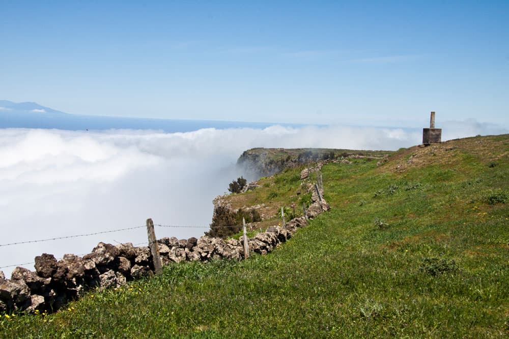
Measuring column at the break-off edge
All the time you have a fantastic view over the El Golfo valley and also over the green plateau of the Meseta of Nisdafe. Shortly afterwards you will see a survey column on a small hill in front of you. This is the Izique (1234 m altitude). You go further down the edge of the plateau and can still enjoy great panoramic views. The path is now a bit confusing and goes along stone walls and over them. Finally you come to a „corner piece“ at the edge. This is the Mirador Izique. And of course you can also enjoy the view from there.
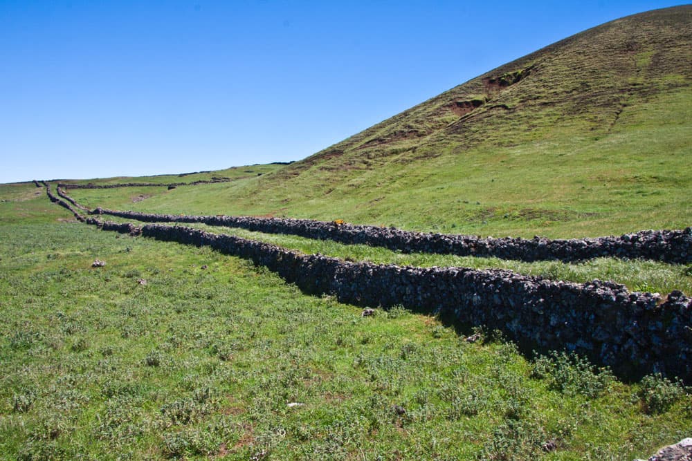
green pastures and long paths bordered by walls
Section Mirador Izique to junction hiking trail
Also the further hike gives us impressive views. But always be careful at the edge, because there are overhangs. There are some earth holes on this section that you should watch out for. You first walk to the left of the wall and later on the right side of it. After some time a path branches off to the right. If you’ve had enough of the edge, you can walk over here to the HI-120. From there it goes back to the Mirador de La Peña or San Andrés, depending on the direction.
hiking trail at the break-off edge
However, our path continues downhill along the stone wall. A short time later you will come across another surveying column (Tibataje at 1085 metres above sea level). Then we continue along the wall. As far as possible, I often avoided the right side of the wall and of course had to cross some transverse walls. A descent with small obstacles. At one point it gets particularly airy, as the path leads directly along the edge of the wall. Pay attention and don’t just enjoy the fantastic view! The path now continues down steeply parallel to the edge. Then the path branches off to the right.
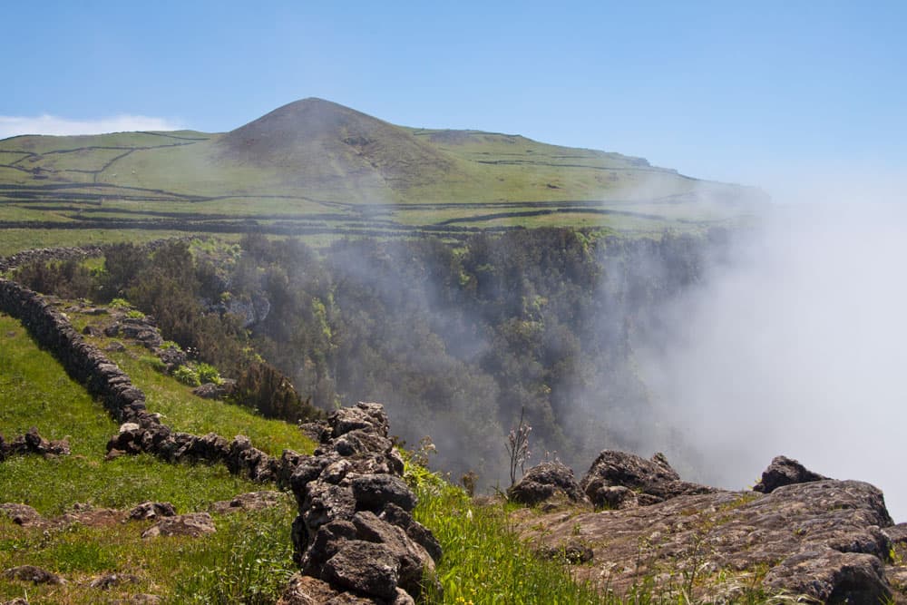
clouds over the valley, that move to the highland
Section of the route Junction Hiking trail to Mirador de La Peña
Now you leave the edge of the abort and walk between stone walls on the path that branches off to the left after a short time. Now it’s just straight ahead for you. And then you come to the point where you turned right on the way there on the hiking trail PR EH 8 to San Andrés. Now turn left.
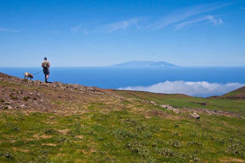
hiker with dog on the plateau direction La Peña
From here, the last piece is identical to your way out. You go straight on the Camino de La Peña for a very long time. Keep left at the bigger fork. Turn left at the next junction. And not far away the parking lot of the Mirador de La Peña is waiting for you.
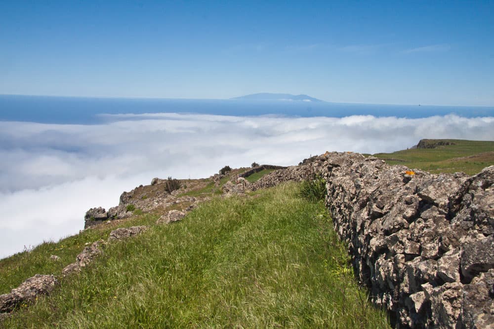
stony walls at the break-off edge to the El Golfo valley
And finally
I hope you enjoyed this great circular walk on the green plateau of the Meseta de Nisdafe. This hike on El Hierro impressed me with its diversity. But please be careful at the edge. I wish you a lot of fun on safe hikes,
Dagmar von SiebenInseln