A leisurely round trip from San Andrés to the cliffs and Isora
This short circular walk starts in San Andrés and takes you over the plateau of Azofa to the eastern cliffs of El Hierro and Isora. You’ll hike along well-maintained paths, driveways and caminos through lonely villages.
Map
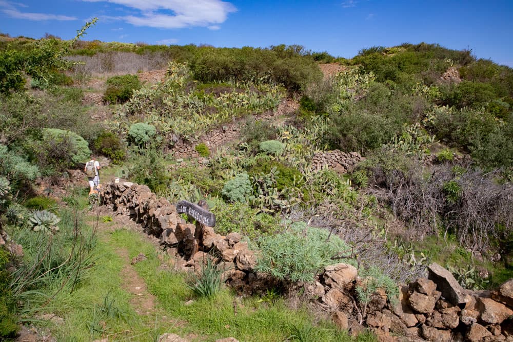
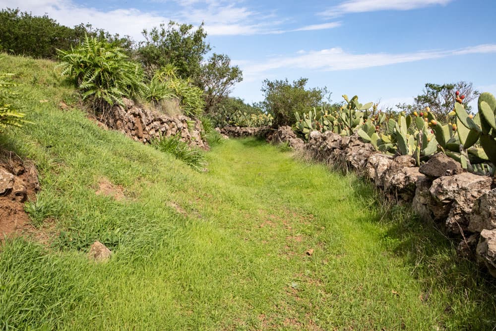
Hiking trail through a lot of green along the steep coast near Isora
San Andrés is the highest town on El Hierro with its 1045 metres of altitude. Here you can stop at one of the bars before or after your walk and have a look at the tranquil life on the plateau.
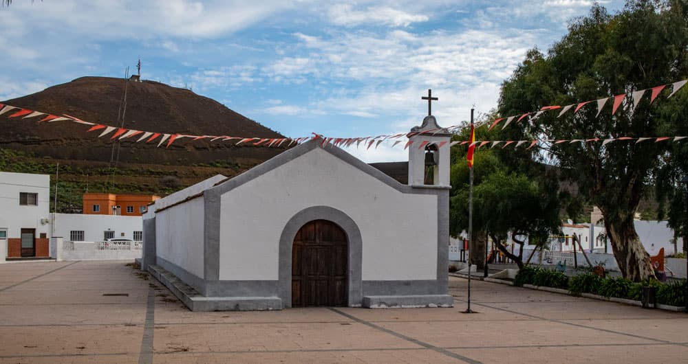
Church and church square of San Andrés
The central highlands of El Hierro consist of the Meseta de Nisadafe and the Meseta de Azofa. Both plateaus consist of pastures, meadows and small volcanic domes. The farmers are engaged in livestock farming, arable farming and fruit growing. While in the west the steep cliffs descend to the Gulf Valley (see also hike Mirador de la Peña), in the east you reach the steep cliffs descending to the coast. You will visit these on this hike at the Mirador de Isora. 
Old stone houses and wild orchards along the way
San Andrés offers countless hiking possibilities
On this tour you will walk down from the capital of the San Andrés plateau to the very original village of Isora. From there you can make a detour to the edge of the cliffs and enjoy a fantastic view of the bay of Las Playas and the Atlantic Ocean. If the round trip is a little too small for you, San Andrés also offers a lot of hiking possibilities. Because in San Andrés many hiking trails converge. I already described two hiking tours that go over San Andrés on seven islands. You can read more about this under variants below.

Track of the hike San Andrés to Isora
General information about the circular walk San Andrés
Starting point and approach
Starting point is the main street or one of the side streets in San Andrés.
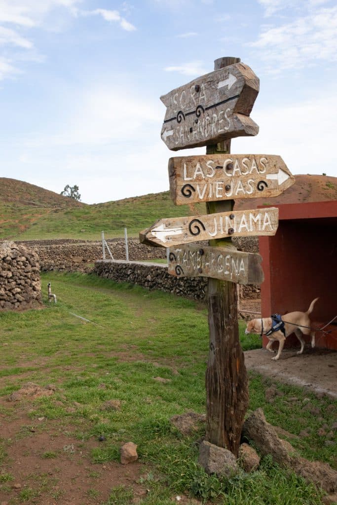
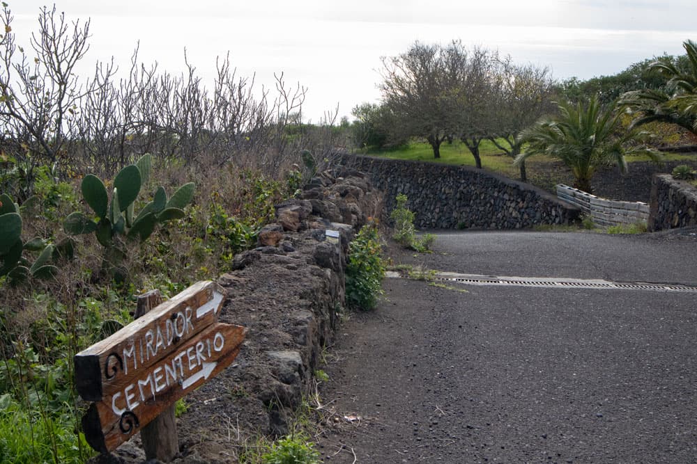
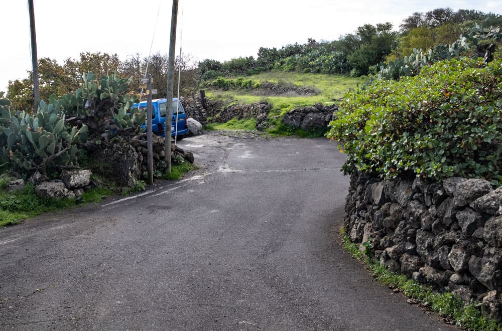
Hiking signs on the wayside
Arrival by car
Depending on which side you drive to the plateau from, you can reach San Andrés via the HI-1, HI-4 or HI-10. You can park on the main road or on the secondary roads.
Arrival by bus
Bus lines 2 and 5 stop in San Andrés. You can find more information on the Transhierro homepage. Time
Article summary and large selection of GPS hiking tracks
Sign up for my newsletter now and get exclusive access to my collected GPS tracks as well as all the brief information about my articles.
Sign up nowI don’t like to give general time information for hiking tours, because the times are very individual. We needed 3.5 hours for this hike with an extensive rest at the steep cliffs.
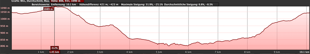
Elevation profile of the hike from San Andrés to Isora and back
Difference in altitude and distance
The difference in altitude is about 380 meters. The distance is a little more than 10 kilometers long.
Requirement
An easy hike that can be easily mastered by anyone with a little physical condition.
Refreshment
Bars/Restaurants can be found in San Andrés and Isora. So take enough water and food with you for the walk.

Tracks of walks around San Andrés - all on seven islands to find
Variants
This hike can actually be combined well with many other hikes and circular walks in the vicinity. Here are two hikes that I have already introduced here on seven islands and that both also lead over San Andrés: Circular hike on the Meseta de Nisdafe to the Arbol Garoé and circular hike over the Mirador de La Peña. 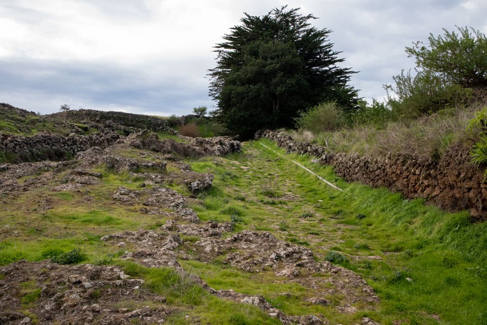
Hiking trail in front of the Montaña de las Rosas
Hike from San Andrés to Isora
Section San Andrés to Camino del Cercado
You start your walk in the main street of San Andrés in the Calle de Jarera. On this street (also HI-1) go west (direction La Frontera) until you reach Calle las Rosas, where you turn left. For a short time you will pass the last houses of San Andrés. Then you are on the open field. After a short time the path forks. You continue straight ahead. The street is now called Calle las Rosas de la Cuesta. Follow it straight ahead for a very long time and ignore all paths turning left and right.
Hiking trail between green meadows and fields
Then the road turns sharp left. However, the path continues straight ahead along a wide cobbled path. You cross a Barranco gully and then follow the path uphill. It takes you to a hill next to the Montaña de las Rosas. At the back of the mountain you walk through green meadows and pastures. Then you meet a road (Camino del Cercado). Continue straight ahead along this road. Follow it for a very long time straight ahead through meadows and pastures. Traffic is almost non-existent.
Hiking path junction in front of Tajace de Abajo - road or green hiking path? You have the choice
Section Camino del Cercado to Isora
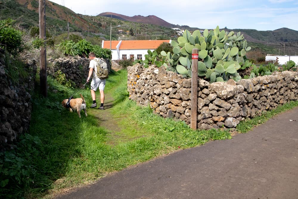
After passing some houses on the left side of the Camino del Cercado, a small path branches off to the left. This will take you back to the road after a short while. This is Calle Tajace (HI-401). Turn right onto this street and pass some houses that already belong to the village of Tajace de Abajo. Next to the road there are some alternative paths that will take you back to the road. After a short time you will reach the pretty but lonely hamlet.
treet to Mirador de Isora
Article summary and large selection of GPS hiking tracks
Sign up for my newsletter now and get exclusive access to my collected GPS tracks as well as all the brief information about my articles.
Sign up nowYou keep walking on the main road. Then turn left into Calle Ferinto. Follow it downhill for a while. You can already see the village Isora lying in front of you. The large football field of Isora is also conspicuous. The hiking trail will take you past it after a while. Then you come to a street where you can turn left and continue to the centre of Isora. If you want to look at Isora and extend the tour a bit, you should first turn left. To the steep cliffs it goes however right around.
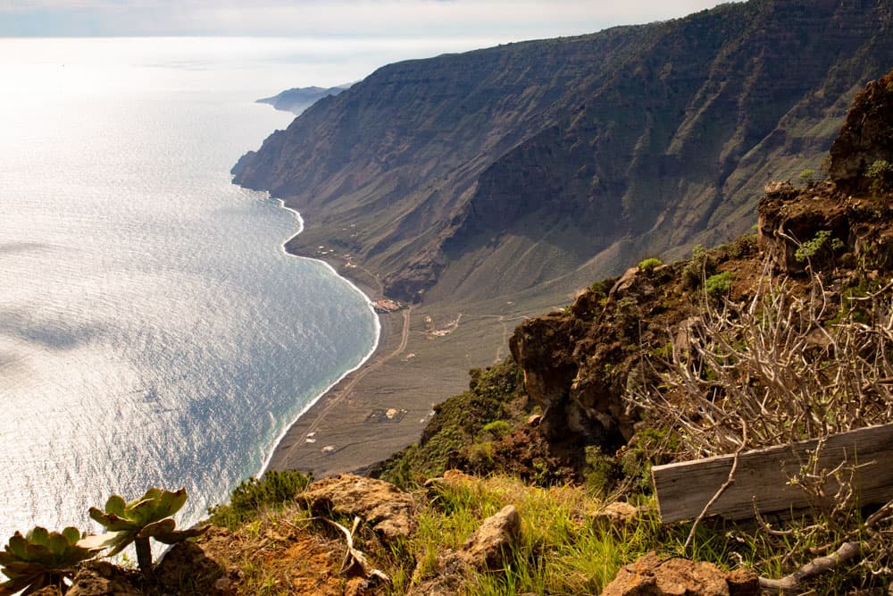
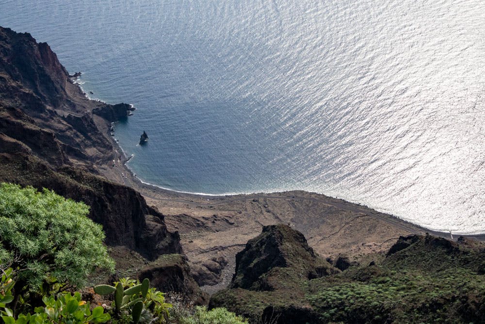
View of the cliffs over Las Playas
Section Isora to Barranco Channel
If you follow the main street of Isora at the football stadium to the right you are still on Calle Ferinto. Here you go straight on for a while. You can’t get lost. The road ends at Mirador de Isora. Here you should plan a rest. Beside the fantastic view of the bay of Las Playas and the coastline of El Hierro, there are many comfortable seats and even toilets. Once you’ve seen it all, you’ll continue on a small hiking trail along the steep coast.
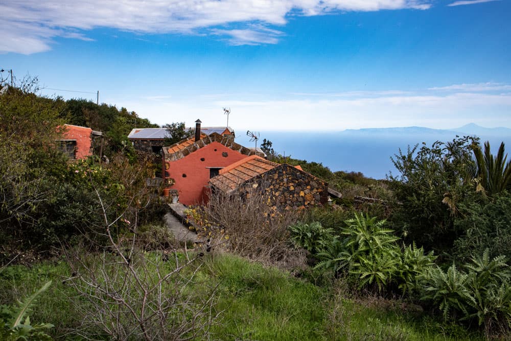
Stone houses near Isora - in the background La Gomera and Tenerife
Next to the road you came on there is a radio mast. There the hiking trail PR EH 3 runs along the coast. For a short time it goes directly and later parallel to the edge of the abort. At a fork you follow the main path, which turns left away from the steep coast. Also ignore other branches and keep straight on the main path. But then you come to a fork where the main path goes down to the right along a Barranco channel.
Hiking trail close to Isora
Section Barranco Channel to Los Llanos
Later the path climbs again to the left. You walk through a lot of green and a beautiful landscape. In the distance you can see the neighbouring islands La Gomera and Tenerife. Then you reach a road in Isora (Calle de Tomperez). If you haven’t made a detour to Isora before, you now have at least the opportunity to get to know the lower parts of Isora. Calle de Tomperez crosses Calle los Valles Echedo. Continue straight ahead and ignore all the other branches.
green hiking path below La Cueva back to San Andrés
Continue straight ahead through Isora, from where you can admire the typical old stone houses. Calle de Tomperez changes to Calle Jirdana after a very long time. But you also continue straight ahead on this street. There are still pretty stone houses along the way. At a fork in the road, follow Calle los Llanos to the left. In the district Los Llanos of Isora keep straight on. You will pass a pretty square that invites you to take a break.
Hiking trail on small, barely frequented roads
Section Los Llanos to San Andrés
When you have finally left the last houses of Los Llanos behind you, Calle los Llanos turns into a hiking trail along the slope. This will take you up below the coastal road to the small hamlet of La Cuesta. There the path leads into Los Castaños street. This road joins the main road Calle La Cuesta, which you cross. On the other side you pass two houses on Calle Jirdana. After the second house, the path turns left uphill.
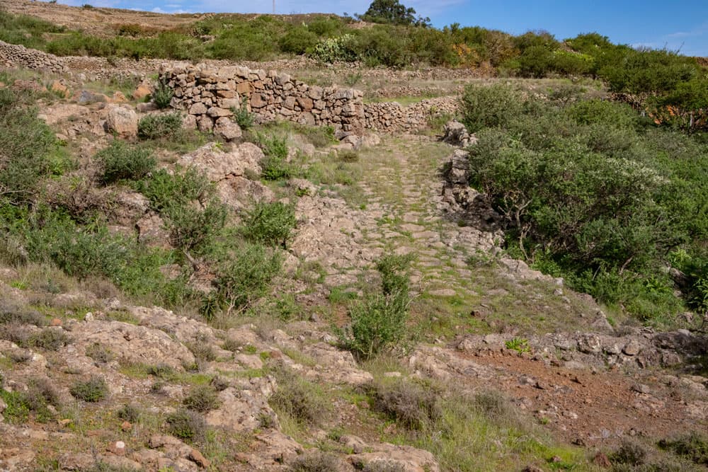
Hiking trail San Andrés - Isora over old cobbled Caminos
On the path Calle las Rosas a la Cuesta (PR EH 4), which is marked white and yellow, you go up steeply. Later the trail flattens out a little. When you arrive at the first houses of the hamlet of Las Rosas, the path branches off to the right before the first house. This path takes you back towards San Andrés. You will reach the street Calle Jarera Bajo, which you follow uphill. At the end you have a long ascent through the city until the street Calle Jarera Bajo brings you back to the main street and thus to the starting point of the hike.
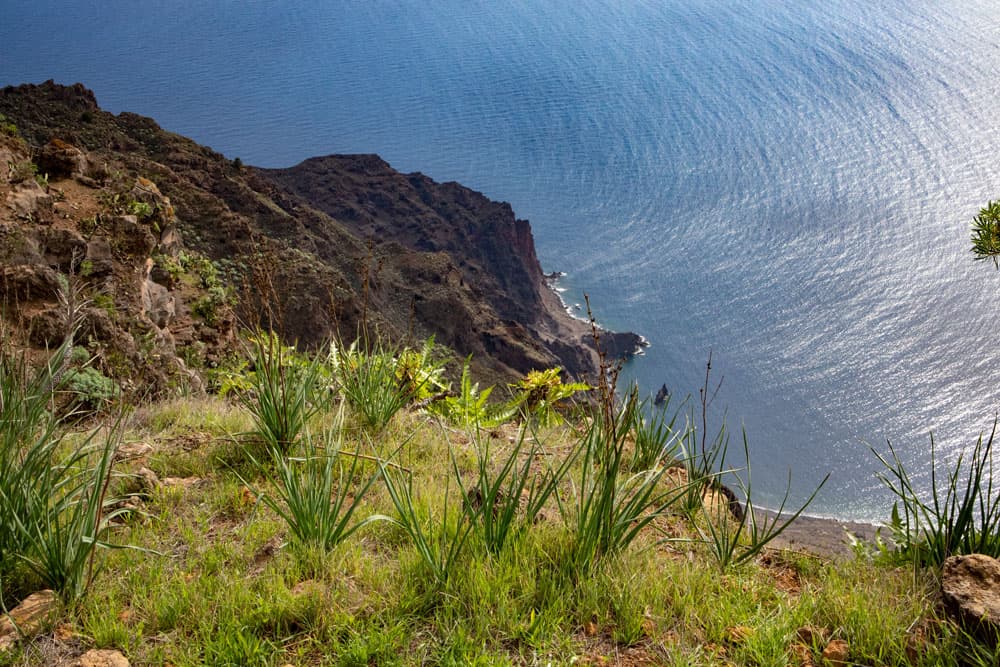
View from the steep coast into the depths
And finally
I hope that you enjoyed this small but really beautiful tour on the plateau Azofa of El Hierro.
I wish you lots of fun on all your hikes,
Dagmar von SiebenInseln