Small hiking tour through green vegetation to Arbol Geroé
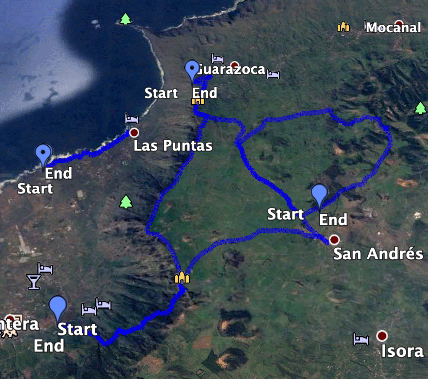
The small Arbol Garoé circular walk starts near San Andrés. It takes you to El Hierro in the moderate up and down over the Meseta de Nisdafé plateau. The trail also takes you to the Arbol Garoé Visitor Centre.
Map
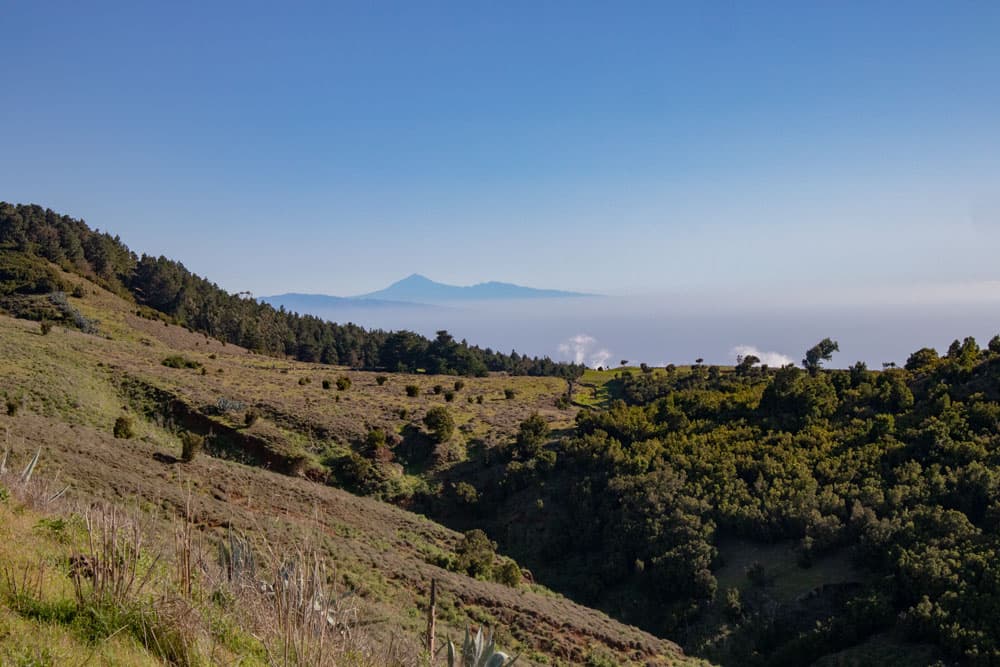
View from El Hierro to Tenerife with Teide and La Gomera
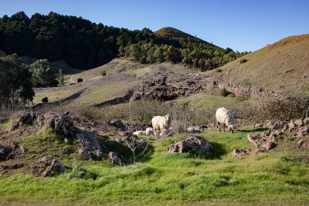
You walk through green hills and volcanic landscapes, through eucalyptus forests, past pastures and small hamlets. In the hamlet of Las Montañetas you can see typical old Canarian houses. A wonderful round trip to get to know the centre of the Meseta de Nisdafe.
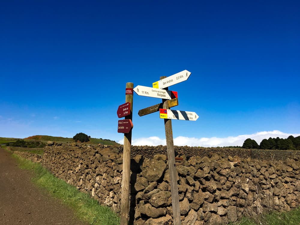
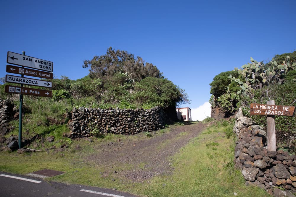
post signs on the circular Arbol Garoé
From time to time, however, the plateau is surrounded by clouds, which can take your view away. The reason for this cloud formation is the trade winds, which also press the clouds against the steep slopes on El Hierro, which then condense in height. They drip off the plants and the water seeps into the ground. The principle is called horizontal precipitation. The high humidity, however, means that you will find a green landscape full of vegetation on El Hierro. This also ensures the survival of the lush laurel forests on the Canary Islands.
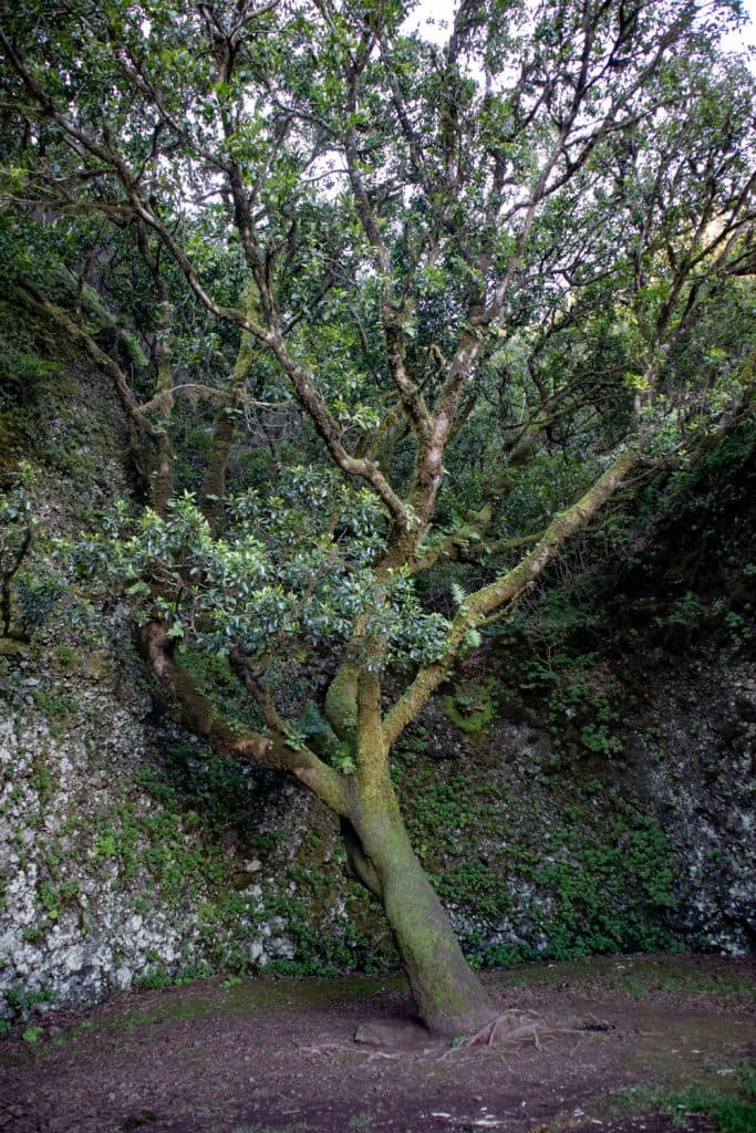
Arbol Garoé today
What is the Arbol Garoé now?
Today’s Arbol Garoé tree is one of the Madeira Laurel trees (Ocotea Foetens) and also has the ability to absorb moisture from the air. But the original Garoé is said to have been unique on the whole island and is called a holy tree. However, it was blown over by a hurricane in 1610. Since it supplied the inhabitants of that time with water, its loss was a catastrophe for them. The Spanish king probably didn’t take the request for remedy seriously, as the inhabitants spoke of a holy tree.
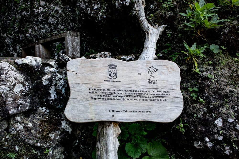
information board about Arbol Garoé
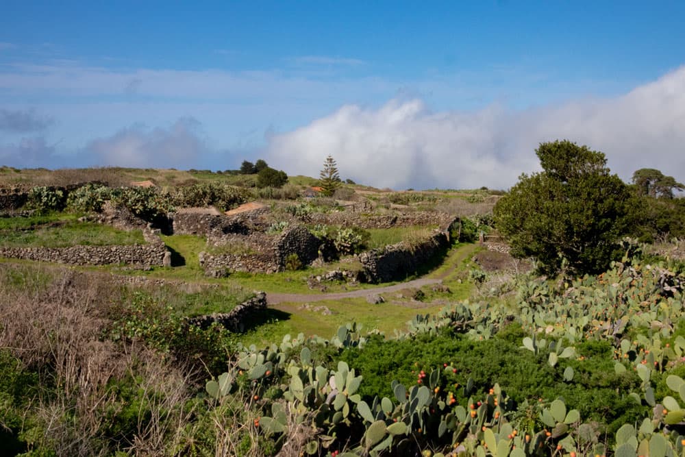
Many inhabitants of El Hierro are said to have died of thirst as a result. A century ago, the current stink laurel tree was planted on the site where the Arbol Garoé stood. Around the tree and in the area where it can be found, you can also visit numerous water depressions (albercas) that are still important today for the water supply of the vegetation. In the visitor centre you can not only visit the Garoé, but also see how the natives of the island got their drinking water. This station is part of a 15 kilometre trail that aims to show the importance of water for El Hierro.

Circular Hike Arbol Garoé
General information on the Arbol Garoé circular walk
Starting point and approach
At the HI-10 near the village of San Andrés there is a small car park for hikers. The place is called Raya Cuatro Esquinas. Here you start the hike. There is already a sign to the Arbol Garoé.

Raya Cuatro Esquinas - starting point
Arrival by car
Depending on from which side you drive to the plateau, you can reach San Andrés via the HI-1, HI-4 or HI-10. From there it is about 1 kilometre on the HI-10 to the starting point of the hike. If you arrive on the HI-10, stop about one kilometre before San Andrés.
Article summary and large selection of GPS hiking tracks
Sign up for my newsletter now and get exclusive access to my collected GPS tracks as well as all the brief information about my articles.
Sign up nowArrival by bus
Bus lines 2 and 5 stop in San Andrés. You can find out more on the Transhierro website. Time
I don’t like to give general time information for hiking tours, as the times are very individual. For this small tour we needed just over 3 hours to visit the information centre.

Elevation profile Circular Walk Arbol Garoé
Difference in altitude and distance
The difference in altitude is approx. 350 metres. The distance is scarcely 10 kilometers long.
Requirement
An easy and for everyone with a little stamina easy to master tour. It is really a simple, but scenic tour with a lot of variety and interesting information.
Refreshment
There are only restaurants and bars in San Andrés near the starting point of the hike. Therefore, take enough water and food with you.
tracks of the hikes Arbol Garoé and Mirador de La Peña
Variants
This tour can be combined well with various other hiking and circular walks in the vicinity. It is identical to the Mirador de La Peña circuit for a short distance. It also borders on the San Andrés – Isora circuit. All three tours can be combined very well. Therefore, if this circular hike is too „little“ for you, you can extend it in any direction. 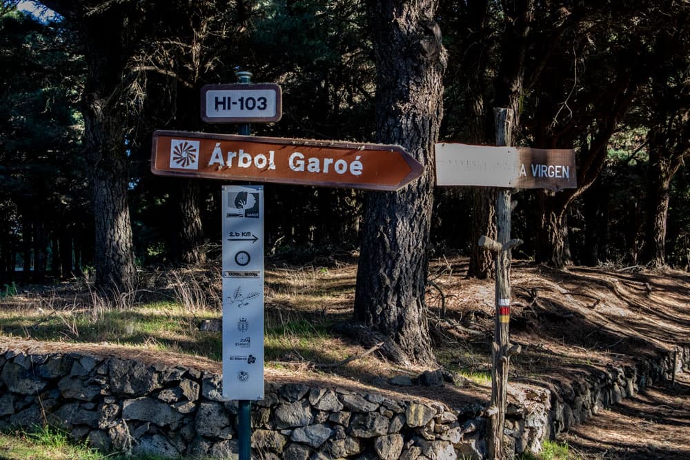
Signpost Arbol Garoé
Circular walk Arbol Garoé
Raya Cuatro Esquinas section to Arbol Garoé information centre
You start this circular hike on the HI-10 near the town of San Andrés. There is a small car park for the hikers. The place is called Raya Cuatro Esquinas. There is also a signpost Arbol Garoé. You walk the straight path into the forest. This section belongs to the big hiking trail GR 131 – Camino del la Virgin leading over the island. After a short time, the path takes you out of the forest and along the Entremontañas Mountain. Cattle often graze here from the nearby hamlet of La Albarrada. You arrive at a fork. Here, from the right, comes a path from San Andrés. Go straight ahead on the left up the steep asphalt road.
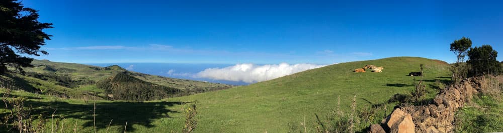
Panoram - Meseta de Nisdafe
The trail leads past cow pastures and drip troughs (Los Dornajos). Now you already have a beautiful view over the Meseta de Nisdafe plateau, which spreads out in front of you. You walk for quite a while on this ridge path with beautiful views on both sides. Slowly the path descends a little. Then you get to a fork again. On the right the path leads to the nearby hill Ventéjis. However, you go down the road on the left. After a short time you are in front of the information centre Arbol Geroé.
Article summary and large selection of GPS hiking tracks
Sign up for my newsletter now and get exclusive access to my collected GPS tracks as well as all the brief information about my articles.
Sign up now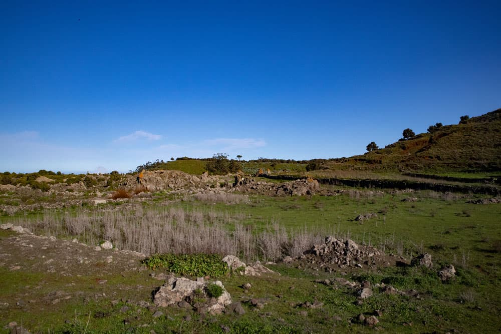
green plateau - Meseta de Nisdafe
Arbol Geroé section to HI-110 road
Here you can go to the visitor centre where you will find a lot of information about water management. The Arbol Geroé can also be admired here (for information, see section 2 above). Then a small path continues in front of the information centre. This leads you along the right side of the Petraje. After a short time, a path branches off to the left, which leads you quickly up to the ridge. From there the trail descends between Agaven. The green landscape of the Meseta de Nisdafe lies at your feet with beautiful views.
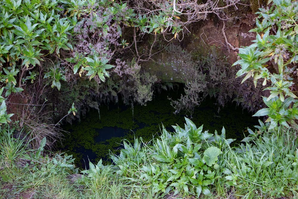
a water hole - Alberca
The path continues downhill into a paved path that leads through a small eucalyptus forest. You get out of the forest and meet another forest as you descend. There the path leads into a driveway, which you follow to the right. This path leads into a road that leads you through woods, meadows and past a finca. The road widens and you will see some buildings along the way. Finally, the path joins the HI-110 road.
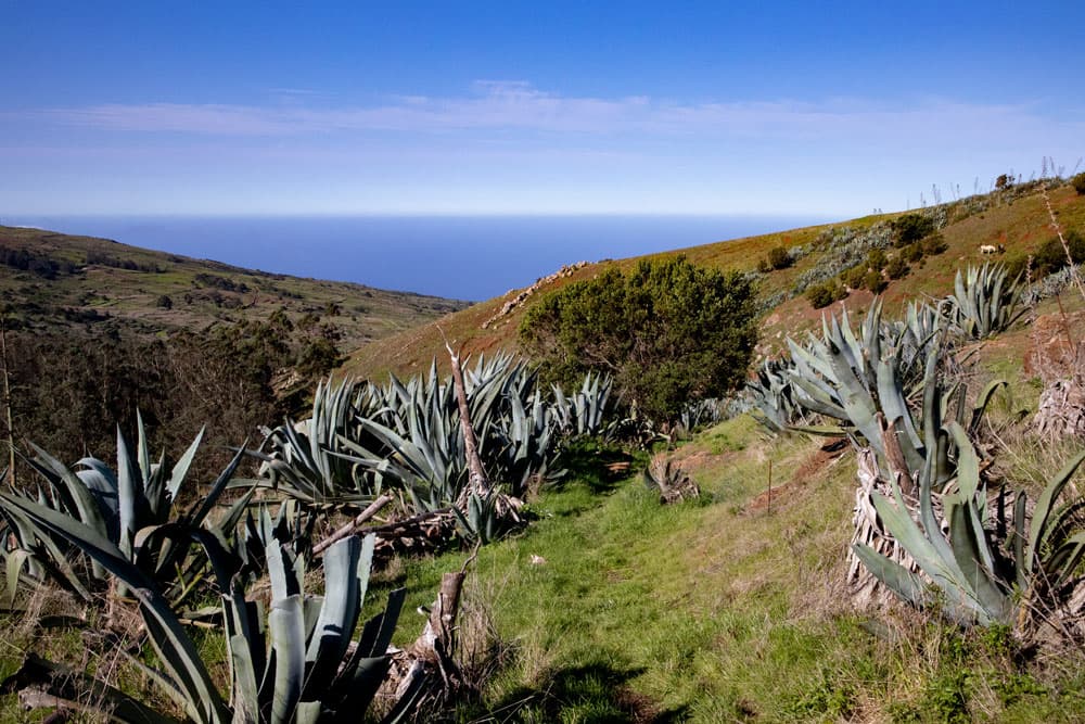
Hiking trail through Agaven with sea view
Section HI-110 to Barranco Channel
On the HI-110, turn left and after a short time you will come to a fork in the HI-10 road. Here, turn right and continue along the road. Don’t be afraid of the traffic. I myself have seen very few vehicles on this section. On El Hierro it is possible to walk on the local roads. This road takes you straight through the small village of Las Montañetas. Here you can still admire picturesque old Canarian houses. The small stone buildings are to the right and left of the road nestled in lush green nature.
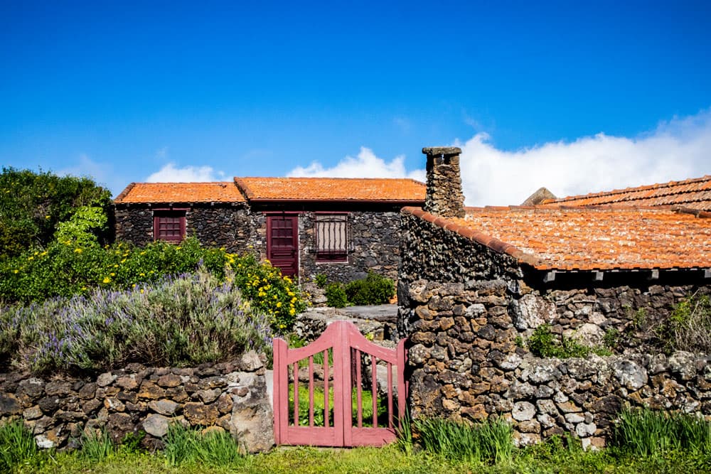
Stone houses and green vegetation along the way
At the end of the village, the path continues uphill on a small road to the left. Keep right at the first fork. You ignore the branching field paths. At a junction, follow the HI-120 to the left, from which you turn off only when the PR EH 8 (white yellow) trail is signposted to the left. This is the small path that you can also follow on the round from Mirador de La Peña to San Andrés. The path continues to climb steadily and gently. You walk on pretty paths through a green landscape. The paths are often bordered with small dark stone walls. After some time you will reach a small rocky Barranco channel. 
Hiking trail through fields and green meadows
Section Barranco Gutter to Cuatro Esquinas
You go into the Barranco Gully, keep to the right and climb up the rocks on the left again. The path continues to climb in this green landscape. Finally the path leads into a driveway. Follow it straight ahead. From the right, the HI-121 joins the path. Just before you reach San Andrés, the GR-131 – the Camino de la Virgin – crosses your path. If you want to walk via San Andrés, go straight ahead and reach the village in a short time. Return to the starting point via the HI-10.
hiking junction in Las Motañetas
Otherwise, the circular path leads you to the left at the turn-off onto the GR-131. Through the fields you can return to the starting point of Raya Cuatro Esquinas in no time at all.
little stonehouses in Las Montañetas
And finally
I hope you enjoyed this little hike on El Hierro. I hope you enjoyed this short hike on El Hierro. The hike can also be combined very well with the hikes from San Andrés to Isora and with the hike to Mirador de La Peña. I wish you a lot of fun hiking!
Dagmar von SiebenInseln