Pico de la Zarza – summit on a volcanic edge
The Pico de la Zarza with its 807 meters of altitude is considered the highest peak on the Canary Island of Fuerteventura. It lies together with the Pico de la Palma (744 m altitude) and the Pico de Mocán (792 m altitude) as well as the Morro del Joaro (621 m altitude) on a crater rim.
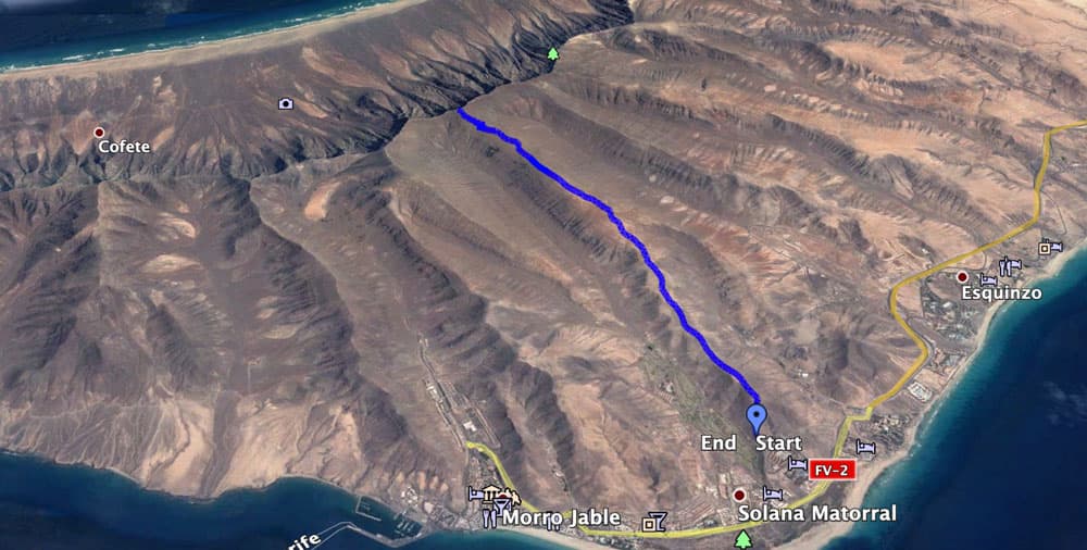
Map

hiking trail to the summit of Pico de la Zarza over the ridge
This crater rim belonged to a large stratified volcano that sank into the Atlantic Ocean 12-14 million years ago. What is left now is this enormous abort edge on the Jandía peninsula. The highest elevation is the Pico de la Zarza or also called Pico de Jandía.
hiking path to Pico de la Zarza
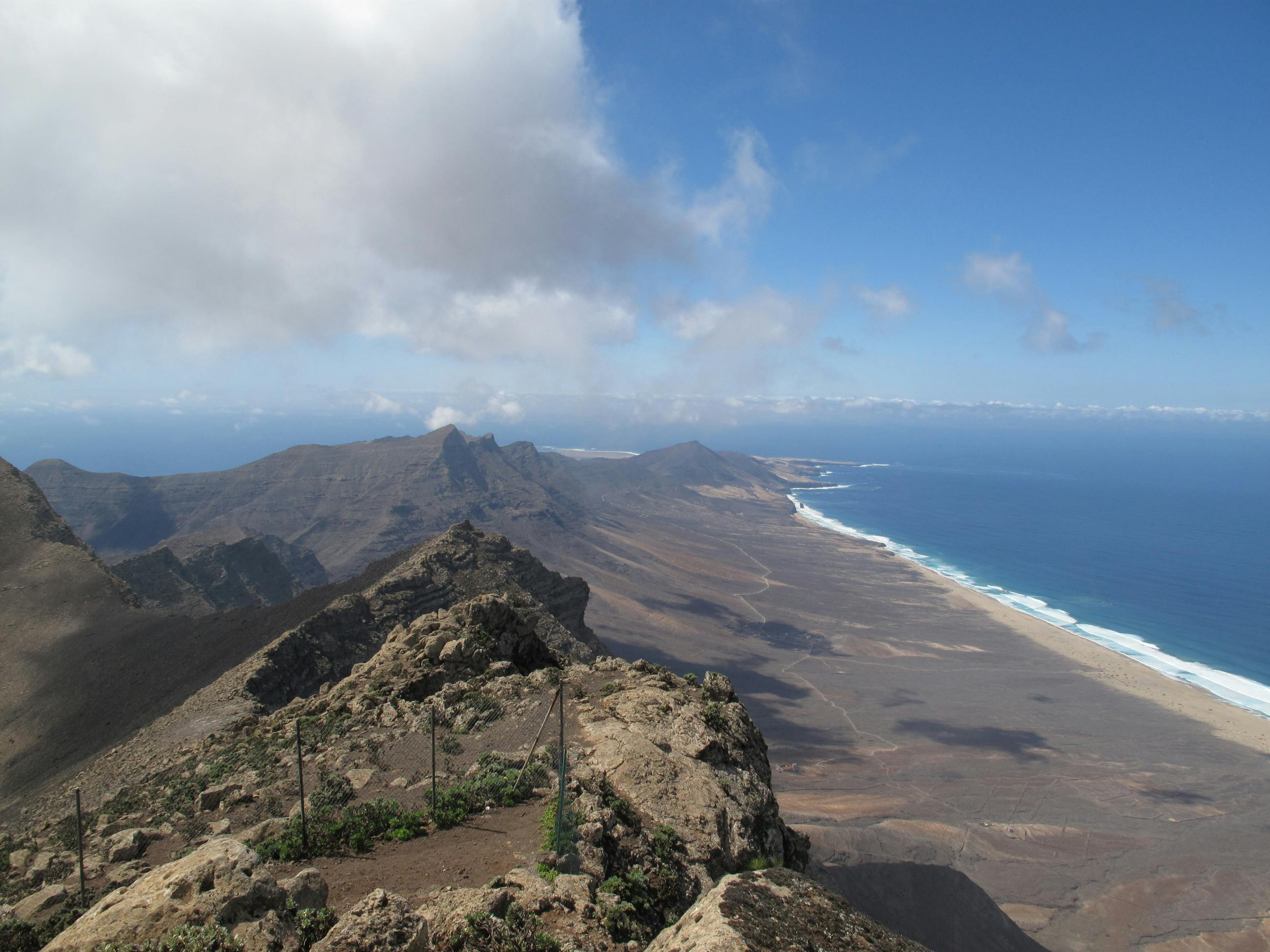
At the top of the Pico de la Zarza, you will find yourself on the edge of the Cofete coastal plain. In good weather, the view of the wide plain, the beach and the Atlantic Ocean from up there is fantastic. The trail starts near the southern tourist town of Jandía Playa, which belongs to Morro Jable. It leads up to a ridge path that takes you above and around some elevations finally to the summit of the Pico de la Zarza.
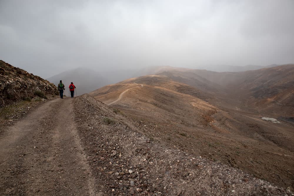
hikers on the wide hiking path over the ridge in clouds
Hiking on Fuerteventura – sun and rain
Even though Fuerteventura is better known for its miles of white sandy beaches and the high sand dunes, there are also some good hiking possibilities on the island. Years ago I went some tours in the rough terrain on the west side of the island. As I live on Tenerife, it is always a little trip to Fuerteventura, so that I do not have too often the opportunity for hiking there. All the more pleased I was that it finally worked out on the Pico de la Zarza. So I can finally present you a hike on Fuerteventura.
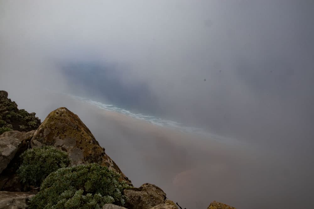
view through the clouds down to the beach
So much for the good news. But unfortunately it rained like buckets on my hiking trail. Very unusual for this otherwise so dry island. We „fought our way through“ soaked to the bones to the summit. As you can see from the pictures, there was hardly any visibility on the way there. And also on the summit we had to wait for cloud holes to have a look at the beautiful west coast. On the way back we were lucky to see the sun, so that you can take a small photographic impression of this wonderful hike with you.
track hike to Pico de la Zarza
General information about the hike on the Pico de la Zarza
Starting point and approach
The hike starts in Jandía at the Calle de Sancho Panza. Alternatively, you can start in Jandía on the coastal road Avenida de Saladar.
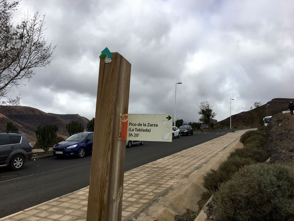
signpost to Pico de la Zarza - starting point
Article summary and large selection of GPS hiking tracks
Sign up for my newsletter now and get exclusive access to my collected GPS tracks as well as all the brief information about my articles.
Sign up nowArrival by car
If you come by car, take the coastal road FV-2. If you come from the north, turn right at the second roundabout into Calle de Quijote. From the town and south, turn left into Calle de Quijote.
If you like, you can also start walking from here.
Otherwise, take the first street on the left (Calle de Sancho Panza). Follow it until it forks uphill. Keep right at the fork. After about 100 metres, the path starts on the right. Parking is available at the roadside.
Arrival by bus
After Morro Jable the bus lines 01, 04, 05, 09, 10, 25 and 111 go. You find more details and exact timetables on the homepage of Tiadhe. Time
I don’t like to give general time information for hiking tours, because the times are very individual. We needed a little more than 4,5 hours for this tour with summit rest.
Difference in altitude and distance
The difference in altitude is approx. 760 metres. The distance is approx. 13.5 kilometers long. If you start walking from the village, it should be about 15 kilometres.
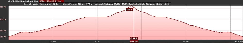
elevation profile hike to Pico de la Zarza
Requirement
An easy and for everyone with a bit of stamina easy to master tour. The hiking trails are mostly wide and well marked. Only in the last part to the summit they become a little narrower and steeper.
If you are unlucky enough – like me – to hike there in heavy rain, adjust to a lot of mud on the trails and don’t forget the rain gear.
Refreshment
Restaurants, bars and shops are only in Jandía (1.5 km from the starting point). Therefore, take enough water and food with you.
Article summary and large selection of GPS hiking tracks
Sign up for my newsletter now and get exclusive access to my collected GPS tracks as well as all the brief information about my articles.
Sign up nowVariants
The tour can even be extended to a round tour. On the way back you can either descend to the right (Barranco de Vinámar) or to the left (Barranco de Butihondo) shortly after the summit descent to the neighbour Barranco. From there you return to the Barranco Grund to Morro Jable or to the main road.

view on Jandia and the eastcoast
Hike to the Pico de la Zarza
Section Jandía, Calle de Sancho Panza to mountain ridge
You start your hike at the Calle de Sancho Panz in Jandía. The PR FV 54 trail begins on the right and is marked with a small post pointing to Pico de la Zarza. You walk up the road, which initially runs parallel above the road. The path goes past a larger building. In some big hairpin bends it goes up the mountain. Once you have reached the ridge, you can look far ahead in good weather. The trail stretches far in front of you.
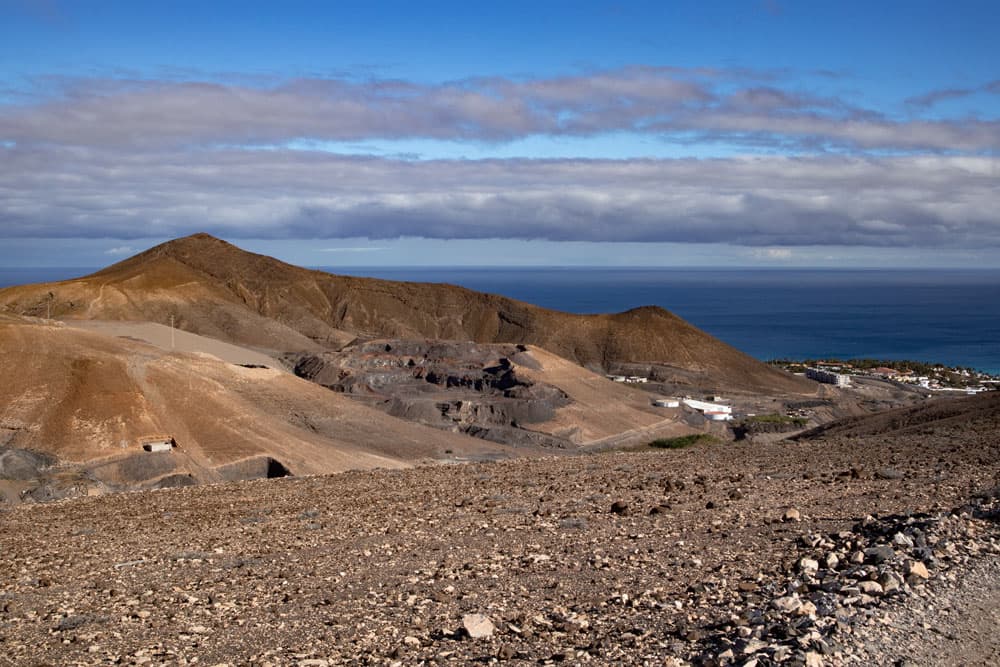
View of the surrounding heights and the Atlantic Ocean
From time to time it goes slightly downhill, but essentially you hike from a „hill“ on the ridge to the next elevation. First you walk along the right side of the ridge and can therefore look right into the Barranco de Butihondo. Later, the path goes in such a way that you can also look left over the Barranco Vinámar to Jandía and Morro Jable. Back you can see the white beaches of the east coast of Fuerteventura and the Atlantic Ocean.

Panorama - view to the east coast, the Atlantic Ocean and Jandia
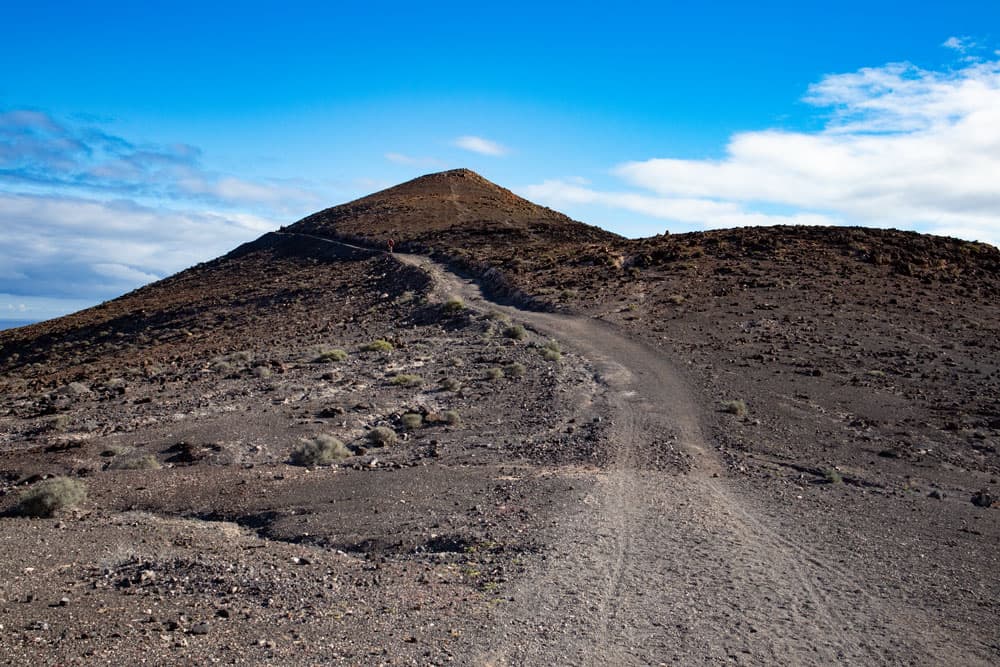
Section of ridge to Pico de la Zarza
You hike along the ridge path, which finally runs left again on the mountain side over the Degollada de Vinámar. Then the path becomes narrower. From now on the path climbs up the mountain in steep narrow serpentines. If you go up there like me in the rain, you will come across muddy paths. You will finally reach a fenced area. Since the Pico de la Zarza is located in the nature park Jandía, the fence should keep the many free-running goats away from the summit area. Therefore, hikers should take care to close the fence carefully.
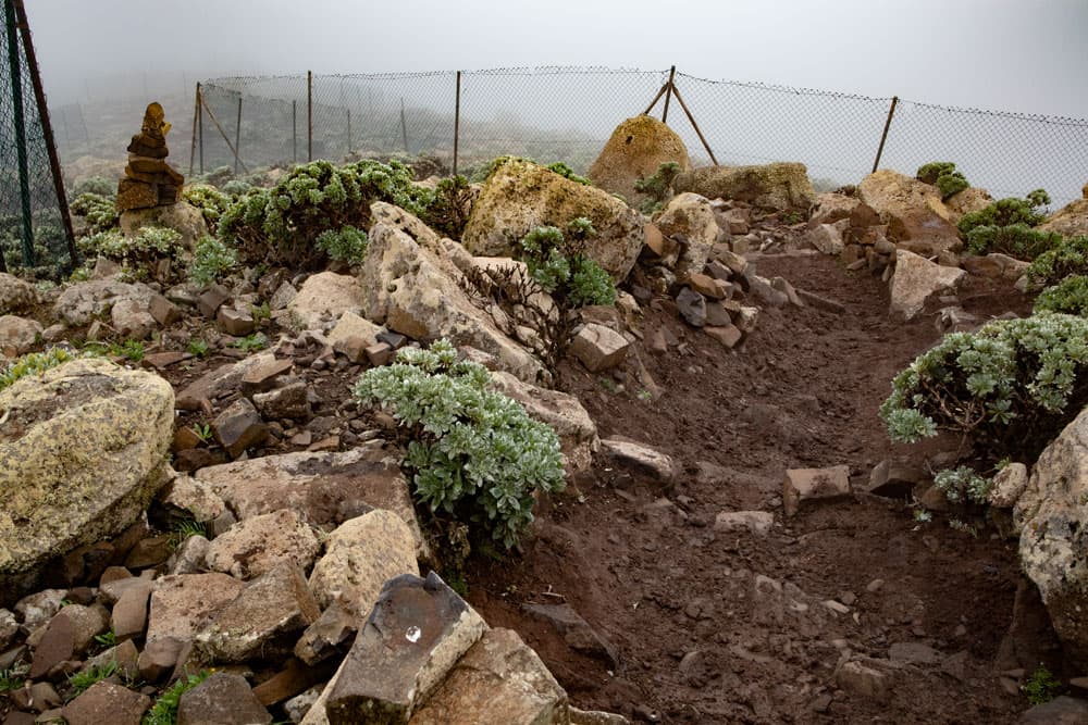
path to the summit along the fence
There’s plenty of goats around here. You will probably meet some of them on the hike. Endemic plants such as the Kleinie, the Jandía Natternkopf, the Canarian star-eye or even winter daisies grow in the summit area. From the gate you continue to climb steeply up the small path between rocks. And then you are at the top of Pico de la Zarza, the highest point of Fuerteventura. This is at the same time the edge to the west coast and the edge of the volcano. If the weather is good, you have a fantastic panoramic view from up here. If you – like me – are unlucky, you have to be content with cloud holes.
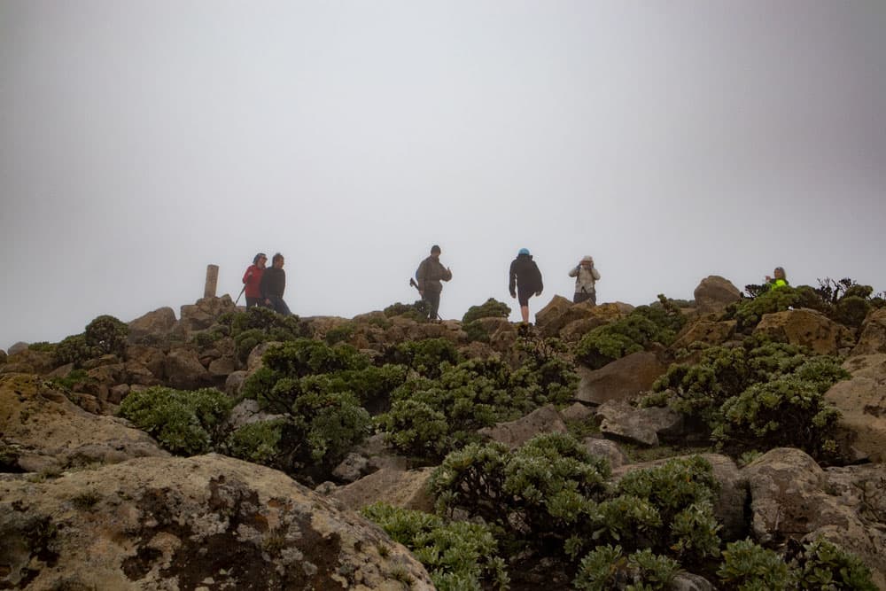
summit and break-off edge - Pico de la Zarza in clouds
And finally
I hope you enjoyed this little hike on Fuerteventura. If you want to do it, make sure you get better weather than me. By the way, there are now seven islands on Facebook and Instagram. I am looking forward to your visit there as well. I wish you much joy while hiking,
Dagmar von SiebenInseln