The Barranco Guayadeque – spectacular hike on old Canarian territory
The Barranco de Guayadeque in Gran Canaria is a very special barranco. Not only the size and the special length of the canyon with 11 kilometres as also the steep rock walls impress but also the wild nature and the numerous traces of the former inhabitants of the island.

Clouds over the plateau
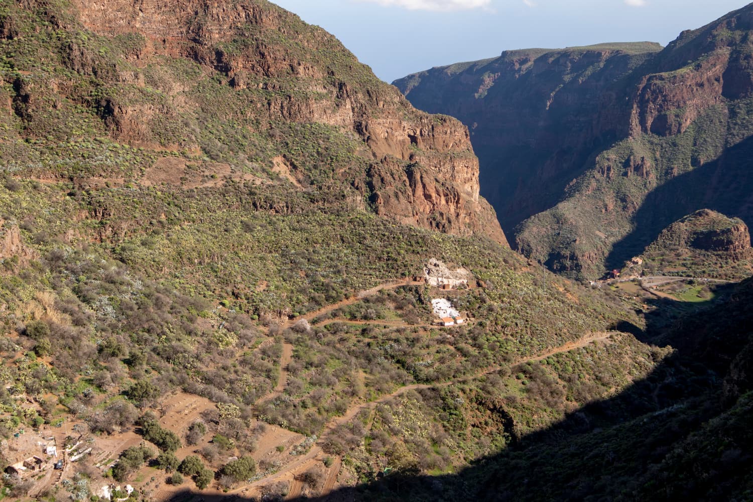
The Barranco extends over an area of 7.255km2 close to Ingenio and Agüimes in the eastern part of Gran Canaria. It is one of the largest ravines in the Canary Islands. You will encounter many watercourses and also remains of watermills that were of considerable importance to the inhabitants of the valley.
Map

Flowering almond trees in the Barranco de Guayadeque
The gorge is famous for unique endemic animal and plant species, such as the Lagarto Canarión, the largest lizard species in Europe and Africa. These animals can grow up to 80 cm long. Also remarkable are the many cave houses where mummies, clay vessels, graves and old inscriptions have been found. On the way to the starting point of the hike you will pass the Museo de Guayadeque, which provides detailed information about the culture of the old Canarians and about the findings from the Barranco de Guayadeque. Guayadeque means, according to the old canarian language of Ignacio Reyes, „calm spirit“ or „reserve of calmness“.
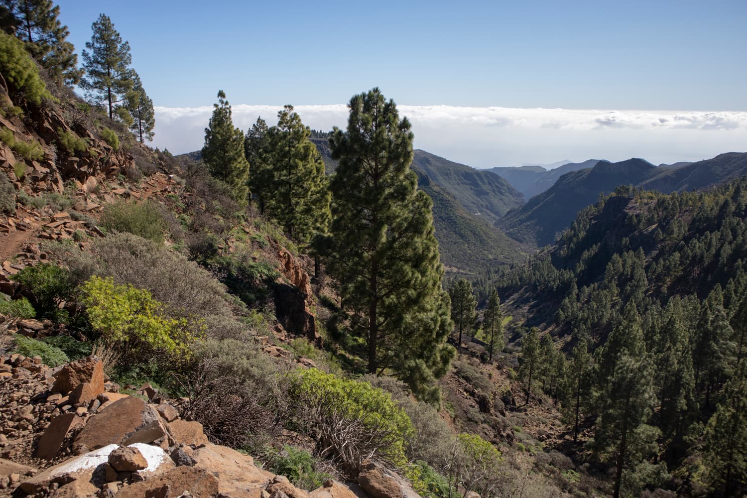
In the highlands above the Barranco de Guayadeque
Big round tour through the Barranco de Guayadeque
This big circular hiking tour through the Barranco de Guayadeque requires a good physical condition due to the length and the metres of altitude to be managed. You start the hiking tour after a longer drive through the Barranco at approximately 980 metres of altitude. The highest point of the hiking tour is the Kreuz de Socorro that you will find at approximately 1.700 metres of altitude. The paths are mostly well arranged, paved and hardly exposed.
View over the pine forests and clouds in the height
But in order that also hikers who do not want to do such a long tour can see something of this impressive Barranco, I have arranged some short alternatives and shortcuts under variants. And those who want to see the big volcanic crater (Caldera de los Marteles) will find below an extra round tour in order to have a look to this one with its 500 metres diameter. Before or after the hiking tour, a visit to the Museum de Guayadeque or the cave restaurant Tagoror at the starting point is really recommendable.
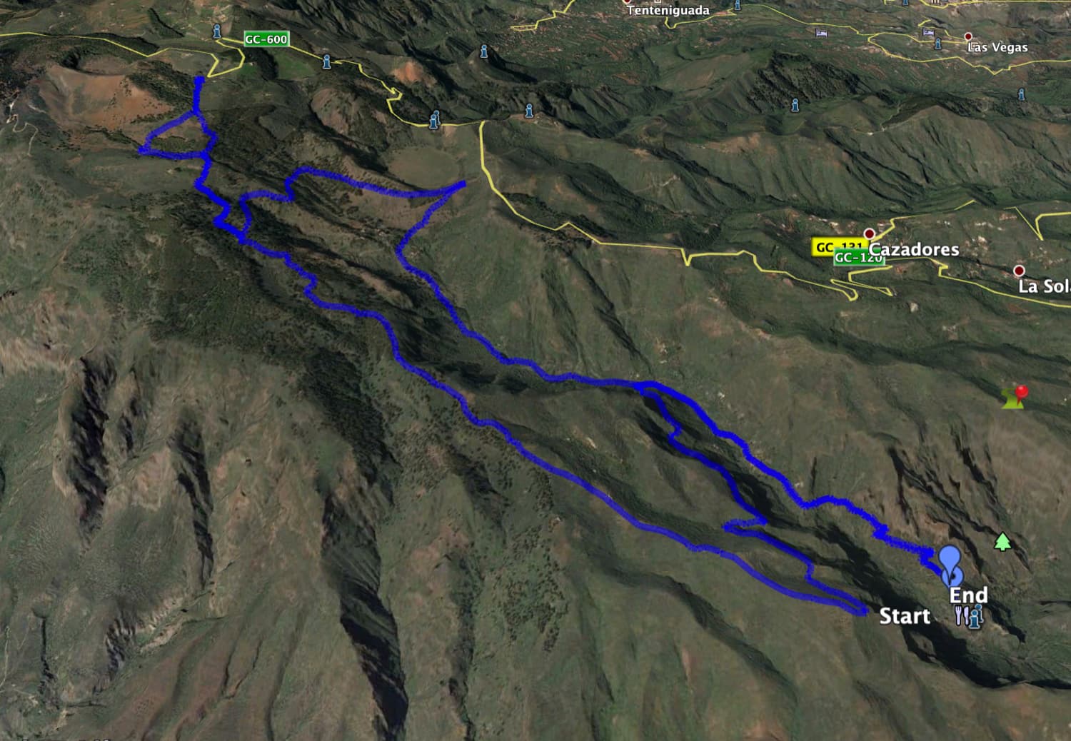
Track of the hike Barranco de Guayadeque
General information to the circular hiking tour Barranco de Guayadeque
Starting point and approach
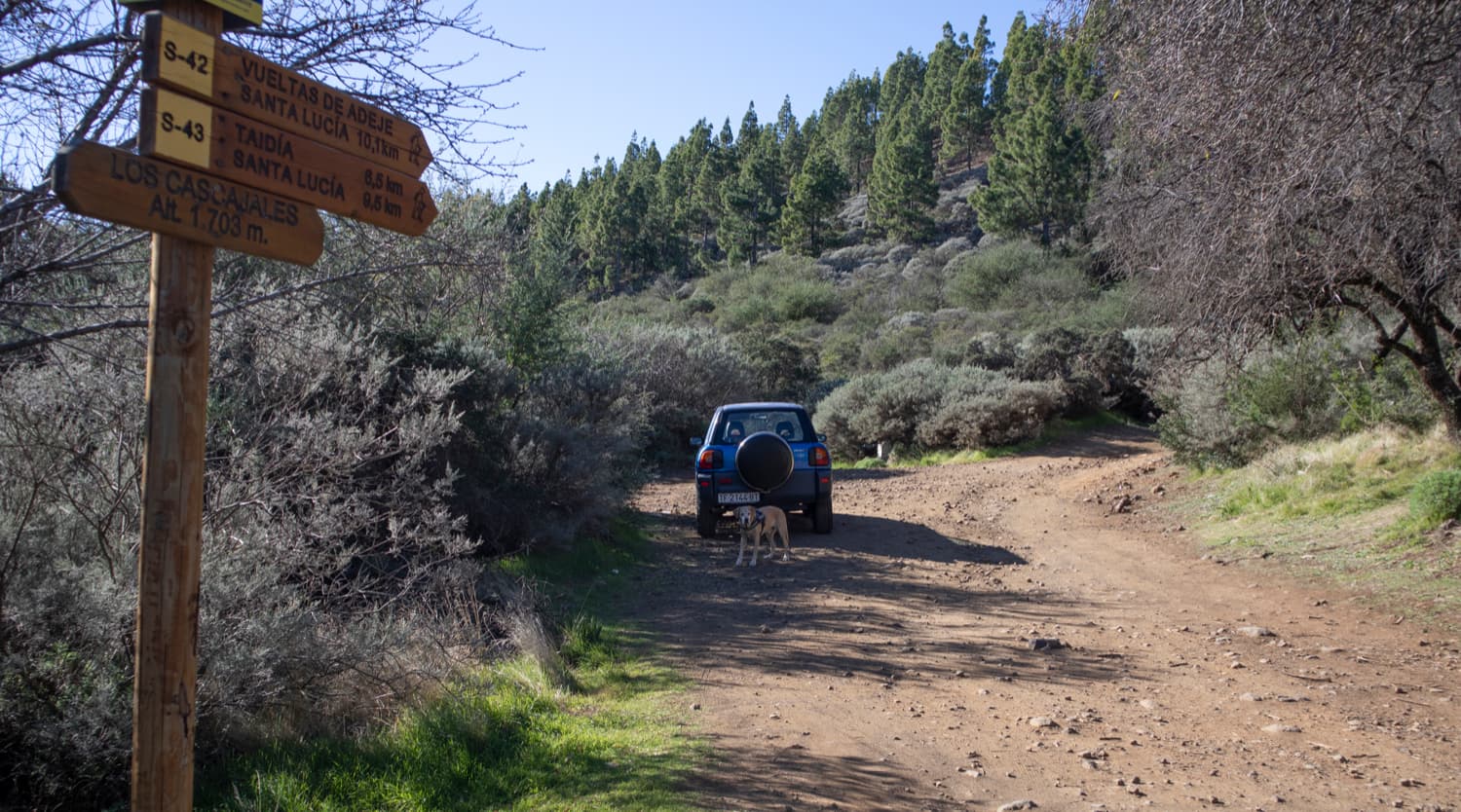
Starting point of this hiking tour is the former cave restaurant Tagoror at the Montaña de las Tierras at a height of approximately 980 metres. In front of the restaurant and at the access road there are parking possibilities at the roadside.
Coordinates 27.936209, -15.512141
Approach by car
From the island motorway GC-1 you leave the eastern part of the island towards Ingenio. You cross the whole village on the main road and keep going upwards towards the mountains. There are also some signpostings to the Barranco de Guayadeque. You leave the place on the Calle de Guayadeque. This road takes you downwards to the Barranco de Guayadeque. There, you meet the road that comes from Agüimes. Now you drive around to the right. You pass the Museo de Guayadeque and drive further and higher into the Barranco up to almost the end of the road, the cave restaurant Tagoror.
If you want to do the small round trip around the Caldera de Los Marteles, the starting point is the Curva del Agua at the GC-130 at the dried up reservoir (Embalse de Cuevas Blancas).
Approach by bus
It is not possible to get there by bus, so that alternatively, only a taxi trip from Agüimes or Ingenio is possible.
Time
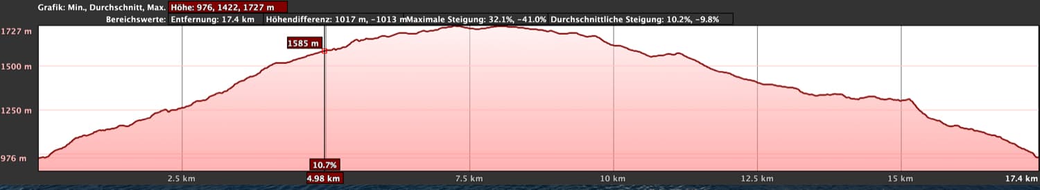
I do not like to give general time indications for hiking tours, as the times are very individual. We needed 5,5 hours for the big round tour with breaks. The small round tour took a little more than 1,5 hours.
Elevation profile hike Barranco de Guayadeque
Difference in altitude and length of the route
The difference in altitude is about 850 meters in ascent and descent and the length of the route is about 18 kilometres.
And the difference in altitude of the small tour is 230 meters in ascent and descent. And it is almost 7 kilometres long.
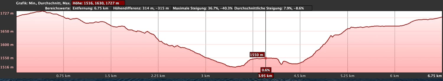
Elevation profile Circular Caldera de Los Marteles
Requirement
Article summary and large selection of GPS hiking tracks
Sign up for my newsletter now and get exclusive access to my collected GPS tracks as well as all the brief information about my articles.
Sign up nowThroughout the entire hike you can walk on good paths, some of which are paved with large stones. But because of the length, the partly steep ascents and the many meters of altitude difference, you should be in very good physical condition. If you do not want to do the whole tour but still want to see something of Barranco de Guayadeque, then simply look below under the variants for shorter alternatives.
Refreshment
There is only the cave restaurant Tagoror (meeting place) at the starting point. Therefore, take enough water and if necessary food with you. 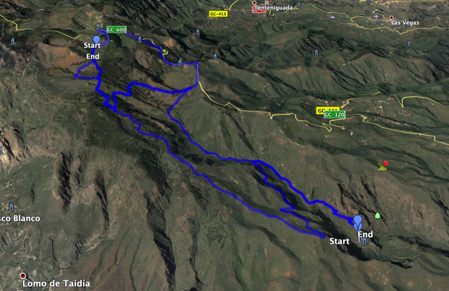
Track of the hike Barranco de Guayadeque and circular Caldera de Los Marteles
Variants
This tour through the Barranco de Guayadeque is very long. If you do not want to walk the whole round (or even further) and (still) want to see something of the Barranco, there are the following possibilities.
1. to save a little distance and climb, you can start the hike near the Cruce del Olivo. To do this, you have to drive on the GC-130 and turn left down from it in order to get close to the hiking path.
2. to get an impression of the wild nature and the cave houses in the Barranco, you can also follow the track to the Caldera de los Marteles and then go back the same way.
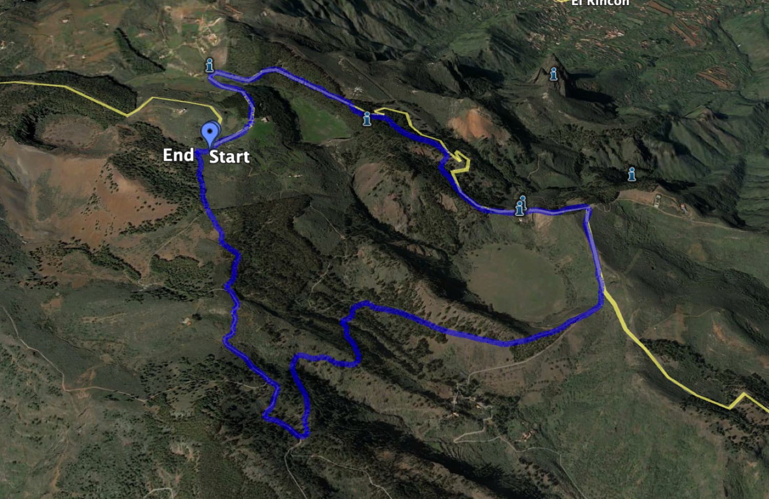
Track around the crater Caldera de los Marteles
3. however, if you prefer a walk high above the Barranco, I will describe a beautiful hike around the volcanic crater Caldera de los Marteles at about 1500 meters altitude.
4. finally, you don’t have to hike up to the end of the hike and thus quite as high as I did. As you can see well on the track, you can save a big part of the track in the upper part if you just follow the round trip.
5. if you feel like doing more, you can combine the round tour with the small tour in the upper part and make a very big round.
6. there is also the possibility to extend the round tour in the upper part a little bit, if you don’t change to the other side of the Barranco early and climb even higher. Then you will reach the highest point of the hike and make a very big round tour this way.

View down in the Barranco de Guayadeque
Big round hiking tour through the Barranco de Guayadeque
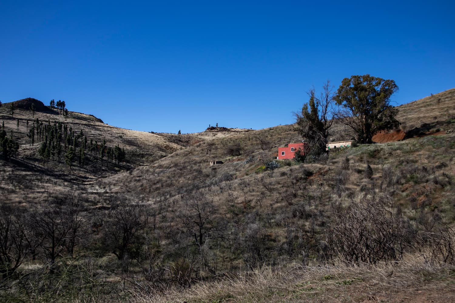
From the starting point at the restaurant or roadside you follow the road uphill. You are now on the Montaña de las Tierras. At the right side of you are the steep and rugged walls of the Barranco, at the left side green meadows. After a short time the road turns into a driveway. Follow this road for about 1.4 kilometres. To the left and right there are paths leading to private properties that lie along the road. The path takes you higher and higher into the Barranco. Looking back, you can already see the starting point lying far below you.

Hiking trail Barranco de Guayadeque
After crossing the Barranco to the left after about 1.4 kilometres, you come to a fork. Here you keep left and climb up the narrow path steeply. After a short time you will reach the Cruce del Olivio at 1250 metres. Here you will return from the top left. Now keep to the right. Shortcut 1 under Variants starts the round here, so you can save almost 300 meters of altitude difference this way.

Hiking crossroads in the Barranco de Guayadeque - Cruce del Olivio
Section Cruce del Olivio to Caldera de Los Marteles
From now on, the hiking trail takes you up the right side of the Barranco de Guayadeque. After some time, the path leads along some pines. High above you on the right, you can already see the dark slopes of the Caldera de Los Marteles. The path comes back to the bottom of the valley and crosses it to the right. Behind a large farmstead, the path goes uphill on the right. Partly it leads over lava scree. You leave the wooded area and climb very steeply up the slopes of the Caldera de Los Marteles.

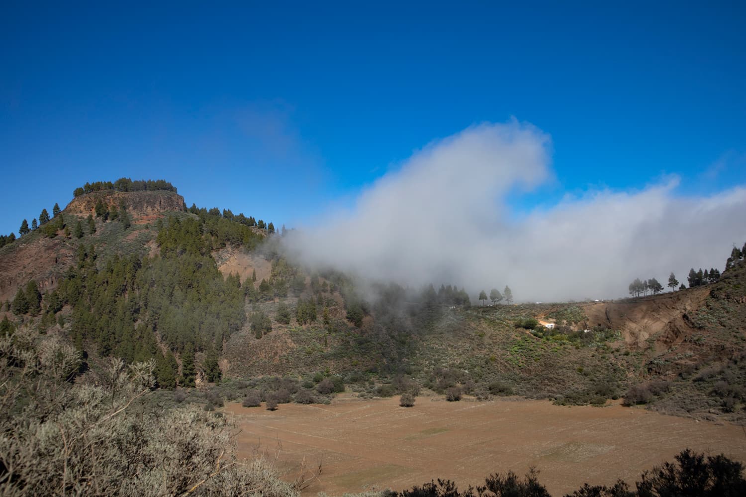
Clouds are gathering over the Barranco de Guayadeque
In the distance you will hear dogs barking from the farmsteads that are now already below you. At the end of this steep path you will come to a larger path which you follow to the right. But after about 100 metres this track leads into another track. You keep sharply to the left. Now you walk parallel along the slope of the Caldera de Los Marteles. This path is also part of the small round tour (see under variants 3). You continue climbing on the lava path, which after a short time turns into pine forest.

View to the upper part of the Barranco de Guayadeque
Section Caldera de Los Marteles to Curva del Agua
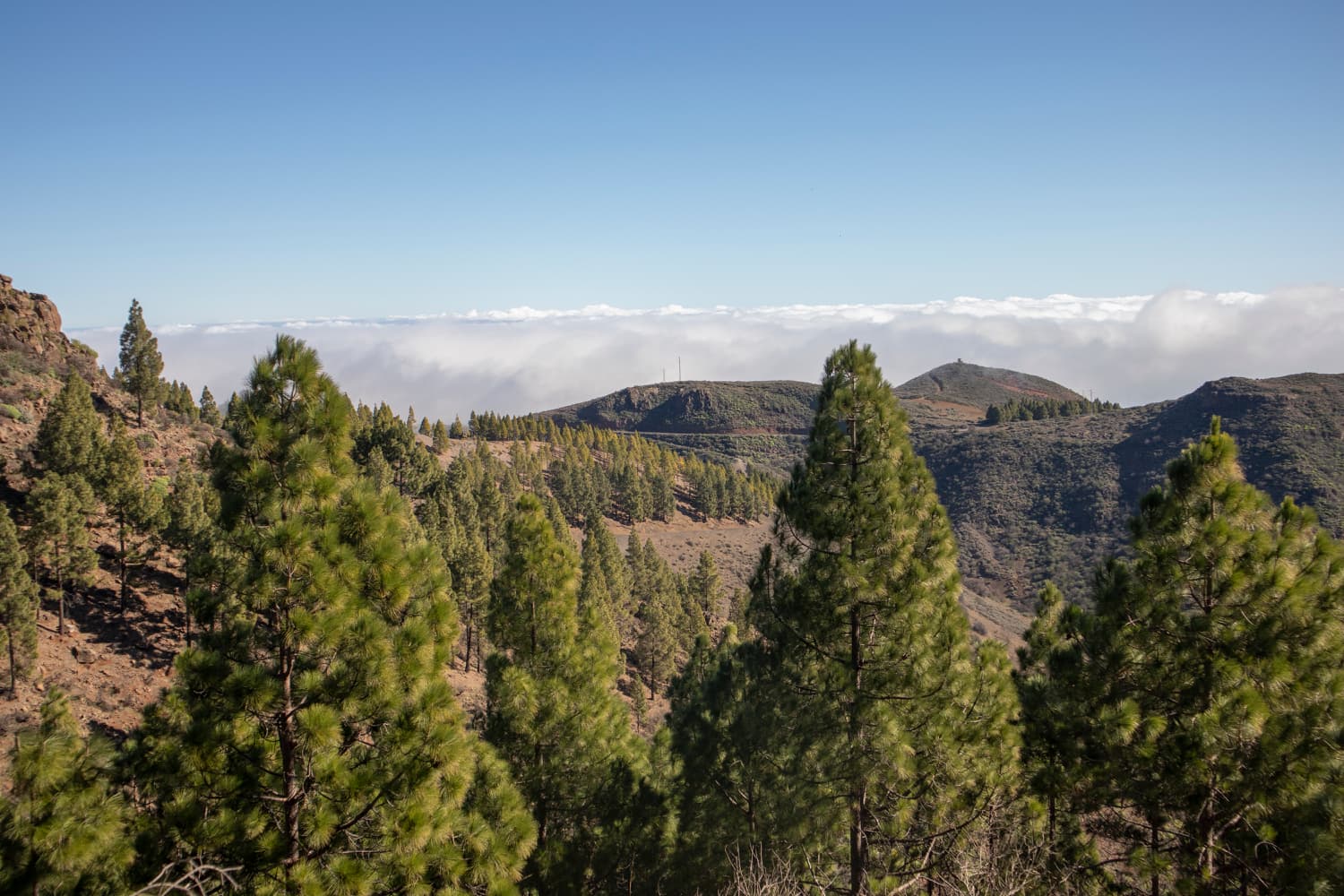
From this beautiful path through the pine forest you can always enjoy magnificent views of the Barranco to your left. I was there once in sunshine and once in absolute cloudiness. With clouds the beautiful views are of course a little clouded. And the now gently ascending hiking path through the forest is good to walk. You arrive at a fork. As you can see, I turned left, as the path runs beautifully along the edge of a high rock slope above the Barranco.
View from the slope path above the crossing of the Barranco de Guayadeque
If you want to go a big loop, you should keep straight ahead on the right side against the track here. Then after some time you will get close to the dried up reservoir Embalse de Cuevas Blancas. Passing a finca, the hiking path leads you to the GC-130 that is also called Curva del Agua due to the water reservoir. Here, the further hiking trail turns left. And at this point, also the small round trip around the volcanic crater Caldera de Los Marteles (variants 3) starts.
Article summary and large selection of GPS hiking tracks
Sign up for my newsletter now and get exclusive access to my collected GPS tracks as well as all the brief information about my articles.
Sign up now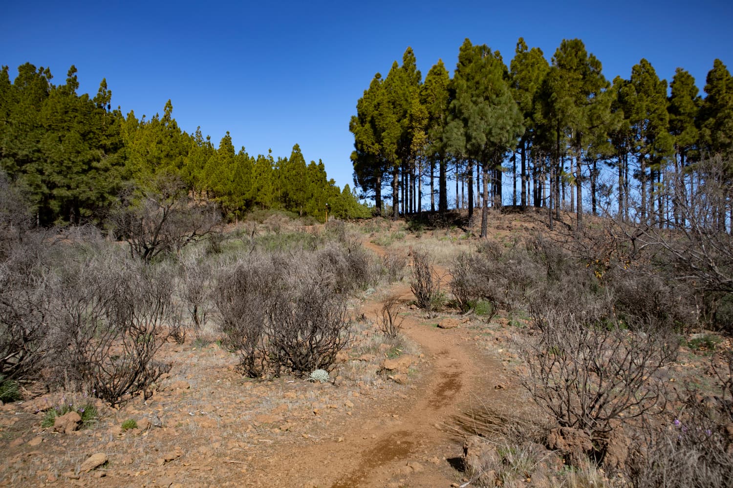
Hiking trail near the Embalse de Cuevas Blancas
Section Curva del Agua to Cruz del Socorro
From now on you can follow the signs to Santa Lucia for a very long time. As you can see on my track, there is again a shorter and a little longer possibility. You walk on wide roads and beautiful forest paths through a very nice hilly landscape. Finally the wide track brings you back into the pine forest. After a short time you will reach a wooden cross. This is the Cruz del Socorro and with 1681 meters the highest point of the hike. From here, many hiking trails start.

View from the height into the Barranco up to the coast
On the path on the left side, which is marked off by a stone wall, you get back to the outward path on the other side of the Barranco. I came out after Track at this point and continued to hike to the Curva del Agua. So whoever has walked left at the top of Caldera de Los Mateles at the fork will come out at this point (so my track).

The plateau above the Barranco de Guayadeque
Section Cruz del Socorro to Cruce de los Caminos
If you haven’t done the big lap, you can decide (like my track) to make a detour to the Curva del Agua and then come back here. But the way back leads you further on the half left turning track. This small path leads down and after a short time it brings you to a track through the pine forest. Here you walk for quite a while. Finally you come out of the pine forest on the wide driveway and find yourself on a kind of viewing platform. This is the Sepultura de Gigante.

Rugged rocks border the Barranco de Guayadeque - here: Sepultura de Gigante
From up there, you have a wonderful view to the Barranco de Guayadeque and the mountain Sepultura de Gigante that is located on the other side of the Barranco. Up here, there is a wonderful resting place with first-class views. You hike along the road along the ridge straight ahead. On the right, a path leads down to a house and shortly after that you ignore a path that turns left. Keep straight on along the stone-lined path and the parallel road. Your path always leads along the ridge and you continue to enjoy beautiful views. At the end of the ridge path you will reach a fork (Cruce de los Caminos).

Hiking trail in the height above the Barranco de Guayadeque
Section Cruce de los Caminos to the starting point Montaña de las Tierras
At this crossroads, paths to Santa Lucia and Temisas turn right. But you keep sharp left. Now the path leads you down the mountain slope. You cross a valley floor and then go to Paso Bermejo. Over red ground you hike for a while with still beautiful views of the Barranco Guayadeque. You will walk along the hillside and pass some slight mountain incisions. But finally the path turns into a steep serpentine path.

Starting point of the hike - Restaurant Tagoror
This one quickly takes you down to the Cruce del Olivio. At this point, the round hiking tour is finished. You go back to the right, on the same path that you came. In about 1600 metres downhill on the road you will reach your starting point again, the Montaña de las Tierras.
Starting point of the hike Small circuit above the Barranco de Guayadeque
Description short hike around the Caldera de los Marteles
Section Parking at the GC-130 (Curva del Agua) until Caldera de los Marteles
You start the hike at the GC-130 (Curva del Agua). From here you follow the signs to Santa Lucia for a long time. You will hike on wide roads and beautiful forest paths through a very pretty hilly landscape. Finally, the wide road takes you into the pine forest. After a short time you will reach a wooden cross. This is the Cruz del Socorro (1681 m altitude difference). Many hiking trails start from here.
Clouds on the saddle above the Caldera de los Marteles
You choose the path on the left, which is marked off by a stone wall. With beautiful views of the Barranco de Guayadeque, you always walk along the slope, crossing the gorge. At the other side you will get to a main hiking path that you follow to the right. The path leads you through pine forest and finally along the slope of the Caldera de los Marteles. Finally, you will see the large volcanic crater and continue walking along its edge.
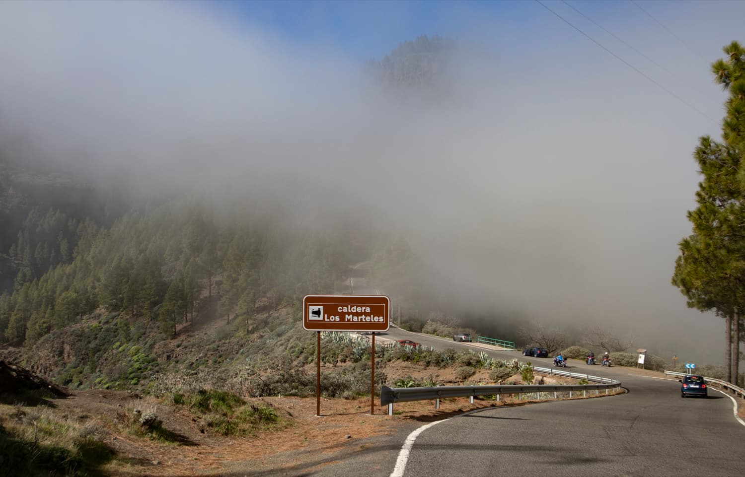
Caldera de Los Marteles
Route section Caldera de los Marteles to starting point (Curva del Agua)
Then you get to the GC-130, which you follow to the left. It leads you in a left turn to the actual caldera. There you can – if no clouds come in – enjoy wonderful views in all directions. Afterwards you follow the road. Shortly after the caldera, the hiking trail leads up into the forest on the left side. This path is partly steep and always runs parallel high above the GC-130.

Hiking trail on the slopes of the Caldera de los Marteles
High above the dried up reservoir Embalse de Cuevas Blancas, the hiking path finally gets back to the road. As there is not much traffic on the GC-130, one can now continue the rest of the way without any doubts at the road. In a big arch, the road around the lake takes you back to the starting point (Curva del Agua).

Hiking path on the driveway high above the Barranco de Guayadeque
And finally.

with hiking dog Lasko
I hope you enjoyed the walks and excursions around the Barranco de Guayadeque. This Barranco actually offers much more than only impressive hiking tours. An unforgettable nature experience, interesting historical findings and maybe a visit to a cave restaurant. In any case, I wish you nice experiences during the discovery of the Barranco de Guayadeque,
Dagmar von SiebenInseln