Roque Nublo – Landmark of Gran Canaria
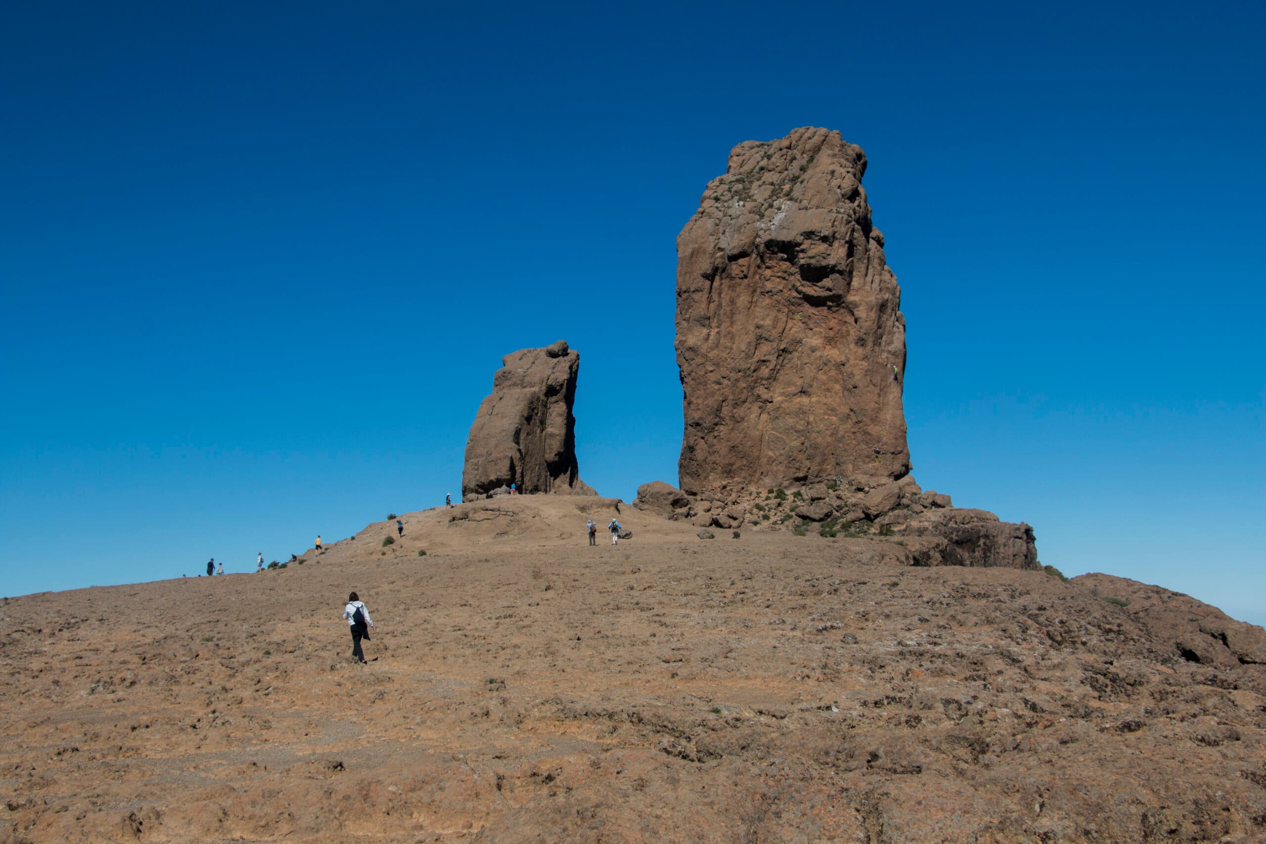
Roque Nublo (the Cloud Rock) is an approximately 65-meter-high imposing rock located in the center of the island in the Tejeda district on Gran Canaria. This impressive rock is considered the island’s landmark. Standing at 1,813 meters above sea level, it is visible from afar and is the third-highest peak on the island. Since its summit was first reached by a German climbing team in 1932, it has also become a destination for climbers who can often be seen scaling its steep walls. The monolithic rock was formed by volcanic activity and is surrounded by a fascinating landscape of pine forests and spectacular views.
Map

Roque Nublo
Roque Nublo is located in a protected natural area and is designated as a natural monument. On June 29, 2005, the area around was declared a UNESCO World Biosphere Reserve. In pre-Hispanic times, the large rock was a sacred site for the indigenous people of Gran Canaria. Today, it is a popular destination for hikers and tourists who want to enjoy the breathtaking views and natural beauty of the Cloud Rock.

Climbers at Roque Nublo
Hike around Roque Nublo
The short circular hike around Roque Nublo is relatively short compared to many other hikes and is not strenuous at all. The short route, with its just over 4 kilometers and nearly 250 meters of elevation gain, is very easy. However, since locals and tourists alike love Roque Nublo, a visit to the large rock is one of the things you must do once you land on Gran Canaria.
If the hike around Roque Nublo alone is not enough for you, you can easily combine it with other hikes that adjoin this short circular route. More details on this can be found below under Variations.

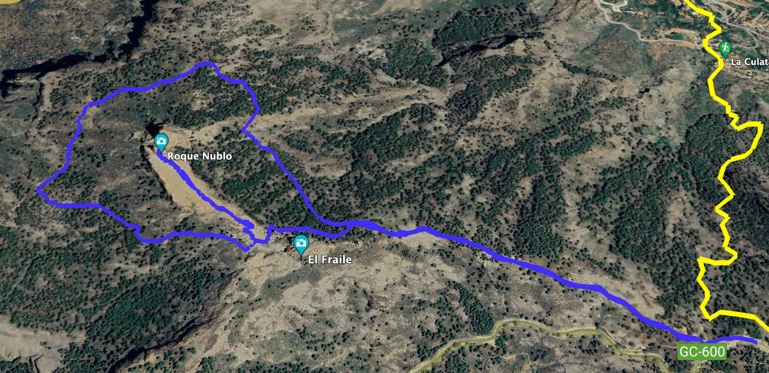
Track of the hike to Roque Nublo
General Information about the Short Circular Hike
Starting Point and Access
You start your hike at the Mirador Degollada de la Goleta on the GC-600 at kilometer 11.
Arrival by car
You can reach Mirador Degollada de la Goleta from both directions via the GC-600. There are parking spaces available on both sides of the road. Parking is also possible along the roadside. However, due to the great popularity, there is always a high number of visitors.
Arrival by bus
There is no bus service on this route. However, it is possible to take bus line 18 to the nearby village of Ayacata and from there hike up to Roque Nublo. Details and more information about bus trips on Gran Canaria can be found here: Guaguas Global. Article summary and large selection of GPS hiking tracks
Sign up for my newsletter now and get exclusive access to my collected GPS tracks as well as all the brief information about my articles.
Sign up nowTime
I am reluctant to give exact time estimates, as times can vary greatly. For the Roque Nublo hike, we took a little over an hour. However, in good weather, it is worth spending more time on the plateau below Roque Nublo, perhaps having a picnic and enjoying the beautiful view while maybe even watching climbers.

Elevation profile of the hike to Roque Nublo
Elevation Difference and Route Length
The elevation difference is approximately 230 meters, and the route is just under 5 kilometers long.
Requirements for the hike
The hike follows well-maintained trails and is more like a long walk.
Refreshments
There are no refreshment facilities along the route. Please make sure to bring enough water.

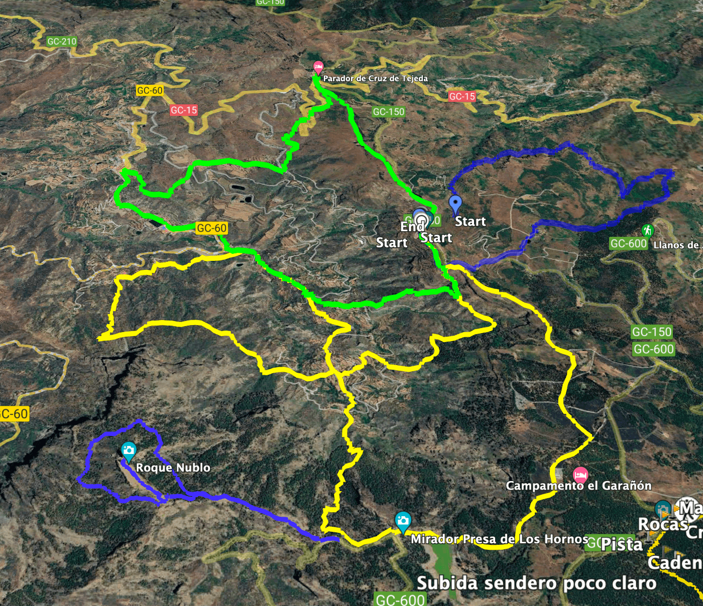
Track Roque Nublo (blue bottom left) and neighbouring tracks Cruz Tejeda (green) and Culata (yellow)
Variants
You can easily combine this hike with many nearby hikes. The hike already connects near the starting point to the large circular hike around La Culata. Therefore, you can combine the hike with a trip to the small Canarian village of La Culata. You don’t have to go to La Culata right at the beginning of the round. In the article, I have described several turn-offs from the circular route that take you down to La Culata. For those who want to hike even further, you can also continue in the other direction on the La Culata hike past the Presa de Los Hornos dam and then hike to the Zona de Acampada Llanos de la Pez. Additionally, you can take bus line 18 to the nearby village of Ayacata and hike up to Roque Nublo from there. The hiking signage in the Roque Nublo area is excellent. There are many opportunities to branch off from the small circular route and extend the hike.
If the small circular route is too long for you, you can skip the loop and go directly to Roque Nublo.

View from the Roque Nublo plateau to the surrounding mountain ranges
Article summary and large selection of GPS hiking tracks
Sign up for my newsletter now and get exclusive access to my collected GPS tracks as well as all the brief information about my articles.
Sign up nowShort Circular Hike Roque Nublo
Section Degollada de La Goleta to Turn-off towards La Culata
You start your hike on the GC-600 at Mirador Degollada de La Goleta. At the beginning, the path to the La Culata hike branches off to the right. You stay on the middle path, which runs along the left side of the mountain slope and rises very gradually. After some time, you will already see the mighty Roque Nublo (1,813 meters) ahead of you. However, in front of you is the smaller rock El Fraile, the Monk (1,655 meters). When you reach this rock, there is a fork in the path. Here you can choose: to the left, you can go directly to Roque Nublo or go around it clockwise. I preferred to go right first and circle the rock counterclockwise to spend ample time at Roque Nublo after the circuit.

View from the Roque Nublo hiking trail towards the west
Section Turn-off towards La Culata to Turn-off Path to Roque Nublo Plateau
You follow the trail marked towards La Culata and hike slightly downhill through the pine forest. After less than a kilometer, you come to a turn-off. From here, you can also extend your tour to La Culata by turning right. Otherwise, continue left on the path through the pine forest. The path leads you further around Roque Nublo’s rock face.

Roque Nublo and El Fraile
To the right, towards the west, you can enjoy beautiful views over the wide valley ahead. After some time, you reach another turn-off. The right path takes you into the Barranco del Nublo below Montaña del Aserrador. For the circular route, keep left. Now you ascend steeply for a short time. Then you reach another fork, where the left path leads directly up to the plateau of Roque Nublo.

Panorama from the Roque Nublo plateau to the surrounding heights with Tenerife in the background
Section Turn-off Path to Roque Nublo Plateau
Take the left path, which ascends slightly. After a short time, you will be standing on the plateau below Roque Nublo, where you can enjoy the magnificent views in all directions. You might even be lucky enough to watch climbers ascending the rock.
Then, return to the turn-off and keep left. After a short time, you will pass the caves (Cuevas de Roque Nublo). Passing Roque del Fraile, turn right to return to the starting point of the hike at Degollada de La Goleta.

Rock formations next to the Roque Nublo
And finally
I hope you enjoyed this short circular hike around Roque Nublo. If this hike is too short for you, you can combine it with many beautiful hiking trails in the area. Whatever you decide, I wish you much joy on all your hikes,
Dagmar from SiebenInseln


