Lakes Hiking tour from Soria to Chira Lake
Map
Today’s hike on Gran Canaria starts in Soria. It does not only lead you through two small typical Canarian villages. The special feature is the crossing of the gigantic dam wall of Lake Soria. Then you hike to the top of the Lomo de la Palma. But that’s not all.

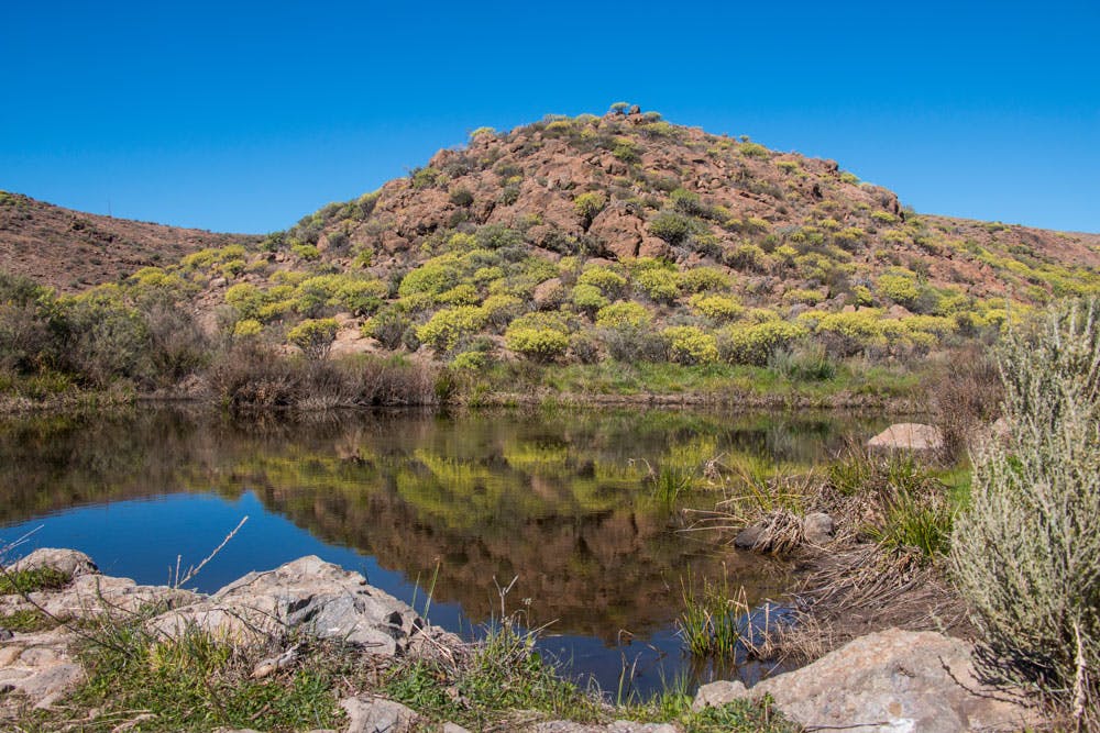
Lake Chira Gran Canaria
On the other side of the mountain range the Chira Lake awaits you, which you completely circle. The hike takes you to the small village of Cercados de Araña. Back you go again over a dam wall. This time the one of Lake Chira and then back to Soria via a water channel.
view back to Soria and dam
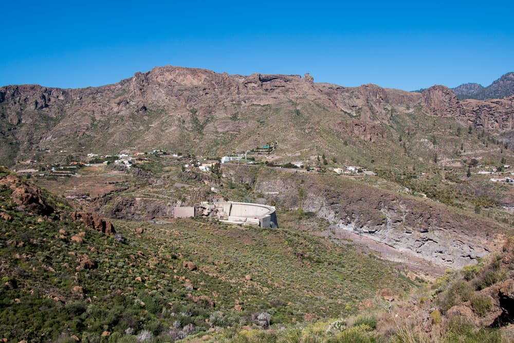
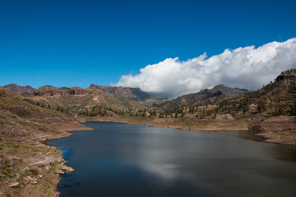
Embalse de Soria – the Soria Reservoir
In addition to the long water channels, the large reservoirs on the island play an important role in the water supply on Gran Canaria. At the starting point of our hike, Soria, there is the large Soria reservoir. The huge dam is the largest of its kind on the Canary Islands. And the construction of the dam, completed in 1972, took more than 10 years. Worth mentioning is, that the basin has a circumferential capacity of 32 cubic hectometres.
dam wall from Soria
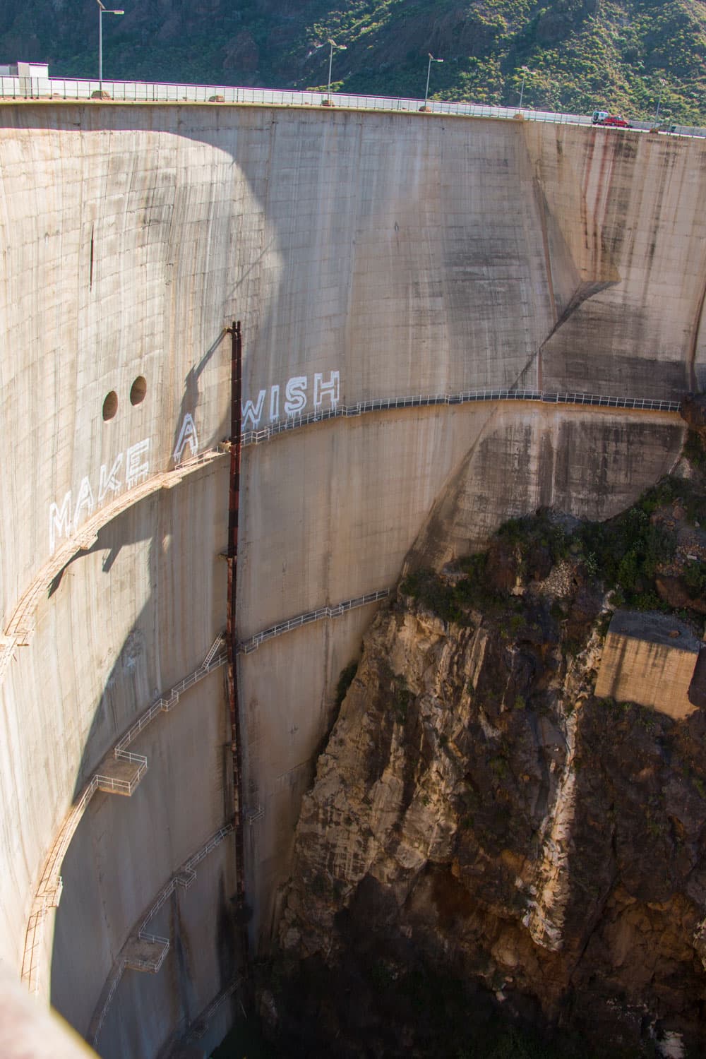
The inflow of the basin comes from the overflow of the Chira dam and the overflow of the Las Niñas dam. Both lakes are located near Soria. Of course, water from the Arguineguín gorge also reaches the basin itself. The crossing of the dam of Soria, which is part of the circular hike, is certainly a hiking experience of a special kind.
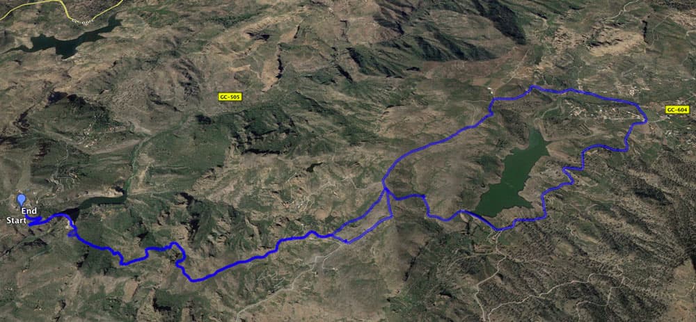
Track Hike Soria via Lomo de Palma to lake Chira
General information about the circular hike around the lakes of Soria and Chira
Starting point and approach to Soria
Starting point is Soria. There you can park at the bar/restaurant Casa Fernando or at the small parking lot opposite the bar. Further parking spaces are available at the roadside of the small village.
Arrival by car
From the south of the island you come on the GC-1 and then drive either on the GC-505 or via Mogán on the GC-200 and then on the GC-505 to Soria. From the other sides of the island there are many possibilities (depending on the location). You keep in the direction of the centre of the island and then you come to Soria via the GC-605 and the GC-505.

view from the wall to lake Chira
Arrival by bus
Unfortunately there are no buses to Soria, so you have to use your car for this hike.
Time
Article summary and large selection of GPS hiking tracks
Sign up for my newsletter now and get exclusive access to my collected GPS tracks as well as all the brief information about my articles.
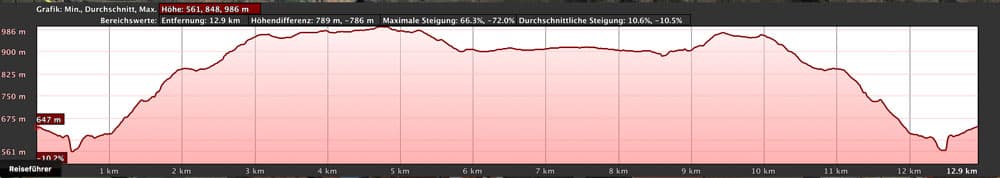
Sign up nowI don’t like to give general time information for hiking tours, as the times are very individual. I needed 5 hours for this hike with extensive breaks (especially at and on the dam).
elevation profile lake Soria via Lomo de Palma to lake Chira
Difference in altitude and distance
The difference in altitude is about 540 meters. The distance is almost exactly 13 kilometers long.
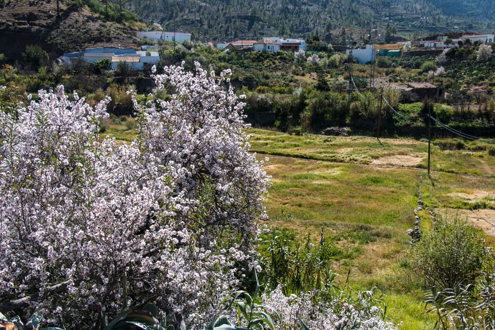
Almond trees on the way
Requirement
A simple hike that reminds of a walk in large parts like around Lake Chira. The ascent to the Lomo de la Palma after the Soria dam is a little strenuous. The same applies on the way back for the ascent from Lake Chira to the Lomo de la Palma.
Refreshment
There are restaurants at the place of departure Soria and in the place Cercados de Araña. For the ascents to Lomo de la Palma, please take enough water with you.
Variants
This tour can be combined well with different other hiking and circular walks in the vicinity (also around the other lakes like the lake Cueva de las Niñas).
Soria
Hike from Soria around Lake Chira
Section Soria to the Soria Dam
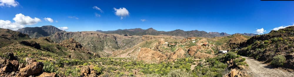
You start your hike on the main road in Soria. Next to the restaurant Casa Fernando there is an asphalt road towards the dam. This is a small stretch along a road that is not very busy. After two serpentines you reach the big forecourt of the dam of Soria. Here you can look around in peace and let the enormous impression of the huge walls and the surroundings have an effect on you. On one side of the Soria Sea and on the other side you can see the gorge of Arguineguín.
You can reach it by stairs on the main road on the dam and then to the other side. There you cross a kind of parking deck. Just behind the last building of the dam the trail starts. You are at an altitude of 630 metres and now have the first ascent to Lomo de la Palma in front of you.

in Soria you walk highly up on the path
Section Soria dam to Lomo de la Palma
Behind the dam you first hike very comfortably towards the mountains on a moderate ascent. You reach the gorge of Amácigo. Gradually the path becomes steeper and leads uphill in serpentines. The small serpentines take you up quickly. So the view back to Soria with the lake becomes better and better. Some small steps are cut into the rock to improve the path.
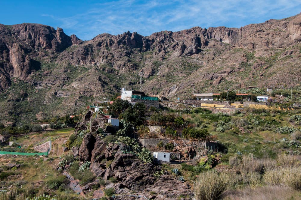
the houses of Lomo del Palma
After about an hour you should have reached the steepest part of the ascent. After you have walked through the last rocks, you stand on a small plateau. There the trail continues. At the next fork you go straight on. Once again it goes up in very small serpentines towards Lomo de la Palma. You pass the small houses of the village and reach a high mountain ridge behind the houses. This is the Lomo de la Palma (approx. 900 meters altitude).

view from the hight
Article summary and large selection of GPS hiking tracks
Sign up for my newsletter now and get exclusive access to my collected GPS tracks as well as all the brief information about my articles.
Sign up nowSection Lomo de la Palma up to the junction of the main road
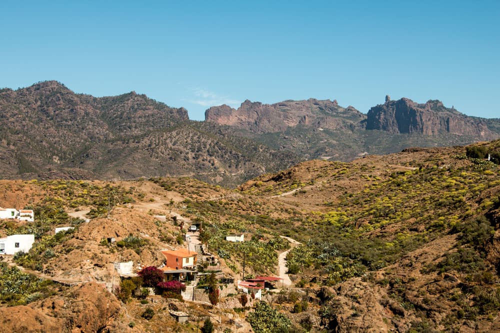
This mountain ridge lies between the Soria and the Chira lake. You now walk around the ridge. As you can see on my track, this is possible on the left as well as on the right side. I walked on the road to the right on the way there. On the left side of the elevation I went back. The way around to the right is a little longer. But you only have to follow the wide road. The path to the left goes through nature and past lonely houses.
view on the plateau between lake Soria and Chira
Exactly at the point where both paths meet again around the Lomo de la Palma, a path leads downhill to the right. There you will come back on the way back. However, on the way there, keep straight on the main path. The track is wide and leads you into a wide landscape, which is bordered in the distance by the central rock massif. After about one kilometre on this track you can leave the main path to the left. When I was there, the path was marked with stone figures. On my track you can see the place where I turned left.

hiker on the path with almond trees
Section of road junction main road to Cercados de Araña
The small branch from the main path leads you parallel to the left of the slope. Then it crosses the slope and it goes in a wide arc closer to the slope. From there you have a wonderful view of the Chira Lake, which now lies on the right side below you. Continue straight ahead slightly uphill and come back onto the piste. Here is the intersection Cruz de los Caminos. Follow the slope to the right. Now the path leads you parallel to the Chira lake.

view on Cercados de Araña
At the roadside there are almond trees, which of course look very pretty during the flowering season in the first months of the year. On your way you will pass houses that already belong to Cercados de Araña. It goes through fields and finally over a small bridge over the Barranco. After a few hundred metres past fields, you come to a fork and keep right. Once again the path crosses a bridge. Then you come to a road. Turn right into the centre of Cercados de Araña.
lake Chira
Cercados de Araña section to small dam wall
A short time later you will find a small square and the main road GC-604. If you want to take a break in a bar or a restaurant, you can quickly turn left to the guesthouses of the village. However, the next way is to the right along the main road. From here you walk about 2 kilometres along the main road. It is more of a walk. And luckily the road is not very busy. You can enjoy beautiful views of Lake Chira and back to Cercados de Araña.
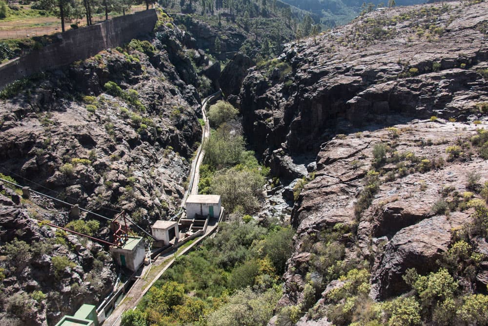
Waterchannel between lake Soria and lake Chira
When you reach the end of Lake Chira, cross the road and the dam of the lake. From here there are also beautiful views of the lake. On the other side of the dam there is a small path that will take you along pipes and finally along a water channel. Here you walk a little while until you meet a small wall that dams a smaller lake. Here at the lake is another beautiful place for a rest.

Panorama Soria
Section small dam wall to Soria
When you’ve had enough rest, you’ll wander over the little wall. On the other side it is hard to find a path. But stone men point the way. And after some time you meet the rocky slope, which you have to climb up to get back on the track from Lomo de la Palma to Cercados de Arañas. When you are back on the piste, you can either follow it to the left to Lomo de la Palma. You can also go straight on as described before and walk along the ridge to the right.
When you have reached the houses of Lomo de la Palma, follow the same path you came, back to Soria.
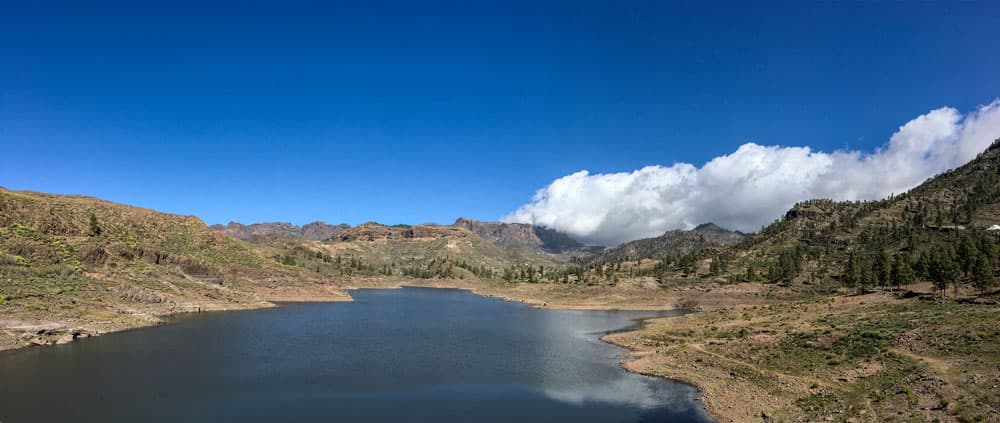
lake Chira
And finally:
I hope you enjoyed this walk around Soria and Lake Chira. If you should make the hike and notice any changes to my description or have other important information for other hikers, I would be very happy to hear your comments. If you like, you are also welcome to register in the hiking forum and exchange ideas with other hikers. I wish you a lot of fun while hiking!
Dagmar von SiebenInseln