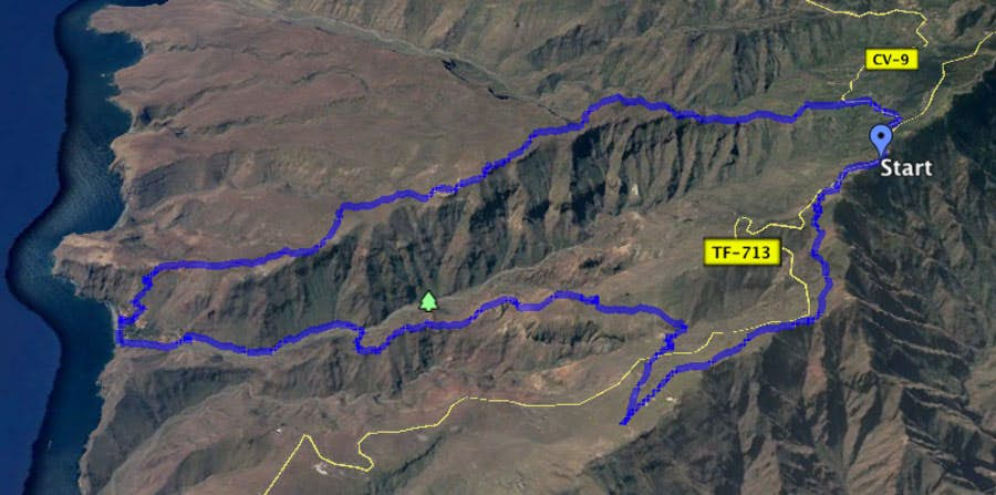
Today’s circular walk from Degollada de Peraza to Playa del Cabrito is hard to beat in variety. The adventurous hike takes you through a wild landscape. You will visit lonely gorges, bizarre rocks and the small beach oasis El Cabrito. Absolute highlights of this hike are the many beautifully situated abandoned villages. But the almost 20 km long hike is also exhausting and will lead you over many altitude meters from the mountains down to the beach and back again.
Hiking route PR LG 18 between Tacalcuse and Berruga
Map
Information Hike Playa del Cabrito
Start/end of tour: Mirador Degollada de Peraza (GM2, formerly TF-713), km 16
Arrival and departur
Car: via island road (GM2, formerly TF-713), parking at Mirador available
Bus: further information Guagua Gomera Homepage 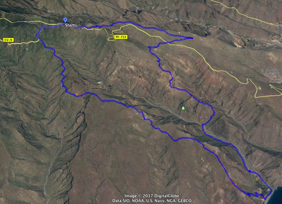
Track to Playa de Cabrito - view west to east
Valle Gran Rey – San Sebastian Line 1
Alajero – San Sebastian Line 3
San Sebastian – Airport La Gomera Line 7
Track Hike to Playa el Cabrito - view east to west
Length, altitude, time, requirements and refreshments
Length: approx. 20 kilometers
Difference in altitude:
951 meters in descent and ascent
absolute: approx. 1250 meters in descent and ascent
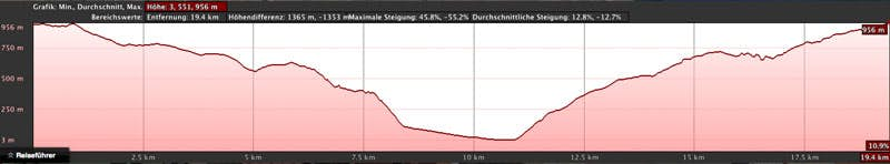
elevation profile hike Playa el Cabrito
Time
At least 7 hours pure walking time. With small breaks you should plan about 8.5 hours.
Requirements
Good physical condition, sure-footedness and head for heights are required. This is a long and strenuous hike. In some places the paths are exposed and in others difficult to find.
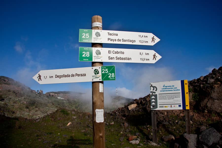
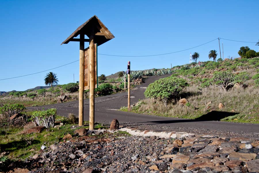
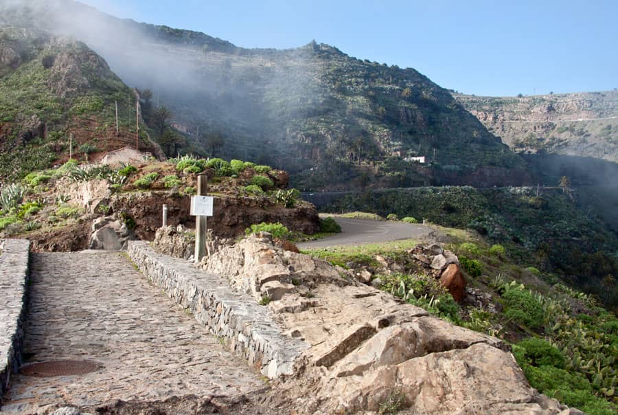
signpost to Playa el Cabrito
Refreshment
Article summary and large selection of GPS hiking tracks
Sign up for my newsletter now and get exclusive access to my collected GPS tracks as well as all the brief information about my articles.
Sign up nowAt the starting point of Mirador Degollada de Peraza there is a restaurant and at Playa del Cabrito it is possible to fill up with fresh water. On the rest of the hike, there are no places to stop for refreshments or fresh water. Therefore, you have to take enough water and food for the people and the accompanying dog with you.
Possible combination with the hike Playa del Cabrito
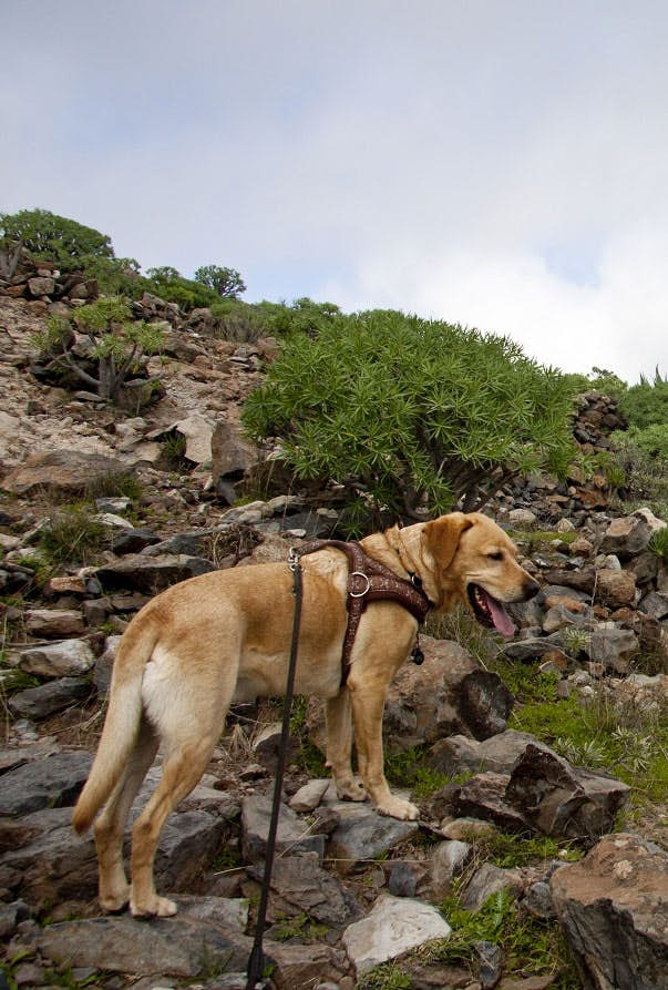
Hiking dog Lasko
Those who want to make do with half of the tour and thus a downhill hike can return by boat from Playa del Cabrito to San Sebastian. Then there is enough time for a refreshing swim at Playa del Cabrito. In the valley of El Cabrito there is a Finca Oeko Hotel on the beach, which offers holidays on a remote finca. If you like you can use the boat service between Playa del Cabrito and San Sebastian which is organized by the finca. A previous registration under the telephone number +34 922145005 is absolutely necessary. Hiking in the wild island south of La Gomera
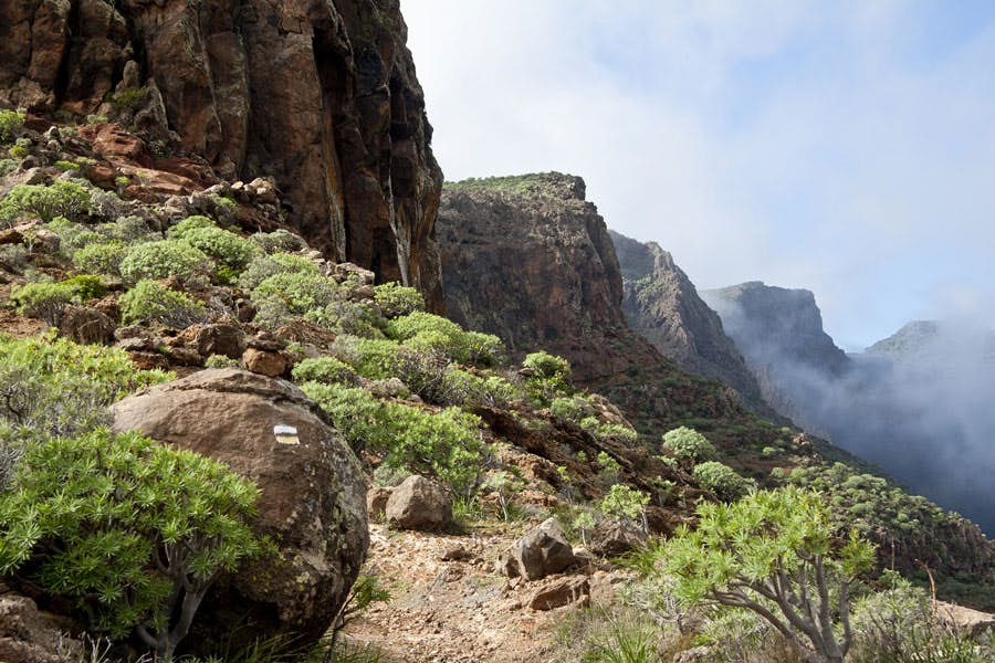
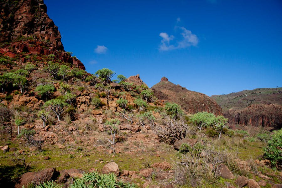
La Gomera is the second smallest Canary Island after El Hierro. But on the relatively small area (369 square kilometers) it unites different landscape forms. In the south, there are dry zones that rather resemble deserts. While up in the central highlands, humid cloud forests predominate. As in the Teno Mountains on Tenerife, many rugged gorges (Barrancos) stretch from the centre of the island towards the sea. And today’s circular walk leads into one of these impressive gorges – into the Barranco Juan de Vera.
The hiking trails are excellent. However, clouds are to be expected from time to time at high altitudes.
But already the journey to the starting point, the Mirador Degollada de Peraza, is an experience in itself. The GM-2 is the most beautiful panorama road of the island. It leads from the capital San Sebastian in the east of the island towards the famous Valle Gran Rey. It goes by the national park and past the well-known rocks, Roque Agando, Roque Zarcita and Roque Ojila. From the GM-2, very close to the Mirador Degollada de Peraza, there is the GM-3, which leads down to Playa de Santiago. The whole area in the southeast of La Gomera is characterized by barren slopes, rugged rocks and steep Barrancos. Precipitation is rather rare here.
Circular walk Mirador Degollada de Peraza – Playa del Cabrito
Section Mirador Degollada de Peraza – Pico Gomero
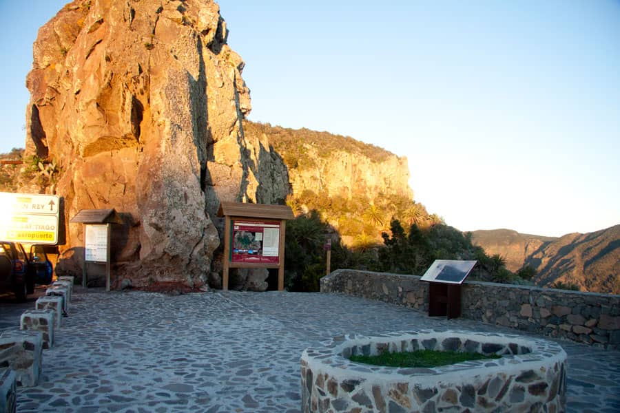
Mirador Degollada de Peraza - starting point for many hiking tours
The tour starts at the vantage point, the Mirador Degollada de Peraza at 951 metres above sea level. There on the Degollada de Peraza begin and cross several hiking routes. First you go directly down the wide paved path – behind the Mirador in a northerly direction, so to speak – towards Barranco de la Laja. Follow the signs for the GR 131 (white/red). After a short time, you will not go downhill, but the GR 131 will take you to the right. At first the path leads along the steep slope. Then the path continues uphill to a high plateau. There you meet a wide road that leads you right past the distinctive radio mast on the top of the mountain Tagamiche.
mirador (view point) close to Pico Gomero
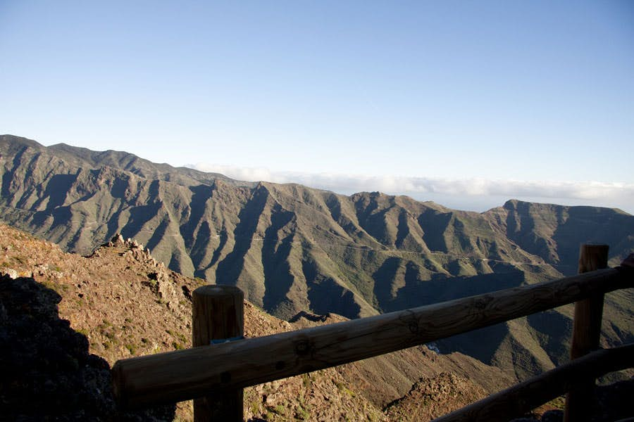
Shortly after, a paved hiking trail descends to the right. This crosses the road again and leads you down to the left on a ridge. To the right of you, there are poles on this path, from which you move away more and more. Keep left along the ridge and walk past a rock face below an old stone house. This will not be the last older house you will encounter on this hike. After about 30 minutes you will find yourself at a height with a fantastic panoramic view. The path rises slowly on the right side of the ridge. At an altitude of 812 metres you pass the Pico Gomero.
Wild landscape in front of Roque del Sombrero
Section Pico Gomero – Roque de Magro
crossroad close to the little village of Ayamosna
As you continue your hike, you will come across the line poles again. You reach a plateau and a road runs parallel to the hiking trail. Follow this road until you reach a small fork in the road in front of the village of Ayamosna. The houses of the small mountain village are up there in the shelter of mighty rocks. Here you leave the hiking trail GR 131. At the crossroads turn right down the road towards the main island road. You cross the road and meet Casa Caída (El Magro) on the other side of the road.
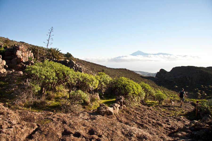
hiking path on the ridge with mount Teide in the background
There the small path continues. In some serpentines it takes you down to the green Barranco de la Guancha. Once the path forks at half height above the Barranco bed. You keep to the right and are guided in a wide arc into the bottom of the Barranco. After only a few metres in the Barrancogrund, the path continues on the left side of the gorge. It goes up a small path in the direction of Roque de Magro (690 metres above sea level).
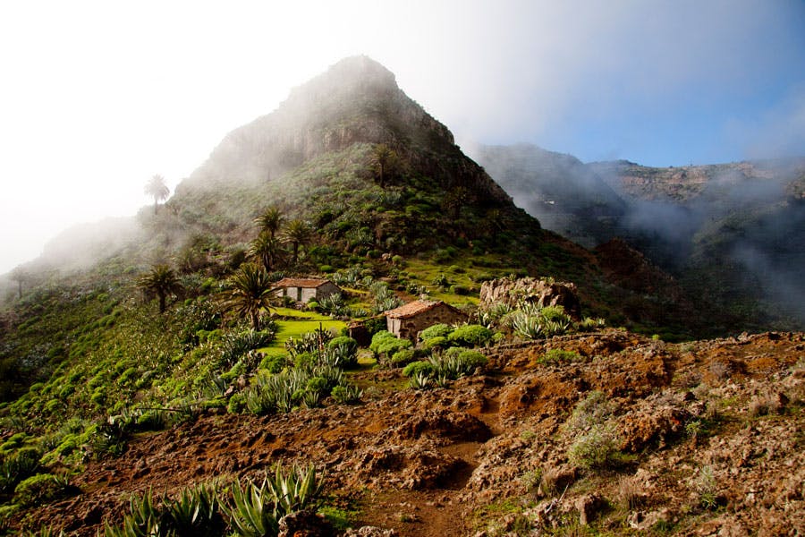
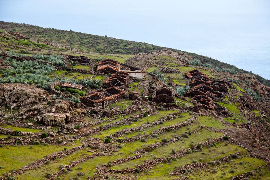
Section Roque de Magro – Roque del Sombrero – Roque García
At this point the trail is wider again and easy to find. It runs below the rock face of the Roque de Magro. A short time later you reach the abandoned village of El Magro. If you have some time, you can have a look around in the first abandoned hamlet near the old houses. Up there on the ridge you will also meet the hiking trail, which will take you further in the direction of the striking rock Roque del Sombrero (672 metres above sea level). Turn left over the ridge until you reach the saddle of Roque del Sombrero. From there the path takes you to the right underneath the big rock.
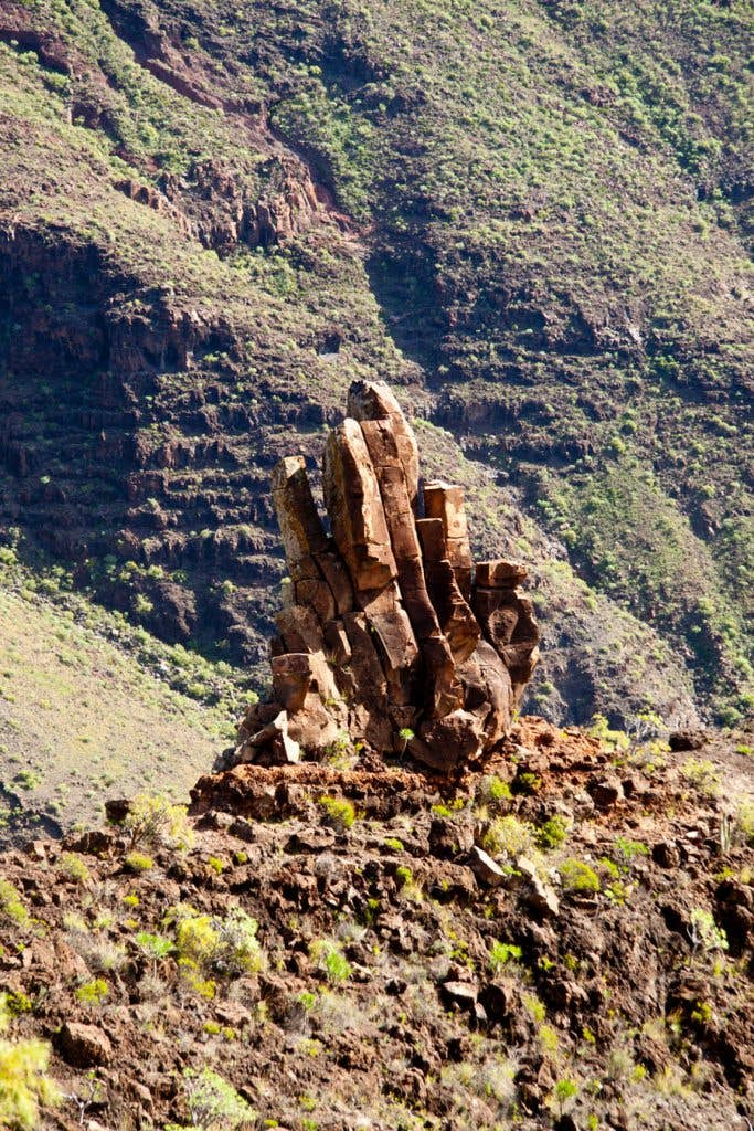
rock - shape of a hand
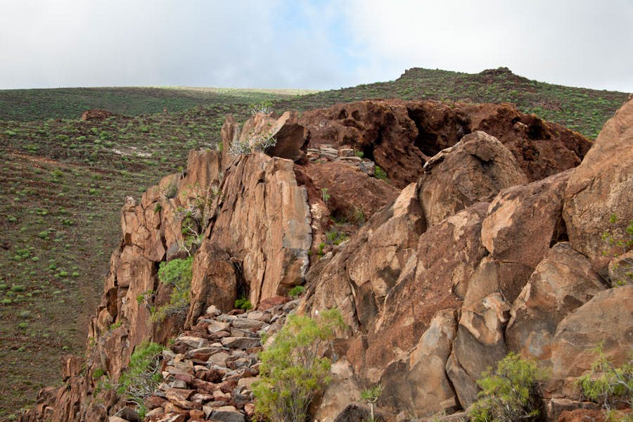
When you have bypassed the Roque del Sombrero, you can already see the next group of rocks below you. It continues along paths that are sometimes difficult to find, but always along the ridge. When you have reached the saddle, turn right again in small serpentines past this mighty rock group. Partly the path is a bit exposed. You walk directly along the foot of the rock and have a fantastic view of the Barranco Juan de Vera and the opposite side of the gorge. When you have bypassed this rock massif after about 20 minutes, you will find a ruined house again. You follow the ridge height and reach the next rock massif, the Roque García (443 meters altitude difference).
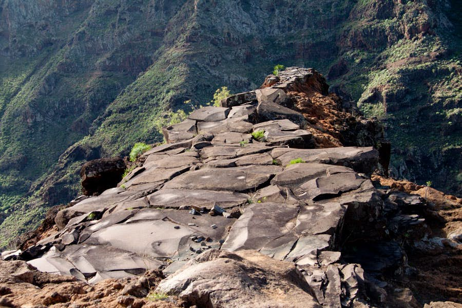
a viewing platform that couldn't be more beautiful
Section Roque García – El Cabrito
Article summary and large selection of GPS hiking tracks
Sign up for my newsletter now and get exclusive access to my collected GPS tracks as well as all the brief information about my articles.
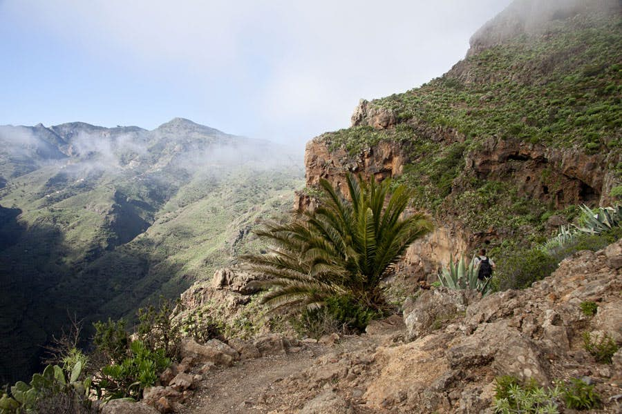
Sign up nowAt Roque García we turn left around the rock and climb up for a short time to get to the next saddle. Cross the saddle and climb down briefly on the other side. Then it goes on a narrow path directly along the rock. Here you have to be sure-footed, because on the right it goes steeply downhill into the Barranco Juan de Vera. Those who are free of vertigo can enjoy the wonderful view. After a short time, you reach a striking rock plateau. There you can rest and enjoy the fantastic views of the wild landscape. From this viewing platform you can also see Playa del Cabrito far below you for the first time.
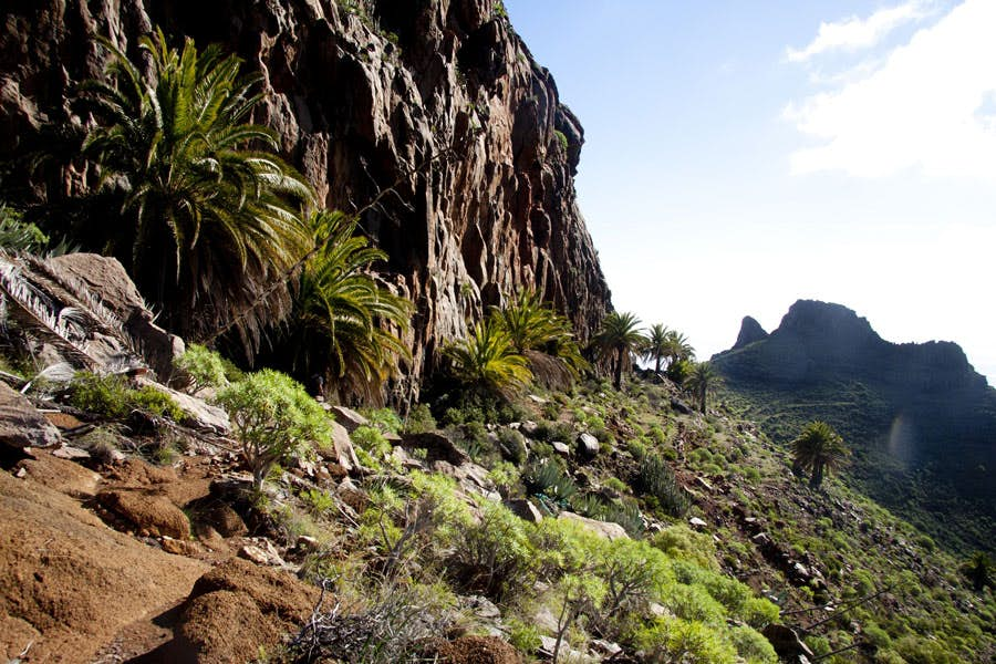
The hiking trail leads along a long rock formation
You continue along the basalt wall and after a short time you reach the crest height again. Here is a very striking rock, which looks like a hand (370 meters altitude). Then it goes for you still briefly on the ridge way straight ahead. Then the path leads you on steep and steep serpentines down to the Barranco Juan de Vera. The descent is really difficult because of the many stones on the very steep path. But down in Barranco it gets easier. You cross the Barranco and turn left on the other side of the gorge. This will take you further down the valley in about 30 minutes to Playa del Cabrito.
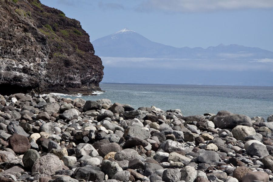
Playa el Cabrito with view to Tenerife and Teide
Playa del Cabrito
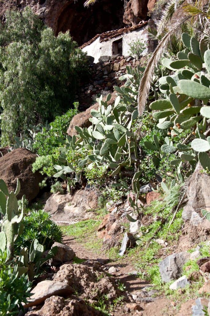
El Cabrito is a remote area. The area of the Oekofinca with the hotel itself may not be entered. Therefore, when you approach El Cabrito, the path leads you left along a wall. The trail joins the GR 132, which leads from San Sebastian to Playa del Cabrito. Both merge into a wider path. It runs between the hotel grounds and the pebble beach. Shortly afterwards you will pass the reception. If you want to continue by boat to San Sebastian, you have to report here at the reception. But prior booking is absolutely necessary. There is also a faucet where you can fill up with fresh water.
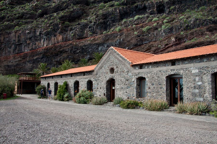
Hotel reception at Playa del Cabrito
Continue straight ahead to the boat landing stage. If you have time, you can rest here on the beach. From there you have a fantastic view to the neighbouring island Tenerife with the Teide. But if you want to hike on, just before the pier, keep to the right around the valley inwards. There the hiking trail GR 132, which is also hiking trail 28 here, runs between gardens and a rock face. Then turn left and continue uphill along a path surrounded by walls. This path leads you to another steeply ascending paved path, which branches off to the left of the first path. Here you leave the area around Playa del Cabrito.
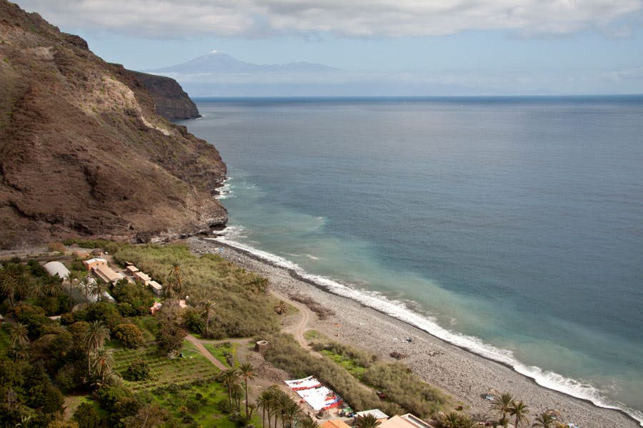
Playa del Cabrito
Playa del Cabrito – Morales section
You climb steeply up the paved path that led you out of Playa del Cabrito. The path forks, keeping to the left. At another fork it turns right. If you look back, you can still enjoy a beautiful view of Playa del Cabrito from the top. After about 30 minutes of walking uphill you reach the ridge height, which you now follow. In the next half hour you continue on the hiking path, which first runs left a little away from the ridge height. Later the path returns to the ridge. Here you meet a path crossing the path that leads up from the Barranco Juan de Vera.
View on the gardens of the finca El Cabrito
Now you are so high that you can look back and see Playa de la Guancha and shortly afterwards the airport and the area around Santiago. Then you come to the abandoned village of Morales. You will see the houses in front of you for a long time. The hiking trail then leads you directly through the lonely village. It goes directly past the houses. You will also see a house with a large stone oven. At the end of the village, when you have passed the last house, the GR 132 goes left to Santiago. However, continue straight on and follow path 28 or PR LG 18.1.
on stony narrow hiking trails uphill
Morales – Tacalcuse section
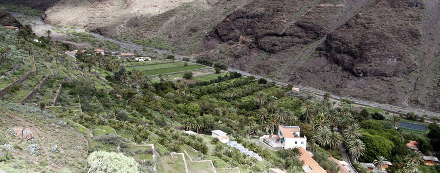
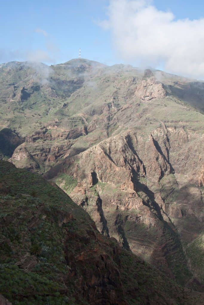
The way between the two abandoned villages cannot be overlooked. It leads you over slopes and past other abandoned houses. Mostly it runs uphill along the ridge. After some time you reach the foot of a rocky peak on which there is a mast. Keep left there. From the left, after some time, the hiking trail 25 or old also PR LG 18 comes up the mountain and unites with your path. After some time you will reach a very green high valley. Here there are palm trees and the path descends slightly.
the abandoned ruin village of Morales
A little later you pass empty houses again. The houses of Tacalcuse are partly built in the rock and offer an impressive sight. You are now already 860 meters high again and might like to use this wonderful place for a small rest. From here you can enjoy fantastic views of the mountains and gorges west of you.
Section Tacalcuse via Berruga to Mirador Degollada de Peraza
The trail continues uphill from the houses of Tacalcuse and sometimes a little downhill from time to time. Finally you reach a path that leads you high above the Barranco Chinguarime on a narrow path along the abyss. Also here the path partly goes a little downhill and then further up again. After about 40 minutes the path will take you past the abandoned houses of Berruga. These are on the left below you on a saddle. If there are clouds over them, you will have an unforgettable experience.
Ruin house on the wayside Tacalcuse
Already from the far distance you will see the antenna mast on the Degollada de Peraza
Already from a distance you can see the distinctive antenna mast on the mountain top near the Mirador Degollada de Peraza. Now it’s not far. You climb further on the way and after a short time you hit the road GM-3. Suddenly you are back in civilization after a day of loneliness. You follow the road uphill to the right. Shortly before the Mirador Degollada de Peraza the road leads into the GM-2. A little later you are back at the starting point.
here the hiking route meets the street GM3 - almost done
And finally
I hope you enjoyed this circular walk through the wild southeast of La Gomera. For me personally this was the most varied, but also the most challenging hike on the small island so far. And what do you think? I am looking forward to your experiences,
Dagmar von SiebenInseln