The Ruta de los Volcanes is one of the most famous hiking tours on the Isla Bonita, as La Palma is also called. As the name suggests, the route passes many large volcanoes in the southern part of the island. The tour, which is approximately 18 kilometres long, starts or ends in the mountain village of Los Canarios, located in the south of La Palma. At the other end of the impressive hiking tour, which takes you up and down the entire southern ridge of La Palma, there is a scenic picnic spot, Refugio El Pilar.
General Information
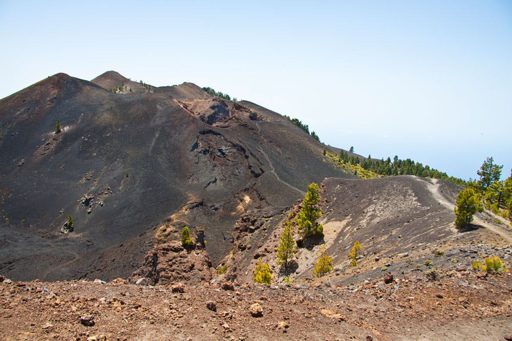
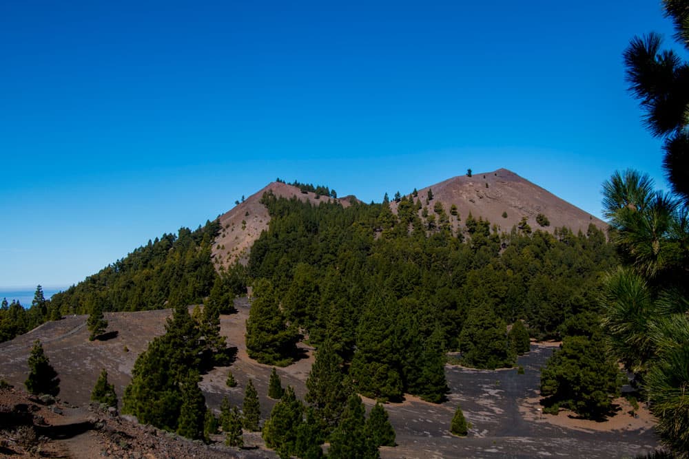
Track Ruta de los volcanes - Los Canarios to Refugio el Pilar - view from the westside
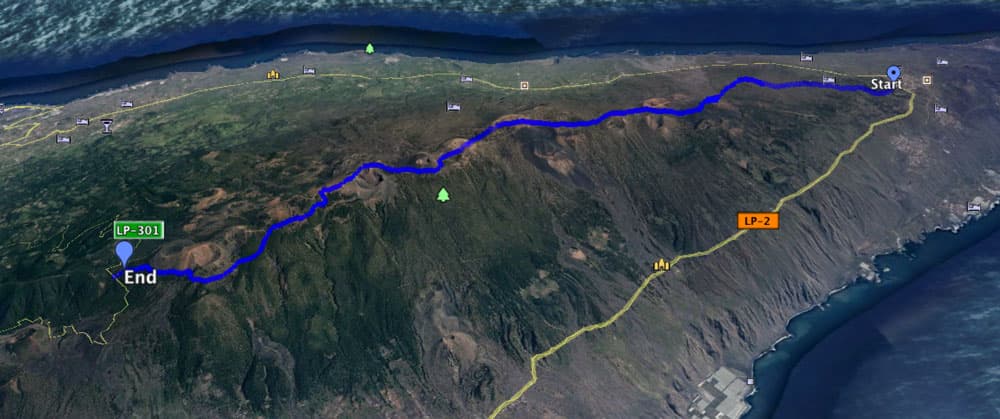
Map
Starting point
Los Canarios, church square, Plaza San Antonio
How to get there by bus
Bus lines 200, 201 and 203 stop in Los Canarios. further information you will find here. How to get there by car:
You can get to Los Canarios from the direction of Inselosten on the island road LP-1 and on LP-2 from the west side of the island. Parking is available on the main road or the side roads. Towards the north/mountains, Calle St. Antonio leads you to the church of San Antonio Abad and the church square.
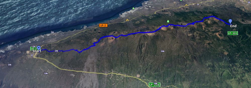
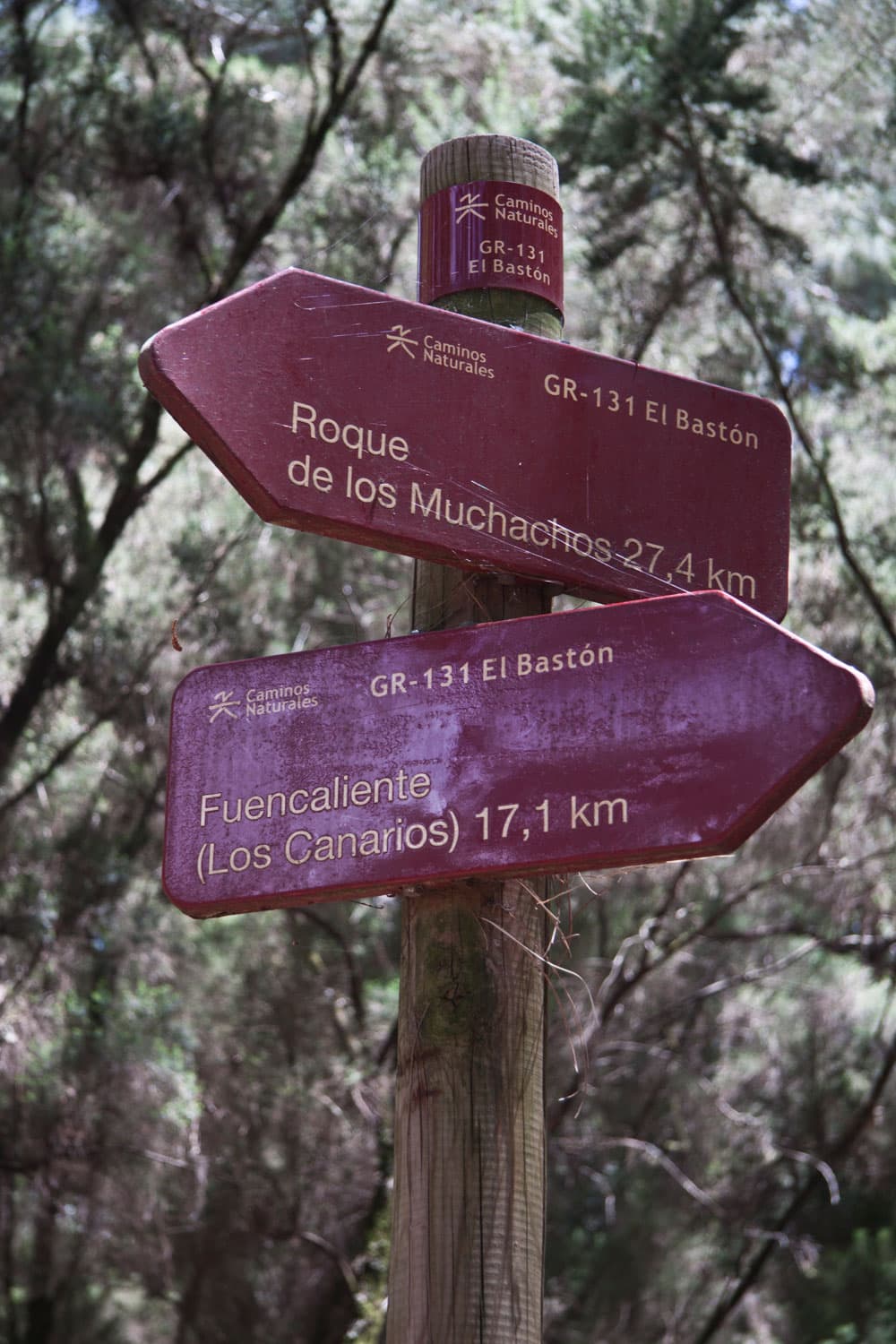
Ruta de los Volcanes - Los Canarios to Refugio el Pilar - view from the eastside
Destination
Refugio del Pilar

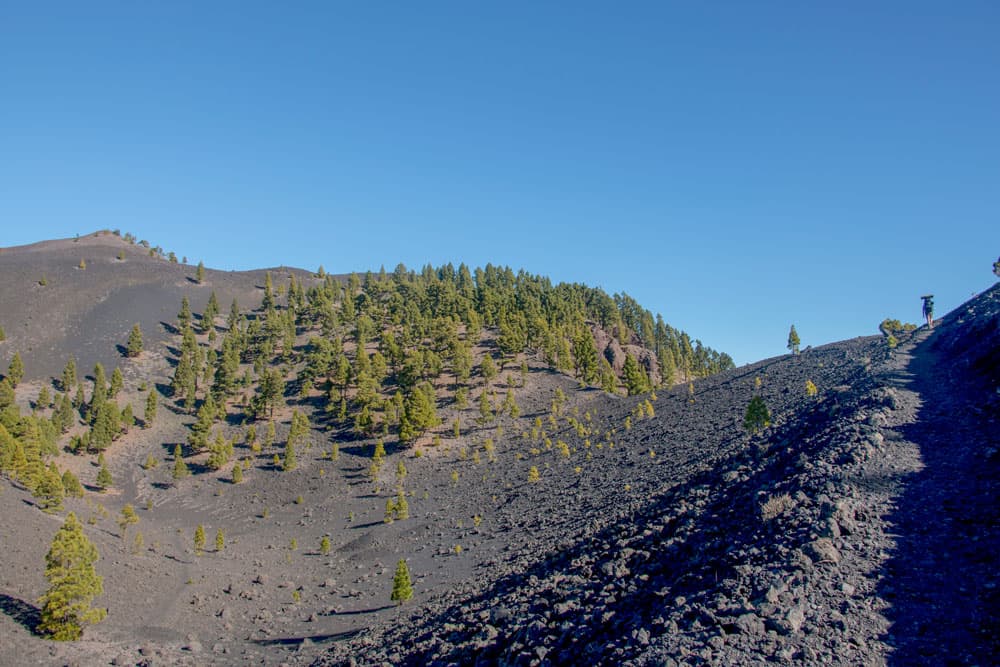
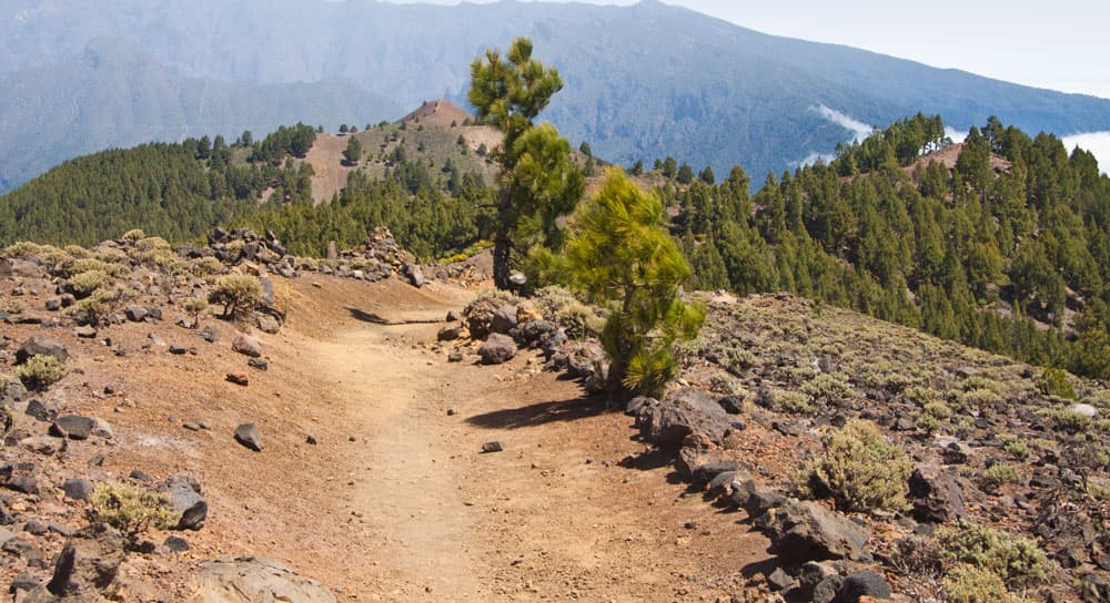
Ruta de los Volcanes - hiking path
Approach
There is no bus connection here. The journey or/and organised departure is only possible by car or taxi.
Arrival by car: Middle/West: Via the island roads LP-3 and LP-301. From the east side of the island via LP-202 and LP-301. At Refugio del Pilar there are sufficient parking spaces.
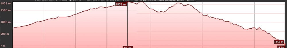
elevation profile Ruta de los Volcanes
Difference in altitude and way
Ascent: approx. 1200 meters altitude difference (absolute)
Descent: approx. 850 m altitude difference (absolute)
ap. 20 km
Time
It all depends on J. The ultramarathon participants will certainly run the course in less than three or two hours. You should better plan at least six hours for a course.
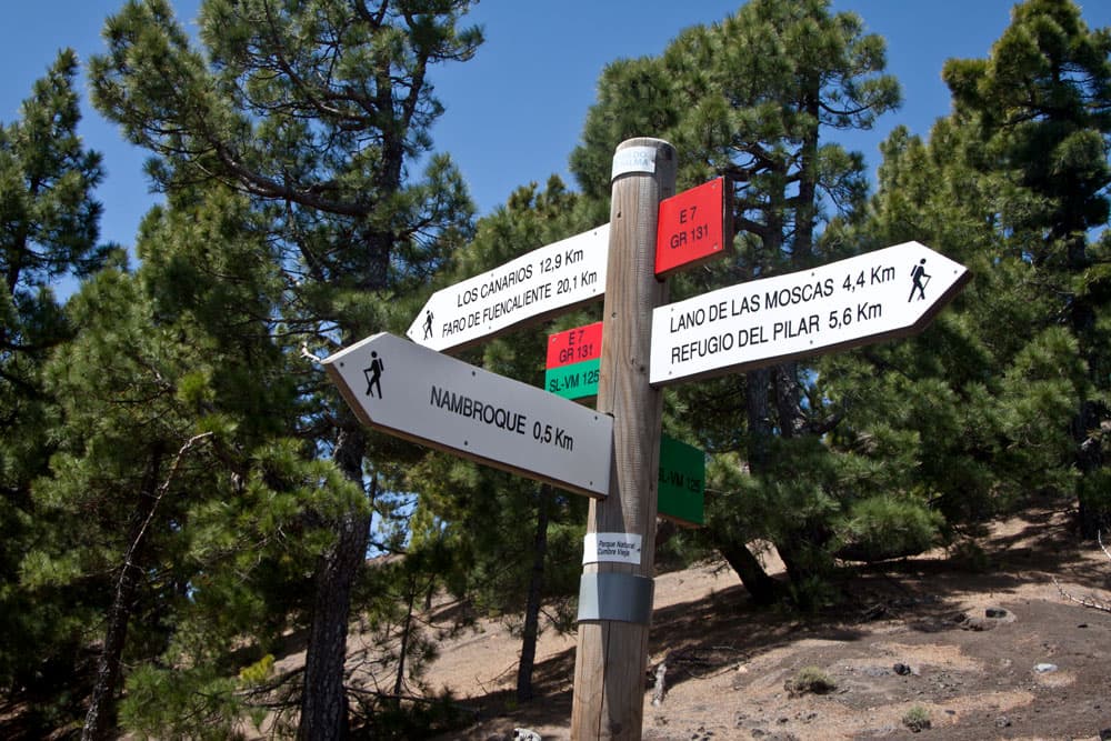
Ruta de los Volcanes - signpost
Requirements
From time to time surefootedness is required and of course a good physical condition. But all in all the hike takes place on good paths and paths and is well signposted.
Note
On this tour there can often be stormy winds or clouds due to the altitude.
Article summary and large selection of GPS hiking tracks
Sign up for my newsletter now and get exclusive access to my collected GPS tracks as well as all the brief information about my articles.
Sign up nowRefreshments
In Los Canarios there are several restaurants and bars. Otherwise, there is no place to stop for refreshments along the entire hiking trail. Therefore you should take enough water and food with you.
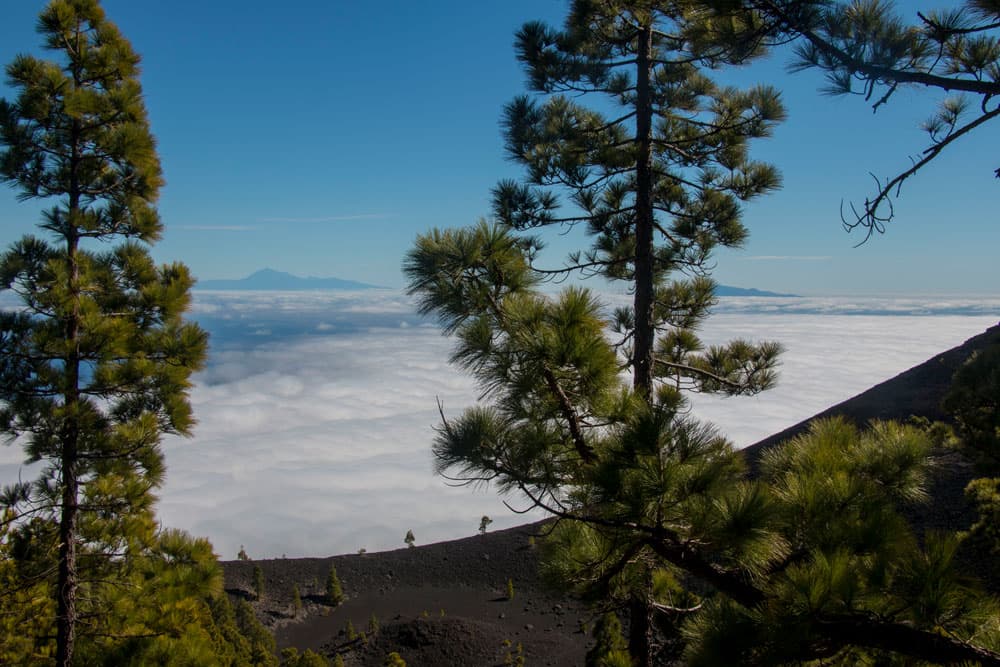
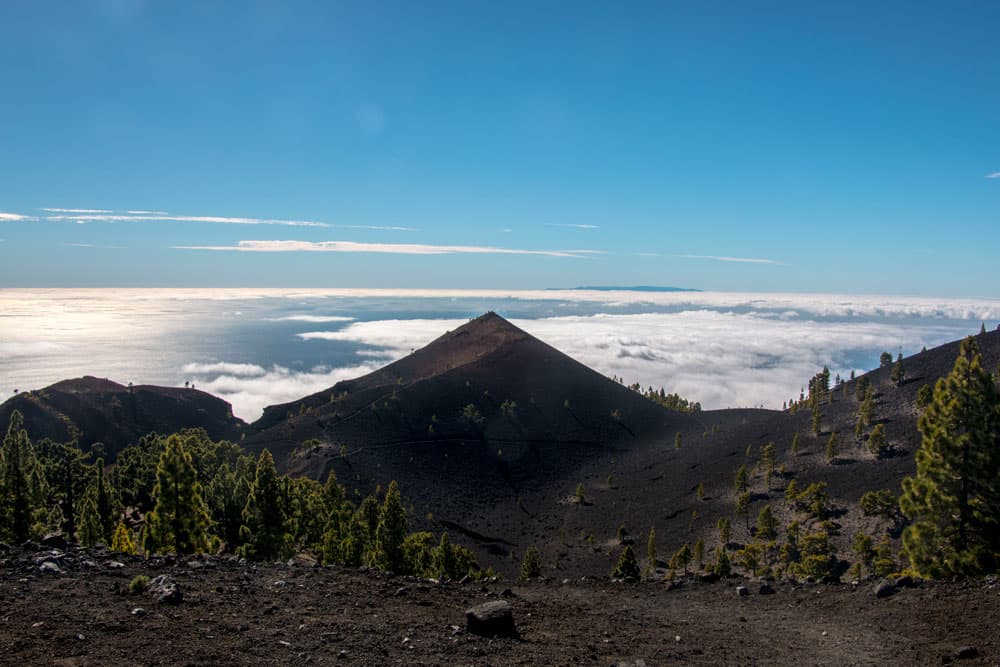
Ruta de los Volcanes - above the clouds with view to Tenerife
For dog lovers
Since there is no water except at the Fuente de los Roques (1200 meters altitude difference) and start/finish at the Refugio del Pilar, please also think of the four-legged friend and take enough water with you.
Variants
signpost Los Canarios
As this is a long tour, it can also be divided into two day tours. Thus an ascent from Los Canarios to the highest point of the tour, the volcano Deseada II, is possible (with return trip). The same way it goes from Refugio del Pilar to Deseada II and back again. This way you can walk the Ruta de los Volcanes practically twice. You can get to know the route from both sides.
I introduce the tour from Los Canarios. If you like, you can also start at Refugio del Pilar and hike to Los Canarios. Whichever variant you choose, both are scenically beautiful. But it is easier to start the hike in Refugio del Pilar. There you are already at 1.440 meters altitude and therefore have less meters to climb.
For the more comfortable: from Los Canarios, forest tracks lead to the high Fuente de los Roques rest area (1,200 metres above sea level). If you want to save the 1.5 hours uphill and about 480 meters of altitude difference, you start the hike from here.
Ruta de los Volcanes and the Transvulcania
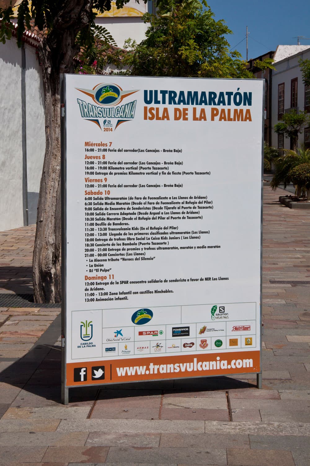
The famous island Ultramarathon Transvulcania
Before you go hiking on this famous trail, you should know who else is going on here. The Ruta de los Volcanes is a very special route. It is part of the famous Transvulcania ultramarathon, which has taken place once a year on La Palma since 2009. The Ultramarathon, now known worldwide, takes place there in May. It covers 73 kilometres, on which a difference in altitude of 8525 metres (4415 uphill, 4110 downhill) has to be overcome. Start is in the morning at 6 o’clock in the darkness at the lighthouse of Fuencaliente at the coast. The ultramarathon runs across the entire island along the ridge and volcanoes to Puerto de Tazacorte. It ends in Los Llanos de Aridane. There is the ultramarathon, the marathon, a half marathon and a small vertical trail. The number of participants in the starting year 2009 was still below 500. In May 2017, 3600 runners from all over the world took up the enormous challenge.
Ruta de los Volcanes – a half marathon
The half marathon of Transvulcania starts together with the ultramarathon and the marathon in Fuencaliente. It then leads the runners via Los Canarios and the Ruta de los Volcanes to the Refugio del Pilar. And this is exactly the route of the half marathon today. Well, you can save yourself a few meters of altitude. You don’t have to start in the dark or at the coast in Fuencaliente. You start in Los Canarios at a comfortable 722m altitude.
many volcanoes along the hiking path
While the runners here already have some meters of altitude on their backs, you can start fresh in the small mountain village. While hiking comfortably, you can enjoy the fantastic view on all sides of the island and across the Atlantic to the neighbouring islands. And when you arrive at Refugio del Pilar after this wonderful ridge hike, you will hopefully not be rushed, but relaxed and full of new impressions.

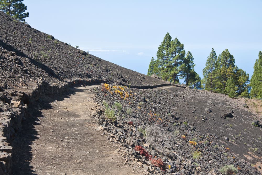
dark soil and only a few pines around the hiking path
Los Canarios – salt, wine and volcanoes
I introduce the Ruta de los Volcanes from the small administrative town Los Canarios, as the marathon also leads in this direction. Before we finally start, some information about Los Canarios and its surroundings. Los Canarios has only a few hundred inhabitants. Besides the 16th century church, Antonio de Abad, Los Canarios is known for its good island wine and the salt flats in the coastal village Fuencaliente. Due to the fertile volcanic ash, the vines have been thriving on the municipal territory for many years in addition to banana cultivation.
The Fuencaliente saltworks have been in existence since 1967 and are the last saltworks still in operation in the Canary Islands province of Santa Cruz de Tenerife. Today, a visitor centre and a restaurant are connected to the saltworks. From Los Canarios it is worthwhile to visit the volcano San Antonio. The crater rim is accessible and a visitor centre informs about the volcanic activities on La Palma. From there it is also not far to the volcano Teneguia, which lies 438 meters high and was only formed in 1971 during a three-week eruption.
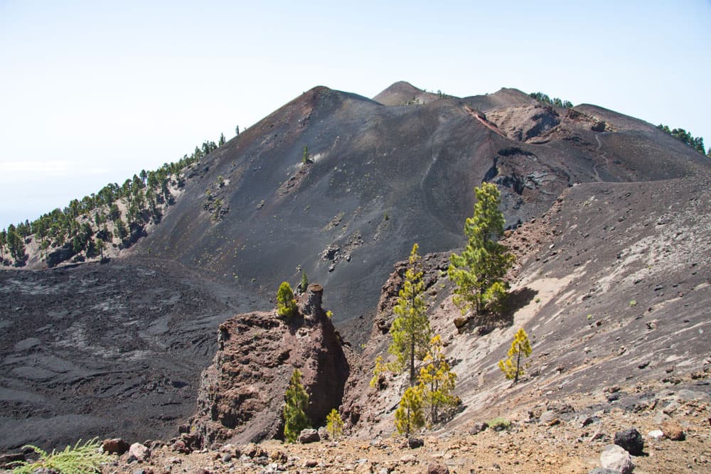
View of the southern volcanoes during the ascent to the volcano La Deseada
Ruta de los Volcanes – Hike from Los Canarios to the Refugio del Pilar
Hiking route Los Canarios – Montaña del Pino
The starting point of the hike is the Plaza San Antonio, the unmissable church square in Los Canarios. From there it goes along the Calle José Pons. At the end of this street you cross another street. Then the path, which is a driveway at first, leads you uphill. Follow the well-signposted GR-131 to the Refugio del Pilar. At the beginning of this hike, the path takes you in a wide arc around a small first mountain on the left.
resting place Fuente de los Roques
You cross a road and two paths that start from the main path. The route takes you uphill through stone walls, pine woods and vineyards. Some of the way goes steeply uphill. Before you, you will soon recognize the Montaña del Pino by its striking radio masts. You also bypass this mountain on the left side of the hiking trail. Then it goes steeply uphill on partly with stones bordered ways.
Ascent to Martín Volcano
Article summary and large selection of GPS hiking tracks
Sign up for my newsletter now and get exclusive access to my collected GPS tracks as well as all the brief information about my articles.
Sign up nowHiking route Montaña del Pino – Volcano Martín
A little later a steep path branches off to the right down to the rest area Fuente de los Roques. Since this resting place can be reached from Los Canarios on a forest road, it is also possible to undertake the hike from here. This will save you about 1.5 hours of ascent. From here it goes signposted further uphill in the direction of the mountain Fuego or also Montaña la Semilla (1248 height meters). You bypass this mountain on the hiking trail on the right.
Hiking trail along the volcano
For a short time it then goes slightly downhill. Then the trail leads you right around on a wide path. This becomes narrower and steeper and leads through the Barranco Gully towards the Martín Volcano. To the left you now leave the Montaña Pelada (1410 m altitude). The path takes you up a steep slope on the left side of the Martín volcano.
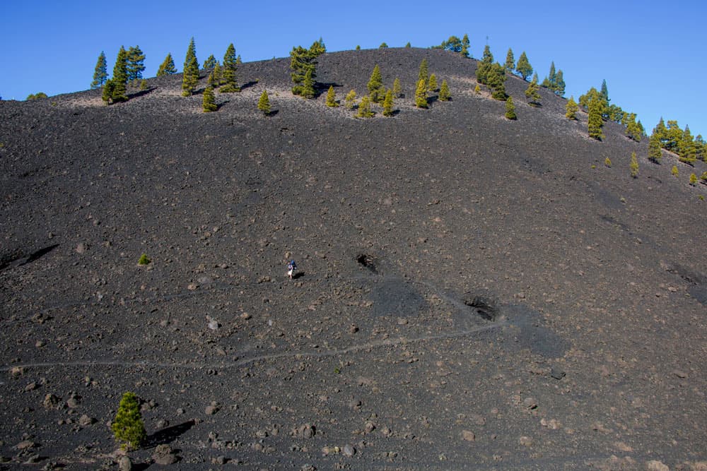
on the mighty volcanic slopes man seems small
Hiking route Martín Volcano – Summit and Fuente del Fuego
You will pass the Ruta de los Volcanes very close to the summit of the volcano San Martín (1597 meters altitude). If you still have time and strength – a detour to the summit (right along) or to the Fuente del Fuego (left along) is already worthwhile because of the wonderful view. Each route takes about 10-15 minutes.
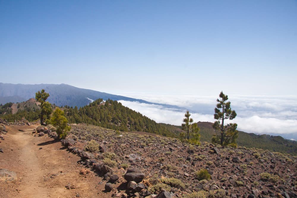
hiking on the ridge above the clouds
The main GR-131 path continues from Martín volcano along the ridge and bypasses another volcanic cone. After you have walked a long time through lava and almost empty volcanic landscape, there are suddenly again pines. When the weather is clear you already have an impressive view of the neighbouring islands La Gomera, El Hierro and Tenerife with the Teide. Between bushes and pine trees you continue uphill and downhill for a while.
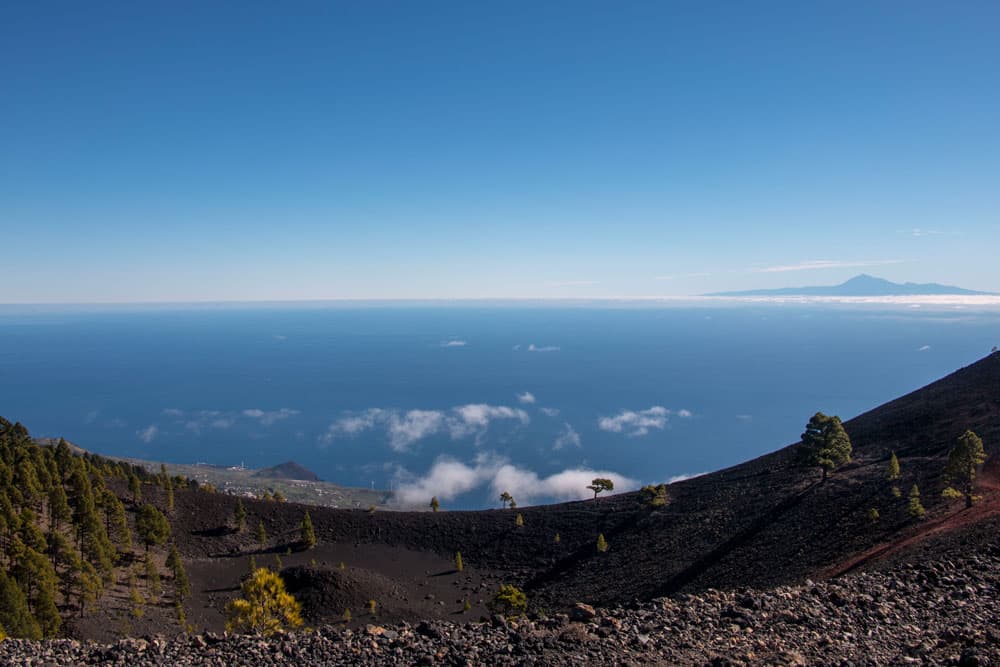
view from the top on Tenerife and Teide
Walking route Volcano Martín – Deseada II
The route takes you along the ridge with magnificent views of the slopes of the Caldera of La Palma and the neighbouring islands. It’s almost done now. You are approaching the highest point of the hike, the volcano Deseada II with its 1932 meters of altitude. Now you are probably on your way for almost four hours. Enjoy the wonderful panoramic view from up here.
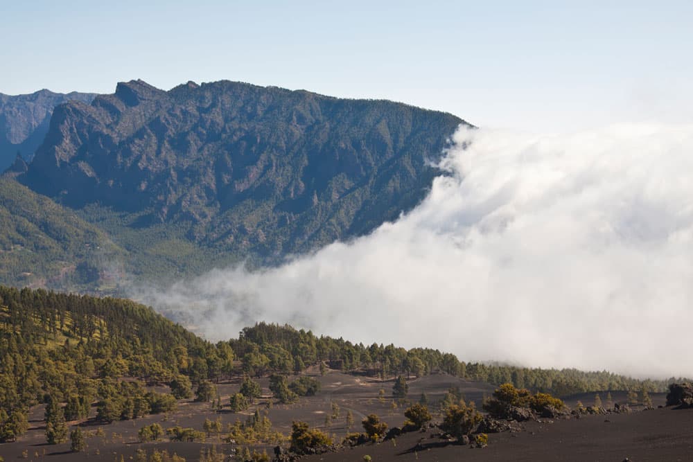
Over the mountain ridges the huge cloud rollers come in from the east
Shortly before you reach the summit of Deseada II, a path branches off to the right. This leads parallel to the main path on the right side of the Deseada II up to the main summit of the Deseada (1945 m altitude) and past the crater Duraznero back to the main path. Whichever route you choose, fascinating views are guaranteed.
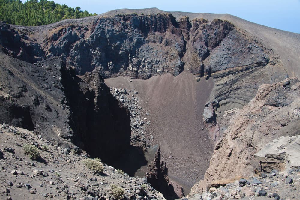
Ruta de los Volcanes - close to the volcanoes - Crater of Hoyo Negro
Hiking route Deseada II – Mirador del Hoyo Negro
Both paths meet again at the foot of the Montaña de Fraile. On the left side of the crater we continue through black lava fields. Next you will see the volcano Pico Nambroque (1924 m altitude) on your right. On the right side a summit path branches off from the main path to the summit (hiking time to the summit approx. 15-20 minutes).
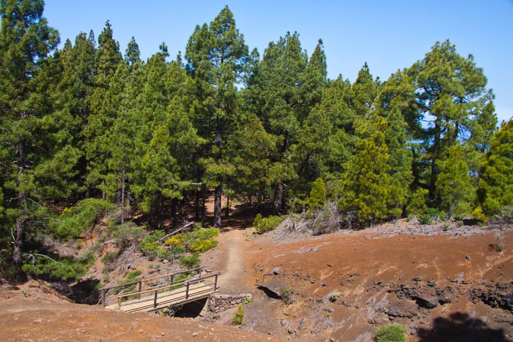
Ruta de los Volcanes - from time to time the path leads through pine forests and here over a small bridge.
On the left side the next exciting volcano is already waiting for your visit. The path leads to the right past the crater of the crater del Hoyo Negro. From there it goes up again to the Mirador del Hoyo Negro (1890 m altitude).
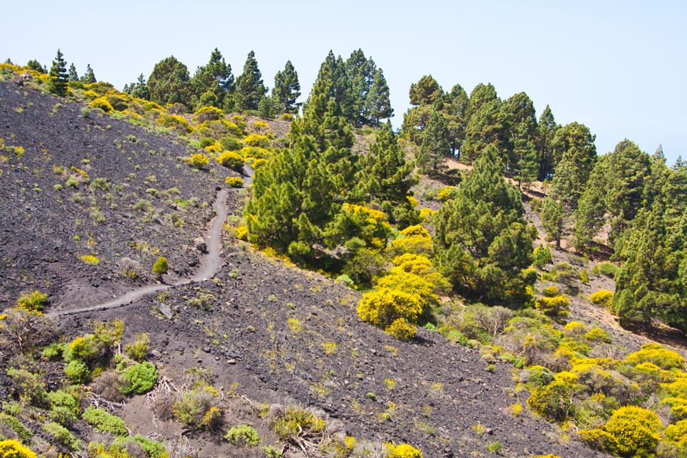
Ruta de los Volcanes - Hiking trail along the slope
Hiking trail Mirador del Hoyo Negro – Pico Birígoyo
From there, follow the ridge path up and down gently. Once again you will have fabulous views of the west coast of La Palma. Then it goes downhill. The trail crosses a bridge and then goes left along the Montaña de los Chárcos. Again it goes through pine forests and broom bushes. You can also enjoy wonderful views of the entire west coast and the northern part of La Palma.
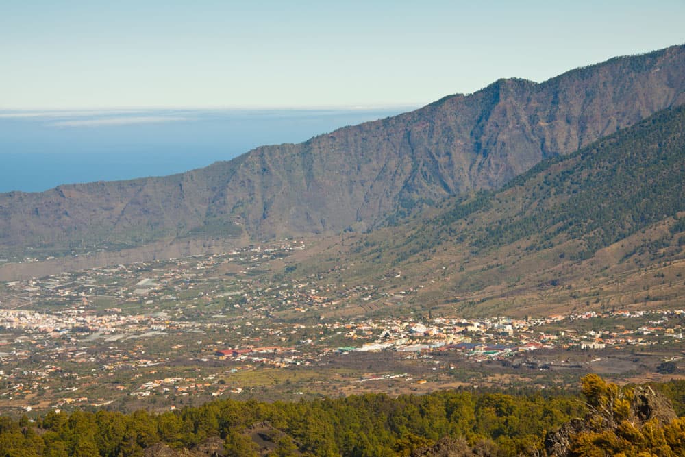
View from the height before El Pilar to the valley around Los Llanos
Later we continue downhill on the GR-131 to the right on a forest road for about 20 minutes. On the left, the itinerary takes you along the Montaña Barquito. On the left, you will continue around the massif of Pico Birígoyo. From Mirador del Hoyo Negro it’s a good 1.5 hours downhill to Refugio del Pilar. On the way you still have great views of the Caldera de Taburiente and the entire Aridane valley in front of you.
Ruta de los Volcanes
Hiking route Pico Birígoyo – Refugio del Pilar
Then it’s back to the pine forest. Partly in wide serpentines you hike downhill towards Refugio del Pilar. Throughout the hike there are many hiking routes to the right and left of the path. But the signs are good. At the end of the hike, you simply continue along the main GR-131 path.
Finally you arrive at the picnic area Refugio del Pilar. There you can see the exhibition about the Cumbre Viaja in the visitor centre. You have done it. Many meters of altitude and a charming hike lie behind you.
Ruta de los Volcanes - fantastic views of both sides of the island from the mountain ridge
And finally
I hope that you enjoyed the little trip to the Isla Bonita, La Palma. Write me about your personal hiking tour on the Ruta de los Volcanes. Have fun hiking!
Dagmar from SiebenInseln