Montaña Blanca – volcanic hike of a special kind
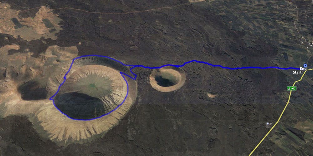
Map
This hike on Lanzarote over the Montaña Blanca (also known as Caldera Blanca) takes you over the entire crater rim of the mighty volcano to the summit. At almost 600 metres, it is the highest volcano on the island. The hiking trail is called Caldera Blanca or the „Los Islotes“ trail.

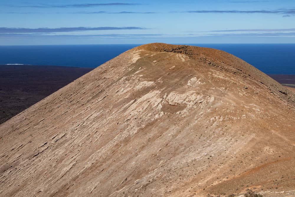
Montaña Blanca
It first leads through lava fields that were formed during the eruption of Timanfaya between 1730 and 1736. Los Islotes refers to small islets that protrude from the lava fields. This refers to the volcanoes, which are lined up next to each other and stand out from the dark lava with their bright colours.
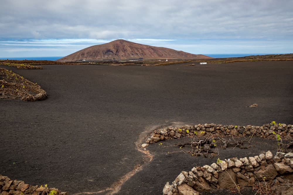
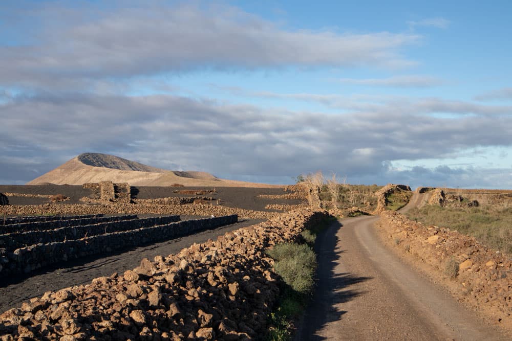
view to the Montaña Blanca from the far distance - vine plants
The volcanoes Montaña Blanca, Montaña Caldereta and Risco Quebrado also belong to these „little islands“. At the foot and on the crater slopes and in the big crater you will even find plants and green bushes, depending on the rainfall. So it is not surprising that there are also goats and sheep that will accompany you on your hike. But before you climb the biggest volcano of the island, the Montaña Blanca, you first pass the smaller volcano Montaña Caldereta. This volcano can also be climbed in a small extension of this hike.
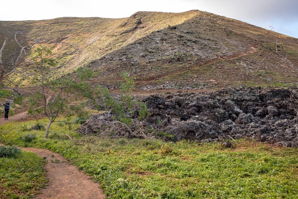
the volcanic slopes, lava and a little green
Landscape reserve La Geria and the old capital Teguise
The entire area around the Montaña Blanca belongs to the protected landscape area of La Geria. In this area the famous wine is cultivated on Lanzarote. The type of viticulture differs considerably from the type of cultivation known to us. Because on Lanzarote the wine is cultivated at ground level in hollows, which are filled with dark volcanic sand. On the way to the hike you can already see many of these vines in the fields.
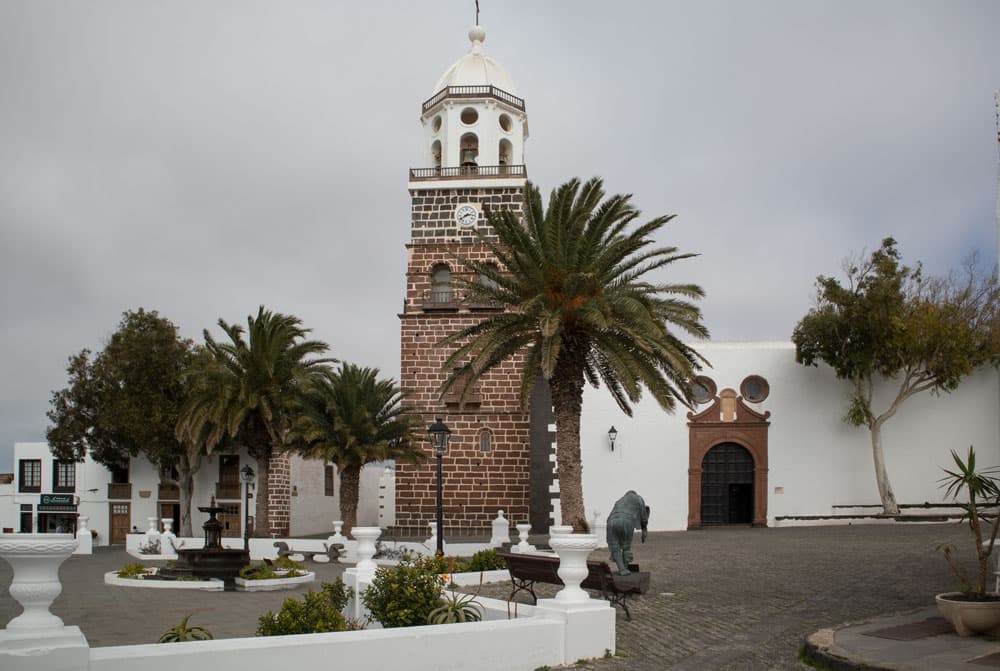
church and church square in Teguise
If you still have a little time before and after the hike, you should also visit the old capital of the island, Teguise. Only a few kilometres away from the starting point of the hike, there is the tranquil village. It is built in the typical old style of the island. The architect Caesár Manrique, who was born on the island, made sure that here and in other places on Lanzarote the typical architectural style has been preserved. White houses with green windows dominate the street scene. It is worth visiting the village square, the church and the narrow streets.
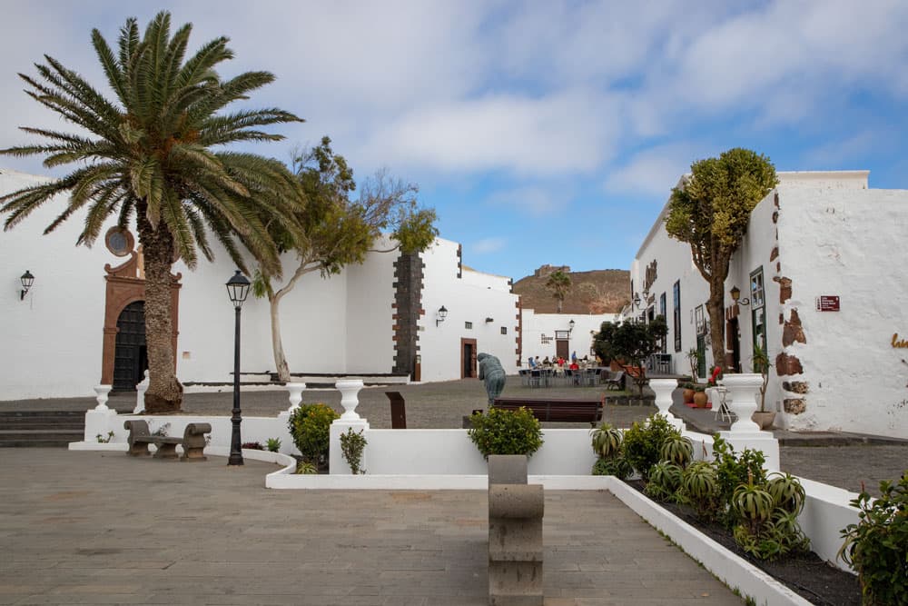
old capital and picturesque village - Teguise
General information about the hike Lanzarote Montaña Blanca
road at the start of the hike - both volcanos in the background
Starting point and approach
Starting point of this hike is a small crossing at the LZ-67 at the place Mancha Blanca. Shortly after the place the LZ-67 makes a big curve. Two roads lead in different directions, so that there is a small crossing. Your walk starts here at the beginning of the road towards Montaña Blanca.
Approach by car
The small place Mancha Blanca is centrally located in the northern volcanic area of Lanzarote. So you can approach from all four directions on different access roads. At the LZ-67 you will find – as described above – the starting point of the hike. Parking is available at the roadside. If you like to walk less, you can also drive in the driveway and park there at the roadside.
Article summary and large selection of GPS hiking tracks
Sign up for my newsletter now and get exclusive access to my collected GPS tracks as well as all the brief information about my articles.
Sign up now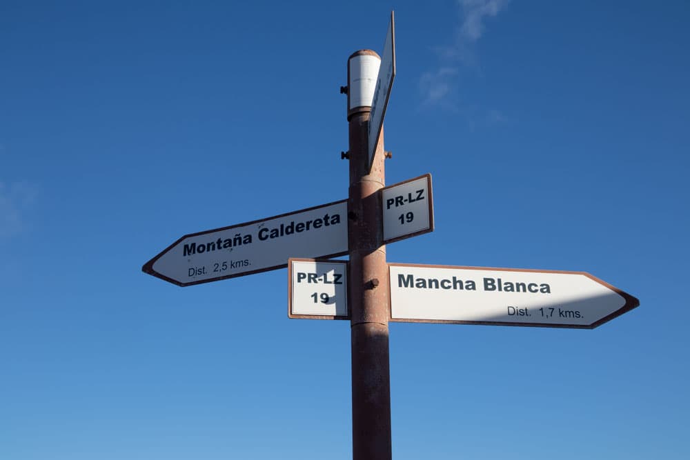
signpost Montaña Caldereta
Arrival by bus
Bus line 53, which runs between La Santa and Teguise, stops in Mancha Blanca. You can find more information on the homepage of the bus line. Time
I don’t like to give general time information for hiking tours, as the times are very individual. We needed a total of 4 hours for this group hike with a detailed rest on the summit.
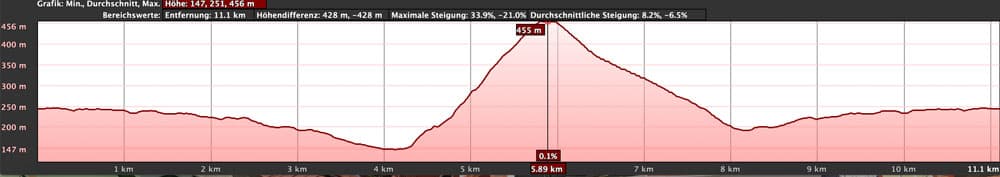
elevation profile hike Montaña Blanca
Difference in altitude and distance
The difference in altitude is about 400 meters. The distance is about 11.5 kilometers long.
Requirement
Since the hike is a little long, you should be in good shape. The ridge must be free of vertigo and sure-footed. But otherwise it is an easy and for everyone easy to master tour. The hiking trails are excellent and not to be missed.
Refreshment
There are no restaurants, bars and shops on this hike. Therefore take enough water and food with you.
Variants
This tour can be combined well with various other hiking and circular walks in the vicinity. This way the hiking trail can be extended by walking around the volcanoes. Besides the Montaña Blanca you can also climb the smaller neighbouring volcano Montaña Caldereta. If the ascent of the Montaña Blanca is too strenuous and you would like to see a volcano, you can of course only climb the Montaña Caldereta.
Transition road to the path through the lava field
Lanzarote – Hike over the Montaña Blanca
Road section LZ-67 near Mancha Blanca to Montaña Caldereta
You start the hike at LZ-67 at the point where the road branches off towards Montaña Blanca. First, walk along the road for a while. Here you can also park cars with hikers and from time to time caravans. The path goes through lava fields and on the left and right of the path you can also discover vineyards. After some time the fields will stop. Now you are already walking through lava fields, which seem to spread out to infinity next to the trail.
mountain ridge path Montaña Blanca
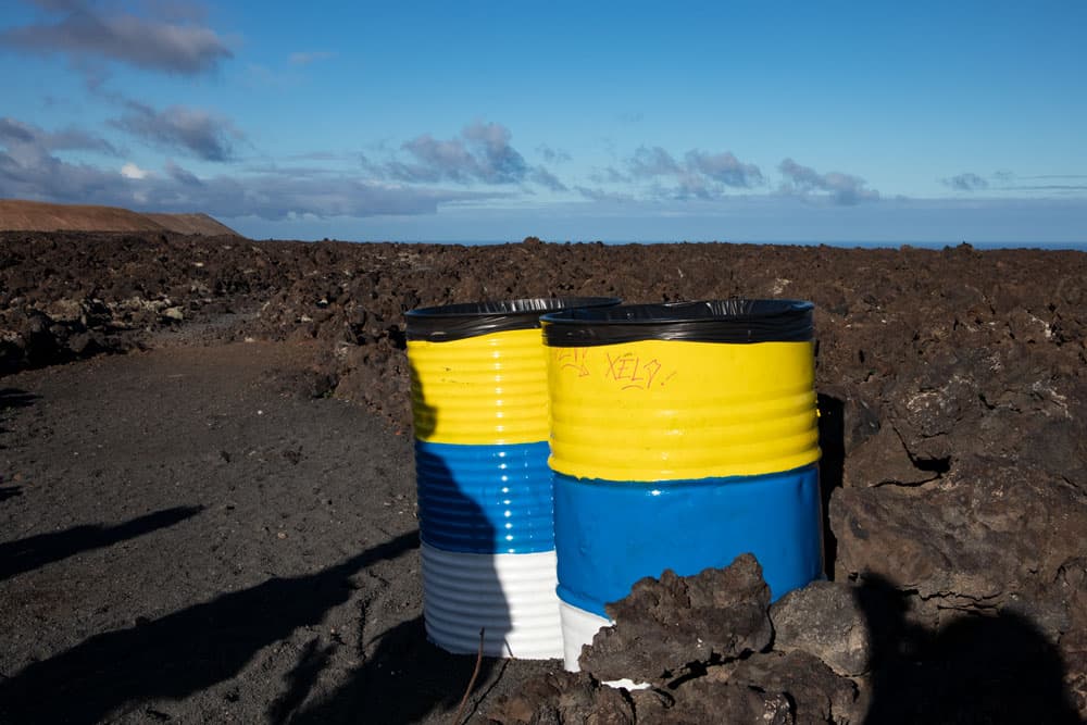
Far ahead you can see the volcanoes Montaña Caldereta and Montaña Blanca. Then the road ends at two conspicuously painted barrels. On the right the actual hiking path begins, which now takes you further through the lava fields in a light up and down direction of the volcanoes. The path is well marked and equipped with informative signs about the volcanic landscape. About one hour after the beginning of the hike you reach the foot of the Montaña Caldereta. You are now below the first volcano.
Article summary and large selection of GPS hiking tracks
Sign up for my newsletter now and get exclusive access to my collected GPS tracks as well as all the brief information about my articles.
Sign up now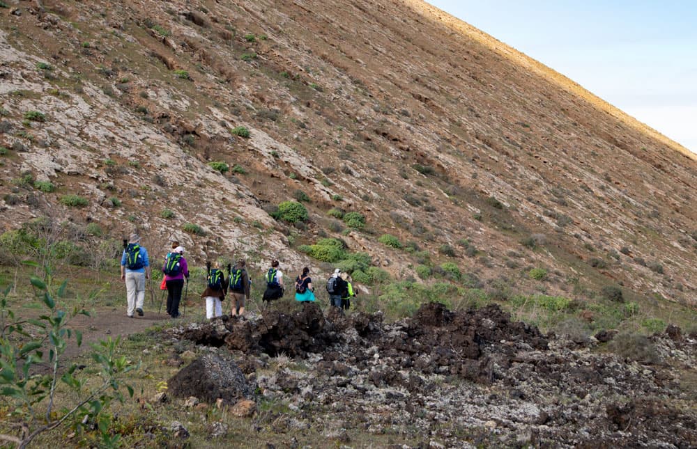
hiking group at the bottom of Montaña Blanca
Route section Montaña Caldereta to ascent path Montaña Blanca
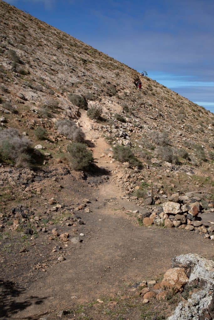
Here, at the foot of the Montaña Caldereta, you will find green bushes again. You walk around to the right at the foot of the volcano along the footpath. After a short time the ascent goes up to the left. If you want to extend your hike, you can do it here by climbing the Montaña Caldereta. The trail continues straight on. As soon as you have left the foot of the volcano on the footpath, the rest of the trail runs through dark lava rock again. When you have almost crossed the lava flow between the two volcanoes, a footpath meets your path from the left.
hike on the ridge of Montaña Blanca
This is your later way back. But now you go straight on. Already after a short time you are standing at the foot of the Montaña Blanca. The path leads you along the foot of the volcano. From time to time there is a little green here. But to your right is the dark lava flow. When you have circumnavigated about a fifth of the volcano, the path forks. If you keep to the right, you can get further into the lava fields and to other volcanoes. But keep left. This is the ascent to the Montaña Blanca.
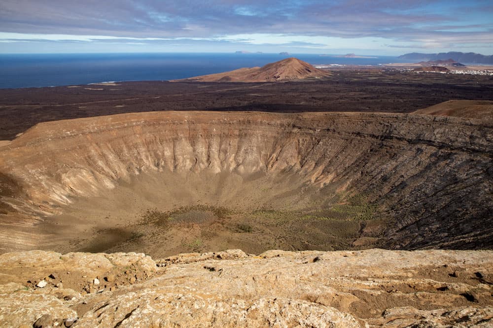
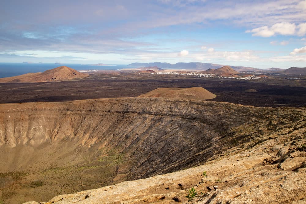
huge crater of Montaña Blanca
Section of the Montaña Blanca ascent to the summit
The ascent path is the small strenuous part of the hike. You are at an altitude of about 150 metres and from here you climb over 400 metres to the summit. At first, the path leads straight up along the slope. After some time you have reached the first difficult section and are on the edge of the huge volcano. From here you can take a first look into the huge crater. The view into the crater, up to the summit and to the surroundings is simply indescribable.
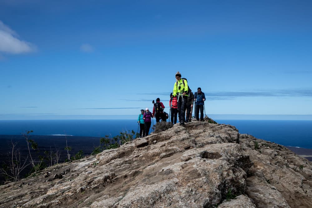
hiking group on the ridge of Montaña Blanca
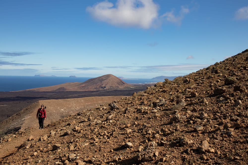
But you also see that you are on the lower part of the crater rim. To the left in front above you is the summit. And to this summit you now climb further on the ridge path. On the whole way the view to the surroundings and also to the crater gets better and better. The path runs over rocks. But since it always goes uphill on a ridge, you can’t miss the way to the summit. At the summit you should rest at the surveying column and enjoy the overwhelming view.
descent path Montaña Blanca

CANCO Lanzarote - Excursions and Sights
Section of the route from the Montaña Blanca summit to the starting point of the hike
When you have enjoyed the view of the summit enough, continue straight ahead along the ridge path. This will bring you slowly down over rocks to the other side of the volcano. When you have reached the opposite side of the summit, the volcano edge becomes a bit wider here. Once again you can enjoy the wonderful view from up here. Then a narrow descent path on the right leads you down the slope of the volcano.
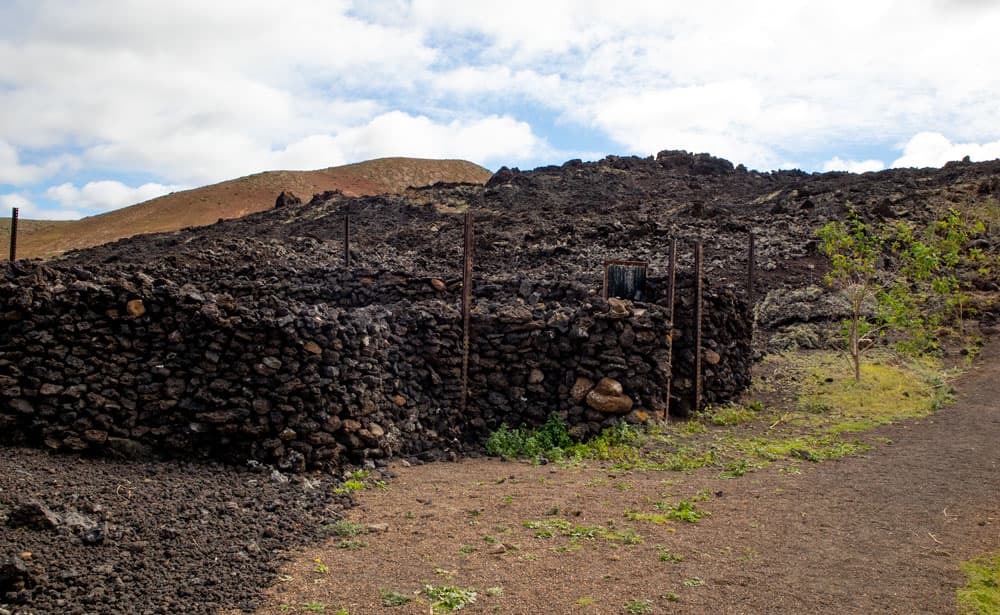
stone goat stables at the foot of Montaña Blanca
At the foot of the Montaña Blanca, the path makes a small bend to the left. At the foot of the volcano you walk towards black volcanic stone walls and animal stables. The path leads through these. After a short time you will find the main path again. This is your way out. Now turn right and walk back on the same path you came up to here.
crater of Montaña Blanca
And finally
I hope that you enjoyed the hike over the volcano rim with wonderful views over the Canary Island of Lanzarote. Even if I don’t know Lanzarote so well from hiking yet, I will definitely return there one day for hiking. Anyway, I wish you a lot of fun hiking on all the Canary Islands,
Dagmar von SiebenInseln