Garachico – Round tour through Canarian villages with fantastic views

Garachico - little town with colourful houses
Map
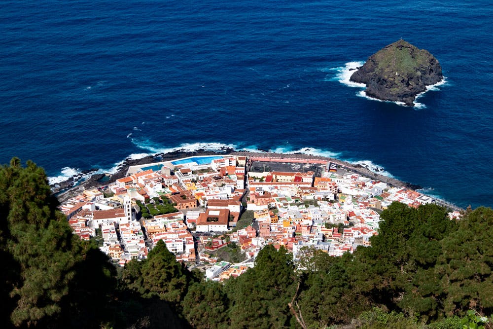
Garachico is a beautiful town with stately colourful houses in the north of Tenerife. This is where today’s circular walk starts, which will take you along the coast. Via a long car tunnel the hike first leads to the neighbouring village El Guincho.
From there you will hike steeply uphill to the village of Genovés. On the way you can enjoy wonderful views of the entire north coast and the Atlantic Ocean far below you.
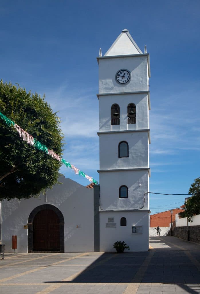
church square Garachico
You cross Genovés and then go along an alpine path to the small village of San Juan del Reparo. Before we return to Garachico on the way back in steep serpentines from the heights back to the coast, it is worth a little detour to a spring and a view point with wonderful views. Also San Juan del Reparo invites with church square and bar to a break. On the descent you will be accompanied all the way to Garachico by magnificent views of the picturesque town.

new habour of Garachico
Garachico – History with many strokes of fate
Before or after your hike you should definitely take the time to visit the small town of Garachico with its colourful mansions. Garachico is one of the most beautiful cities in Tenerife. The city was founded in 1496 by a Genoese banker. Through trade with sugar cane and wine from the neighbouring Icod de los Vinos, Garachico quickly developed into the largest trading centre of the island. The former wealth of the city can still be seen today in the impressive mansions.

street along the coast in Garachico
But from the 17th century onwards many strokes of fate struck the city. There was a bubonic plague epidemic, a plague of locusts and several large fires. On May 5, 1706, after a volcanic eruption of the Montaña Negra, huge lava masses destroyed large parts of the city and the harbour. Garachico was rebuilt and since 2012 there is a small fishing and marina again. But the former importance of the city as a big trading place had disappeared since then.

Panorama view from the hight to the coast around Garachico
Recent thunderstorms in November 2018 in Garachico
The latest weather events on Tenerife in November 2018 have also made Garachico a bad place again. After huge waves that hit the north coast and flooded the shore areas, two houses had to be cleared in Garachico and 39 people had to be evacuated.

hiking path over the streets of Garachico
If you zoom in a little on my photos of the city, you can see that, for example, the entire football stadium has been completely destroyed by the waves. It only remains to hope that the pretty city will be spared similar catastrophes in the future. But despite all the adversity, it is still a really worth seeing place and attracts many tourists every day.

hiking trail circular Garachico
General information about the circular walk around Garachico
Starting point and approach
The starting point of the hike is the coastal road TF-42 Avenida Adolfo Suárez in Garachico.
Arrival by car
From the north towards Puerto de la Cruz you can take the TF-42 to Garachico. If you are coming from the south on the TF-1 motorway to Santiago del Teide, take the TF-82 towards El Tanque. If you like, you can take the road to Icod de los Vinos and then turn left onto the TF-42 towards Garachico. Shorter but richer serpentines are to turn left after El Tanque onto the TF-421 and go down to Las Cruces towards the coast. Turn right onto TF-42 and continue to Garachico.

PR TF-43 in Garachico
Parking is available (partly) for a fee everywhere in the village. I parked for this hike opposite the sea swimming pools (free of charge). There also the round trip starts.
Arrival by bus
Article summary and large selection of GPS hiking tracks
Sign up for my newsletter now and get exclusive access to my collected GPS tracks as well as all the brief information about my articles.
Sign up nowIn Garachico the Titsa bus lines 107, 363, 906 and 911 stop.
In San Juan del Reparo the bus lines 325, 392 and 460 stop.
Details, exact timetables and connections can be found on the Titsa homepage. 
hiking path San Juan del Reparo - Mirador
Time
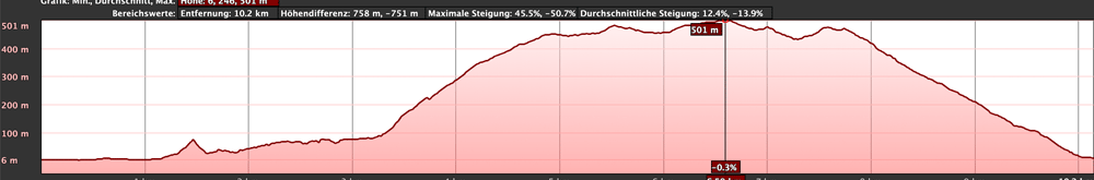
I don’t like to give general time information for hiking tours, because the times are very individual. For this tour I needed about 5 hours with some detours and a long rest. The pure hiking time was a little less than 4 hours.
elevation profile circular Garachico
Difference in altitude and distance
The difference in altitude is about 630 meters. The distance is about 12 kilometres.
Requirement

hiking path into Garachico
I would like to classify the tour as moderately difficult. Because of the length and height you need some stamina. At the beginning on the section above the tunnel the path is a bit confusing and overgrown. Surefootedness required. But the rest of the way runs on very good hiking trails.
Refreshment:
There are restaurants, bars and shops in Garachico, El Guincho and San Juan del Reparo. Nevertheless, take enough water with you for the intermediate routes.

Trip to a Mirador and old tracks
Variants
Of course this tour can also be done the other way round. If the whole tour is too long for you, you can simply climb the way from Garachico to San Juan del Reparo and descend again. And if that’s still too much, you can also take the bus (see bus connections above).
But if you want to hike more and further, the hiking trail PR TF 43 is the right choice. Tours around the volcano Chinyero are described here. And the hiking trail from Garachico is the longest official hiking trail to get to Chinyero. On this path you climb about 18 kilometers from the coast to about 1500 meters of altitude. And the beginning of this hike between Garachico and San Juan del Reparo is exactly part of the circular hike described here. 
view Garachico
Circular walk around Garachico
Section Garachico to junction hiking trail in front of the tunnel
You start this circular hike directly at the coastal road TF-43. Maybe you have already had a look around the town before. Now it goes first on the footpath at the sea direction Icod de los Vinos along. To your right you see the pretty mansions of the city and to your left the Atlantic Ocean. After a short time you will reach the new fishing and marina. To avoid having to walk along the road, turn left into a path that leads you through the green between the harbour and the road towards the road tunnel.

hiking path above the tunnel - Garachico

ascent at the street in Garachico
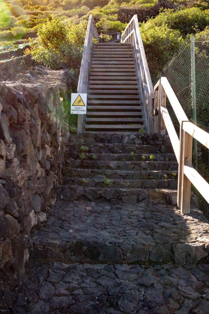
A small arc goes around a house and then you are back on the TF-43 road that you cross. Here I made a small detour. Please don’t let this irritate you in the track, because I climbed up there at a water channel to enjoy the view from up there. You continue straight ahead along the road until you reach the tunnel. There is a hiking trail on the other side of the guardrail (which you have to cross) up the slope on the right.

village street El Guincho
Section of road junction hiking trail in front of the tunnel to El Guincho
Article summary and large selection of GPS hiking tracks
Sign up for my newsletter now and get exclusive access to my collected GPS tracks as well as all the brief information about my articles.
Sign up nowFrom the direction, the path that leads you to the overgrown car tunnel cannot be missed. You walk quite close to the left edge of the tunnel through bushes. From time to time you have to look for the way a little in the „wilderness“. But in the end the tunnel on the mountain slope slowly rises. At the end of the tunnel the road leads you back onto the road. You cross it. On the other side of the road you continue in the direction of Icod de los Vinos. In order not to walk along the road, you can – as in the track – go down a small curve and uphill again parallel to the road.
steep ascent in the village of Guincho close to Garachico
Hiking trail over a wooden bridge
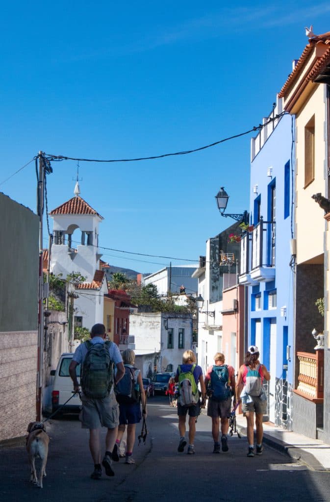
Soon after you reach the idyllic village of El Guincho. Here you can also make a short detour down to the church square on the left. Then you walk along the main road through the village. After a wide right bend you cross the road. You follow a small road uphill on the opposite side. From this road you turn left again into the first road, which leads you steeply up the mountain. When you reach the top, the actual hiking trail begins.

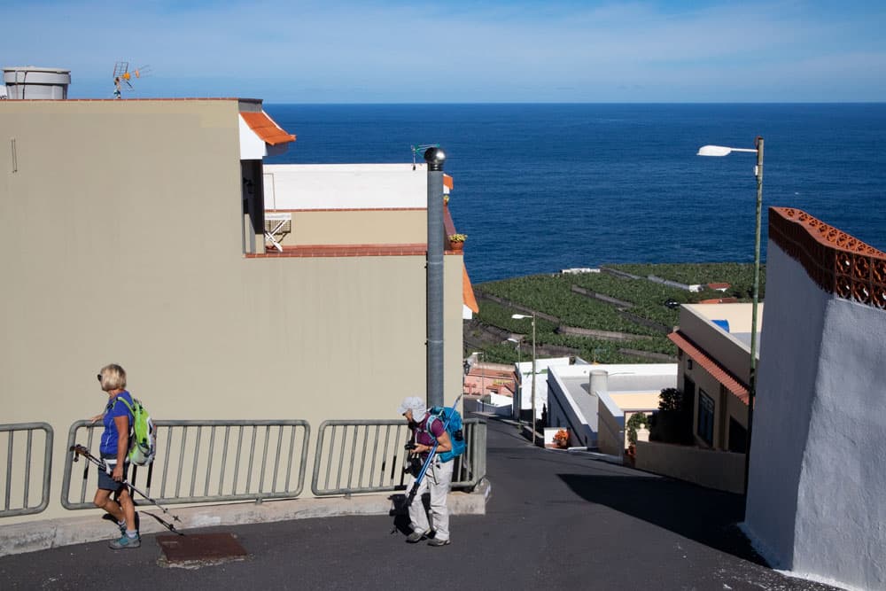
view to the Atlantic and the banana plantations around Garachico
El Guincho section Start of the trail to Genovés, Calle Viañatico.
The hiking trail leads you over El Guincho first over a wooden bridge. The path then climbs steeply up the mountain. Now the most strenuous part of the hike begins. But if you look around, you will be rewarded with wonderful views. You walk past bushes, trees and terraced fields. After a wide serpentine you will pass a ruined house. From there the view over wild gardens to the coast is particularly beautiful. The bushes gradually change into terraced fields. And then you have completed the most difficult part of the ascent and arrive in the village of Genovés.

hiking on the street in Genovés
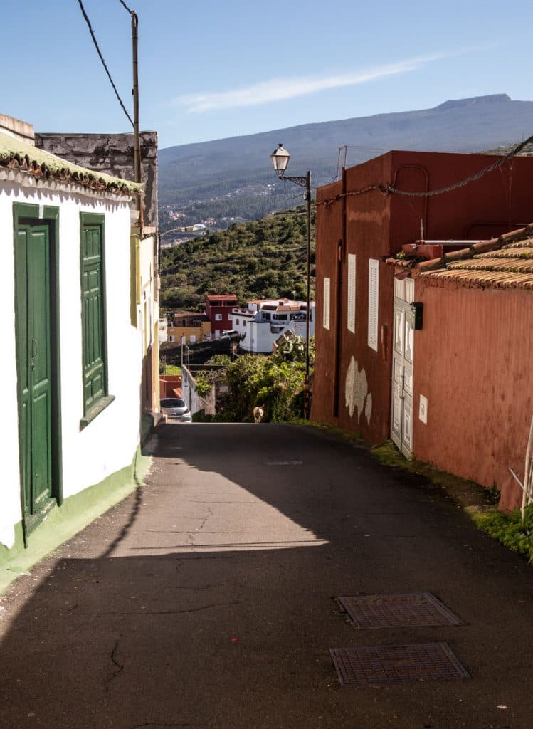
The hiking trail ends at a house in a small street, which you follow uphill through the village. You cross the TF-82 and turn into Calle la Palma on the opposite side. Shortly after, at the first fork in the road, turn right into Calle Real. Then walk along Calle Real for a while through the pretty and tranquil village. You will gain more height. At some point the road leads back to TF-82, but you immediately turn left again into the next street, Calle Viañatico.
hikers in the village street of Genovés
Section Genovés, Calle Viañatico to church square San Juan del Reparo
Calle Viañatico returns to the TF-82 after a very short time, which you cross. On the other side of the road, go down to the right and follow the path that takes you through greenery parallel to the road and past beautiful fincas towards San Juan del Reparo. Just before the sign of San Juan del Reparo you come back to the TF-82, which you follow on the sidewalk for a short while until you reach the church square.

hiking path behind Genovés along houses
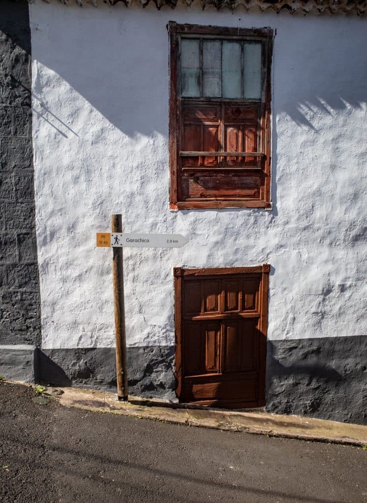
The church square is ideal for a rest. Afterwards it goes only downhill. On the church square you will also find good signs for the TF-42 hiking trail, which leads from Garachico to Chinyero. So if you want to do some more altitude difference, you can continue uphill here. For all others it goes on the opposite street side signposted with the TF-42 now again down to Garachico.

Dragon tree at the wayside
Section San Juan del Reparo to Garachico, Calle de Volcán
You walk downhill between the houses of San Juan del Reparo. Keep left at the first fork. At the end of the first straight, the road descends steeply. Here you can – if you like – make a small detour. You can take a small path to the left of the main road. This will lead you up the hill along the slope. You can enjoy wonderful views of Garachico, which lies deep below you. The path runs through a small forest, past old tracks and ends on a kind of panoramic terrace with fresh spring water.

San Juan del Reparo - hiking path through the village
When you are back on the main path, you go down it between the houses. Behind the last houses of San Juan del Reparo the path begins. This will lead you downhill for about an hour in wide serpentines, partly wooded. All the time you can enjoy wonderful views of Garachico and the north coast. In Garachico you first arrive on a road with a barrier, which then changes to Calle de Volcán.

hiking path in San Juan del Reparo
Section Garachico, Calle de Volcán to Plaza de la Libertad
Follow Calle de Volcán to the left and around a big bend. The path then descends to the left, signposted. A small path will take you to the Camino el Monte between walls and fields. After a short while, the Camino el Monte leads into Calle Alcade de Perlaza, where you turn right. A little later the path leads you down to the left into Dieciocho de Julio street. Follow this small road to its end and you will find yourself in front of the large Plaza de la Libertad and the church.
village street in Genovés
If you look closely, this is where my track ends. Because I settled down here in the shady trees for a coffee. I assume that you will find the short way to your car or bus from here alone. If you keep to the right at the end of Plaza de la Libertad and then turn left into Calle Calvo Sotelo, after a short time you will be back on the promenade and at the starting point of the hike.
San Juan del Reparo - signpost
And finally
I hope you enjoyed the walk around Garachico and the Canarian villages. On this hike you will also have plenty of opportunities to stop and try some of the local specialities. Whichever route you choose, I hope you enjoy it a lot,
Dagmar von SiebenInseln