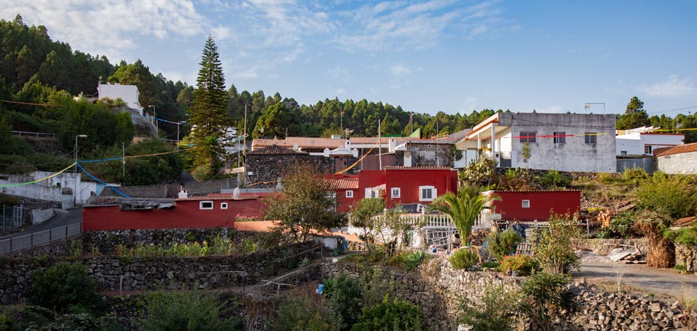
The tranquil village of La Montañeta
Despite intensive search in various travel guides and in the net I found unfortunately hardly any information about the small village La Montañeta in the northwest of Tenerife. La Montañeta is located at the TF-373 between Icod de las Vinos and Santiago del Teide.

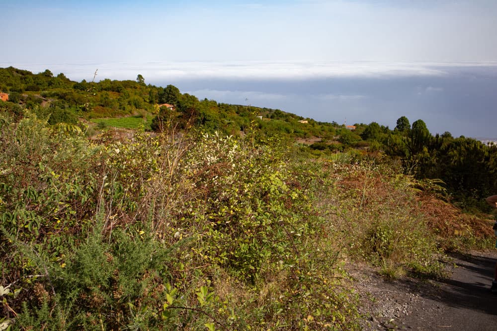
View down to the North Coast
Map
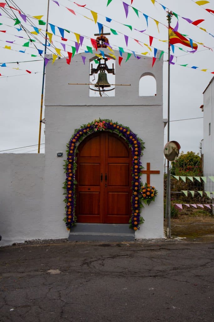
The whole village is surrounded by large pines. And there is a small chapel directly at the street, the „Ermita de San Francisco“ with a big party and picnic place. At the beginning of October there is a regular „Fiesta“.

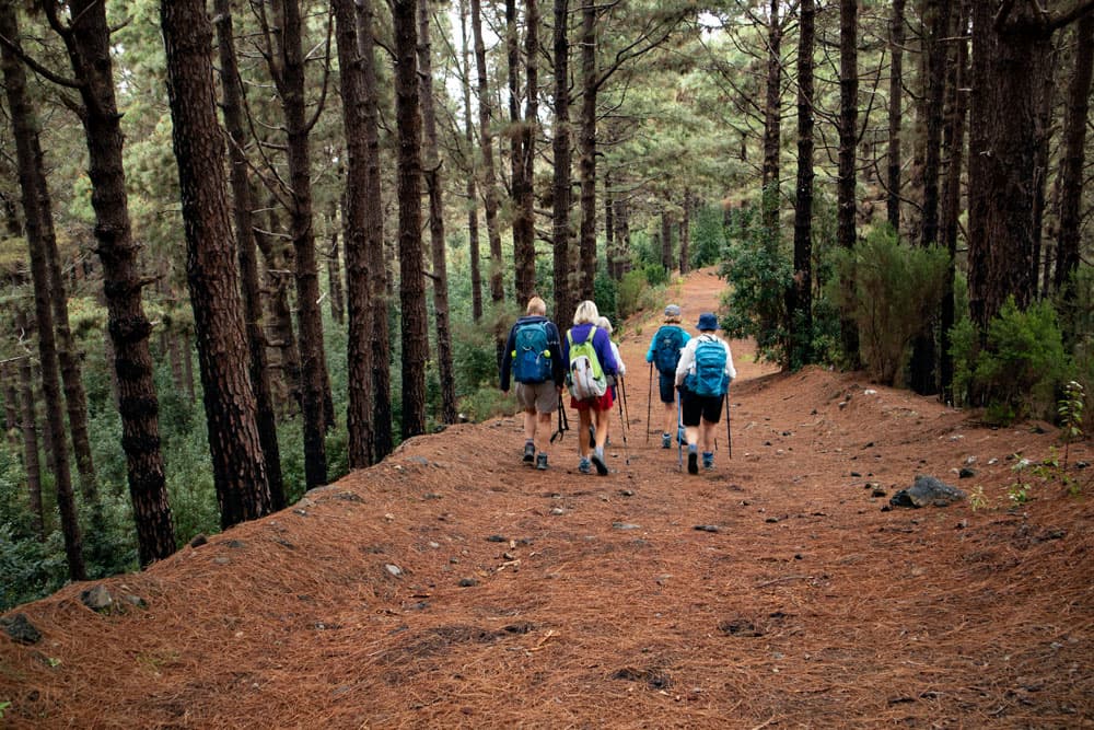
hiking group in La Montañeta
But even without being very well-known, a walk through the quiet alleys of this contemplative place is worthwhile. During the hike that starts at the fairground, I offer a variant where you can hike through the whole village La Montañeta right at the beginning of your round tour. If you choose the other option, you can visit the friendly village after your hike.
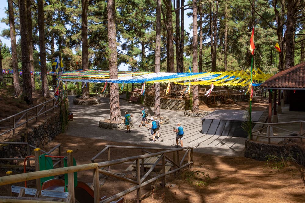
La Montañeta - Festival and picnic site
Hike from La Montañeta
I present to you two variants for a circular walk from La Montañeta. The first one takes you up the hill and later on a long slope. From there you have nice views of the north coast in good weather. You have the possibility to walk down to Cruz del Camino and have a look at the village. Then it goes in a very large arc over Fuente de La Vega and over the wooded heights back to the starting point. In Fuente La Vega you will find a very old waterhole whose history goes back to the beginning of the 18th century.
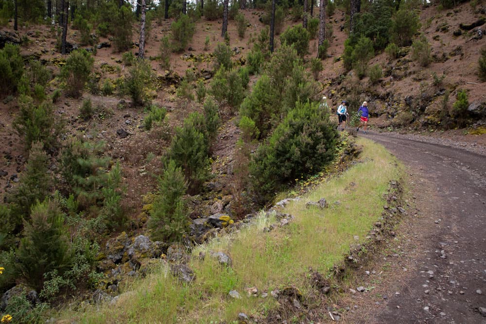
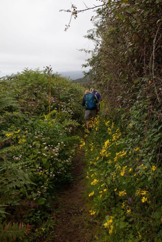
hiking path through the forest - La Montañeta
In the second variant, you first hike downhill through the village of La Montañeta. Then you hike uphill and high above the north coast on the same path as in variant 1. You can also visit the famous fountain and then make a small arc around Fuente La Vega. Then it goes straight over Las Abiertas up the mountain. The big road takes you back through the pine forest to the starting point. Both walks can of course be combined in many different ways.
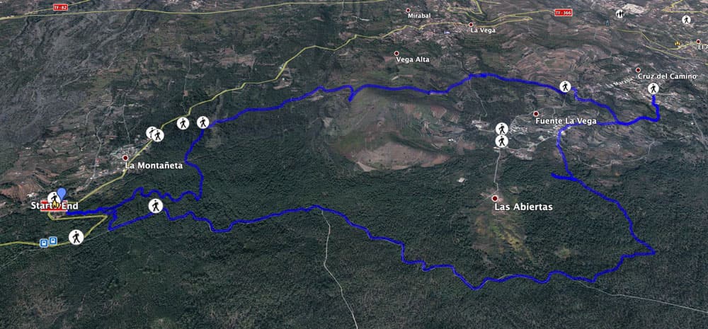
Track hike from La Montañeta 1
General information on the circular hike from La Montañeta

Track hike from La Montañeta 2
Starting point and approach
The starting point is the La Montañeta festival and picnic area, located on the TF-373.
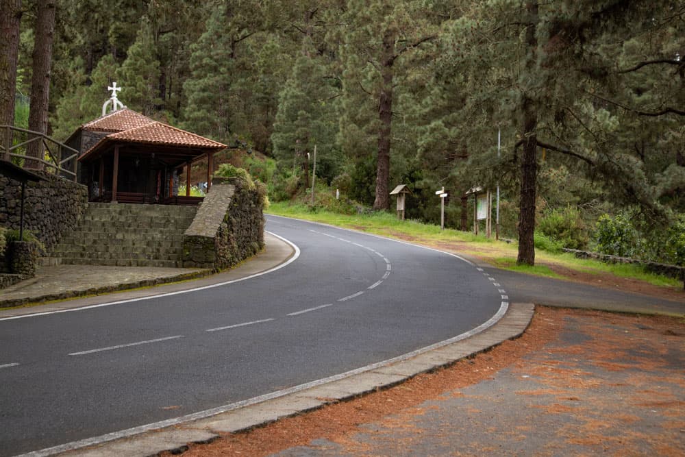
Ermita San Francisco close to the TF-373 - La Montañeta starting point
Arrival by car
From the north, take the TF-5 or from Icod de los Vinos, first take the TF-366 towards La Vega/La Montañeta. And from the south, take the TF-1 to Santiago del Teide. So there, take the TF-82 towards El Tanque. At the junction in front of the restaurant Las Fleytas keep right on the TF-373 until La Montañeta.
There are plenty of parking spaces along the road.
Arrival by bus
The Titsa bus line 360 stops directly at the starting point, but also in La Montañeta. Further information can be found on the Titsa Homepage. Time
I don’t like to give general time information for hiking tours, as the times are very individual. For the first variant we needed 4.5 hours with breaks and for the second variant 3.5 hours.
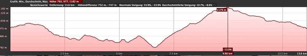
elevation profile - hike La Montañeta 1
Difference in altitude and distance
Article summary and large selection of GPS hiking tracks
Sign up for my newsletter now and get exclusive access to my collected GPS tracks as well as all the brief information about my articles.
Sign up nowThe difference in altitude for the first variant is approx. 560 metres. The distance is approx. 14 kilometers long. The second variant is 11 kilometres long and there are about 400 metres of difference in altitude to overcome.

elevation profile hike La Montañeta 2
Requirements and remarks
Both tours are easy tours. But the longer you choose your variant, the more stamina you need. If it is very hot on the island, you will often find pleasant shade in the pine forests on these tours. However, during the winter months it can get a bit cool, cloudy and foggy.
Refreshment
In the place La Montañeta there is a bar. But whether it is always open, I cannot say. If you take the branch to Cruz del Camino, you will also find bars there. Another possibility for a stop could be in Fuente La Vega. But I haven’t discovered a bar there yet. Therefore in any case enough water and if necessary food supply for on the way take along. You will also pass the fountain of Fuente La Vega where you can fill up with fresh water.

Both tracks of the hikes La Montañeta for combining
Variants
Here I describe both variants of the circular hike, which you can combine afterwards as you like. If you are a „discoverer“ yourself, you will also find many other possibilities for good hikes and other combinations around La Montañeta.

Hiking trail through the pine forest
First variant – circular hike from La Montañeta
Route from La Montañeta fairground to hiking trail (marked yellow and white)
You start your hike at the fairground of La Montañeta. You will cross the square and walk up the mountain on a hiking trail, partly in serpentines. The path runs parallel to the TF-373. Before the road makes a sharp right turn, keep left at a fork. You will now hike through the pine forest for a while. It goes up and down through dense forest. Then the path leads you uphill. Since this section is hard to describe, you should use the JPS track if possible.

Hiking trail high above the north coast near Las Abiertas
Finally you meet a path that takes you sharply to the left and down through the pine forest for a while. You cross a gully and continue straight ahead downhill. Finally you reach a piece of free land. There you meet a hiking trail that is marked yellow and white from time to time and that you follow to the right.

Pines hanging with ferns
Section of the trail (marked yellow and white) to Fuente La Vega fountain.
The hiking trail takes you uphill along the slope. Partly it runs on a wide road, partly on a rather overgrown path. First you hike through the forest. But then you pass some finches, meadows and woods. You hike uphill along a slope and have a good view over the entire north coast of Tenerife – at least with a cloudless sky.

The fountains at Fuente de La Vega
You walk straight ahead for a very long time and also cross a road that leads down to La Vega. Straight ahead the trail ends at a road below Fuente La Vega. After a few meters to the left along the road you can visit the famous old fountain that gave the place its name. If you need it, you can also fill up with drinking water or refresh yourself.

History of the Fuente La Vega
Fountain section Fuente La Vega to centre Fuente de La Vega
From the fountain, follow the road for a short while, which takes you to the right in the direction of Cruz del Camino. After a few metres, however, the path goes uphill again, passing a farmstead on the right. You go past the houses and then left on an asphalted path steeply uphill. The path runs along the gardens. Then it climbs steeper again in a small path. You follow this path for a while, which finally leads you along the slope and on a ridge along a transversal hiking trail.
Hiking trail with a view of the north coast
Follow this path to the left if you want to visit the small village of Cruz de Camino. In a short time you will arrive in the middle of the village square. Otherwise, turn right immediately. If you want to visit the place, you either come back to this point or you turn around Fuente de Vega (as described in variant 2). With both options you will finally arrive at the centre of Fuente La Vega.

Hiking trail through small villages - Fuente La Vega
Section Fuente La Vega centre to La Montañeta fairground
Article summary and large selection of GPS hiking tracks
Sign up for my newsletter now and get exclusive access to my collected GPS tracks as well as all the brief information about my articles.
Sign up nowIn this variant we hiked up the hill on the left side of the road. With it you walk a little bit through the forest. You can also take a shortcut and walk straight on to the right towards Las Abiertas (variant 2). The 1st arch variant takes you steeply through the pine forest up the mountain. Finally you reach a wide forest road. The ascent is over.

View of the Teide from the hiking trail
From here you walk around to the right very long and very comfortable on the forest road back to La Montañeta. Some time before the forest road meets the TF-373, you have the possibility to descend to the picnic area on two different paths. But you can also simply follow the signs for the PR TF-43. After a short time you will return to the starting point.

hiking path - Fuente La Vega
Second variant – circular hike from La Montañeta
Route section La Montañeta Festival and picnic area to square/hiking trail marked yellow white
You start again at the festival and picnic area of La Montañeta. But this time you go on the other side of the road towards La Montañeta. After a short time you will find hiking signs. Turn right and follow the PR TF 43.4 towards La Montañeta (700 metres). Now you walk along the entire length of the village and can get an impression of village life.

Signpost PR TF 43.4 close to La Montañeta
Finally at the end of the village you come to the TF-373, which you cross. You hike uphill through the pine forest and after a short time you come to a free place where the hiking trail (variant 1) comes downhill from the right. Continue straight ahead. Now the path is for a while identical with the path variant 1, which I describe again here (copied). Follow this path marked yellow and white for a while.

View from the top to the clouds above the north coast
Section hiking trail (marked yellow white) to Brunnen of Fuente La Vega
The hiking trail takes you uphill along the slope. Partly it runs on a wide road, partly on a rather overgrown path. First you hike through the forest. But then you pass some finches, meadows and woods. You hike uphill along a slope and have a good view over the entire north coast of Tenerife – at least with a cloudless sky.

hiking path - la Montañeta
You walk straight ahead for a very long time and also cross a road that leads down to La Vega. Straight ahead the trail ends at a road below Fuente La Vega. After a few meters to the left along the road you can visit the famous old fountain that gave the place its name. If you need it, you can also fill up with drinking water or refresh yourself.
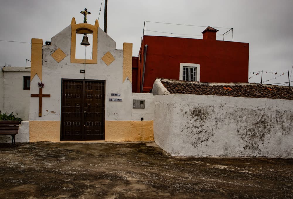
Ermita de Carmen - Fuente La Vega
Fountain section Fuente La Vega to centre Fuente de La Vega
From the fountain, follow the road for a short while, which takes you to the right in the direction of Cruz del Camino. After a few metres, however, the path goes uphill again, passing a farmstead on the right. You go past houses and then left on an asphalted path steeply uphill. The path runs along the gardens. Then it climbs steeper again in a small path. You follow this path for a while, which will finally take you along the slope and a ridge on a transversal hiking trail.
Hiking trail through pine forest - La Montañeta
Follow this path to the left on this tour. If you want to visit the small village Cruz de Camino (variant 1) you will reach the village square in a short time. Otherwise you walk around to the left. But shortly after you turn right into the hiking trail PR TF 42.3 towards Fuente La Vega. If you want to visit Cruz de Camino, come back here. This path takes you along a scenic path with beautiful views in a wide arc to the centre of Fuente La Vega.
a little overgrown trail
Section from the centre of Fuente La Vega to the La Montañeta fairground.
From the center you have again different possibilities (see variant 1). In this variant you go straight ahead through Fuente La Vega towards Las Abiertas up the mountain. Then you go up steeply through the pine forest. Finally, you reach the wide forest road with this variant as well. But you have shortened a whole section and are already further west than in variant 1.
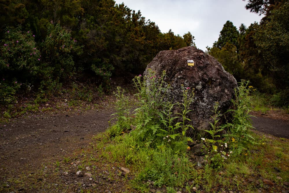
Hiking trail marking yellow white
From here you walk around to the right very long and very comfortable on the forest road back to La Montañeta. Some time before the forest road meets the TF-373, you have the possibility to descend to the festival and picnic area on two different paths. But you can also simply follow the signs for the PR TF-43. After a short time you will return to the starting point.
Chirche of Cruz del Camino
And finally
I hope you enjoyed these varied walks around La Montañeta. If you read and look carefully, you will find that both walks together can be varied in many interesting combinations. So you can choose the one that is best for you. We wish you a lot of fun while hiking,
Dagmar von SiebenInseln