The Montaña Blanca and the Huevos del Teide
The Montaña Blanca, with its summit of 2748 metres, is 30 metres higher than the Guajara on the other side of the caldera. Nevertheless, Guajara is considered the third highest peak in Tenerife after Pico del Teide and Pico Viejo. This may be due to the fact that the Montaña Blanca, right next to the mighty Teide, looks like a small promontory of the same. Somehow it seems to belong to the Teide. 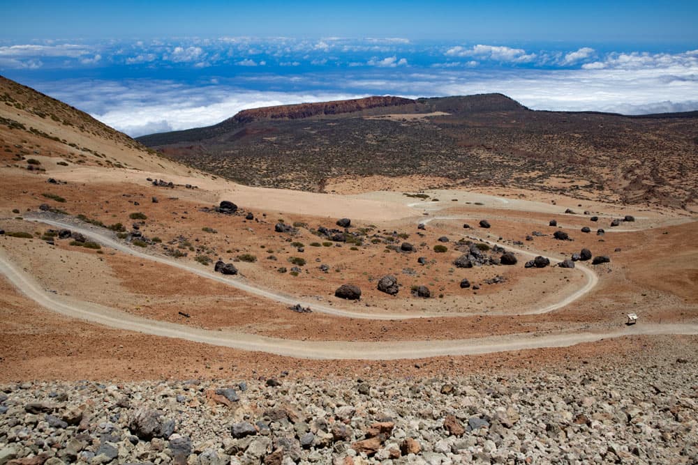
Montaña Blanca hiking trail with serpentines and Fortaleza in the background
Map
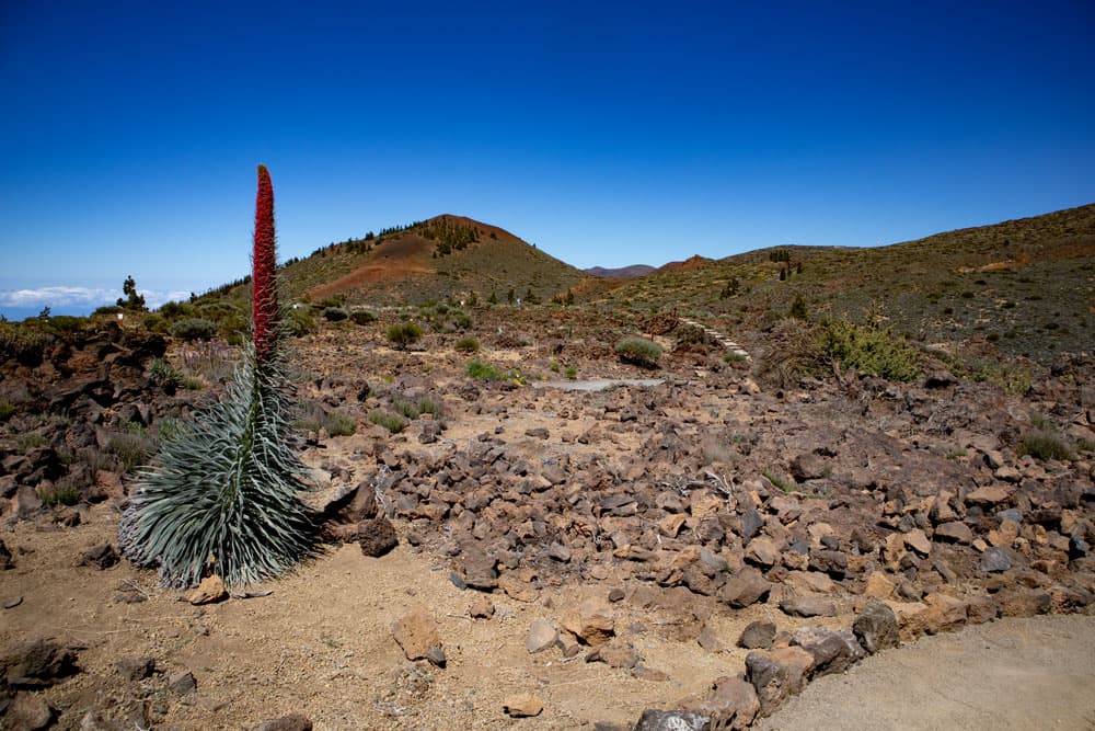
Tajinaste close to El Portillo visitor centre
The Montaña Blanca is, as the name already says, of a white yellowish colour. The colours contrast particularly well with the black lava flows that flowed down from the Teide towards the Montaña Blanca. And then there are the big black boulders, the Huevos del Teide (Teide eggs). How these big boulders got there on the light sand surfaces can only be guessed. They could have detached themselves from the lava flow. They could have grown bigger when rolling. What is certain is that they are pretty to look at. And they are often the only place where you will find some shade when the heat is high.

Panorama - Hiking trail Montaña Blanca with pumice stone slopes
Two walks to the Montaña Blanca
Today I introduce two ways to the Montaña Blanca. The shorter path is part of the ascent to the Altavista refuge and Pico del Teide. The longer route starts at the Visitor Centre in El Portillo. It takes you over the Montaña de los Tomillos in the direction of Montaña Blanca. You will reach the main road to Teide and from there you climb through Huevos del Teide towards Teide. Finally the path forks and you will reach the summit of the Montaña Blanca. 
hiking trail towards Teide and Montaña Blanca from El Portillo
The way back takes you via Lomo Hurtado towards Montaña Negra and Fortaleza. An impressive descent overlooking another side of the Teide. Shortly before you reach the Fortaleza massif, you climb a little uphill again. In the easy up and down you get through the interesting barren bush landscape back to the visitor centre El Portillo. Before or after the hike you should definitely visit the well-kept open spaces in the visitor centre, where many native plant species can be found. And when you get there in May, you will also see the red shining Tajinasts.

Track hiking trail Montaña Blanca from El Portillo
General information about the walks Montaña Blanca
Starting point and approach
- 1.0
small ascent: car park at TF 21 on Cañadas road at km 40 approx. three kilometres behind the cable car station towards El Portillo (2350 m above sea level).
- 2.0
big round tour: National Park Visitor Centre El Portillo at TF 21 (2053 m altitude)
Arrival by car
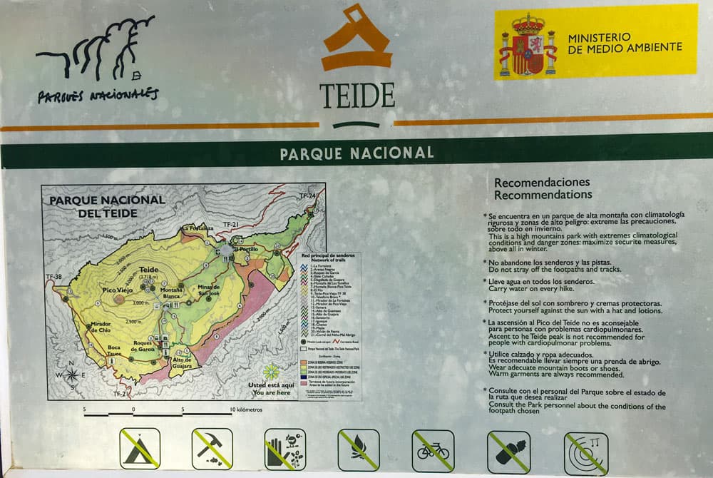
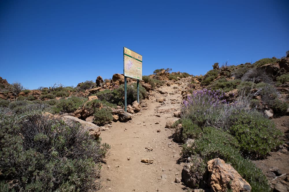
Hiking board Teide National Parc
Both starting points are on the TF-21 and can therefore be reached from all sides of the island via the Teide access roads.
To 1 : It is partly difficult to find a parking place here, because there are only few parking places available. These are heavily used, as this is also the way to the Pico del Teide. In this case I recommend you to use the parking places along the street or at the Parador Nacional. However, there are seven kilometres between the Parador and the starting point of the hike. From there you can take the bus to the starting point (see bus connection). Please do not leave any valuables in the car, as it happens from time to time that the windows of the cars parked there are smashed to steal valuables.
On 2. at the Teide National Park Visitor Centre El Portillo there are enough good parking places available.
Arrival by bus
Twice a day the Titsa bus lines 342 (Costa Adeje – El Portillo) and 348 (Puerto de la Cruz – Parador Nacional) drive along this route and stop if desired at the starting point to variant 1 and regularly at the visitor centre in El Portillo. Further information on Titsa Homepage. 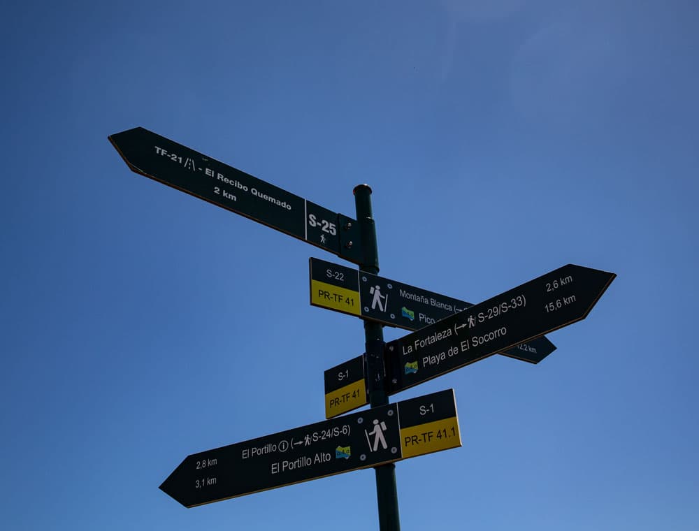
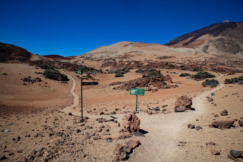
signposts to the different hiking trails
Time
I don’t like to give general time information for hiking tours, as the times are very individual. 1. For the ascent and descent on the small path I needed about 3 hours with a long rest at the summit.
Article summary and large selection of GPS hiking tracks
Sign up for my newsletter now and get exclusive access to my collected GPS tracks as well as all the brief information about my articles.
Sign up now2. the big round tour lasted about 6 hours with breaks.
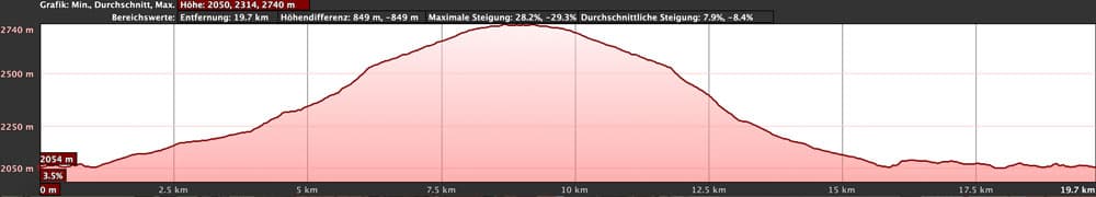
Difference in altitude and distance
elevation profile Montaña Blanca big circular from El Portillo
- 1.0
the difference in altitude is about 450 meters. The distance is approx. 11 kilometers long.
- 2.0
here the difference in altitude is a little over 800 meters and the distance is about 21 kilometers long.

elevation profile Montaña Blanca short way on the hiking trail 7
Requirement
Both tours run on very well laid out wide footpaths. Therefore both tours are basically to be described as easy. However, it should be noted that hiking can be more difficult at altitude due to the thinner air. There is no shade on the whole way, so that sun protection is absolutely necessary. For the long second hike a very good condition is still necessary.
Refreshment
There are restaurants and bars near the visitor centre El Portillo. It is absolutely necessary to take enough water and food with you.
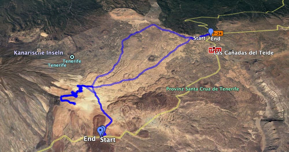
Tracks Montaña Blanca short hike on trail 7 and circular from El Portillo
Variants
This tour can be combined with various other hikes and circular walks in the vicinity. On the one hand, a combination with the Pico del Teide Tour is a good idea. 
Track Montaña Blanca on hiking trail 7
Those who only want to see the Montaña Blanca on the shortest way, choose the variant 1. Those who want to do an interesting long circular hike should choose variant 2. Both tours can also be combined with each other. Because from variant 2, a path (hiking trail number 27) branches off to the starting point of the first variant. So you can go all the way in a very large tour.
Finally, from El Portillo there are various tours on and around Fortaleza (signposted with hiking trail 1), which can also be easily combined with variant 2.

view to Teide from Montaña Blanca
Hike to the Montaña Blanca car park at the TF 21 at the Cañadas road at km 40
Parking lot to fork Teide ascent path
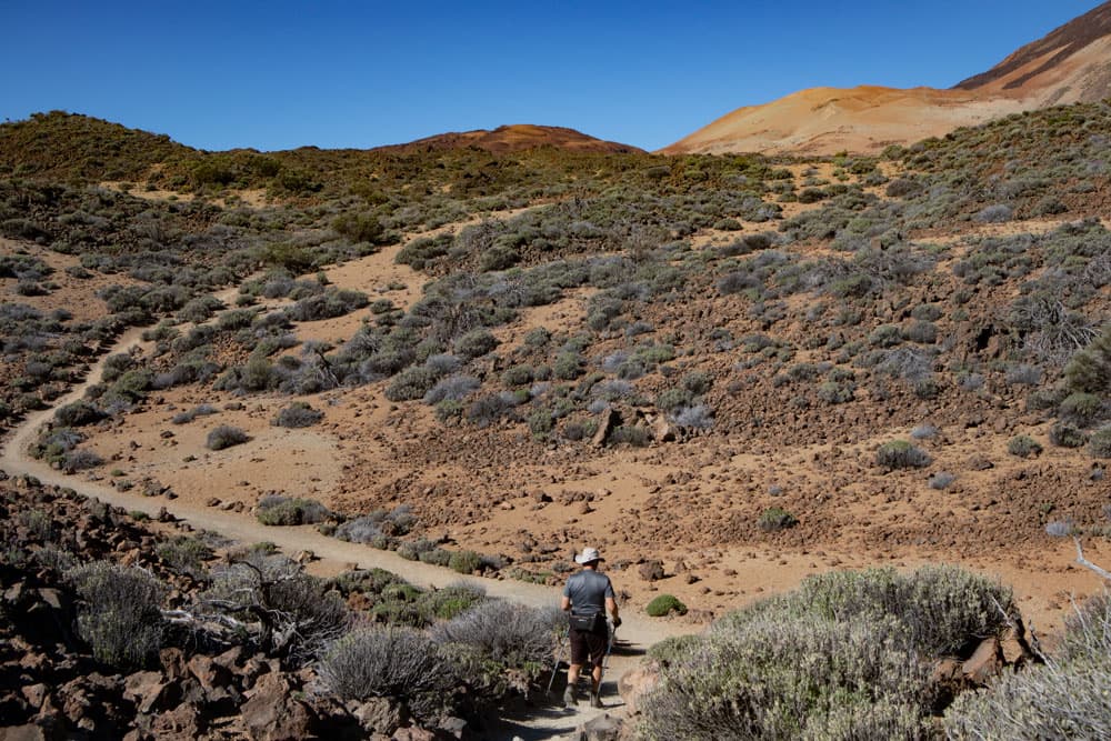
From the car park at TF-21 (km 40.6) there is a wide signposted road towards Teide (path number 7). This path climbs gently through the light beige pumice slopes. It leads past an experimental field. Near there, a path branches off to the right downhill (hiking trail number 27). This goes to the way to the Montaña Blanca from El Portillo (see variants). Continue straight ahead. After some time, the path goes through wide serpentines. Now it goes slowly more and more uphill.
to Montaña Blanca you´ll find well maintainde hiking trails
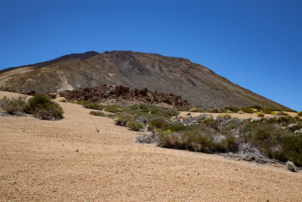
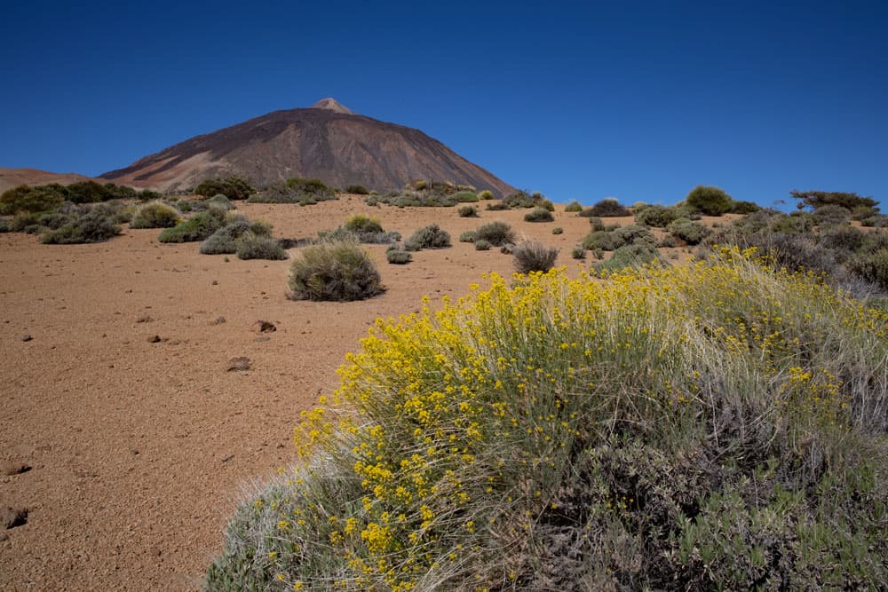
In front of you you can see the large lava flow that once flowed down from the Teide. The wide path runs in wide serpentines up the slope of the Montaña Blanca. To the left and right are the black Teide eggs (Huevos del Teide). The large dark rocks of black lava rock, which remind of large eggs, stand out impressively against the white pumice stone. Finally, you can see the ascent to Teide in front of you. The serpentines meander steeply up the crater rim of the Teide to the Altavista mountain hut.
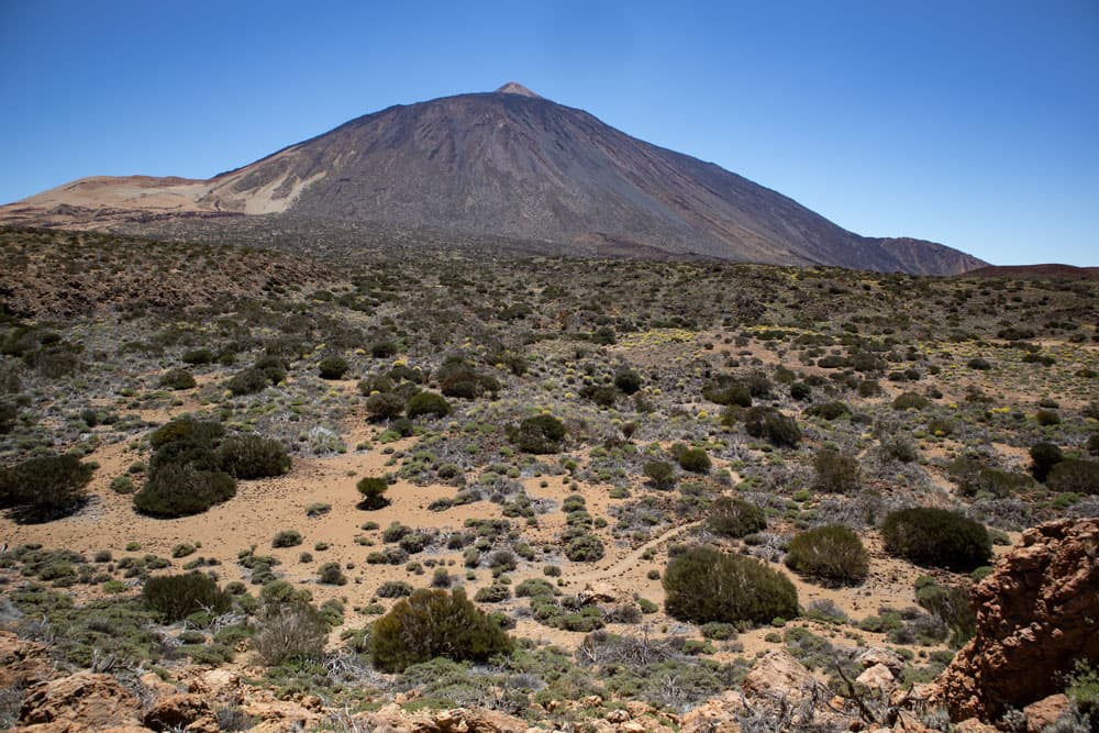
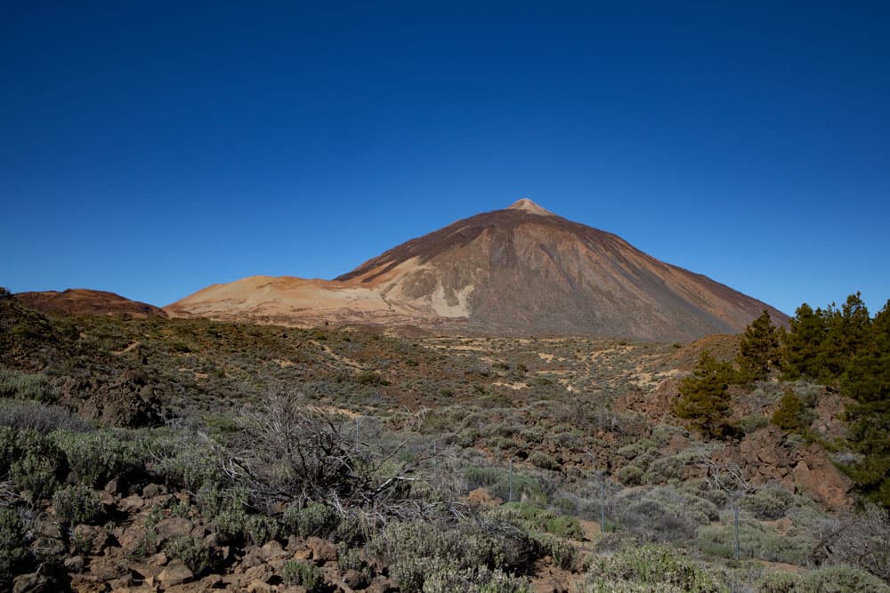
Teide and Montaña Blanca
Teide section Ascent path to Montaña Blanca peak
After about 1.5 hours you almost reach the summit (2748 m) of the Montaña Blanca. The path climbs up on the left, following the signs for Teide. You go up a little on the clear path. The path then takes you around to the left onto the ridge path. In a relatively short time you now walk along the right side of the slope below the summit ridge. On the left a small path leads up to a summit of the Montaña Blanca. Continue straight ahead to the summit plateau.
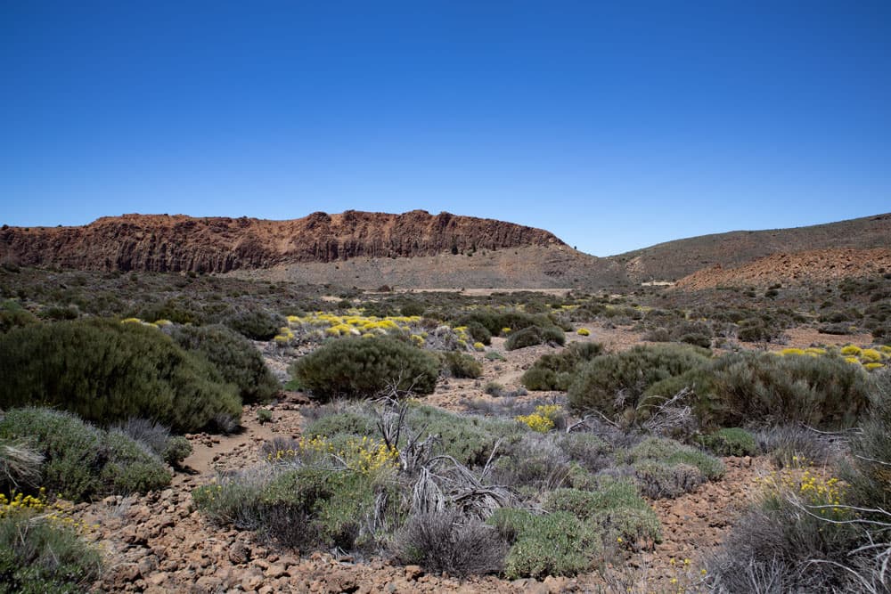
the Fortaleza
Article summary and large selection of GPS hiking tracks
Sign up for my newsletter now and get exclusive access to my collected GPS tracks as well as all the brief information about my articles.
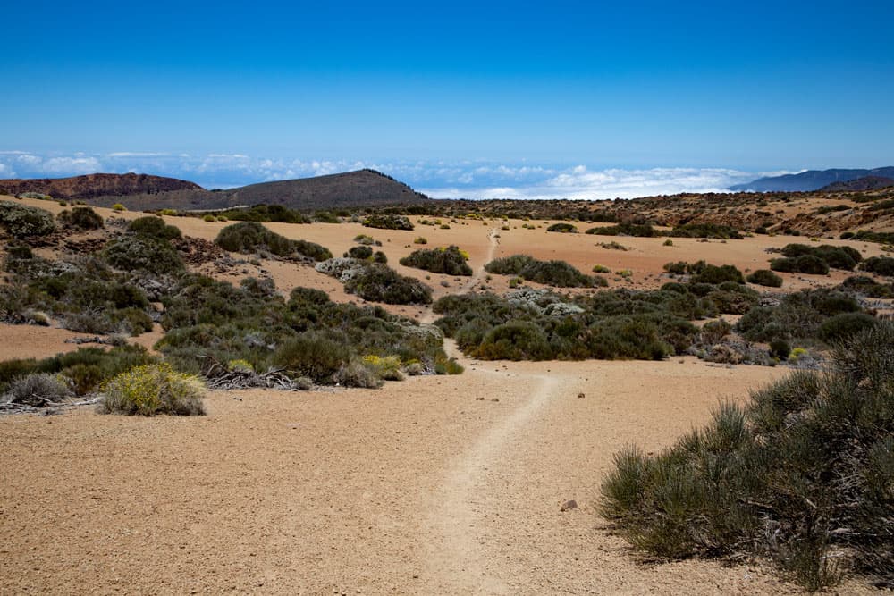
Sign up now Here you can go up to the small summit and circle it on a path. In cloudless weather you have an impressive view. You see the Teide, the Caldera and the surrounding Cañadas. On the horizon you can see Gran Canaria. On the other side you can see the north coast, the Oratava valley in the background and the endless slopes of the Montaña Blanca. These slopes change into scrubland that extends to Fortaleza and El Portillo. If you don’t want to go back the same way, check out the options below.
view to the backside of Mount Teide
Hiking on the Montaña Blanca from the El Portillo Visitor Centre
El Portillo Visitor Centre section to Montaña de los Tomillos
You start your hike directly at the visitor centre El Portillo. From the entrance you follow a path through the gardens. Here you can already get a good impression of the flora in the Teide National Park. You walk slowly uphill on the trail that takes you behind the visitor centre on trail number 1. At the beginning it’s slightly uphill and then downhill again. In front of you you can already see the mighty Teide in the distance and the Montaña Blanca to your left.
Hiking trail through bushes
This is your walking direction. You go through a gate and a little later you pass a path leading down to the right. This leads to Fortaleza. You go straight ahead. Shortly after you come to a fork in the road. On the right is your later way back. But on the way there you go left with the hiking trail number 6. After a short time there is another crossroads. To the left it goes up to El Portillo Alto and to the right down to Fortaleza. Continue straight on through the pumice stone slopes. After some time you reach a small chain of hills. This is the Montaña de los Tomillos.
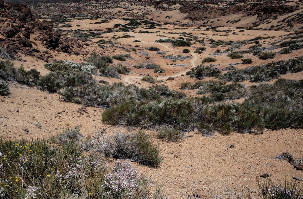
View of the hiking trail through the plain
Follow the Montaña de los Tomillos until trail number 7 (main trail Teide).
You will pass on the left side the Montaña de los Tomillos. Here the path is now partly steep. At some plateaus at the end of the respective ascent paths you can already enjoy wonderful views. Then the path flattens out again for some time. A little later, trail number 27 turns left from your hiking trail. It leads to the starting point of the first route and near an experimental field you reach the main path (hiking trail number 7), which leads from the car park on the Teide. However, you continue straight on for a long time towards Montaña Blanca and Teide.

Teide and summit of Montaña Blanca
Partly the path is now quite steep. Little by little there is less and less vegetation and most of the time you walk over the white stone. On the left there is a path that leads up to the main path from the car park to the Montaña Blanca. On the track you can see that I walked it once. But your way goes straight on. After a short time a path branches off to the right. This is path number 22, which you will go back to later. Now it’s really uphill again. The path leads you straight up the sandy path. At the top of a hiking sign you reach hiking trail number 7, which leads up from the parking lot to Teide.

Crossing path number 27 between the big Montaña Blanca lap and the ascent path number 7.
Section of trail 7 to Montaña Blanca peak (from here identical to variant 1) and return to fork in trail number 6 with trail number 22.
You hike up the slopes of the Montaña Blanca in wide serpentines between the Teide eggs. Then the summit (2748 m) of the Montaña Blanca is almost reached. The path climbs on the left side, while it continues straight on to the Teide, signposted. You go up a little on the clear path. The path then takes you around to the left onto the ridge path. In a relatively short time you now walk along the right side of the slope below the summit ridge. On the left a small path leads up to a summit of the Montaña Blanca. Continue straight ahead to the summit plateau.
hiking trail with hiker close to El Portillo
Here you can go up to the small summit and circle it on a path. In cloudless weather you have an impressive view. You see the Teide, the Caldera and the surrounding Cañadas. On the horizon you can see Gran Canaria. On the other side you can see the north coast, the Oratava valley in the background and the endless slopes of the Montaña Blanca. These slopes change into scrubland that extends to Fortaleza and El Portillo. Then you descend again on the same path until you reach the fork in path 6 (outward path) with path 22 (return path).

Panoramic view of the north coast and the Cañadas from the Montaña Blanca
Section fork Hiking trails number 6 and number 22 to visitor centre El Portillo
At the fork, keep left on the way back. This path leads you along narrow paths – from time to time through bushes – downhill towards Fortaleza. Some sections are really steep downhill, so you quickly lose altitude. Through rocks it goes downhill into a wide valley. For some time you walk left of a long rock band (Cañada de los Guancheros) towards Fortaleza. Finally you cross a valley incision and climb up a small path on the other side. Slowly the path turns away from Fortaleza, which is now quite close to you.
flowering shrubs and Teide in the background
You are on a plateau which you cross to the edge of the path. There you meet the hiking trail 1 again, which leads left to Fortaleza (see variants). However, you go around to the right. The trail runs parallel to the edge of the abort. At the edge of the plateau you go down on the path. After you have crossed a valley, you climb up again on the other side. You meet another fork and go left. Straight ahead it goes on the way there. After a short time you’ll come to another fork. This is your way to the right. Now go left and on the rest of the way (identical to the way there) back to the visitor centre El Portillo.
Teide and Montaña Blanca - view from El Portillo
And finally
I hope you enjoyed the walks on the Montaña Blanca. And as you can see, there are so many ways to get to the white mountain. You will find the right variant for you. I wish you a lot of fun while hiking,
Dagmar von SiebenInseln