Volcanoes Montaña Negra and Chinyero
Map
The Montaña Negra is a real eye-catcher in its dark colours with the reddish edge. On seven islands I have already described some tours in the foothills of the southern Teide region.

Montaña Negra
If you have already read a bit here, you may remember the report about the volcano Chinyero. To get to the Chinyero volcano, there are many variations, most of which you will find in the article. 
Panorama Montaña Negra
And not far from Chinyero is the Montaña Negra. The same applies as with the Chinyero. You are not allowed to climb both volcanoes for nature conservation reasons. But you can hike to the Montaña Negra and circle it completely in a fantastic hike. If you look at the tracks of the Chinyero hikes, you will notice that the Montaña Negra is very close by. Therefore it is a good idea to visit both volcanoes together.

Hiking trail an the sloops of Montaña Negra
Eruption of the volcano Montaña Negra
Volcano Montaña Negra – also called Montaña del Estrecho (Volcán Garachico) – erupted in 1706. This eruption lasted nine days and caused severe damage. The then port city of Garachico is located 8 kilometres as the crow flies from the Montaña Negra. Two lava flows of about 500 meters width poured over the place. This was largely destroyed.

Lava field Montaña Negra
The western lava flow then flowed over the harbour of Garachico and destroyed it to a large extent. Since then the importance of Garachico for the island has changed completely. Because after the destruction of the harbour, the merchants moved to Puerto de la Cruz (then called Puerto de la Orotava). The inhabitants of Garachico became impoverished and partly emigrated. Only since 2012 a small harbour for private and fishing boats exists again in Garachico.

Track Circular Hike around Montaña Negra
General information about the circular hike around the Montaña Negra
Starting point and approach
Starting point of the hike is the small village San José de Los Llanos. There is a large car park and a picnic area (Zona Recreativa de San José de Los Llanos) right next to the TF-373.
Starting point: Zona Recreativa San José de Los Llanos
Arrival by car
Coming from the south via Santiago del Teide via the TF-82, turn right towards Icod de los Vinos onto the TF-373, which you follow for a while past the first possible entrance to San José de Los Llanos. After the village there is a roundabout. There you turn right in the direction of the village. After a short time you will see the large car park in front of the picnic area on your left. Coming from the north, you either come via El Tanque via the TF-82 and then turn left and continue as described above. Or you can come from Icod de los Vinos via TF-373 and turn left just before San José de Los Llanos to the parking lot.

Zona Recreativa San José de Los Llanos and parking
Arrival by bus
Article summary and large selection of GPS hiking tracks
Sign up for my newsletter now and get exclusive access to my collected GPS tracks as well as all the brief information about my articles.
Sign up nowIn San José de Los Llanos the Titsa line 360 stops. Further details can be found on the Titsa homepage. Time
I don’t like to give general time information for hiking tours, because the times are very individual. For this tour I needed a good 2.5 hours pure hiking time. Because of some rest and photo breaks I was in the end almost four hours on the way.

elevation profile cirucular hike Montaña Negra
Difference in altitude and distance
The difference in altitude is about 330 meters. The distance is about 12 kilometers long. I am writing here, because I often compare the data of my JPS App with the data of the apps of other hikers. We rarely have the same data. Therefore all data are to be regarded only as rough approx. values.
Requirement
This circular hike around the Montaña Negra is really an easy and for everyone with a little physical condition well to manage tour. At the beginning of the hike, finding the way is a bit tricky, so I would advise you to go with Track and JPS. It might also be helpful to walk the trail in the other direction. So it should be easier to find without a track. But all in all the ascents are moderate and the hiking trails are wide and easy to walk on. You can expect easy walking and a beautiful nature all around.

signpost hiking trail Montaña Negra
Refreshment
There are restaurants and bars only at the starting point San José de Los Llanos. And even there it is not guaranteed that a restaurant is actually open. Therefore, take enough water and food with you.

above track Montaña Negra and around many different tracks around Montaña Chinyero
Variants
This tour can be well combined with a lot of other hiking tours and circular walks in the vicinity. A look at the tracks around the Chinyero area is enough. And you will notice that there are many possibilities of combining Chinyero hikes with the circular hike around the Montaña Negra. As mentioned before, without a JPS track it might be helpful to go the other way around. 
hiking path to Montaña Negra
Great circular walk around the Montaña Negra
Section parking lot San José de Los Llanos up to the aisle with electricity pylons
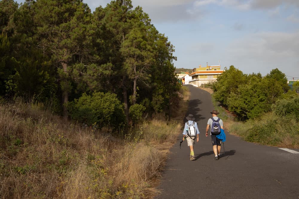
The starting point of your hike to the Montaña Negra is the large car park at the Zona Recreativa near San José de Los Llanos. You go uphill across the entire picnic area until you reach a road. This is Calle Corsino Cairos Pérez. Turn left and follow the road uphill. It makes a sharp turn to the right and you follow the course. After a few meters, however, there is a wide path on the left into the forest. The trail is marked yellow and white.

hiking crossroad - on the way up: straight
You follow this path, which tapers quickly. At first the path is clear and you follow it for a while. After some time you come to a fork. The trail is marked yellow and white and would lead you uphill on the right. This is your way back. However, you go straight ahead, although there is a yellow and white cross on a stone. After a short time you reach a corridor with power poles, which you cross.
Street through San José de los janos - Calle Corsino Cairos Pérez
Section of track from the aisle with power pylons to the lava flow
Article summary and large selection of GPS hiking tracks
Sign up for my newsletter now and get exclusive access to my collected GPS tracks as well as all the brief information about my articles.
Sign up nowYou walk along the forest lane on the right side. Then the path leads you diagonally up into the forest. From here the path is indeed quite difficult to describe, as it goes right through the forest. Often the path is well visible and well marked. Another time it goes through bushes for a while. We found the way again and again, because it goes basically easily uphill.

hiking path through the woods
After you have walked for quite a while, you reach a wider forest path, which you follow for a while. Keep left at a fork. This path ends after some time on another path that you cross. A small path with dense bushes on the sides goes up diagonally opposite. Now follow it for a while. When you’re back on a wider path, the forest will slowly clear. You cross the last forest area and are already standing in front of the wide lava flow of the Montaña Negra.

hiking over volcano stones and through green pine trees
Section lava flow to Arenas Negras
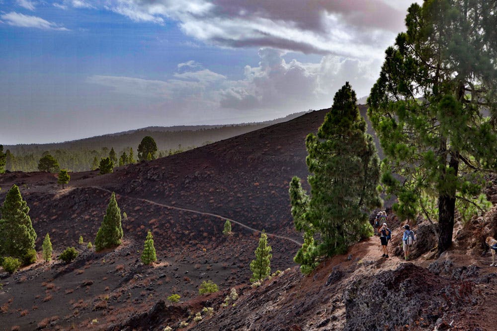
When you come out of the forest, the path leads you straight ahead. Then it goes uphill for some time parallel to the edge of the forest. Now you can’t miss the narrow path. It always leads you parallel in the constant up and down along the Montaña Negra. To your right you can now see the huge volcano. Black earth and green pines offer a fascinating contrast and an impressive landscape around you.
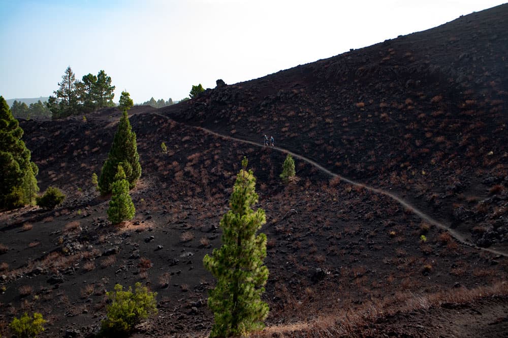
Hiking path along Montaña Negra
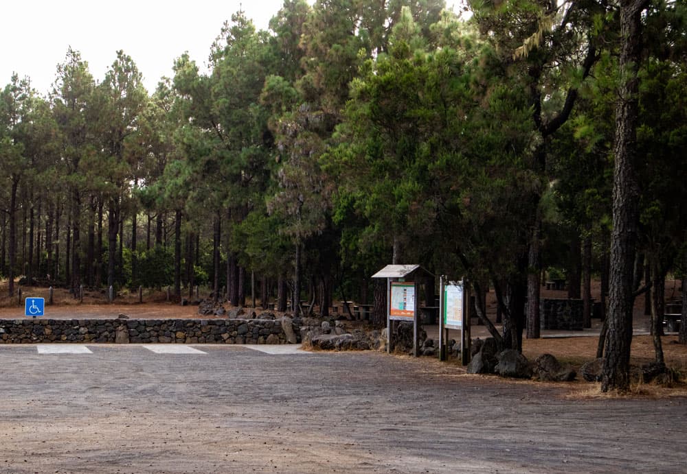
After walking along the entire side of the Montaña Negra, you come to a hill that leads you further along the side of the volcano. The path now runs again along trees and brings you back to the forest after a while. When you are back in the forest, it doesn’t take long and you meet the Zona Recreativa Las Arenas. Here is a large picnic area where you can also camp. Many hiking trails converge in Arenas Negras. You will find big hiking boards and maybe you want to take a rest.

hiking across the lava stream
Section Arenas Negras to covered water channel
From Arenas Negras follow the wide BC 1.12 hiking trail towards Chío and the TF-43.1 towards Chinyero, marked yellow and white. It will take you uphill on a wide road parallel to the Montaña Negra volcano. You continue to follow the signs. But then the main hiking trail continues straight ahead towards Chinyero. A wide path turns right. Follow this path. For a short time you walk through the forest. Here you meet a covered water channel.

covered water channel - Montaña Negra
And then after a short time you are back on the lava flow in front of the Montaña Negra. The path takes you in large arches past the other long side of the Montaña Negra. The landscape here consists only of black lava stone. After some time the path runs very close to the foot of the Montaña Negra. Then you come to a point below the Montaña Negra where a covered water channel runs. From here you have a wonderful view of the volcano and the surrounding area. On the water channel you can sit well and take a rest.
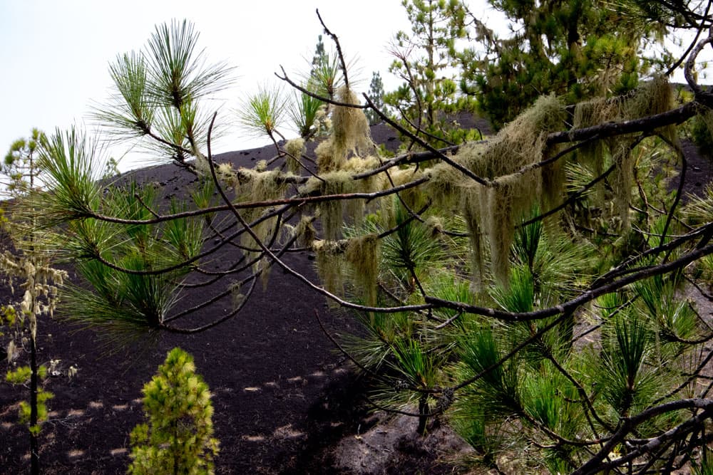
lichens on the pines
Section of covered water channel to point of departure San José de Los Llanos car park
You walk a little along the water channel. After a short time you come to a fork in the road. The main path continues straight ahead. But you go down to the right. The path first leads you down the mountain in a few long serpentines. Then you are back in the forest. Now follow the path downhill. From time to time you come across forest roads that you always cross straight. The path usually continues well marked on the opposite side.

way back around Montaña Negra
After some time you will also see signs for San José de Los Llanos. The path passes a memorial with the date 1959. Shortly before San José de Los Llanos you cross the forest road again. This time in a different place. And shortly afterwards you come to the crossroads of the way there. Now go around to the left. You go back the way you came. This will take you back to the hiking car park in a short time.

Arenas Negras - Hiking Information Board
And at the end
I hope you enjoyed this beautiful walk around the Montaña Negra. Years ago I was up there when it had snowed a little. The white snow in contrast to the black volcanic stone looked especially pretty.
Since the way there through the forest is very difficult to find, you should definitely use the JPS Track. You might be able to go the other way as well. This will make it easier for you to find your way there. I wish you a lot of fun on all your hikes,
Dagmar von SiebenInseln