Montaña de Tejina – a 2-million-year-old volcano
Montaña de Tejina is located within the municipality of Guía de Isora, above the village of Tejina, at a mid-altitude in the southwest of Tenerife. This volcanic rock, more than 2 million years old, was formed during the same geological period as Las Cañadas. Montaña de Tejina is of great value to geologists due to its volcanic material, primarily composed of phonolite and trachybasalt, later covered by lava flows. Erosion has created extraordinarily deep ravines on both sides of the volcano: Guaria and Cuéscara.
Map
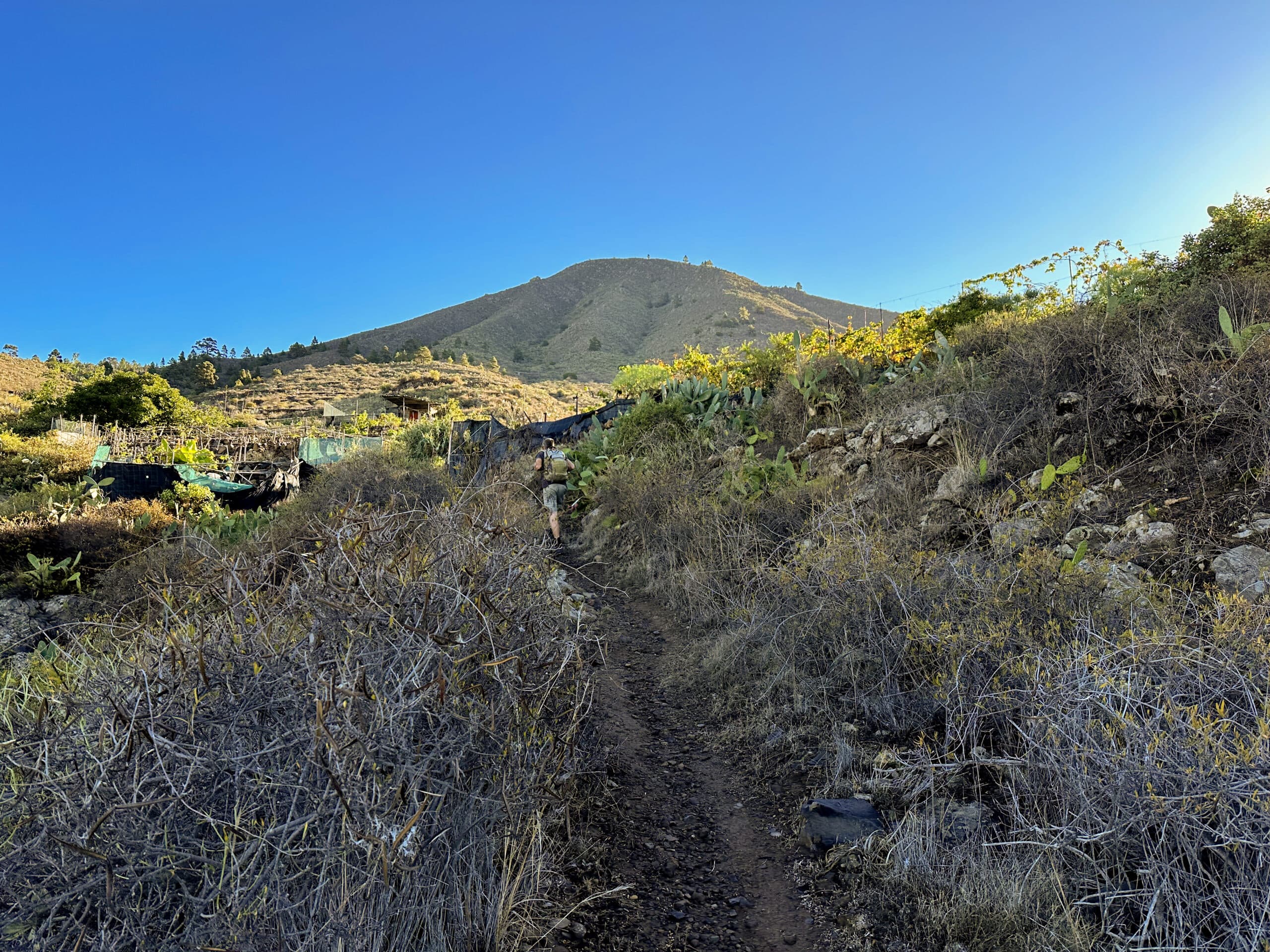
Ascent via Tejina - in the background the Montaña de Tejina
Montaña de Tejina covers an area of 169.7 hectares, rising between the Barranco Guaria and Barranco Cuéscara. This 1,055-meter-high volcanic mountain was considered sacred by the Guanches. It was later used for agricultural purposes for a long time. Today, it is a protected natural area and a refuge for numerous endangered plant species. From the summit, visitors can enjoy a magnificent panoramic view and explore several hiking trails.
Barranco Guaria
Hike through Barranco Guaria and around Montaña de Tejina
The hike begins in the small village of Tejina. First, you head north. After a slight ascent along the slopes of Montaña de Tejina, you descend into Barranco Guaria on the north side of the mountain. Once in the ravine, you continue deep into it for a long time. Just before reaching Galería Fuente de Guía, you will find a very steep ascent that leads you up to the hamlet of Las Fuentes.
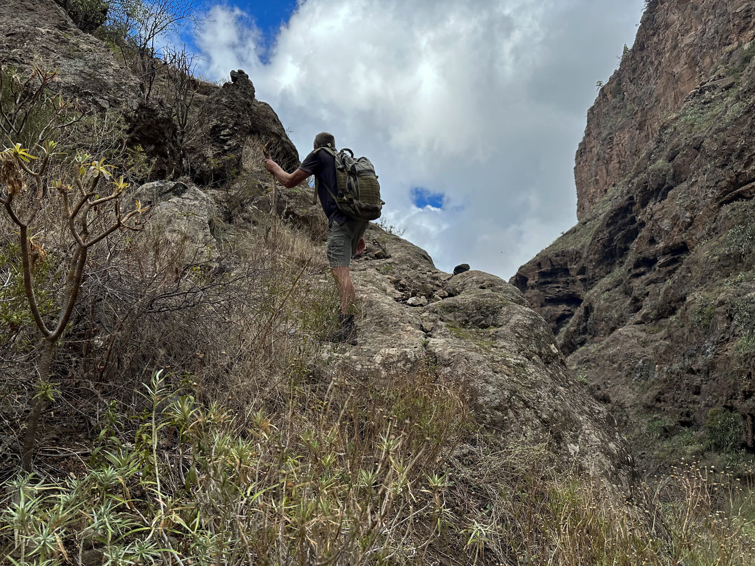
Steep ascent to the Montaña de Tejina shortly before Las Fuentes
With the ravine and ascent behind you, the hardest part of the hike is over. You then continue in either a small or large loop back to Tejina, just before Vera de Erques. While you hike on proper trails from Las Fuentes onwards, the section through the ravine and the ascent can be a bit rough. However, I can recommend an alternative route on a beautiful trail for this part as well.
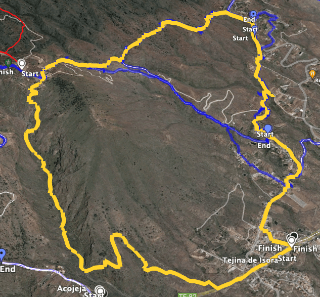
Track of the Montaña de Tejina hike (yellow)
General information about the Montaña de Tejina hike
Starting point and getting there
You start your hike in Tejina on the TF-82 in front of the restaurant Vanessa.
Access by car
From the south or north of the island, take the TF-1 or directly the TF-82. There is roadside parking available in Tejina.
Access by bus
Several bus lines go to Tejina. For detailed information, check the Titsa website. Time
Article summary and large selection of GPS hiking tracks
Sign up for my newsletter now and get exclusive access to my collected GPS tracks as well as all the brief information about my articles.
Sign up nowI am hesitant to give precise times as hiking durations are very individual. We took about 5 hours for this loop, including breaks. Keep in mind that progress in Barranco Guaria is slower due to necessary scrambling and some rough terrain.
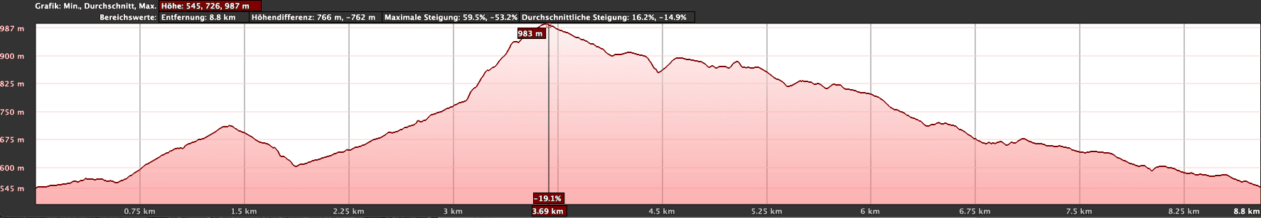
Elevation profile of the Montaña de Tejina circular hike
Elevation change and distance
If you complete the entire loop, you will cover about 650 meters of elevation gain. The route is approximately 10 kilometers long.
Difficulty
Most of the loop follows good and well-marked trails. However, the path through Barranco Guaria and the ascent to Las Fuentes are quite rough. You will need to be careful to follow the path, often climbing over large rocks and boulders, and you should be sure-footed and free from vertigo for the ascent.
Refreshments
There are refreshment options only at the starting point in Tejina. Be sure to bring enough water and possibly food.
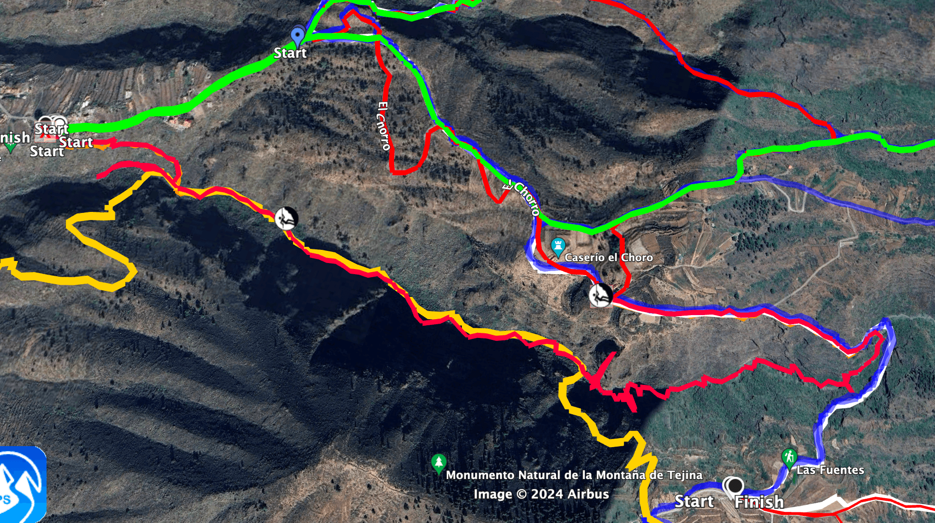
Yellow: Hike through the Barranco Guaria with ascent path Red on the yellow: Abseil route and path from Acojeja to the abseil point Blue in parts: the path around the Barranco Guaria to Las Fuentes
Variants
You have the option to shorten the loop on the way back to Tejina, saving about 2 kilometers.
If you want to avoid the ravine and steep ascent, you can cross the Barranco on the hiking path and ascend to Acojeja. From there, you can make a large loop around Barranco Guaria to Las Fuentes. This scenic alternative adds about 2 kilometers to the hike.
Abseiling: Enthusiasts can also abseil in Barranco Guaria. This way, you can explore the upper part of the ravine, which is otherwise inaccessible to hikers. The abseiling spot starts on the trail between Acojeja and Las Fuentes just before it bypasses Barranco Guaria.
In addition to the hike described here, there are many other hiking options around Tejina, Vera de Erques, Acojeja, and Las Fuentes. There is a good network of trails, and you can even hike up to Las Cañadas if you wish.
View from the Montaña de Tejina ascent route back into the Barranco Guaría
Montaña de Tejina loop hike
Section from Tejina TF-82 to Barranco Guaría
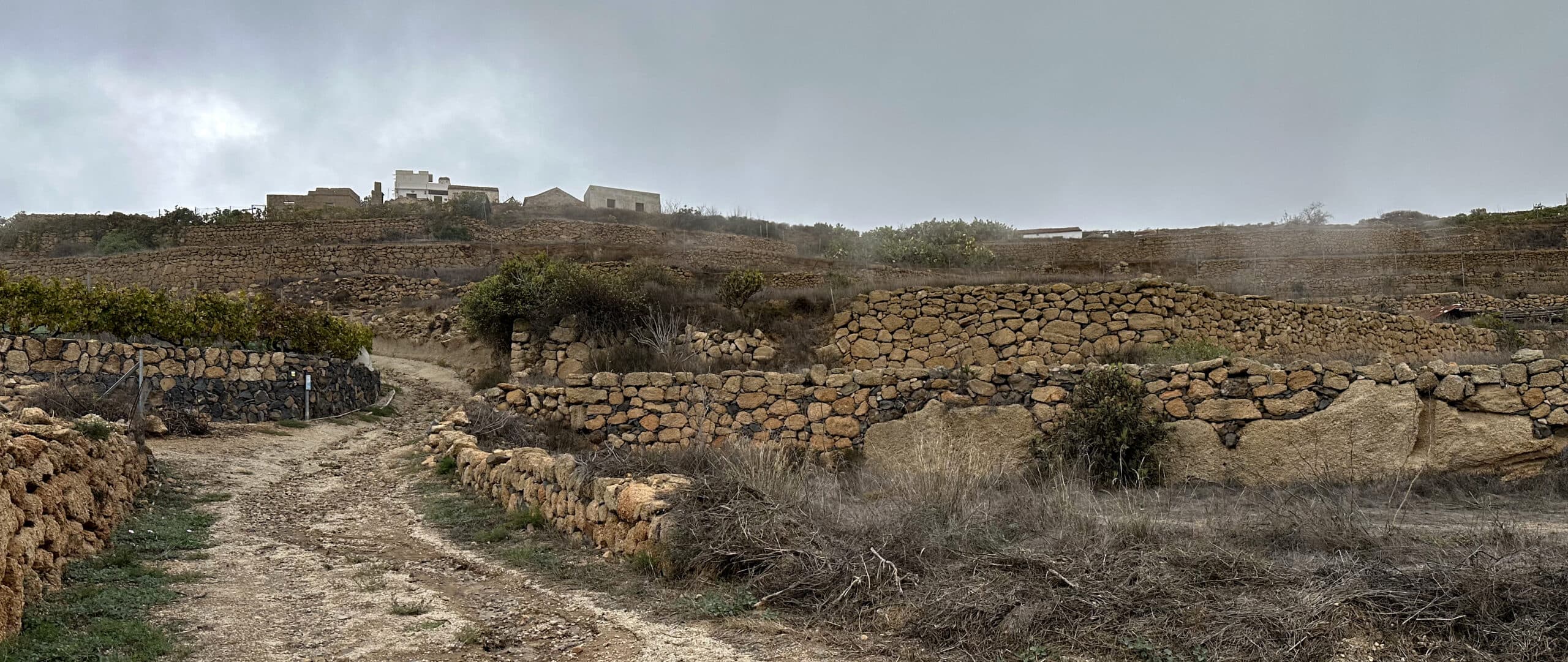
You start your hike in Tejina on the TF-82 and head north towards Guía de Isora along the road. Walk along the road until you pass the last house of Tejina. Then look for a path that leads down to the right off the road. We walked along the road for a while before taking a path, but you can also leave the road right after the last house and walk parallel to it. Eventually, you will find a trail that leads uphill past properties and terraced fields. You will already have beautiful views back to the coast and up to Montaña de Tejina.
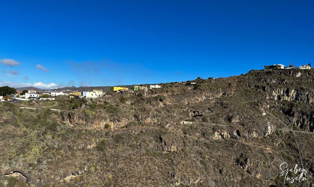
View from Montaña Tejina over to Acojeja
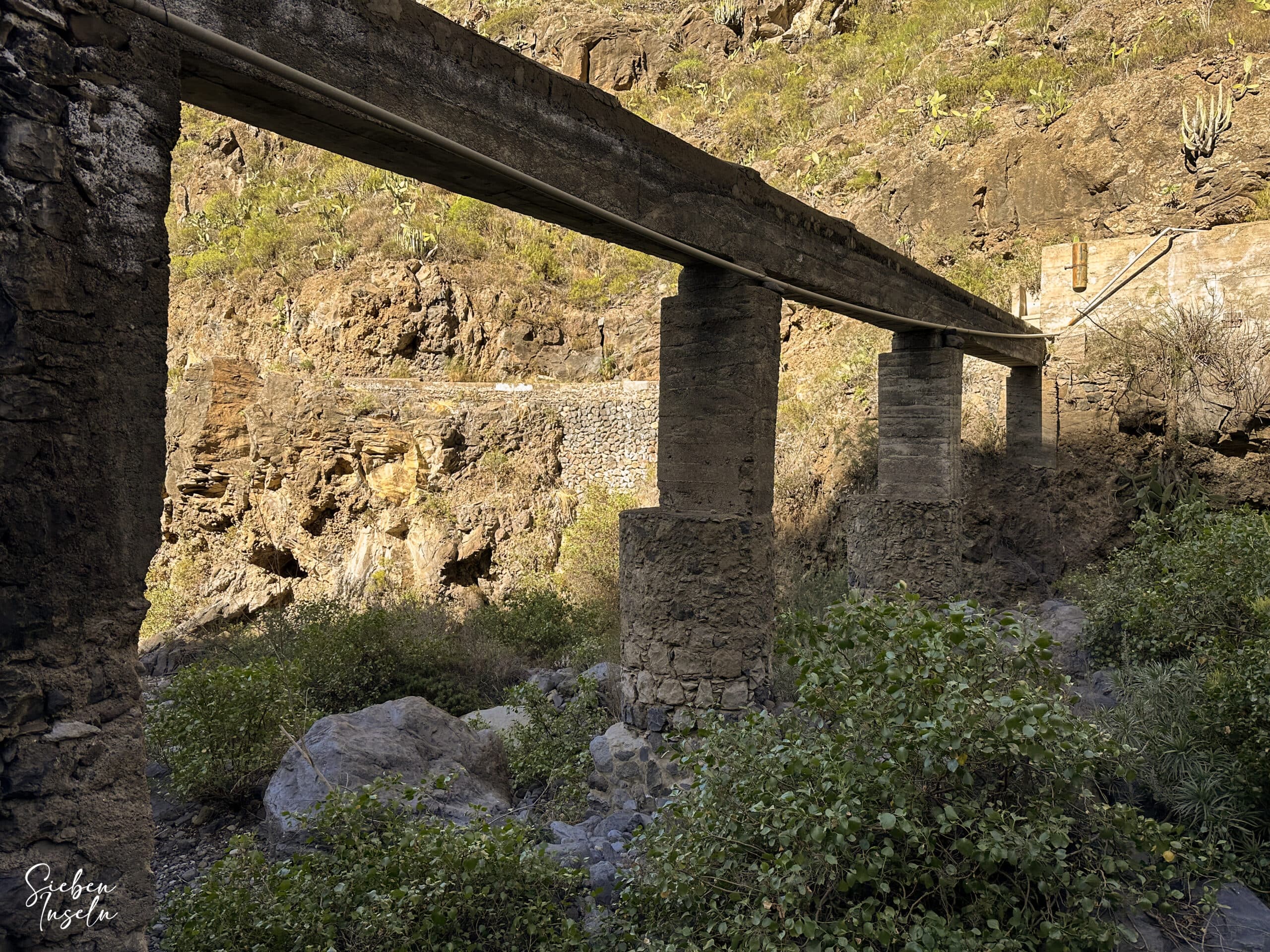
At this point, the route was a bit unclear, so there may be other options. We climbed up the first ridge and then descended in a loop over the next ridge. Between these two points, there is also a shorter path. Eventually, you will come across a trail that takes you steeply down into Barranco Guaria, past many water pipes.
Article summary and large selection of GPS hiking tracks
Sign up for my newsletter now and get exclusive access to my collected GPS tracks as well as all the brief information about my articles.
Sign up now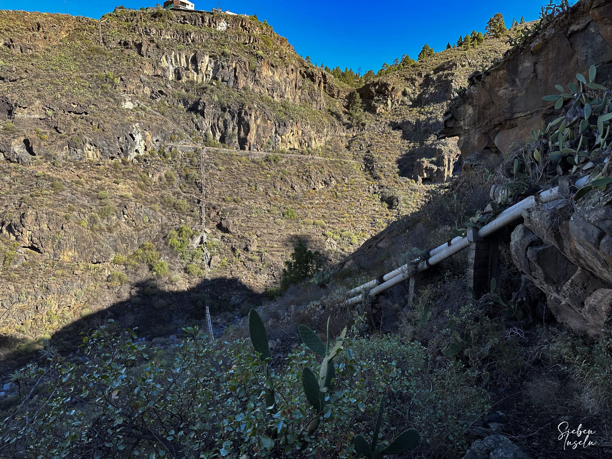
Montaña de Tejina hiking trail along water pipes down into the Barranco Guaria
Section from Barranco Guaría to Galería Fuente de Guía
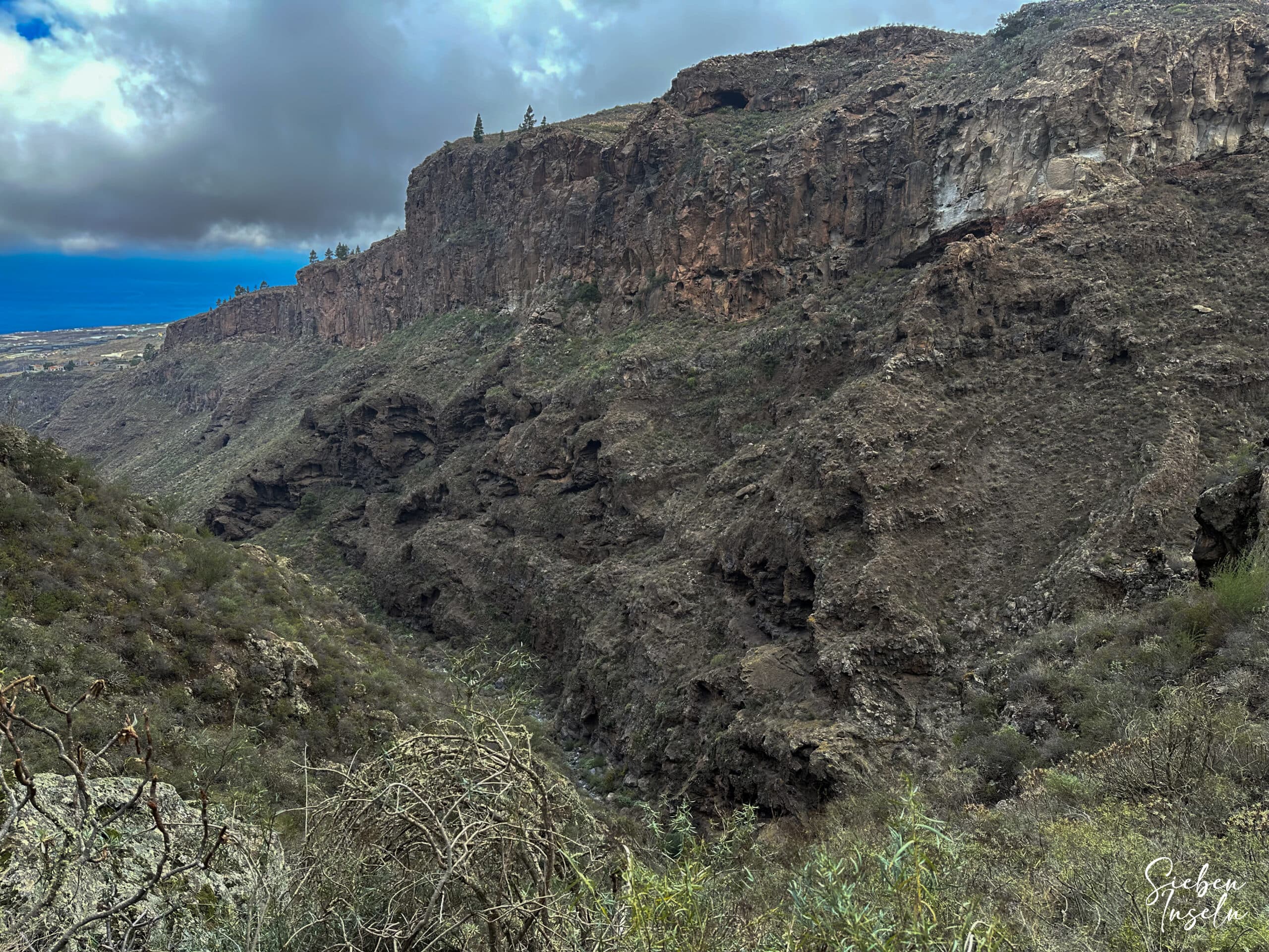
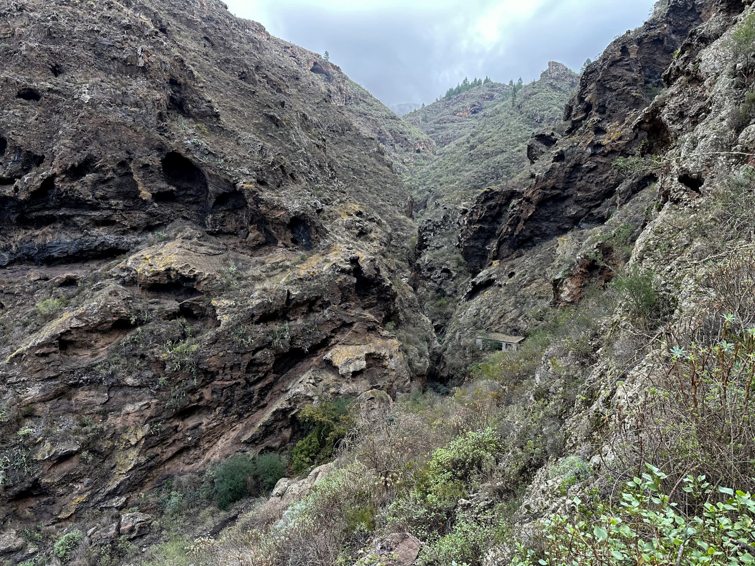
If you want to avoid the scrambling and steep ascent out of the ravine, simply follow the trail straight ahead. This takes you up to Acojeja. From there, follow the PR TF-69 trail around Barranco Guaria to Las Fuentes. Otherwise, head right and hike off-trail into Barranco Guaria. The ravine is beautiful, with steep and wild vegetation on the sides. The path can be hard to find at times, but the ravine itself guides your way. Occasionally, it gets a bit rough and takes time to scramble through.
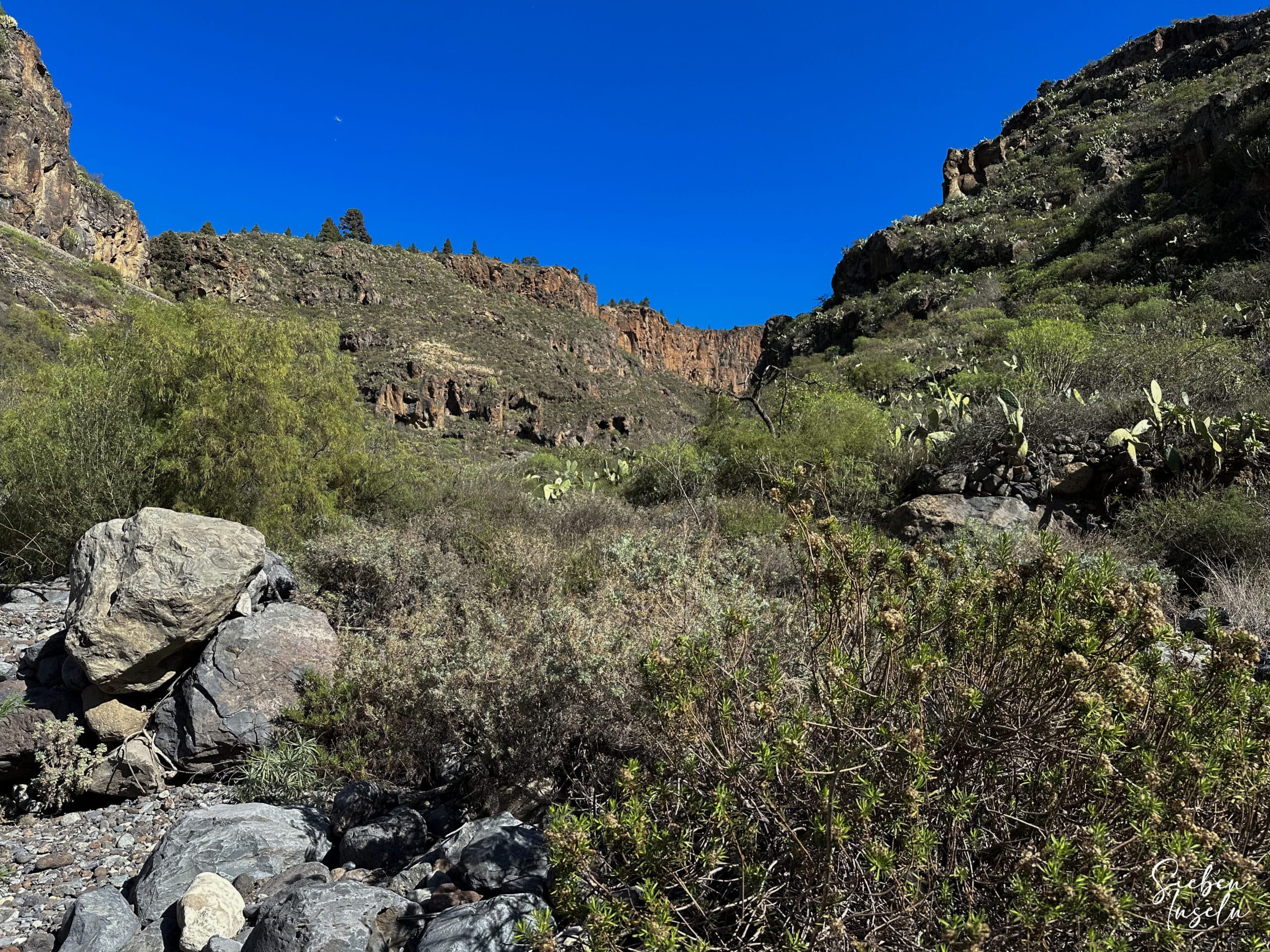
the wild Barranco Guaria
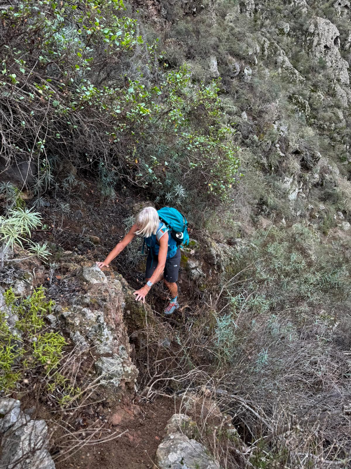
When you are close to Galería Fuente de Guía, try to get to the right side of the ravine. This also involves some scrambling. You can walk up to the gallery, but the ravine ends with high drops shortly after. It’s a nice route in reverse for abseiling. On the right side of the ravine, you will see cairns marking the way a few meters above you. Climb up to these to find a narrow path that quickly and steeply leads up above Barranco Guaria.
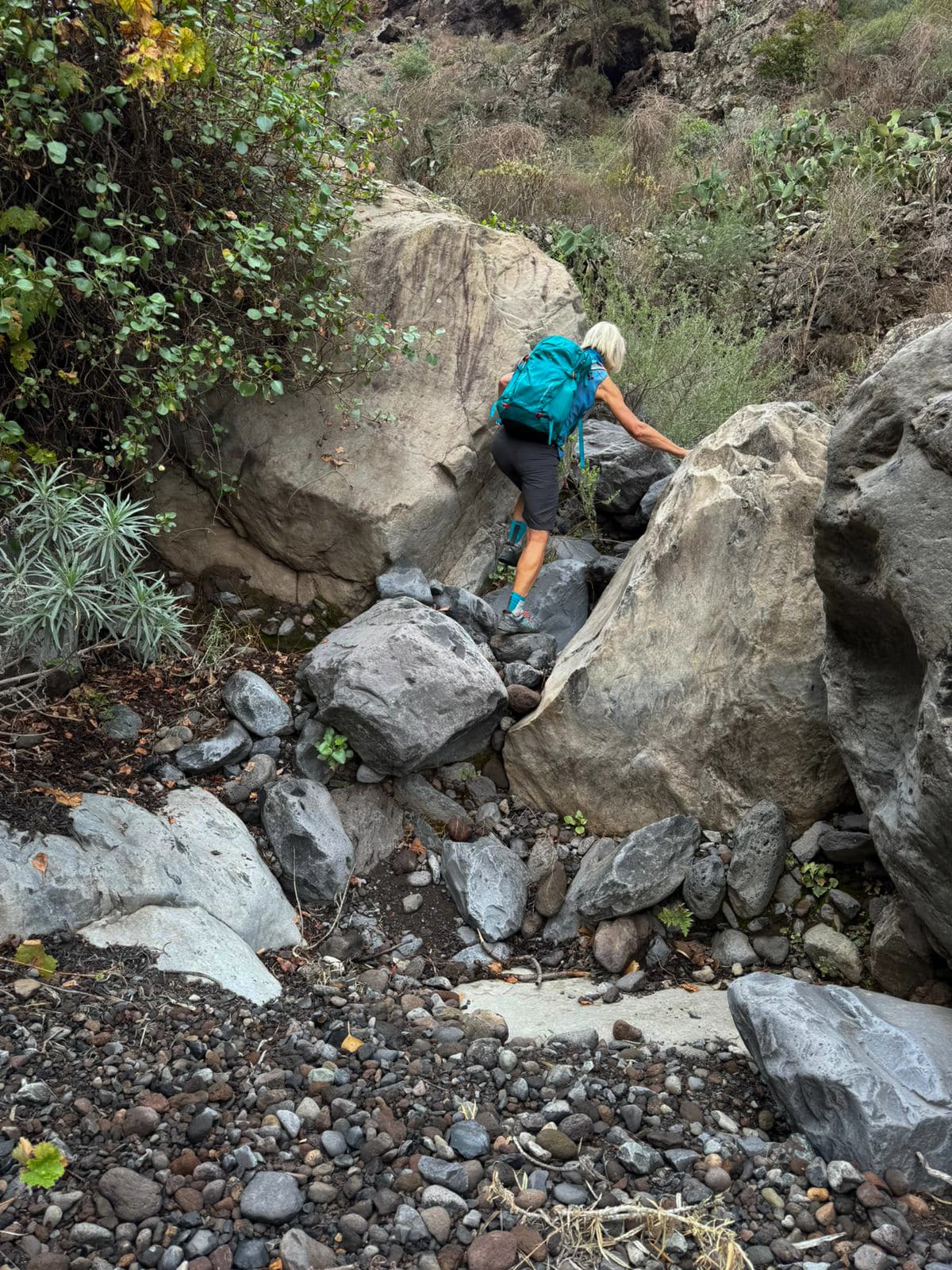
Climbing in the Barranco Guaria below the Montaña de Tejina
Section from Galería Fuente de Guía to beyond Las Fuentes
Now comes the hardest part of the hike, as you climb steeply towards Las Fuentes. Below you, Barranco Guaria with the gallery fades away. After some time, you will see terraced fields and walls high above you. After the climb, you will reach Las Fuentes on Calle las Fuentes. If you took the route around the PR TF-69, you will come here via Calle las Fuentes. If you wish, you can make a detour to the ridge with Ermita de San José, a cave, and enjoy a beautiful panoramic view in good weather. Unfortunately, when we did this hike, clouds rolled in, so we skipped this detour.
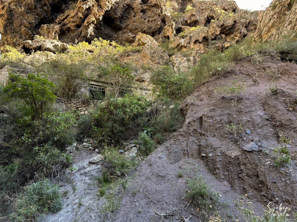
Barranco Guaria with Galeria Fuente de Guía
Steep path out of the Barranco Guaria onto the Montaña de Tejina marked with cairns
Continue straight ahead downhill. Soon you will meet Calle las Fuentes again. If you want to shorten the loop, follow the road or a parallel path back to Tejina. We extended the hike on the PR TF-69. This beautiful trail leads you up and down over several ravines towards Vera de Erques.
View from the Montaña de Tejina ascent path back to the Barranco Guaria with Galería Fuente d Guía
Section from beyond Las Fuentes to the starting point at TF-82
On the PR TF-69, you first cross Barranco la Asomada. Then you go down and up over the ravines de Cuéscara, los Granelitos, and Llano Angulo. Finally, you cross Barranco Montiel. Here you have another option to take a shorter route down to Tejina on the right. Otherwise, you cross Baranquillo los Goros. Then you reach the TF-465 road and are almost in Vera de Erques. Here, turn right on the road. Quickly leave it again to the right onto the trail.
Hiking trail near Las Fuentes
This trail takes you down into Barranco Montiel. At the bottom, cross the ravine to the right and after some time, you will reach the other side on Calle las Fuentes. Follow it downhill to Calle Virgen del Rosario. Walk along this road for a long time downhill. At a junction, turn right on the road. After a long time, turn left onto Calle la Milagrosa or Calle Corazones de Tejina. Shortly, you will reach your starting point at the TF-82 near the restaurant Vanessa.
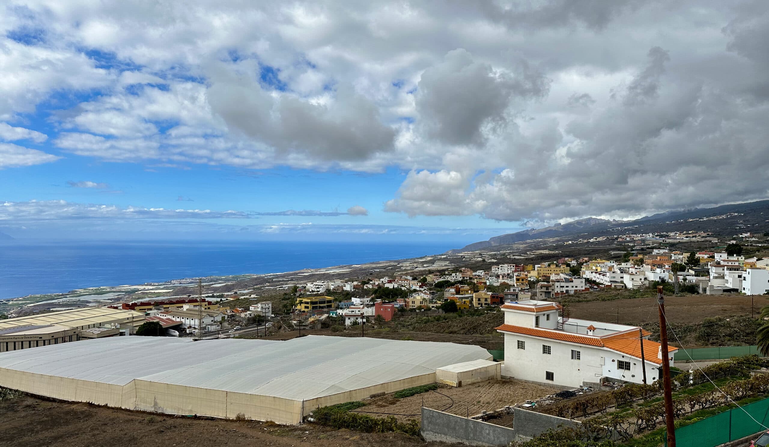
View of Tejina and the coastal region - way back
Y finally
I hope you enjoyed this adventurous hike through the wild Barranco Guaria and over Montaña de Tejina. With the many variations this tour offers, you are sure to find the right loop for you. I wish you much joy on all your hikes,
Dagmar from SiebenInseln

