Taborno and the „Matterhorn“ of Tenerife
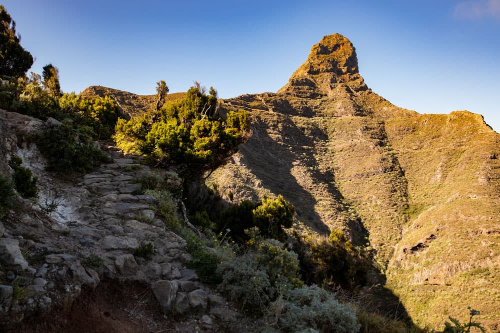
The Roque Taborno (703 metres above sea level) with its striking shape is the landmark of the small town of Taborno. It is also known as the „Matterhorn of Tenerife“.
Map

Panorama - Anaga coast and mountain ranges around Afur - Roque Taborno
You can also combine it with this great circular hike from Taborno in a short hike. Taborno itself is a small village with less than 100 inhabitants. There is a small bar with a shop, a chapel and a few houses.
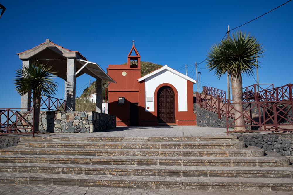
church of Taborno
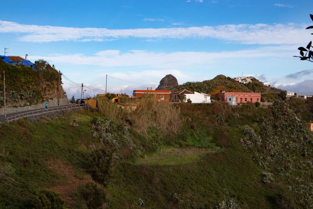
The inhabitants live mainly from agriculture. It is impressive how they work the terraced fields on the steep slopes. Even if you don’t want to walk around Roque Taborno, from Taborno, which is 630 metres above sea level, you have a wonderful view of the whole area and far into the Anaga gorges to the sea.
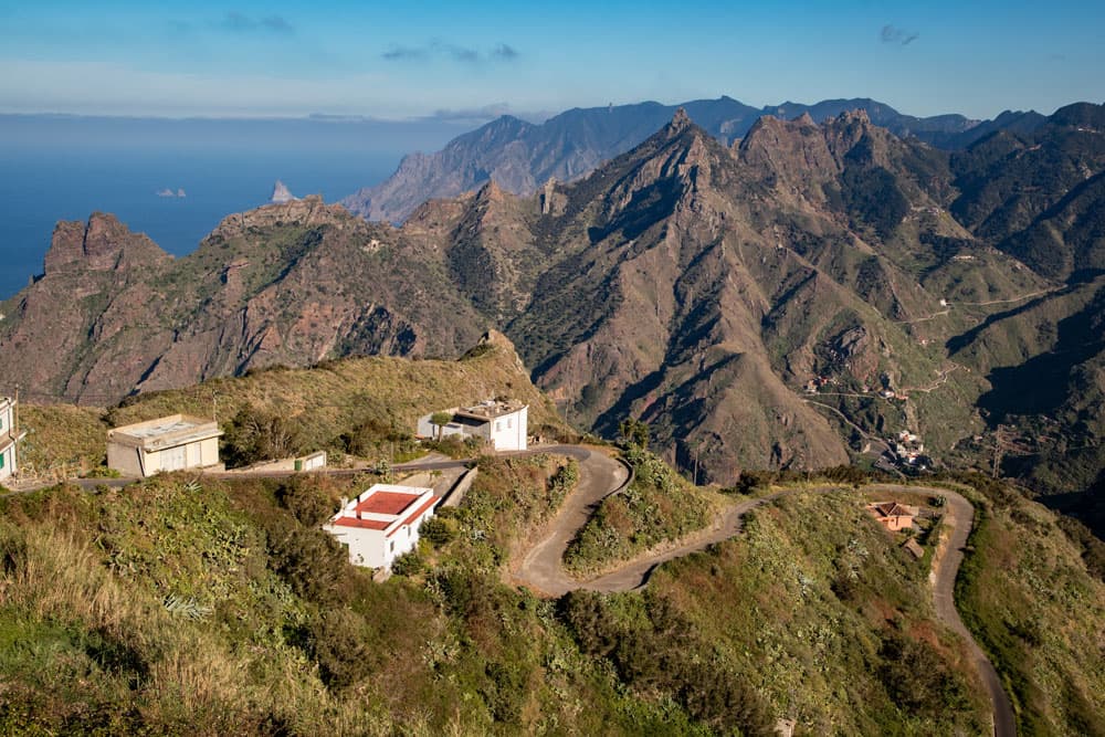
view down to Taborno
Descent hike from Taborno to the sea to Tamadite beach.
This fascinating circular hike takes you from the height of the small mountain village of Taborno in a wide arc to a ridge. You descend via the hamlet of El Frontón to Afur. From Afur you go down to the beach of Tamadite as described in the circular hike from Afur to Taganana. 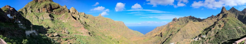
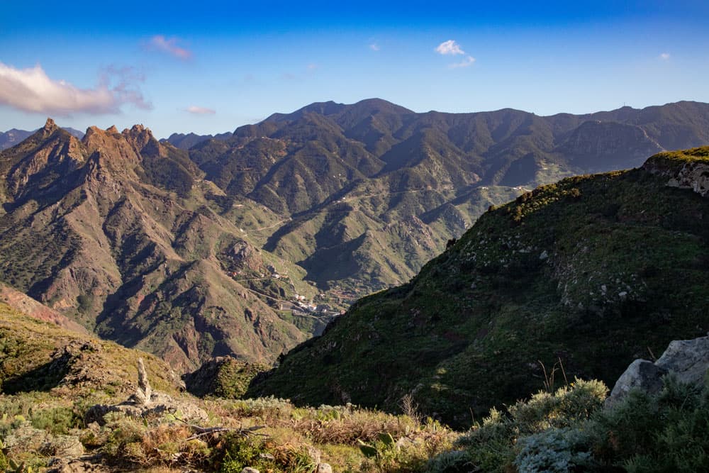
Panorama - mountains around Taborno
The way back from the beach is more than impressive. This leads you high above the Barranco de Tamadite up the steep walls back to Taborno. However, this section is really only possible with good physical condition and absolute surefootedness as well as a head for heights. The path leads along narrow paths close to the abyss and has some exposed sections. A path for adventurers who love „black“ routes.

track of the circular hike from Taborno to Afur
General information on the Taborno Circular Hike
Starting point and approach:
the little village of Taborno
The place Taborno in the Anaga on 630 height meters is starting point of this tour. The hike starts at the place in front of the chapel or at the bus stop.
Arrival by car
You come on the Anaga mountain road TF-12 from the direction of La Laguna. After passing Cruz del Carmen, take the first road on the left (TF-138) towards Las Carboneras/ Taborno. After some time the road forks. Turn left towards Las Carboneras and turn right towards Taborno.
Arrival by bus
The Titsa bus line 275 stops in Taborno. You can find more information on the Titsa Homepage. The bus stop is right at the entrance of the village from where you can start the hike. Time
I don’t like to give general time information for hiking tours, because the times are very individual. For this hike with a longer stay at the beach it took us 5.5 hours.
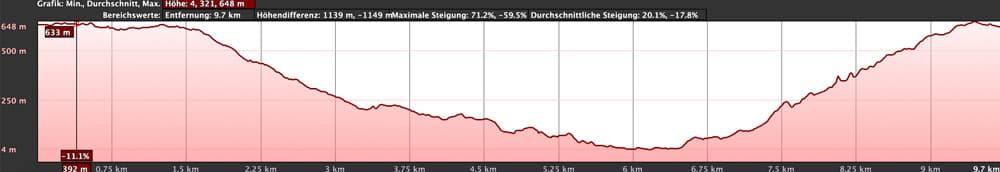
elevation profile circular hike Taborno - Afur - Tamadite - Taborno
Article summary and large selection of GPS hiking tracks
Sign up for my newsletter now and get exclusive access to my collected GPS tracks as well as all the brief information about my articles.
Sign up nowDifference in altitude and distance
The difference in altitude is approx. 750 metres. The distance is about 10 kilometers long.
Requirement
The first part of the hike from Taborno via El Frontón to Afur and from there to Tamadite beach takes you along well-marked trails. Up to Afur I classify the hike as easy and from there to the beach as easy to moderate. But from the beach back over the steep wall to Taborno it is actually a quite difficult stretch. On the one hand the way is very bad to find (at the beginning). Furthermore, the paths are narrow and often directly along the abyss. There are also airy and exposed passages. In addition, it often goes up very steeply. This section is really not recommended for everyone. Those who do not have a good physical condition, sure-footedness and a head for heights should better avoid the beautiful circular hike from Afur or go back the way there. 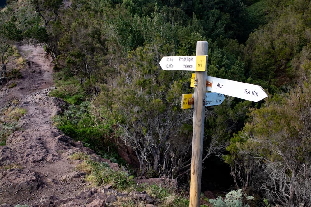
signpost to Afur
Refreshment
There is a small bar in Taborno and Afur. Therefore you should take enough water and food with you.
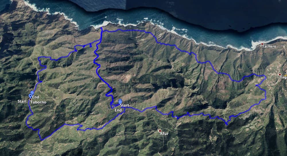
tracks of the two circular hikes from left to right:
1. Taborno-Afur-Tamadite-Taborno
2. Afur-Tamadite-Taganana-Afur
Variants
This tour can be combined well with various other hiking and circular walks in the vicinity. First of all the round tour around Afur to Taganana should be mentioned here. Both tours have the section from Afur to the beach of Tamadite in common. Furthermore, this big round tour can be completed by the small round tour around the Roque Taborno (simply signposted from Taborno).
Those who find the last part of this hike too difficult should better combine it with the Afur Tour or go back the same way.

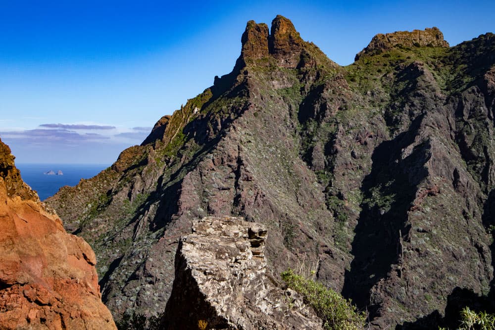
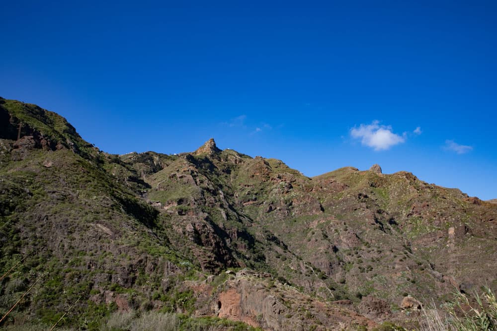
Roque Taborno
Circular hike Taborno – El Frontón – Afur – Beach of Tamadite – Taborno
Section from Taborno to Bergkamm
You start the hike in front of the church or along the main road Casero de Taborno in Taborno. Then walk along the road to the entrance of the village, where the bus stop is. To the left of the road a small path leads uphill. This is the path PR TF 9, marked yellow and white. This small path leads you in a large arc over the terraced fields of Taborno. From up here you already have beautiful views of the small village and the surrounding area. You ignore the branching paths that lead into the gardens and to the fields and stay on the main path.
hiking path beneath Roque Taborno
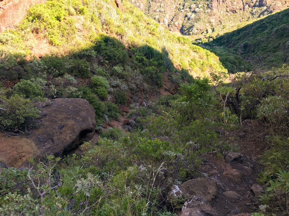
The way goes slightly up and down through the slope. You walk through the forest for a while and after a short climb you meet the hiking trail PR TF 2.1. Follow it to the left. Now you hike along a ridge with wonderful views. On the left side you see a forest area and on the right the wide view over the ridges of the Anaga. Deep below you can already see El Frontón and Afur.
View from the ridge to Taborno
Section mountain ridge to Afur
The last part of the descent to El Frontón is quite steep. Then you cross a road over the hamlet and continue on the opposite side of the road. The path passes some houses and then goes downhill in big serpentines and later small serpentines. After less than half an hour you have reached the first houses of Afur. From there the trail continues downhill. But now you walk on a concrete road.
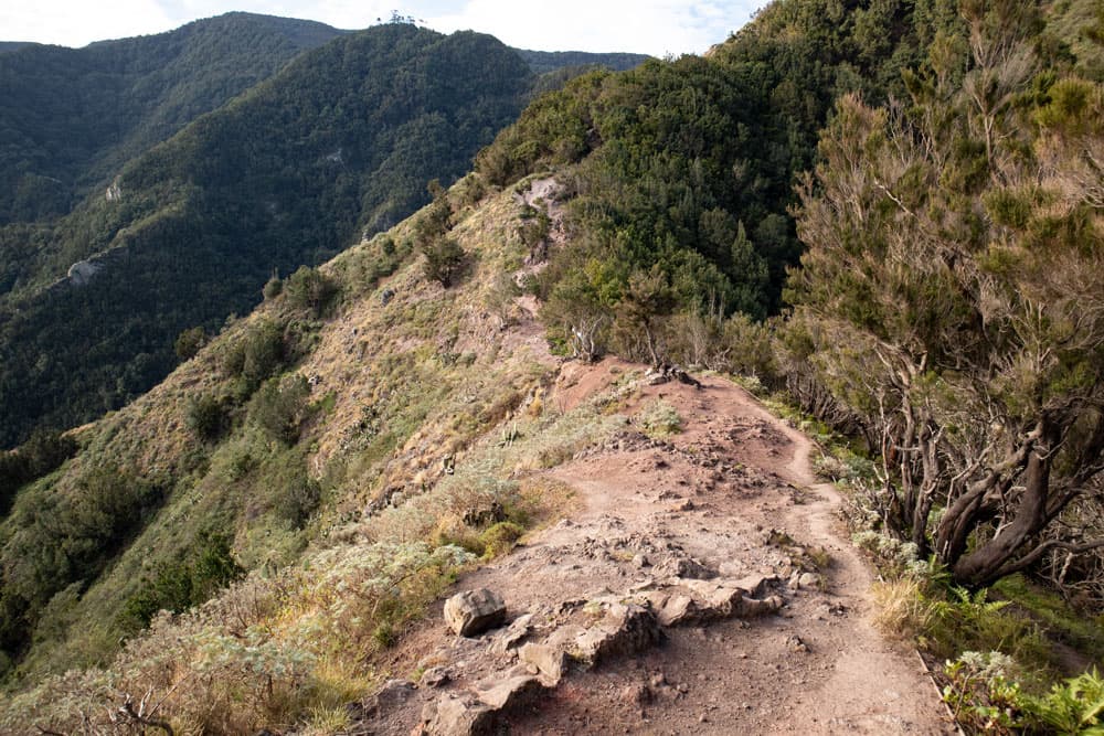
hike over the ridge from Taborno to Afur
You follow the path further and further down. Afur is now quite close in front of you. You go down to the Barranco bottom of the gorge of Tamadite. You cross it and go up again on the other side to the centre of Afur. There the hiking trail leads you over the church square down to a parking lot. And from there the trail starts through the Barranco de Tamadite down to the beach.
View down to Taborno
Afur to Barranco Ground section
The hiking trail with hiking signs to Tamadiste (Tamadite) and yellow white markings is well prepared. From the car park follow the road. Shortly afterwards, the PR TF 8 hiking trail turns right, taking you down into the Tamadite gorge. You first walk along the slope. From time to time even some parts of the trail, which are particularly steep, are secured with a railing.
Article summary and large selection of GPS hiking tracks
Sign up for my newsletter now and get exclusive access to my collected GPS tracks as well as all the brief information about my articles.
Sign up now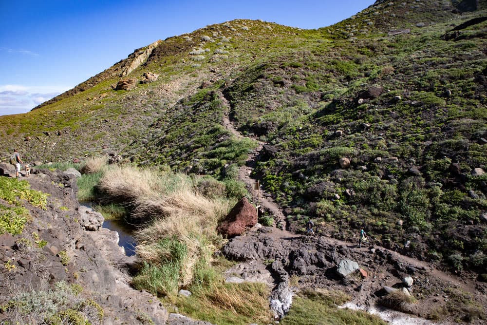
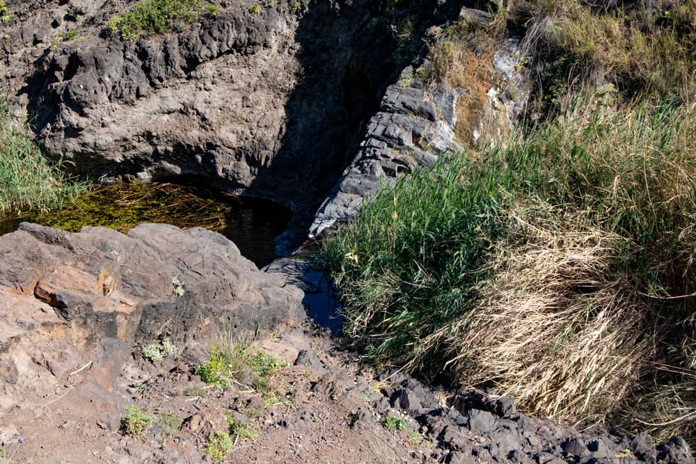
junction hiking trail with waterholes and reed
You hike in this section high above the Barranco ground. From time to time you can also meet goats looking for food on the lower slopes of the village. After some time you will reach a small pass between high rocks. There it goes down steeply on the other side. You walk on the slope side and slowly approach the bottom of the Barranco. There can be a lot of water here depending on the season. But in general the bottom can be crossed on big stones.
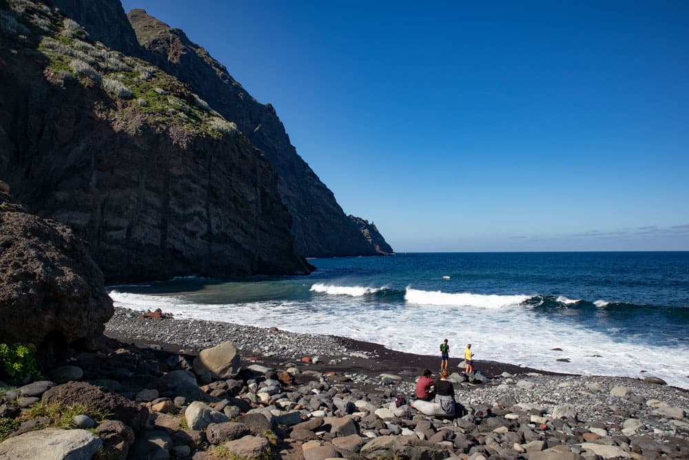
beach of Tamadite
Section Barranco Ground to Tamadite Beach
You walk through reeds and then along a path along rocks on the other side of the Barranco. The path now climbs up again high above the Barranco Ground. In an arc it leads you up to another rocky peak, which you avoid. On the other side you can already see the Atlantic in the distance. Once again it’s about another rock up and down. Then you slowly walk downhill towards Tamadite/Tamadiste beach.
beach of Tamadite
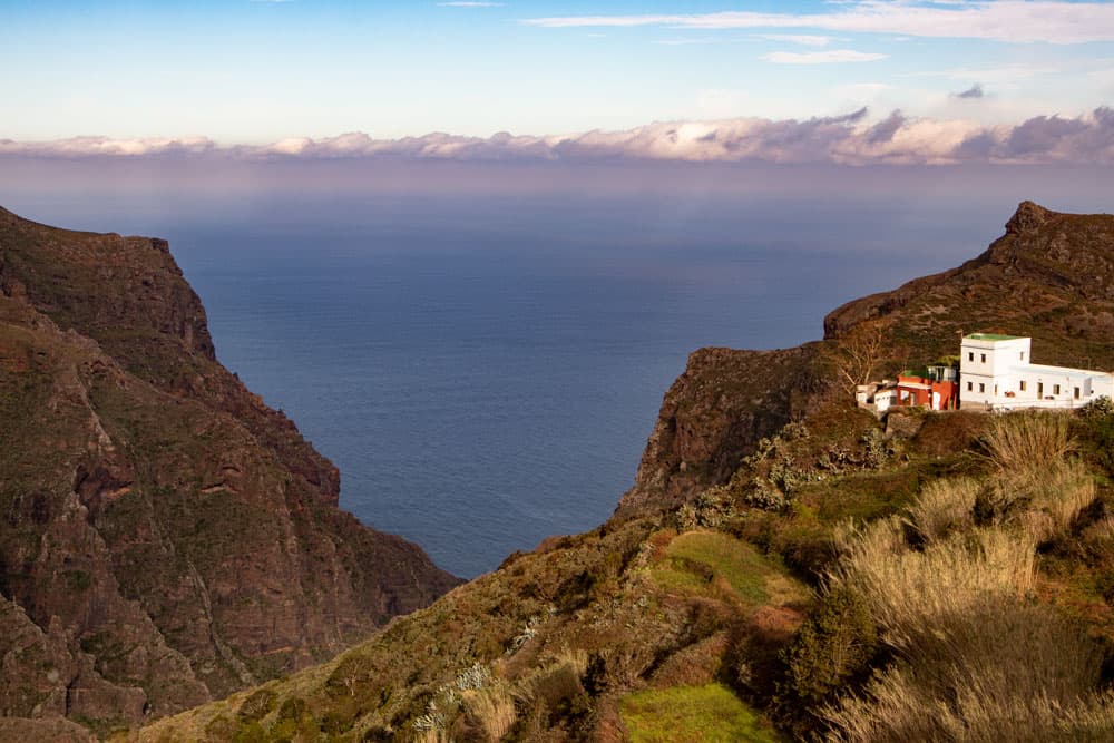
On the left above you are now some small houses and many terraced fields. To your right is the Barrancio bed. Every now and then you come across big or even just small water holes, some of which are covered with reed. They are separated by rocks and cascades and really pretty to look at. You walk through a green and very varied landscape. Then you come to a junction. To the right it goes to Taganana. Straight ahead you go in shortest time to the lonely beach. You should definitely pay a visit to this beach. An ideal resting and resting place.
Taborno with its Roque seen from Afur
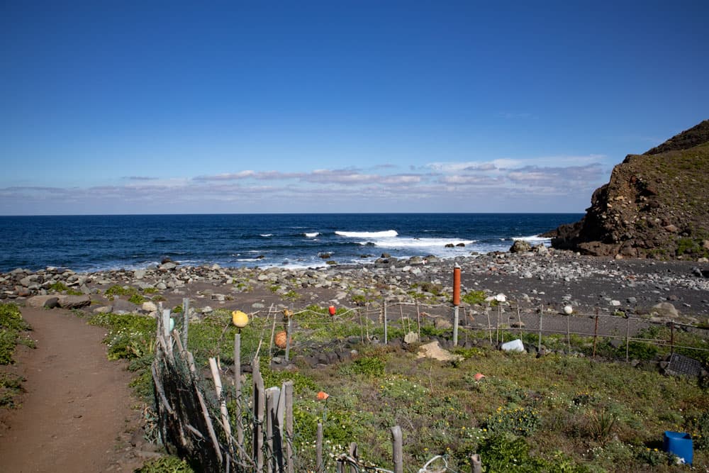
Section Tamadite beach to creek bed
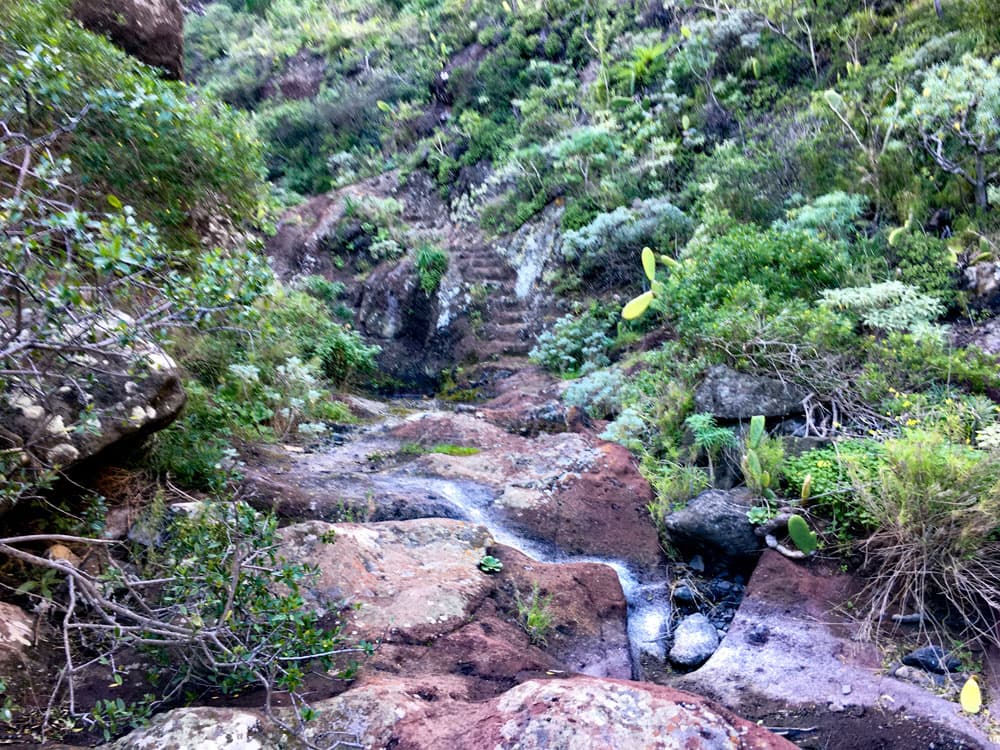
After you have hopefully enjoyed enough beach, the hardest part of this tour comes – the steep ascent in rough terrain to Taborno. You walk back from the beach on the path you came from. At the first big cascade (waterfall) a small path leads uphill on the right side of the slope. You walk along the right side of the slope. To your right are some small houses and terrace fields. Then you cross the small ridge and get to a path on the other side of the slope.
Cascade and junction to Taborno
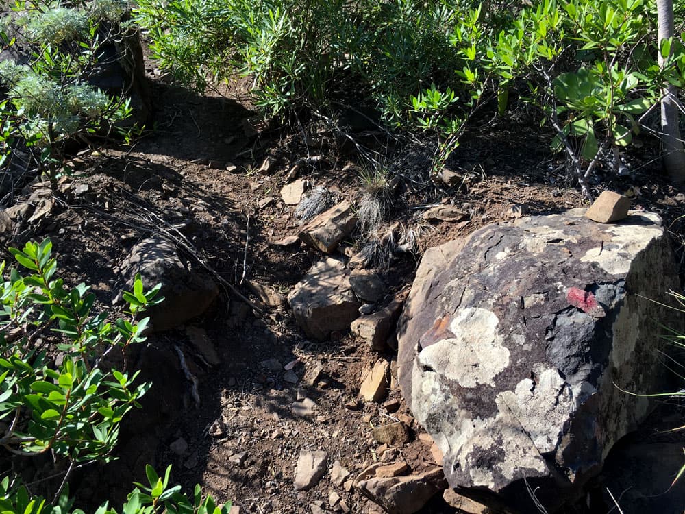
Follow this little path around to the right. You go straight ahead for a very long time. The small path is overgrown and sometimes hard to find. Since I knew that I had to cross the Barranco to my left at some point, I (as you can see in the track) turned left twice too early and looked for the way on. In fact, however, it continues straight ahead for a very long time and steeply uphill on narrow paths. Only when you see a very big rock in front of you in the stream bed do you go into the Barranco.
hiking trail at the ground of the Barranco - way back to Taborno
Section Bachbett to Wald
After a few metres, a small very steep path leads up to the left out of the stream bed. The path partially climbs steeply on small rock steps. Very quickly the Tamadite beach remains below you. The path continues narrowly along the right side of the slope. On the left below you is the deeply incised Barranco. After some time you have to master a short steep ascent. The trail then leads over a rock plateau, at the end of which you climb very steeply for a short while. Here you climb steeply on rock steps. So it was not easy for us to get my big Labrador over it. But luckily it worked out. For this little climb you have to be really free of vertigo.
narrow hiking trail
On the other side of the ridge you get back on your way. This will now take you uphill on the right side of the Barranco ridge. You walk further and further into the valley. At some point you have reached the Barranco bed again. Now the path continues uphill through the gorge. This time, after about 100 metres, the path leads you steeply up to the right out of the Barranco bed. Now you can’t miss the path any more. It leads you further uphill and then left again towards Tal Grund. From there it goes in a further slope crossing by high bushes and forest.
path through the Barranco back to Taborno
Forest section to Taborno
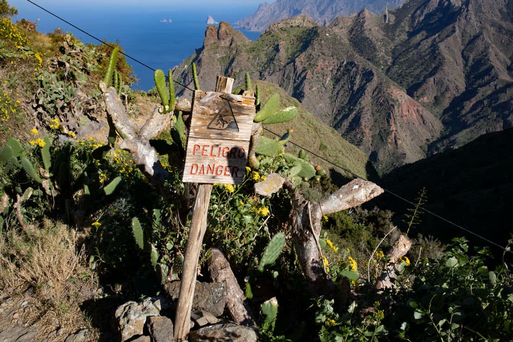
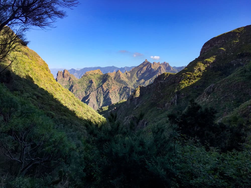
The path through the forest area is narrow. Even if you no longer look into the abyss, watch your footsteps, because the blackberry bushes on your left also lead steeply downhill. You bypass the forest at the end of the slope and climb up to a rocky plateau on the ridge. Here you have a wonderful view back to „almost“ your whole trail and all the way to Taganana. Now it won’t be long before you reach the first houses of Taborno. There are signs that this path is „dangerous“.
start/end hiking trail Taborno
The ascent ends at a crossroads that leads to the right to Roque Taborno. If you haven’t had enough adventures yet, you can now turn right and walk around the „Matterhorn“. Otherwise it goes left over a ridge and then through forest uphill further back to Taborno. You come out at the main road of Taborno. Here you pass a Mirador and quickly return to the church square and the starting point of your hike.
view from the hiking trail back to the Barranco of Tamadite
And finally
I hope you enjoyed this varied hike in the Anaga Mountains in Tenerife. Since the last section is really difficult, please only go if you are an absolutely safe hiker. I wish you a lot of fun while hiking!
Dagmar von SiebenInseln