Arico and the Barranco Tamadaya
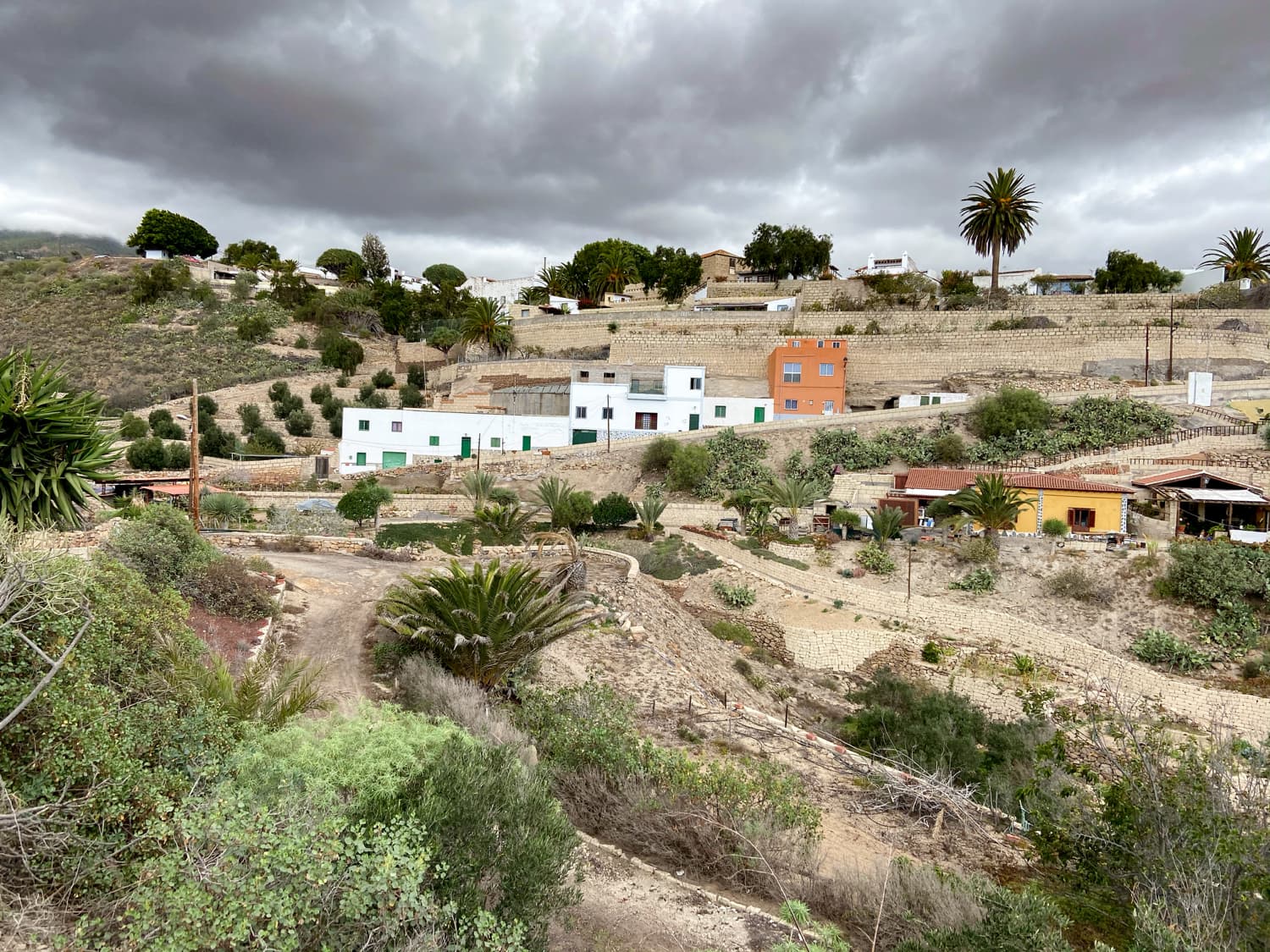
The small municipality of Arico with about 8000 inhabitants and its famous Barranco Tamadaya is situated in the south-east of Tenerife. Arico consists of several historical districts. There is Arico Nuevo, Arico Viejo and La Degollada. The buildings and streets appear tidy and well-kept, so that a visit to the village in connection with a hike is definitely worthwhile.
Arico Nuevo
Map
The inhabitants make a living from agriculture, especially wine growing, home-produced honey and goat keeping. Arico is particularly popular with active holidaymakers because of the wonderful hiking and climbing opportunities. It is interesting to note that the municipal area of Arico extends from 0 metres in altitude (beach level) to over 2500 metres in altitude on the eastern slopes of the Cañadas.
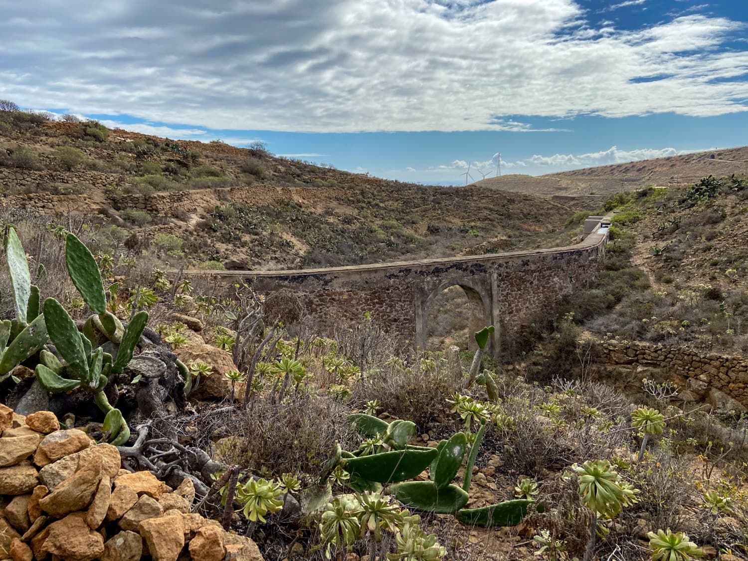
Old bridge with water channel (viaduct) on the hiking trail
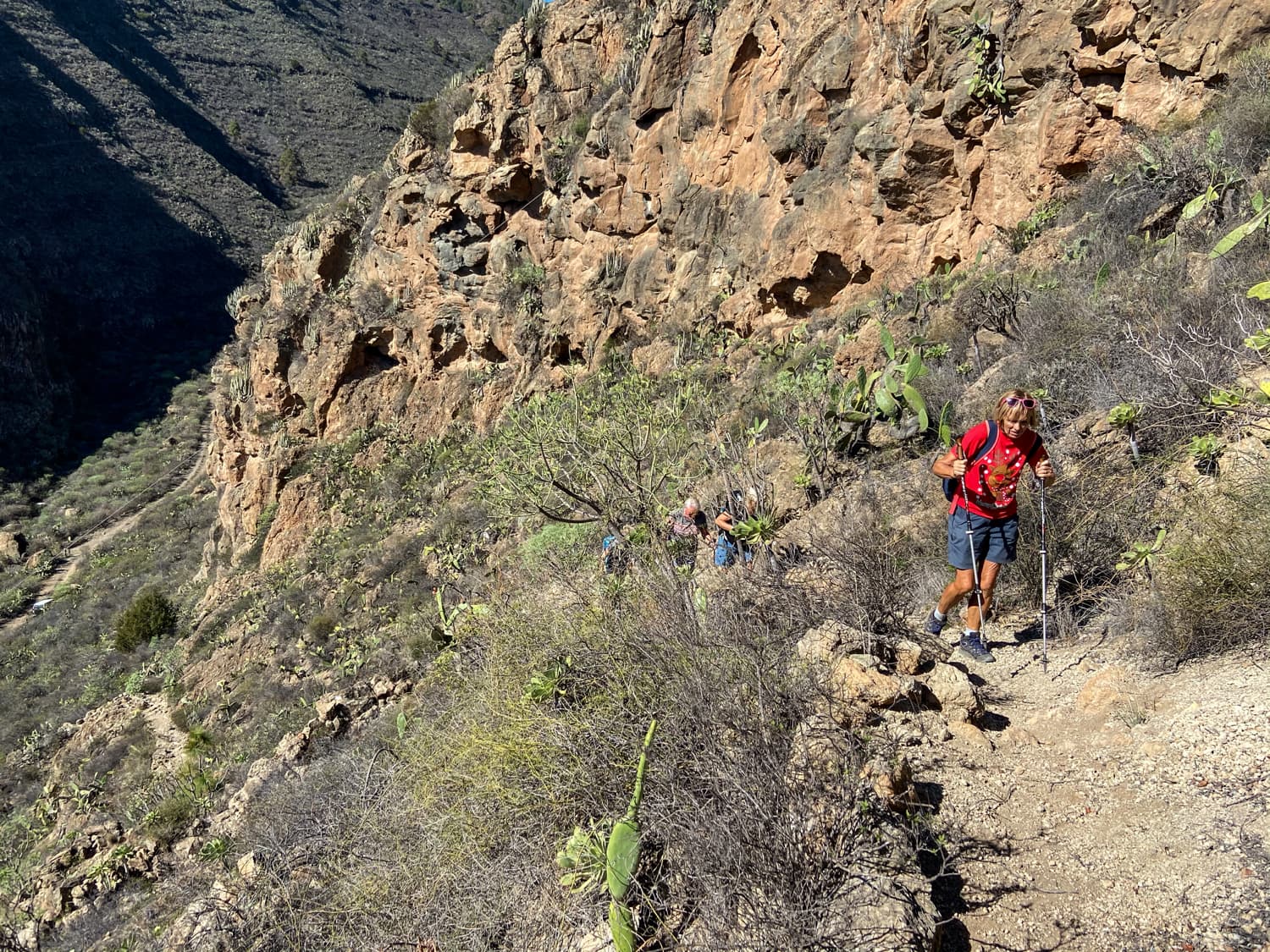
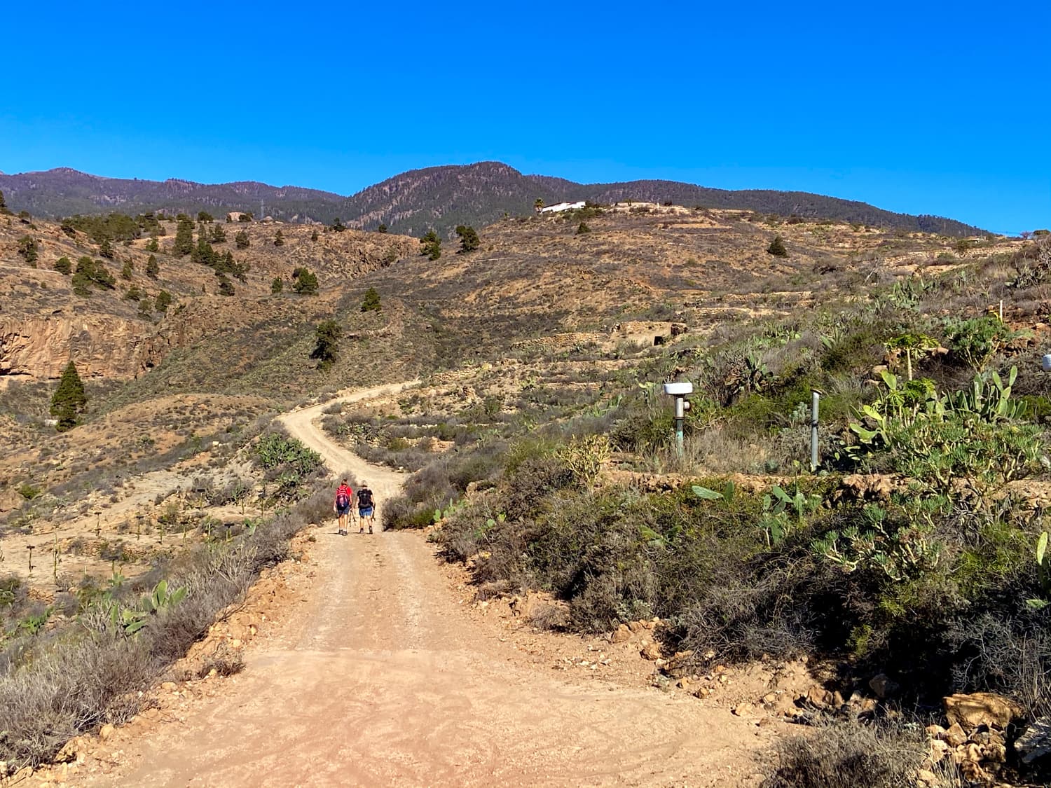
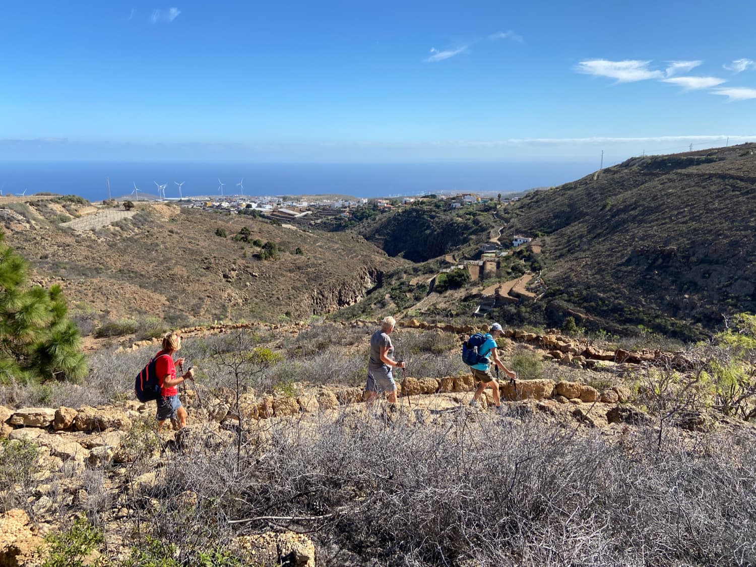
There are endless hiking possibilities and countless climbing tours for all demands and desires. There are particularly many climbing opportunities in the Barranco de Tamadaya. The Barranco de Tamadaya is a long gorge near Arico. In parts it is very narrow and steep. If you do the hike presented here from Arico Nuevo, you will certainly meet some climbers. You will also pass places where prepared climbing ropes are hanging. Several climbing companies in Tenerife have specialised in this region for their activities. On one of the hikes presented here, you can enjoy views from above into the Barranco Tamadaya. On the other hike, you will cross the Barranco Tamadaya and also hike up to the Galería Tamadaya.
Hikes Arico Viejo, Arico Nuevo and Barranco Tamadaya
I called the first hike Arico Viejo because it starts in Arico Viejo. It takes you up via La Degollada and La Sabinita and then back in a wide arc in a south-westerly direction via Arico Nuevo. I named the second hike Arico Nuevo after the starting point. It takes you in a small arc up to La Sabinita. From there you hike into the Barranco Tamadaya. The hike takes you up the gorge to the Galería Tamadaya. If you like, you can continue from there and visit the second Galería, which is higher up.
The way back is steep on the other side of the Barranco up to a ridge from where you can enjoy wonderful views. You climb down the ridge until you return to the Barranco Rand Tamadaya. There, the trail descends steeply into the very narrow Barranco Grund. At this point you will surely meet many climbers. On the other side of the Barranco you climb back up to La Degollada and from there hike back to Arico Nuevo. Another hike high above Arico can be found on Seven Islands here. 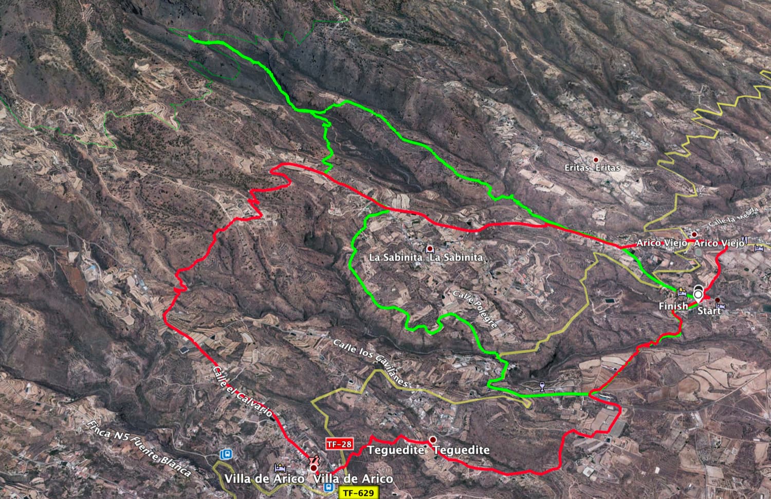
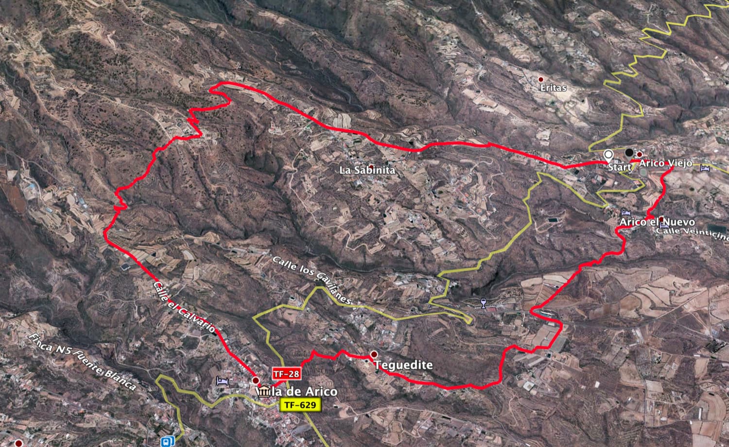
Tracks Arico Viejo (red) and Arico Nuevo - Barranco Tamadaya (green)
General information about the circular walks around Arico and the Barranco Tamadaya
Starting point and how to get there
Arico Viejo hike: The hike starts in the centre of Arico Viejo on Calle La Gollada.
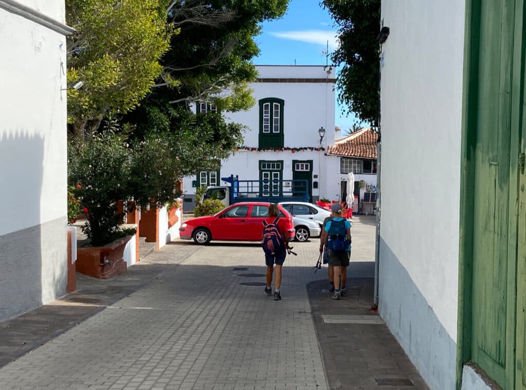
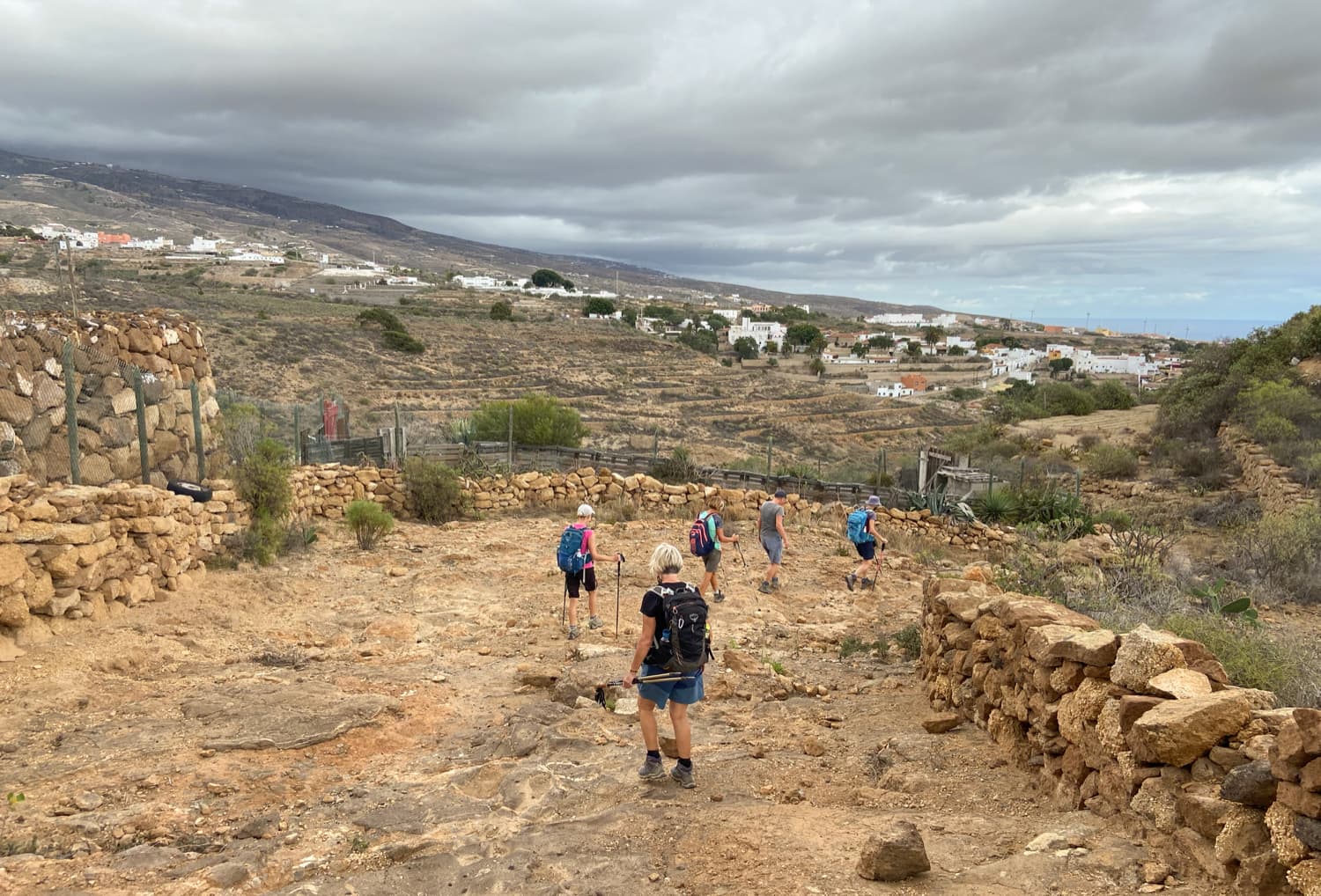
Hikers in front of the church square of Arico Nuevo
Arico Nuevo hike: The hike starts in the church square in Arico Nuevo at the end of the Calle Nuestra Senora de la Luz.
Access by car
Arico Viejo hike: Coming from the north or south on the TF-1 motorway, take the Poris de Abona exit towards Arico Viejo on the TF-625, driving straight into the town on the TF-625. At a crossroads, continue straight ahead. Here you can park your car at the side of the road.
Arico Nuevo hike: Coming from the north or south on the TF-1 motorway, take the Poris de Abona exit towards Arico Viejo on the TF-625. Drive straight into the town on the TF-625. At a crossroads, keep left on the TF-28 and head towards Arico Nuevo. In Arico Nuevo, turn left off the TF-28 into the small street Calle Nuestra Senora de la Luz. Drive to the end of the street until you reach the church square. There are parking spaces there.
Arrival by bus
You can get to Arico Viejo and Arico Nuevo by bus with the Titsa line 430. You can find more information on the Titsa homepage. Time
I don’t like to give general times for walking tours, as the times are very individual.
We needed 3.45 hours for the hike from Arico Viejo and just over 4 hours for the hike from Arico Nuevo, with short breaks and a long rest.
Article summary and large selection of GPS hiking tracks
Sign up for my newsletter now and get exclusive access to my collected GPS tracks as well as all the brief information about my articles.
Sign up now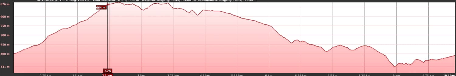
Elevation profile of the Arico Viejo hike
Difference in altitude and distance
Arico Viejo hike: The difference in altitude is about 480 metres. The route is just over 11 kilometres long.
Arico Nuevo hike: The difference in altitude is about 640 metres. The route is approximately 13 kilometres long.
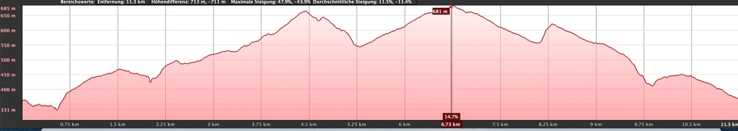
Elevation profile of the Arico Nuevohike
Requirements
Both hikes require a little physical fitness due to their length. You should also have a head for heights, as both hikes lead through gorges. The Arico Nuevo hike, which leads into the Barranco Tamadaya, is a little more strenuous than the Arico Viejo hike, as it offers quite steep descents and ascents. In any case, surefootedness should also be present here.
Refreshments
There are restaurants, bars and shops in both Arico Viejo and Arico Nuevo. Nevertheless, be sure to take enough water with you for the road.
Arico Viejo Hike Track
Variants
Both hiking tours around Arico Viejo and Arico Nuevo and into the Barranco Tamadaya can be wonderfully combined. As you can see in the picture, you can make a shorter or a very long tour out of the two circular walks. The Arico Nuevo hike includes an excursion into the higher Barranco Tamadaya, which takes you to the Galería Tamadaya. If you like, you can climb another 500 metres from there (very steep path) and reach the second Galería in the Barranco Tamadaya. Those who want less can simply skip this little excursion.
There is also another beautiful round tour high above Arico, which you can find here. 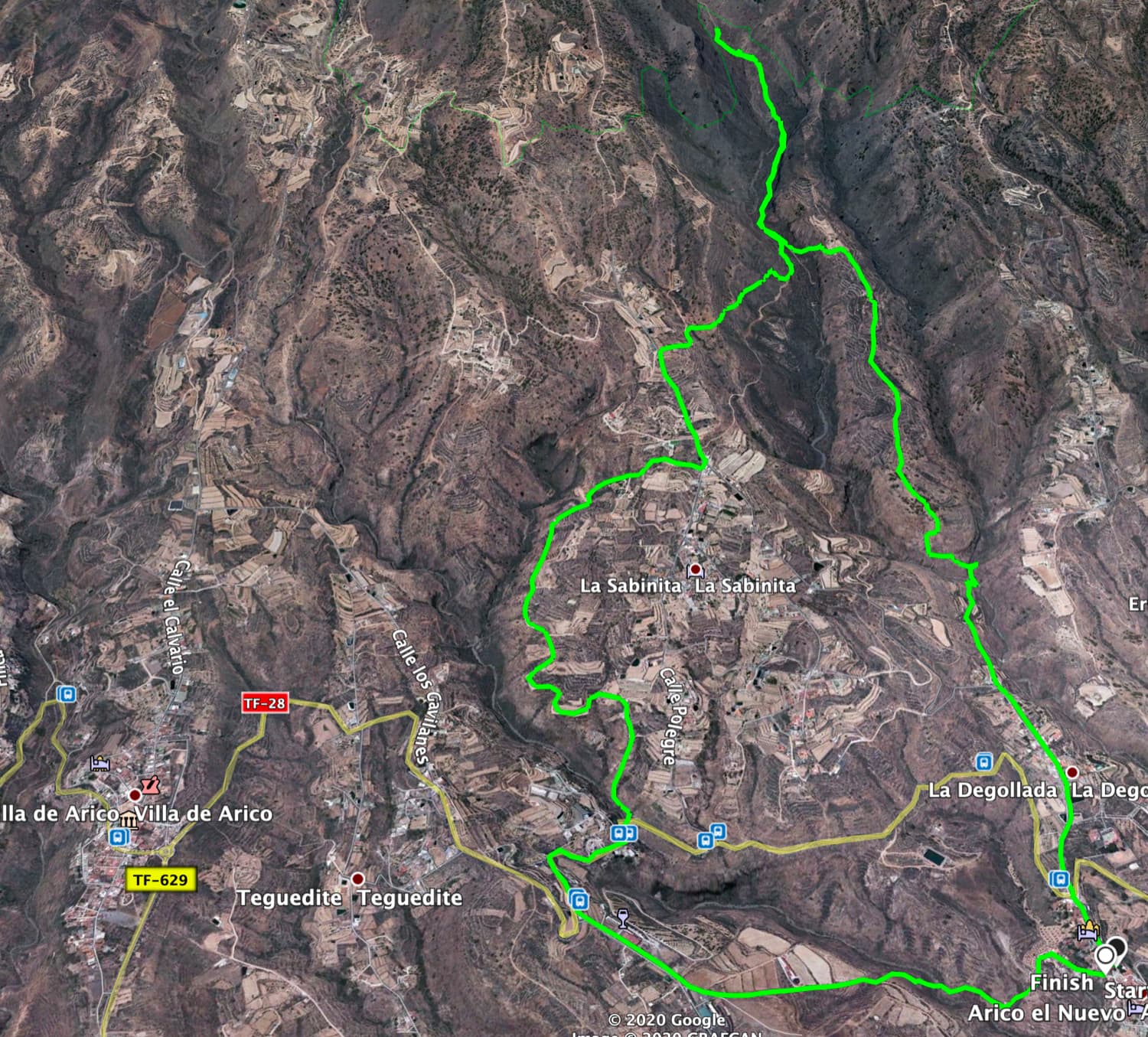
Arico Nuevo Hike Track
Hike Arico Viejo
Route section from the centre of Arico Viejo to the fork above La Sabinita
You start your hike in the centre of Arico Viejo on Calle Gollada, which you hike uphill. After a short while you will come to Calle Degollada, which you follow uphill around to the right. You walk through the village of La Degollada and along the edge of the Barranco Tamadaya. From here you can already enjoy wonderful views into the barranco and back to the coast. Then the road turns left from Barranco Tamadaya towards La Sabinita.
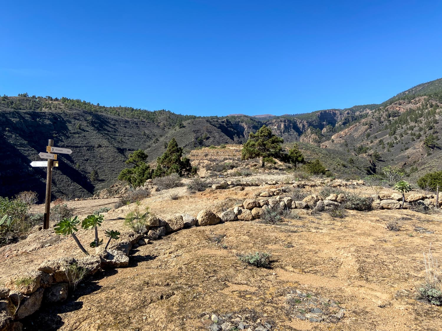
You will also pass through the small Canarian village of La Sabinita and then the hiking trail continues steadily uphill. Eventually you come to a hiking crossroads. The path to El Contador is signposted on the right. Here you will turn off on the Arico Nuevo tour. But on this hike you go straight on a little further and thus also up the mountain. After a short while, you will come to a fork in the road. Now take the road that branches off to the left of the main path. 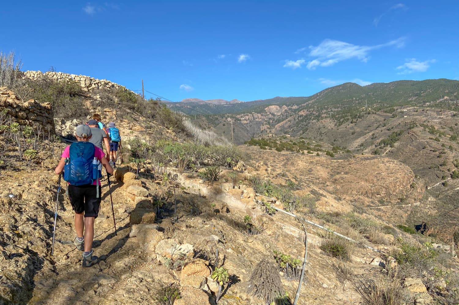
Hike up Arico Viejo
Route section Fork over La Sabinita to the narrow mountain ridge
The wide sandy path first leads you downhill into a small ravine and uphill again on the other side. You will come to another fork. The right way would be to go around to the right and make a curve around a kind of large finca. We went around to the left and then came out on a private finca. The owners were friendly and led us back along the path via their property. But you should keep to the right and use the driveway.
Hiking trail behind La Sabinita
At one point the track turns right and continues along the barranco. Here you go down a narrow path into the barranco. Once you have crossed the barranco, the path leads you back up the other side of the barranco. You walk more or less at altitude along the mountain slope and cross a wide ridge that lies between two gorges. From the heights there are again wonderful views. On the other side, the path leads you down into another barranco and up again on the opposite side. Now you are on a narrow ridge.
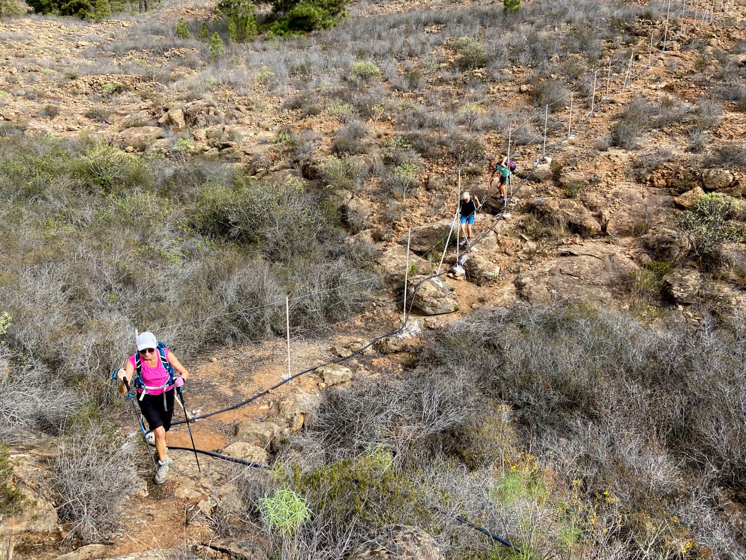
Crossing a small barranco between fenced areas
Narrow ridge section to TF-20
The rest of the trail leads you first to the left over the ridge and then down into another small barranco, which you cross with the path. The trail continues on a plateau with fields and ends at a road. This is Calle el Calvario. Turn left into this street and walk downhill into the centre of Villa de Arico. Another interesting insight into Canarian life and architecture awaits you as you walk through the small village. Calle el Calvario continues straight ahead into Calle Benitez de Lugo. This ends at the village church, which you bypass on the hiking trail.
Article summary and large selection of GPS hiking tracks
Sign up for my newsletter now and get exclusive access to my collected GPS tracks as well as all the brief information about my articles.
Sign up now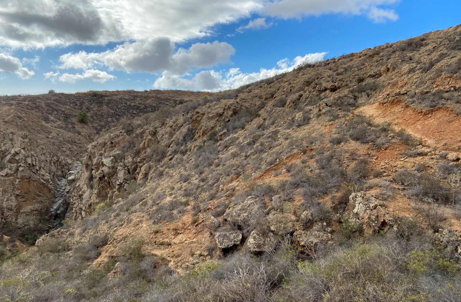
Hiking trail along the slope of the Barranco
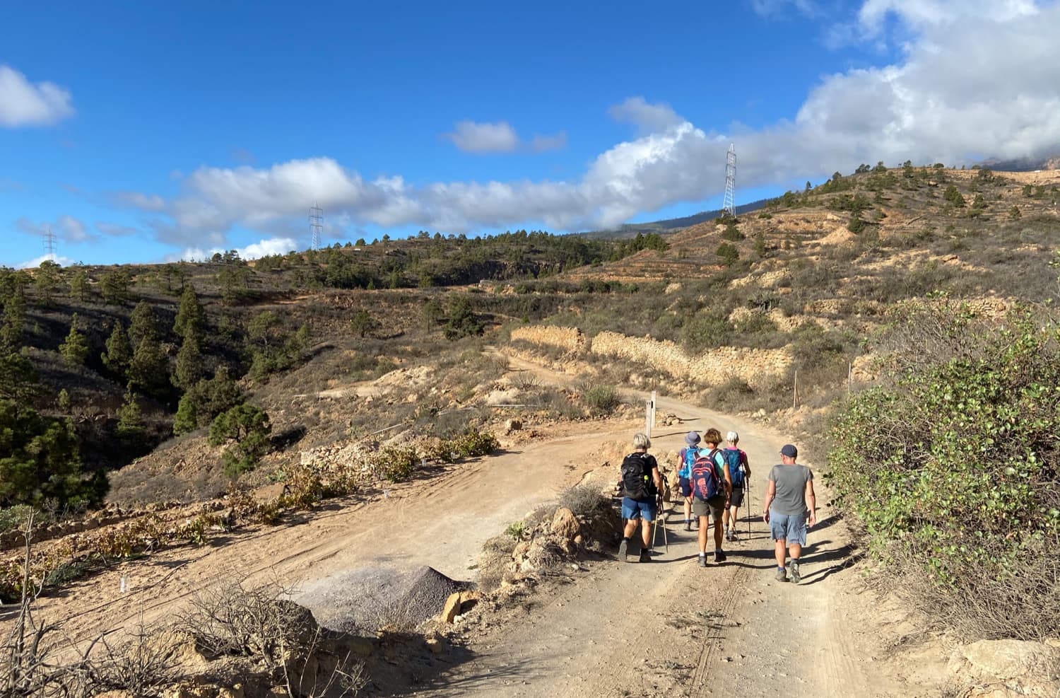
Keep left and go downhill until you reach the TF-28 road, which you cross. The trail takes you downhill to the hamlet of Teguedite. It ends at a road that you follow around to the right. After a few metres, another road turns off to the right and you walk along it for a while. Finally, behind a house, the trail branches off from the road on the left. It will take you further downhill. At a fork, keep to the left. The trail leads through fields and plantations for a while. You will then rejoin a road (again the TF-28).
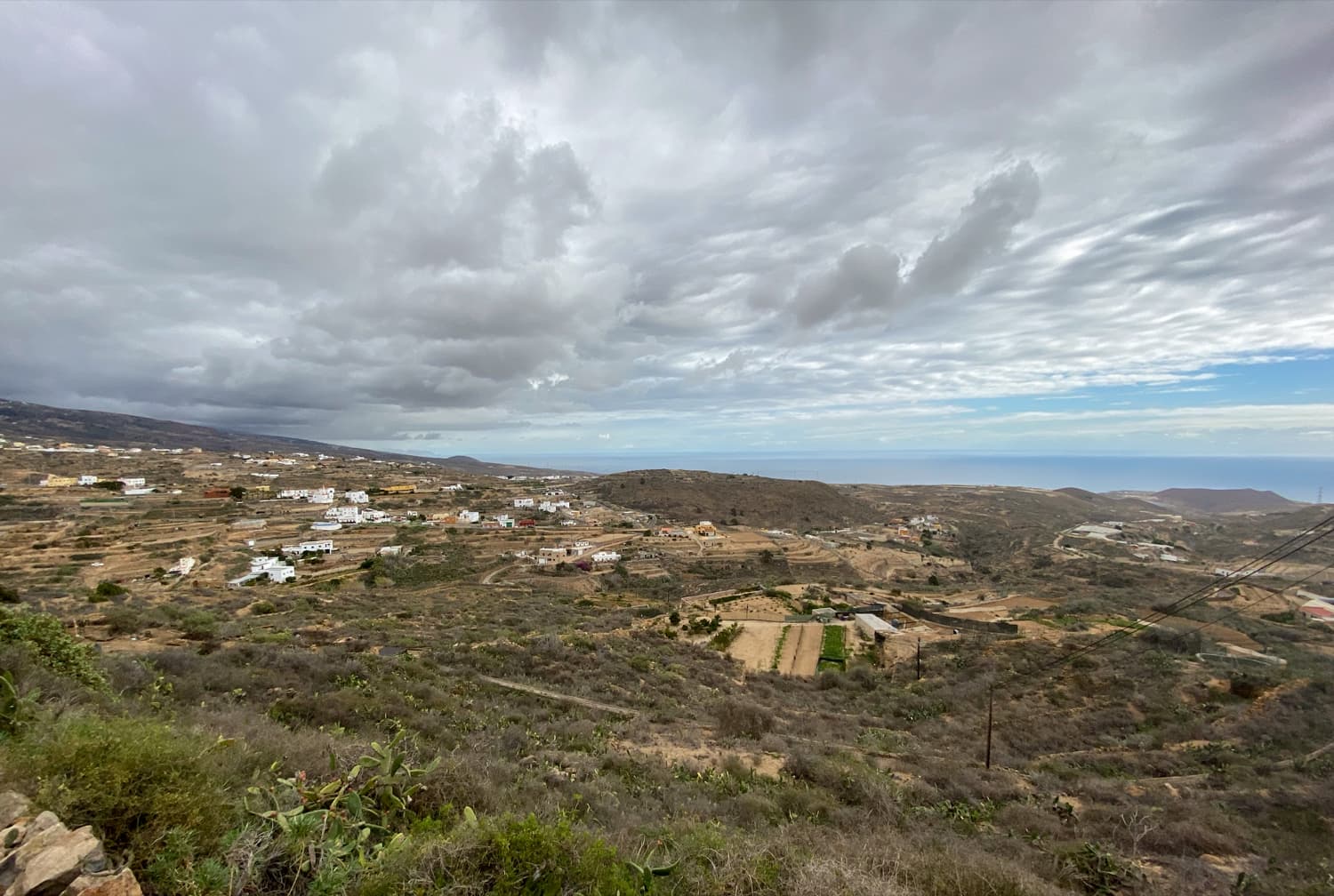
View from the heights to the east coast of Tenerife
Route section TF-28 to starting point Arico Viejo
You go around to the left for a short while on the TF-28. Then the trail on the opposite side takes you further down. For a while you walk along cultivated fields and farms. Then you descend steeply into the deep Barranco Lere. Once you have crossed the bottom of the Barranco, the path goes uphill again on the other side. After a short while, the path leads you to Calle las Cuevas. Take this road down to the left and go up again in a large curve to Arico Nuevo. You will reach the church square where the Arico Nuevo walk starts.
Wide hiking trail down to Arico Nuevo
But now you cross the church square. After a few metres you come to a road that takes you around to the left towards Arico Viejo. Walk uphill for a while until you reach the TF-625 in Arico Viejo. From here you hike around to the left until you reach your starting point. Perhaps you would like to stop off in one of the many bars, as we did. In any case, the Arico Viejo hike ends here.
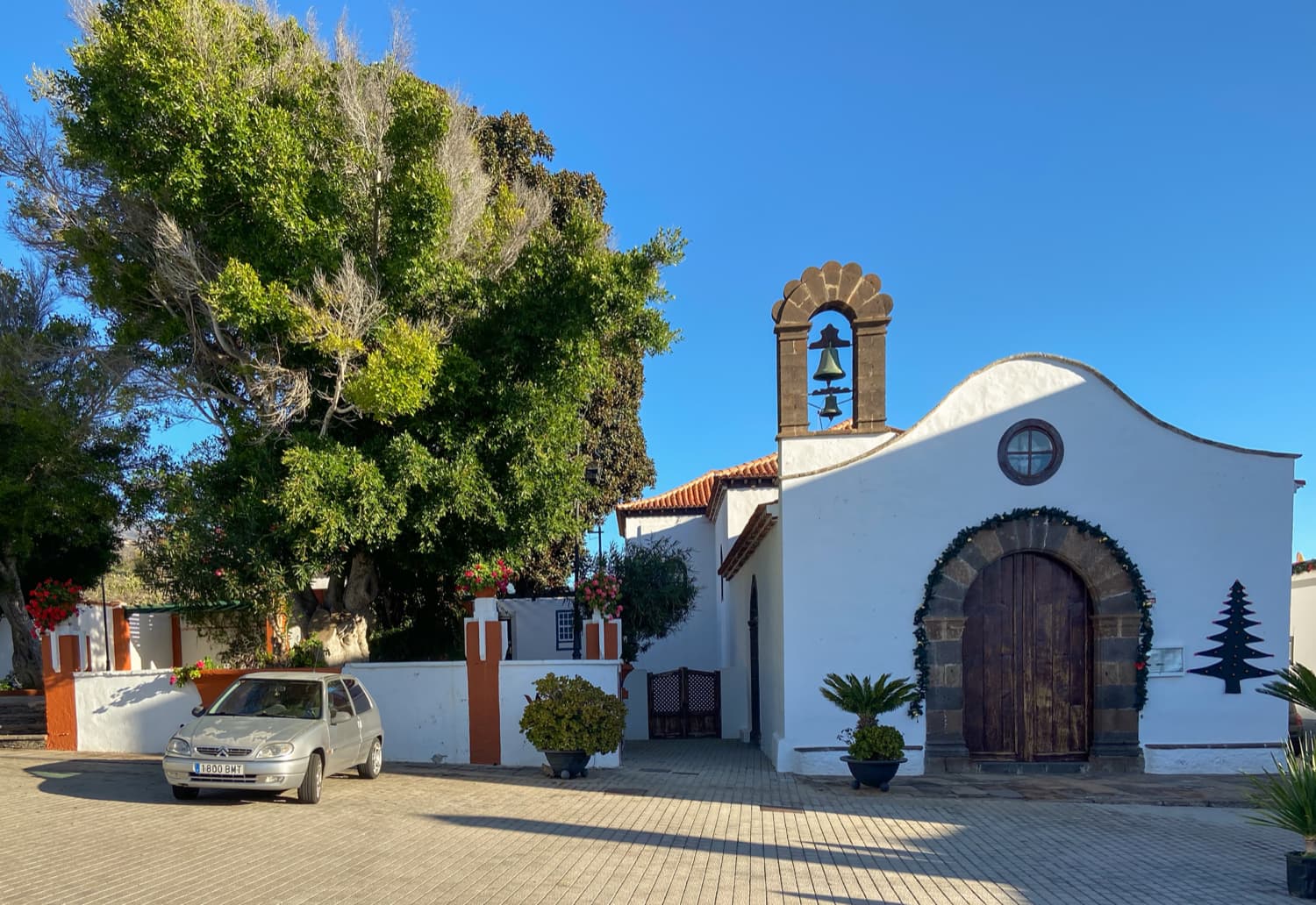
chirch square Arico Nuevo
Hike Arico Nuevo and Barranco Tamadaya
Arico Nuevo church square Calle de las Paredes section via Arico Viejo
You start your hike at the church square in Arico Nuevo. From there you walk down Calle las Cuevas. The route is identical to a section of the Arico Viejo hike – only in the opposite direction. You cross the Barranco Lere and hike up the opposite side past terraced fields. Then you meet the TF-28. On the Arico Viejo hike you came here from the left. Now you go around to the right along the TF-28. After a while the road forks. Turn right and walk downhill along Calle de Polegre.
Hiking trail towards Barranco Tamadaya
Eventually you will reach a barranco over which the road crosses a bridge. Cross the bridge. Just after the bridge, the trail branches off to the left. Above the gorge, the path goes uphill on narrow, partly steep paths. You come to a small peak with a cross and follow the hiking trail straight ahead. Eventually you will come to a track, which you continue to follow straight ahead. Then you come to another track, which you follow to the left. This path leads you uphill in wide arcs along the barranco, past fields, properties and farms. It ends at Calle de las Paredes.
Galería Tamadaya
Section Calle de las Paredes via Arico Viejo to Galería Tamadaya
You are now in La Sabinita. In a few metres to the left you will reach the main path, which you follow uphill to the left. This short section uphill to the turn-off from the road to the right is again identical to the Arico Viejo hike. Walk until you reach the junction where the trail to El Contador is signposted. Here you turn right from the main path. This path takes you first through a small gorge and then on a narrow path deep down into the Barranco Tamadaya. Keep left and you will come to a signposted path that will later be your way back.
Threshing place on the ridge - Barranco Tamadaya
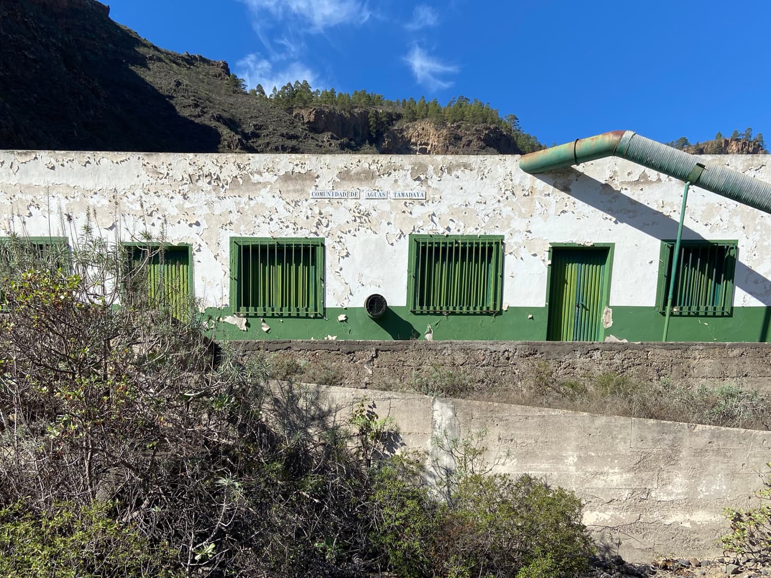
But for now, take the wide path further up into the barranco if you want to see the Galería Tamadaya. If you want to shorten the walk and not visit the Galería, you can also follow the signposted path. If you continue up the barranco, you will come to the Galería Tamadaya after a while. It is also worth going further up. If you still have time, desire and strength, you will come to a second Galería after another 500 metres. The path up there, however, is quite steep. For plant lovers, the Barranco Tamadaya offers a great variety of endemic plants.
Ruined house on the ridge above the Barranco Tamadaya
Section Galería Tamadaya to starting point Arico Nuevo
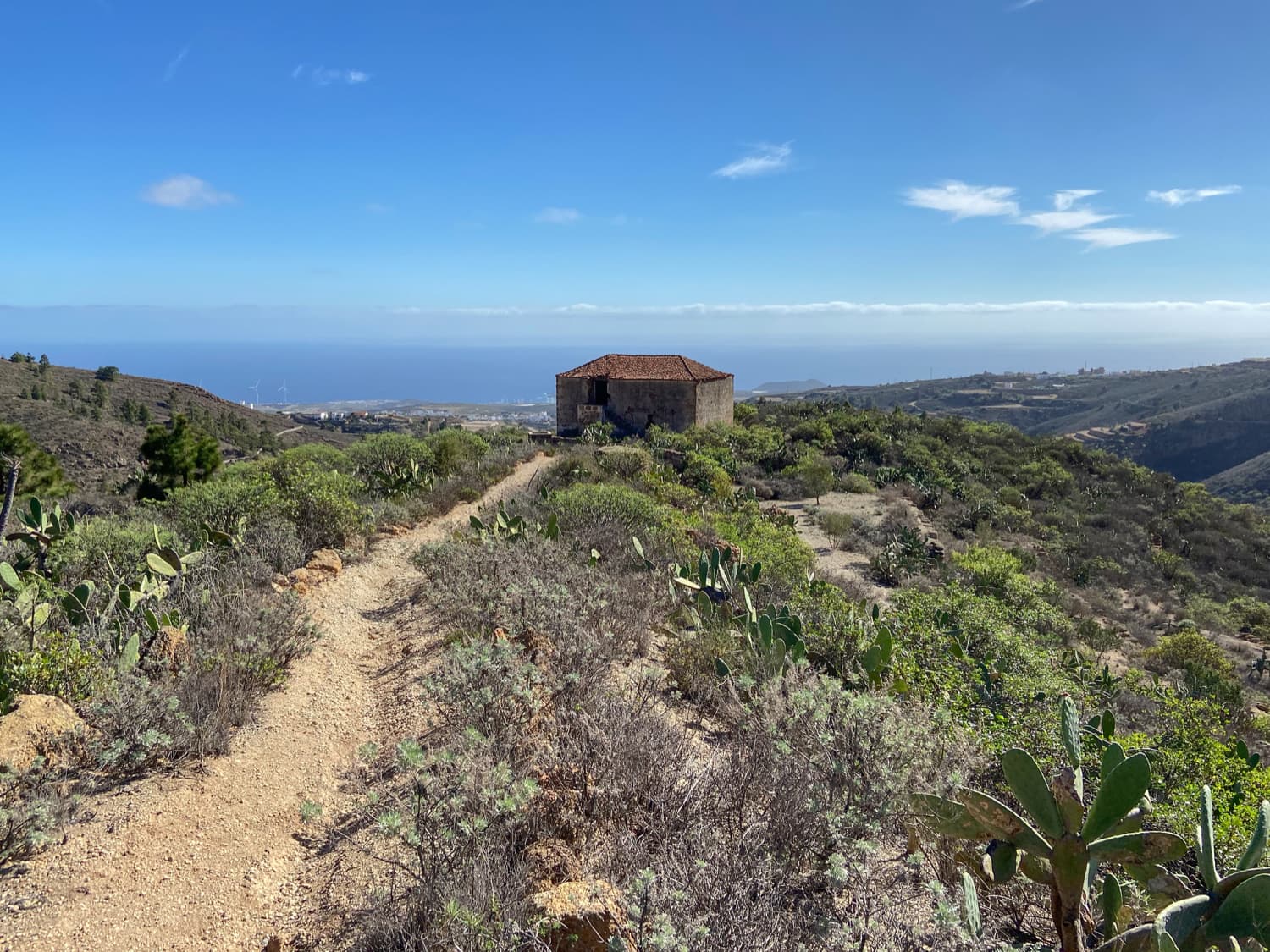
When you have explored the upper Barranco Tamadaya enough, go back to the junction. Here, a steep ascent on narrow paths begins on the left. But the magnificent views over the Barranco Tamadaya and the surrounding area are enough to compensate for the effort. After the ascent, you will find yourself on a mountain ridge with again beautiful views. There is an old threshing floor – an ideal picnic spot. Then you go right around down the ridge. Along the way you will pass a large old ruined house and further on you can enjoy views all the way to the coast.
Descent into the Barranco Tamadaya on the way back below La Degollada
At the end of the ridge, there is a very steep descent to the bottom of Barranco Tamadaya. Here, too, you can usually see many climbers. You reach the Barranco Ground, which you cross. On the other side you climb up again. Calle la Degollada takes you to La Degollada. Cross the small village and continue straight downhill. Finally, you will cross the TF-28 again, and opposite it, Calle Nuestra Senora de la Luz will take you back to the starting point of the hike, the church square of Arico Nuevo.
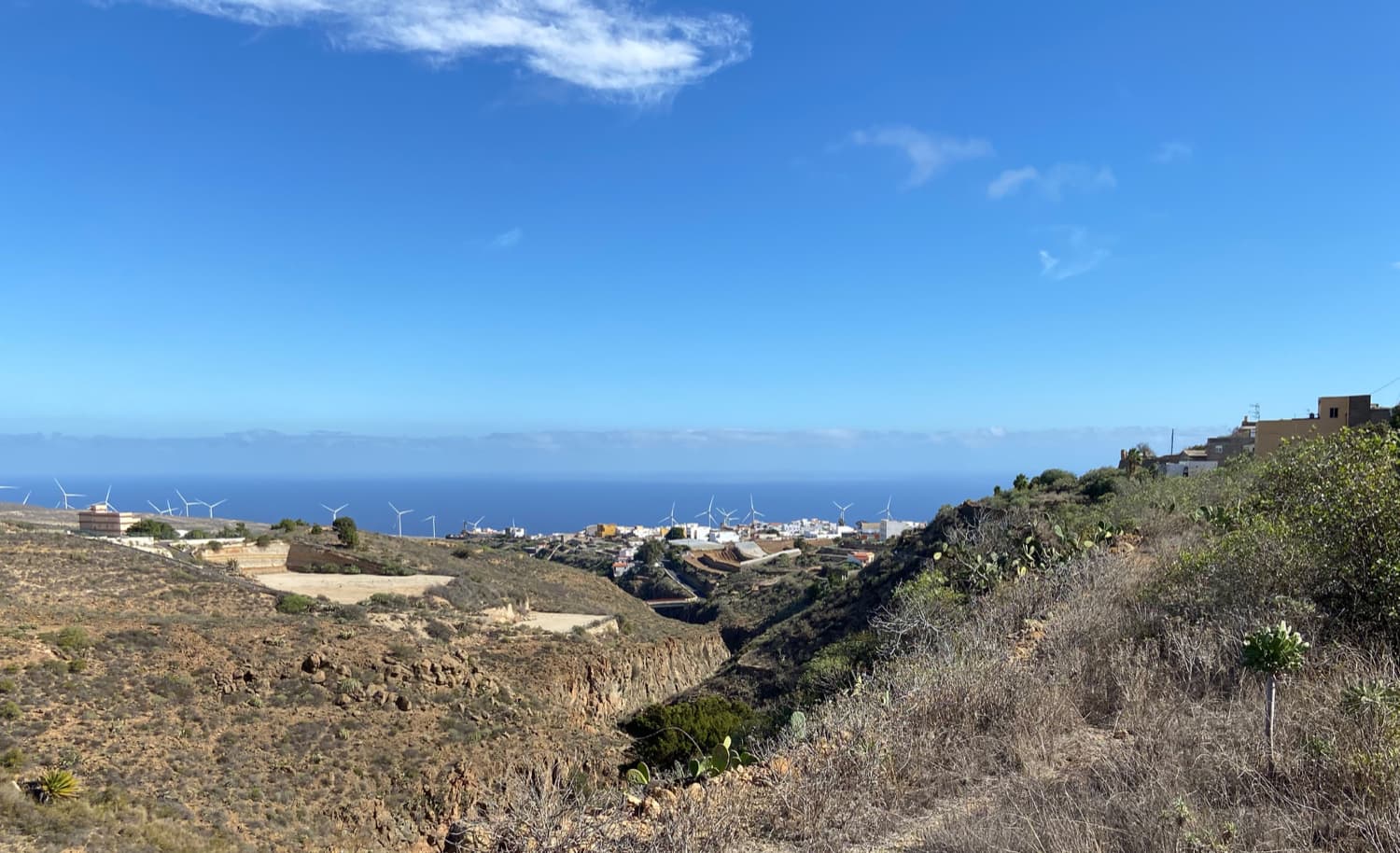
View of the east coast of Tenerife
And finally
I hope you enjoyed the two hikes around Arico and the Barranco Tamadaya, which can be wonderfully combined in all lengths and demands. I would like to say a special thank you to all the loyal readers on Seven Islands. With you and your suggestions, the site has become what it is today. Many readers look for hiking tours on the site and seem to find what they are looking for. I am glad that the Seven Islands is being used more and more and that all the beautiful hiking trails on the Canary Islands can enjoy more visitors. I wish you all continued beautiful walks on all paths and stay healthy,
Dagmar from SiebenInseln