Round trip La Zarza – La Sombrera – Sabina Alta
On the eastern slopes of Tenerife above Fasnia, this beautiful circular tour starts in La Zarza. In addition to La Zarza, it takes you through two other small impressive towns high above the east coast. It is educational because you can learn a lot about the landscape and the history of this region on multilingual information boards. For example, you will walk past old wells where drinking water was fetched for the villagers many years ago and where the women of the village met to do their laundry together.
Map
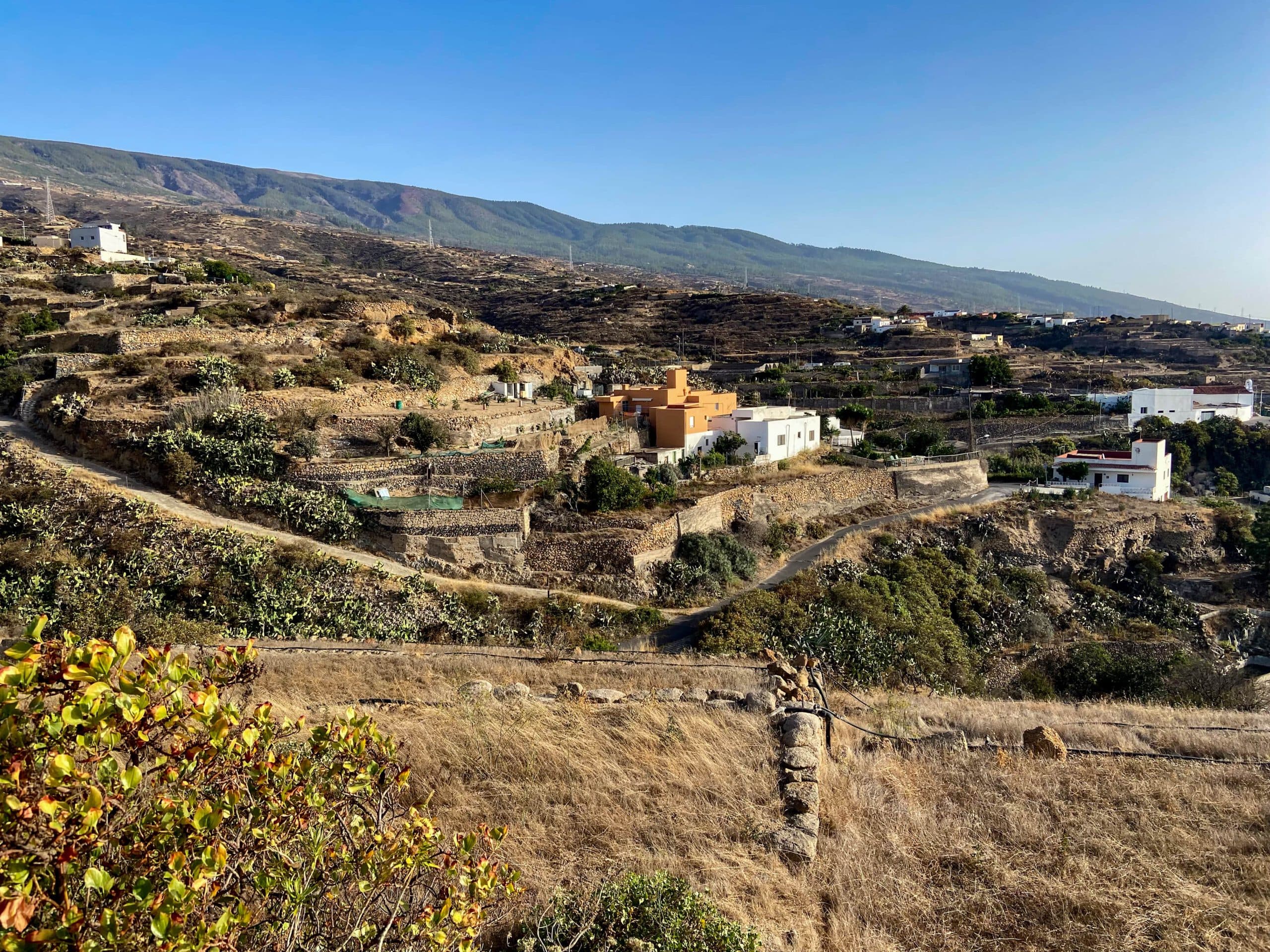
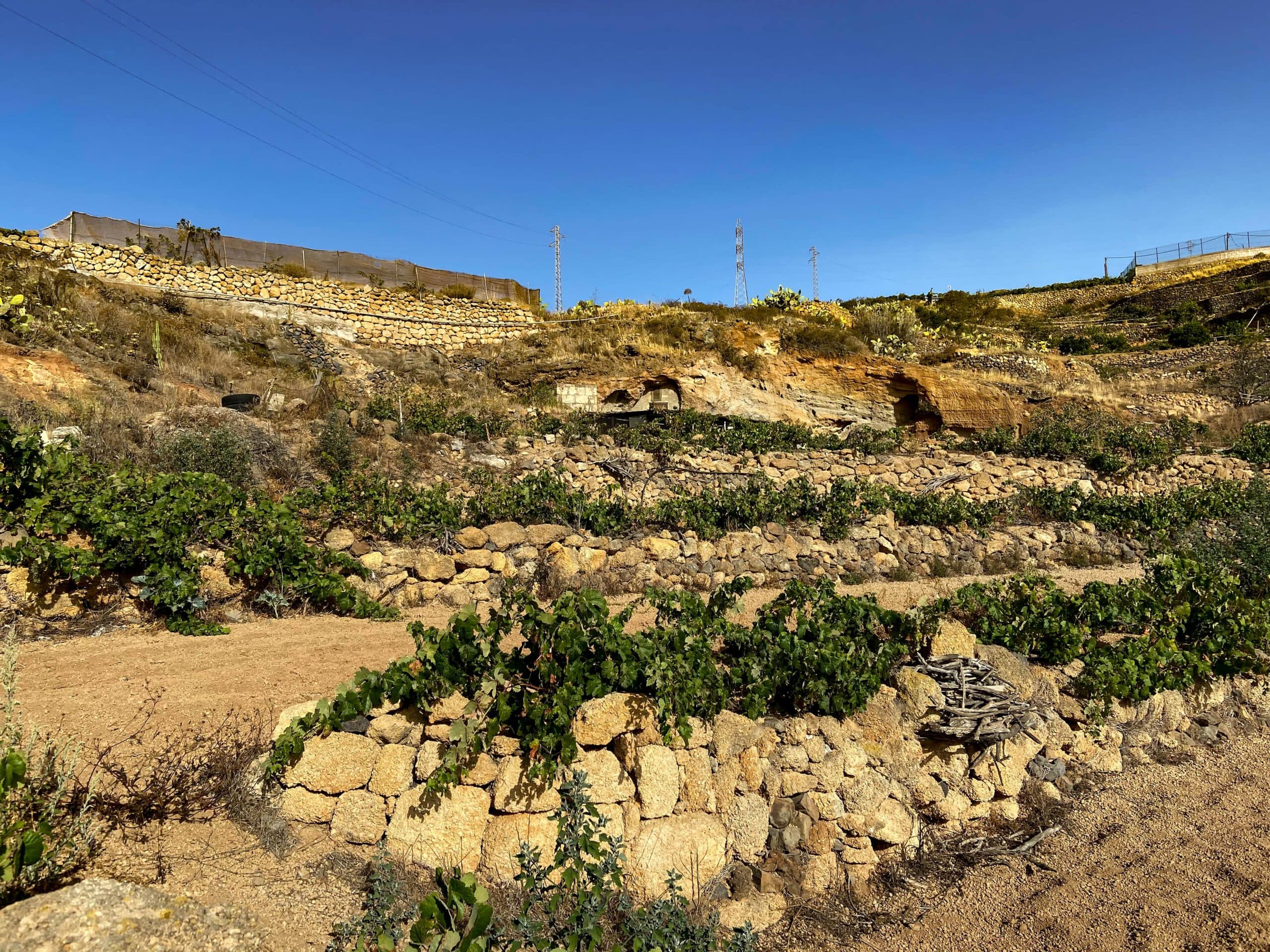
View back to La Zarza
But of course you will not only read and learn on this beautiful round tour. You hike through a varied landscape with gorges, terraced fields and can enjoy great views. You start in La Zarza and then hike back via La Sombrera and Sabina Alta after your excursion into the heights above the small town. Along the way, you will come across many abandoned houses, which today bear witness to the once lively rural life in this region.
Information by the wayside
La Zarza – small and large round
As is often the case, I offer you two interesting variants of this hike today. There is a very well signposted La Zarza – Sabina Alta loop. This is just under 5 kilometres long and runs along very well-maintained hiking trails. You will also find the information boards along this route. The extended route is almost twice as long and, as far as it runs parallel to the small hike, naturally also offers you the information boards.
Paths along the Barranco
The large loop partly follows the official hiking route. However, the rest of the route takes you a little further up, so that you can see La Zarza, La Sombrera and Sabina Alta from above. As far as you walk on the well-designed hiking route, you will also find very good paths. On the other route, however, you can expect hard-to-find paths and covered canals as a hiking trail.
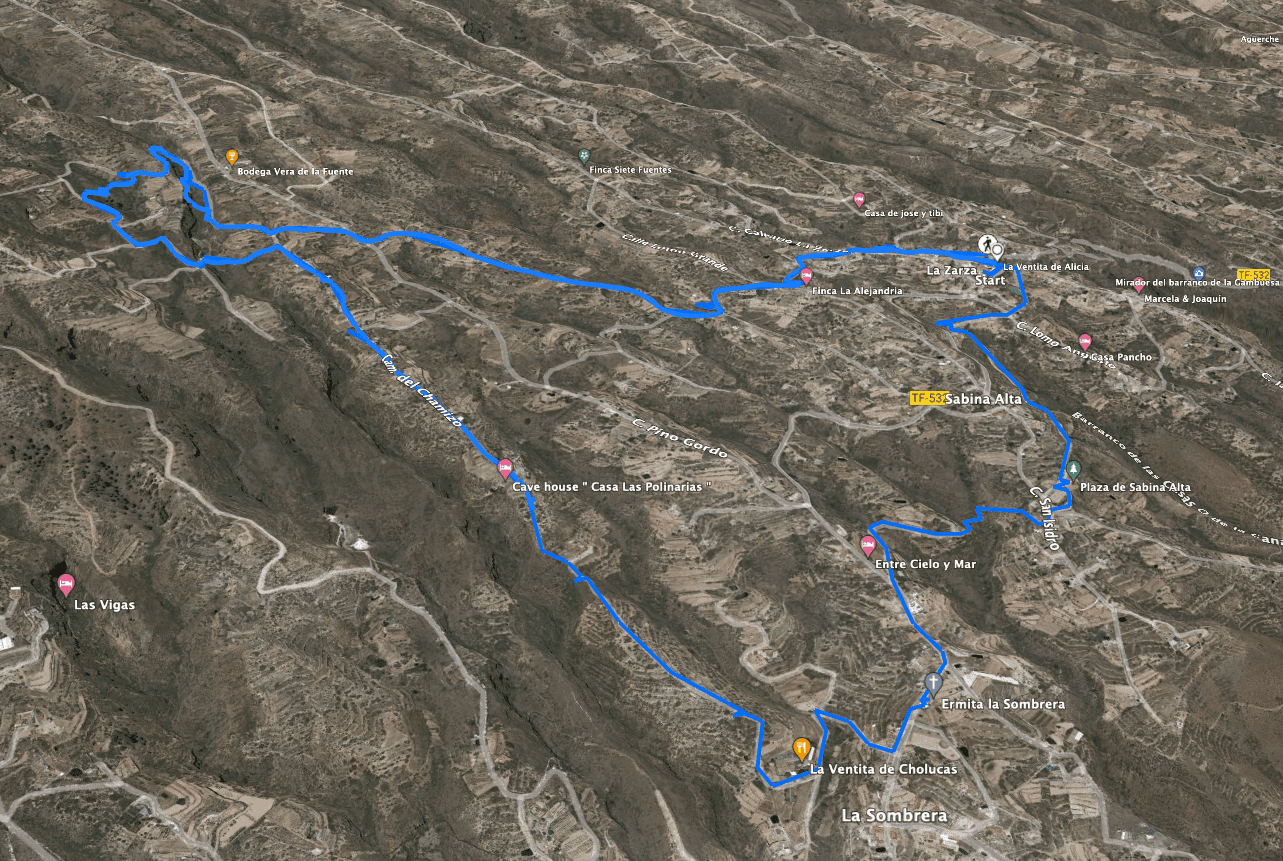
Track La Zarza - La Sombrera - Sabina Alta
General information about the La Zarza – La Sombrera – Sabina Alta round trip
Starting point and approach
The starting point of the hike is the small town of La Zarza on TF-532, Calle la Union.
Starting point in La Zarza
Arrival by car
You come from the north or south via the TF-1 and exit at Los Roques, Fasnia No. 32. Then take the TF-620 to Fasnia. From there, take the TF-532 to La Zarza. An even shorter route is to take the narrow Carretera La Vista road directly up from the motorway to La Zarza. There is plenty of parking close to Calle la Union (exit at the TF-532 bend) and on the roads.
Arrival by bus
The Titsa bus line 33 stops at La Zarza. Details and more information can be found on the Titsa homepage. Time
I don’t like to give general times for hiking tours, because the times are very individual. I needed about 3.5 hours for this hike. The small loop should take much less time.
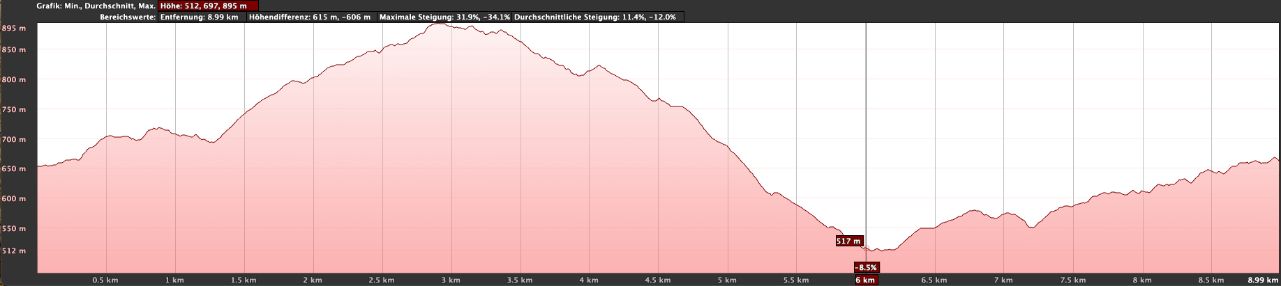
Altitude profile La Zarza - La Sombrera - Sabina Alta
Article summary and large selection of GPS hiking tracks
Sign up for my newsletter now and get exclusive access to my collected GPS tracks as well as all the brief information about my articles.
Sign up nowAltitude difference and route length
The difference in altitude on the large loop is approx. 460 metres and the route is approx. 9.5 kilometres long. On the small loop, the difference in altitude is 170 metres and the route is just under 5 kilometres long.
Requirement
The small loop is an easy hike on good signposted hiking trails. The big loop has it all. You hike on small roads, driveways, hiking trails, paths, but also once through difficult terrain and over a covered water channel. You should therefore be sure-footed for the long loop. This short section of the big loop is not suitable for everyone.
Refreshment stops
Restaurants, bars and shops can be found in La Zarza and possibly also in La Sombrera and Sabina Alta. However, please take enough water for the round trip.
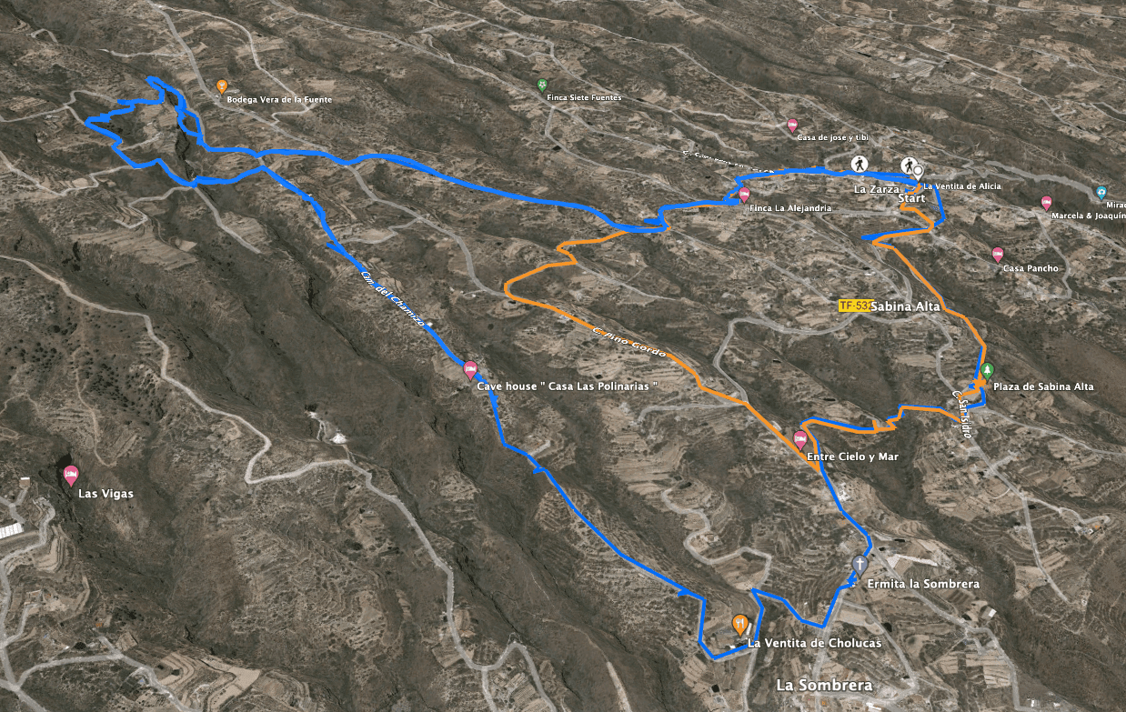
Track La Zarza - La Sombrera - Sabina Alta - orange: short loop
Variantes
You can vary the route of this tour according to your needs. It can be combined well with various other hikes and circular walks around Fasnia.
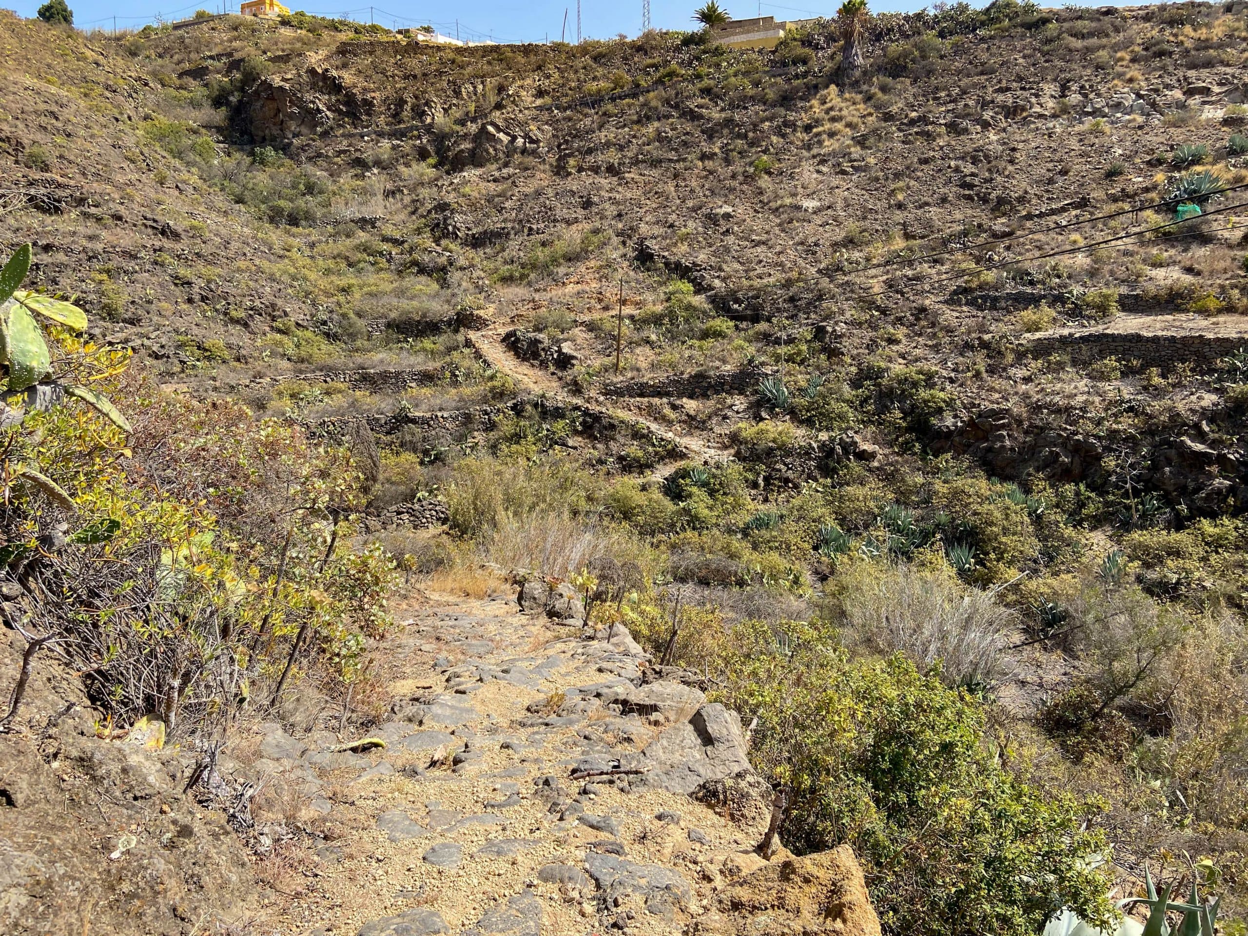
Hiking trail through ravines towards La Zarza
Round trip La Zarza – La Sombrera – Sabina Alta
Section La Zarza, Calle la Union to La Zarza Calle Lomo Grande
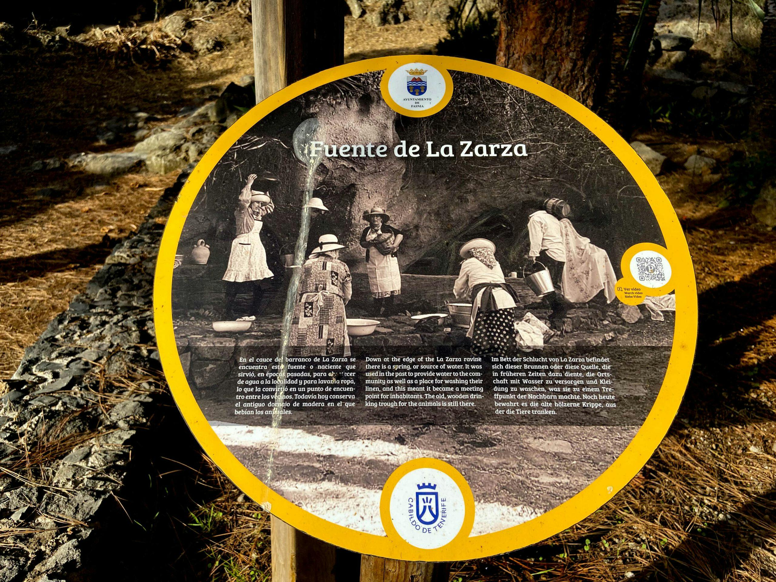
You start your hike in La Zarza on the TF-532 at Calle la Union. The small loop, which you also follow at first, is very well signposted with signs (Ruta Circular de La Zarza – Sabina Alta). Immediately at the car park and Calle la Union, the wide footpath branches off, which will take you to the source of La Zarza after 300 metres. There, at the spring, you will find the first information boards about the „Fuente de La Zarza“.
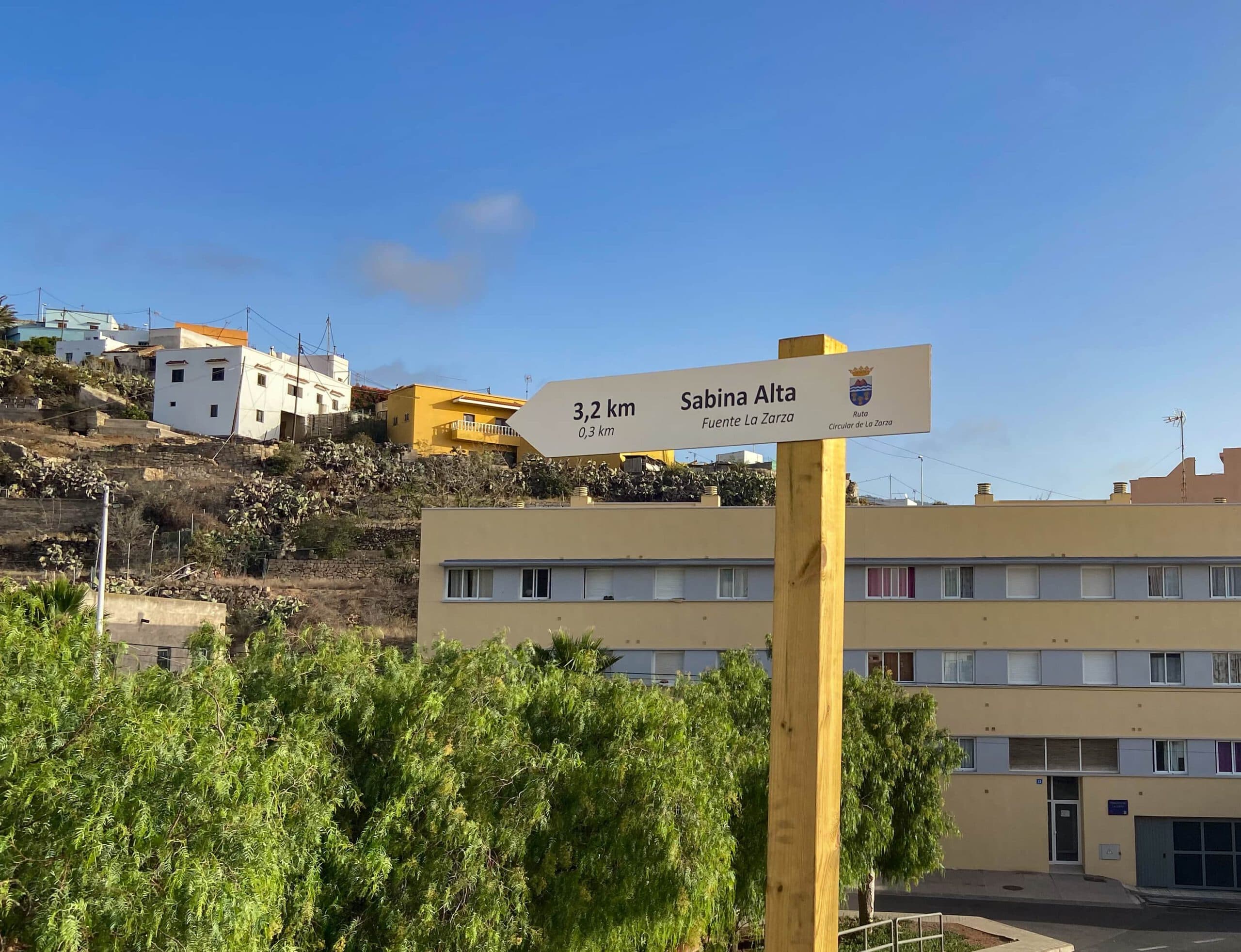
Hiking signs in the direction of Sabina Alta (short loop)
At the spring, leave the wide road and walk uphill on a narrow path. You walk up a slope and then reach Calle Calvario de La Zarza. Follow this to the right for a very short distance. After a few metres, a wide road branches off to the left. Follow this. This road leads you past fincas and fields. Finally, you will reach Calle Lomo Grande.
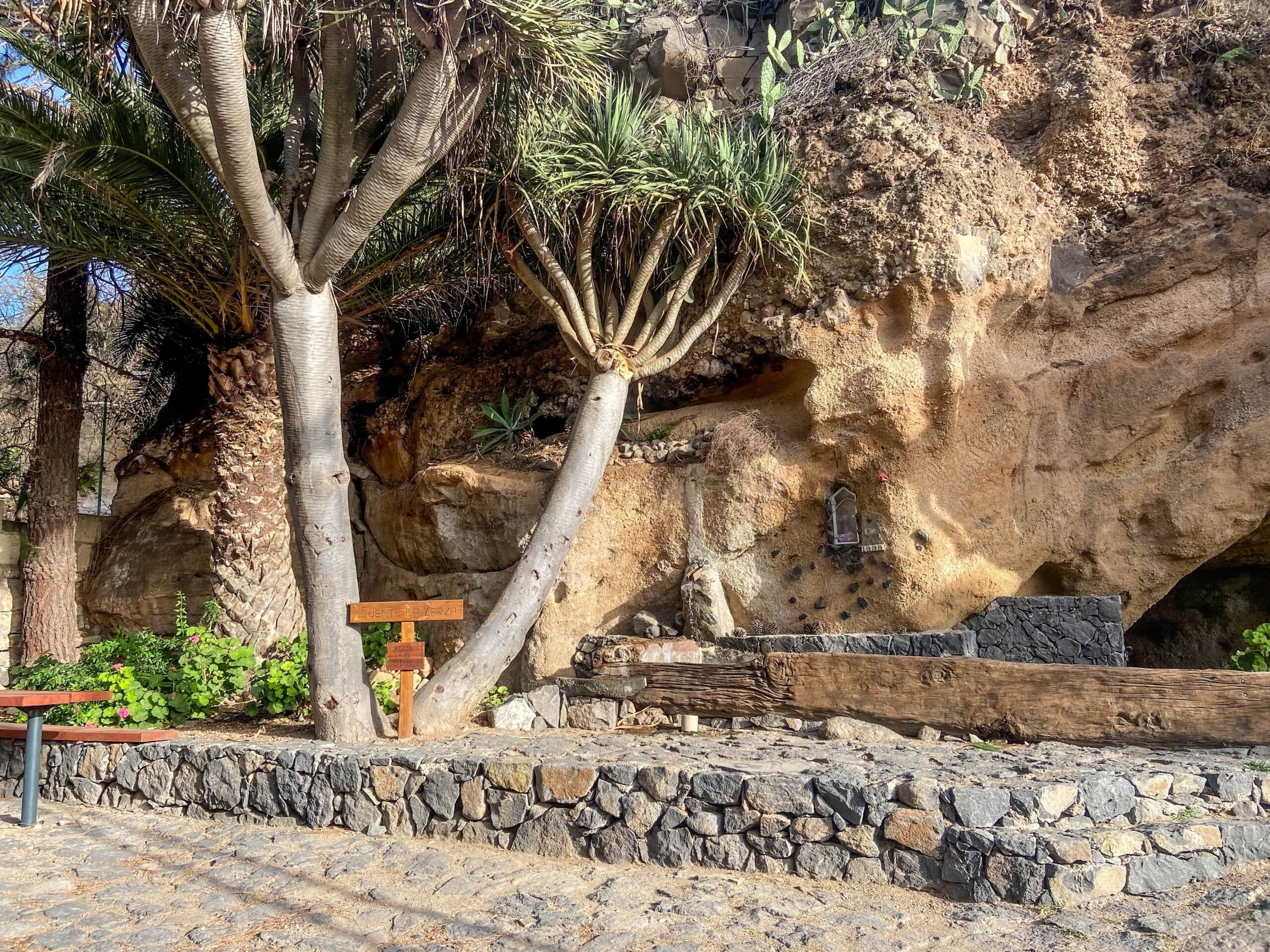
Fuente La Zarza
Route section La Zarza, Calle Lomo Grande (description of small round trip differs) to Calle Pino Gordo
You hike up Calle Lomo Grande to the right, only a few metres uphill. Then the path branches off on the left. You walk around a small ravine with many fields, past a finca and finally reach the end of the street Calle Hoya Mena. A road continues slightly downhill between houses. Shortly after, the large and the small circular route separate.
Hiking trail near La Zarza
On the small circular route, continue straight ahead on the road until you reach Calle Pino Gordo. From there, turn left and walk downhill along the road. You will then reach the Camino Laja Martín, which you follow to the right. This ends at the road connecting La Sombrera and Sabina Alta. Now you are reunited with the great circular route.
However, on the large circular route, you branch off onto a path to the right uphill. Follow this path on the ridge past fincas, houses and fields for a long time until you reach Calle Pino Gordo.
Terraced fields along the hiking trail
Article summary and large selection of GPS hiking tracks
Sign up for my newsletter now and get exclusive access to my collected GPS tracks as well as all the brief information about my articles.
Sign up nowSection Calle Pino Gordo to Street at the Gorge
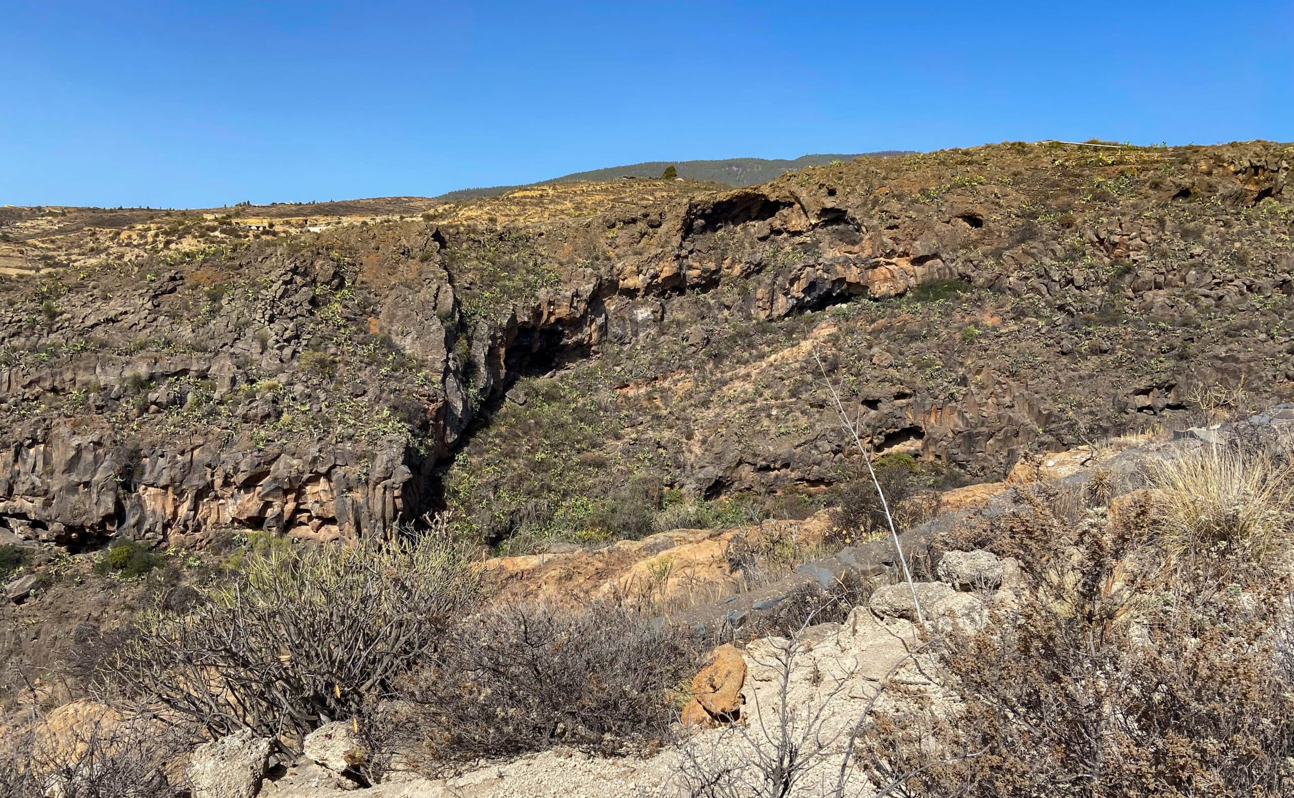
Follow Calle Pino Gordo around to the right, then shortly afterwards turn left again at the junction. At the end of the road you will come to a track, which you follow around to the right. This will take you along a path high above a ravine. From here you have wonderful views back to the coast and over the small ravine with a Galería and Fincen. You walk past an Ermita with a spring. Then the path crosses the gorge in one turn and goes uphill on the other side.
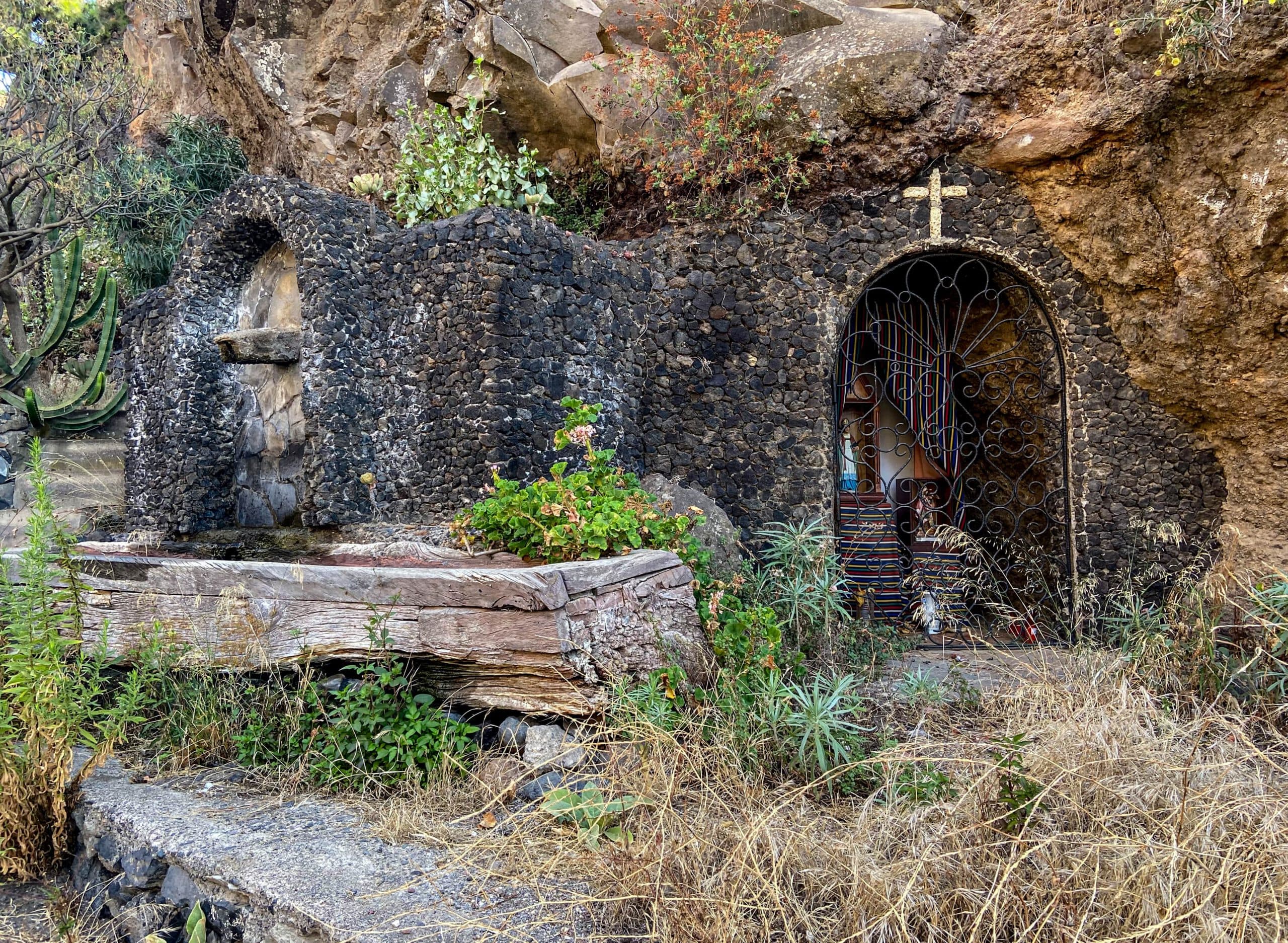
Spring and Ermita along the way
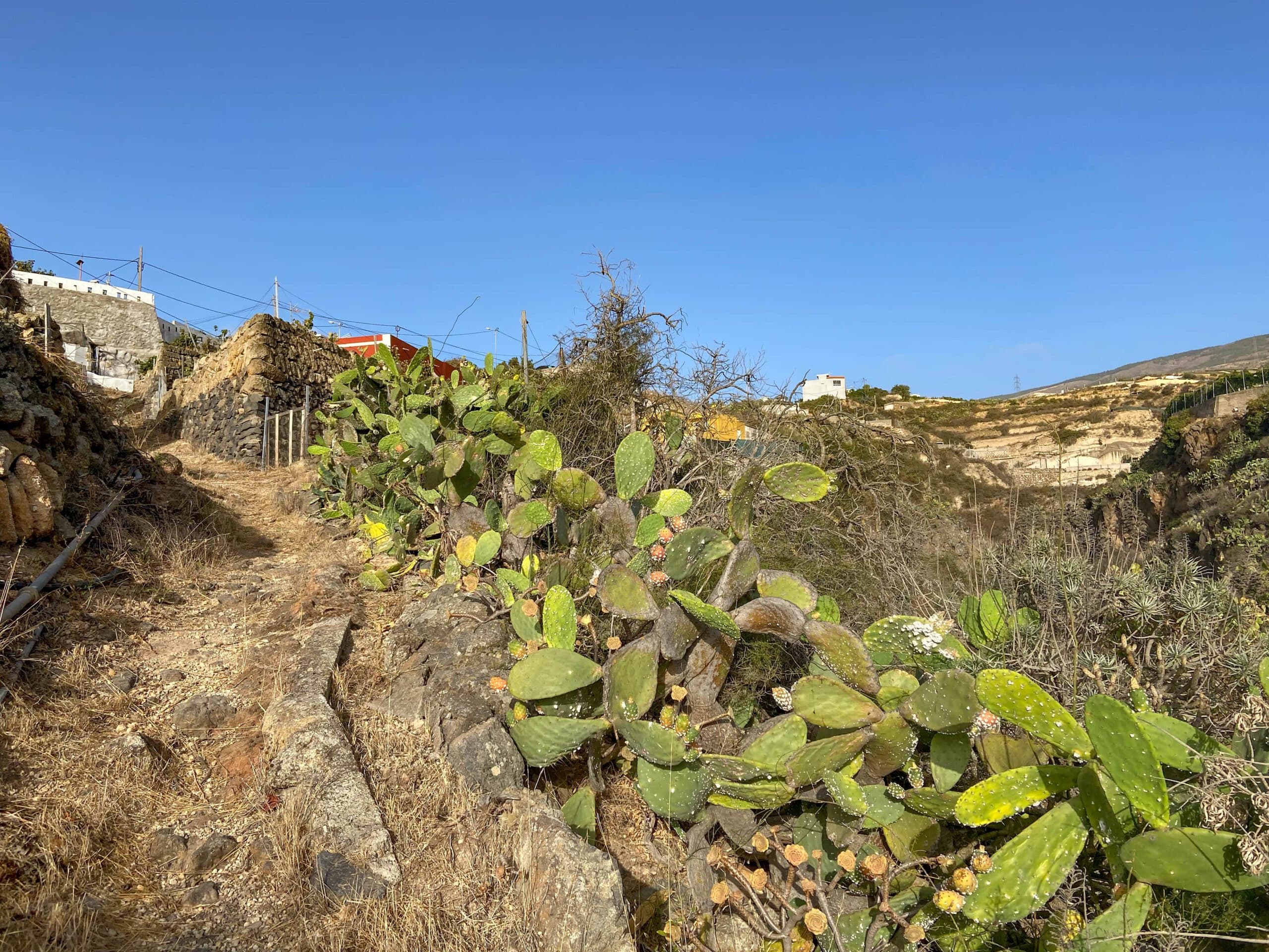
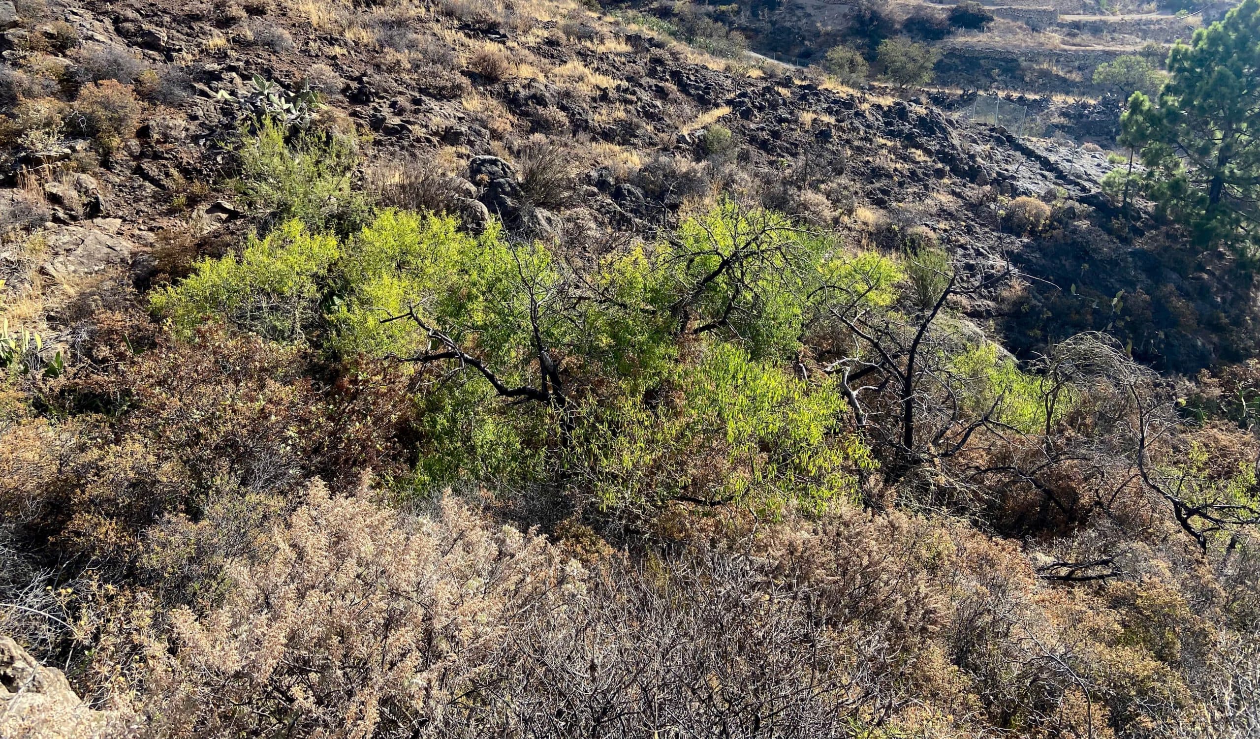
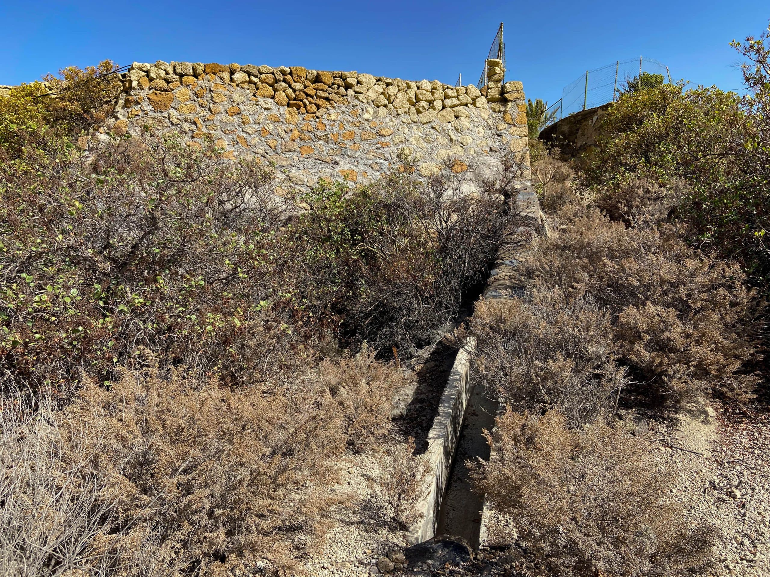
It then turns away from this small ravine. You will reach another ravine, which you will bypass. Here you have two options. Either you continue to follow the road and go around the small gorge. It is more exciting to follow the small path next to a green gate (photo). It is a little difficult to find in places, but it takes you across small paths and stones through the small gorge back to the road.

at this green gate starts the hiking trail that leads you away from the road - a bit overgrown and hard to find
Road section at the gorge to white terraces
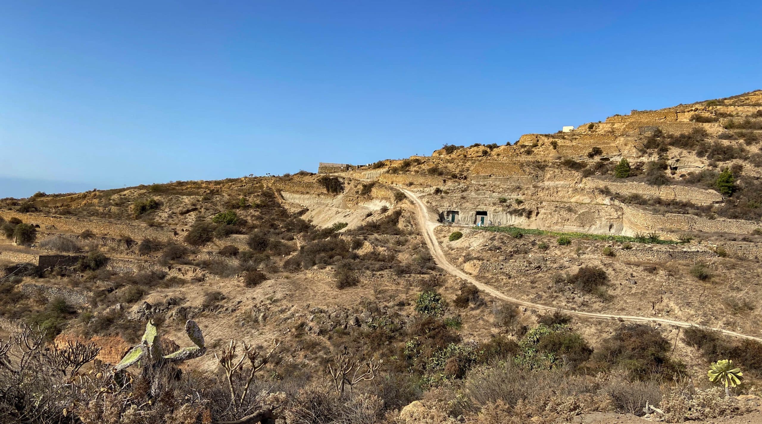
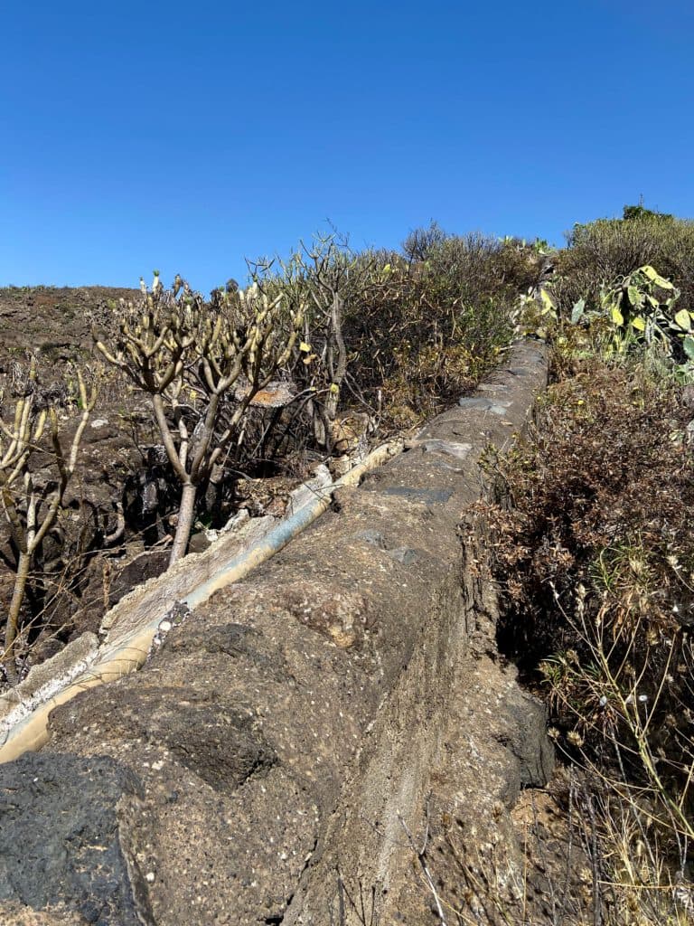
At first, follow the road downhill and ignore the outgoing path. But at the next crossroads, keep to the left. On the way, you cross the gorge back again. On the other side, keep to the right for a long time on the Camino de Chamizo. You will also pass the cave house „Casa Las Polinarias“. The wide road ends at this point. The next part of the hike to the next road is a little tricky and the path is not easy to find.
Hiking trail through a small gorge
At the end of the road, walk past the house and continue straight ahead on a narrow path. The path continues downhill along a canal. Then you come to white terraces. From here you have another beautiful view over the east coast of Tenerife. From terrace to terrace, small paths lead down to the next terrace.
Road between La Zarza and La Sombrera
White Terraces to Sabina Alta section
After descending from terrace to terrace, you will reach the water channel again. You can also find parallel paths. But the best way to get down along the canal is directly to a large abandoned estate. There you will be on a road again. Follow it along the ridge downhill. It meets another road, which you follow around to the left until you reach Camino Laja Martín. You are now in La Sombrera.
Path over terraces towards La Sombrera
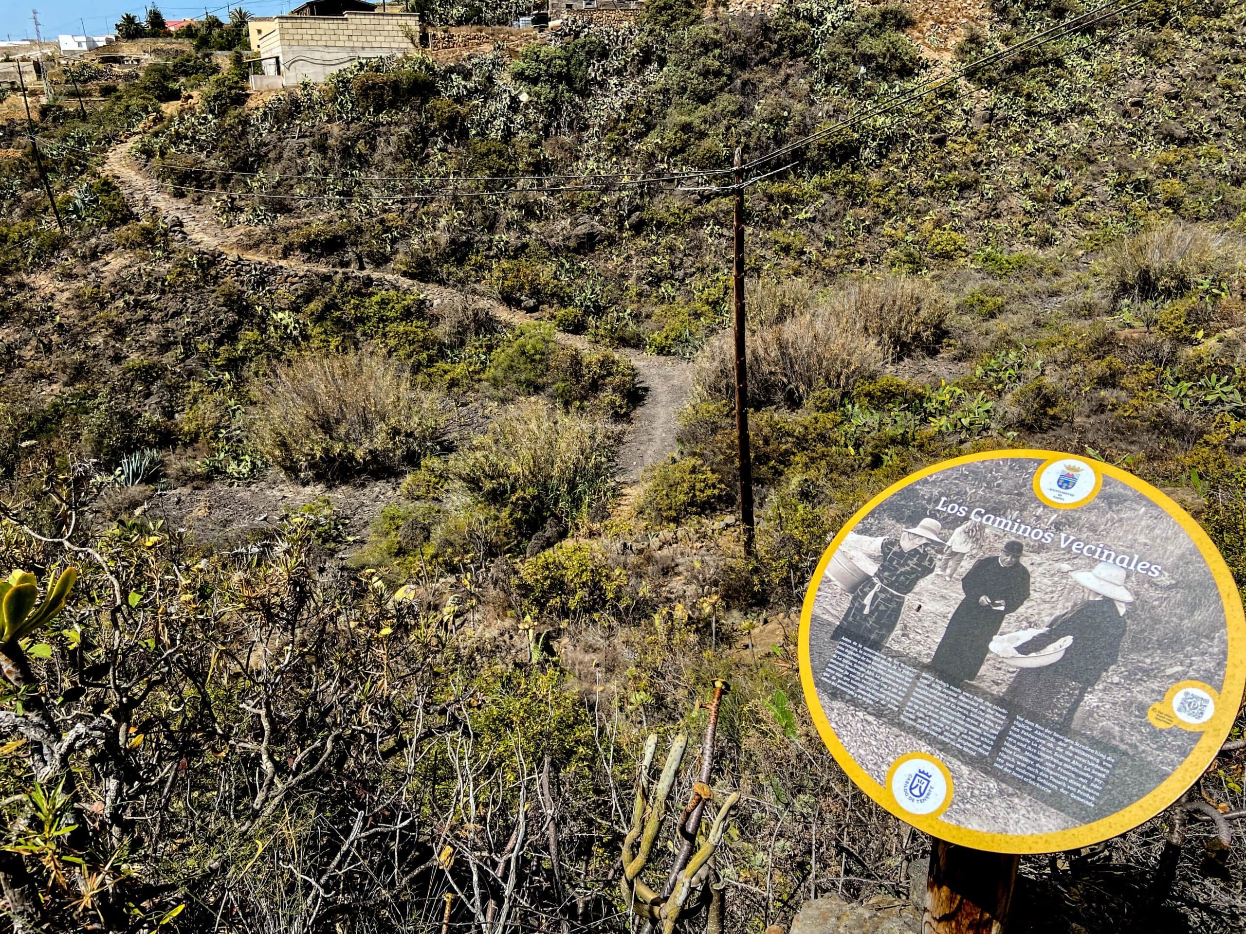
Turn left and continue along the Camino Laja Martín past the Erminta la Sombrera. At a fork at the end of the village, turn right off the Camino onto a small road down into the next ravine. This is also the point where the small circular route meets the large circular route again. Before the next bend, the trail branches off the road to the right and takes you across a ravine with more information panels to Sabina Alta.
Path across a canal towards La Sombrera
Sabina Alta to La Zarza section Starting point
The trail through the gorge ends in Sabina Alta on Calle San Isidro. Go around the street to the left for a short distance and then turn right. Passing the Plaza de Sabina Alta, you walk along the slope for a very long time and cross the next ravine. On the other side, you already come up to La Zarza. The trail leads to Calle Lomo Angosto.
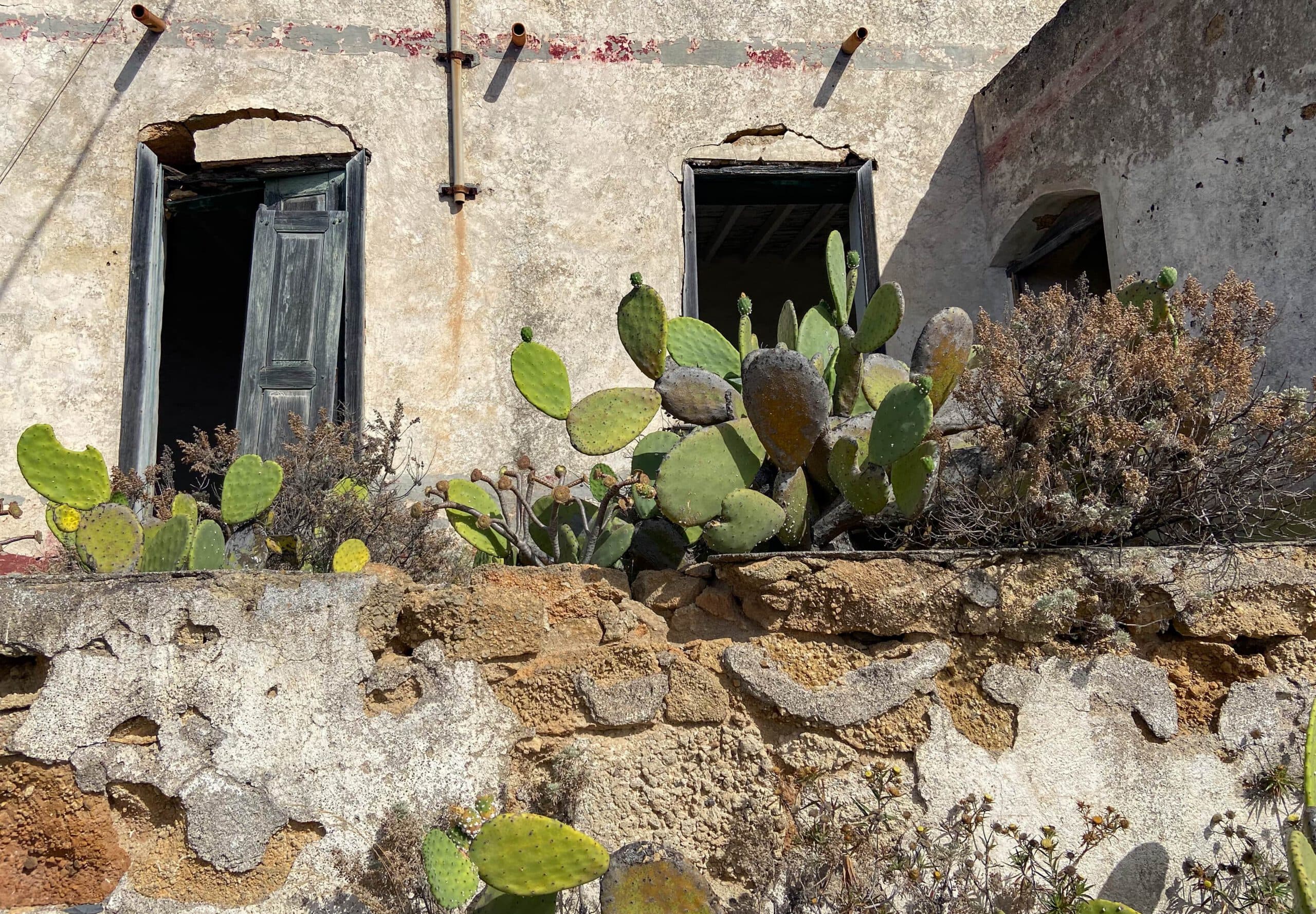
Ruined house by the wayside
Cross this and walk along a small road for a while. At the end of the road, before it goes uphill to the left, continue on a narrow path below the football pitch. This will take you to Calle Tres, which at its end will bring you back to the TF-532 in a few metres and thus to the starting point.
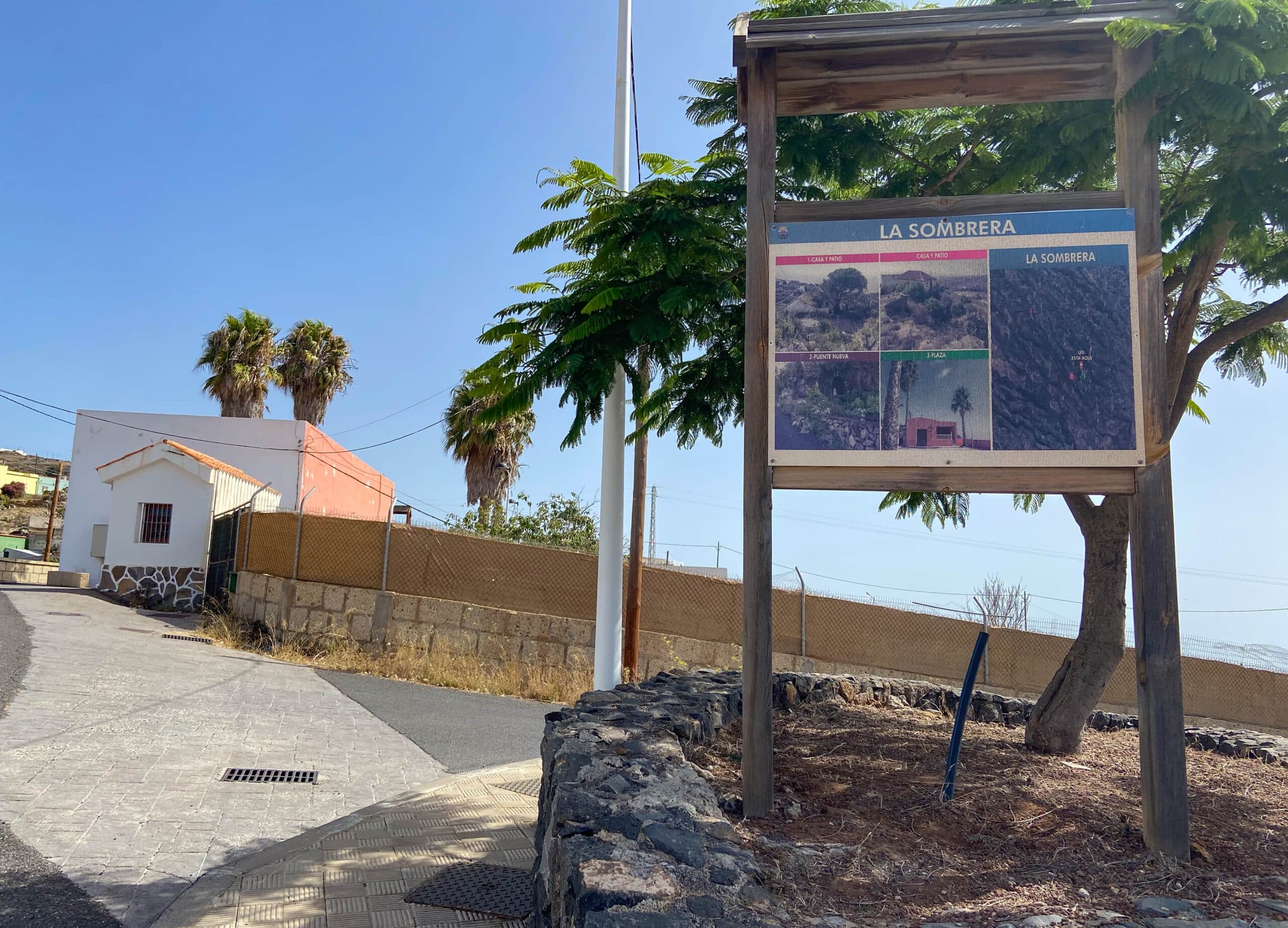
La Sombrera
And finally
I hope you enjoyed this hike through small hamlets, fields and with lots of information. The length and difficulty of this hike can also be adapted to your own needs. I wish you much pleasure on all your hikes,
Dagmar from Siebeninseln