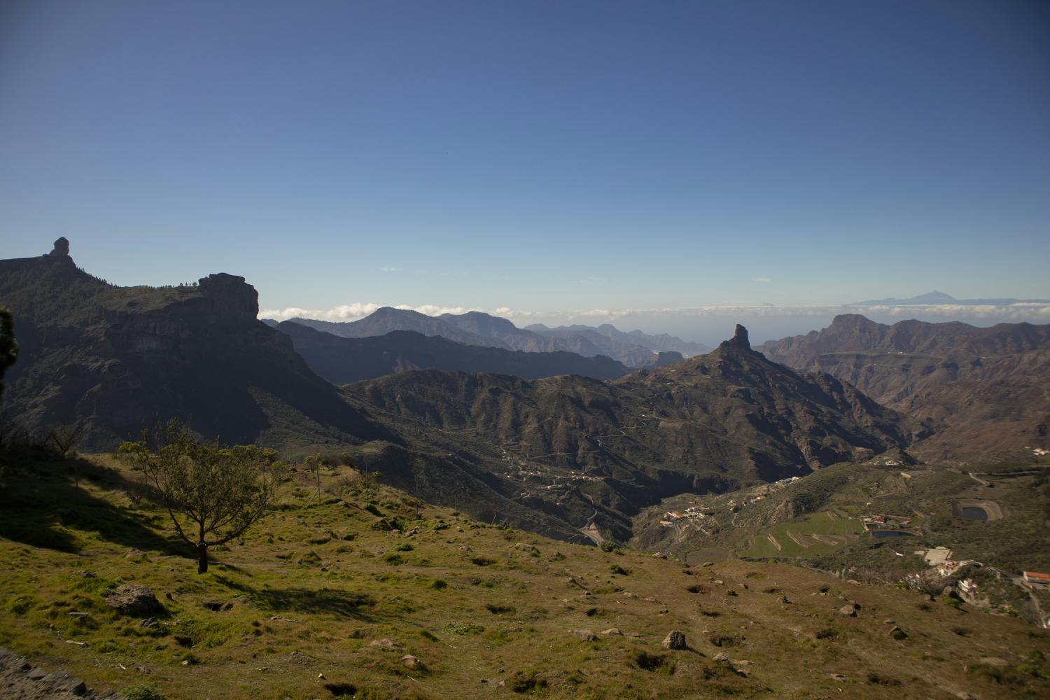
Mirador Degollada de Becerra with beautiful views
The varied round tour in the centre of the island starts at the Mirador Degollada de Becerra viewing platform. It is located on the GC-150, which leads to the highest point of the island, the Pico de las Nieves (1948 m altitude).
Map
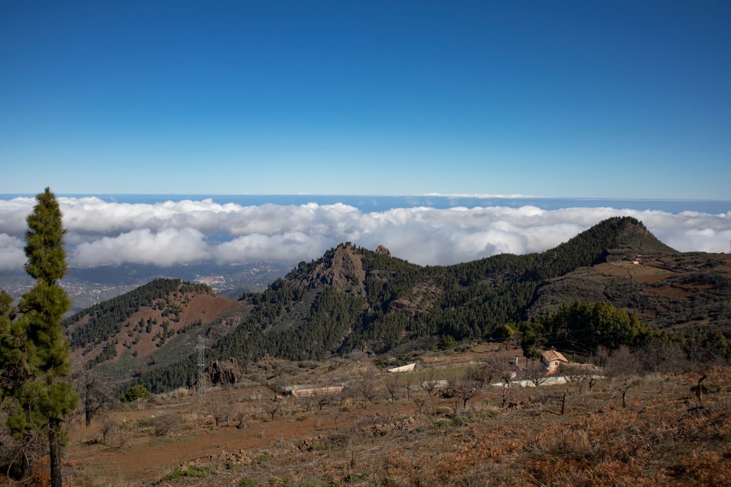
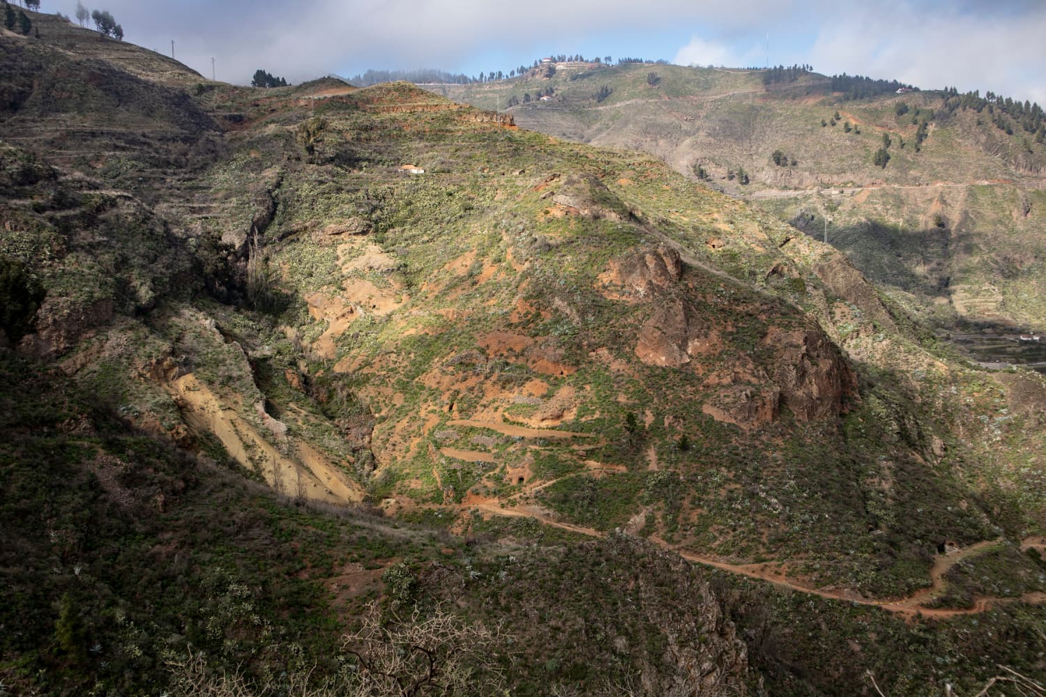
View over the mountain ranges and the clouds from the Becerra hiking trail
But also at the Mirador Becerra you are already at 1550 metres altitude and all around you have a wonderful view over the island.
View from the height to the coast
To the west, in the distance from the Mirador and also on the whole last part of the walk, you will see the striking Roque Nublo, the symbol of Gran Canaria. Far below you is the mountain village of Tejeda. To the north-west, the mountain range Riscos de Chapin lies before you, which stretches all the way to Artenara, the highest municipality on the island. This chain forms the weather divide on Gran Canaria between the green, rainy north and the dry, sunny south.
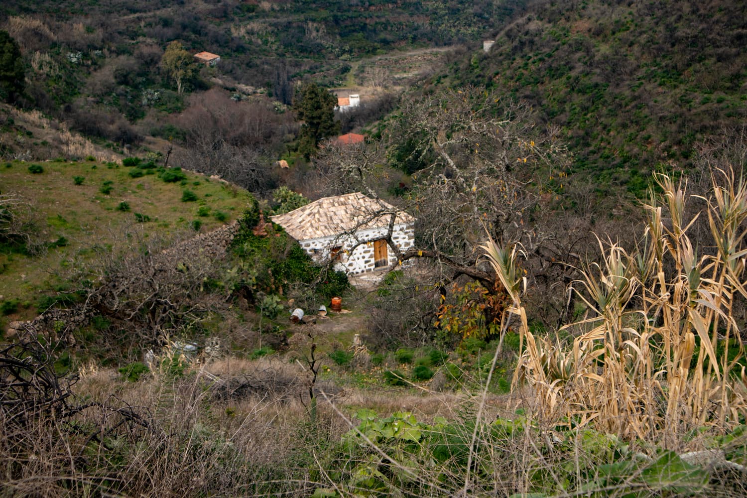
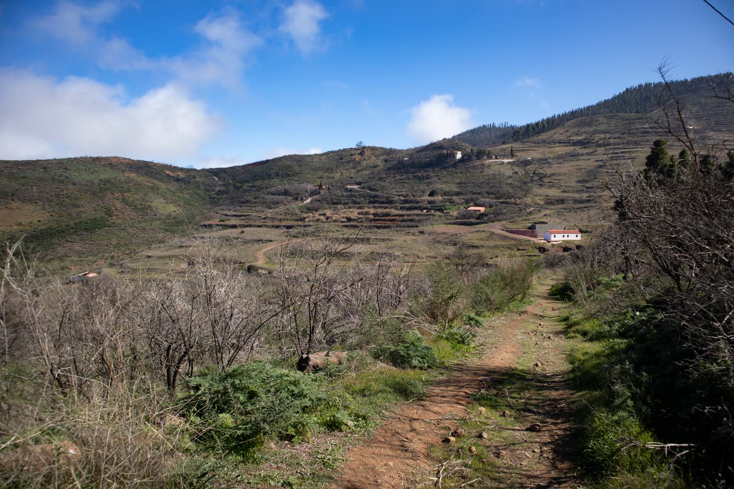
lonely houses along the way
Becerra circular walk
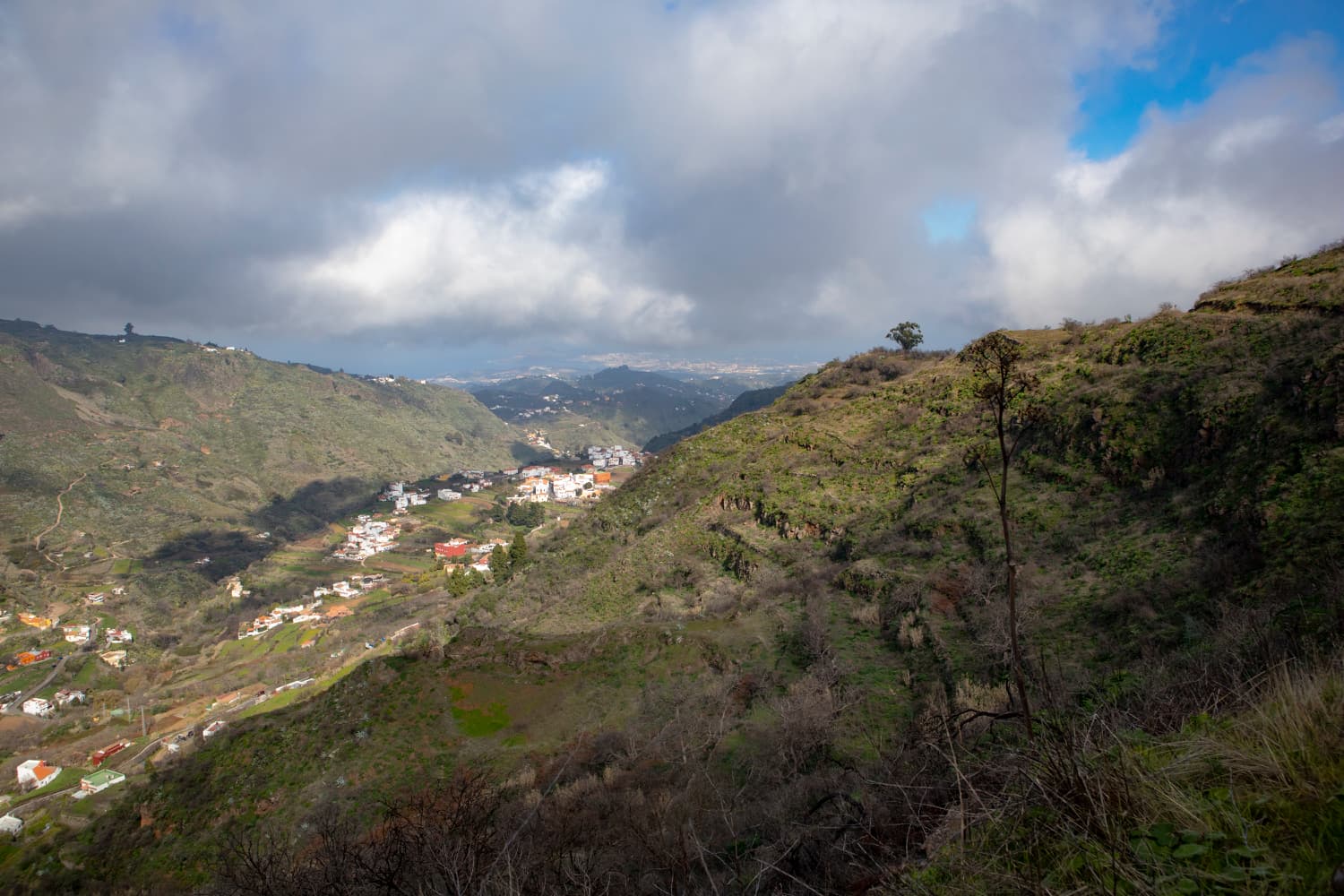
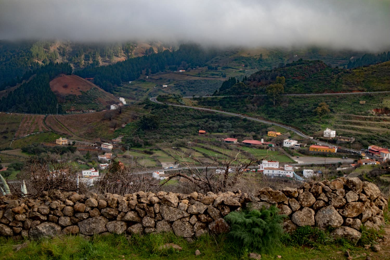
The hike itself starts at the Mirador, so that right at the beginning of the Becerra circuit the island lies at your feet. You walk down a mountain slope always parallel to the Barranco de la Mina. There is an old watermill and a lot of water in the creek to see. Finally, you will walk around the mountain that delimits the Barranco on the right and you will reach a kind of panoramic terrace. From there you can look out over the other side of the island and enjoy views over the south-east and the hamlets deep in the valley below you.

Becerra hiking trail - panoramic path along the canal
Afterwards, the path goes uphill on a steep ridge. Later you will pass through a small ravine and then through a forest until you reach the Degollada de la Cumbre. From here you will return to the Degollada de Becerra along a panoramic path. The whole time you are looking back at the western part of the island with the impressive profile of Roque Nublo. This tour is neither particularly long nor strenuous, just a beautiful round trip with impressive views.
Track of the Becerra hike
General information about the circular tour Becerra
Starting point and approach
The starting point for this hike is the Mirador Degollada de Becerra on the GC-150 at KM 2.3 at an altitude of 1550 metres. Parking spaces are available at the Mirador de Becerra.
Access by car:

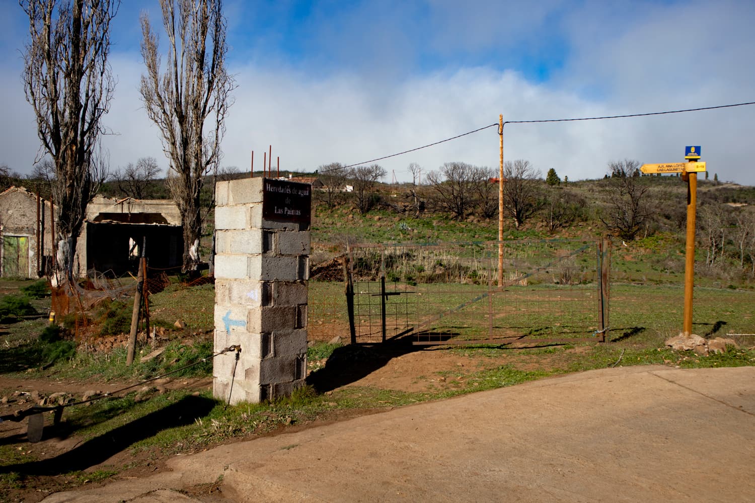
Hiking trail signage
Article summary and large selection of GPS hiking tracks
Sign up for my newsletter now and get exclusive access to my collected GPS tracks as well as all the brief information about my articles.
Sign up nowYou can reach the centre of the island from all sides of the island. You can either take Artenara or the GC-15, which will take you to the Mirador Degollada de Becerra via the GC-150. Or you come from the east and can choose different routes, which will take you to the GC-150.
Arrival by bus
There is no bus service to the Mirador Degollada de Becerra. Therefore, you can only get there by car (or taxi if necessary).
Time
I do not like to give general time indications for hiking tours, as the times are very individual. We needed a good two hours for this small tour with many rest and photo breaks.
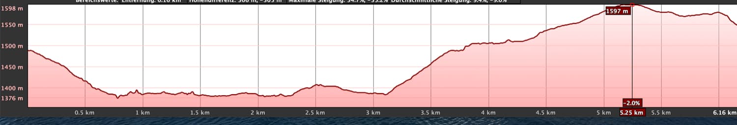
Elevation profile of the Becerra hike
Height difference and distance
The difference in altitude is about 250 metres and the route is about 7 kilometres long.
Requirement
This is really an easy hike that can be easily managed by everyone, which I would rather call a long walk.
Refreshment
There are no restaurants, bars or shops around the Mirador de Becerra. So make sure you have enough water and if necessary food (if you want to have a picnic at one of the beautiful viewpoints, for example).
Variants
This tour can be easily combined with various other hiking and circular walks in the vicinity. Because there are always other paths that depart from this small round tour. However, as I myself have not yet undertaken any other paths in the vicinity, I am unfortunately unable to make any further concrete suggestions at the moment. Interesting is certainly a round tour that runs parallel to this hike at the Barranco de la Mina, but then turns west and returns to the Degollada de Becerra from the other side.
Furthermore you will find the hike around the Barranco de Guayadeque, which offers additional beautiful small round tours with wonderful views, especially in the upper part. 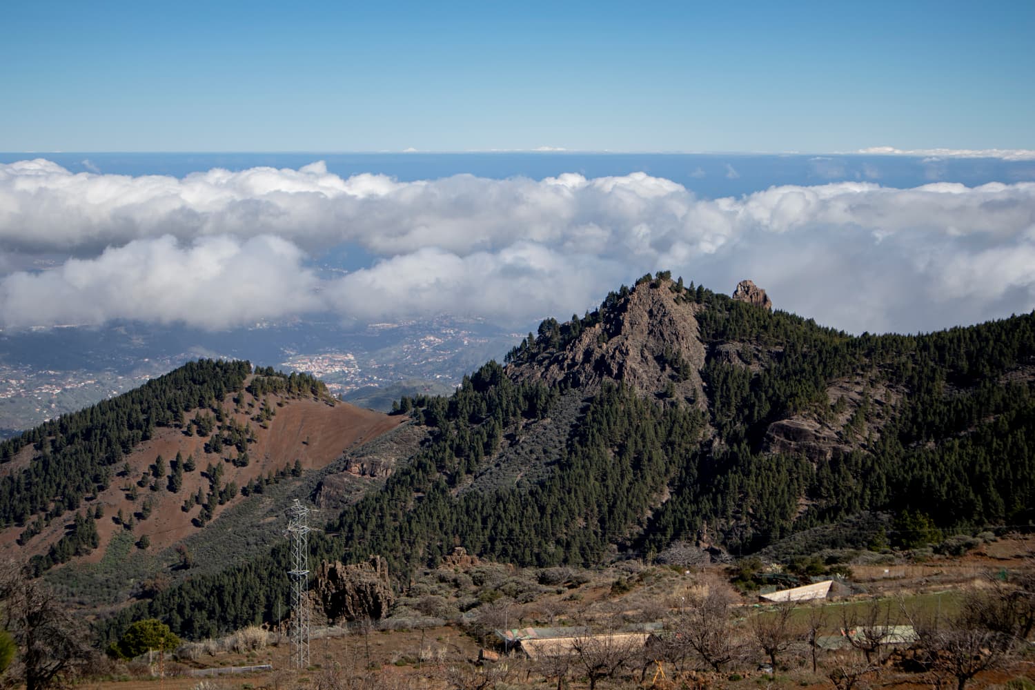
View of the vast landscape of Gran Canaria from the Becerra hiking trail
Circular walk from the Mirador de Becerra
Section Mirador de Becerra to the ruins of the house
Article summary and large selection of GPS hiking tracks
Sign up for my newsletter now and get exclusive access to my collected GPS tracks as well as all the brief information about my articles.
Sign up nowYou start your walk at the Mirador de Becerra viewpoint, 1550 metres above sea level. There you cross the road, because the actual hiking trail starts on the opposite side. From there, you first walk downhill on a wide path towards Barranco Grund. When you arrive, you will come across a path which you follow to the left. This is narrower and runs along the bottom of the valley. On the left side there is another house (Finca Mirca), which you will pass.
Hiking trail along the Barranco de la Mina
You walk along a stone wall and surrounded by terraced fields in the upper part of the Barranco de la Mina. After a short time the path leads you past an old water mill, which is hidden in bushes and trees along the path. At very wet times the path can be a bit muddy here and there. Now you walk slowly up the slope on the right side of the Barranco and then you move away more and more from the Barranco ground. If the creek in the Barranco carries a lot of water, you will hear the water rushing for quite a while. Then you will pass a ruined house and later you will reach a fork in the road.
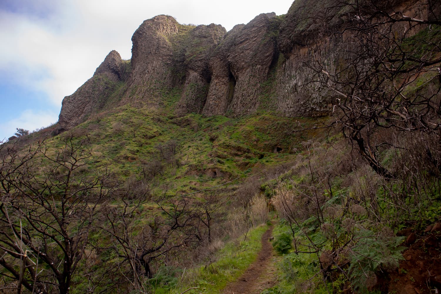
View into the Barranco de la Mina
Section of the trail fork to the viewing plateau
To the left, the road descends towards Las Lagunetas. But you take the path further uphill to the right. The rest of the path on the slope is easy to find and will slowly take you higher and higher. You will come to a water canal where the path continues to run along. From here you will again have wonderful views over the island – a wonderful panoramic path. Then you reach a ridge. High above you, there is a house on the right, to which a driveway leads up. However, you continue straight ahead and follow the path that runs along the mountain slope.
View of the hamlet of Cueva Grande from the viewing plateau behind the stone wall
Again, you will have beautiful views of houses far below you. After a while you will pass a large concrete ruin on your left. Shortly after, the path changes sides with the Barranco and after a while, passing a large farmhouse on the left below you, you reach a crossroads. The main path continues straight on down the valley. However, keep right and go uphill on a dirt road. After a short while the path (Camino Real) branches off to the right. The path now goes steeply uphill. After walking along a wall for a while, you will reach a large plateau with magnificent views.
Hiking trail past terraced fields
Section of the trail from the viewing plateau to Degollada de Becerra
This is an ideal place for a rest. You look down on the village of Cueva Grande. Afterwards you continue steeply uphill on the ridge. After some time the path changes from open terrain to forest. At times you walk along a water channel. The path is not to be missed and finally leads you further uphill through a small valley. You can already see the first houses from a distance. Finally you will come to an old ruined house. Here your narrow path now turns into a wide path. In a short time this will take you to the left onto a concrete road.
Signposting Becerra hiking trail in front of a finca - transition from hiking trail to concrete road
Follow this concrete road uphill to the right. You will pass a few houses and after a short time you will reach the street GC-150. Now you walk downhill to the right along the GC-150 for a few minutes. You follow a right and then a left turn. At the second right-hand bend, leave the road at the beginning of the bend and you will come to the PR-GC 40 path, which you follow to the right and after about 50 metres you will reach the Degollada de la Cumbre. Keep to the right here as well. At the end of this varied circular walk you can now walk along a beautiful panoramic path. You can enjoy the best views of the mountains of Gran Canaria and in a short time you will be back at the starting point, the Degollada de Becerra.

Roque Nublo with Tenerife and Teide
And finally
I hope you enjoyed this small but nice round trip on Gran Canaria. Finally I would like to make a remark about the track. If you follow me or read my articles regularly, you know that you can download all tracks for free after signing up for the newsletter on Seven Islands. This is also the case with this track. However, a small mishap has happened to me, because I forgot to start the JPS. Besides, I really only went on this tour once. For this reason the first 1.5 kilometres are without track. But I am sure you can bridge this gap very well with the description. If one of my readers should go this tour and have a track, I would be glad about a mail, so that other readers can download a complete track.
I wish you a good time on all your walks,
Dagmar of SiebenInseln