Agulo hike with glass viewing platform and visitor centre
Map
Today’s hike over the small village of Agulo on La Gomera takes you steeply through a reddish rock face to Mirador Abrante. But the hard climb is rewarded. A glass viewing platform with fantastic views awaits you at the top.
Mirador Abrante above Agulo
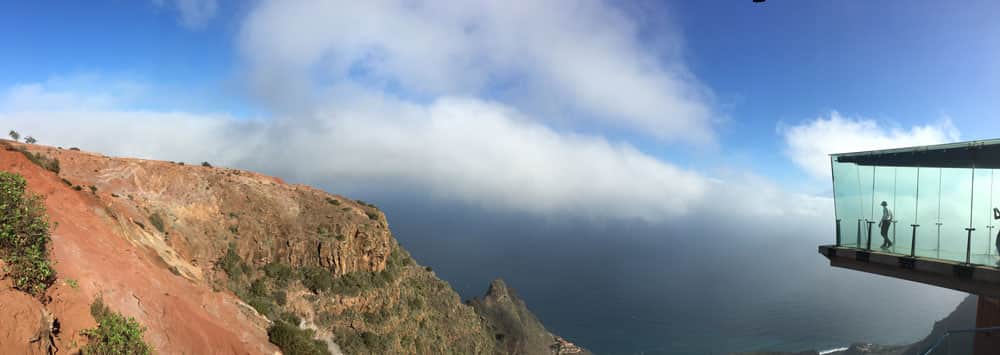
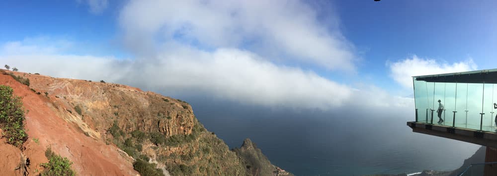
From this Mirador you not only have panoramic views over the entire mountain region to Tenerife, but also the glass „Durchsicht“ 200 meters down. Very close to the Mirador Abrante is the visitor centre of the national park Juego de Bolas, which attracts beside a botanical garden with a lot of interesting information about the island.
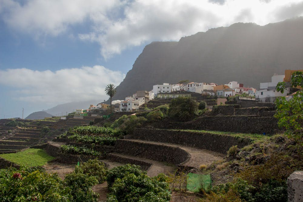
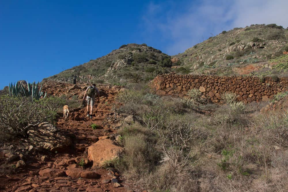
terrace fields around Agulo
Agulo – the glass viewing platform ends in nothingness
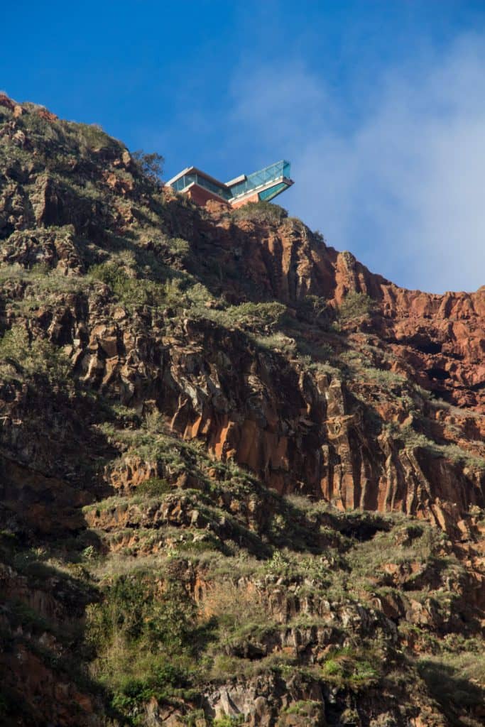
The glass viewing platform Mirador Abrante is located about 200 meters above the small village of Agulo. With its glazed length of 7 meters it ends in „nothing“. It is the main attraction of the small municipality of Agulo in the north of the Canary Island of La Gomera. Because of the viewing platform many tourists come daily. Mostly you reach the glass „Skywalk“ by bus via an access road. Far more interesting, however, is the hike from Agulo through the rock face to Mirador Abrante.
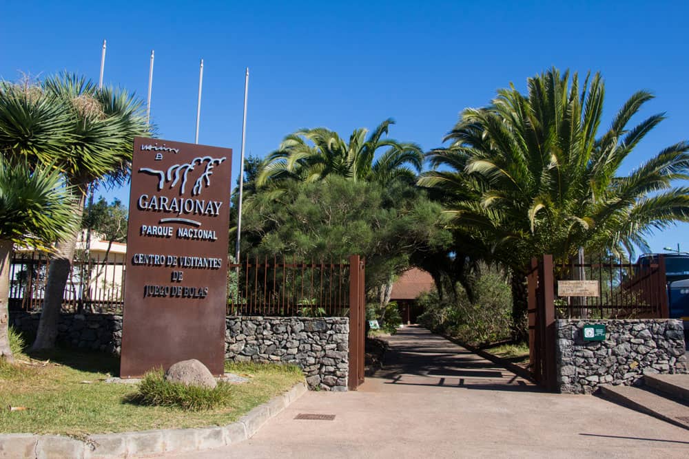
Visitor Centre Juego de Bolas
The cliffs around Agulo form an open semicircle towards the northeast. They were formed by overlapping basalt and trachydolerite. Further information about the Mirador and the glass viewing platform can be found here. The Mirador is open from 10 am to 6 pm and from June to the end of September from 11 am to 7 pm. Admission is free. 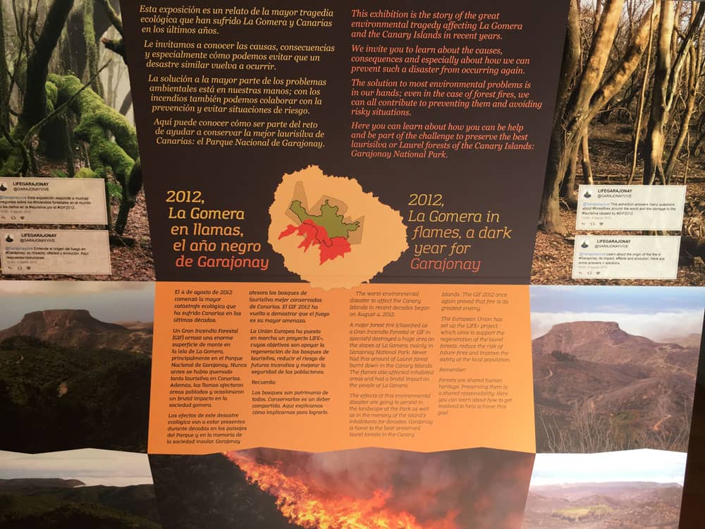
Information Board in the visitor centre of Juego de Bolas
Agulo – Juego de Bolas Visitor Centre
After the Mirador Abrante, this tour takes you to the Juego de Bolas National Park Visitor Centre. On the way there you will see red earth in many places. It was formed by chemical processes caused by the weathering of water. Both the Mirador and the Agulo Visitor Centre are located in a specially protected nature reserve. During the hike you can find many protected plant species, such as the rooting chain fern. The large visitor centre of the Juego de Bolas National Park is open daily from Tuesday to Sunday from 9.30 am to 4.30 pm. In addition to the small botanical garden, which offers an interesting overview of the island’s native plant species, visitors can gain many interesting insights and information about the geology and culture of the Canary Islands. Film screenings await you in several exhibition rooms and a museum. The culture, like the whistled language El Silbo is explained as well as the life of the natives of the island. You can visit the interior of an old farmhouse and handicraft workshops. A visit is worthwhile in any case.
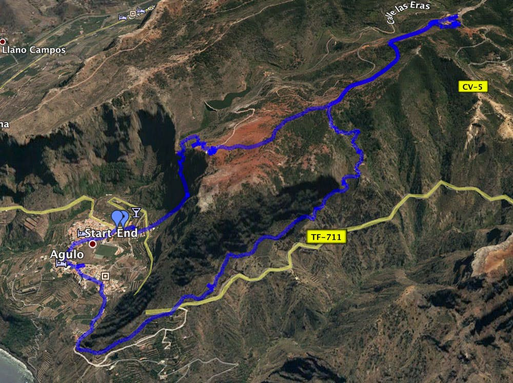
Track of the circular hike from Agulo to Mirador Abrante and Juego de Bolas
General information about the circular hike
Bus stop at the main road of Agulo GM 1 (TF-711)
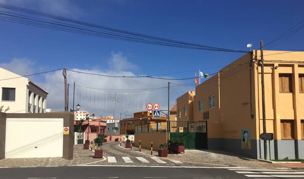
Starting point - main street Agulo
Starting point and approach
By car
Article summary and large selection of GPS hiking tracks
Sign up for my newsletter now and get exclusive access to my collected GPS tracks as well as all the brief information about my articles.
Sign up nowGM1 (TF-711) from direction Hermigua or Vallehermoso
By bus
In Agulo, line 2 stops, which runs between the capital San Sebastian and Vallehermoso. Further information on the Homepage Guaguagomera. 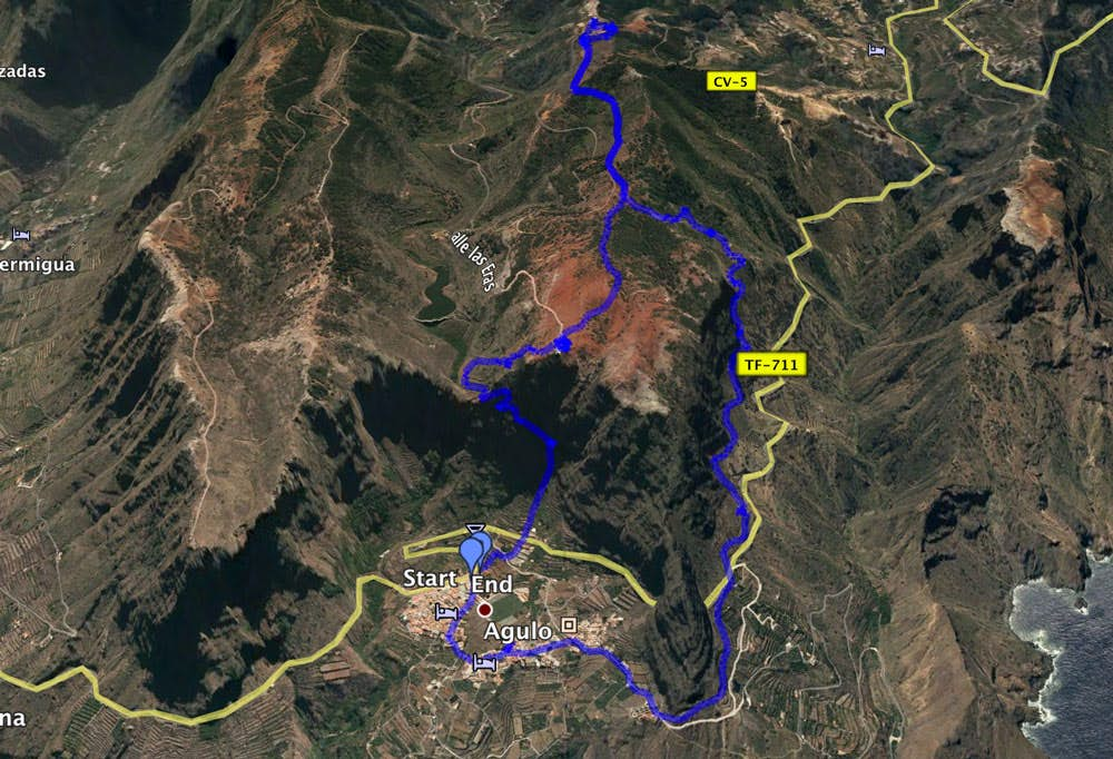
Track circular hike Agulo - Mirador Abrante - Juego de Bolas
Time
I don’t like to give general time information for hiking tours, because the times are very individual. Especially with this tour I needed a lot of additional time, because I wanted to see the Mirador Abrante and the visitor center in peace. So it became 4 hours for me.
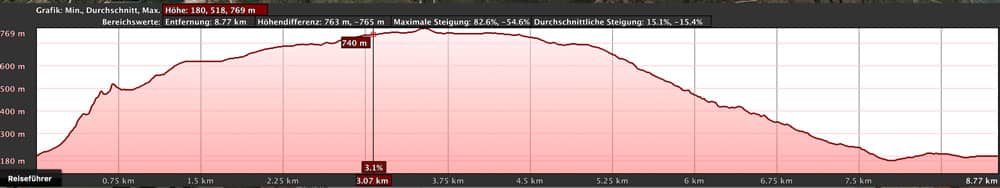
elevation profile Agulo - Mirador Abrante - Juego de Bolas
Difference in altitude and distance
The difference in altitude is about 600 meters. The distance is about 9 kilometers long.
Requirement
Challenge: The steep ascent from Agulo through the steep face requires not only stamina but also sure-footedness and a head for heights. The rest of the tour from the Mirador Abrante is possible for everyone on well laid out paths.
Refreshment
Restaurants, bars and shops in Agulo as well as a restaurant in the Mirador Abrante and bar and restaurant Juego de Bolas next to the visitor centre.
Variants
This tour can be combined well with various other hiking and circular walks in the vicinity. In the article „Circular hike via Vallehermoso through the Tamargada gorge“you can find all the circular hikes that follow this circular hike under „variants“. Thos who are not sure-footed and free of vertigo can also choose the ascent and descent from and to Agulo on the descent path presented here. 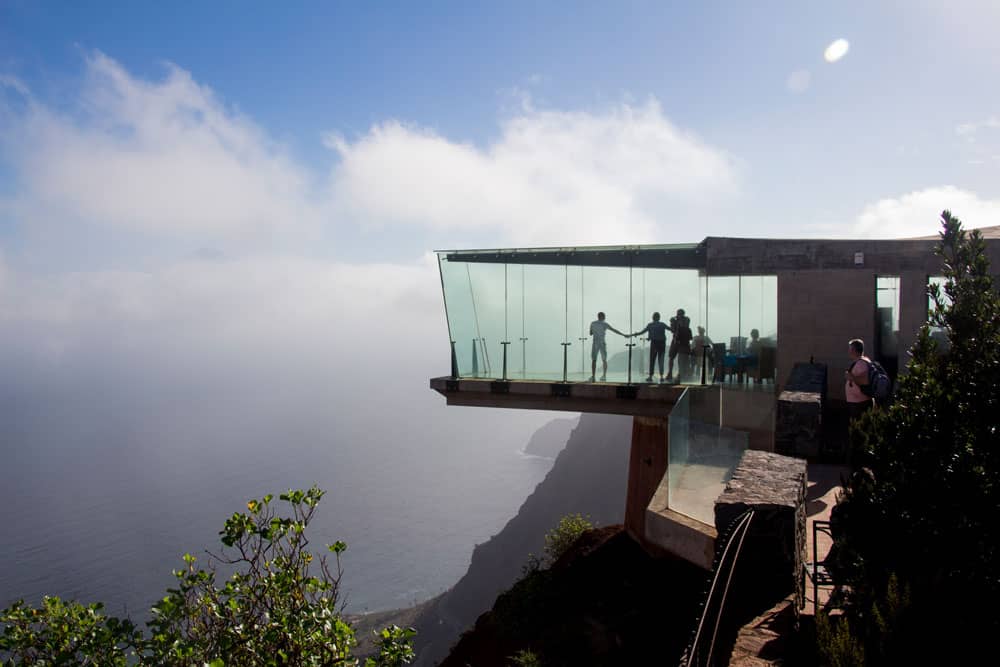
Mirador Abrante - glass sky walk at height
Hike to the Mirador Abrante and the visitor centre Juego de Bolas
Section Agulo to the Mirador de Agulo
The hike starts directly at the main road GM 1 in Agulo. At the end of the „straight line“ through the village towards Vallehermoso, there is a stairway on the right side. Trail 34/35 leads to the Mirador Abrante and the Juego de Bolas Visitor Centre. The stair climb takes you up steeply between terraced fields. First the path leads you over a small road and then it crosses the GM 1 above the village. On the other side of the road, the Camino de los Pasos takes you directly to the reddish cliff in front of you.
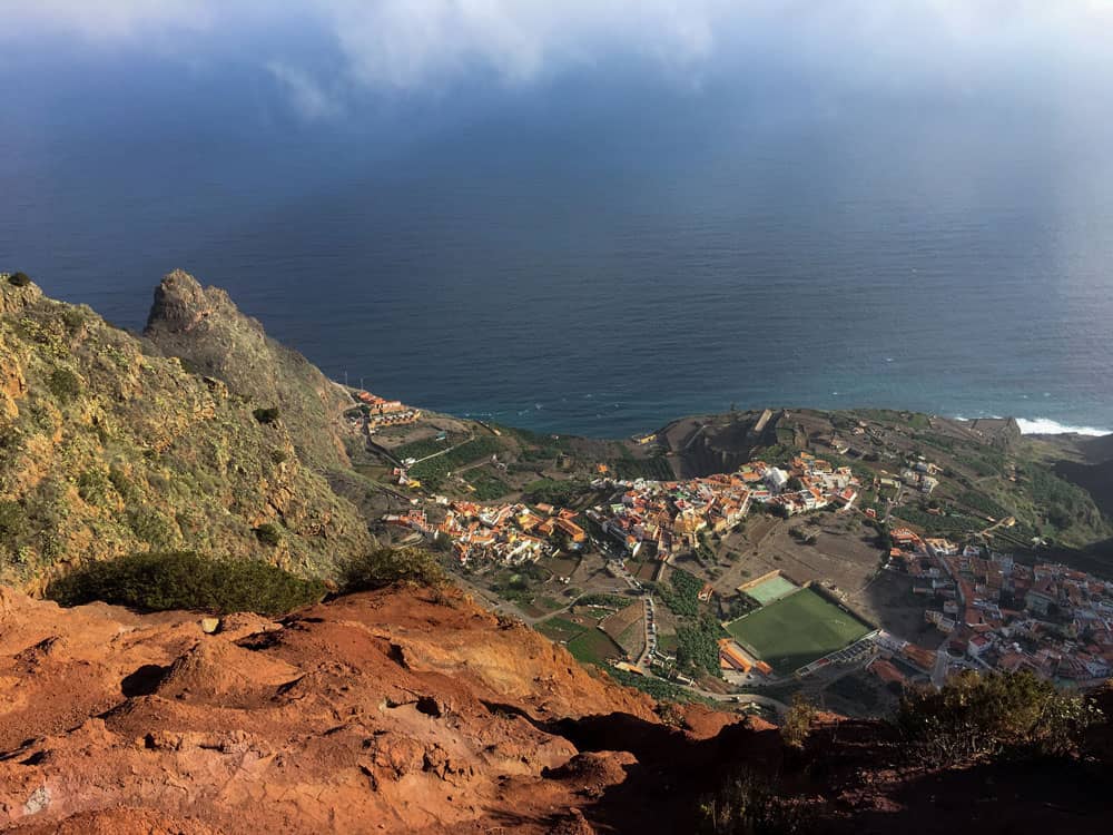
view from the sky walk Mirador Abrante down to Agulo
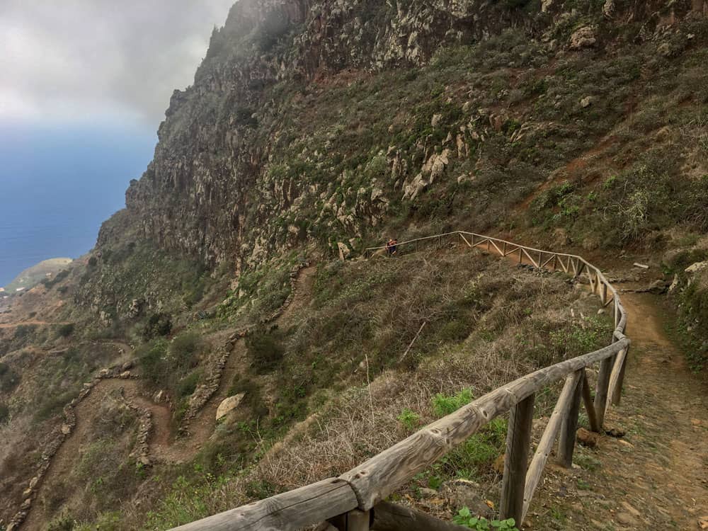
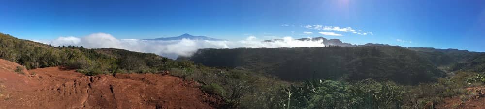
Very quickly you are at the foot of the mighty rock face. You can’t miss the path. It goes in small serpentines steeply uphill. High above you, you can occasionally see the glass viewing platform that protrudes over the rock face. Next to you it’s steep downhill. But the path is not really exposed. After about half an hour you have reached the steepest and most strenuous part of the ascent and are standing at the Mirador de Agulo. From there you already have a wonderful view over the whole village and the rugged cliffs around Agulo. In the distance you can see the Teide on the neighbouring island of Tenerife.
Section Mirador de Agulo to Mirador Abrante
Article summary and large selection of GPS hiking tracks
Sign up for my newsletter now and get exclusive access to my collected GPS tracks as well as all the brief information about my articles.
Sign up nowI was told that here at the Mirador de Agulo after heavy rains a thundering waterfall is supposed to fall down the rocks. I didn’t see anything of it and was glad that it was cloudy during my hiking tour, but it didn’t rain. Now, on the plateau, the way turns away from the rock face. After a short time you reach a fork in the road. You keep going uphill to the right. This second part of the ascent to Mirador Abrante is much more comfortable than the first part through the steep rock face.
path between Mirador Agulo and Mirador Abrante
In partly wide serpentines you go up over the reservoir below you towards the rock face. In less than an hour you may have reached the Mirador Abrante with its glass viewing platform. I had already given more information in the first section. The panoramic view of Agulo from the height is unique. If not too many tourists have arrived by bus, you can also enjoy the view from the bird’s eye view from the glass „Skywalk“.
Section Mirador Abrante to the visitor centre Juego de Bolas
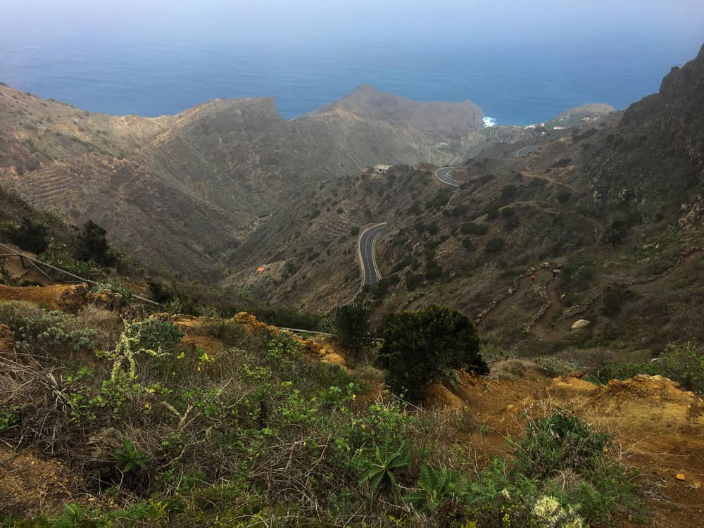
Just before the Mirador Abrante, on the right side of the road, the path that takes you to the Juego de Bolas Visitor Centre continues. From Mirador Abrante, 625 metres above sea level, the National Park Visitor Centre is just 120 metres above sea level. You will walk through an eroded landscape with reddish soil. The view of the surrounding mountain ridges all the way to Tenerife accompanies you.
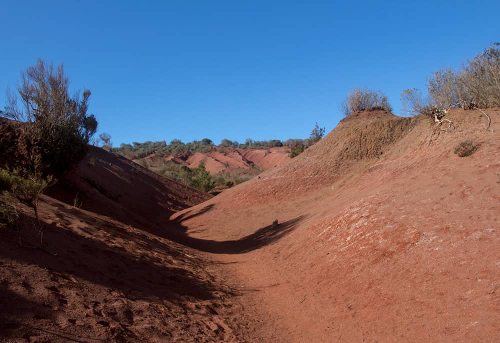
Erosion landscape with red soil
After about half an hour you arrive at a hiking crossroads. Turn right and take a longer path back to Agulo. After another 20 minutes you will reach the Juego de Bolas Visitor Centre (information in the second section) via mostly good wide stone and sand paths. If you are interested in culture, geology and native flora and fauna, you should allow some time for your stay.
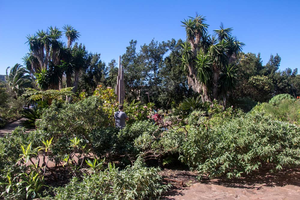
The botanical garden at the visitor centre
Route Juego de Bolas to Agulo/Las Rosas crossroads
After you have seen everything in peace in the visitor centre located at 745 metres above sea level and perhaps also made a rest, you go back to Agulo. It goes on the same way you came, about 20 minutes back to the hiking crossroads. There you don’t go back towards Mirador Abrante, but keep to the left. The path leads you on wide stairs down the red ground.
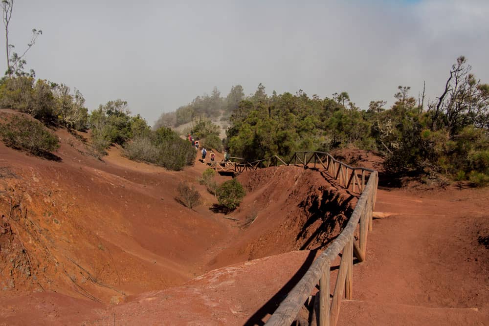
Descent path via a red sandy staircase climb
First you go through an erosion zone. Then follow paved wide serpentines. These take you quickly downhill. With cloudless skies you can enjoy beautiful views of the Barranco de las Rosas and the Atlantic coast. After a good half hour you will come to another fork in the road. Turn left towards Las Rosas. But you go down to the right in the direction of Agulo.
Descent path to hiking crossroads via paved serpentine paths
Section hiking crossroads to Agulo
From the hiking crossroads, the slightly wider cobbled hiking trail descends in wide serpentines along the rock face. After about 30 minutes you reach the road GM-1 again, which you will see from above for some time. You cross the road and the trail continues downhill diagonally opposite on the other side of the road. You walk around a rock. After a short time you reach the cemetery of Agulo.
View on the descent down to the Atlantic coast
You walk past the cemetery and follow the paved road. In a wide left turn the road leads you to the small village Agulo. It should be the most beautiful place of La Gomera. If this is true I am not able to judge. But a walk in the beautifully arranged lanes with the colorful little houses is worthwhile itself any time. You go past the church square and then hold yourself right around. So you come back to the main street, your starting point.
Panoram view from the hight - Tenerife in the background
And finally
I hope that you liked this little tour on the island La Gomera high above Agulo. I especially liked it because it combines hiking, nature and a lot of interesting information.
What is new this year on seven islands is that I have uploaded all the information sheets on the tours and the GPS tracks in a folder. If you sign up for the newsletter, you will have unlimited access to all tours.
I wish you a lot of fun while hiking!
Dagmar von SiebenInseln