Vallehermoso – an attractive area for hikes
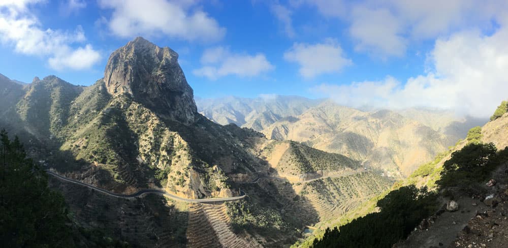
Today’s circular hike near Vallehermoso on La Gomera takes you to the Tamargada mountain range with views of the gigantic Roque El Cano. Then we descend to Vallehermoso to Playa de Vallehermoso. There you can have a look at the Castillo del Mar. From the beach it goes up to the steep coast. Then you walk back through the lonely gorge of Tamargada. Through reeds, over mountain ranges and past ruins you return to your starting point.
Map
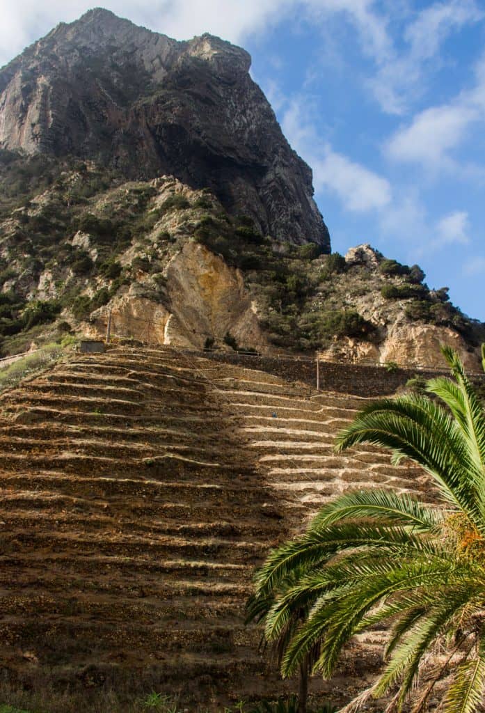
typical terrace fields at the wayside
Vallehermoso – Agriculture, handicrafts and a little tourism
The small municipality of Vallehermoso has about 3000 inhabitants and an area of 109.11 square kilometres. The name says it all. Vallehermoso means beautiful valley. And Vallehermoso is indeed a beautiful valley. There are still many terraces where potatoes, tomatoes, wine and bananas are grown. Vallehermoso is also the centre of palm honey production. Besides agriculture, the population lives from handicrafts and tourism.
View on the Roque El Cano - Vallehermoso
Vallehermoso and the history of Castillo del Mar
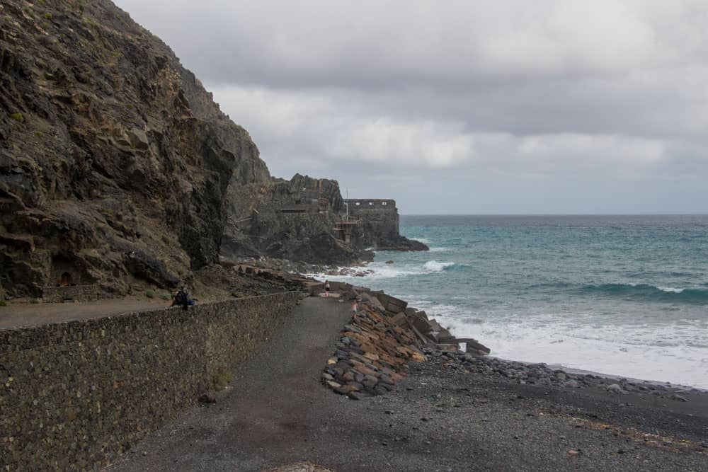
At Playa de Vallehermoso you pass very close to El Castillo del Mar. The Castillo del Mar was built in 1890 as a loading station. Once, all the island’s goods, especially bananas, were loaded onto ships here. A sign informs that here in 1910 the first vehicle with a steamboat came to the island. In order to protect the trading centre from pirates, there were cannons in addition to the trading office. A real fortress in Vallehermoso.
On the lower floor was the actual packaging department. In 1950 the company was stopped and the Castillo del Mar in Vallehermoso was forgotten. When Franco came to power, many inhabitants of La Gomera emigrated illegally from Castillo del Mar in Vallehermoso to South America.
Vallehermoso - Castillo del Mar
Vallehermoso and the recent history of Castillo del Mar
Then the photographer Thomas K. Müller bought the building in 1981 and wanted to build a cultural centre there. Access was only possible via the sea and the first attempts at restoration failed. Only when coastal roads were built on La Gomera in 2001 was there a way to the Castillo near Vallehermoso. Thus the restoration of the Castillo began with conversion to a cultural centre.
The entire history of the reconstruction is documented in one room. But then there was probably a financial problem and the authorities did not supply the building with electricity. So the Castillo was closed. When I was there for the last time in January 2018, the road to the Castillo was closed because of the danger of falling rocks. Large rocks and many stones blocked the access via the road.
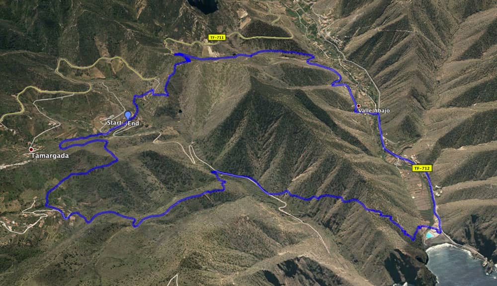
Track circular Pie de la Cuesta - Playa Vallehermoso - Tamargada gorge
General information about the circular hike at Vallehermoso
Starting point and approach
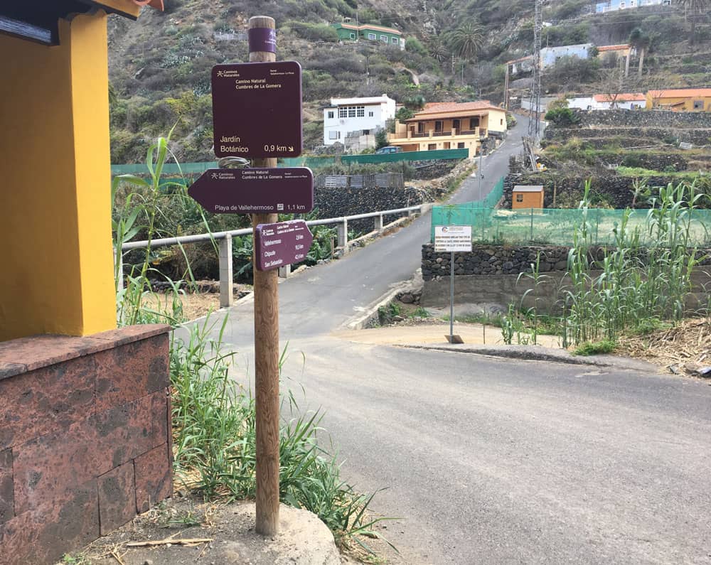
Village Pie de la Cuesta below the village Tamargada at the GM 1 (TF-711)
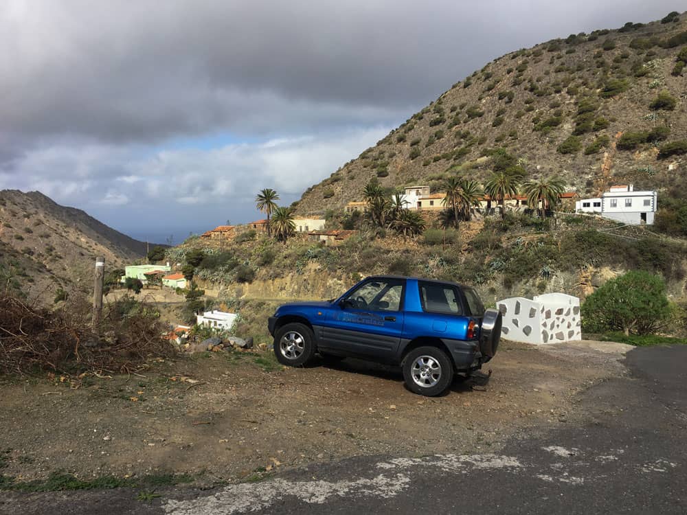
starting point Pie de la Cuesta
Arrival by car
GM1 (TF-711) from Hermigua or Vallehermoso. Coming from Hermigua, pass the village of Tamargada. Take the second small road down from GM 1 (TF-711). After about 1.5 kilometres you will reach the small hamlet of Pie de la Cuesta. Just behind the Ermita de la Caridad del Cobre (small church) there is a big hiking sign (crossroads) and space for several cars.
Arrival by bus
In Tamargada the line 2 stops, which runs between the capital San Sebastian and Vallehermoso. From there you can climb down stairs to the starting point (at the restaurant/bar). But since this is a circular hike, you can of course also start the hike at any other point. If you take the bus (lines 2, 4, 5) to Vallehermoso, you can also start from there. Then you simply walk from the centre of the village towards Playa de Vallehermoso. Further connections see here. Article summary and large selection of GPS hiking tracks
Sign up for my newsletter now and get exclusive access to my collected GPS tracks as well as all the brief information about my articles.
Sign up nowTime
I don’t like to give general time information for hiking tours, because the times are very individual. I needed about 4 hours for this tour with breaks.
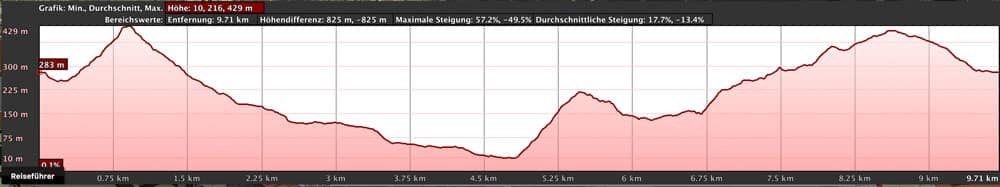
elevation profile Vallehermoso
Difference in altitude and distance
The difference in altitude is about 650 meters. The distance is almost 10 kilometers long.
Requirement
There should be some stamina. But otherwise it is an easy hike on good hiking trails. Therefore this tour is basically feasible for everyone.
Refreshment
Restaurants and bars only in the nearby Vallehermoso – not on the hiking route. A kiosk on the beach is also not always open. Therefore, be sure to take enough water and food with you.
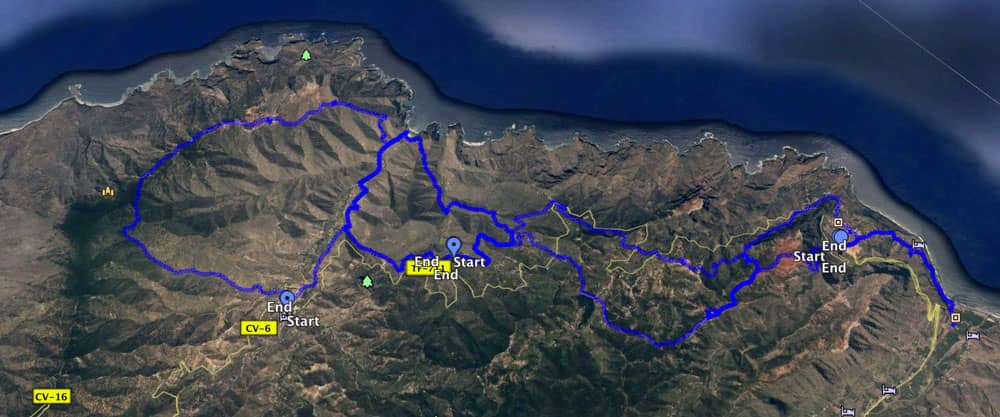
Tracks of four circular hikes around Vallehermoso
Variants
This hike can be combined well with various other hikes and circular walks in the vicinity.
On the track you can see this round tour and three more round tours. I have already described the tour around Agulo here. Then there ist the round tour from Pie de la Cuesta via Las Rosas to the visitor center. And not to forget the tour to Cumbre de Chijeré. You can combine all four tours as you like. 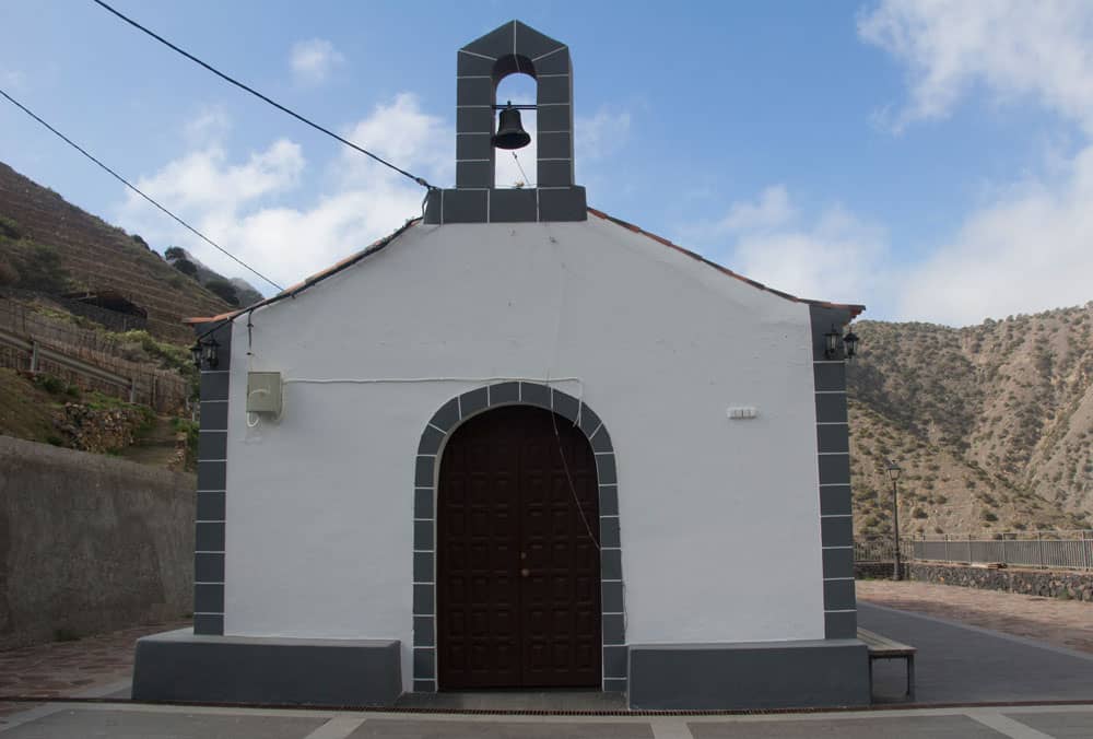
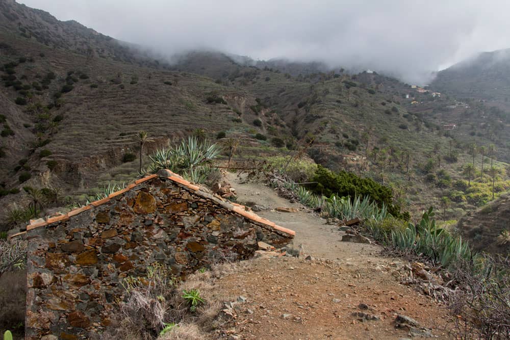
Pie de la Cuesta - Ermita de la Caridad del Cobre
Circular hike over Vallehermoso through the Tamargada Gorge
Section Pie de la Cuesta – ridge height Lomo de la Culata
You start your hike in the small hamlet Pie de la Cuesta at the hiking board. Nearby is the small church of Ermita de la Caridad del Cobre. Maybe you’d like to have a look at it before the hike. In Pie de la Cuesta, several hiking routes converge. At the hiking board you follow the hiking path 38 in the direction of Vallehermoso. It leads you directly past the houses of Pie de la Cuesta downhill. You first hike down a small path into the Barranco de los Zarzales.
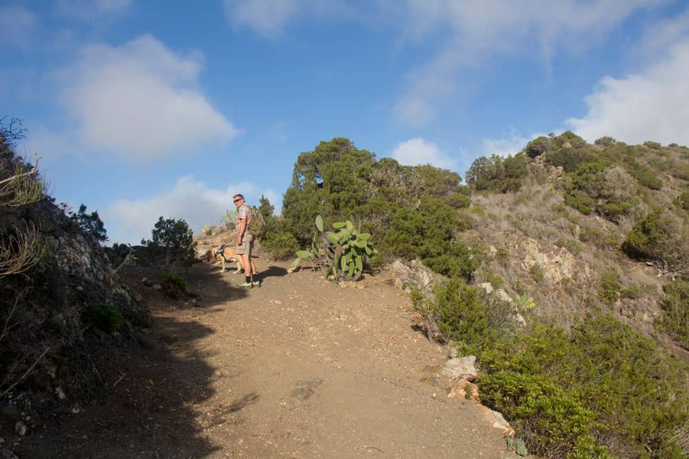
on the comb hight - hiker with dog - Vallehermoso
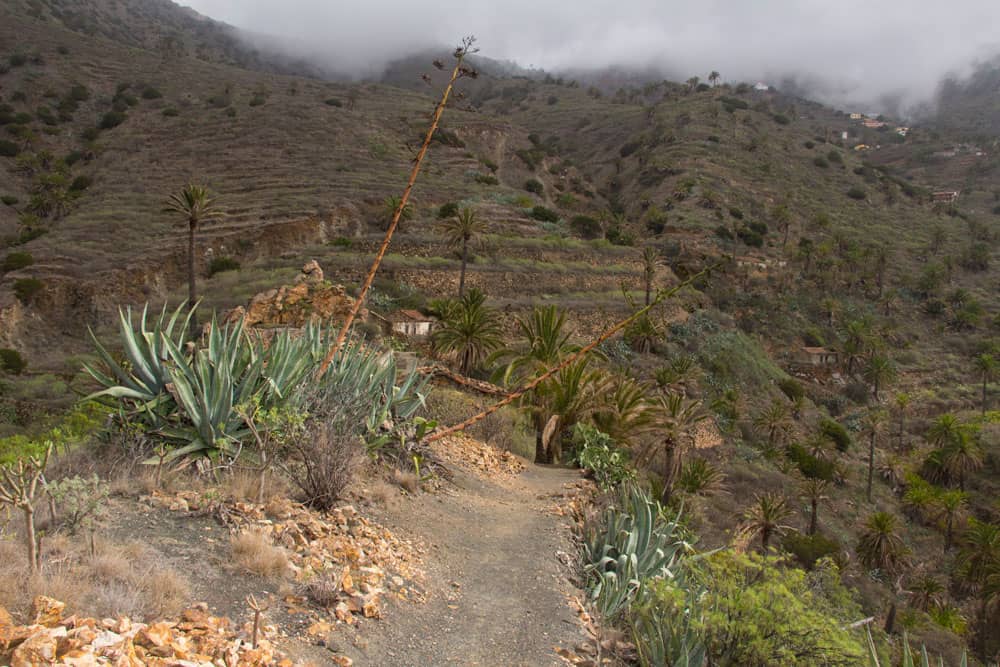
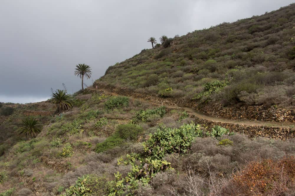
It goes in a wide arc to the other side of Barranco. There you climb past a large farm. Shortly behind the farm you come to a road, the Calle Pie de la Cuesta. Follow this road for a little over 100 metres to the right. At the next sharp left turn, leave the road and take the path again. From now on you can’t miss the path up to the crest height. It goes steeply uphill and you can already enjoy wonderful views of the Tamargada valley. Below you the TF-711 runs through the tunnel. You walk over it. Then the ascent is over.
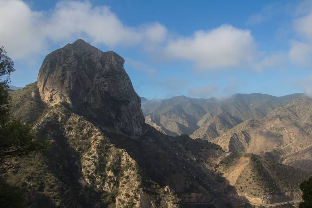
La Gomera - Roque El Cano
Route section ridge height Lomo de la Culata to junction hiking trail from Vallehermoso
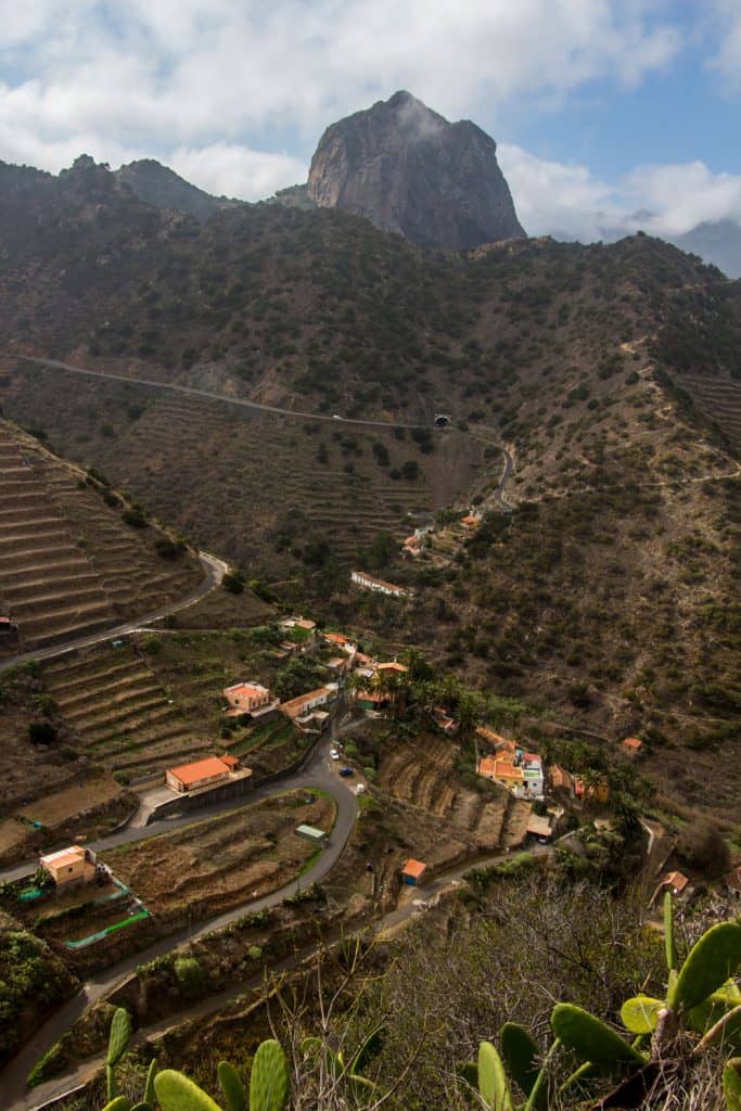
From up here on the ridge height Lomo de la Culata at 415 meters altitude you have fantastic panoramic views in all directions. The striking rock of Roque El Cano is directly in front of you. On serpentines you go downhill towards Barranco de la Culata. After some time, the serpentines turn into a hiking trail that leads you to the right along the slope towards Vallehermoso. This path soon joins the GR 131 long-distance trail, marked in white and red, which crosses the island of La Gomera.
Pie de la Cuesta in front of the Roque El Cano
On both sides of the Barranco you can see the typical terraced fields. Some are still cultivated, others are abandoned. At the end of the valley path you come to a fork. You follow the GR 131 to the right while you turn left towards Vallehermoso. If you started from Vallehermoso, you will come to the circular path at this point.
Hiking path at the street to Playa Vallehermoso
Article summary and large selection of GPS hiking tracks
Sign up for my newsletter now and get exclusive access to my collected GPS tracks as well as all the brief information about my articles.
Sign up nowYou keep to the right and the trail turns into a road. On Calle Lomo Barro you walk towards the beach past fields, houses and farms. After some time, the path goes down left across the valley to the main road TF-712. The path turns right and continues to Playa Vallehermoso. After a short time you will find yourself in a large square in front of a sea pool on the beach. If you like, you can take a short trip to the beach. To your left is the Castillo del Mar (see description above).
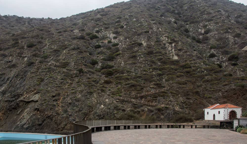
Playa Vallehermoso with sea swimming pool and steep coastal path
The hiking trail PR- LG 6 continues to the right over a small bridge at the foot of the steep cliffs. From there the path climbs up the cliffs in serpentines. You can look back to Vallehermoso and the Atlantic Ocean as well as the Castillo del Mar. In about 30 minutes you have also managed this climb and are standing at the top of the steep coast. A fantastic view rewards you after the hard climb.
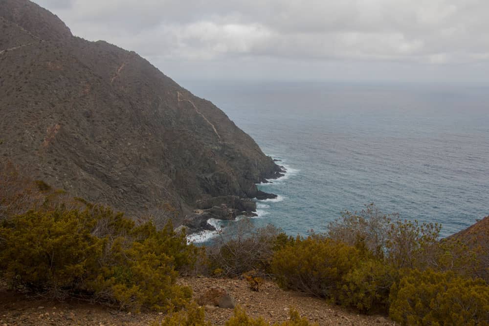
View from the steep coast on the Atlantik
Section Kammhöhe on the steep cliffs to the roadway Wasserreservoir
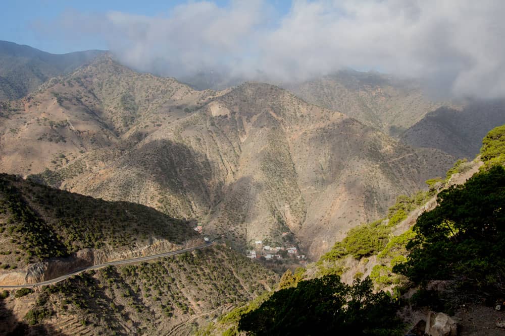
After you’ve enjoyed all the views from up here again, you’ll descend the slope very comfortably on a beautiful path, some of which is secured with railings. After some time the path changes into a wider road. This is a track that leads through the Tamargada Gorge. If you want to extend this round, you can turn left on the road to the coast. There it goes to the Punta de la Sepultura. From there it used to be possible to descend on a small steep path to Playa de la Sepultura. Today the path is partly slipped and buried and nobody should be recommended.
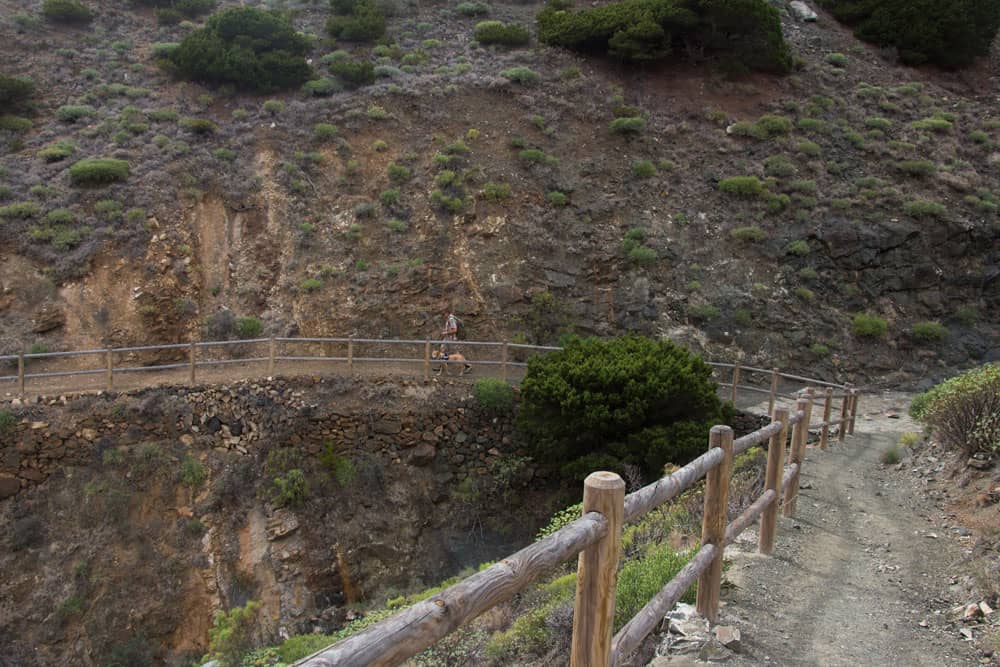
Hiking path from the steep cliffs down to the road in the gorge of Tamargada
However, you continue up the valley slope to the right. Soon you will pass a water reservoir. Shortly after the water reservoir, the hiking trail leads off to the left. Alternatively, you can simply follow the road straight ahead. It leads you directly to Pie de la Cuesta to the starting point. But on the left side you have a scenically very varied route over the village Simancas in front of you.
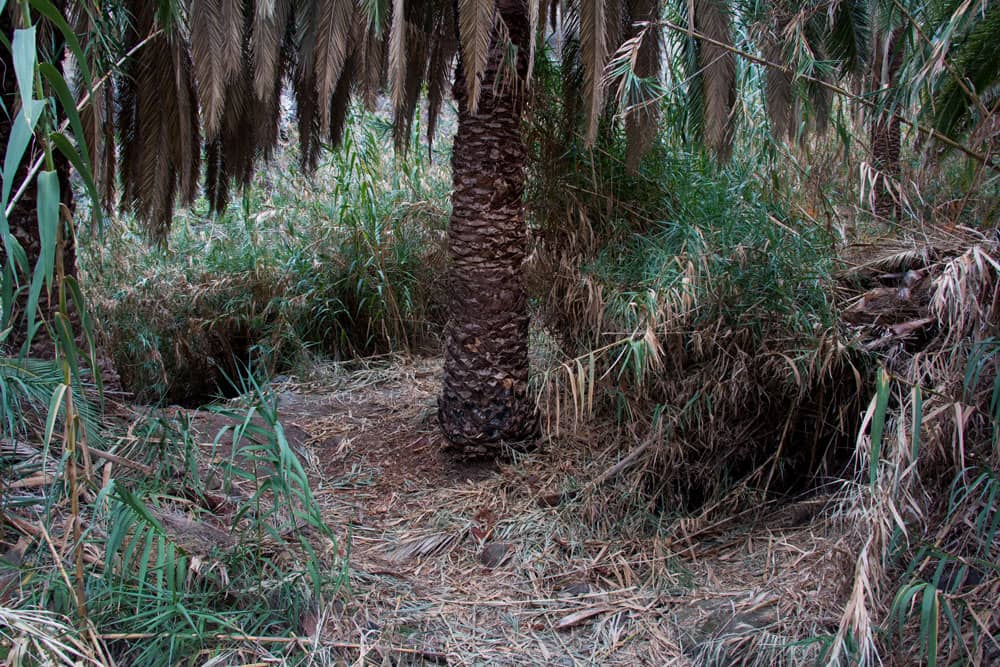
Hiking trail through reeds under palm trees
Section of the water reservoir road to Simancas
The trail first leads you down through high reeds and then over a stream bed. On the other side you continue along the streambed and then the path climbs in steep serpentines. After about half an hour you have reached the top and are on a small ridge. From here you have a wonderful view of the whole Tamargada gorge. The small path leads you on the right side of the slope and then close to the ridge towards Simancas.
old houses at the way over the ridge
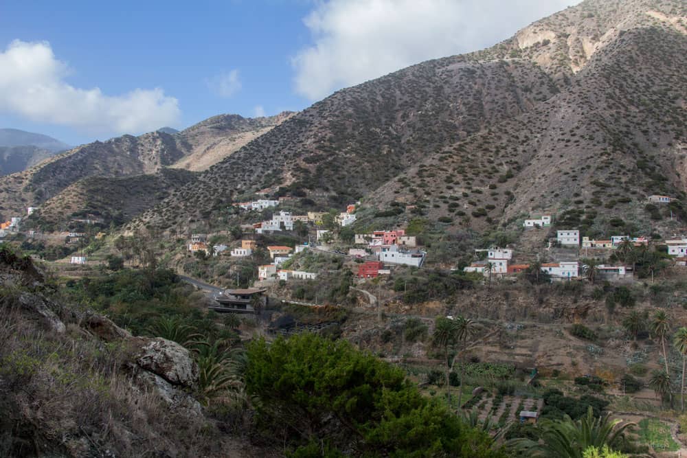
You will pass imposing rocks and several abandoned farms. In the distance you can already see the small village of Simancas in front of you. After the last ruins the path leads you down into a small gorge. You go on the right side of the slope. The path then leads you in an arc around the small gorge. Then it goes up towards Simancas. At the first houses of Simancas you meet a concrete road, the Calle de Simancas.
ruin houses in front of Simancas at the hiking path
Section of Simancas to Pie de la Cuesta
You walk about 100 meters along the Calle de Simancas. Then you will see signs and follow trail 38 to Mazapeces. It goes slightly downhill on a path below Simancas. You will pass some houses while you go down into a Barranco. On the other side of the valley the path forks. Keep right towards Mazapeces. It goes up on a path on the slope. At the top you walk around the mountain.
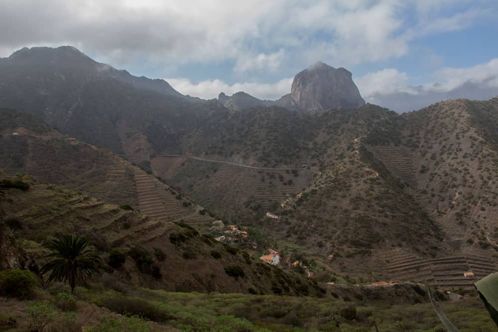
Barranco de Tamargada with little villages
hiking path from Simancas to Mazapeces
On the other side of the slope you can already see the starting point Pie de la Cuesta lying deep below you. You go down the slope comfortably on the way. Shortly before Mazapeces you come to a crossroads. Keep right here. A wide often paved path leads you in a short time down to the church Ermita de la Caridad del Cobre. Above the church square or on the path above the church square you will reach the starting point of the hike in a short time.
views down into the Barranco of Tamargada
And finally
I hope you enjoyed the little circular walk on La Gomera. Together with the other walks nearby you have many possibilities to explore the area of Vallehermoso and around the Tamargada Gorge. The still missing round to the Cumbre de Chijeré I will stop soon.
I wish you a lot of fun on all your hikes.
Dagmar von SiebenInseln