Hiking on La Gomera through idyllic Canarian villages
Today’s hike on La Gomera takes you to the north of the island. On the 14 km long tour there is much to see. You start the La Gomera hike in the hamlet of Pie de la Cuesta below the village of Tamargada. Then you hike uphill through small Canarian villages to the town of Las Rosas.
Map
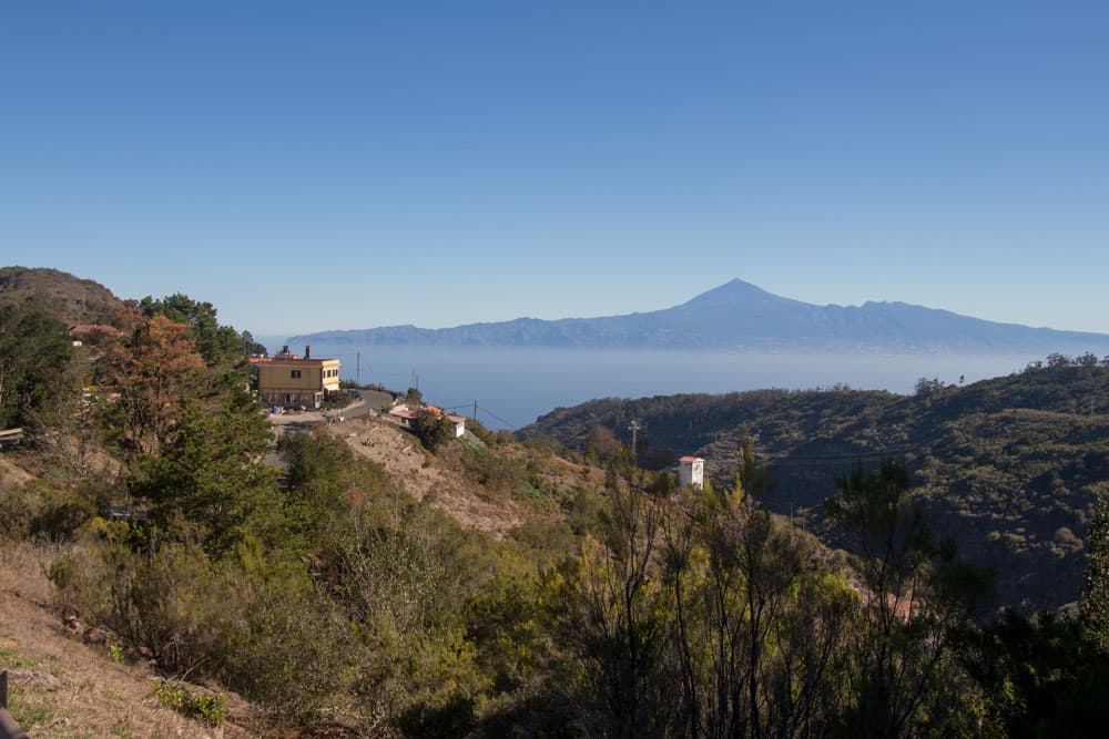
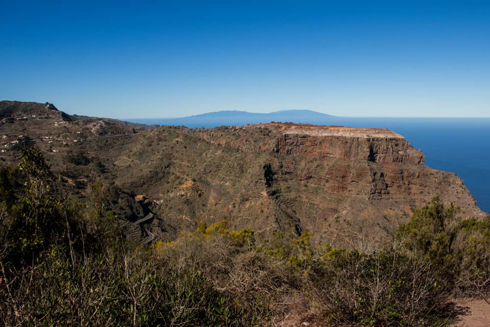
Panorama over the mountains of Vallehermoso La Gomera
From there we continue through the cloud forest up to the Cañada Grande. After a round trip, which also takes you past the large Juego de las Bolas visitor centre, the way back takes you through the lonely mountain villages of La Vega and Simancas. 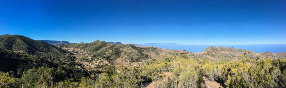
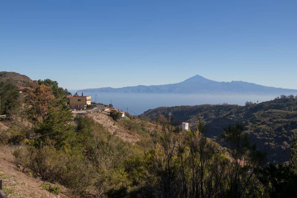
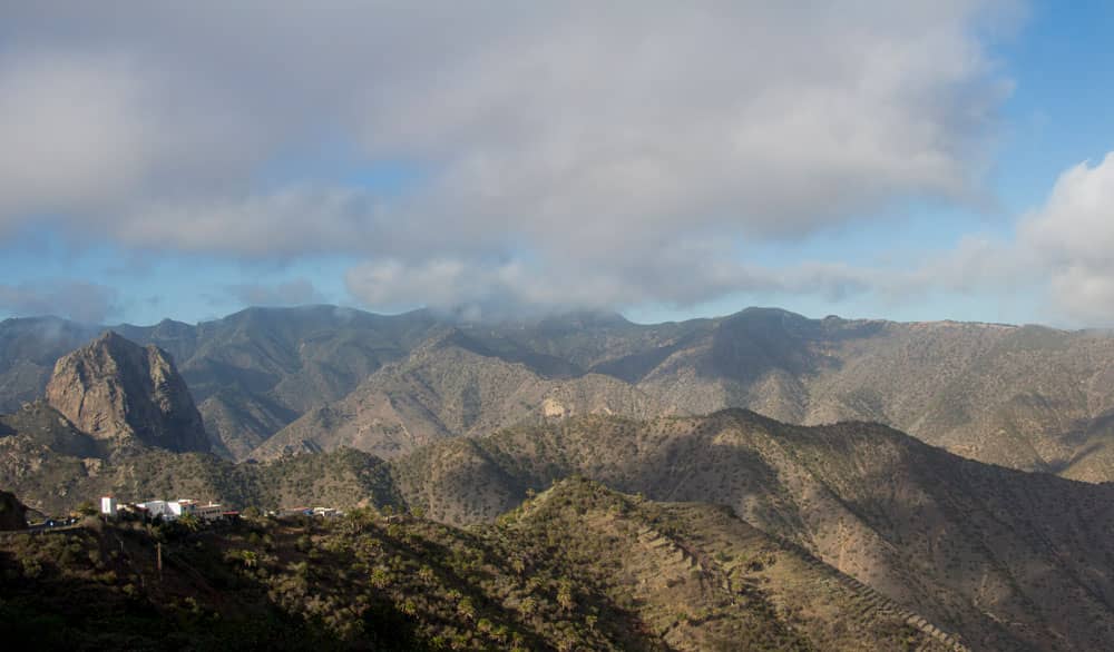
Panorama view from the hight at Cañada Grande on La Gomera
Hiking in the north of La Gomera with trade winds and clouds
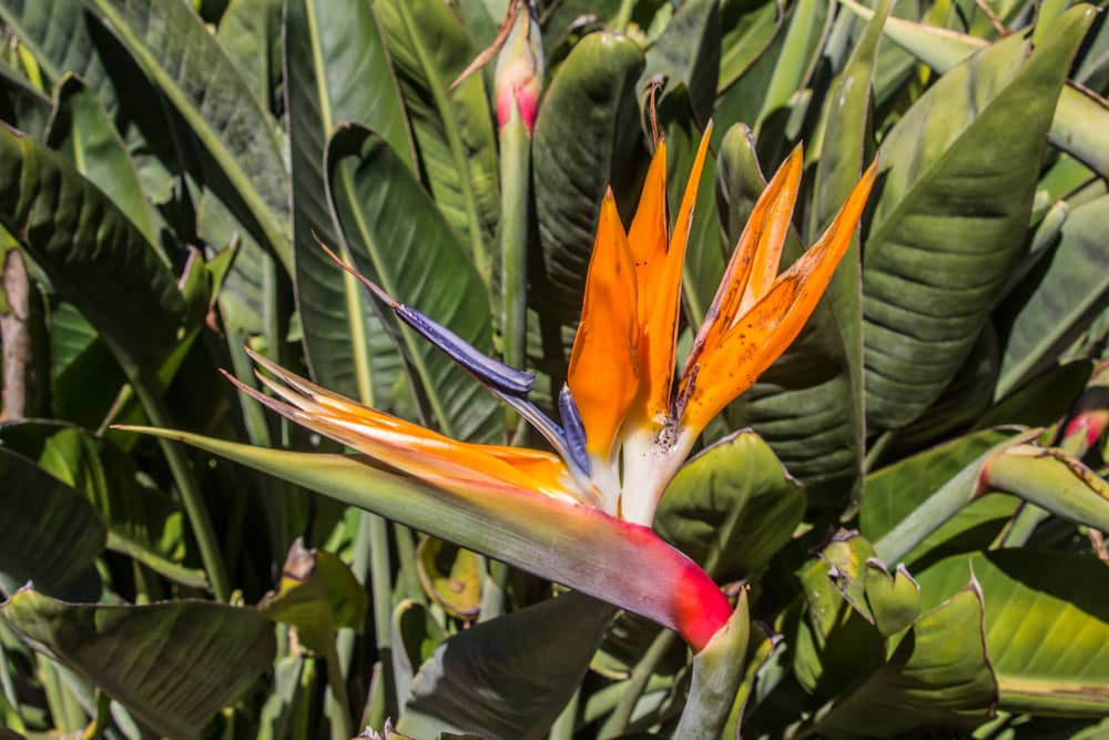
Strelicia La Gomera
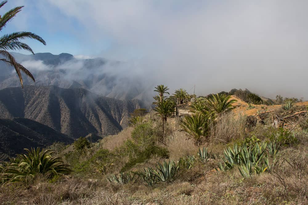
On La Gomera it is exactly like on the sister islands El Hierro, Tenerife, La Palma and Gran Canaria. Due to the trade wind, which also rains down the trade clouds on the slopes, the vegetation in the north of the island is green. There are cloud forests, palm groves and countless terrace fields. But there is also a downside for hikers. Sunshine does not always prevail in the north. Hikers often have to reckon with clouds, if not even with extensive rain showers.
During my last stay on La Gomera in the north, the „weather god“ was half good to me. That means that from six days on three days the sun was shining. Blue sky and only occasionally dark clouds were to be seen. But on three days it rained so heavily that hikes were really only possible as walks near the coast. Fortunately, I had already done this beautiful tour, because otherwise I would have rained a lot.
General information about the circular hike in the North of La Gomera
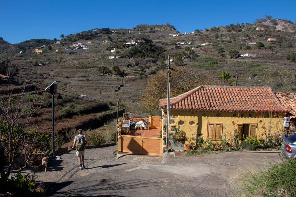
Start point Pie de la Cuesta
Starting point and approach:
Village Pie de la Cuesta below the village Tamargada at the GM 1 (TF-711)
Arrival by car:
GM1 (TF-711) from Hermigua or Vallehermoso. Coming from Hermigua, pass the village of Tamargada. Take the second small road down from GM 1 (TF-711). After about 1.5 kilometres you will reach the small hamlet of Pie de la Cuesta. Just behind the Ermita de la Caridad del Cobre (small church) there is a big hiking sign (crossroads) and space for several cars.
Arrival by bus:
In Tamargada the line 2 stops, which runs between the capital San Sebastian and Vallehermoso. From there you can climb down stairs to the starting point (at the restaurant/bar). But you can also start the hike at the place where it crosses GM 1 (TF-711).
Time:
I don’t like to give general time information for hiking tours, because the times are very individual. I needed about 6 hours for this tour with breaks.
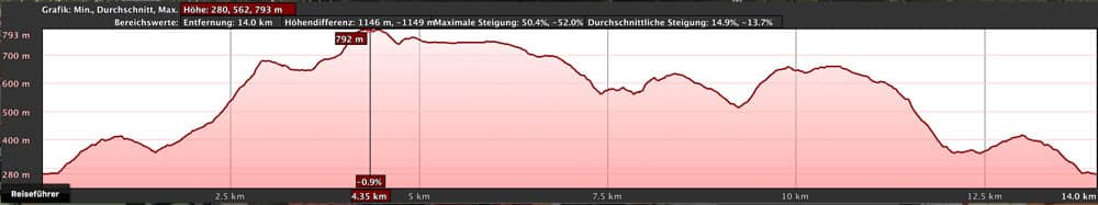
elevation profile from the circular hike Tamargada La Gomera
Difference in altitude and distance:
The difference in altitude is about 920 meters. The distance is 14 kilometers long.
Requirement:
Because of the length there should be some physical condition. The steep ascent from Tamargada requires sure-footedness and a head for heights in a few places. But basically this is a tour on good hiking trails and feasible for everyone.
Article summary and large selection of GPS hiking tracks
Sign up for my newsletter now and get exclusive access to my collected GPS tracks as well as all the brief information about my articles.
Sign up nowRefreshment
Restaurants and bars in Tamargada, Las Rosas as well as the Juego de Bolas bar and restaurant next to the visitor centre.
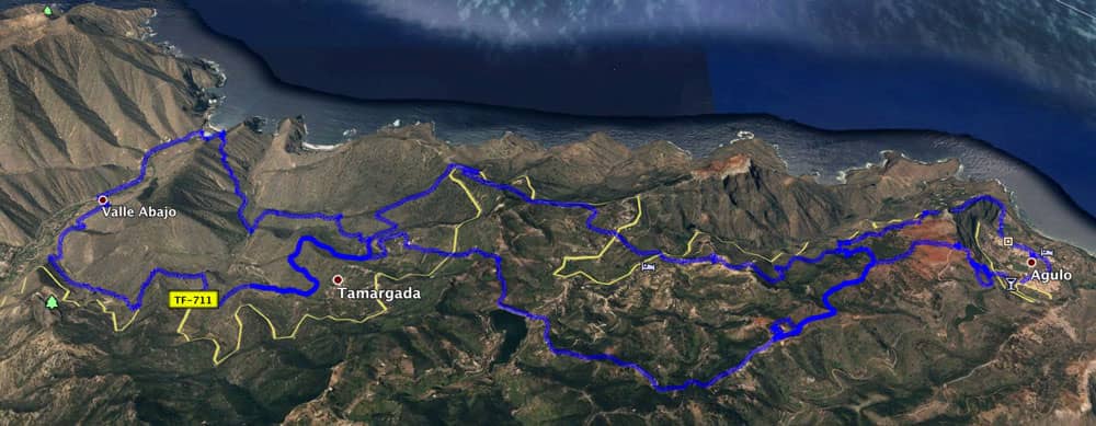
Track of the hike (in the middle) in combination with two other circular hikes on La Gomera
Variants:
This hike can be easily combined with various other hikes and circular walks in the vicinity.
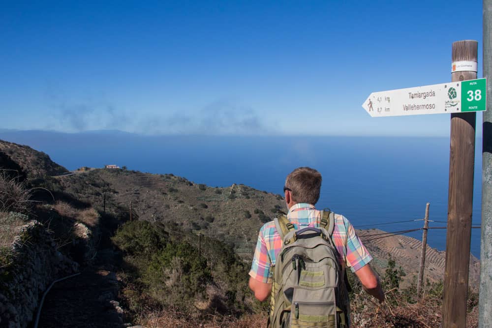
On the track you can see two more round tours in addition to this one. I have already described the round tour around Agulo here. And here you will find the round tour around Vallehermoso . You can combine all three tours as you like. A part of this hike between Pie de la Cuesta and Cañada Grande is the hiking trail GR-131/No. 38, which runs between Hermigua and Vallehermoso. You can therefore combine this section with a walk between these two places.
The same applies to the section between Cañada Grande and Las Rosas. This is part of the GR-132 trail, which also runs – but higher – between Hermigua and Vallehermoso.
I chose the entrance in Pie de la Cuesta and had to walk the way to the place Simancas double (way there and back). If you want to „save“ this small stretch and the hamlet Pie de la Cuesta, you can of course start the circular hike at any other place. This is the advantage of a circular walk.
View from Tamargada in the Barranco with the Roque El Cano
La Gomera circular hike around Tamargada
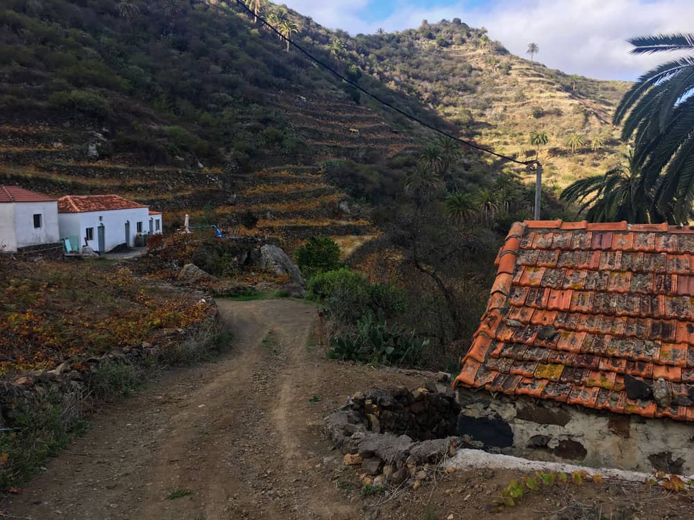
Section Pie de la Cuesta to Simancas
You start your hike in the small hamlet Pie de la Cuesta at the hiking board. Several hiking trails converge here. From here you can walk on different paths to Vallehermoso. On this hike you neither go down to the coast nor to Vallehermoso. It goes exactly in the opposite direction to the village Simancas (direction Hermigua, San Sebastian). You pass the small church of Ermita de la Caridad del Cobre. Behind the church, a small path leads uphill through reeds.
view to the Roque El Cano
The path is wide and well paved. After a short time the path ends at a crossroads. Turn right to the village of Mazapeces. Follow path no. 38 or GR 132 to the left towards Las Rosas and Simancas. On the left side of the slope, the path rises slowly. Already here you have a beautiful view over the whole valley below Tamargada up to the Roque del Cano. When you reach the top, circle the mountain and follow the path down the hillside to the first houses of Simancas. You will need about half an hour to get there.
Hiking path at Simancas
Section Simancas to Las Rosas
Before you reach the town centre, a signposted GR 132 path branches off to Las Rosas /far direction San Sebastian on the right-hand side. This small steep path climbs up and you quickly reach a wider road that takes you past the first houses to a road after some time. This small road (Calle Simancas) takes you up through the village of Simancas in wide arches. After about 20 minutes you will reach GM-1, which you will cross.

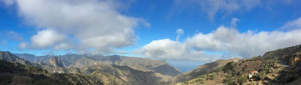
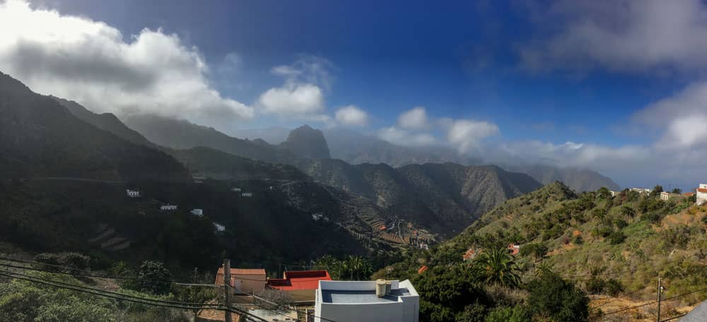
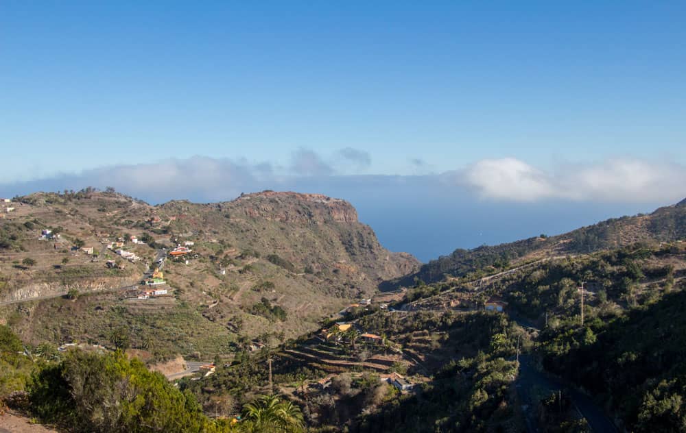
Panorama View Vallehermoso La Gomera
From here it’s quite steep on narrow paths up the mountain. But the hard climb is worth it. From the ridge there is a wonderful view back over the valley of Tamargada. And at the same time Las Rosas with the reservoir in the valley lies in front of you. At the top you will find a small road that will take you down to Las Rosas in a short time. At the first intersection there is a shady resting place with benches and tables. Maybe time for a little rest?
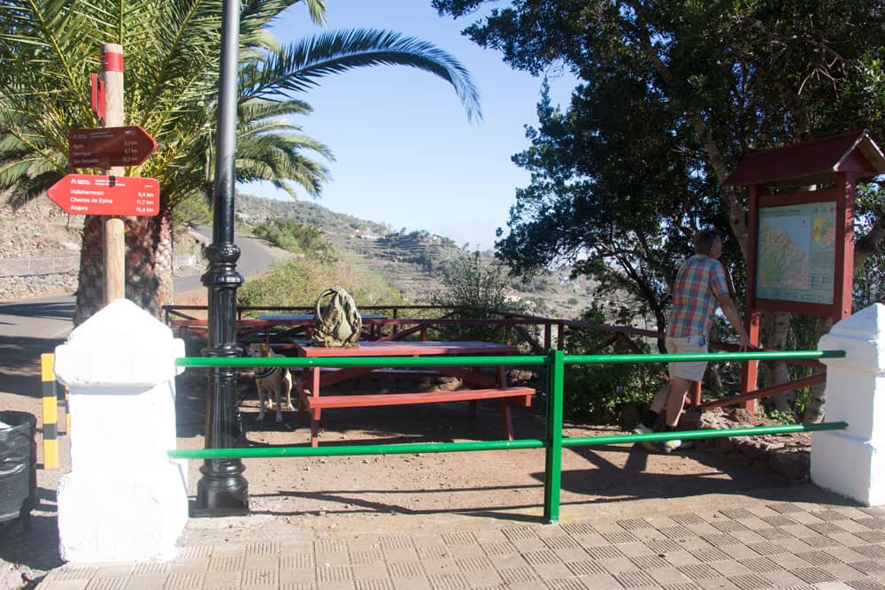
Resting space and hiking routes crossing in Las Rosas
Section Las Rosas to the Carretera Laguna Grande
At the rest area, the footpath continues to the left over a bridge in front of the dam towards the centre of Las Rosas. Once you have crossed the bridge, cross Calle Rosas. The path will take you straight ahead past some houses. After a short while you will come across a road again, which you follow up the hill to the right. Very soon the road makes a left turn downhill. There your path leads right away from the road.
View back - hights and mountain villages - north of La Gomera
Continue straight ahead into the forest. On narrow paths it goes steeply uphill for a while. At the clear height you can enjoy a wonderful view in all directions. Here the path forks. You keep left. The hiking trail continues through the forest and then along the edge of the forest with a wonderful view. Then you get through a small Barranco between houses back into the forest. Fields and forest alternate until you meet a road. This is the Carretera Laguna Grande.
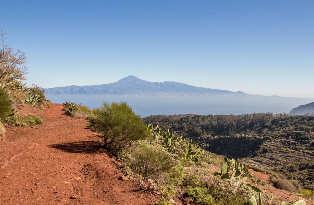
hiking path with view on Tenerife
Article summary and large selection of GPS hiking tracks
Sign up for my newsletter now and get exclusive access to my collected GPS tracks as well as all the brief information about my articles.
Sign up nowSection Carretera Laguna Grande to the hiking crossroads
At first the hiking trail runs through the forest parallel to the road. But then it continues for a while directly along the road. First houses appear and then you see the big restaurant Juegas de Bolas in front of you. A short time later you are standing directly in front of the visitor centre. If you haven’t visited it on other tours, it’s worth a visit.
well postsigned hiking routes
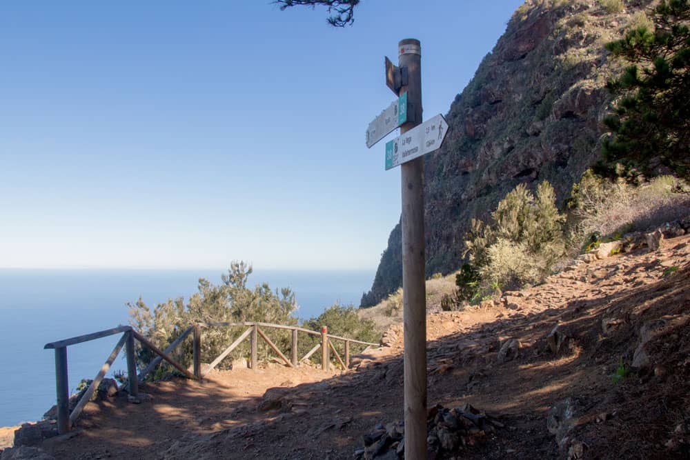
Now you are at 745 meters above sea level and have a wonderful view of the island landscapes around you. In the distance, if the weather is clear, you can see Tenerife lying with the Teide. In front of the visitor centre, the GR-132 footpath turns right towards Mirador Abrante. First a little uphill and then downhill along the hillside, the trail takes you about 20 minutes later to a large red crossroads.
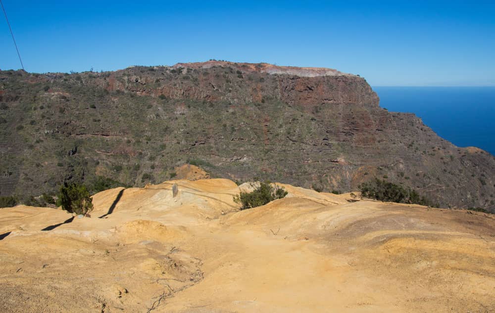
hiking over white rocks
Section of the hiking trail to the road via Las Rosas
Straight ahead, you can go to Mirador Abrante in 20 minutes. This circular walk will lead you down the rock steps in the eroded railing to the left. Furthermore you have wonderful views. After a short time your hike continues on stone steps, which lead you quickly downhill. In front of you lies the Barranco de las Rosas. About 30 minutes after the hiking crossroads at the top you come back to a hiking crossroads with a ruined house. To the right, the GR-132 continues towards Agulo. 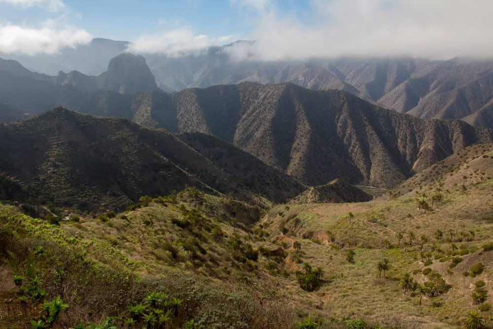
The hights around Tamargada with Roque El Cano
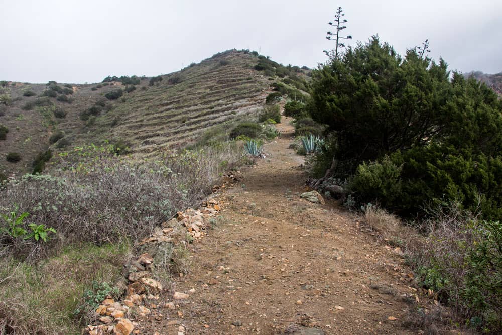
Keep left towards Las Rosas on the Camino El Pedregal. It always runs along the slope – partly through the forest and then again over sand and stone slopes with fantastic views. You will pass an abandoned house again and circle around a Barranco. The path then climbs steeply up to a clear hill with a cable mast and a view. You continue straight ahead. After a short time the path divides. Here you follow the path to the right. You descend over another plateau to a driveway.
Hiking Path Las Rosas
Section of road via Las Rosas to La Vega
Follow this road further down towards Las Rosas. After a short time, at the first houses of Las Rosas, the road turns into a street (Calle de la Tagora), which goes downhill to the right. After 5 minutes, the path turns right off the road. A narrow path descends through a small Barranco. Then you cross the GM-1 again. On the other side, not to be missed, the trail continues. First it leads you leisurely on a wide path to the left. But then it goes up the slope on the right very steeply on a small path.
Rugged rocks, mountain villages and the GM 1
This short very steep section ends again at the GM-1 next to the restaurant Las Rosas. Once again you cross the road and continue your way on the concrete path diagonally opposite. Between houses and fields, the last climb of this hike climbs up the slope to the hamlet of La Vega. First you go straight up on a road. Then the path turns right through fields to the houses of La Vega on the crest.
Hiking path 38 between Hermigua and Vallehermoso
La Vega section to path to Simancas
In the hamlet of La Vega on the ridge, cross a small road and follow the path straight ahead. Now you go along the right side of the hill above the GM-1, which will lead you along terraced fields for a while. After about 15 minutes you reach a free place on a ridge. Here you will find dilapidated houses and an old threshing floor. During my hike I met there also free-running goats.
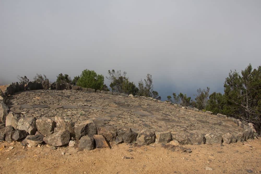
old threshing floor
From there you walk on a road in a short time down to the GM-1, which you now cross for the last time on this hike. You go left for a short time along the GM-1. At the first left turn a road branches off to the right, which you follow downhill. After a short time you reach a kind of open space. There a narrow path branches off to the left over a mountain ridge. Here it goes down quite steeply. Partly the path is a little overgrown and difficult to walk.
path - descent to Simancas
Section path to Simancas to Pie de la Cuesta
The section on the steep path to Simancas is a bit difficult, but offers beautiful views over the entire valley below Tamargada. Already from a distance you can see the tranquil village of Simancas below you. And then you reach the first houses. After a short time you will find yourself on Calle Simancas again. You cross the street.
Hiking path between Simancas and Pie de la Cuesta
On the other side of the road, the signposted path no. 38 will take you past Simancas. You cross the Barranco and finally reach the place where you climbed up from Simancas to Las Rosas in the morning. From here, all you have to do is follow path no. 38 in the direction of Vallehermoso (first paragraph).
descent to Simancas La Gomera
And finally
I hope you enjoyed this beautiful circular walk on La Gomera. The whole tour or parts of it as a great combination with other routes in the area. La Gomera is really an El Dorado for hikers. Have fun on your own hikes on the beautiful little Canary Island of La Gomera.
Dagmar von SiebenInseln