GR-132 on 130 kilometres along the wild coast of La Gomera
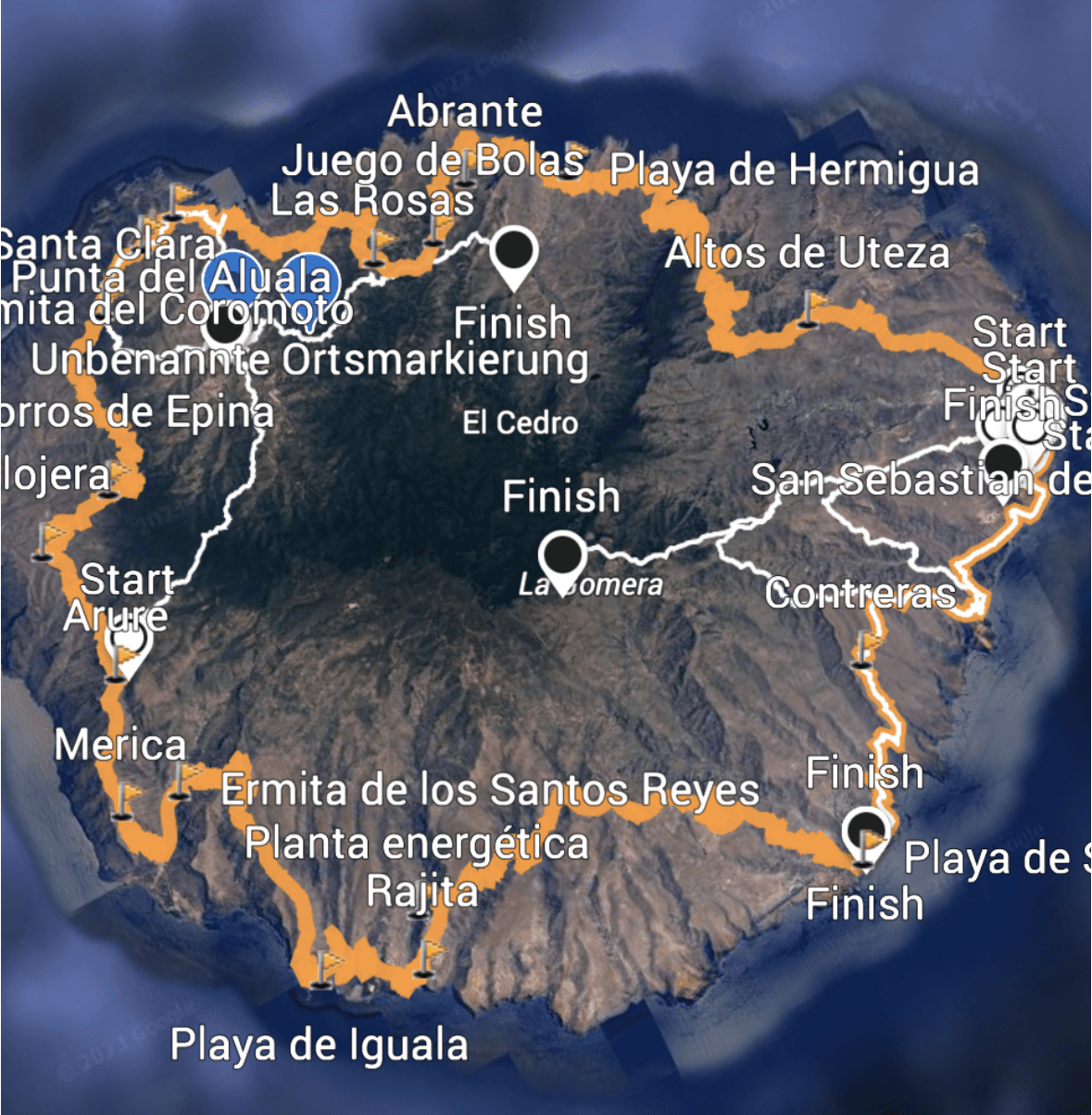
Track of the island hiking trail GR-132 - orange
Map
On La Gomera there are the GR-131 and GR-132 long-distance hiking trails. While the GR-131 runs through the centre of the island’s heights, the GR-132 hiking trail runs roughly parallel along the coast. I have described my hike on the GR-131 from San Sebastián over the heights of La Gomera to the Valle Gran Rey here. Now I would like to start describing the individual sections of the much longer GR-132 long-distance hiking trail.
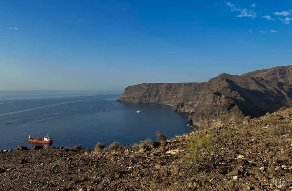
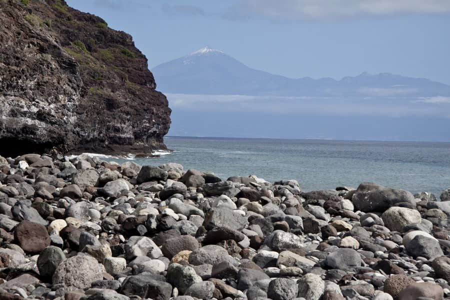
View of the coast from the GR-132 hiking trail - Playa del Cabrito in the background
Officially, it is approx. 130 kilometres long and divided into 8 stages. And if you follow these really challenging stages, you walk anti-clockwise around the island. I don’t know exactly why, but I decided to run clockwise around the island. That’s why we started with stage 8 of the GR-132.
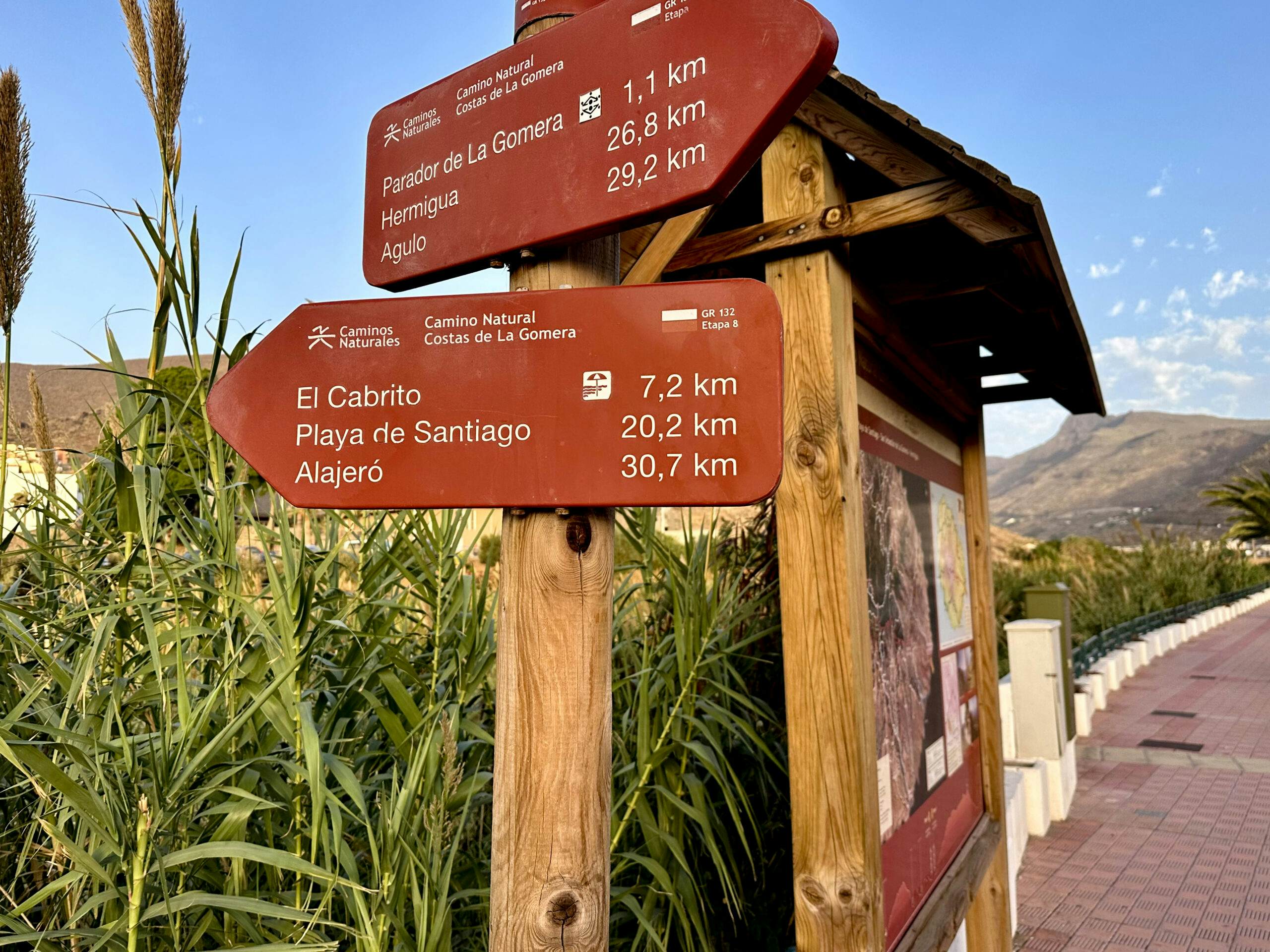
Hiking signs on the GR-132 stage 8 Camino Natural Costas de La Gomera
On the GR-132 from San Sebastián to Playa de Santiago
This section takes you on the GR-132 from the small capital of La Gomera, San Sebastián, to Playa de Santiago. The route is around 23 kilometres long and takes you steeply up and down through several ravines. Through the many barrancos, you have to overcome a total of almost 1100 metres of altitude. That’s a tough start, especially if you have to do it in the heat and in Calima (which unfortunately was the case for us).
If you want to divide this section into two parts, you can also book a room at the Hotel Finca Cabrito halfway along the route. The hotel is located roughly in the middle of the route. However, it is also the only option for accommodation and food or drink that you will have on this section of the GR-132. If you are hiking through to Playa de Santiago, it is advisable to book accommodation there in advance (unless you want to sleep on the beach or take the bus back).
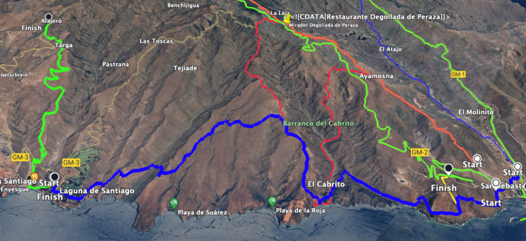
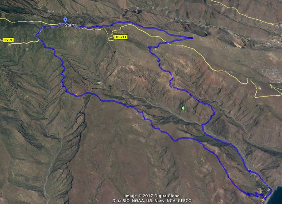
Track of the hike on the GR-132 stage 8 from San Sebastián to Playa de Santiago
General information about the hike on the 8th section of the GR-132 from Sebastián to Playa de Santiago
Starting point and approach
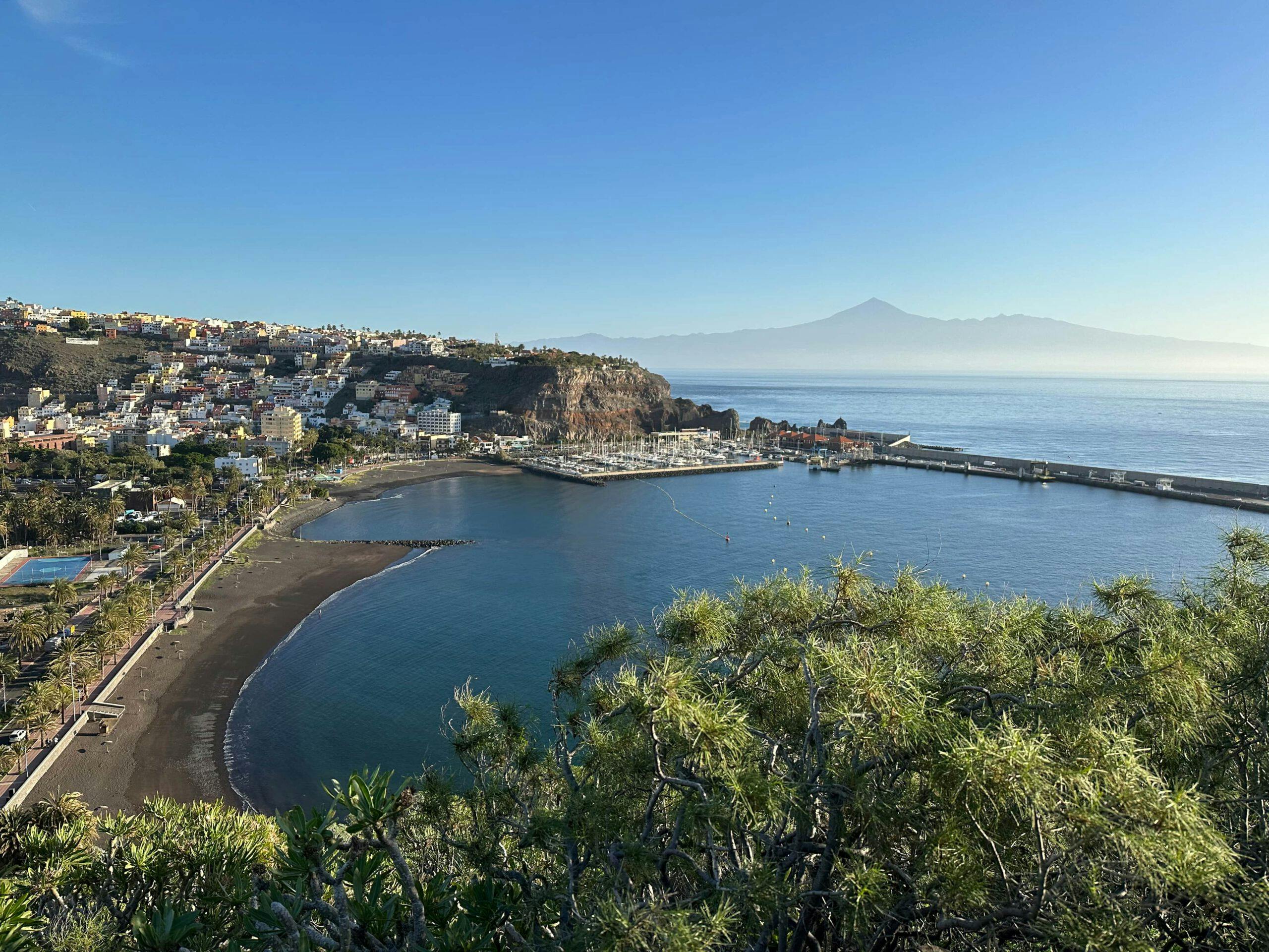
The hike starts in San Sebastián de La Gomera. You can of course start your hike anywhere in the city. However, the actual start of the GR-132 is in San Sebastián at the end of Calle Barranco la Concepción.
Getting there by car
You can drive to the starting point from anywhere on the island, as almost all roads ultimately lead to San Sebastián. There are car parks on the roads in San Sebastián.
Getting there by bus
If you want to travel to San Sebastián by bus from anywhere on the island of La Gomera, you will find the following information on the GuaguaGomera website for exact details of bus routes and times.
Time
I don’t like to give time estimates as these can vary greatly for different people and can be influenced by different circumstances (weather, closures etc.). We needed over 9 hours for this section. However, these hours include short breaks and a very long break in PlayaCabrito.
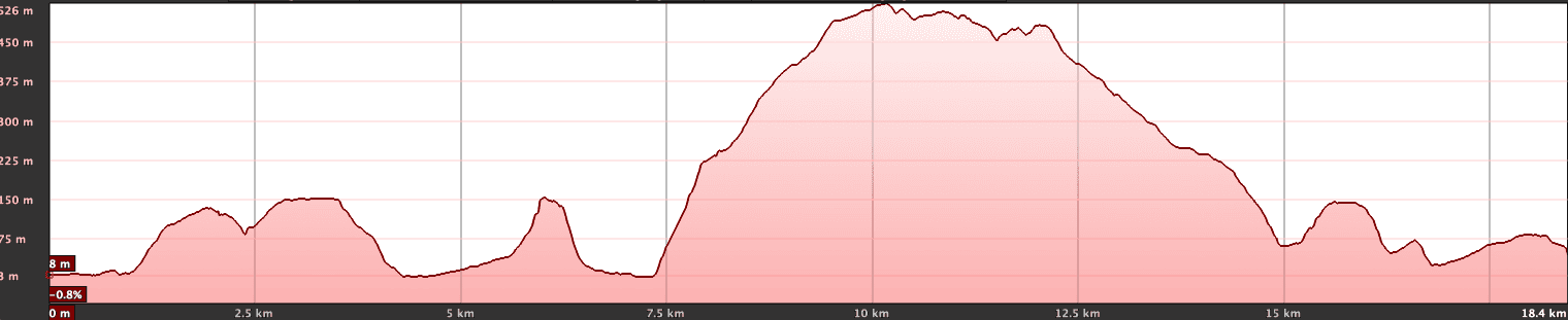
Elevation profile of the GR-132 stage 8 hike from San Sebastián to Playa de Santiago
Elevation gain and route length
Article summary and large selection of GPS hiking tracks
Sign up for my newsletter now and get exclusive access to my collected GPS tracks as well as all the brief information about my articles.
The route is just under 23 kilometres long and the elevation gain is just under 1100 metres.
Requirements
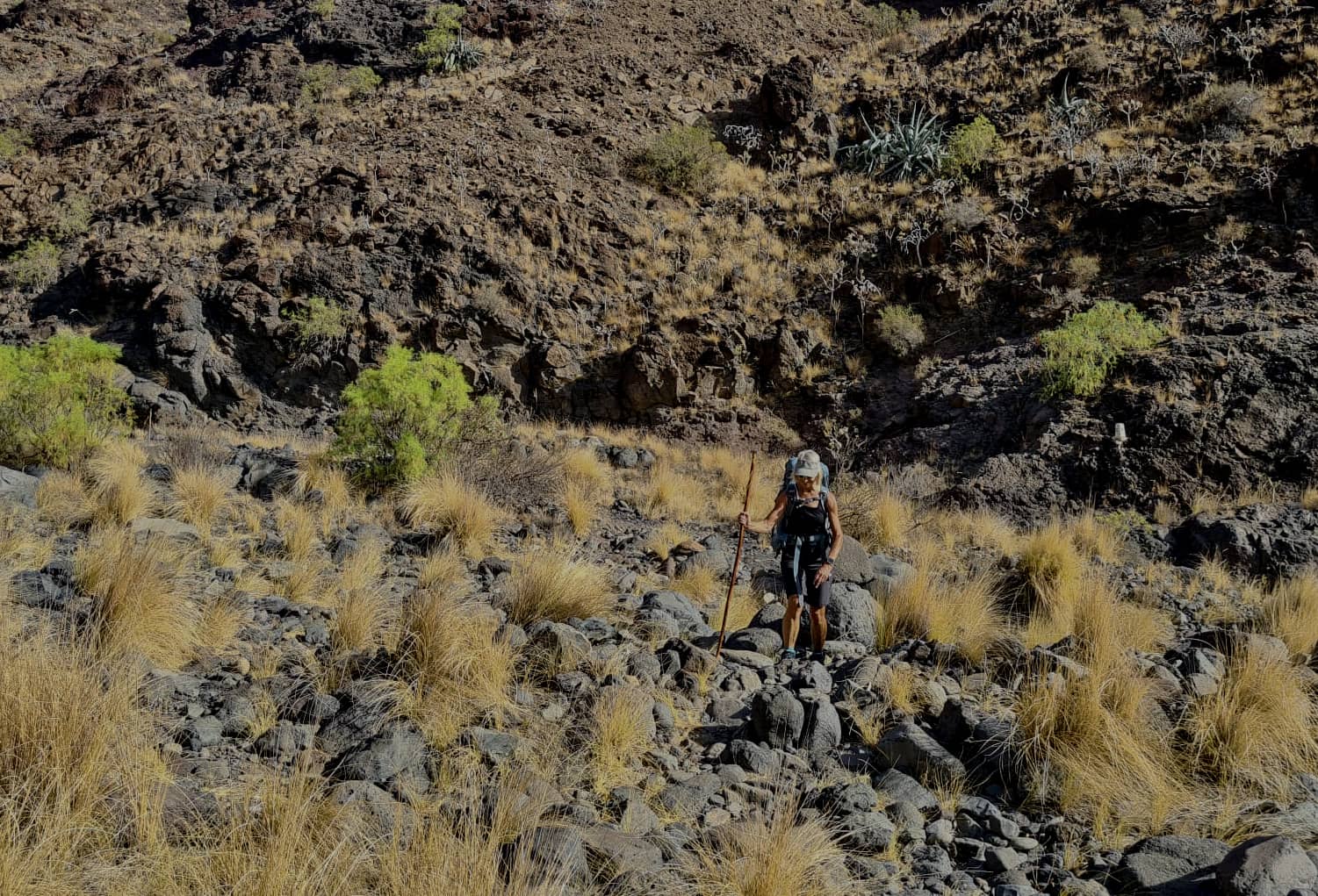
The hike follows the well-known GR-132 hiking trail, which means that the hiking trails are generally well laid out. Nevertheless, you should have a head for heights and be sure-footed in a few places. However, a very good level of fitness is essential for this long and really strenuous section of the route.
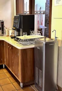
Water dispenser at the Hotel Finca Cabrito
In any case, you must have enough water with you. I had 4 litres with me and had used it up by the end, which had never happened to me before. However, it was also extremely hot on our tour through the Calima.
Refreshments
You can only stop for refreshments halfway along the route at the Hotel Finca Cabrito. You can also refill your water bottles there free of charge.
Variants
There are only variants for this section of the route in that you can stay overnight at the Hotel Finca Cabrito halfway along the route.
If you don’t want to walk this route but would like to visit the remote El Cabrito beach, you can also just walk there and then return from there by boat.
Track of the circular hike El Cabrito
From the Degollada de Peraza, there is also a long circular walk to Playa de Cabrito, which I have described on SiebenInseln.
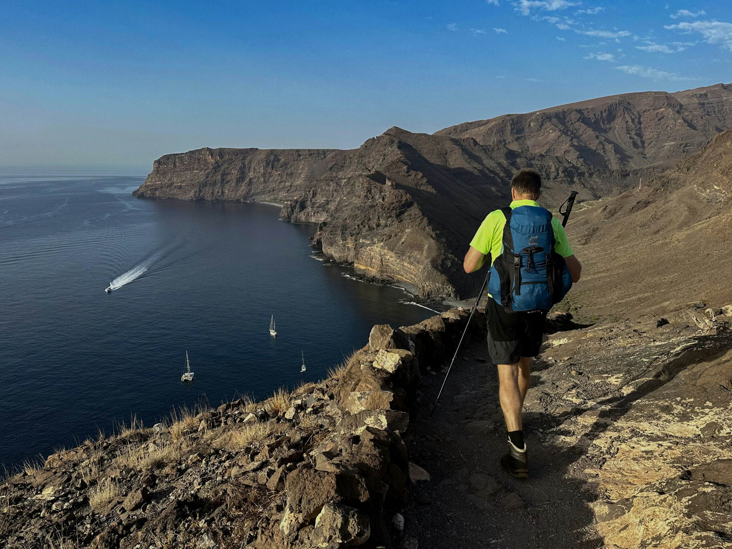
Hiker on the GR-132 hiking trail high above Playa de La Guancha
Circular walk La Gomera on the GR-132 – Part 1 from San Sebastián to Playa de Santiago
San Sebastián to Barranco del Revolcadero section
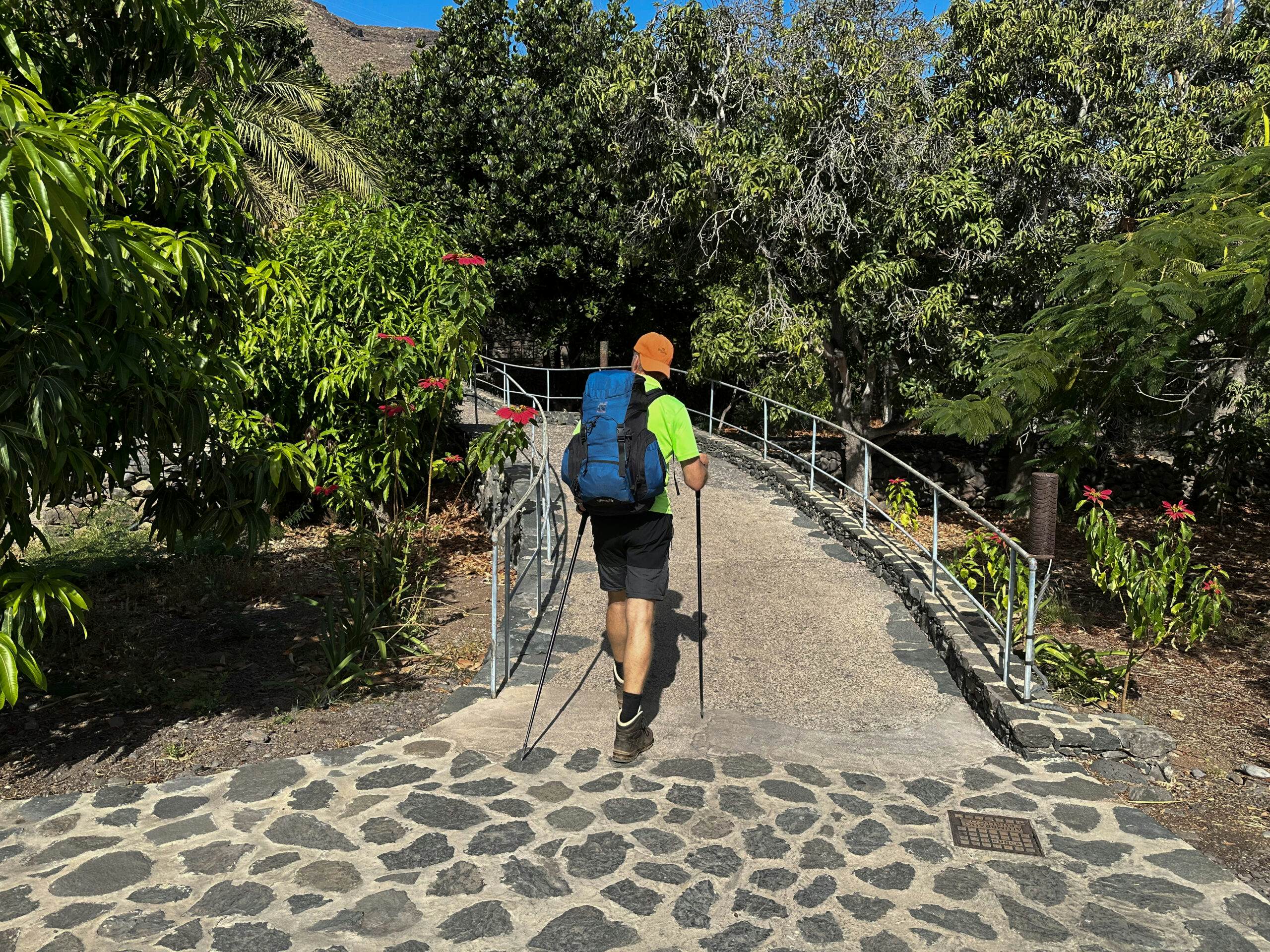
You start your hike in the town of San Sebastián de La Gomera and then keep to the left. There you will already see a figure of Christ high up on the mountain, looking over the harbour. At the end of Calle Barranco la Concepción there is a hiking sign pointing to the GR-132 Etapa 8 – Camino Natural Costas de La Gomera. Leave the road here and climb up the hiking trail.
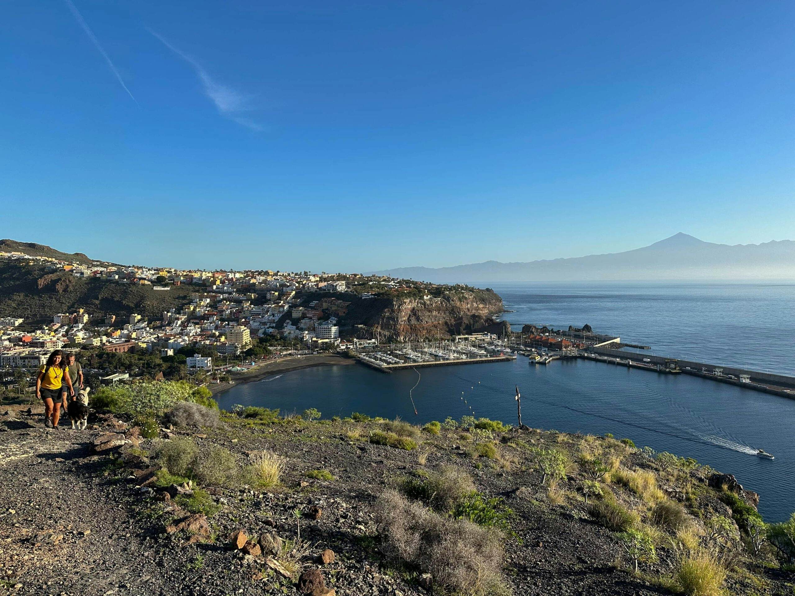
View back from the hiking trail to San Sebastián and Tenerife with the Teide
You quickly gain height and can soon look back over the city and the harbour. Then you walk around the mountain and follow the hiking trail that runs below the statue of Christ. You soon reach the first gorge, which you will follow on this hike. You hike down into the Barranco del Revolcadero, cross it and hike uphill again on the other side.
Crossing the Barranco de la Guancha
Barranco del Revolcadero section to the ridge between Barranco de la Guancha and Barranco del Cabrito
On the ascent, you will come to a path that branches off to the right. It leads up to GM-2. However, you continue straight ahead and can enjoy beautiful views of the coast. Behind the next bend, you can already see Playa de La Guancha ahead of you. Hike down into the next gorge and cross it. You then descend to the Playa de la Guancha.
View from the steep ascent path over the Barranco de La Guancha to the ridge
There you walk parallel to the beach past a house. The path then turns away from the beach and into the Barranco de la Guancha. For a while, you walk parallel to the dry stream of the gorge. It goes slightly uphill. Then the path crosses the stream to the left and a steep climb follows. You climb up the path to the ridge above you between the Barranco de la Guancha and the Barranco del Cabrito.
Article summary and large selection of GPS hiking tracks
Sign up for my newsletter now and get exclusive access to my collected GPS tracks as well as all the brief information about my articles.
Hiking crossroads on the ridge - the descent path to Playa del Cabrito begins here
Ridge section between Barranco de la Guancha and Barranco del Cabrito to the ascent path towards Morales
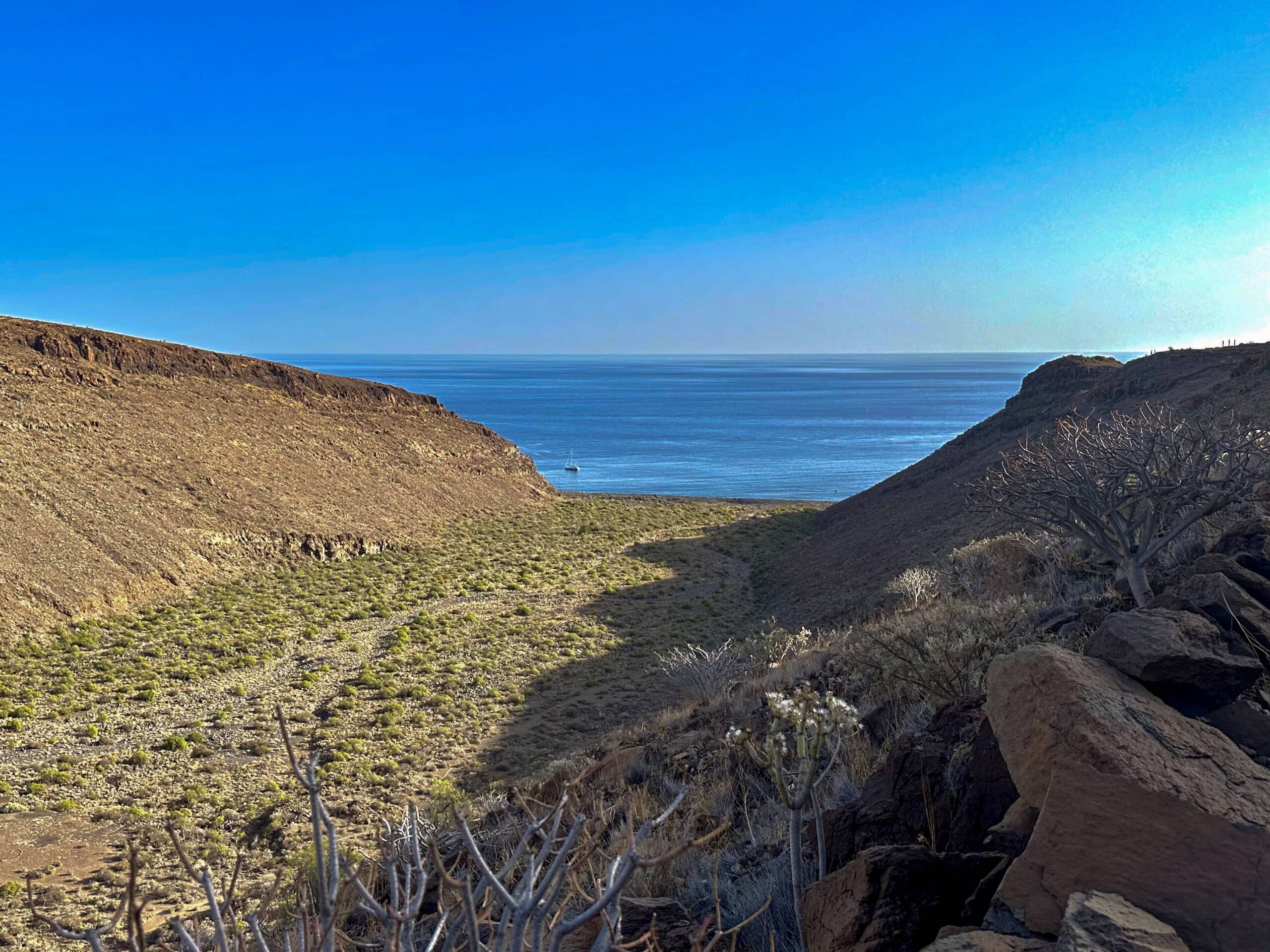
You will find signposts at the top of the ridge. You can also hike further up the ridge (circular hike El Cabrito). But for the GR-132, keep left and descend a long way down into the Barranco del Cabrito. Once at the bottom, take Calle el Cabrito to the beach and the hotel. Here you can top up your water bottles and perhaps take a longer break.
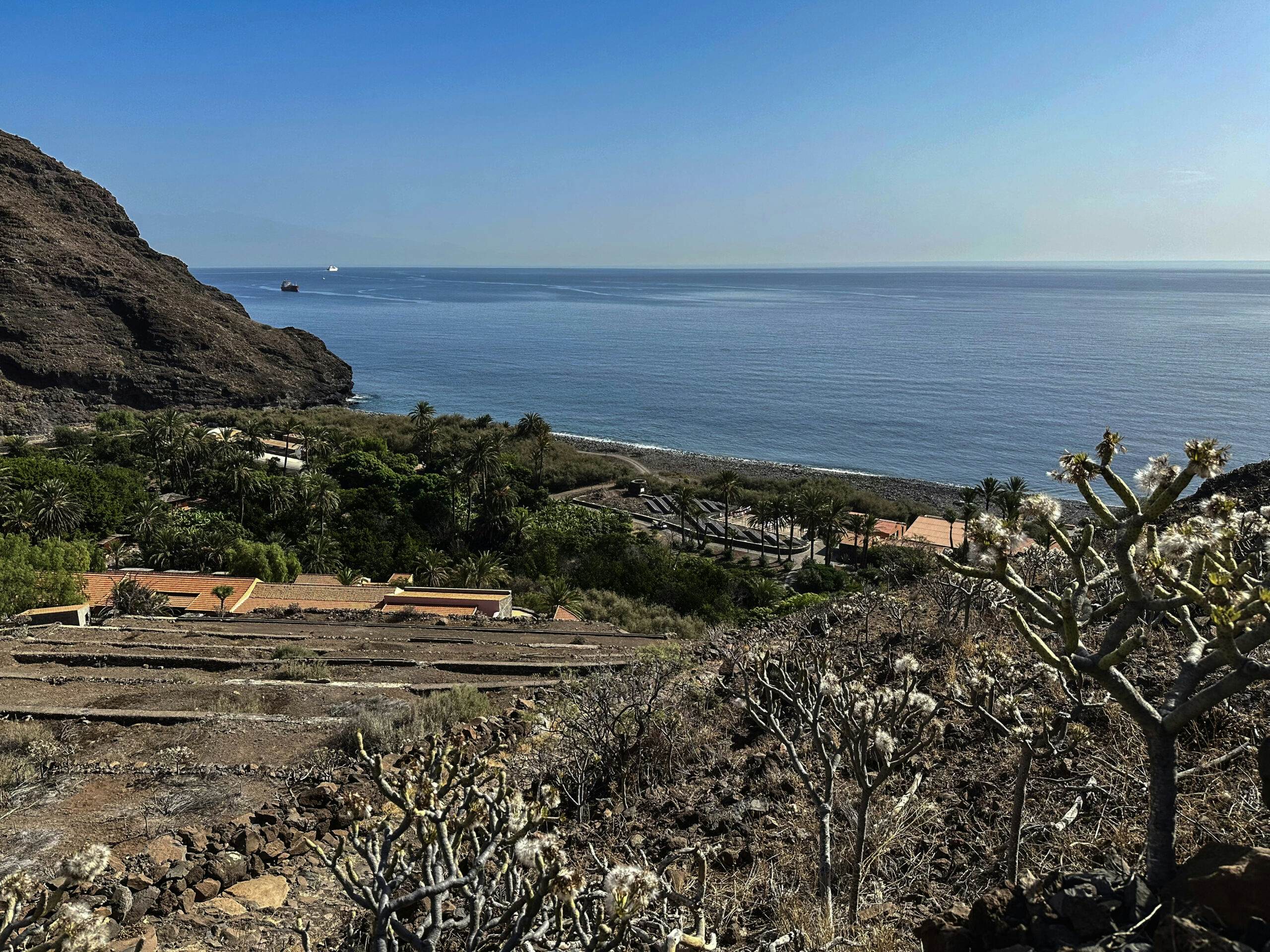
El Cabrito beach with a view of the Teide towards Tenerife
This is followed by a very steep ascent. You follow the GR-132, which is also hiking trail 28 here, between gardens and along a rock face. Then turn left and continue uphill on a walled path towards Morales. This path leads you onto another steeply ascending cobbled path that branches off to the left of the first path. The path forks, keeping to the left. At another fork, turn right. If you look back, you can enjoy a wonderful view of Playa del Cabrito from above.
Ascent path from Playa del Cabrito
Ascent section towards Morales to the Morales GR-132 junction
After about 30 minutes of hiking uphill, you will reach the ridge, which you now follow. For the next half hour, continue along the hiking trail, which initially runs to the left a little away from the ridge. Later, the path returns to the ridge. Here you will come across a hiking trail that crosses the path and leads up here from the Barranco Juan de Vera. Now you are already so high that you can see the airport and the area around Playa Santiago on the left.
View from the ascent path back to Playa del Cabrito
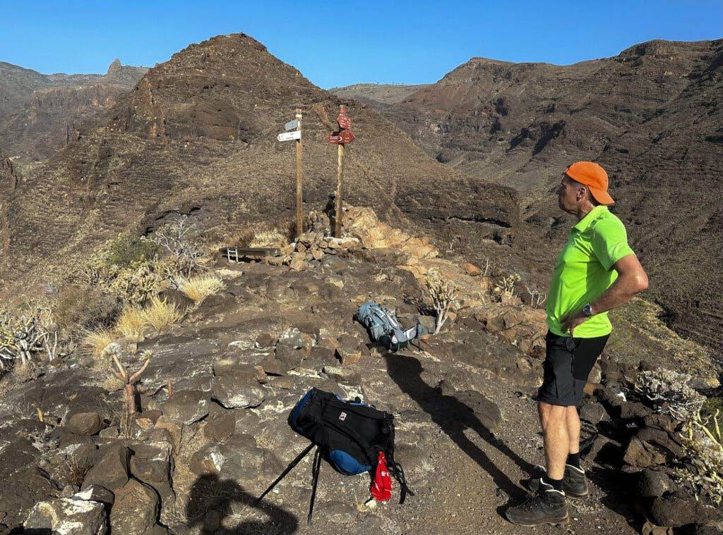
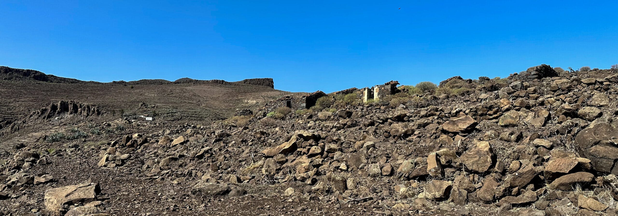
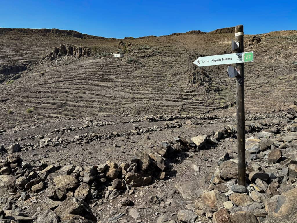
Finally you come to the deserted village of Morales. You can already see the houses ahead of you for some time. The hiking trail then leads you directly through the lonely village past the houses. For example, you will also see an old threshing floor and a house with a large stone oven. At the end of the village, when you have passed the last house, the GR-132 hiking trail – also 27 – branches off to the left towards Playa de Santiago.
from the distance you can already see the abandoned houses of the hamlet of Morales
Section at the Morales junction GR-132 to Barranco Chinguarime
From the junction, the trail initially goes downhill a little and in some places also holds altitude around the Barranco de Morales. A long but not very steep ascent follows on the other side. Once you have crossed the mountain on the hiking trail at the top, you will see another barranco in front of you. You also cross this Barranco del Guincho and reach the Lomo de Contrera on the other side. You come to a hiking trail, which you follow round to the right past the deserted village of Contreras.
Turn-off at Morales in the direction of Playa de Santiago
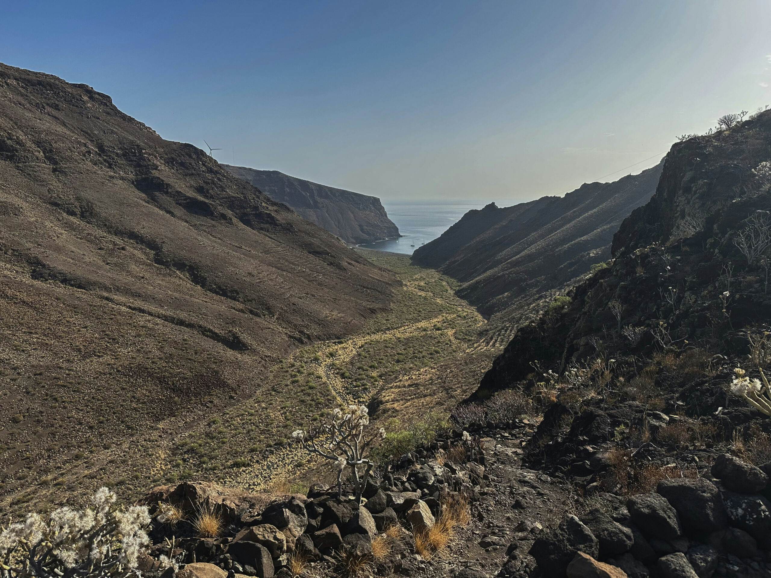
From Contreras, you now hike downhill for quite some time. The hiking trail then turns right and takes you to the edge of the mighty Barranco Chinguarime. You now descend into it. Once at the bottom, you cross the gorge on a path. A track then begins, which takes you up the other side of the Barranco. After a short time, the GR-132 branches off to the right uphill from this track.
Barranco Chinguarime section to Playa de Santiago
Above the Barranco Chinguarime, you reach an inhabited ridge. The descent into the next gorge, the Barranco Tapahuga, begins again on the opposite side. In between, you cross a road on the descent. Once you reach the bottom of the gorge, cross the wide Barranco valley on a straight path. This brings you to Calle Playa de Santiago. Turn left to the beach. But follow the road uphill to the right.
View back to the Barranco Chinguarime
Once you reach the top, the road takes you for quite a while below a large hotel complex and close to its golf course. At the end of the road, you will finally reach the main island road GM-3. You have now reached the upper part of Playa de Santiago. To get to the town, take the GM-3 or alternatively go down the stairs. It’s probably time for you to rest a little now too.
View of Playa de Santiago with the GM-3
And finally
I hope you enjoyed this first section of the GR-132. From here, continue on the GR-132 to Alojeró. After this hike, however, you will probably stay in Playa Santiago and fall into bed very tired like me. I hope that you will continue to follow me on the GR-132 and wish you lots of fun on all your hikes,
Dagmar from SiebenInseln
Thank you for reading!
If you've found my hiking guides on SiebenInseln helpful for your Canary Islands adventures, please consider leaving a small tip. Your support is greatly appreciated and helps cover the costs of maintaining this blog.