Today’s La Palma round trip takes you from the height of the Cumbre Viaja past volcanoes down to the coast to the southern tip of the island. Some time ago I wrote here about the famous Ruta de los Volcanes, about which the Ultramarathon Transvulcania takes place every year. Also today’s hiking route is another part of this marathon. The start for the marathon is the southern tip of La Palma at the Faro de Fuencaliente. There at the Atlantic you will find salt fields, lighthouses and beaches inviting for a swim. 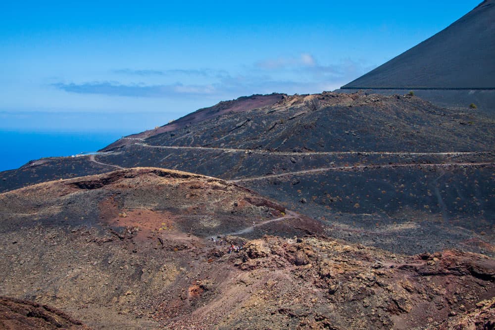
Hiking routes around the volcanos San Antonio and Teneguía
Map
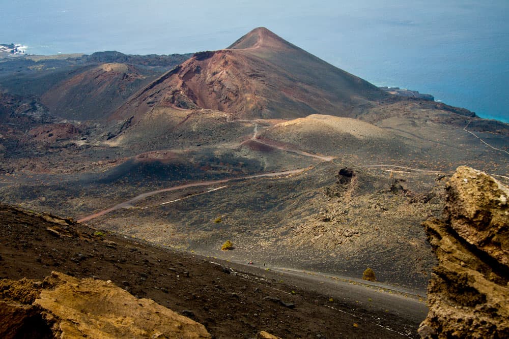
The south of La Palma – green pine forests and dark lava flows
The south of the Canary Island of La Palma is of younger volcanic origin than the north. More than 120 volcanoes can be found along the Cumbre Viaja, which stretches from the Refugio del Pilar to the southern tip of La Palma. The landscape is marked by black sand landscapes, lava flows, pine and laurel forests. Below the most southern place of La Palma are the striking volcanoes San Antonio and Teneguía. At the volcano San Antonio a visitor centre has been established and the crater rim can be climbed from there.
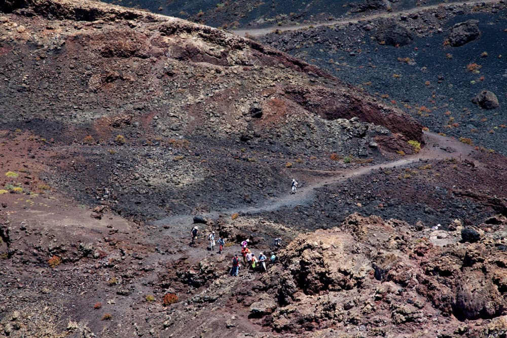
Hiking group at the foot of Volcano Teneguía
The volcano Teneguía did not erupt until the year 1971, so that actually there is still a smell of sulphur in the air. But on the tour you will not only see volcanoes. At the southern tip you will meet lighthouses and salt flats. And if you like, you can take a refreshing swim in the Atlantic Ocean. The two beaches Playa Nueva and Playa del Faro are in close proximity to the lighthouses.
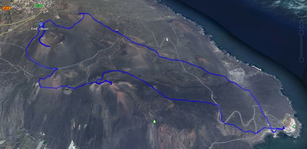
Track of the circle hide from Volcano San Antonio via Faro de Fuencaliente
Information about circle volcano tour
Place of departure
Los Canarios (Fuencaliente), Centro de Visitantes Volcán San Antonio – Parking spaces available at the Visitor Centre (chargeable) and in front of the entrance on the road.
Visitor Centre
Opening hours: daily 9.00 – 18.00 h and in summer from 9.00 – 21.00 h
Phone: +34 922444616

Visitor Center Volcano San Antonio
Costs: Parking and entrance together cost 5€. If you do not want to visit the visitor centre and do not want to walk on the edge of the volcano, you can also park on the street not far from the visitor centre.
Arrival by bus
Bus lines 200, 201 and 203 stop in Los Canarios. Further information buses on La Palma on the Homepage of TILP. Arrival by car
You can get to Los Canarios from the direction of Inselosten on the island road LP-1 and on LP-2 from the west side of the island. You can park on the main road or on the side roads if you want to see the town first.
There are good signs to the starting point, the Visitor Centre, which is outside the town centre. In the centre of Los Canarios take the LP-209 towards the coast. The Visitor Centre is on the left side of the road.
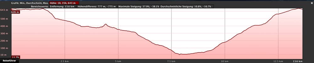
Elevation profile circle hike San Antonio via Faro de Fuencaliente
Difference in altitude
630 vertical meters in descent and ascent, absolute: 790 vertical meters
Time and length
The circular hike is 14 kilometres long. You should plan about 6 hours with a visitor centre and breaks.

Hiker on the path through lava
Article summary and large selection of GPS hiking tracks
Sign up for my newsletter now and get exclusive access to my collected GPS tracks as well as all the brief information about my articles.
Sign up nowRequirements
All in all, it is an easy hike on good hiking trails. The ascent to the volcano Teneguía requires sure-footedness. Special care should be taken in places exposed to the wind (e.g. volcanic ridges). Please do not climb the Teneguía in bad weather and strong winds.
Refreshment
In Los Canarios there are several restaurants and bars. There is also a restaurant (El Jardín de la Sal) near the saltworks at the Faro de Fuencaliente. On the way in between there is no place to stop. Therefore, think about sufficient water and food.
Variants
- 1.0
The tour can be done with a visit to the Centros San Antonio and a walk on the edge of the volcano and of course without it.

signposted hiking routes
Directions: – by car via LP-207
2. If you prefer to start with an ascent, you can also start the tour in Faro de Fuencaliente.
– by bus: line 203 (Los Canarios – Faro de Fuencaliente)
3. Those who want to see both volcanoes but prefer a shorter tour can return to the starting point after the ascent of the volcano Tenguía on a shorter round tour (without coast) around the volcano San Antonio.
4. Those who only want to walk downhill hike from Los Canarios to the Faro de Fuencaliente and take the bus back.

View on Los Canarios and the Volcano San Antonio
Circular walk from Los Canarios over the volcano Teneguía and Faro de Fuencaliente
Start of the hike at the Centro de Visitantes Volcán San Antonio
If you would like to skip the visitor centre, which is subject to entrance fees, you can read on in the next section. But in my opinion, a visit of the centre with a following volcano ascent is worthwhile in any case. In the museum itself you can learn a lot about volcanology and especially about the volcanic activities on La Palma. In the Centro you can inform yourself about the more recent volcanic activities on La Palma by means of models, display boards and films (also in German). Especially interesting are the films of the eruption of the volcano Teneguía in 1971.
View on the Volcano Teneguía
Immediately next to the visitor centre, a path leads to the crater rim of the volcano San António, which erupted in 1677. The edge of the volcano is only half walkable. You climb from 630 to 657 meters of altitude up to the surveying column. On the whole way you can not only look continuously into the inside of the crater, but you also have an impressive view over the whole south of La Palma. At the surveying column, however, visitors have to turn back for nature conservation reasons.

Volcanic landscape in the south of La Palma
Section Centro de Visitantes to volcano Teneguía
The hike continues along the GR 131 trail, which starts right next to the car park. From here, follow the signs for Faro de Fuencaliente. The path then descends in steep serpentines along the volcanic slope. In about 10 minutes you will reach a dirt road. The trail leads you down to the left and offers impressive views of the south of La Palma.

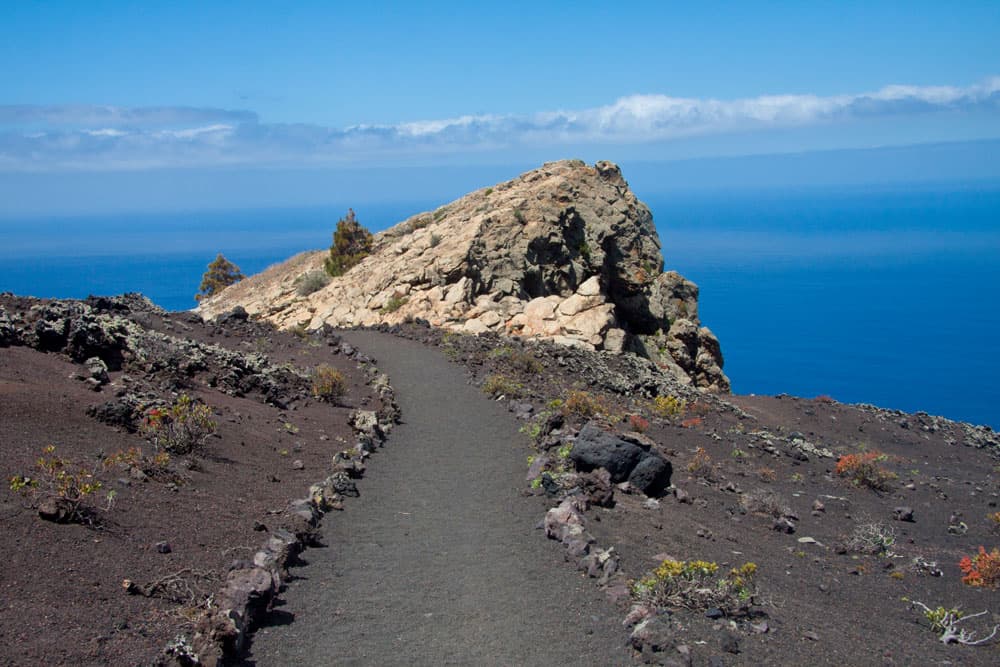
The hiking route in the south of La Palma passes the Roque Tenguía
After a short time you will see the bright Roque Teneguía on your right. Shortly thereafter, a path marked with stones leads from the slope to the right down towards the volcano Teneguía. Before the Roque Teneguía, which you reach after a short time, you turn left. The path goes uphill for a short time and then through a slope parallel to a water channel. Finally you cross this one at a water reservoir. From there you follow the road below the reservoir, which will take you in a short time to a kind of parking lot at the foot of the volcano Teneguía.

View from the hight to the west cost of La Palma
Ascent to the Teneguía Volcano
From the foot of the volcano Teneguía, on the right side, there is a clearly marked path that slowly leads up to the crater edge of the Teneguía in several bends and hairpin bends. The rock next to and in front of you glows in all possible shades and you will pass several hot spots on your way to the summit. Here the volcano erupted only in 1971. You are at the site of the recent volcanic eruption on the island of La Palma.
path with rows of stones for the Roque Teneguía
Article summary and large selection of GPS hiking tracks
Sign up for my newsletter now and get exclusive access to my collected GPS tracks as well as all the brief information about my articles.
Sign up nowOver a narrow ridge, which you should avoid during storms and bad weather, you finally reach the summit of the 438 meter high volcano Teneguía. From up there you can enjoy a fascinating view of the neighbouring islands La Gomera and El Hierro as well as the southern tip of La Palma. From up here we return to the foot of the volcano.

A small ridge leads to the top of the Volcano Teneguía
Section volcano Teneguía up to the Faro de Fuencaliente
Shortly before you reach the foot (parking lot) of the Teneguías, the GR 131 takes you around to the right. The main road is marked with stone rows. You cross a large lava field and continue at the end at the edge of it. At a fork in the road, turn right on a narrower path over another lava field. After you have also left this lava field behind you, the path will lead you down towards Faro de Fuencaliente after some time.

Dark volcanic soil characterizes the landscape of the south of La Palma
Follow the path and after about 30 minutes you will come across a road. Turn right and after a short time you will find the continuation of the trail on the opposite side. Once again it goes downhill until you meet the road you cross again. The southern tip of La Palma is now directly in front of you. You walk towards it and cross a road a third time. A few minutes later you are at the Faro de Fuencaliente.

Hiking route down to Faro de Fuencaliente
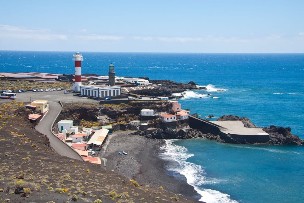
Faro de Fuencaliente – lighthouses, salt flats and water
Here at the Faro de Fuencaliente you will find the bus stop of the bus line 203. Those who do not want to walk any more can also take the bus from here back to Los Canarios. At the Faro de Fuencaliente, at the southern tip of La Palma, a rest is worthwhile in any case. The older lighthouse was renovated there in 2006. It is a visitor and information centre of the marine reserve of the island La Palma and a marine museum. Next to it is the newer lighthouse from 1985.
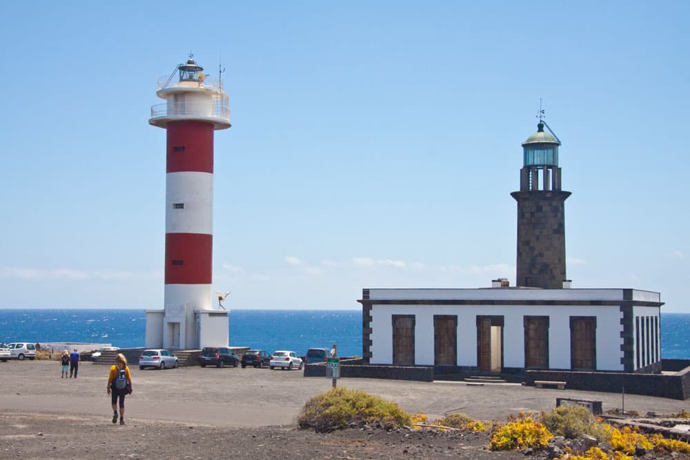
lighthouses Faro de Fuencaliente
Then there are the bright white salt saltworks to admire. The restaurant El Jardín de la Sal is right next door. If you want to know more about the saltworks and the salt production, you can do this on the homepage. And those who can use a bath in the Atlantic Ocean for refreshment can enjoy this at the small Playa del Faro or at Playa Nueva. 
Salt flats at the Faro de Fuencaliente
Section Faro de Fuencaliente – LP 207 (road crossing)
The way back goes first over the road in east direction. After a few minutes, there is a dirt road on the right that leaves the main road in the direction of Las Cabras. At first it always leads you in the direction of windmills that cannot be overlooked. There the path forks and you pass a gravel pit, which you leave on your left. For you it goes up the hill on the left.

Windmills on the south coast of La Palma
Here you will come across red and white red marked small columns, which you will encounter several times on the way on and which you can follow. Keep left at the next fork. After another 100 metres, turn left again up the slope. The red and white red columns point the way. From here it goes steeply uphill. It gets really exhausting again. After about 30 minutes you cross a road, the LP 207.

on dark earth the hiking trail leads uphill
Section LP 207 (road crossing) – parking Volcán San Antonio
After you have crossed the road, you continue up the mountain. After some time you will come to a wider road, which you follow uphill. Half an hour later you reach a plateau. Here mainly wine is cultivated. Shortly afterwards the hiking trail crosses a road again and after a few minutes you’ll find yourself again at a crossroads.
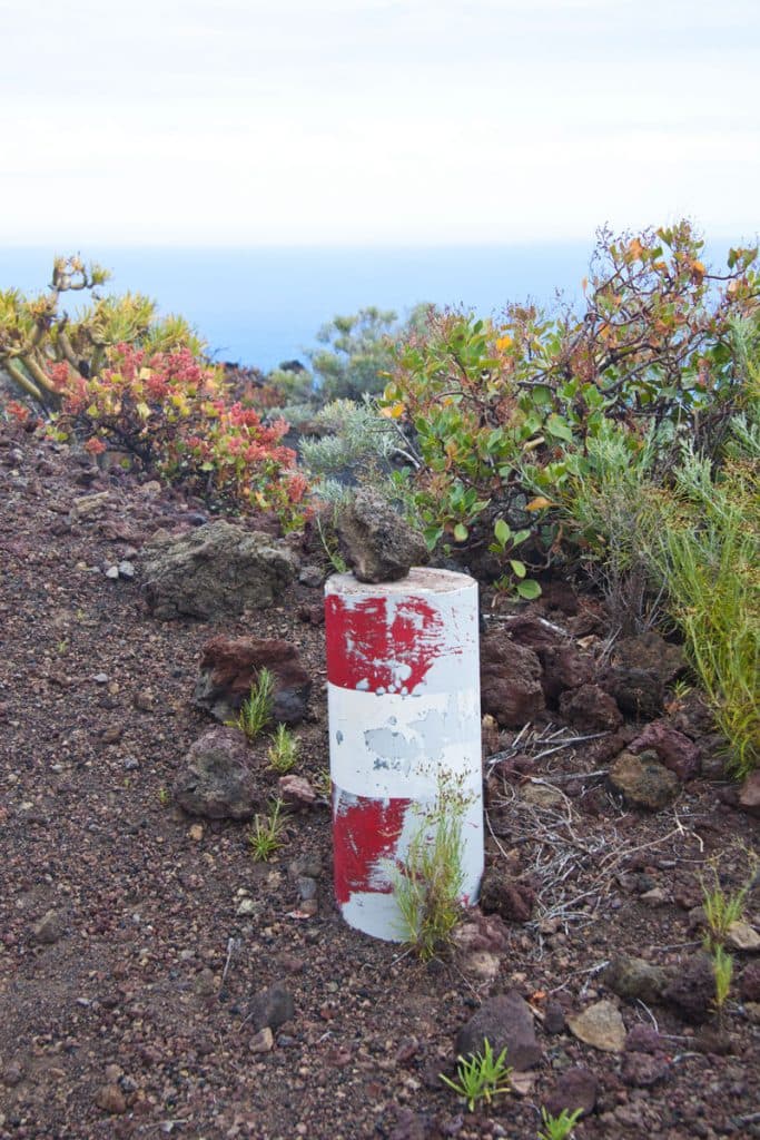
red white red marking column - La Palma
Here, from the left, there is the hiking path that leads directly up from the volcano Teneguía. You keep straight on and follow the path for about 30 minutes through the vineyards. It goes steeply uphill until you reach a valley. On the left there is a volcanic vent. After a short time you reach a crossroads. Turn left here. Now follow the path through the slope. From here there are wonderful views of the southern tip of La Palma with its volcanoes. When you have reached the hill, you continue on the road, which soon leads you to the left around to the starting point, the parking lot.
Option: From the volcano Teneguía to the starting point, the car park at the visitor centre San Antonio.
Those who only want to see the two big volcanoes but do not want to descend to the coast, follow the tour description exactly until after the ascent of the volcano Teneguía. Then, at the foot of the volcano Teneguía, you follow the road uphill again. After approximately 15 minutes you arrive at a large fork in the road. Here you keep to the right. Shortly thereafter, another fork follows, where you turn half left. After a few minutes you will come to a crossroads.

piste road
From the right you come to the hiking trail that leads up from the coast. Keep close to the left and follow the path for about 30 minutes through the vineyards. It goes steeply uphill until you reach a valley. To the left is a volcanic vent. After a short time you reach a crossroads. Here you turn left. Now you follow the hiking path through the slope. From here there are wonderful views of the southern tip of La Palma with its volcanoes. When you have reached the hill, you continue on the road, which soon leads you to the left around to the starting point, the parking lot.
And finally
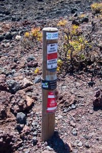
La Palma - hiking mark
I hope that you enjoyed this beautiful circular walk and wish you much pleasure in discovering the southern tip of La Palma.
Dagmar von SiebenInseln