This circular hike starts in the small village of Aldea Blanca, which lies about 200 metres above the south-east coast of the island of Tenerife. Aldea Blanca means white village. The town has around 1,000 inhabitants and has its own parish. The big castle is conspicuous and does not fit into the Canarian landscape and history. Tourists who want to watch „Canarian knight games“ are brought there.
Map
hikers on the trail - Aldea Blanca
hiking path at the street - San Miguel de Abona
More interesting from a historical point of view are the many informations you get about the geology, landscape and agriculture of this southern part of the island during your hike. All the way from Aldea Blanca to the larger town of San Miguel de Abona there are signs and interesting signposts. The larger town of San Miguel, with over 15,000 inhabitants, has many old Canarian buildings, tranquil alleys and pretty restaurants. It is situated at an altitude of about 600 metres.
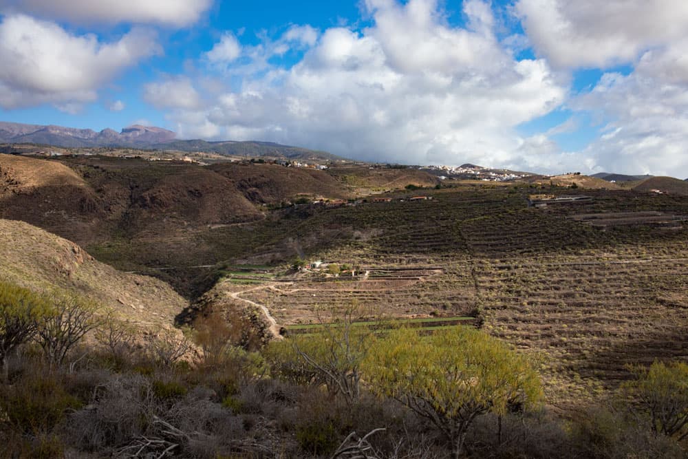
Calle Caserio la Hoya - hiking trail Aldea Blanca to San Miguel
Aldea Blanca to San Miguel – an educational trail about history, culture and geology
The first settlement in the area around San Miguel de Abona was called La Hoya. There you hike through on this round tour. The first settlers settled there because the village is surrounded by water springs and is well suited for the cultivation of agricultural products. It was also well hidden, so pirates sailing around the island could not see it. But millions of years ago the geological history of the Canary Islands began well before this time.
Aldea Blanca and coastal view
There are more than 20 volcanoes in the area around Aldea Blanca and San Miguel. These were all active and their lava, which flowed over the ground, was the basis for the later agriculture. The soil covered by the lava had to be removed later by the first inhabitants. Then new soil was applied and the agricultural use of the area began. Even today you will discover small terraced fields, but also huge vegetable growing areas in the Aldea Blanca area.
Track circular hike from Aldea Blanca to San Miguel de Abona
General information on the Aldea Blanca circular walk
Starting point and approach
Starting point of the hike is the village Aldea Blanca at the TF-657 in front of the big castle (signposted as Castillo de San Miguel).
tourist castle in Aldea Blanca
Arrival by car
You drive on the island motorway TF-1 in the south. From exit 62 Las Chafiras/Las Galletas/San Miguel, take the TF-65 towards San Miguel de Abona. At a large roundabout turn left onto the TF-657 in the direction of Aldea Blanca. You will immediately find yourself in the village and after a short while you will reach the large castle (on the right). Parking is available in front of the castle after turning right. This is also where the hike starts.
signpost SL TF-231
Arrival by bus
In Aldea Blanca the bus lines Titsa 484, 486 stop. In San Miguel de Abona the bus lines 416 and 486 stop. You can find more details on the Titsa homepage.
Time
I don’t like to give general time information for hiking tours, because the times are very individual. For this hike we needed about four hours with an extensive rest. It makes sense to stop in one of the small restaurants or in a tapas bar in San Miguel. Also worth a visit is the little town with its pretty Canarian houses.
Article summary and large selection of GPS hiking tracks
Sign up for my newsletter now and get exclusive access to my collected GPS tracks as well as all the brief information about my articles.
elevation profile Aldea Blanca to San Miguel de Abona
Difference in altitude and route length:
The difference in altitude of this hike is approximately 500 metres. The distance is approximately 11.5 kilometers long.
Requirement
An easy tour that can be easily mastered by anyone with a bit of stamina. If the tour is too long for you, you can go only one way and take the bus back.
Refreshment
There are restaurants, bars and shops both in Aldea Blanca and in San Miguel de Abona. Therefore only take enough water with you.
crossroads for hikers in San Miguel TF-231.1 und 231
Variants
This tour can be easily combined, shortened or extended with various other hiking and circular walks in the vicinity. If the tour is too long for you, there is only one way between Aldea Blanca and San Miguel and you can go back by bus. As in my opinion, the way described here is much more interesting and varied than the way back, I would choose the way described here for only one tour. Those who want to hike a little further will see that there are many places on this circular hike where you can extend the tour a little.
Panorama - view from the little summit to the Atlantic, coast and mountains
Circular walk Aldea Blanca – San Miguel de Abona
Section Castle Square Aldea Blanca to hiking trail over the vegetable fields
You start your walk on the Castle Square in Aldea Blanca and cross the street (Calle Hermano Pedro). On the other side of the road, turn right and follow Calle Hermano Pedro a little. At the second junction turn left into Calle la Valeria. Walk down this street a bit. There is a square on the right before the first bend. There you will also find the hiking signs to San Miguel de Abona SL TF-231 (Camino de la Centinela).
signpost SL TF-231
Cross the square and go up some steps on the right. You are now on a footpath that leads you slightly uphill through wasteland and isolated houses. After a short time, the path leads into a wide road, which you follow to the right. Shortly before you hit the road, the road forks. You go around to the left. The path leads you between buildings and large vegetable fields. Then it goes steeply up the mountain on a narrow path.
start hiking trail in Aldea Blanca
Section of trail over the vegetable fields to below La Centinela
This first steep little ascent takes you up over 150 metres in altitude. Back you can now look at the south coast and Aldea Blanca with its green areas. At the end of the path you will come to an abandoned road. Walk a few meters to the right. Then the path continues on the opposite side of the road. You pass a water reservoir. Then you cross the TF-657 and follow the hiking path again on the other side of the road.
fields around Aldea Blanca
On the other side of the road you continue on a small path steeply up the slope. You go towards the peak of La Centinela. If you look back, you have wonderful views over the south coast and the surrounding volcanoes. So you can see the Montaña Las Tabaibas directly below you. But before you reach the summit, where you can see a Mirador, the path leads you to the right along the slope of the mountain.
hiking path - in the background Aldea Blanca
The route goes below La Centinela to Calle de Caserío de la Hoya.
Article summary and large selection of GPS hiking tracks
Sign up for my newsletter now and get exclusive access to my collected GPS tracks as well as all the brief information about my articles.
The trail will now take you along the hillside high above the Barranco Arujo for a while. After some time it goes downhill again for a while. On the left a path leads up to the Mirador de la Centinela. If you want to enjoy a panoramic view from the height, it is worth a detour here. The path continues straight ahead down a wide path. Down on the left side of the path there is an abandoned house (Casa del Gato). On the way you walk along the foot of the impressive Roque de Jama.
view down to Aldea Blanca and the coastline
You climb up again on the opposite side of the valley. The path is a wide paved path that looks like an old Camino Real. You can continue to enjoy magnificent views of the imposing landscape. Along the path you will find many information boards about geology, settlement and agriculture in this area around Aldea Blanca and San Miguel de Abona. A small climb follows. And then you are on Calle de Caserío de la Hoya.
view to the hiking trail, mountains and abandoned house
Section Calle de Caserío de la Hoya to Calle de la Iglesia.
The trail leads past some pretty houses and also a Casa Rural, where there are holiday apartments. Continue along Calle de Caserío de la Hoya until it joins the Camino de La Hoya. Follow this road to the left. It takes you uphill between houses, gardens and fields. Here is the first settlement around San Miguel, La Hoya. After some time the path branches off to the right from the Camino. You can also continue straight ahead and extend the route a bit.
paved path up to San Miguel
The path takes you right past a house and into the Barranco de Drago. There you pass the Fuente de Tamaide. Then it goes steeply uphill again with a view back to the impressive rock walls of the Barranco. You’ll come to Calle La Fuente, which you follow to the left. At the next fork, however, keep right and come to Calle de la Iglesia. Now follow it straight ahead. You ignore the forks.
Casa Rural in San Miguel and paved hiking path
Section Calle de la Iglesia to the centre of San Miguel de Abona
Calle de la Iglesia takes you slowly uphill through fields and isolated houses towards San Miguel de Abona. Finally you reach the village. Now it’s up to you how much and what you want to see. There are nice little bars and restaurants where you can stop. On my track you can see that we stopped at a very nice little restaurant in the Calle Obispo Perez Caceres. This is also a hotel and is called Hotel Cuatro Esquinas.
hiking path junction - lefthand the way back
There everything is very cosy and friendly furnished and you sit in a beautiful courtyard. If you prefer a picnic, you can also sit on the large church square and watch the village life. Whatever you decide to do, the small pretty village is definitely worth a visit.
street way back through San Miguel de Abona
Section San Miguel de Abona to Aldea Blanca, Calle Las Lajas
When you’ve seen enough, we’ll head back to Aldea Blanca. First you go back to the church square on Calle de la Iglesia. But there you don’t go straight on like on the way there, but turn left into Calle Jose Hernandez Alfonso. On this road it goes down steeply by the place. After some time you cross the Calle la Cruz and go straight on through the Calle la Abejera. This will take you out of the village.
hiking path direction Aldea Blanca
It goes past individual farmsteads until you are again on a wide road between fields. You can’t miss the way on. You can already see Aldea Blanca lying below you in the distance. The wide path leads you down on the left side of Barranco Espinosa. Quickly you approach the first houses of the village. You cross Barranco on the path and arrive at Aldea Blanca on Las Lajas street.
hiking path cloth to Aldea Blanca
Section Aldea Blanca, Calle Las Lajas to point of departure Parking Castle
You go down Calle Las Lajas to the left. After a short time this street meets Calle La Tosca. Turn left again. You will pass a small chapel with a church square. Shortly afterwards the road forks. You keep left. At the end of the street you meet the TF-657 again. Here you keep left again and after a short time you get to the starting point in front of the castle.
hiking path along the church of Aldea Blanca
And finally
I hope you enjoyed this circular walk through Aldea Blanca and San Miguel de Abona. From this hike there is a short sequence of views from La Hoya to the Barranco. You can also watch some small hiking movies from Seven Islands on YouTube in the future. So far there is the canal hike near Erjos and the hike to the rock gate El Bujero as video. I wish you a lot of fun on all your hikes,
Dagmar von SiebenInseln
Thank you for reading!
If you've found my hiking guides on SiebenInseln helpful for your Canary Islands adventures, please consider leaving a small tip. Your support is greatly appreciated and helps cover the costs of maintaining this blog.