Ascent Roque del Jama and circular hike to the Casas Altas
On this interesting circular hike in the southeast of Tenerife you first climb the Roque del Jama from the small village El Roque. It takes its name from the town of Jama, which is not so far away.
Map
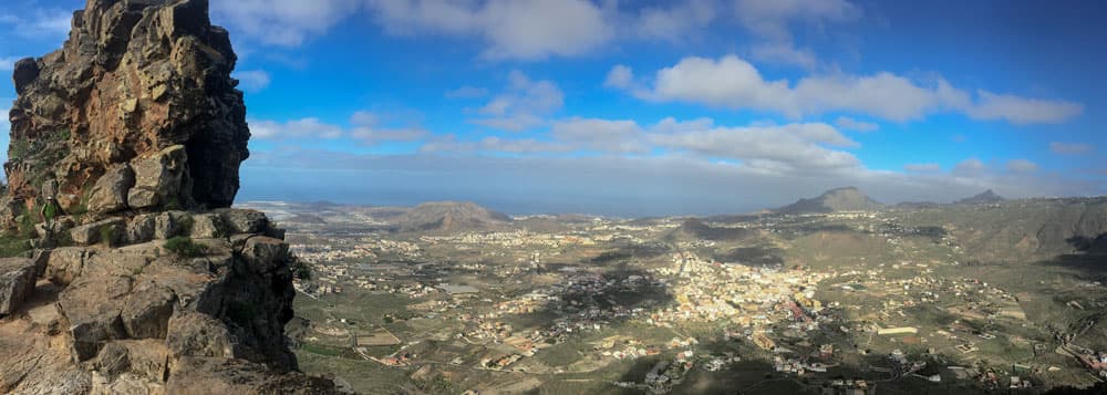
Panorama - view from Roque del Jama
From the rugged and steeply sloping summit plateau you can enjoy a wonderful view over the southeast coast of Tenerife. You descend from Roque del Jama on a route other than the ascent route. Then you walk a short distance on the road towards San Lorenzo.
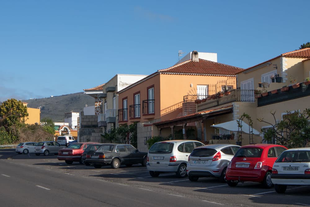
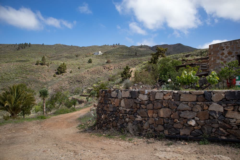
The village of El Roque
But then it goes steeply up again on the mountain slopes in the direction of Jama. You walk past water canals and old houses. Looking back there are always wonderful views. You walk through the hamlet of Casas Altas, which I will describe in more detail in the next section. On the mountain ridge and arrived in Jama the way back leads you in a wide curve back to the starting point El Roque.
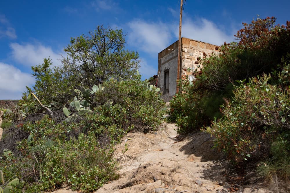
Las Casas Altas - an old little village
The Casas Altas – a protected cultural asset
The Casas Altas are a particularly well-preserved hamlet situated at an altitude of about 770 metres. It is said to be one of the oldest settlements on the plateau between Arona and Vilaflor. The stone houses were built in traditional architecture. They are made of basalt stone, tuff and sandstone and are therefore ideally suited to their surroundings. The hamlet is surrounded by terraced fields. Nearby there is a small spring that supplied the Casas Altas with water.
Hiking path to Casas Altas
The paved road at the Casas Altas, opposite the Roque del Jama, is a branch of the Camino Real de Chasna (Royal Trade Route). This once led from the coast to Vilaflor. Also worth seeing are the water channels cut into the ground. These are said to date back to the times of the natives. In September 2004, the hamlet of Casas Altas was declared a cultural asset in the category of protected town centre (Bien de Interés Cultural con la categoría de conjunto histórico).
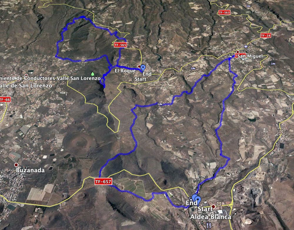
Track of the Circular Walk Roque del Jama
General information on the Roque del Jama circular walk
Starting point and approach
You start this hike in El Roque at TF 565.
Arrival by car
parkings in the street of El Roque - starting point
By car, you can reach El Roque from the TF-1 motorway. At Las Chafiras, take the exit for San Miguel. Take the TF-65 to the centre of San Miguel de Abona. There the TF-65 ends and meets the TF-28, which takes you left out of the village (direction San Lorenzo). If you have already reached El Roque, turn right onto the TF-565. After a short time you will see de Roque del Jama on your left. On the right side of the road there are many parking spaces.
Arrival by bus
Article summary and large selection of GPS hiking tracks
Sign up for my newsletter now and get exclusive access to my collected GPS tracks as well as all the brief information about my articles.
The Titsa bus line 416, which runs between Los Christianos and Granadilla, stops in El Roque. You can find out more on the Titsa homepage.
Time
I don’t like to give general time information for hiking tours, because the times are very individual. For this tour we needed about 4.5 hours with an extensive rest.
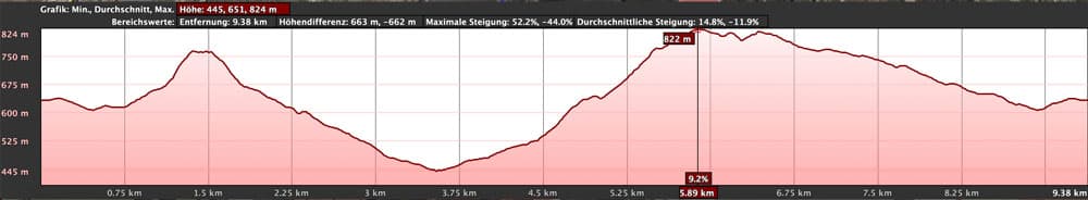
Elevation profile Circular Roque del Jama
Difference in altitude and distance
The difference in altitude with ascents and descents is about 600 meters. The distance is 9.5 kilometers long.
Requirement
A circular hike on good hiking trails that can be easily mastered by anyone with a little stamina. The ascent and descent to the Roque del Jama alone is a bit scrambly in some places. Near the summit plateau and on the way back, the small path is sometimes a little difficult to find. But you can’t get lost. The descent from Roque de Jama is very steep at some passages.
Refreshment
There are restaurants, bars and shops in San Miguel de Abona in sufficient number. But in El Roque and on the hiking path I did not see any bar. Therefore I have to take enough water and food with me.
tracks of the hikes to Roque del Jama and around Aldea Blanca
Variants
This tour can also be done without the Roque del Jama ascent, if the ascent is too exhausting for you. Then you keep immediately from El Roque on the road Camino la Fuente direction San Lorenzo without turning left to the Roque del Jama. Another big circular walk from Aldea Blanca to San Miguel is also nearby. Maybe you like to connect the tours.
view from Roque del Jama to the southeast coast of Tenerife
Circular hike around the Roque del Jama
Section El Roque to summit Roque del Jama
You start your circular walk in the small town of El Roque on the TF-565. The trail follows the main road for a while. After a short while turn left into Calle la Degollada. You walk straight along this street for a while. Behind a large farm, behind which the road descends the mountain (Camino la Fuente), there is a path to the left of the road towards Roque del Jama. Follow this wide and later narrow path straight ahead along the small ridge path uphill. The Roque del Jama is right in front of you, so that you can hardly miss the path.
Hiking path to Roque del Jama
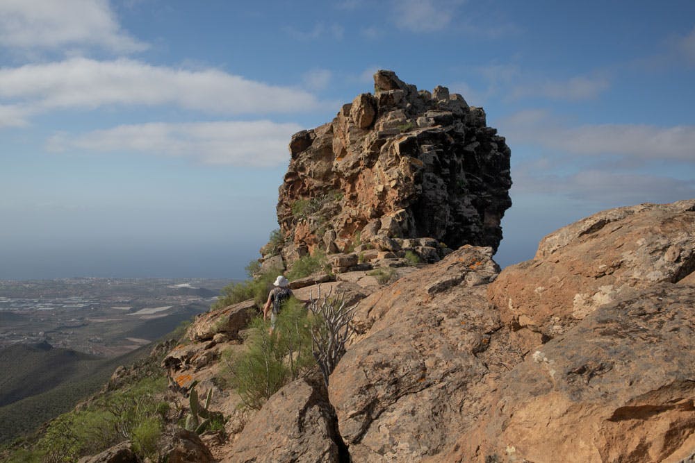
After you have mastered the first height (Vorberg), you come to a kind of small plateau. Here you keep a little to the left. Later you will return here from the right. Now you climb up to the left, the sometimes a little unclear path. From time to time you have to scramble a little. The path leads you left around the rock to the summit ridge. Continue straight ahead on the left side of the rock. Then you stand on the summit or only a large rock, which is perhaps better suited for mountaineers, lies in front of you.
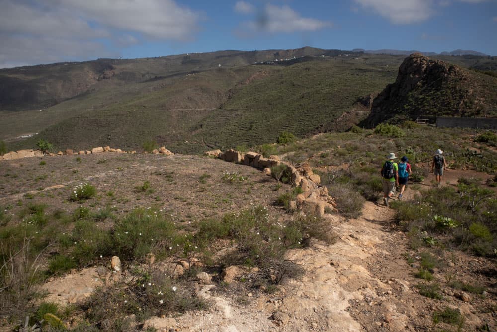
hikers on their way up to the summit of Roque del Jama
Section Roque del Jama to Camino la Fuente
Article summary and large selection of GPS hiking tracks
Sign up for my newsletter now and get exclusive access to my collected GPS tracks as well as all the brief information about my articles.
From the summit you can enjoy a magnificent view of the surrounding area as far as the Atlantic Ocean over the entire southeast coast of the island. On one side the descent is steep. When you have seen enough and perhaps made a first rest, you first go back on the summit ridge path. But then you stay further near the left steeply downhill side. So you can do a small round here as well and make the descent different from the ascent.
view to the surroundings and the coastline from Roque del Jama
You go down steeply on a narrow path. But you still have fantastic views. Finally the path leads to the right away from the steep face and you cross a small hollow and walk downhill along the opposite side of the slope. Then the path crosses your way there and you continue down the ridge path. You come to an old threshing floor. Immediately behind it you go left downhill on a path. This path meets another path, which you follow around on the right. After some time you reach the Camino la Fuente again on the slope side.
Demolition edge at the top of Roque del Jama
Section Camino la Fuente to Casas Altas
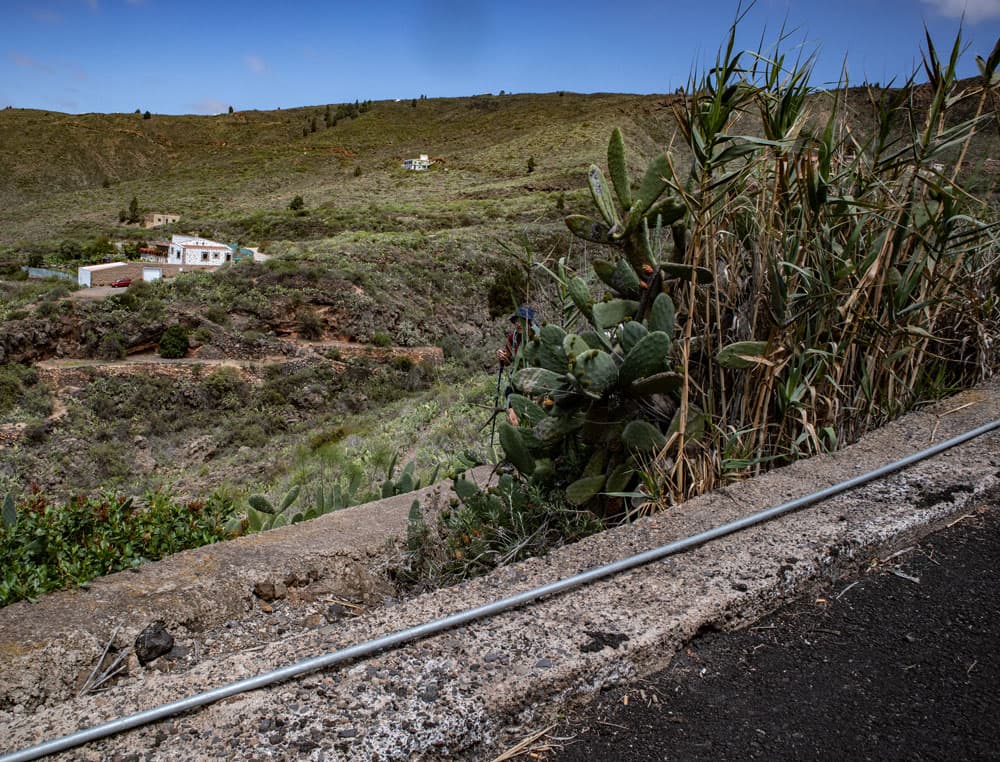
You’re going a long way down the road. But you can hike well here, because there is little traffic. You come to the first houses of the Valle de San Lorenzo and continue along the main road. Here in Valle de San Lorenzo the street is called Camino las Manchas. Later the road Camino Cercado las Toscas turns right. Turn into this road. After a short time you will see a larger property on your left. Opposite there is a kind of free space. From this square the first long hiking trail starts straight up towards Jama.
hiking path through Casas Altas
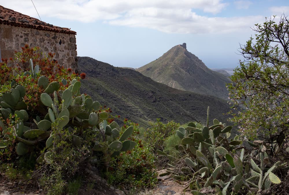
This brings you up the mountain. You pass a building and reach fields and fenced gardens. Here you make a small arc around the gardens. Behind them the hiking trail leads further up. It runs along the Barrancos and the water pipe. Halfway up the slope you reach buildings used for the water channels. Circle them and continue up the steep path. This will take you to the Casas Altas. You can read more about this small hamlet in the 2nd paragraph above.
hiking path along the slope
Section Casas Altas to Jama village exit
If you have looked at the tranquil hamlet with the old houses, paths and canals in peace, it goes a little further leisurely up the mountain. The hiking trail makes a wide arc at a terrace with an information board. Then you walk a little further straight ahead. But after a short time a path branches off to the right into the Barranco. It is easy to overlook. And as you can see on the track, I also went straight ahead. But you should keep down to the right.
here the hiking path meets the street
The path leads you down into the Barranco and around it. On the other side it goes uphill again. From here you have a wonderful view of the whole ascent and over to Roque del Jama. You follow the small path, which at the end leads you along a water channel to a road. Turn right and follow the road straight ahead out of the village of Jama. At the end of the village, the road turns into a road that you continue to follow.
the hiking trail paths an old threshing circle
Section Jama village exit to starting point parking lot in El Roque
The way leads you finally in a big serpentine down the slope. You come back to the TF-565, which you follow a little to the left. After a short while a path leads to a finca on the right. Follow this path until you reach the finca and then follow the path that passes the finca on the right. After some time you’ll reach the TF-565 again. This time you’ll walk a little to the right along the road.
Roque del Jama and the surroundings of El Roque
Before you reach a Barranco, a path branches off to the left towards El Roque. You can already see El Roque lying in front of you. After some time, the path turns into a wide road and then into a road that passes between the first houses of El Roque. It ends on the Camino la Fuente at the point where you turned off on the way to Roque del Jama. Now turn left on your way back to the nearby car park.
View from Casas Altas to Roque del Jama
And finally
I hope that you enjoyed this hike to Roque del Jama combined with the ascent to Jama via Casas Altas. If you notice „changes“ to my description on this or any other hiking tour, or if you have additions or hints, I am always glad about your information. I run the blog privately, so that I can’t constantly go out and revise all tours again and again. In this respect I would be pleased about your assistance, so that we can provide good information for all hikers here. Many greetings and beautiful hiking tours for you,
Dagmar from SiebenInseln
Thank you for reading!
If you've found my hiking guides on SiebenInseln helpful for your Canary Islands adventures, please consider leaving a small tip. Your support is greatly appreciated and helps cover the costs of maintaining this blog.