Guía de Isora, Chío, Chiguergue and Arguayo – four places and one hike
This hike takes you along the western slopes of Tenerife above the coast through the four typical Canarian towns of Guía de Isora, Chío, Chiguergue and Arguayo. You start your hike in Guía de Isora and hike below the village to Chío.
Map
View from the top of La Gomera
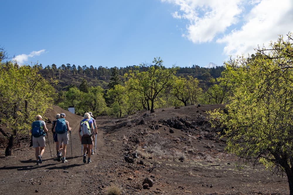
You walk through this place in the direction of Arguayo. While you make the way there below the villages, you go back above the villages via Chiguergue. This will give you a wonderful circular walk that will take you through four typical small Canarian villages as well as through fascinating nature.
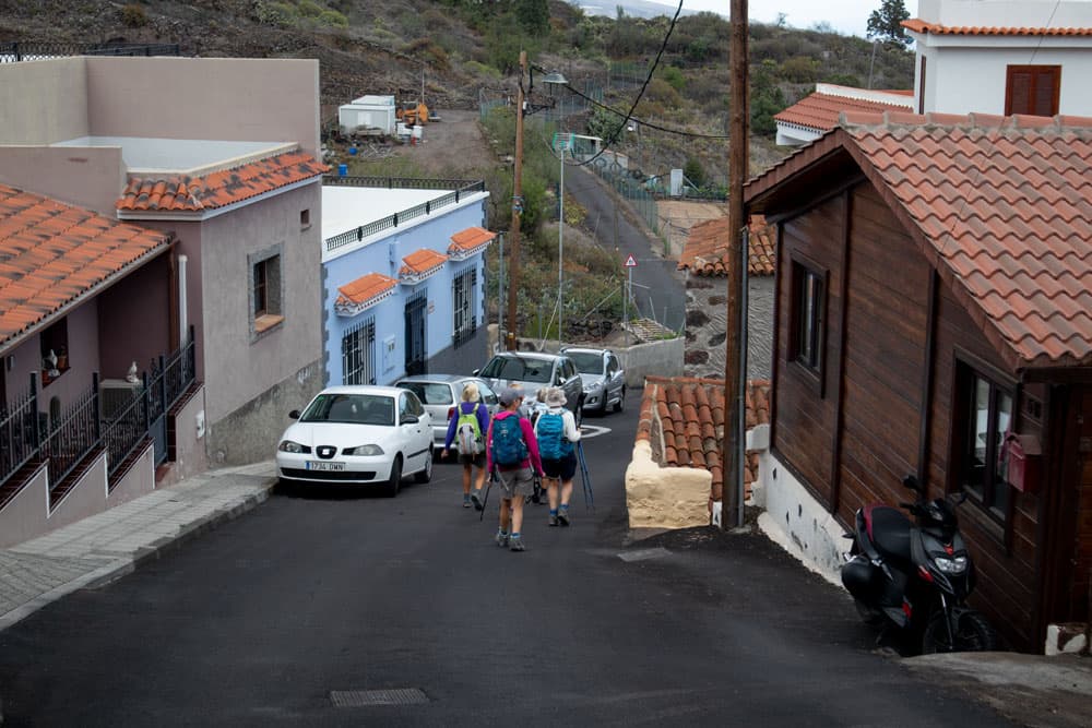
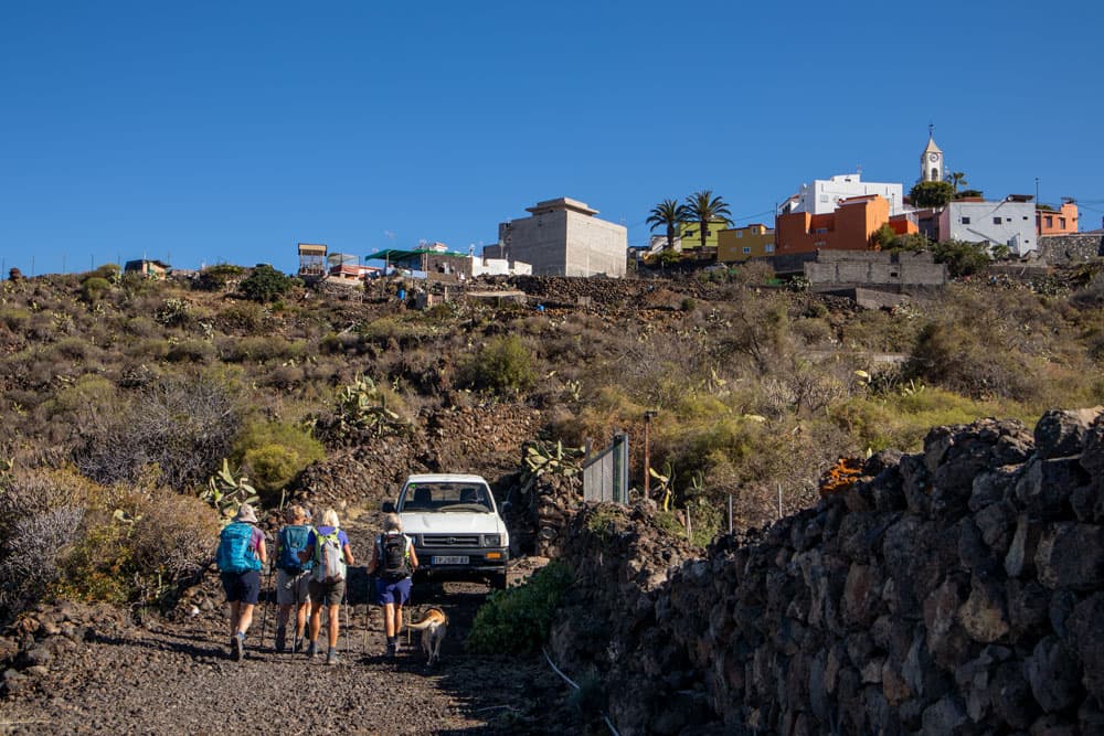
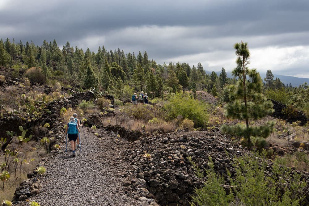
Hiking Trail direction Chío
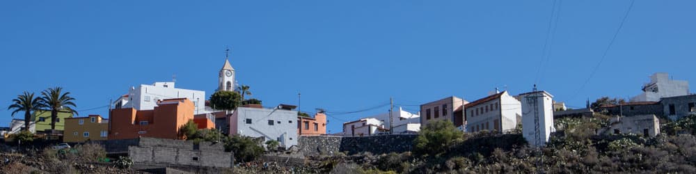
Gúia de Isora
Guía de Isora is a district municipality with approx. 21,000 inhabitants and is situated at an average altitude of 600 metres. There are shops, cafés and restaurants. In 2009, Guía de Isora was declared a cultural asset because of the many buildings that can be found in the old town in the traditional Canarian style. The old part of town is thus under monumental protection. Thus, in the old town, you will also find the church Nuestra Señora de la Luz that dates back to the 16th century. There are many small winding alleys. In some places, there are also still some traditional places, as for example old washing or threshing places. On this hike you will have plenty of opportunity to stroll through Guía de Isora before or after the hike.
Church in Chío - San Juan Bautista
Chío
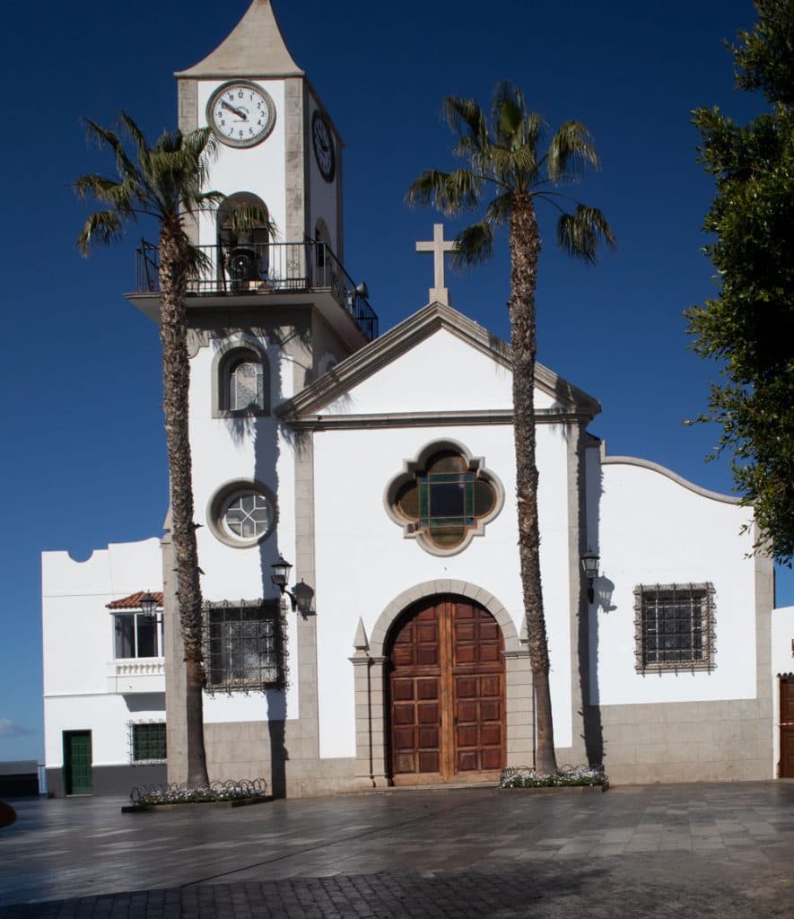
The typical Canarian Dort Chío also belongs to the municipality of Guía de Isora. The picturesque village lies at an average altitude of 680m. Chio has about 2500 inhabitants. The church San Juan Bautista de Chio, which originates from the 17th century, was rebuilt in the 20th century.
As in Guía de Isora, many inhabitants live from agriculture. Around Guía de Isora and Chío you will find large banana plantations, but also tomato and potato plantations as well as fig and almond trees. And just like Guía de Isora, Chío offers a wonderful view of the southwest Atlantic coast and the Teno Mountains in the west. On this hike you hike on the way there and back through different parts of Chío.
Arguayo
Arguayo is a small town very close to Santiago del Teide, to whose municipality it belongs. The village has about 400 inhabitants and is situated at an altitude of 900-1000 m. As also in Chío and Guía de Isora, the people in this rural area live from agriculture. On the main road there is a restored farmhouse in which the small private pottery museum „Alfarero de Arguayo“ is located. Here, even today, pottery is carried out according to the technique of the indigenous people, the guanches. So there is no potter’s wheel and all the pottery is handmade.
In the small mountain village there are bars, cafés and a church called Iglesia Nuestra Señora de Candelaria. You will not walk through Arguayo on this hike, but you will have the opportunity to make a detour there, as the hike takes you right past the village.
Hike through Chiguergue
Chiguergue
The small village of Chiguergue lies at 750 metres above sea level and belongs to the municipality of Guía de Isora. The origins of Chiguergue go back to the 18th century when the first houses were built on the road to Chirche. Also the inhabitants of this small place live from agriculture. In the 19th century, certain types of cacti were already bred here. Two big celebrations in April (Virgin de la Milagrosa) and August (San Roque) attract many visitors every year. Also in this place there are still old Canarian threshing places as well as old stone ovens to visit. You hike through this place on your way back.
All four small villages are picturesquely situated, typically Canarian and offer beautiful views of the coast and the neighbouring islands from the top. So you should take enough time on this hike to look at them in peace.

Track of the hike from Guía de Isora via Chío, Arguayo and Chiguergue
General information about the circular walk Guía de Isora, Chío, Chiguergue and Arguayo
Starting point and approach
Article summary and large selection of GPS hiking tracks
Sign up for my newsletter now and get exclusive access to my collected GPS tracks as well as all the brief information about my articles.
Sign up nowStarting point of this hike is Guía de Isora at the street Avenida de la Constitución.
Starting point of the hike: Guía de Isora - Avenida de la Constitución
Arrival by car
From the south, take the TF-1 motorway or the TF-82 to Guía de Isora. Coming from the north, take the TF-82 from Chío. Coming from the south, pass through the town. From the north, turn left at the first roundabout before the village. Coming from the south, turn right at this roundabout. This road is called Calle Ernosto Che Guevara and takes you uphill. At the end of the road you will reach Avenida de la Constitución. Here you turn left and drive a little uphill. There are plenty of parking spaces on the right.
Arrival by bus
In Guía de Isora the Titsa bus lines 417, 460, 462, 490, 492, 493, 494 stop. You can find more information on the Titsa homepage. If you only want to walk to Arguayo (lines 461, 462), Chiguergue (lines 492) or Chío (lines 462, 492), you can also take the bus back from there. The exact connections can be found on the Titsa homepage. Time
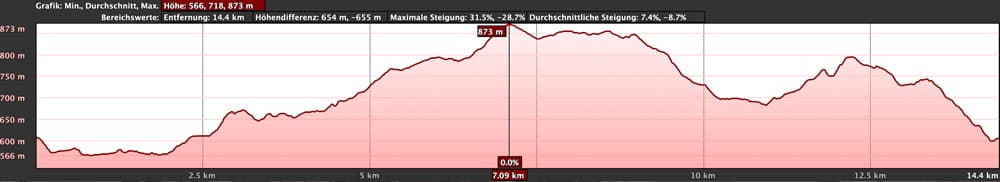
I don’t like to give general time information for hiking tours, because the times are very individual. For this hike we needed about 4.5 hours with some small breaks.
Elevation profile of the hike Guía de Isora via Chío and Arguayo
Difference in altitude and distance:
The difference in altitude is about 550 meters and the distance is 14.5 kilometers long.
Requirement
An easy and for everyone with a little physical condition easy to master tour, which mostly runs on well developed hiking and driving paths.

signpost to Arguayo
Refreshment
There are restaurants, bars and shops in all towns, so you only have to have a little water with you when you’re out and about.

More tracks near Chío
Variants
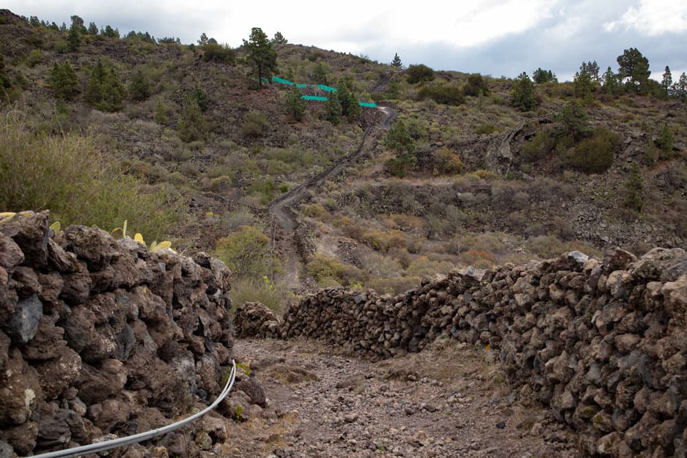
This tour can be easily combined with various other hiking and circular walks in the area. Thus, from Guía de Isora, there are hikes up to the Chirche and further into the Cañadas. The same is true for Chío (see some tracks on the photo). Also from Arguayo there are countless hiking possibilities upwards into the pine forests or over Las Manchas direction Santiago del Teide into the Teno mountains. A hike through further Canarian villages leads from Tamaimo also over Arguayo and can be combined very well with this hike. 
Guía de Isora
Hike Guía de Isora, Chío, Chiguergue and Arguayo
Article summary and large selection of GPS hiking tracks
Sign up for my newsletter now and get exclusive access to my collected GPS tracks as well as all the brief information about my articles.
Sign up nowYou start your hike in Guía de Isora at the Avenida de la Constitución at the upper end. Shortly before the road ends in a field, a path branches off on the left. Follow this wide path down through fields until you reach the TF-82. Cross the road and continue for about 200-300 metres along the road towards Chío. Then a wide road branches off to the left. Follow this road. After some time the main road turns left. However, you continue straight ahead.
Hiking trail in Guía de Isora - junction from Calle de la Constitución
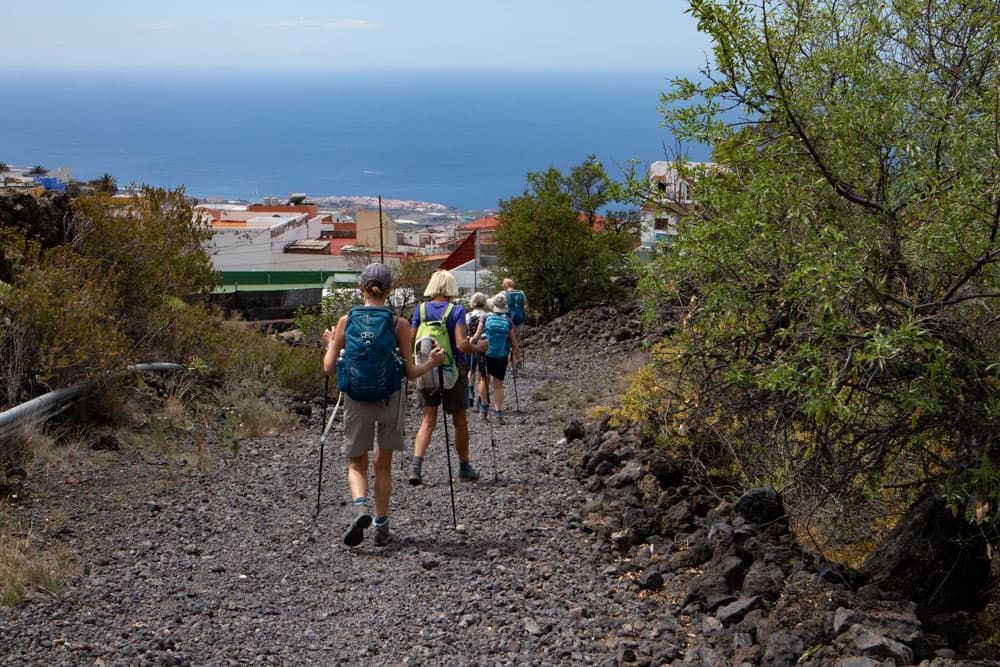
Follow this road for a very long time. To your left you have a wonderful view of the Atlantic coast. You walk through fields, gardens and pass many fincas. You ignore all branches. Finally the hiking trail brings you almost down to the new highway TF-1, which runs below you. Higher parallel to it, the trail leads you on. You cross a larger square. At the end of this square, the trail continues uphill towards Chío.
Hiking path direction Chío
Section of hiking trail in the direction of Chío to Arguayo
In Chío the path meets the street Calle el Vizconde, which you follow to the left. This road takes you straight ahead to the large church square, where you can have a look at the church of San Juan Bautista. You also have a wonderful view of the surroundings from the church square. Go straight ahead past the church square and continue on Calle San Juan. Now you walk on through the village and can admire many typical Canarian houses and alleys. The street turns into Calle la Sabina. Follow this street straight ahead as well.
hiking path with top of Teide in the background
Finally it will take you out of the village. You follow the road straight on until it reaches the TF-82 again. You cross this road. Right on the other side a narrow hiking path continues uphill. On this trail you finally reach the TF-375, the road to Arguayo. After a short time you leave this road again to the left on a hiking trail. The trail leads you parallel to the TF-375 with beautiful views of the Teno mountains up to Arguayo. When you have arrived back at the TF-375, you can reach the center of Arguayo in a few steps if you want to visit it.
path direction Arguayo
Section Arguayo to Chío Calle el Roquillo
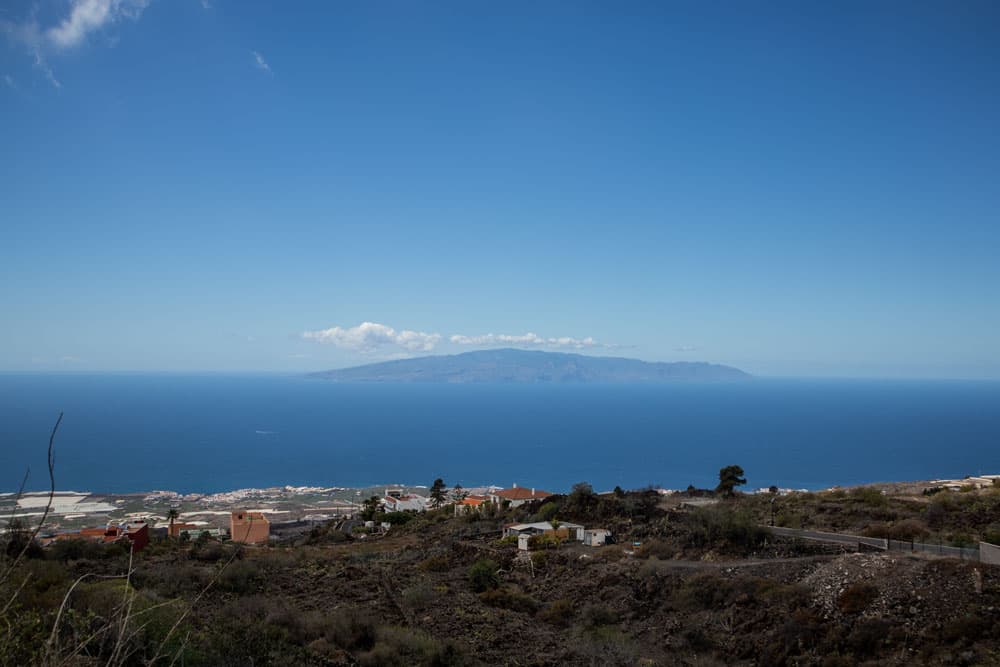
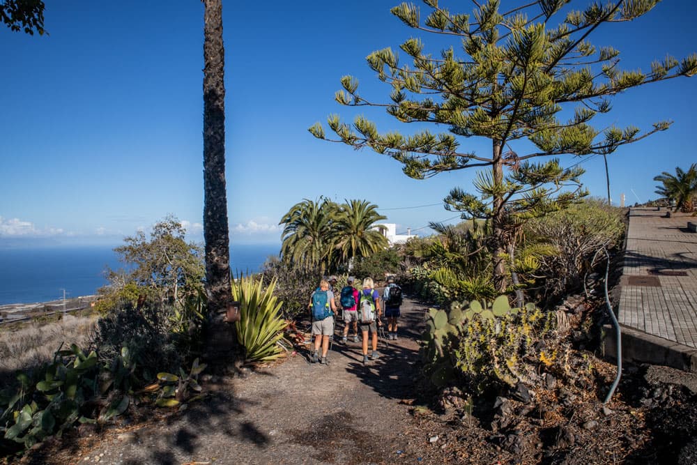
Otherwise you cross the TF-375 shortly before the village and after a few steps you reach the Carretera Arguayo, which you follow to the right. When the road ends, the trail continues straight ahead. Now you hike at altitude and can enjoy magnificent views of the neighbouring islands of La Gomera and La Palma as well as the entire coastline below. In the other direction you can see the Teide high above you.
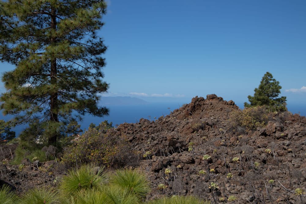
View from the top to the neighbouring islands La Gomera and La Palma
You walk straight ahead through gardens and fields for a very long time. After some time, the trail slowly descends via Chío to the village. Now you can see Chío getting closer again. You cross the TF-38 and then go on the Paseo Indianos. This small steep path ends on the Paseo Liberdad, the TF-38 and the main road of the village. Now follow it around to the left. Now walk along the main road through the whole village of Chío. Almost at the end of the village, at the sports stadium, turn left uphill into Calle el Roquillo.
hiking trail between Chío and Arguayo
Chío Calle el Roquillo to Guía de Isora Starting point
Calle el Roquillo takes you from Chío on a wide path that runs a little up and down towards Chiguergue. After you have crossed a ridge, the path leads you to Chiguergue, the smallest place on this hike. On the road Las Cuevas, later Tinguaro you walk straight ahead through the village. Behind Chiguergue, the path turns into a driveway, which you continue to follow straight ahead for a short time. Shortly before a larger finca, a hiking trail branches off to the right towards Guía de Isora downhill.
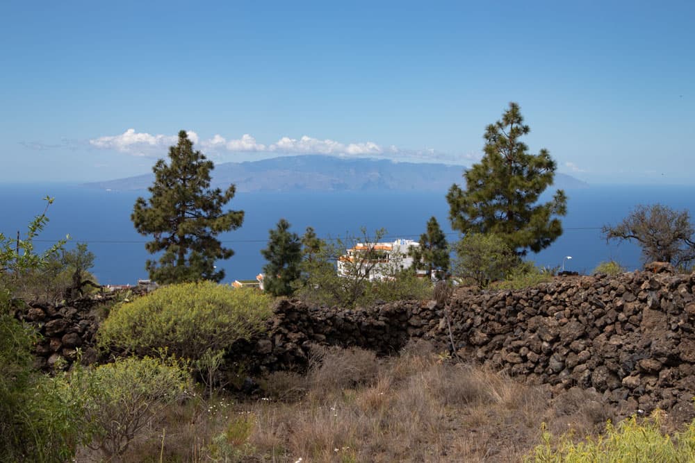
view from the top to La Gomera
Once you have reached the bottom you are back on the Avenida de la Constitución in Guía de Isora. However, you have to walk a little further downhill to the starting point of the hike. You will see the wide road below you. We have walked on dirt roads on the left around an arch. But you can also make an arc to the right. Then you are back on the wide road at the point where you started hiking.
hiking path cloth to Guía de Isora
And finally
I hope that you enjoyed this beautiful circular walk through some Canarian villages on the southwest slopes of Tenerife. It can be combined very well with countless other hikes. Whichever way you choose, I wish you lots of fun on all your hikes,
Dagmar von SiebenInseln