Tamaimo – a good starting point for hikes
The small mountain village of Tamaimo, which lies at 400 to 600 metres above sea level, is a good starting point for hikes in all directions. Here in the blog I have already reported about some hikes you can do from Tamaimo.
Map
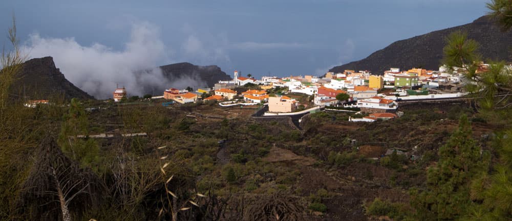
Panorama Arguayo
In the direction of Teno, for example, you go to the Barranco Seco or to the Risco Blanco. Also different tunnel tours with impressive hikes over the rocks of the Acantilados can be undertaken from Tamaimo. But from Tamaimo it goes not only in the direction of Teno mountains.

the former chapel above Tamaimo -the chapel was demolished in 2022
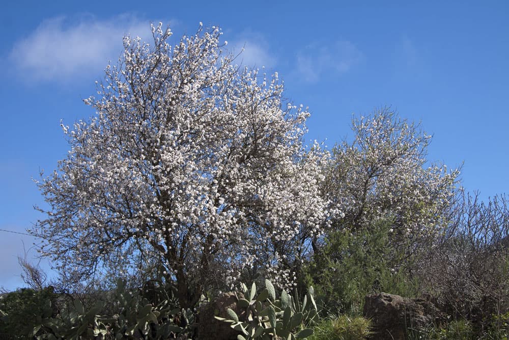
Today’s hike leads you on the other side of the Santiago Valley up to the village of Arguayo. From there we continue over the Montaña La Hoya and then down to the small village Las Manchas. The trail passes quite close to Santiago del Teide. If you like, you can extend the tour in this way. At Santiago del Teide you follow the Camino Royal over the hamlet El Molledo and finally back to Tamaimo. At the time of the almond blossom (January, February), the tour presented here, which also borders on the Ruta de Almendros, is especially beautiful.

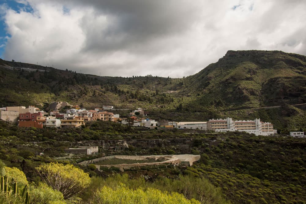
the little canarian village Las Manchas
Tamaimo – still a quiet mountain village
The quiet village of Tamaimo, 6 kilometres south of the capital Santiago del Teide, is still a quiet place to visit. Tourists are primarily some hikers who start their tours from here. From the street cafés on the main road you can watch the local hustle and bustle in peace. Here you can also find the original Canarian tapas. It is worth trying.
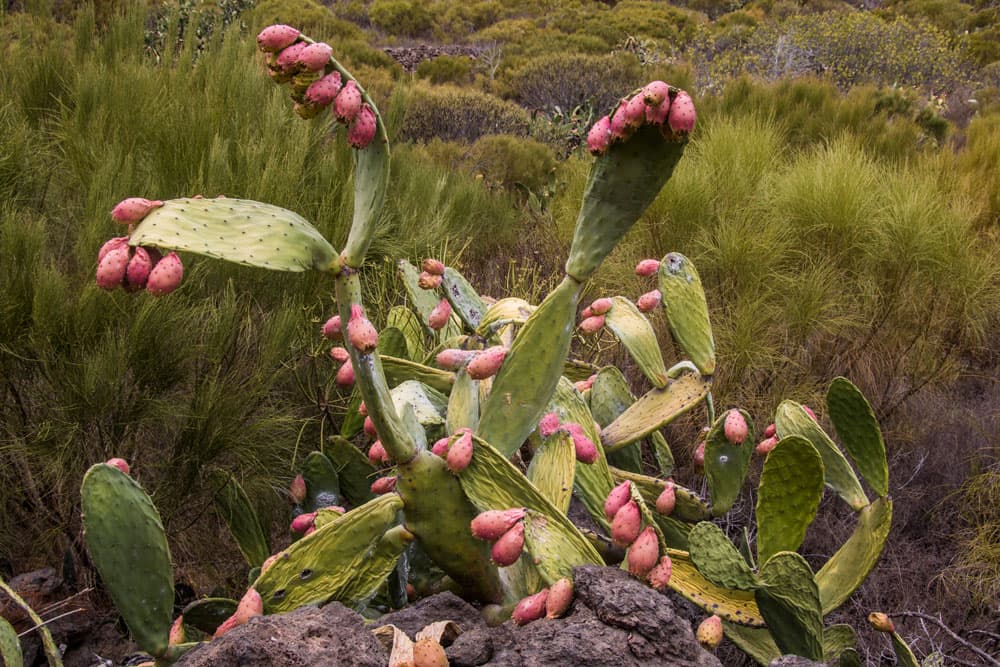
Cacti with figs along the way
Many inhabitants of Tamaimo live from agriculture. They mainly grow bananas, but also potatoes and wine on the surrounding fields. A travel guide once said that Tamaimo would mean tomato in old Canarian and that many tomatoes had been cultivated in the village in former times. True or not? I myself have not yet found any evidence for this assertion.

Track circular hike Tamaimo - Arguayo - Las Manchas - El Molledo
General information about the circular hike around Tamaimo and Canarian villages
Starting point and approach:
The starting point is TF-82, the main road in Tamaimo that runs between Santiago del Teide and Chio.
Arrival by car:
You can reach Tamaimo by car from the north on the TF-82 towards Santiago del Teide, or from the north and south on the TF-1 motorway and exit at Chio. Then take the TF-82 to Tamaimo. From the south towards Los Gigantes you take the TF-454. At the main road Carretera Puerto and also at the TF-82 there are enough parking spaces at the side of the road.
Arrival by bus:
The Titsa bus lines 325 (Puerto de la Cruz-Los Gigantes), 460 (Icod de los Vinos-Costa Adeje), 462 (Guía de Isora-Los Gigantes) stop in Tamaimo. You can find more information on the Titsa Homepage. Time:
I don’t like to give general time information for hiking tours, because the times are very individual. We needed about three hours for this tour.
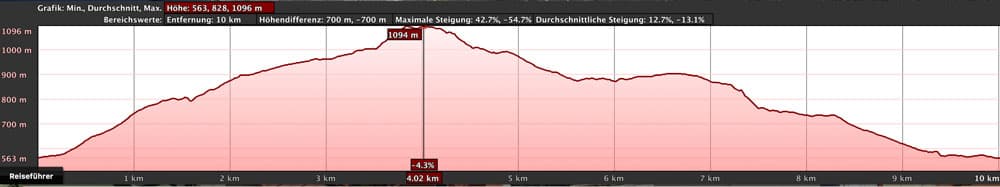
elevation profile circular hike Tamaimo
Difference in altitude and distance:
Article summary and large selection of GPS hiking tracks
Sign up for my newsletter now and get exclusive access to my collected GPS tracks as well as all the brief information about my articles.
Sign up nowThe difference in altitude is just under 600 metres. The route is a little more than 10 kilometres long.
Requirement:
An easy tour that can be easily mastered by anyone with a little stamina. A hike on good hiking trails without great challenges, but with beautiful views and many different impressions.
Refreshment:
There are restaurants, bars and shops in Tamaimo, Arguayo and Santiago del Teide. Nevertheless there is enough water to take with you.
Variants:
This tour can be combined with many other hiking tours in the vicinity. Worth mentioning are:
If the hike is too long for you, you can simply walk the first part from Tamaimo to Arguayo and back. You can find this track in the downloads under the name „Tenerife Tamaimo – Arguayo“.
It is also possible to go to Santiago del Teide and take the bus back. You can easily extend the tour by hiking up to the Montaña Hoya or/and to Santiago del Teide and returning from there via El Molledo to Tamaimo.

the little canarian village Las Manchas
Circular hike Tamaimo – Arguayo – Las Manchas – El Molledo – Tamaimo
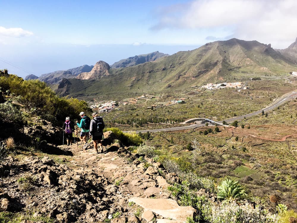
Tamaimo to Arguayo section
You start your hike through a lot of nature and Canarian villages at the TF-82 in Tamaimo. From the big intersection in the middle of Tamaimo town you go out towards Chio. This road is also called Avenida Coronel Gorrín. Between two houses, turn left into Calle La Rosa, almost at the end of the street. Follow it uphill. Behind the last house, turn left onto a path. You cross a water channel and continue uphill along the path.

flowers at the way
It leads you through landscaped gardens and terraced fields with stone walls and pine forest. At the end of the ascent you reach a small asphalt road, which you follow to the left. Then the trail turns left again from the small road. You walk with a view of Tamaimo below the TF-1 motorway. After some time the trail will lead you through a tunnel under the highway. Then you continue to climb steeply, follow the footpath and come out at Arguayo on the TF-375.

view in the valley of Santiago
Section Arguayo to Montaña Hoya
You cross the TF-375 at Arguayo and go uphill a small road left past a house. This will take you to Calle Carretera General, which you follow to the left. You can take the next street or the street after the next right uphill into the village. Now you have the opportunity to take a closer look at the quiet village of Arguayo with its colorful houses. After some time turn right into Calle El Carmen. Then take the next street on the left (Calle San Isidro – Arguayo) uphill. On the left side you will see a small pottery museum (Centro Alfarero y Museo Etnográfico Cha Domitila). Perhaps you have time and desire for a visit. When it’s open, it’s worth a visit that doesn’t cost an entrance fee.
Article summary and large selection of GPS hiking tracks
Sign up for my newsletter now and get exclusive access to my collected GPS tracks as well as all the brief information about my articles.
Sign up now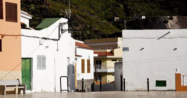
church square of Tamaimo
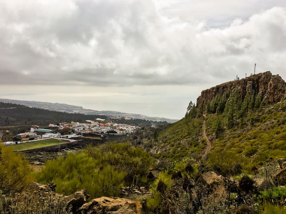
After this short hike from Arguayo you get back to the TF-375, which follows through the right side for a while. Before the road leaves the village, there is a large sports field on your left. When you have passed it, turn left onto a wide road. You follow this wide road, which now takes you a little up the slope of Montaña Hoya (antennas on the summit). If you continue straight ahead along the road, it will take you to the top of Montaña Hoya in a wide arc. From up there you have a good view over the whole Santiago valley and far into the Teno mountains as well as on the Teide (plan 20 minutes extra).
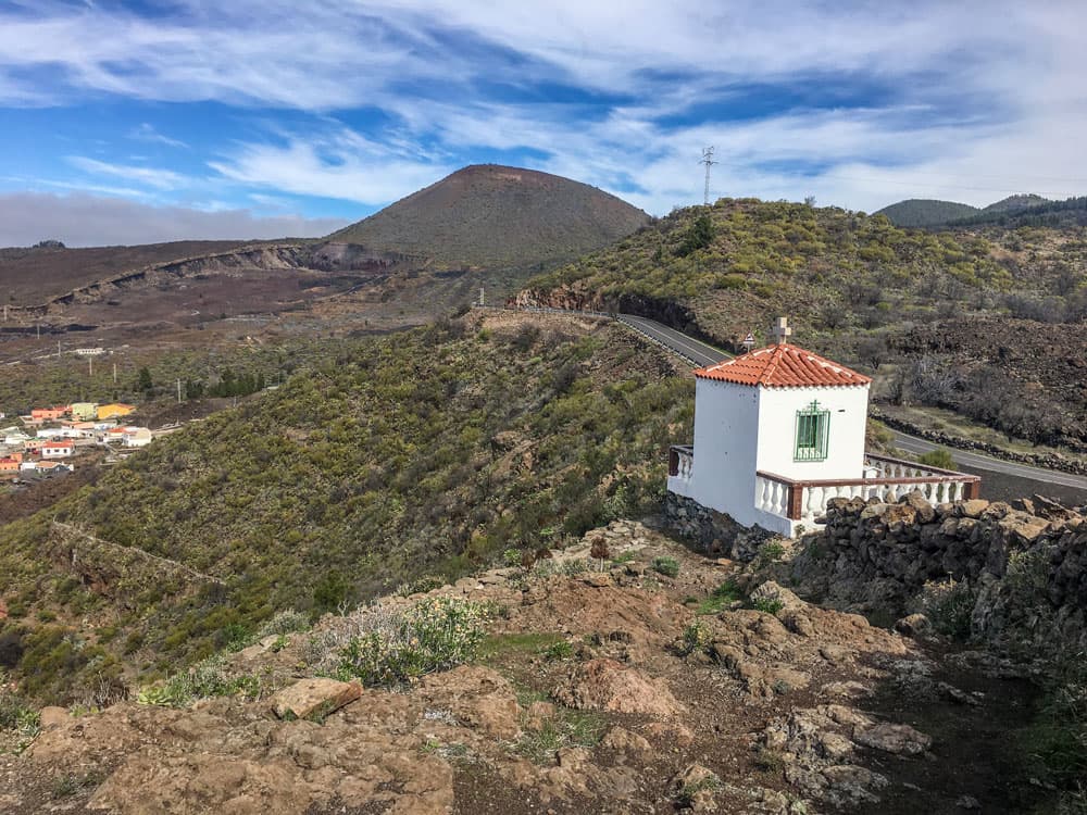
the former chapel over Tamaimo and Las Manchas - the chapel was demolished in 2022
Section Montaña Hoya to the former small chapel
I myself have already been to the summit several times and therefore did without it on this round tour. But on the road towards the summit, a small path marked with stone figures leads up the slope on the right. Here you have to look carefully, in order not to miss the junction. Then it will bring you to the ridge of Montaña Hoya in a short time. Even if you weren’t at the summit, you have a magnificent view up here towards Teide, over the Santiago valley, into the Teno mountains and over Arguayo with the south coast behind it.
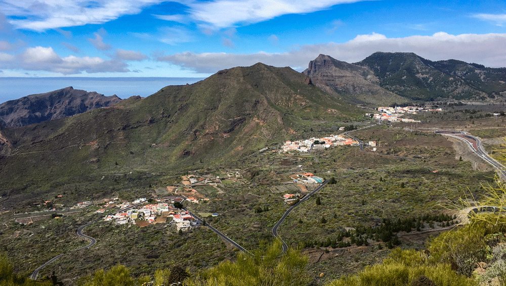
Tamaimo and surroundings
From up here you can easily overlook all the villages you will pass through on this hike. You will now walk along the ridge and the slope of Montaña Hoya on the right for a while. Finally you reach a small white chapel. It is again quite close to the TF-375, but you don’t go down to the road, but walk down the path at the back of the small chapel towards Las Manchas.
hiking trail at the motorway - tunnel
Section from the former small chapel to hiking trail at the motorway
The small hiking trail behind the chapel takes you quickly downhill in a few steep serpentines towards Las Manchas. You cross a water channel and just before Las Manchas you reach a wider path. Finally, the trail turns into Calle los Pinos in Las Manchas. Now you have the opportunity to visit another original Canarian village. If you want to extend the hike, you can also hike from here on hiking trails over the height to Santiago del Teide.
Camino Real - hiking path between Santiago del Teide and Los Gigantes
On the circular route described here, however, you will turn left at the intersection of Calle los Pinos and Calle los Manolos. You walk down Calle los Manolos until the end of the street. The road turns into a wide road that takes you downhill towards the motorway. Shortly before the motorway you don’t cross the small bridge, but follow the path to the left. This runs parallel for a short time along the motorway in the direction of Santiago del Teide.

El Molledo
Section of the hiking trail along the motorway to the El Molledo village square.
After a short time on the hiking trail parallel to the motorway you will come to a tunnel that will take you under the motorway to the other side. Behind the tunnel you turn right and follow a wide road that leads you slowly in a gentle curve towards El Molledo. Since I was a little curious where this path leads to, I followed the path very straight ahead. You can do the same. But you can also take the first opportunity to turn left in the direction of El Molledo.
View to the south coast and the Santiago valley - Aguayo
Both variants will eventually lead you to the TF-82. On my track I had to go a little to the left to get to the centre of El Molledo. If you turn sooner, you have to turn a little right at the TF-82 to get to the entrance to El Molledo. This way you can either walk along Calle de Tagora or Calle Los Almendros to the village square in the middle of El Molledo.
hiking path above Tamaimo and Las Manchas
Section of El Molledo village square to Tamaimo
From the village square in El Molledo, go straight ahead along Calle La Calzada to reach Barranco de Santiago at the end of the village. Turn left and follow the Camino Real that runs between Los Gigantes and Santiago del Teide. This is the PR TF 65 trail, marked white and yellow. The path starts below El Molledo and goes down the mountain in steep bends. After this descent, the descent is much more moderate on the wide Camino Real, slowly descending through the Santiago valley.
view to Santiago del Teide, El Molledo and Retamar
You’ll pass some branches, but keep straight on the well-marked main trail towards Tamaimo and Los Gigantes. After a short time Tamaimo will appear below you. You walk on until the Camino leads you down into the Barranco. Then you cross the Barranco and don’t follow the path on the other side, but take a path into the village, which changes into asphalt shortly after. After a short time you will come to Calle de Agua. Follow it straight on for a very long time on the right. It ends at the main road of Tamaimo, where you turn left and return to the crossroads.
blossoming tree
And finally
I hope you enjoyed this little hike through lots of nature and colourful Canarian houses. This tour is particularly recommended between the end of December and March, when the almond trees are in bloom. If you are still looking for a beautiful holiday flat in Tamaimo, I can recommend a stay with my hiking friend who rents out a very nice flat right next to the hiking routes. I hope you enjoy your further hikes, Dagmar von SiebenInseln

