The most famous gorge hike on Tenerife leads through the Barranco (gorge) of Masca. You will find the exact tour description with me as part of the Great Teno Circular Hike. But even if every hiking company on the island offers this tour and the Barranco of Masca is really worth seeing, there are alternatives. Just next to the Masca gorge are the wild and almost untouched gorges Barranco Seco and Barranco Natero. Both walks through the fascinating gorges are an experience in themselves. But if you like, you can also combine both tours to a circular hike, as both gorges end at the same beach on the Atlantic Ocean. 
Galeria with railway tracks
Alternative Gorge Hike to the Barranco of Masca?
Also the Barranco Seco and the Barranco Natero can be walked like their famous neighbour, the Masca Gorge, from the height down to the Atlantic Ocean. However, those gorges are a little longer. There are also a few more metres of altitude to climb. The Barranco of Masca has 600 vertical meters, the Barranco Seco 820 and for the Barranco Natero there are even 1034 vertical meters to descend or ascend from the sea. But it is worth it. While there are more and more tourists daily in the Barranco of Masca, the neighboring gorges are almost empty. In the Barranco Natero, there is hardly ever anyone to be found and in the Barranco Seco, there are only a few scattered hiking groups from time to time.
Barranco Natero - Old water channel
Map
The nature is very similar in all three gorges, because they are also neighbouring gorges. But maybe the gorges Seco and Natero are a bit rougher and wilder than the Barranco of Masca. The Barranco is even laid out correctly in some parts of the way. Ropes are attached to difficult passages, and so that the hiker knows where he is, there are number plates everywhere. You won’t find any of this in the neighbouring gorges, just as you won’t find any hiking signs. And whoever arrives at the beach of Seco and Natero once, has to climb the same way again. This is what keeps most tourists away from these canyons. They love the Masca descent and the subsequent boat trip from there to Los Gigantes.

Panorama Barranco Seco
Who loves loneliness
Neither the Barranco Natero nor the Seco Gorge offer this luxury of continuing by boat from the beach. But the hiking experience is completely different. There is neither a ticket booth nor cold soft drinks on the beach. And even on the way it will be rare for you to meet a person. In these gorges you really have to be in close contact with nature. Only the ruins, which point to earlier activities to the water extraction, are remnants of human existence in this silence. Today it is „naturally“ quiet in the gorges around you.
In the Barranco bed of the Natero you will often find water
Only when you reach the beach will you perhaps from time to time hear some music from the ships anchoring in the bay. That’s all. If you love loneliness from time to time, the Natero Gorge and Barranco Seco are the place for you. In order to make the hiking experience a little more varied, it is of course also possible to climb down in one Barranco and up again in the other. I will describe both ways and their combination to you.

Track Barranco Natero - Barranco Seco
General Information
Barranco Natero – Natero Gorge
Starting point
Mirador Masca on TF-436 between Santiago del Teide and the town of Masca. The Mirador is about 400 meters below the Cherfé Pass.
How to get there by bus: The Titsa bus line 355 runs between Buenavista del Norte and Santiago del Teide and stops at the Mirador de Masca. Further Information at the Titsa Homepage. How to get there by car: The TF-436 runs in narrow serpentines and because of the traffic to Masca it is quite well frequented. Parking is available at Mirador Masca. From time to time a car stops there to sell fresh fruit to tourists.

elevation profile Barranco Seco up down and up
Difference in altitude
1032 meters altitude difference

elevation profile Barranco Natero down - Barranco Seco up
Requirement
Difficult: The path is well marked. However very long, very steep, partially exposed and also slipped and buried by rockfall in some places. The Barranco Natero should not be used during rain and storm. Absolute surefootedness and a head for heights are required. The small paths are partly exposed and more than just a little „climbing“ is necessary.

Track Barranco Seco
Hiking time
Pure hiking time for the path to the Barranco: plan at least 5 hours for a tour.
Information on weather, clothing, refreshments
Do not go into the Barranco when it is raining or wet. Avoid any risk of overburdened or sacked roads. Wear long trousers and sleeves to avoid scratches from bushes. Bring plenty of water and provisions with you, as there is no place to stop for refreshments.

Hiking dog Lasko
Water for humans and dogs
Normally there should be water for humans and an accompanying four-legged friend at different places in the gorge. But in absolute dry periods you should not rely on it and have enough water with you.
Tip: If you descend and ascend in the same Barranco, you can also deposit water on the way so that you can collect it again on the way back. This will save you the weight of lugging up and down. And you’ll certainly be thirsty enough on the ascent.

Track Barranco Natero - Barranco Seco
Barranco Seco – Seco Gorge
Starting point
Village El Molledo at the church

El Molledo church
By car: El Molledo is on TF 82 between El Retamar and Santiago del Teide. In the village there are enough parking possibilities at the roadside.
How to get there by bus: The Titsa bus lines 325 (Puerto de la Cruz – Los Gigantes), 460 (Icod de los Vinos – Adeje), 462 (Guía de Isora – Los Gigantes) stop in El Molledo.

Track Barranco Natero Barranco Seco - view from the westside
Difference in altitude
880 meters of altitude difference from El Molledo to the beach of Barranco Seco (about 1000 meters in total)
Article summary and large selection of GPS hiking tracks
Sign up for my newsletter now and get exclusive access to my collected GPS tracks as well as all the brief information about my articles.
Sign up nowTime
Pure hiking time for the path to the Barranco: plan at least 3.5 hours for a tour.
Requirements
sure-footedness, head for heights and good physical condition.
Information on weather, clothing, refreshments
In the lower part of the Barranco there is a danger of falling rocks in various places. Never go into the Barranco when it is raining or wet. Avoid any risk of buried or sacked roads. Wear long trousers and sleeves to avoid scratches from bushes. Bring plenty of water and provisions with you, as there is no place to stop for refreshments.
Water for humans and dogs
Normally there should be water for humans and an accompanying four-legged friend at different places in the gorge. But in absolute dry periods you should not rely on it and have enough water with you.
Tip: If you descend and ascend in the same Barranco, you can also deposit water on the way so that you can collect it again on the way back. This will save you the weight of lugging up and down. And you’ll certainly be thirsty enough on the ascent.

Barranco Natero - green wilderness
Hiking tours – possibilities, alternatives
1. Barranco Natero (up and down)
2. Barranco Seco (up and down)
3. combination: one canyon down and the other uphill
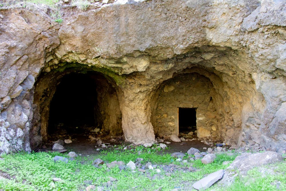
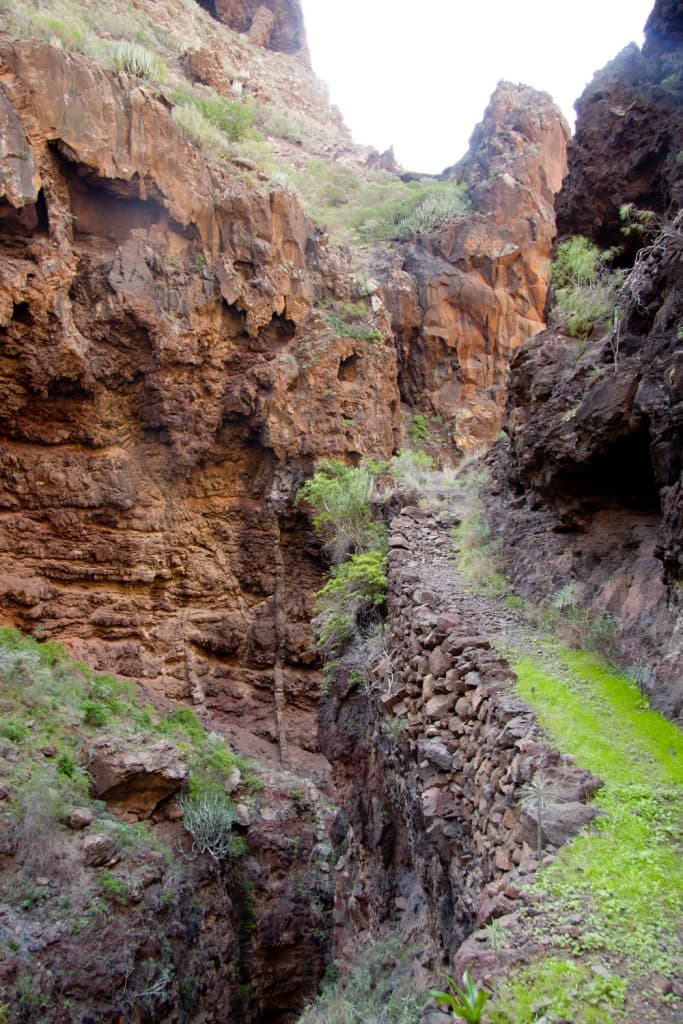
4. combination with the tunnel tour possible (Tamaimo-Barranco Seco- Los Gigantes). If required, you can choose to enter or exit the Barranco via one of the two tunnels rather than via El Molledo on the way back or out. This shortens the route. If the tours seem too strenuous for you and you still want to go into a wild, lonely gorge, you can simply descend each gorge for a few hundred meters and then climb back up again. Here, in the Barranco Seco, the Galería de la Junquera offers itself at an altitude of 400 metres. And also in the Barranco Natero, it is very interesting to walk down to the first Galería and to look at the old ruins, machines and tracks in the wild nature that surrounds them.
hiking path above the Barranco Natero
Hike through the Barranco Natero
The Natero Gorge a real insider tip
If you are looking for Barranco Natero or Natero Gorge on the Internet, you won’t find too much about it. As far as I know, the hike is not included in any hiking guide. And in some hiking forums because of the Barranco Natero and the Barranco Seco often simply treated as the same gorge. And even on a large information board in the port of Los Gigantes, the Barranco Natero is simply embezzled. The board shows the southwestern rocks of the Teno Mountains with their gorges. The Barranco Natero is missing.

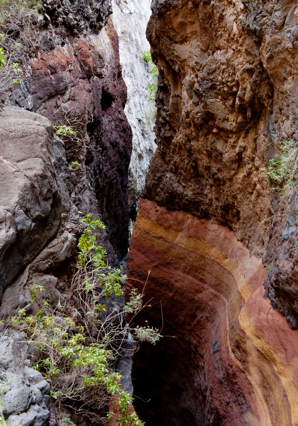
Deposits in the Barranco Ground
But the Barranco Natero really exists. It runs parallel to the Barranco of Masca, only from a bigger height of the Teno mountains and ends at the bottom of the Atlantic. Down there at the lonely beach there is an exit at the northern end of the gorge, while the Barranco Seco flows into the same beach to the south. Perhaps this common feature is the reason why the Barranco Natero is mentioned almost nowhere in the travelling literature. In fact one of the little insider tips for hikers and enthusiastic climbers.

Panorama Barranco Natero
Hike from the Mirador Masca via the Casas de Araza
The starting point for this hike is the Mirador Masca at 1038 metres above sea level. Tourist buses park here with people who want a view over the entire southern Teno mountains. But from this impressive place, the hike to the famous Guergues Steig and also the hike to the Barranco Natero begins. It goes about 200 meters down the road (TF-436) towards Masca. In the first sharp right bend, the hiking trail branches off to the left onto the Guergues Steig and also into the Barranco Natero.
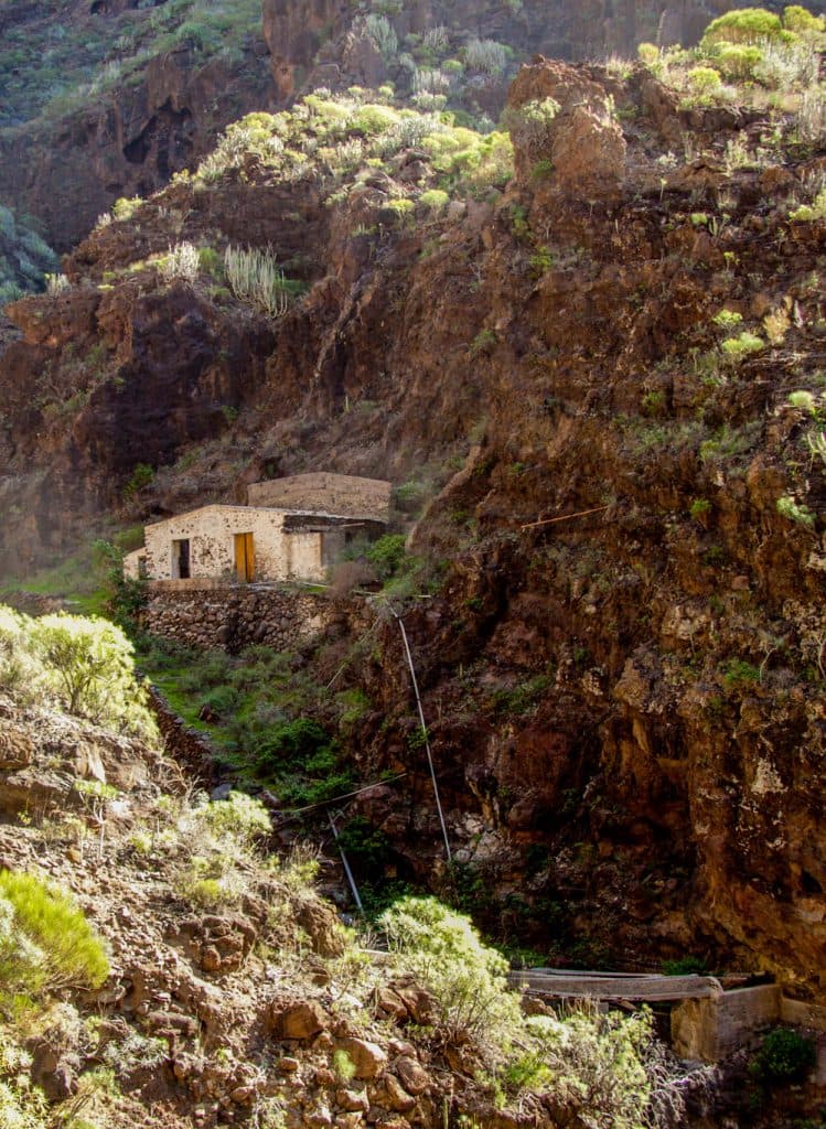
Barranco Natero - ruin house
Below the road there are some lonely farmhouses, the so-called Casas de Araza. A small dirt road leads down the mountain to the houses in the direction of Barranco. You stay for a short time on the ridge path to the Guergues Steig and then branch down to the left towards the valley at the first opportunity. Here there are many small paths that are constantly frequented by the goat herders who bring their herds up the Guergues Steig. Already after five minutes you cross the small Barranco below the houses.
Hike Casas de Araza – Barrancogrund 760 m altitude difference
On the other side of the valley you will find a path that you follow to the right. There are no signs here. Only a few stone men from time to time. The path leads you on the left side of the valley. You go through a kind of gate and then around a big rock and in ever steeper serpentines down into a side valley. You hike until you reach the bottom of the valley. Partly you will have to make your way through the bushes. But the path itself is easy to see. After about half an hour you will come across the first watercourses and water accumulations at a height of 760 metres at the bottom of the gorge.

Narrow path above the Barranco ground
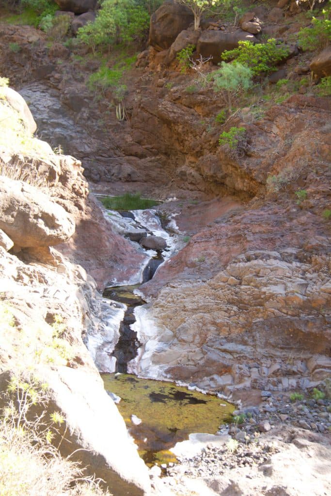
Shortly afterwards you will finally arrive at Barranco Natero from the side valley. To the right and left the mighty rocks rise steeply. High up on the right you can see the Guergues Steig. Also on the left side steep big rock walls that separate the Barranco Natero from the Barranco Seco. From time to time the top of the white Risco Blanco looks out like a big head in some places above the crest. Unless there is a dry season that lasts for months, you will always come across small water holes at the bottom of the Barranco.

Barranco Natero - an old lorry is remnant from the time when the Galeria was still operated
Hike from the end of the side gorge to the Galería
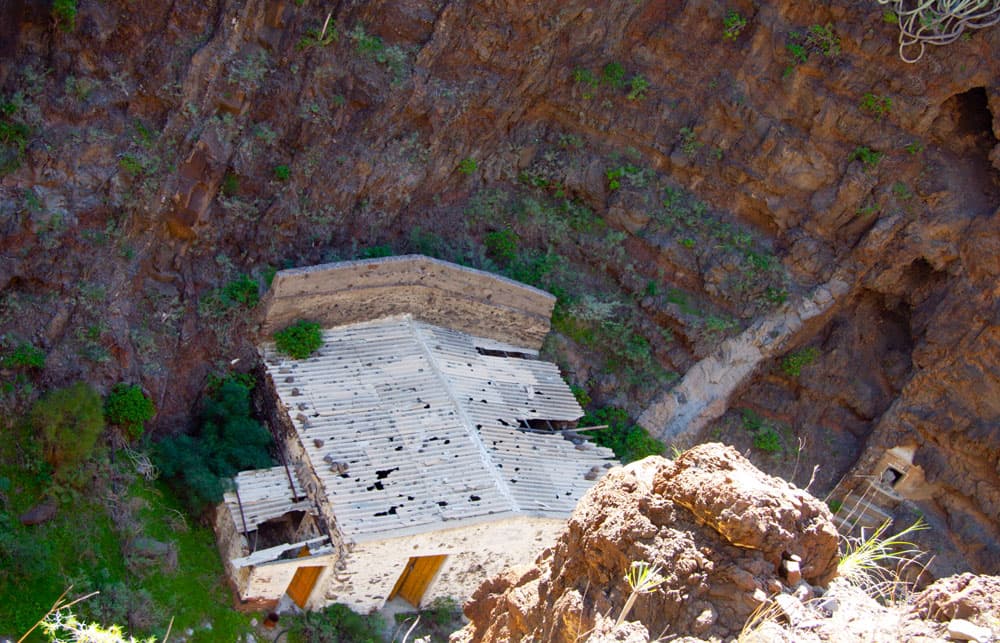
After some time, the bottom of the Barranco becomes narrower and narrower. You now run directly over many small and large stones in the washed out riverbed. It goes steadily downhill and after about another hour you reach a place at a height of about 570 meters where old white barrack houses stand. The ground and all rocks around this place are white. Here is an ideal resting place. Time to look around a little.
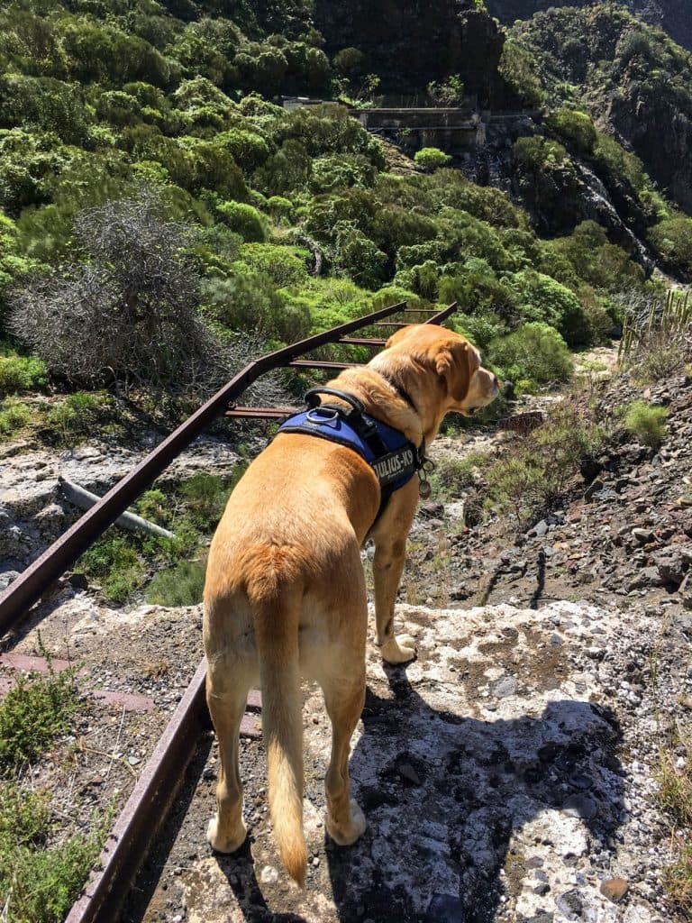
Labrador Lasko at the end of the trails
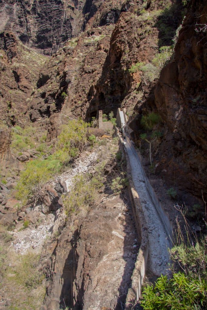
In the barracks there are still some old machines from the 30s of the last century. Tracks run into emptiness and everywhere you will find remnants of past human activities. All these facilities were once built to collect and channel water from the mountains. A small ghost town in the middle of the rampant wilderness.

Barranco Natero - old machines in the galeria
Galería walk on the right side of the gorge.
From the Galería, continue downhill in the middle of the Barranco. The path with the white rocks is already visible from afar. It changes from one side of the Barranco to the other, and then again runs directly through the Barranco for a while. Partly you have to climb over quite big rocks. But you can’t miss the way through the stone men. In the second third of this tour you go up the right side of the Barranco on narrow paths high above the stream.
ruin in the Barranco Natero
Now you can enjoy fantastic views over the gorge and the Atlantic Ocean. Deep below you lies the Barranco bed. In some places the path is a bit exposed, so that you need to be free from vertigo and sure-footed. In other places the path is easily slipped down by rockfalls and wetness or spilt by boulders. Every step must now be taken very carefully and prudently. The further down you go into the Barranco, the more untouched everything looks. In some places it looks as if nobody has been here for years.
Tunnel in Barranco Natero leads to Barranco Seco
Hiking high trail with many tunnels
Article summary and large selection of GPS hiking tracks
Sign up for my newsletter now and get exclusive access to my collected GPS tracks as well as all the brief information about my articles.
Sign up nowAfter the white discolored places, it goes past first at two tunnels. There is a tunnel at a height of approx. 480 metres 20 metres to the right of the path. It starts in a wet stream and is full of water. This tunnel leads through the rock massif into the Barranco of Masca. I myself have never walked far in the tunnel and only have this information from other hikers.
Hiking path in the Barranco Natero
Another tunnel is located shortly after this point on the left side of the Barranco about fifty meters next to the Barranco bed. This tunnel is dry and leads towards Barranco Seco. If you like and have time, you can go a little into both tunnels. Whether this second tunnel can actually be crossed, I do not know. Further down in Barranco there is another shallow crawl tunnel on the right side, which also seems to lead in the direction of Masca.

Barranco Natero - tunnel entrance
From the second tunnel to the lower part of the Barranco Natero
After some time you will pass another ruin on the left side of the Barranco. You walk high up on the right side of the gorge on a very narrow path. The path leads along the rock and you can look down to the white abandoned cottage in the Barrancobett. From here the paths get steeper and steeper and wind down towards the sea on the right side of the slope. The Barranco itself is also getting narrower and darker. Rarely do you come out of the mighty shadow cast by the rock walls.

The hiking trail through the Barranco Natero often leads over large stones.
After about 2.5 – 3 hours you arrive at a very narrow spot, where in Barranco it could only go on for an experienced climber with rope. That’s what it looks like at first sight. But in fact there is a possibility to go up this place on the right side of the Barranco. You walk along a rock cave on the upper right. Then you go down in serpentines to a small meadow. You cross this meadow on a rather overgrown path that widens the gorge for a short time.

Barranco Natero - ruin house
Hike through the lower part of Barranco Natero to the Atlantic Ocean.
After the meadow, the path immediately leads you narrowly along a rock again, which you bypass on the right. Then it goes steeply down again on paths with lots of scree in the direction of Barrancogrund. The last third of the gorge becomes so narrow that the path between the vertically rising rocks is only possible in the Barrancobed. Here, there are always big rocks that have to be climbed over.

Labrador at the beach
At one point there are steps in the red rocks. On these rocks you can climb down into the bed of the gorge like on a ladder. Now in many places you have to really climb. It goes with block climbing and scrambling over big stone blocks. But the effort is rewarded, about 50 meters above the Atlantic the gorge widens. Now the rocks become smaller. And then you stand at the 500 meter long stone beach at the Atlantic.

The Barranco Seco is green and not as dry as its name might suggest.
Hike through the Barranco Seco
Hiking route El Molledo – Pass
The tour begins in the idyllic village of El Molledo (880 metres), between the towns of El Retamar and Santiago del Teide. In El Molledo you start opposite the small church, which cannot be missed in this tiny village. You follow the road straight ahead (Calle La Calzada) until you reach the end of the village behind the last house through a small path into the Barranco Santiago. There you will find the TF 65 trail that leads from Tamaimo to Santiago del Teide.
Barranco Seco - rocks, water and wild nature
You only walk a short distance up the path until you come to a fork in the road. Turn right and continue towards Santiago del Teide. Go straight ahead and after a few metres keep left down the valley, while on the right another path number TF 65.1 leads up to Risco Blanco. You stay on the slightly downhill path that runs through the slope, on which you pass an abandoned goat farm after a short time. Shortly after the abandoned buildings, the trail climbs more and more up the slope towards the pass, which you cross at an altitude of about 825 metres.

Risco Blanco
Hiking route Pass – Galería de Junquera
Now the view in front of you into the Barranco Seco is clear. You walk along the right side of the ridge and after a short time you pass another crossroads where a path leads down to Tamaimo. From here you have a wonderful view of La Gomera and the white volcanic rock Risco Blanco on the right side. After about 10 minutes there is another small fork leading back to Tamaimo. Now the descent begins.

Hiking path through the gorge
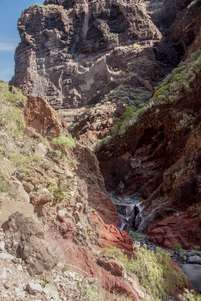
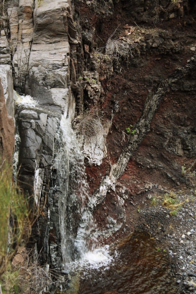
It goes downhill in long steep serpentines. These take you down over 400 metres to the bottom of the Barrancos Seco. You cross a wide white grey limestone channel and soon see old ruins and water channels (Galería de Junquera) at the bottom of the Barrancos. After rainfalls, the Barranco is well filled with water and not dry at all, as its name Seco suggests. Nevertheless you should not rely on it and carry enough water with you.

Barranco Seco - the ruins of the Galería de la Junquera
Hiking route Galería de Junquera up to below the tunnel (180 height meters)
At an altitude of 400 metres you will meet the Galería de Junquera. Here in the Barrancobett next to the old ruins and wagons is an ideal picnic place. From the Galería de Junquera we continue on the right side of the Barranco. A short time later we return to the left side of the gorge. After about 20 to 30 minutes of walking downhill on the path, you will come across a covered water channel on your left, which you continue to follow. Continue along the rock face to a tunnel (see tunnel tour), which leads through the mountain back out of the Barranco Seco into the cliffs of Acantilado of Los Gigantes. 
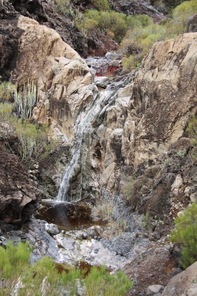
Barranco Seco - little waterfall
You will stay here at about 215 metres above sea level, but continue along the main path that descends to the beach on the right. The path is narrow, partly with a lot of scree and a little rough. The ravine is quite green in water-bearing times. And as it is little used, the small paths are often overgrown with bushes. After a few minutes you reach the bed of the Barranco again. You circle a mighty rock face that seems to support the Barranco to the right and left.
Barranco Seco - rocks and waterfall
Hiking trail of 180 metres in altitude – overhang
From now on the path will be difficult and impassable. There are several ways to get to the beach of Barranco. Many small routes are marked by hikers by stone men. Partly the path goes left or right along the slope of the Barranco. Then again the path crosses the Barranco over rocks and boulders. The Barranco becomes narrower and there is a danger of falling rocks due to the overhanging rock faces.

Barranco Seco - View from the lower part to the Atlantic Ocean
Suddenly you will stand at a point where the path doesn’t seem to go any further. At this point, you can only progress along the steep rock face on the right side if you jump or climb over an exposed rock face on an overhanging rock face. If you are not absolutely sure-footed or free from vertigo, you won’t get any further at this apparently „sunk“ spot. But on the opposite side of the gorge (left) there is a steep slope that also leads down to the bottom of the Barranco.

Barranco Seco - View from the lower part to the Atlantic Ocean
Hiking route overhang – beach
The small path leading back to the bottom is not comfortable either, but feasible. With a little scrambling and careful walking over a lot of rubble it is possible to reach the bottom of the Barranco slowly and carefully. In fact, this spot is also marked with small stone figures. The path through the gorge now becomes narrower and darker. Partly it runs on the right side of the Barranco in a continuous up and down.
Then the path leads again through the middle of the stream bed. It still goes up and down some times very steeply on the sides of the Barranco on narrow paths. A little climbing is also necessary in the Barranco bed. But then you can suddenly hear the sound of the sea and know that you are now approaching the Atlantic. Shortly after that you come over the right side of the slope to a small rock plateau. From there you can take a first look at the long stone beach.

Barranco Seco beach with little hut
At the lonely stone beach
After another 5 minutes you have made it and are standing at the 500 meter long beach of the Barranco Seco at the Atlantic Ocean. This is not a sandy beach, but a wild untouched nature. Only a few ruins testify to the presence of humans. Otherwise, the beach and the surroundings are covered with stones and rocks. In front of you on the Atlantic you can see the passing excursion boats that let their guests have a look at the bay from the sea on the way to the whale watching or to Masca.
Apart from the tourists passing by far along the shore, you will enjoy the complete solitude on this beach. Here you can take a break or a refreshing swim. If you climb over the many stones and rocks on the beach south to the left of the long bay, you can have a look at the near Los Gigantes. On the northern side of the beach the Barranco Seco and the Barranco Natero flow into the Atlantic Ocean.

the stony beach
And finally
you come back from both tours only by strenuous hiking up. Many meters of altitude are still ahead of you. Please don’t forget this when planning your tour. You can walk back the same distance or combine both gorges. Now I hope that you enjoyed the tours again today. And wish you beautiful experiences in the fascinating gorges. Take care of yourself.
Dagmar von SiebenInseln