4/25/2019 (updated: 11/26/2024) | 16min Reading time
Adventurous water walk through a tunnel
DifficultyModerate
IslandTenerife
Altitude650m
Distance11,5km
Circular hike
The tunnel is open (as of December 2023)
Today’s walk takes you from Erjos through the Barranco de los Cochinos (pigs‘ ravine) to a tunnel. There are many tunnels in the Teno Mountains. And some of them are easy to cross. In the article „Pure adventure“ I had already described two of these tunnels. Today’s hike takes us through a tunnel again near the Cuevas Negras. But in this tunnel water flows, so that you have to equip yourself accordingly. With waterproof sandals on your feet and a flashlight you will definitely like the adventure.
Tunnel – Galerias for water extraction, hazards and crossing
The tunnels were built on the Canary Islands to extract water. Here you can find out more about the history of the so-called Galerias. On Tenerife there were already several accidents in these Galerias, because people got accidentally into tunnels, which were not properly ventilated. Very close to the tunnel you can cross on this walk is a sealed tunnel. Unfortunately, six people died in this tunnel (Piedras de los Cochinos Gallery) in 2007.
old equipment used for water extraction in front of the tunnel
But don’t worry. The tunnel between the Barranco de los Cochinos and the Cuevas Negras is well ventilated. You will only get wet feet if you don’t wear rubber boots. Because the water flows through the tunnel. In some places it is only ankle-high. And in other places it almost went to my knee. In summer the walk through the water provides a refreshing cooling. In winter it can be a little bit unpleasantly cold.
Track of the hike Erjos-tunnel-Erjos
General information about the circular walk Erjos – Tunnel – Erjos
Starting point and approach
The starting point of the hike is Erjos, located on TF- 82 between Ruigómez and Santiago del Teide. Parking is available everywhere in the village and on the roadside. There is a large car park opposite the small church. This is also the starting point of the hike.
Erjos - starting point opposite chirch
Arrival by car
From the north you take the TF-82 from Icod de los Vinos via El Tanque and from the south the TF-1 via Santiago del Teide towards El Tanque.
Arrival by bus
The Titsa bus lines 360 and 460 stop in Erjos. You can find more information on the Titsa homepage.
Time
I don’t like to give general time information for hiking tours, because the times are very individual. For this tunnel adventure with a longer picnic I needed about 5 hours.
elevation profile Erjos - tunnel - Erjos
Difference in altitude and distance
The difference in altitude is about 650 meters and through up and down in between about 100 meters more altitude gross. The distance is according to my recording approx. 10.5 long. But as down in Barranco and in the tunnel the JPS had no reception at times, it should be about 11.5 kilometres.
Article summary and large selection of GPS hiking tracks
Sign up for my newsletter now and get exclusive access to my collected GPS tracks as well as all the brief information about my articles.
Altogether you hike on well laid out hiking trails. The section into the Barranco Cochino is quite steep and partly impassable. And also for the ascent back to Erjos a little physical condition is necessary. The tunnel is about 750 meters long. Walking bent down in the ankle to knee-high water is necessary.
Hiking trail signs near Erjos
Important: For the tunnel crossing it is absolutely necessary to bring a good flashlight (better still a headlight). I saw people walking through the tunnel barefoot or with flip flops. Better are of course robust waterproof sandals, which you should bring along on this hike.
Refreshment
There is a bar only at the starting point Erjos. Therefore take enough water and food with you.
variant tracks around Erjos and the tunnel
Variants
This tour can be combined well with various other hiking and circular walks in the vicinity. The route is partly identical with the hike to the Cuevas Negras. On the photo you can see different starting variants and tours. The round tour described here leads you over a ridge with a very good view. You can also take the start of the tour to the Cuevas Negras via Los Silos. On the photo you can see the round tour Erjos – Los Silos – Cuevas Negras – Erjos. Today’s tunnel tour is a shortcut so to speak. You don’t go to Los Silos, but through the tunnel. If you like, you can also start the tour from Los Silos. Then you can follow the description of the tour to the Cuevas Negras described here.
Track of the hike Erjos-Tunnel-Erjos with variant without ridge (orange)
Circular walk Erjos – Barranco de los Cochinos – Tunnel – Erjos
Section Erjos up to the antenna mountain
The hike starts at 1050 metres above sea level in the small village of Erjos on TF-82, diagonally opposite the church, you cross the Camino de el Guanche on a corridor between the houses. Follow the PR TF-52 and PR TF-54 paths towards Los Silos/Monte de Agua. When the road forks, go down a small alley on the left. A short time later you are already walking out of the village on meadows and fields.
view to Erjos from the ridge
The path leads you up to a small mountain with antennas that cannot be overlooked. Alternatively, you can also get here this way: Coming from direction Santiago del Teide, a road branches off to the left at the entrance of the village opposite the tourist information. Cars can be parked there. This is also the hiking trail PR TF-52 and PR TF-54, which leads you with yellow white marking in an arc on a hill opposite the place. After half a kilometre you are also at this point on the mountain with antennas.
hiking trail over the ridge
Section Antennenberg to cloud forest Monte del Agua
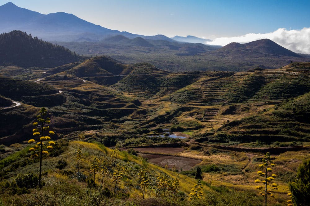
As you can see on the track (picture), there are two possibilities from here again. The shorter way leads right through the forest. If you keep to the left and walk up the ridge, you can enjoy a wonderful ridge walk with beautiful views. I walked around on the left here. You have wonderful views over and around the village of Erjos with its colourful houses all the way to Teide. On the other side you can already see the north coast.
view on the north coast - Los Silos
The ridge hike leads you in a constant up and down along the mountain ridge. At the end of the ridge the trail turns right uphill through the cloud forest. In an arc you get to the hiking path, which is also reached after some time by the shortcut from the right. Follow the signs for Monte del Agua towards Portales on the TF-52/TF-54 path. Now you will pass through the „fog“ laurel forest of Monte del Agua, which today is only a small part of the former „primeval forest“.
view to the coastline
Section of cloud forest „Monte del Agua“ up to the turn-off Barranco de los Cochinos.
Article summary and large selection of GPS hiking tracks
Sign up for my newsletter now and get exclusive access to my collected GPS tracks as well as all the brief information about my articles.
The trees, whose branches intertwine high above you and allow little sunlight to pass through, have the ability to capture the moisture blown in by the trade winds and turn it into rain. That saved them from the clear cut. During the reforestation, in addition to the many native tree species that you can admire on this hike around Monte del Agua and that can only be found on the Atlantic archipelagos (Macaronesia), especially the pine and the eucalyptus have been added. This forest crossing is a really interesting experience, especially for botanists.
my Labrador is joining us
After some time the wide hiking trail TF-52 continues straight ahead towards Las Portelas. However, you follow the narrow path, which is more and more steep, on the TF-54 towards Los Silos. To the right you already have fantastic views of the Barranco de los Cochinos. The path takes you close to the abyss for a short time. In between, the view of the north coast becomes clear. In the distance you will see the sea and Los Silos far below you. After a short while straight ahead on this path a path leads down to the right into the Barranco de Los Cochinos.
path in the Barranco de los Cocinos
Section of road junction Barranco de los Cochinos to entrance Tunnel
The path that gradually takes you to the Barranco de los Cochinos is initially a relatively wide one. After some time, a narrow path branches off to the left. With this path you reach a small hill. And from there it goes downhill in narrow serpentines through bushes. The path is often overgrown and steep, but not to be missed. You walk for quite a while as the bush becomes thicker around you. As you get deeper into the Barranco, it gets darker.
Barranco de los Cochinos
And then you arrived at the Barranco floor. At the wayside, which now leads you for a while on the Barranco ground and close to it, you see remains of old machines. Ruins and water reservoirs are also in the seclusion here. After some time you will always stay along the covered water channel on the right side of Barranco. A narrow path leads along the canal. With it you gradually get back over the Barranco Grund. Once the path leads you briefly under a rock. And then you stand in front of the entrance to the tunnel.
hikers at the channel - Barranco de los Cochinos
Route section Tunnel entrance to Tunnel exit
The entrance to the tunnel is suddenly in front of you. Now take off your hiking boots and change to waterproof shoes. To get into the tunnel, you have to bend down a bit. Please also be careful with your head, as the tunnel is not very high. A flashlight or better still a headlamp is necessary. But the ground in the tunnel is flat. There are no other obstacles. If you have walked for some time, you can already see the light on the other side of the tunnel.
Entrance tunnel
Walking through the tunnel is really an interesting change. And even my dog had his wet fun with it. On the other side of the tunnel you come out on the raised covered water channel. From there, after a few meters, you come down to a small path on the left to an open area.
through the tunnel
Section exit tunnel to Erjos
On the left side a small path leads you in 5 minutes on the main hiking trail PR TF-53, which leads from Los Silos to Erjos. You now climb up to the left. After a short time you will pass ruined houses on the left which are inhabited by hermits. It now climbs steeply. The hardest part of the hike is waiting for you. On narrow paths the path leads through the deciduous forest – partly very steep – uphill. To the right and left of the path, the old water channels accompany you, which are partly overgrown by the lush vegetation or sometimes no longer visible at all.
junction way to the tunnel
Frequently it can become cool and foggy at high altitudes. Then your hand is almost invisible in front of your eyes and the area is reminiscent of a ghost forest. Shortly before Erjos you leave the forest and walk on wider dirt roads. You pass fields, gardens and then the first houses of Erjos. At the end of the walk, you will walk through the houses and gardens on a paved path up to the first street of Erjos. From there it is not far to the starting point of the hike to the church.
hiking path to Erjos
And finally
I hope that you enjoyed this great circular walk through the northern Teno mountains with a tunnel inlay. If you want to see a little video of this hike, you can watch it here. Don’t just take care of yourself in the tunnel while hiking,
Dagmar von SiebenInseln
Thank you for reading!
If you've found my hiking guides on SiebenInseln helpful for your Canary Islands adventures, please consider leaving a small tip. Your support is greatly appreciated and helps cover the costs of maintaining this blog.
Thank you for your support!
SSL secured
Comments
Volodymyr - 11/25/23, 05:41 PM
Did it today. That wasn’t first time walking through the Erjos tunnel but first time with the company. At the exit of the tunnel I saw new build materials in bags with construction mixture. It could be for fixing water tunnel or they are going to seal the entranceexit. From Los Solos entrance nothing has found and only new forbidden sign inside the tunnel about 50 meters from the entrance. Water level is little hight then usual but this is probably related to the rainy weather during these days. Thanks!