Cuevas Negras, abandoned caves, ruined houses and a ghost forest
The Cuevas Negras (black caves) are not all that awaits you on this impressive hike on the northern slopes of the Teno Mountains. You hike from the altitude of about 1000 meters from the small mountain village Erjos almost down to the coast to Los Silos.
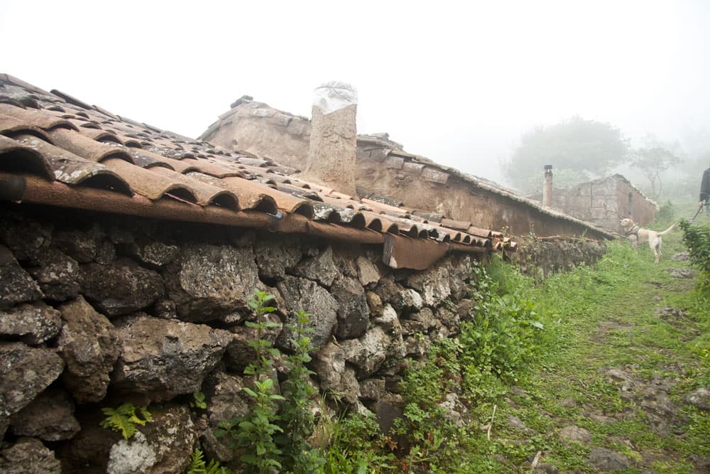
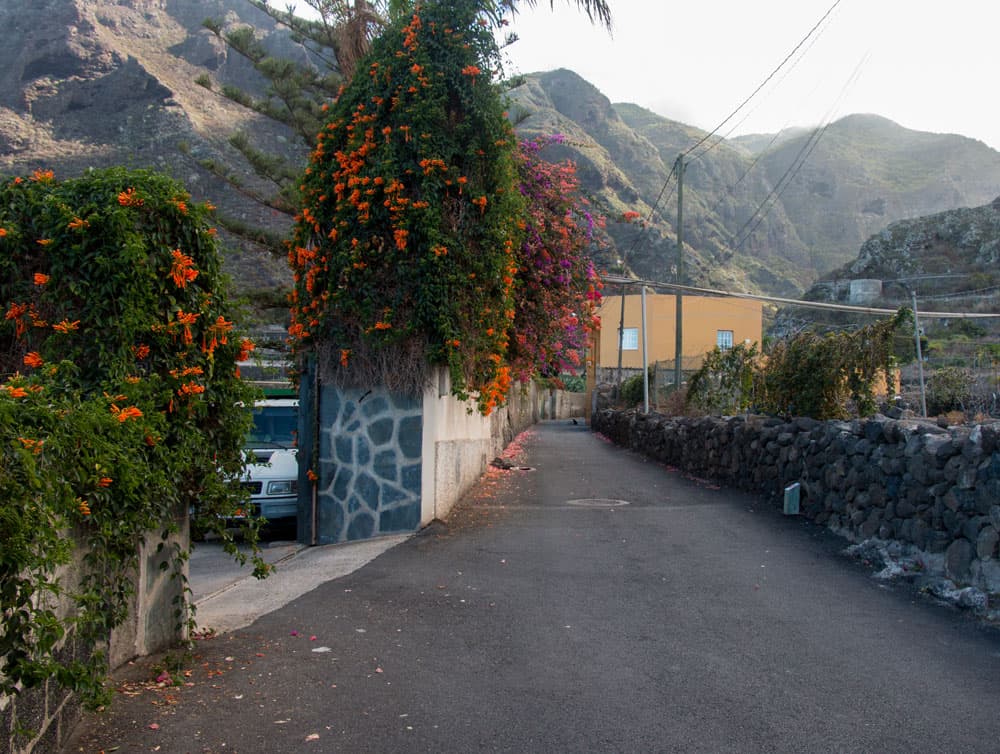
old houses close to Erjos
Beside the laurel forests of the north the tour leads you through an impressive landscape with wonderful views. On old hiking trails you pass lonely ruin buildings and abandoned hamlets like Las Moradas.
Map

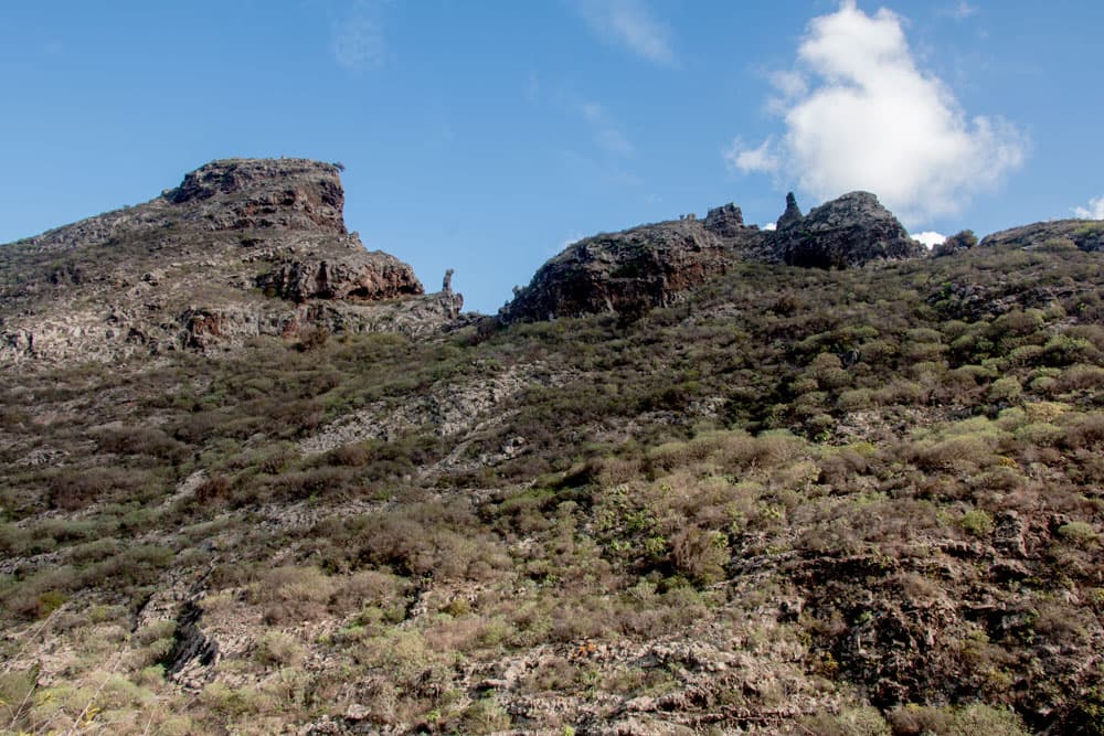
Cuevas negras - dark rocks with caves
The Cuevas Negras
The Cuevas Negras that give this hike its name will be found on the second part of the hike. They are located on the old Camino Real, which leads from Los Silos to Erjos. The Cuevas Negras are first of all unmistakably black caves, which can be seen in the high rocks along the way. The indigenous people of Tenerife, the Guanches, have already lived in them.
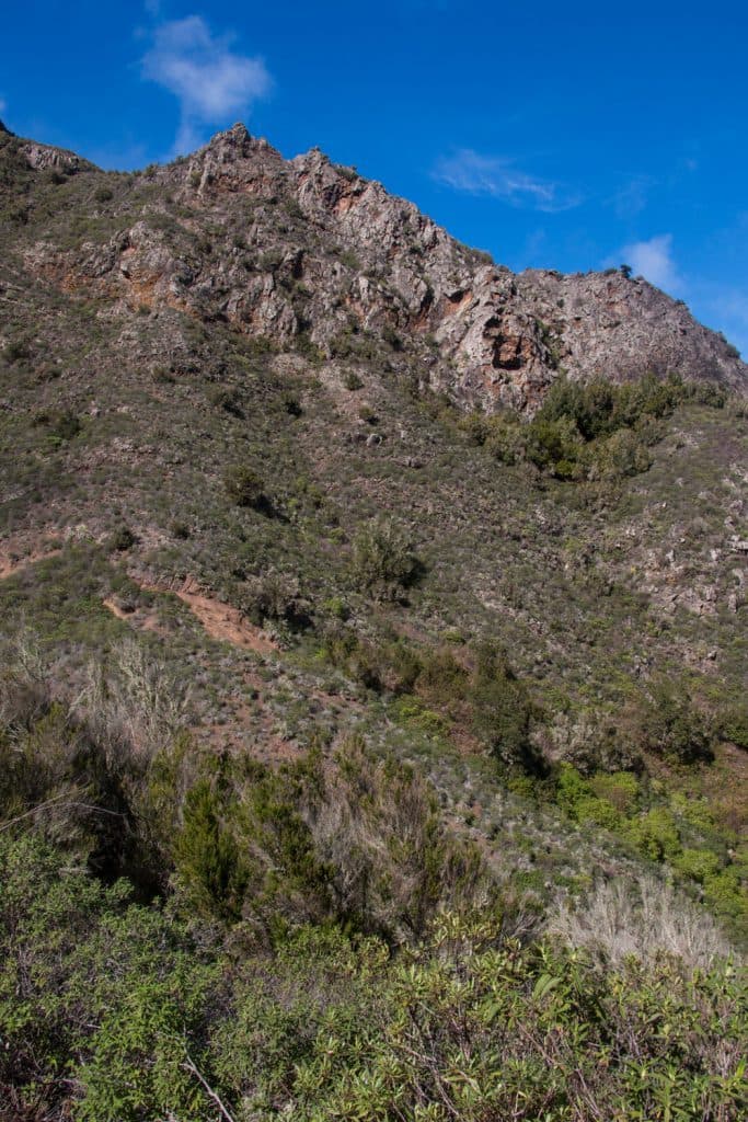
rocks on the way from Erjos to Cuevas Negras
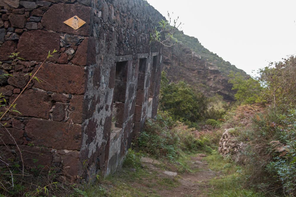
But Cuevas Negras is also a small village that was later built near the caves. The Cuevas Negras gave it its name. The small village of Cuevas Negras was home to farmers who farmed and raised livestock. In Cuevas Negras there were residential houses, a school building and many houses had their own threshing floor. The ruins abandoned by the inhabitants are still preserved to the right and left of the path. In the 70s, the houses were then temporarily repopulated by some „hippies“. Even today you can find a few hermits in the houses.
ruins at the hiking path Cuevas Negras
Las Moradas
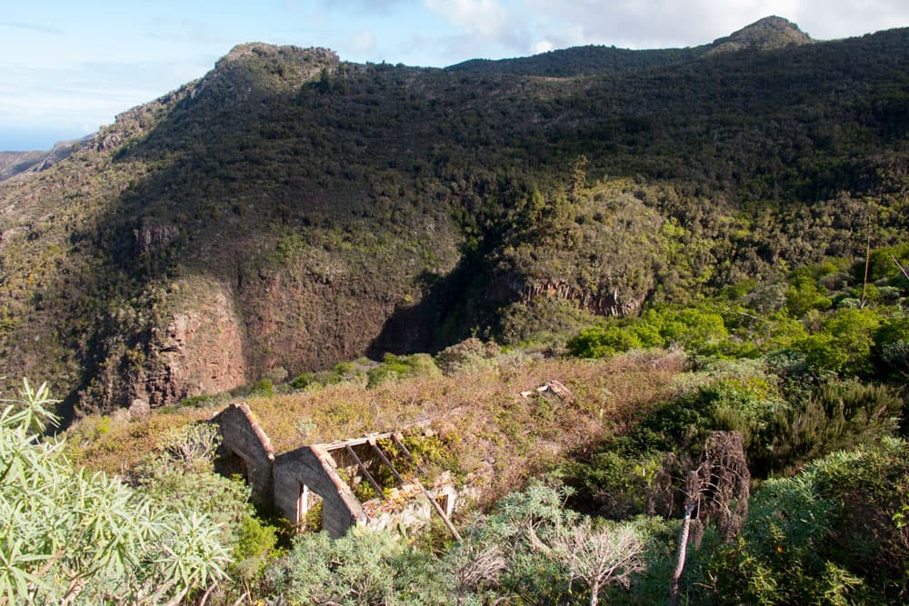
Besides the Cuevas Negras, on the way from Erjos to Los Silos you will pass many other abandoned farms and ruined houses. One or two of them are Las Moradas. These farmsteads are said to have originated from the fact that Guanches originally lived there in caves. Today, Las Moradas is considered to be a prime example of traditional Canarian architecture.
On the way you will pass Las Moradas Bajo (below) and Las Moradas de Arriba (above). At both farms you can still see the houses, barns and storehouses. There is also an oven for burning roof tiles. Terraces can be found all around the farmsteads. They show that the whole area was once used for agriculture and cattle breeding.

Erjos
Erjos
Erjos itself is a small village that was founded a long time ago in the northern Teno Mountains on the edge of the road. Originally a royal road (Camino Real) ran via Erjos from Icod de los Vinos to Santiago del Teide. At that time, the path led through infinitely large forest areas. Gradually, the forest was cleared and houses and agricultural land were built along the way. The first settlers in Tenerife chose places where water and fertile soil could be found.
Thus the forest was gradually pushed back in favour of arable land. Since the middle of the 20th century, attempts have been made to reforest the severely damaged forests on Tenerife. The area around Monte del Agua is a good example of the fact that even today there are still beautiful large forests with a great variety of species.

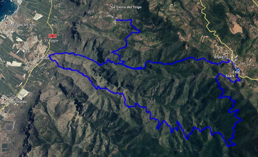
Track Cuevas Negras - Erjos - Los Silos - Erjos
General information about the circular walk Cuevas Negras
Starting point and approach to hike Cuevas Negras
Starting point of the hike is the village Erjos, which is located at the TF- 82 between Ruigómez and Santiago del Teide. Parking is available everywhere in the village and on the roadside. If you want to get to the exact starting point of the hike right away, you can turn into a wide road at km 16 and park your car there.
Arrival by car
From the north take the TF-82 from Icod de los Vinos via El Tanque and from the south take the TF-1 via Santiago del Teide towards El Tanque.

parking lot Erjos
Arrival by bus
In Erjos the Titsa bus lines 360 and 460 stop. If you want to go only half the way and leave Los Silos by bus: there the Titsa bus lines 363 and 107 stop.
Time
I don’t like to give general time information for hiking tours, because the times are very individual. For this tour I needed 5 hours myself with small breaks. More information on Titsa Homepage. 
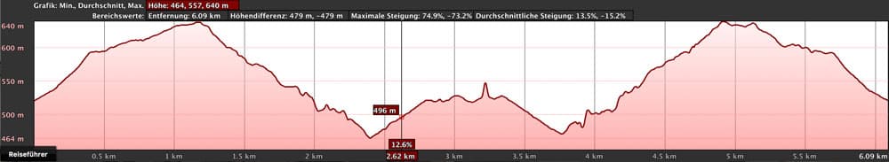
elevation profile Erjos - Los Silos
Difference in altitude and distance
The difference in altitude is about 950 meters and the distance is 16 kilometers long.

elevation profile Los Silos - Erjos
Article summary and large selection of GPS hiking tracks
Sign up for my newsletter now and get exclusive access to my collected GPS tracks as well as all the brief information about my articles.
Sign up nowRequirement
You hike on good hiking trails that are not exposed. However, for the whole distance a quite good condition is already a prerequisite. Especially the ascent from Los Silos to Erjos is very steep and exhausting. But if the whole tour is too exhausting for you, there is no reason why you shouldn’t „divide“ the hike into two hikes.
Refreshments
Restaurants, bars and shops can be found in Los Silos and Erjos. But for the ascent and descent please take enough water and food with you.
Variants
This tour can be combined well with various other hiking and circular walks in the vicinity.
Main track with track to Tierra del trigo
Short hike to the Cuevas Negras
If you would like to see the Cuevas Negras, but don’t like the steep ascent or descent via Erjos or Los Silos, you can also hike from Tierra del Trigo to the Cuevas Negras. From Tierra del Trigo the tour to the Cuevas Negras is only 4 km long with a return trip. On the track it turned out to be 6 kilometres for me, because I walked a lot back and forth on this little tour at the Cuevas Negras and looked at everything very closely. With a long stay you won’t need more than 3 hours for both ways. And there are only 450 meters of altitude to overcome.
Approach via El Tanque TF-82. In the centre of El Tanque turn onto TF-423 towards Tierra del Trigo. The track is available for download.
elevation profile Tierra del Trigo - Cuevas Negras - Tierra del Trigo
Other tours that can be combined very well with this hike are the circular hike from Erjos, which takes you through a water tunnel, and the Lomo Morín hike. Hint
Since you hike here on 1000 meters of altitude on the north side of the island, it can be cool, foggy and windy. So don’t forget to bring warm clothes and rain gear.
Hike from Erjos to Los Silos and over the Cuevas Negras back to Erjos
Hiking path at the sloop
Erjos section to Monte del Agua
The hike starts at an altitude of 1050 metres in the small village of Erjos on the TF-82. Coming from Santiago del Teide, a road branches off to the left at the entrance to the village opposite the tourist information office. Cars can be parked there. This is also the path PR TF-52 and PR TF-54, which leads you with yellow and white markings in an arc to a hill opposite the village. After half a kilometer you are on a mountain with antennas. Follow the signs for Las Moradas PR TF-54.

TF -82
This section is only about two kilometres long, well marked and marked with numbers in interesting places and viewpoints. Quickly the colorful houses of the place behind those in the distance the mighty Teide rises, remain behind you.

hiking crossroad Erjos
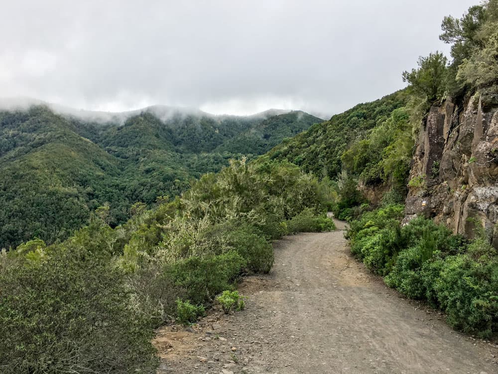
Follow the signs for Monte del Agua towards Portales on the TF-52/TF-54 path. After a short while you will reach the „fog“ laurel forest of Monte del Agua, which today is only a small part of the former large „primeval forest“.

Laurel forest - junction to Los Silos
Section through the laurel forest
The trees, whose branches intertwine high above you and allow little sunlight to pass through, have the ability to capture the moisture blown in by the trade winds and turn it into rain. That saved them from the clear cut. During the reforestation, in addition to the many native tree species that you can admire on this hike around Monte del Agua and that can only be found on the Atlantic archipelagos (Macaronesia), especially the pine and the eucalyptus have been added. This forest crossing is a really interesting experience, especially for botanists. The laurel trunks, like all trees around you, are covered with dense green mosses and lichens. The green vegetation does not stop at the stones and rocks.
clouds over the mountains on the cuevas negra hike
Section Monte del Agua to Casas Las Moradas
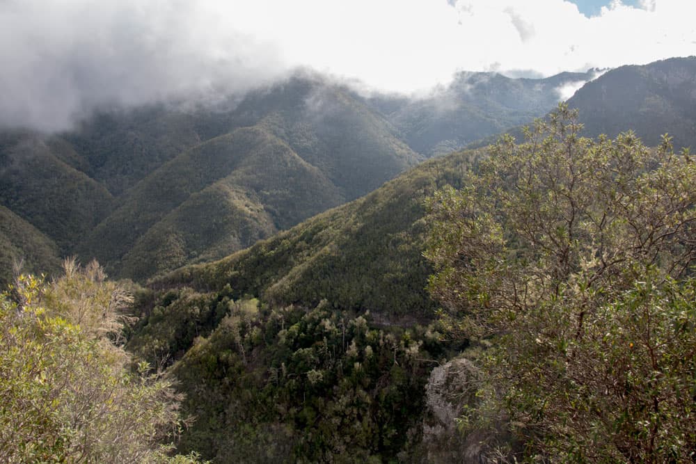
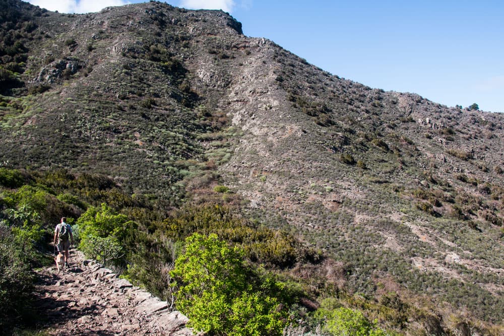
If you have walked about 6.5 kilometres from Erjos, the wide TF-52 trail continues straight ahead towards Las Portelas. However, you follow the narrow path, which becomes more and more steep, on the TF-54 towards Los Silos. To the right there are fantastic views of the Barranco de los Cochinos and the Barranco Bucarón. The path takes you alternately through woods and then back along the abyss.
hiking path Erjos - Los Silos
But there is always a good and wide path. After some time the view to the north coast becomes clear. In the distance you can see the sea and a little later also the place Los Silos (still) far below you. To your right, after some time several ruin houses appear, the Casas Las Moradas in front of us. For more details see above. Here it is a good idea to take a rest and take a closer look at the abandoned buildings.
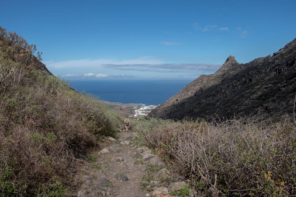
hiking path Los Silos
Article summary and large selection of GPS hiking tracks
Sign up for my newsletter now and get exclusive access to my collected GPS tracks as well as all the brief information about my articles.
Sign up nowSection Casas Las Moradas to Los Silos
Behind every bend, you’ll enjoy a new fantastic view of the rugged cliffs of Barranco and the ridges around you. You walk along the narrow path along the Barranco edge towards the coast. You will always have the sea and the town of Los Silos deep below you in view. The paths are now partly paved with large field stones. Old covered water channels and new water pipes are all along the wayside as you approach Los Silos.
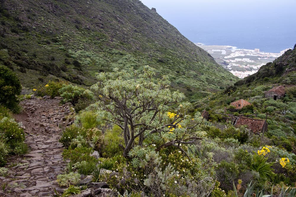
hiking Cuevas Negras down to Los Silos
If you are already very close to Los Silos, the path is steep and serpentines down to the valley. The village of Los Silos is now within reach. After a short time you approach the first houses of the village over a few bridges and under water pipes. The path widens and becomes a driveway. You walk through banana plantations and reeds. And then the road leads you to a road in Los Silos, which leads you to the centre of the village on the left. You walk around to the right for the round trip to the Cuevas Negras.

view down to Los Silos
Route section Los Silos
Those who have gone enough for today can take the bus back from Los Silos. But if you want to go even further, you can also take a rest in one of the small bars and restaurants in the village. The way back is on the other side of Los Silos via the Barranco de Cuevas Negras. The second part of the hike runs along the old Royal Way (Camino Real) that once connected Garachicco and Santiago del Teide.

Los Silos
At the point where you arrived from Erjos at the road (Calle Susana) in Los Silos, turn right. Follow the road for 5 minutes.
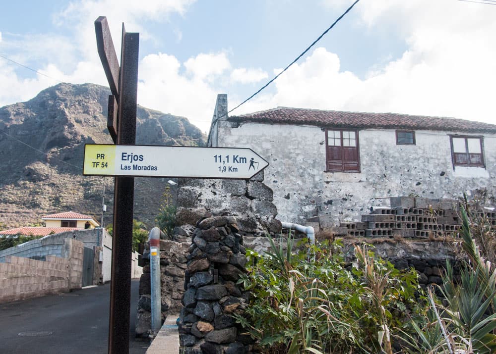
PR TF 54 at Los Silos
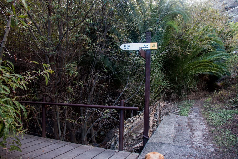
Then it goes over a wooden footbridge and on the right side along a brook. You are on the TF-53 yellow-white marked trail, from where it is 1.7 km to the well signposted Cuevas Negras. First, you take a small uphill road from Los Silos.
hiking path in Los Silos - bridge
Route section Los Silos to the Cuevas Negras
After a short time the path turns into a steep path paved with boulders, which will take you up to Los Silos on many serpentines. To the right and left of the path there are many different flowers, plants and even wild dragon trees, which stand out against the dark rock in their rich green colours. This is the hardest part of the hike, as it goes steeply uphill.
hiking path via street in Los Silos
After 1.5 kilometres you will circle a large black rock with many caves. There you will find a white stone with red inscription „Nr. 6“. From this point you will see many black rock caves to the right and left of the path in the slopes. These are the Cuevas Negras that gave the path its name. Here you can see the caves of the aborigines up close. A short time later you reach the ruined houses of the hamlet of Cuevas Negras.

paved hiking path to Erjos
Section Cuevas Negras to the village Cuevas Negras
If you like, you can look at the ruin houses in peace. The town centre was on the spot where there is a very old tree on the right side of the road. It is a Barbuzano (Apollonias barbujana). Here you will also find rocks overgrown by wild nature, which bear silent testimony to the former activity of the villagers as farmers and shepherds. After the steep ascent, it is worth taking a rest here.
Cuevas Negras - ruin at the hiking path
Cuevas Negras section to Tierra del Trigo junction
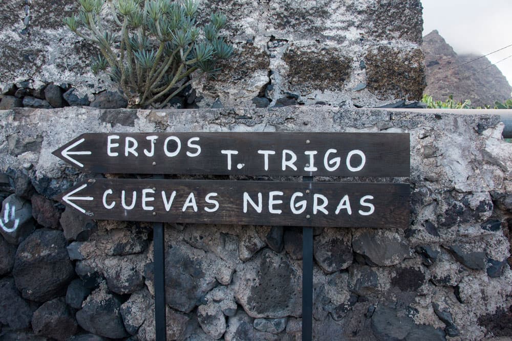
Shortly after the prominent tree, you arrive at a well-signposted fork, from where the path branches off to the left towards Tierra del Trigo and up into the mountains. Here you can take the TF-53.1 hiking trail, which climbs up to the mountain village in about an hour.
The path, which rises between green vegetation in serpentines on the mountain slope, offers beautiful views of the caves, the ruins and the entire north coast. It takes you past more abandoned houses and wild dragon trees. See General Information and Track for more details. In this area there is also a Galeria, a tunnel that runs under the mountain.
junction at Cuevas Negras to Tierra del Trigo
Section Tierra del Trigo junction to Erjos and starting point
You keep going straight ahead along the TF-53 path, which leads you to the houses of Cuevas Negras, in the direction of Erjos. You will gain more and more altitude on the narrow path, which now leads through leafy forest. On the left side you pass a house of the village Cuevas Negras. This house is currently the only one inhabited in the otherwise abandoned village.
Cuevas Negras - rocks on the way up
You climb further on narrow paths through the deciduous forest, partly very steep, uphill. To the right and to the left of the path the old water channels accompany you, which are partly overgrown by the luxuriant vegetation or sometimes not visible at all. Frequently it can become cool and foggy at high altitudes. Then your hand is almost invisible in front of your eyes and the area reminds more of a ghost forest.
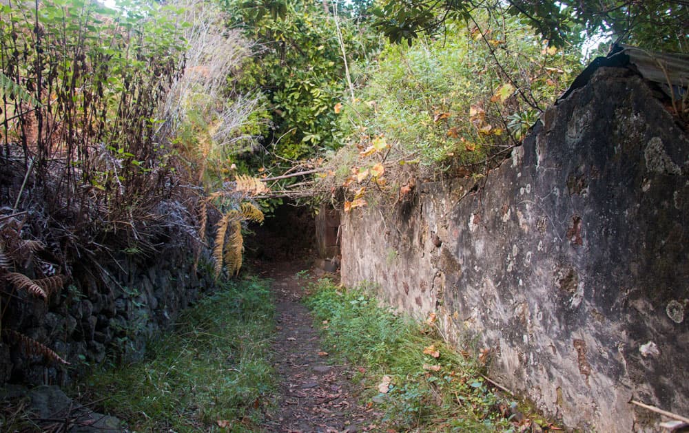
hiking path at the ruins of Cuevas Negras
Shortly before Erjos you leave the forest and continue on wider dirt roads. You will pass fields, gardens and then the first houses of Erjos. At the end of the hike you walk through the houses and gardens on a paved path up to the first street of Erjos. From there it is not far to the church. You can simply follow the good signs of the trail. Follow the main road to the road, the starting point of your hike. A large and varied hiking tour has been completed.

hiking path Erjos
And finally
I hope that you enjoyed this great circular walk around the Cuevas Negras through the cloud forest from the height to the coast. I wish you many interesting discoveries and beautiful experiences on this varied hike,
Dagmar von SiebenInseln

