Waterfalls on Tenerife – Cascada Lomo Morín
Waterfall – Cascada? If you think of the diverse landscapes of the Canary Islands, you might see the wild Atlantic coast in front of you. But waterfalls? Beside beaches and bizarre coastal strips, the Canarian Islands are generally associated with mighty volcanoes, deep canyons, pine forests or a barren lunar landscape. Waterfalls are surely not one of them.

the waterfall Cascada Lomo Morín
Map
But in fact they can be discovered everywhere on the islands. On one hand, after rainfalls or the melting of the snow, there is oftenly so much water running through the canyons that an otherwise dry Barranco can rapidly turn into a raging river in which the water flows down to the sea in cascades.
View of the village Cuevas Negras from the height
But also in the rest of the year, there are indeed some isolated waterfalls everywhere in the islands. I already reported some hiking tours to these. In Tenerife there is the most famous waterfall in the south in the Barranco del Infierno. Further hikes to waterfalls in the south are the hike Barranco del Río. Further there is the hike to Cascada de Chindia. And today there is another hike to the former Cascada Lomo Morín in the Teno Mountains. But also on the other islands there are waterfalls. There are still many tours prepared by me waiting for publication. But as the Spanish say so nicely – poco a poco. Step by step. 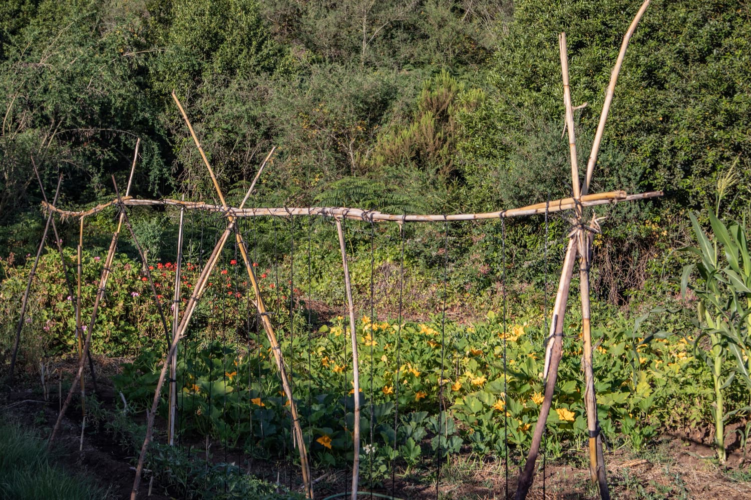
Gardens along the hiking trail
ATTENTION
Since the beginning of 2022, the canal described in the article has been drained. Unfortunately, the Cascada Lomo Morín waterfall no longer exists. You can still do the circular walk without any problems, provided there are no further closures due to the motorway construction.
Hikes in the Teno Mountains and to the former Cascada Lomo Morín
The former Cascada Lomo Morín is located in the northern part of the Teno Mountains. In this area there are endless possibilities for hiking. You can find some of them on Seven Islands under the category Teno Mountains. The famous hike to the Cuevas Negras and the hike through the water tunnel, which can be combined with it, are worth mentioning. Now I would like to introduce a hike that goes from Erjos to the Cuevas Negras. In the abandoned hamlet you follow the hiking trail towards Tierra del Trigo. 
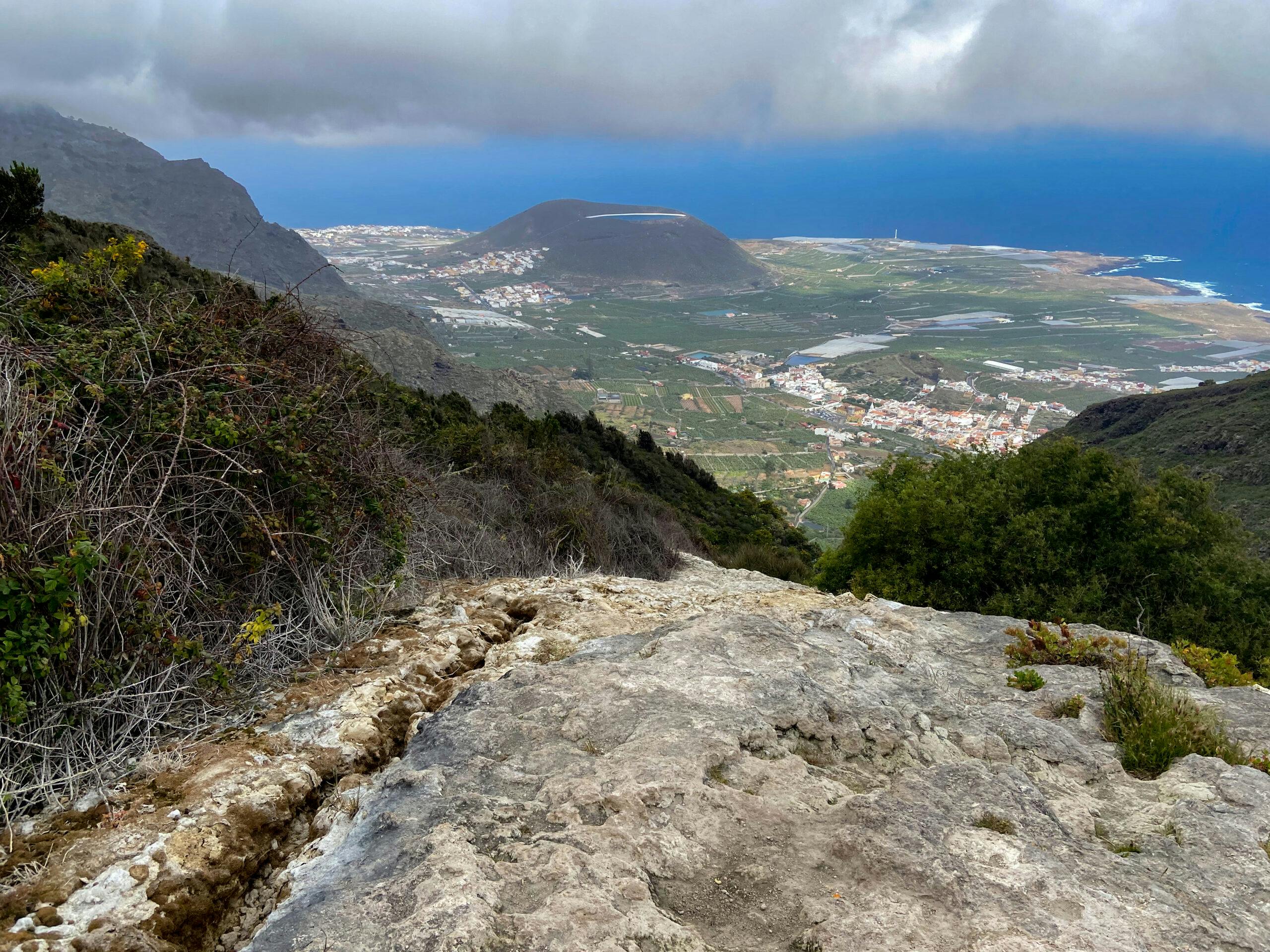
View of the Teide from the hiking trail
After this turnoff I will introduce two different paths that will take you to the Cascada Lomo Morín waterfall. Once you have visited this waterfall, you will take the big round trip past Tierra del Trigo back up to Erjos. This great round trip can be done in many different ways and offers wonderful combinations with other hiking tours in the area.
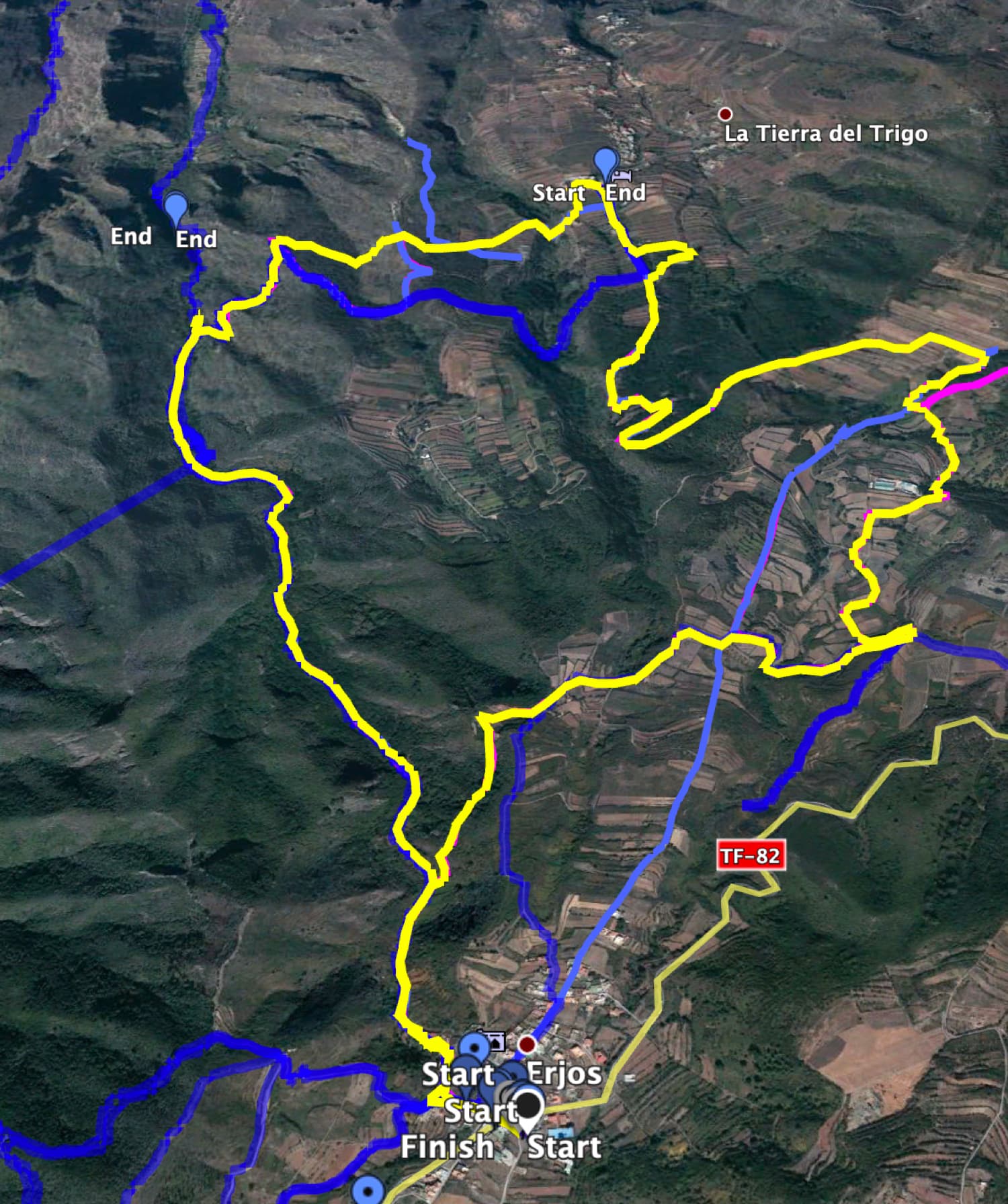
Track (yellow) - circular walk along the canal path - from there blue to the Cascada Lomo Morín
General information about the circular walk Cascada Lomo Morín
Starting point and approach
Starting point of the hike is the village of Erjos, which is located on the TF- 82 between Ruigómez and Santiago del Teide. Parking is available everywhere in the village and at the roadside. I usually start from the big parking lot behind the church.
Approach by car
From the north, take TF-82 from Icod de los Vinos via El Tanque to Erjos. From the south, you take the TF-1 via Santiago del Teide towards El Tanque.
Approach by bus
In Erjos the Titsa bus lines 360 and 460 stop. If you only want to go half way and want to leave from Los Silos by bus: Titsa bus lines 363 and 107 stop there. You can find more information on the Titsa Homepage. Time
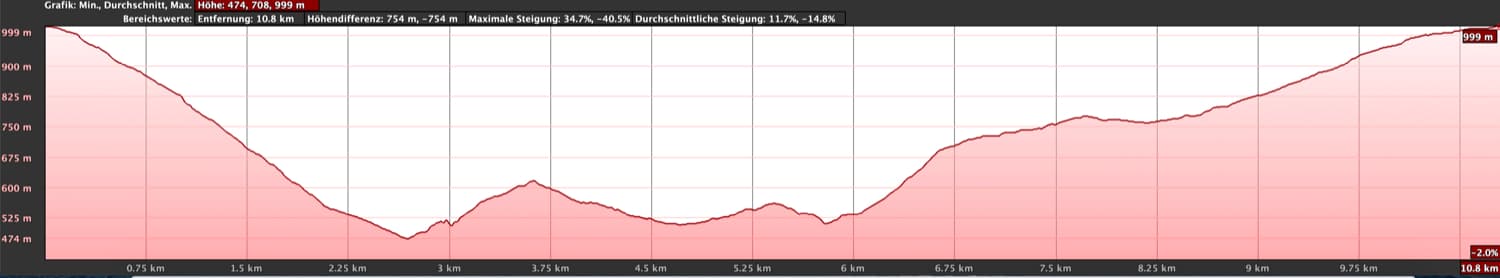
I don’t like to give general time information for hiking tours, because the times are very individual. We needed about 5 hours for this tour with an extensive rest and stay at the Cascada Lomo Morín. But in the article I also give some hints how you can shorten the tour if needed.
Höhenprofil der Wanderung Erjos- Cuevas Negras - Lomo Morín Waterfall - Tierra del Trigo - Erjos
Height difference and distance
Article summary and large selection of GPS hiking tracks
Sign up for my newsletter now and get exclusive access to my collected GPS tracks as well as all the brief information about my articles.
Sign up nowThe difference in altitude is about 750 meters. Depending on the variant, the distance is between 11 and 14 kilometres long.
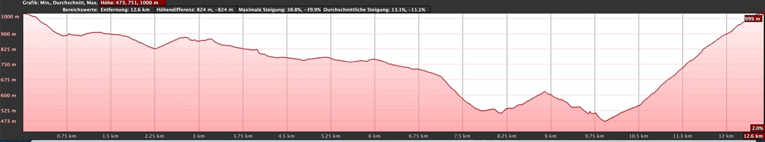
Höhenprofil - Erjos - Tierra del Trigo - Kanalweg - Cuevas Negras
Requirement
With a little bit of fitness this is a tour that can be done by anyone. You hike on good hiking trails. Only a few 100 meters before the waterfall you walk along a canal in which water is splashing. Since this often runs onto the path next to it, it can get a little muddy on the path along the canal in wet times.
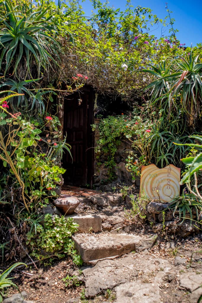
Small café below Erjos in the green
Refreshment
There is a bar at the starting point in Erjos and in Tierra del Trigo. From time to time a small café is open below Erjos. So take enough water and if necessary food with you.
Variants
This tour can be easily combined with various other hiking and circular walks in the vicinity. The famous hike to the Cuevas Negras should be mentioned. This hiking trail is a section of the current circular hike. Then there is the hike through the water channel, which also crosses this track. More hikes around Erjos and Ruigómez can be found on Seven Islands. 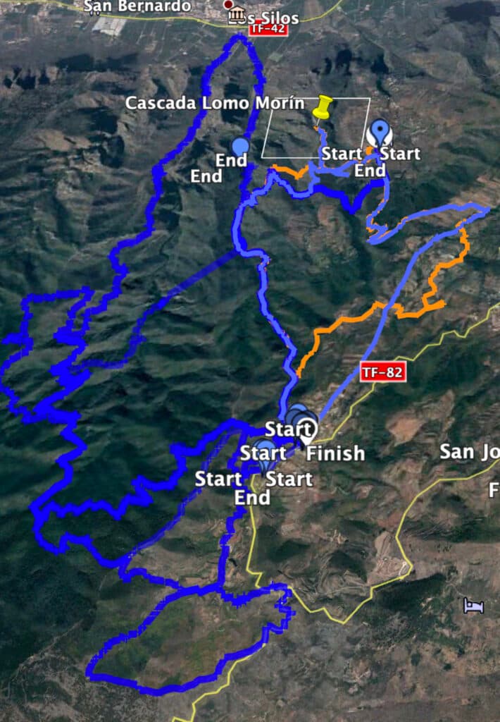
Track to the Cascada Lomo Morín (lightblue) and others near the track
Independently of the many other hikes in the area, this hike itself can be done in different ways. Of course you can walk it in both directions. But there are also – as you can see from the tracks – different possibilities to change the round a little bit and to make it more individual. I will explain the different possibilities in the description.

Dragon tree on the ascent path towards Tierra del Trigo
Round walk to the former Cascada Lomo Morín
Route section church square Erjos to Cuevas Negras
You start your walk at the parking lot behind the church of Erjos, cross the street and go down some steps on the other side of the street. From here you can already follow the signs of the hiking trail PR TF 53 towards Los Silos and the Cuevas Negras. You cross the road Camino El Guanche and continue straight downhill on the road. The road bends to the right. Continue to the end of the road. On the right there is a small picnic area and on the left a narrow path between the houses leads down the mountain. Quickly you pass the last house of Erjos and continue between meadows and fields towards Cuevas Negras.
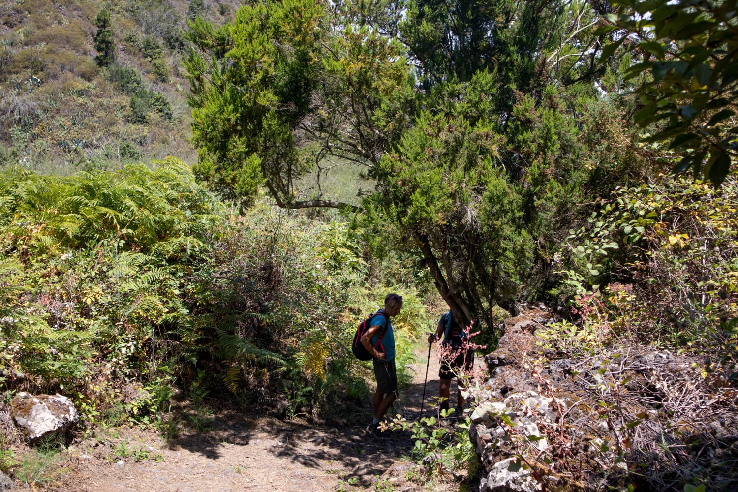
Main hiking trail to the Cuevas Negras PR TF 53
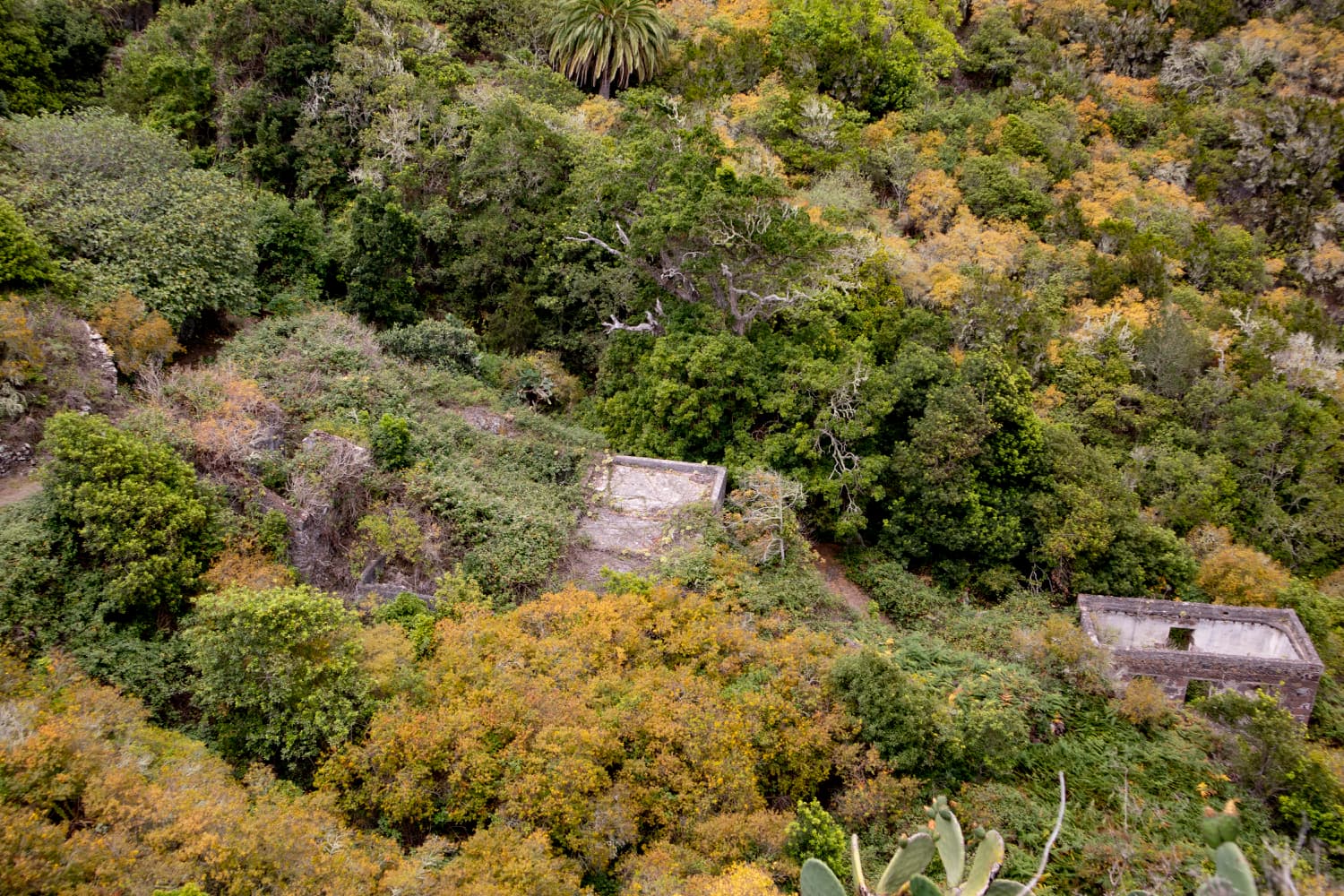
After walking downhill for some time, a small path on the right side of the path leads off. Here you will come back. Of course you can also turn right here if you want to go the round in the other direction. Otherwise you follow the main hiking trail downhill to the Cuevas Negras. You will reach the cloud forest and are surrounded by darkness and lichens. In summer it is very pleasant here because of the shade. In winter, however, it is foggy, wet and cool from time to time. After going down many small and bigger serpentines, you will pass abandoned ruined houses until you finally reach the deserted settlement Cuevas Negras. You can find out more about the big circular hike and the settlement here. 
View over ruined houses to the north coast
Section Cuevas Negras to ridge in front of a finca
At the ruins of the abandoned village Cuevas Negras you leave the main hiking trail to the right. Follow the trail uphill towards Tierra del Trigo. You will quickly gain height on the path and you will have a view of the Cuevas Negras and the whole valley from above. After some time you will reach a ridge on the left side of which are abandoned ruined houses. At this point you can decide whether to continue uphill along the main path or to climb over the ridge and descend to a water channel.

Old ruin houses on the ridge where the channel walk starts
1st alternative: straight ahead along the main path
You just follow the main road straight ahead towards Tierra del Trigo. On the next ridge there is a small path downhill to the left. Deep below you, after a while you will see a finca lying on the spur of the ridge. There are many dogs there and you will hear the barking of the dogs already from far away. The path leads you to a driveway, which you follow to the left towards the finca. If you miss the path, you can also take the next path downhill to the left. Then you make a slightly bigger curve before you reach the path. If you stay on the main path you will reach Tierra del Trigo, but you will miss the former waterfall, the Cascada Lomo Morín.
Walker on the canal
2nd alternative: left over the ridge on the water channel
Article summary and large selection of GPS hiking tracks
Sign up for my newsletter now and get exclusive access to my collected GPS tracks as well as all the brief information about my articles.
Sign up nowYou walk a few meters on the ridge to the ruins. In front of the house on the ridge a small path leads downhill over rocks between the houses. At the bottom you will see a water channel. On the right it disappears into a mountain. On the left you can walk along the water channel. It is wide and has only at the beginning two broken plates to overcome. At the end of the canal, which leads around a barranco on the mountain slope, you come to a small narrow path. On this path, you will soon be on top of the ridge and on a roadway. From the right you come if you have gone the variant 1. Now you just cross the road and go downhill again on the opposite path.

This is how the canal once looked with water

....and this is how you find him today
Section ridge before the finca to the former Cascada Lomo Morín and back at the water channel
If you are on the ridge on the path that leads to the finca, do not proceed to the finca. Many hikers stray to the finca every day and the poor farmer also seems a bit annoyed by the many daily questions about the waterfall. Shortly before the finca, a path leads down the mountain to the right. Follow it and you will come down in a small curve to the former water channel. If you follow the path to the left along the former water channel, after a short time you will reach the place where the Cascada Lomo Morín used to be. Depending on the season, the path was a little wet to really muddy. This is no longer the case after it was drained.

this is how the small waterfall Cascada Lomo Morín looked like

this is how dry it has looked at this location since 2022
But it is worth it. At the end of the path you stand at the top, where the Cascada Lomo Morín waterfall once splashed down. Fortunately, the magnificent view remains. In front of you is the north coast around Los Silos. When you have seen enough, go back to where you came down to the canal on the path from above. Now go straight on. At the next fork in the path, keep left.

Hiking trail near Tierra del Trigo
Section of the road junction until the end of Tierra del Trigo
After a short time the wide path continues left and right. But you go straight on a narrow path through bushes into a barranco. On this path you first go downhill and then uphill again to avoid the small gorge. In the barranco there are small gardens. At the other side at the top, you are already in the small village Tierra del Trigo. You walk along the road a few metres to the left.
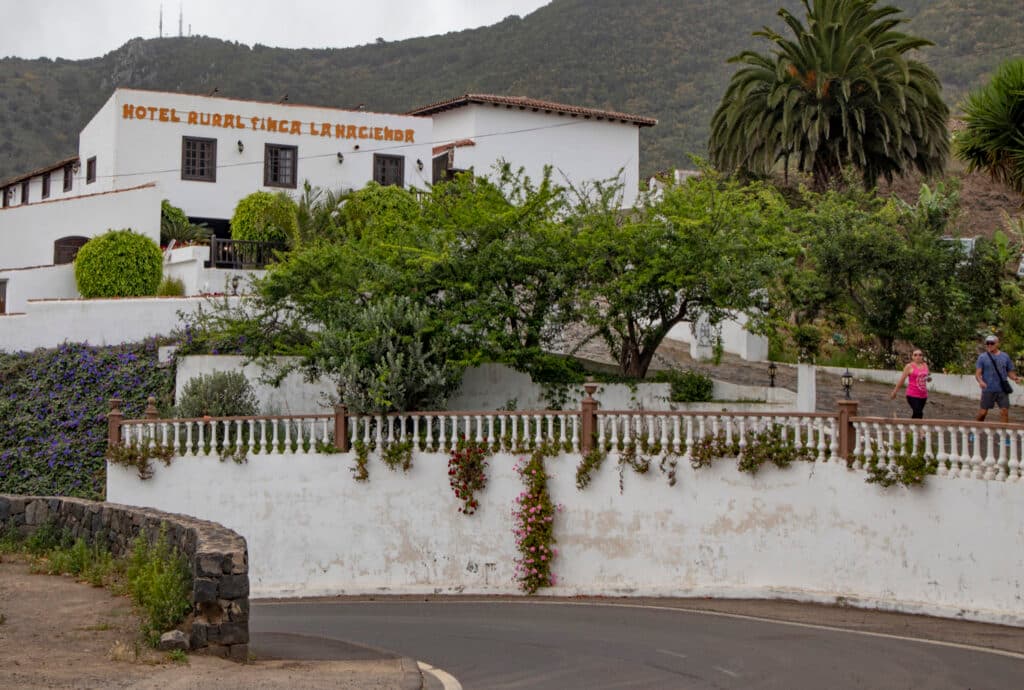
Hotel Rural bei Tierra del Trigo
If you want to go for a walk through the village, keep to the left and at the end of the road keep to the right. You will pass the church square and a bar. In front of you is a large Casa Rural. Now go right and you will see a long uphill road in front of you. Here it goes uphill again after the inspection of the place. Without the round through the village, you come out straight ahead a little higher on the road. If you like, you can take the next path to the left and go another small round through very nicely laid out gardens and fields. Or you can go straight on up the street. You can also get there via the small turnoff.
Hiking trail over Tierra del Trigo
Leaving Tierra del Trigo until the crossroads of Ruigómez – Erjos
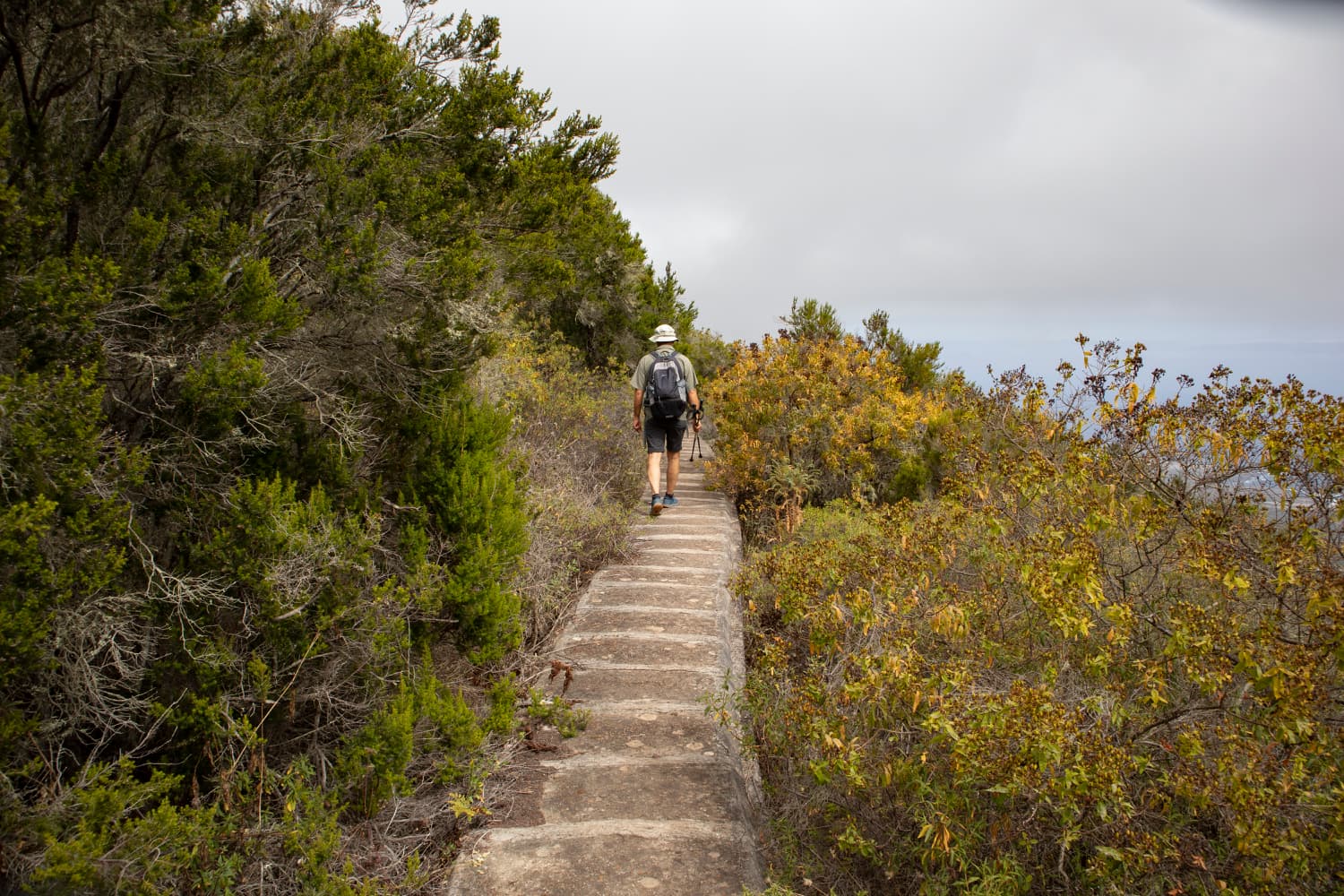
From now on you follow the road for a long time uphill straight ahead. After quite a while the road changes to a small steep path on the left, on which you continue to walk uphill partly over rocks. You walk through bushes and forest. Later the path leads along a fence. In serpentines you now walk uphill along farmsteads. You follow the path, which takes you first through the forest and later on to open fields. Between the fields you continue straight ahead on the path.

View from the height to the north coast
Finally you come to a fork in the path. Here you keep to the right. On a small path at the edge of the forest you go uphill until after a short time you come to a road again. The road leads left to Ruigómez. If you want to shorten the route a little, follow the road to the right and keep going. This road will take you back to Erjos in a straight line. But more interesting is the hiking trail. Here you go left for a few meters on the road. Then you turn right uphill on a path that is marked as a hiking trail.

Potato harvest near Erjos
Section of the trail Crossroads Ruigómez – Erjos to Erjos
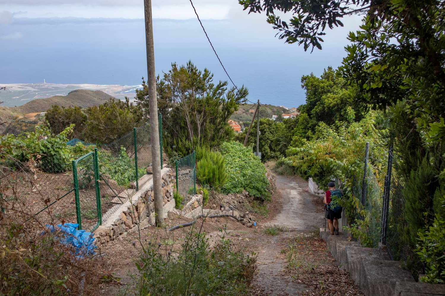
You hike further uphill on the hiking trail. At the next fork, keep right. And at another fork you turn right again. Slowly you have already gained some altitude and can enjoy wonderful views from here. You will walk around a barranco and finally reach the Ruigómez – Erjos road again. Even now you can still take a short cut if you simply follow the road to Erjos to the left. However, the circular walk only goes along the road to the left for a short time. Then you turn right again into a wide path.

Resting on the covered channel
This path leads you for quite a while along some houses, fields and the forest. Finally you come to a fork. If you keep left on the main path, you will reach Erjos immediately. However, the more attractive smaller path turns off to the right. After a short while you will come to a fenced-in area. The path continues to the left. It is narrow and sometimes a little overgrown. It takes you in a wide arc down into the barranco to the main hiking trail PR TF 53, where you turn left and follow the same path back to Erjos and the car park behind the church.
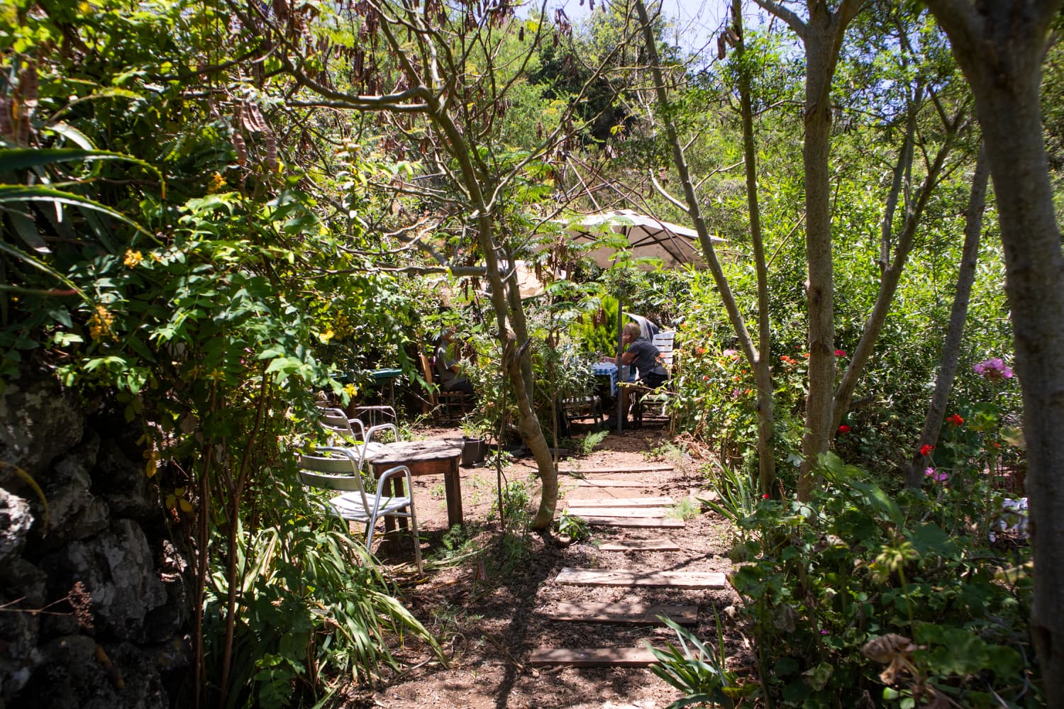
Café in the countryside near Erjos
And finally
This hike is really quite exciting because of its varied landscape. You can see and visit villages, fields, meadows, mountains and canyons as well as ruined houses. Highlights are the place where the former waterfall gushed and the ruined houses Cuevas Negras. And if you want something special at the end of the hike, you can sit in the small café below Erjos in the wild green garden and enjoy a drink of your choice. You can decide the price yourself. I hope you enjoy this really recommendable circular walk,
Dagmar of SiebenInseln