Barranco del Río – wild nature and lots of water
As announced in the last article, today I describe a hiking tour into the Barranco del Río to another waterfall in Tenerife. I already wrote about hikes to waterfalls on the Canary Islands in my last article Cascada Lomo Morín. Map
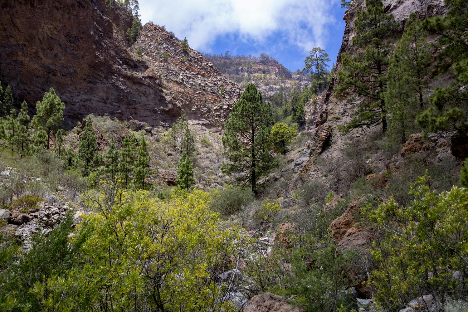
Barranco del Río - bushes, rocks and a narrow gorge
This waterfall is now located in a quite wild and lonely canyon high at the foot of the eastern slopes of the Cañadas. But even in dry weather you will meet water in the Barranco del Río. You hike at a height of more than 1500 metres along the course of the stream in the Barranco del Río and slowly ascend to the waterfall.
Barranco del Río
As this is a rather short hike, you can make a detour to a nice side valley of the Barranco del Río on the way back. As you will have to scramble a lot over rocks and stones during the whole hike, you will need concentration. Hopefully you will not feel like me. I slipped off the slippery rocks a few times and once I even stood with one foot up to my knee in the water. In the hot summer that doesn’t matter – in the winter it can be a bit more unpleasant.
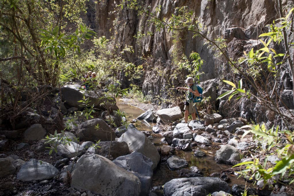
Barranco del Río - crossing the river bed
The hike to the Barranco del Río itself is quite a short hike if you can – like us – drive far uphill on the field paths. Of course you can extend the hike a little bit if you park your car and walk up to the entrance of the Barranco del Río. You can get down into the Barranco itself quite quickly. When you reach the bottom, the pace is a little slower, because you have to scramble over stones, rocks and sometimes even cross the creek.
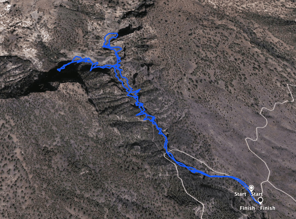
Track Barranco del Río
General information about the hiking tour Barranco del Río
Starting point and approach
You start the hike high above the village of El Río on a dirt road.
Coordinates: 28.112829, 16.340768
Arrival by car
Coming from the north or south on the TF-1 motorway, take exit 49 towards Chimiche/El Río and drive uphill. Keep going straight uphill for the most part. At the intersection with the TF-28, continue straight ahead onto Calle de Las Vegas (the approach is initially identical to the approach of the Las Vegas walk). But after that it goes uphill only on driveways. Here you can either choose „uphill“ and better to follow the coordinates given above. Depending on how suitable your vehicle is for the terrain, you can drive higher up. With a normal car you will have to stop about 1 km before the starting point of the hike and walk. This extends the relatively short hike by 2 kilometres. Alternatively, you can also drive via Vilaflor and the Madre del Agua ski run (see below under variations).
Arrival by bus
Article summary and large selection of GPS hiking tracks
Sign up for my newsletter now and get exclusive access to my collected GPS tracks as well as all the brief information about my articles.
Sign up nowIt is not possible to arrive by bus.
Barranco del Río - narrow gorge with rocks and lots of water
Time
I do not like to give general time indications for hiking tours, as the times are very individual. For this hiking tour we needed approximately 4,5 hours with some breaks. At a brisk pace it should be possible to do it in about 3 hours.
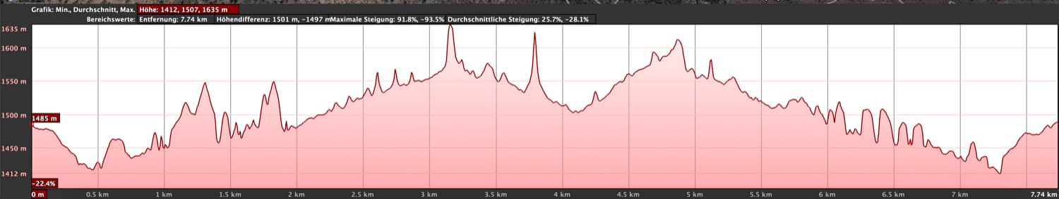
elevation profile of the hike Barranco del Río
Height difference and distance
The difference in altitude is about 680 meters in ascent and descent (with ascent in the side valley). The route is just under 9 kilometres long (if necessary, add 2 kilometres to this if you are walking to the starting point).
Requirement
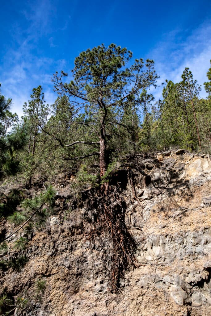
In principle, the hike is easy for everyone. However, because of the sometimes tricky tours over stones and boulders as well as for the brook crossings, a little surefootedness is required and time should be planned accordingly. In the summer time, it is pleasantly shady in many places in the Barranco del Río.
Refreshment
There are no restaurants, bars and shops in the proximity. Therefore, take enough water and if necessary food with you.
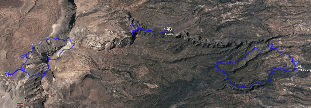
Barranco del Río Track between Track Las Vegas Circular and Guajara Track
Variants
This tour you can only go to the waterfall. Then it will be shorter, of course. Or you can hike additionally – like on the track – up into the side valley. You can extend the length even further if you leave the car on the approach further down and thus extend the route on foot.
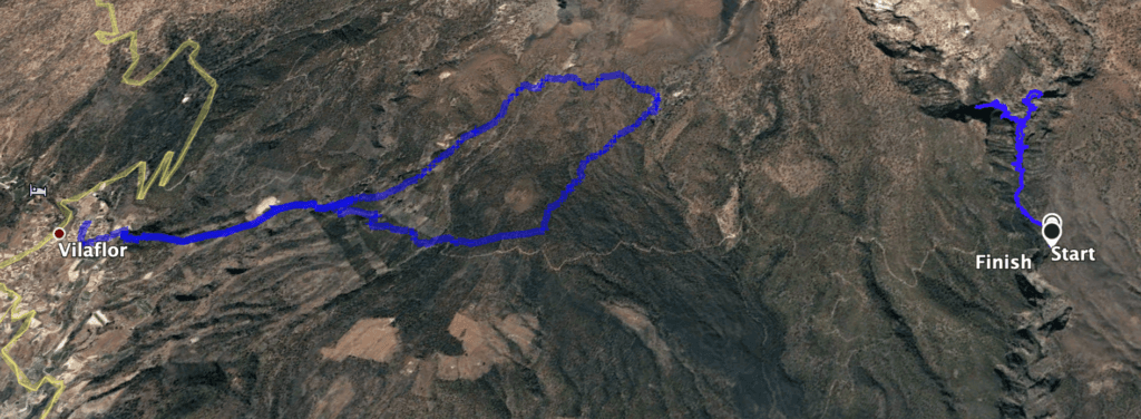
Track Barranco del Río and Track Paisaje Lunar close to Vilaflor
Near the starting point you have a connection to the Paisaje Lunar. However, this is a few kilometres away. If you like it better, you can also go to the Paisaje Lunar via Vilaflor and the Madre del Agua slope (see description of the Paisaje Lunar Hike – there under Variants). 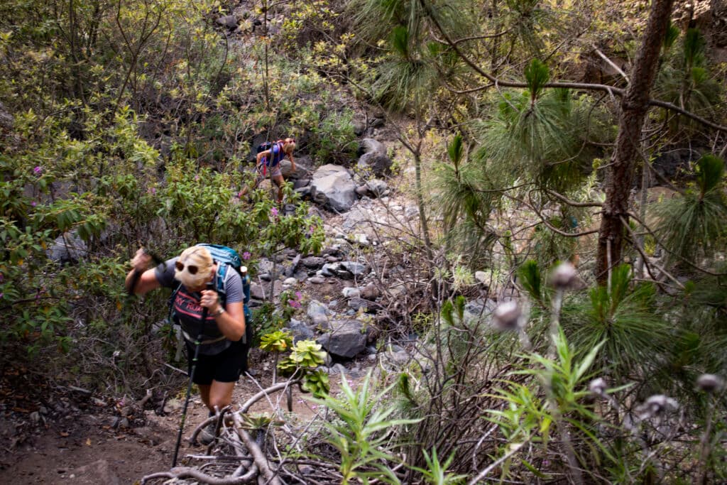
Barranco del Río - hiking path
Hiking through the Barranco del Río
Article summary and large selection of GPS hiking tracks
Sign up for my newsletter now and get exclusive access to my collected GPS tracks as well as all the brief information about my articles.
Sign up nowSection Starting point above the Barranco del Río to the bed of the gorge
You start your hike on the road where you may have parked your vehicle as described above. If it is further down the driveway, you walk straight up the driveway. You will finally come to a T-junction, where a path leads up to the right. Keep left here and after a short time you will reach the starting point of the hike into the Barranco del Río. The road makes a sharp bend to the right at this point. Here you can park with a vehicle suitable for terrain.

Access path down into the Barranco del Río
You follow the road a short distance uphill on foot. Then a small path branches off downhill on the left side. This path will bring you very quickly down into the Barranco del Río. On the opposite side of the Barranco you will see the road towards Vilaflor. When you reach the bottom, keep to the right. After some time you cross the small stream for the first time and follow the narrow path that leads you slowly uphill along the stream.

Barranco del Río - Path down into the canyon
Section of the Barranco del Río stream bed to the waterfall
No further route description is necessary for this hike. Most of the time you walk through the gorge, which is quite narrow in many places, and you don’t have many possibilities to go further. Often the path is clear and leads along the water or the rock. From time to time you have to fight your way through bushes or scramble over rocks and stones. But you can’t miss the direction already because of the narrowness of the gorge and the watercourse, which you just have to follow.

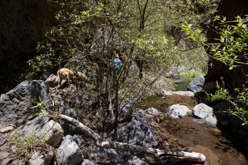
Dog enjoys water
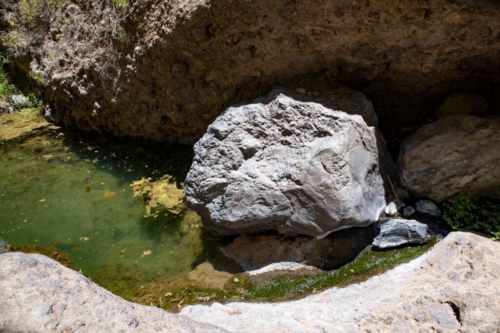
Later the gorge gets wider and on the right side a side valley opens up. You can go into this valley on your way back. But to the waterfall it goes slightly left and now partly a bit steeply uphill. At one point the path is a little bit confusing and you can continue walking in the valley bottom or you can go on with a little scramble on the slopes above the barranco bed. Then you will already hear the waterfall and after a short time you will be standing in front of the pool. Here you have the ideal picnic place.

Barranco del Río - waterfall
Section Barranco del Río waterfall and side valley
When you have admired the waterfall sufficiently, which sometimes has more or less water depending on the season, you go back the same way. At the spot where the side valley opens up to the left, you can take a narrow path through bushes and ascend a bit into the side valley. Here you will definitely not meet other people. It is absolutely quiet and you will meet wild nature. Accordingly, the paths are overgrown.

Barranco del Río - Ascent in the impassable side valley
I ascended in the valley for quite a while (you can see it on the track). Since my fellow hikers stayed behind, I had to go back, too. But if you have time and desire, you can go much further up into the side valley here. When you have explored enough, you can go back to the Barranco del Río on the same track. And then you go back to the starting point on the same path.
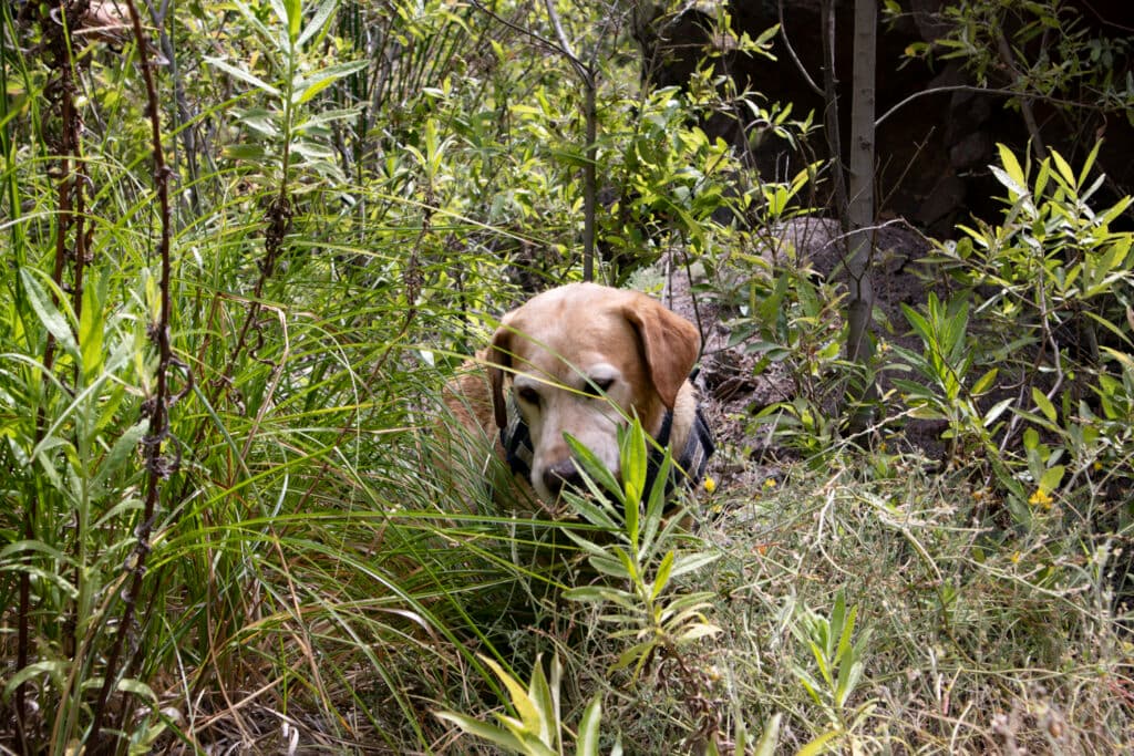
even dog must fight its way through the thicket
And finally
Even though there was only a short description today, I hope you enjoyed this hike. As it is really quite far away from villages and roads, I recommend you to download the track. With track and coordinates you are then in any case on the safe side. Have fun hiking and exploring,
Dagmar von SiebenInseln