Paisaje Lunar – Canary landscape with white volcanic rock
The Paisaje Lunar differs considerably from the other hikes near the Cañadas by its impressive „moon landscape“. In fact, the white volcanic rock formations are among the greatest natural wonders on the island of Tenerife. On this tour you can have a close look at the impressive volcanic rocks in the Barranco de las Arenas. The white rock formed by wind and weather looks as if there are many small towers next to each other. Almost like a fairytale landscape.
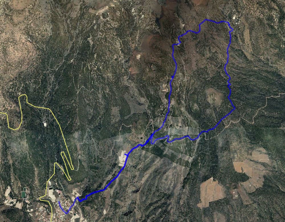
Map
Paisaje Lunar - white volcanic rock
But what kind of stone is this? Some authors call the white volcanic stone pumice, others tuff. Pumice and tuff stones are both volcanic rocks, which are characterised by their pore-rich and fine-grained character. Tufa has more inclusions. But since I am not a geologist, I cannot really conclude which volcanic rock is on the Paisaje Lunar. But these volcanic stone formations that remind of a moon landscape are definitely worth seeing.
The mountain village Vilaflor on 1420 vertical meters
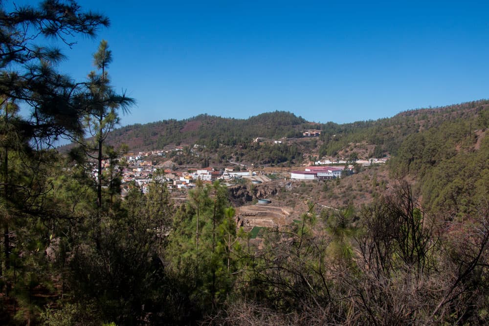
Vilaflor – Spain’s highest mountain village
The mountain resort of Vilaflor is not only known for the Paisaje Lunar, which starts from there as a circular hike. Vilaflor, with its 1,420 metres of altitude, is also the highest place on the island and even in Spain. The air is clean and dry. Therefore Vilaflor is a helpful supporting place for asthma and lung diseases. About 1785 inhabitants live there (as of 2016). The inhabitants live from tourism, bottled water from mineral springs, agriculture, viticulture and of course their handicrafts.
Vilaflor - church and square
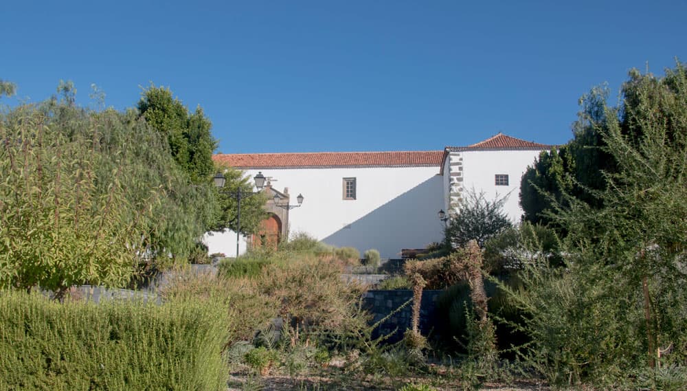
Worth seeing is the entire historical city centre with its beautiful old houses and small alleys. If you want to do the Paisaje Lunar hike, you should definitely combine it with a visit to the historic old town. The centre of the historic town centre is the church square with the church San Pedro from the 17th century, which is built in Canarian style. And there at the lower part of the church square the hike Paisaje Lunar starts.
Paisaje Lunar Track
General information on the circular walk
Starting point
The starting point of the hike is the small mountain village of Vilaflor (1,420 metres above sea level). In the historic city centre the hike starts directly at the lower church square. Opposite the large hiking board there is a signpost which cannot be overlooked.
Arrival by car
From the south, take the Los Christianos exit on the TF-1 motorway and follow the signs for Arona. Then follow the TF-21. At the beginning of Vilaflor turn right into the village and drive straight through the little town in the direction of the historical town centre (signposted). Parking is available on the streets and in a large car park behind the church (free of charge).
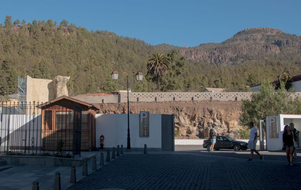
Vilaflor - parking lot
From the north, you can take the TF-38 via Teide National Park. At the Boca Tauce junction, turn off towards Vilaflor. Turn left at the town of Vilaflor. Continue as described in the last paragraph.
Arrival by bus
From Los Christianos there are several bus connections to Vilaflor, which take between 14 minutes and almost 2 hours. The bus lines Titsa number 342 and 482 take less than an hour to get there. On the other hand, the bus lines Titsa number 474, 411, 416 and 450 take almost 2 hours to get there.
From the north around Puerto de la Cruz there are only connections via Santa Cruz de Tenerife, so at least three hours travel time should be planned (not really recommended). Further information on the Titsa Homepage. Time
I do not like to give general time information for hiking tours, as the times are very individual. Hiking should bring recreation and be fun. And also I need for each tour sometimes more and sometimes a little less time. Here the personal rest and break times are not yet considered. But this tour should be between 4.5 and 6 hours depending on speed, condition and length of the breaks.
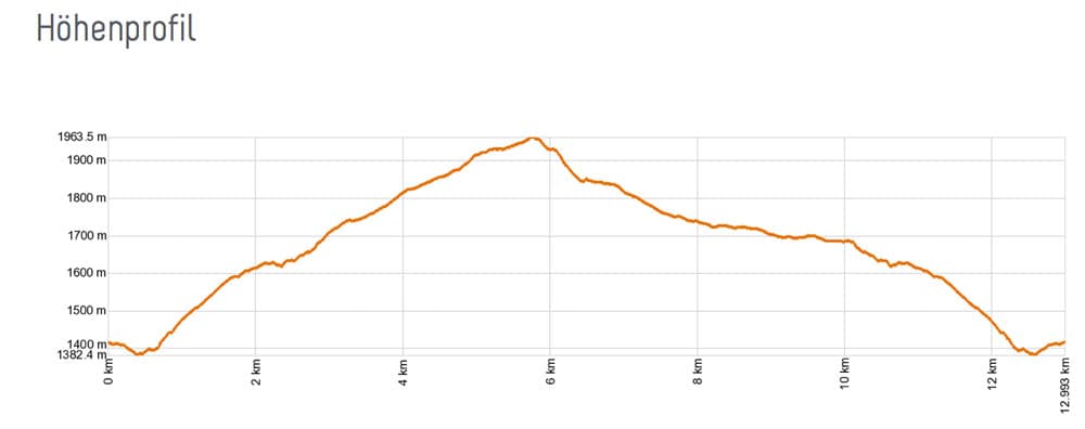
Elevation profile Paisaje Lunar
Article summary and large selection of GPS hiking tracks
Sign up for my newsletter now and get exclusive access to my collected GPS tracks as well as all the brief information about my articles.
Sign up nowDifference in altitude and distance
The difference in altitude is 460 meters net and 750 meters gross (with up and down). The route is approx. 14 kilometres long with a return trip.
Requirement
An easy and for everyone with a bit of stamina easy to master tour. The paths are mostly wide, not exposed and easy to find because of the very good signs.
Refreshments
Restaurants, bars and shops are only available in Vilaflor. Therefore take enough water and food with you. And please also think of the accompanying four-legged friends and bring enough water for them.
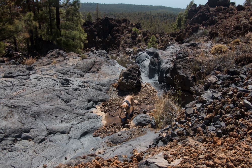
Little water hole - good for Lasko Labrador
Variants
This tour can be combined well with various other hiking and circular walks in the vicinity. The hike up through the Ucanca Gorge to the Ucanca Pass and to the Guajara branches off directly from the round tour. However, this tour is quite demanding because of the many metres of altitude to be overcome (over 1,500). But if you are not satisfied with this demanding route alone, you can also hike from the Ucanca Pass over to Parador. Here (from Vilaflor) and there (from the Parador) are the different possibilities to hike on the Guajara. 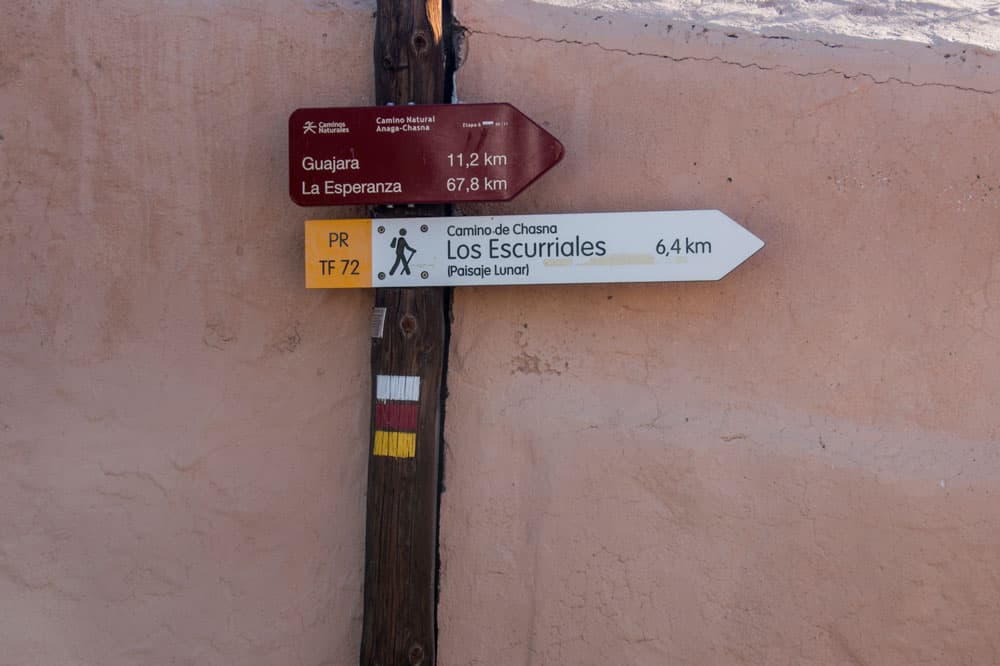
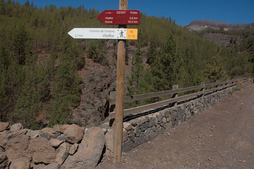
postsign hiking path PR TF-72
The tour can also be combined with the hiking trail PR TF-83, which runs from Cruz de Tea to Los Escurriales. It crosses the Paisaje Lunar in the eastern part. 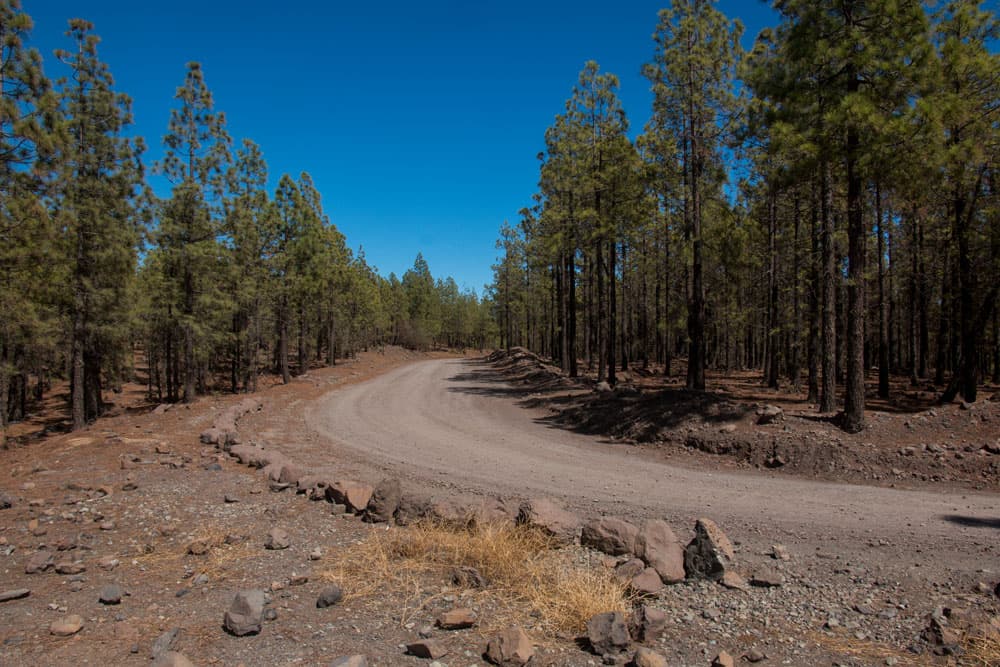
large forest roas (Pista Madre del Agua) - Paisaje Lunar
From Vilaflor to the start of the actual circular hike Paisaje Lunar there are already more than 200 height meters to overcome. If you want it easier, you can also start the hike via Vilaflor at the TF-21 at km 66 at the junction of the Pista Madre del Agua. In this case you have to walk about 4 kilometres on the piste until you reach the entrance to Paisaje Lunar. More and more often I also see that some hikers drive by car along the forest road and park directly at the entrance of Paisaje Lunar. This is certainly very comfortable and nowadays no longer forbidden.
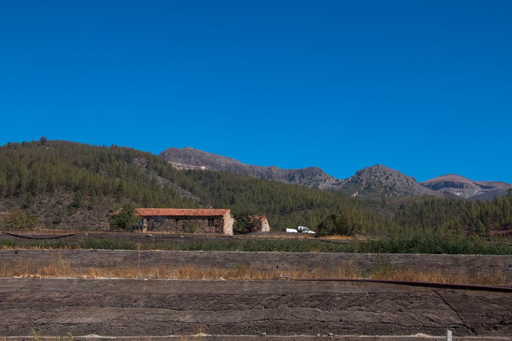
Vilaflor - Barranco de Chorillo with water reservoir
It doesn’t matter in which direction you go on the actual circular hike. I mostly go up on the left side (west) and down again on the right.
Hike Paisaje Lunar
Section Vilaflor to the Finca Casa Galindo
At the lower end of the church square in Vilaflor there is a hiking board. From here it starts. The trail is marked white-red-yellow as a hiking trail (PR TF 72). First go down the village road and take the second left. It goes first downhill. Then turn left again. After a few metres uphill, turn right down a paved path into the Barranco del Chorillo. You cross a road and walk around a large reservoir of water visible from afar.
hiking route from Vilaflor, way to the entrance of Paisaje Lunar
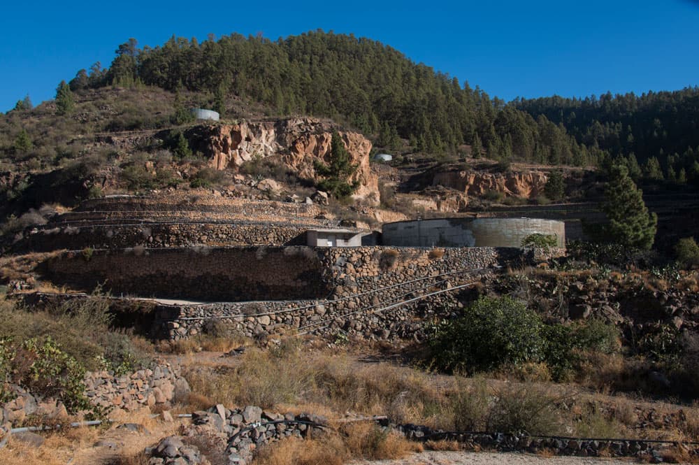
Then you are on a dirt road, which you follow for a short time. Beware: don’t go straight ahead here. Because it is well signposted, but still clearly sharp on the right on a path covered with stones up the mountain. This way is now a steep climb. This is the Camino de Chasna, an old trade route between the southern and northern parts of Tenerife. You walk through pine forest and can enjoy first views back to the south coast and the place Vilaflor. After about 200 meters you will see a large farm with terraced fields on your left. This is the Finca Casa Galindo.
Casa Galindo - Finca clos to the Paisaje Lunar
Section Finca Casa Galindo to the entrance Paisaje Lunar
Continue straight ahead past Casa Galindo. The path climbs slightly and forks after a short time. Now follow the stone paved path down to the right. It leads you in some wide serpentines down into the Barranco de las Mesas. You cross it at the bottom and go uphill again on the other side through pine forest. Then you stand on the forest track Pista Madre del Agua.
Paisaje Lunar - postsign direction Vilaflor from the driveway
Here you will meet some parked vehicles. As described in the information, it is forbidden to drive on this forest road. But the temptation to save the altitude meters from Vilaflor and to park directly before the actual entrance into the Paisaje Lunar is apparently big. The alternative would be to park the car at the TF-21 at the junction to the Pista Madre del Agua and walk the 3.7 kilometres to the entrance of the Paisaje Lunar.
Article summary and large selection of GPS hiking tracks
Sign up for my newsletter now and get exclusive access to my collected GPS tracks as well as all the brief information about my articles.
Sign up now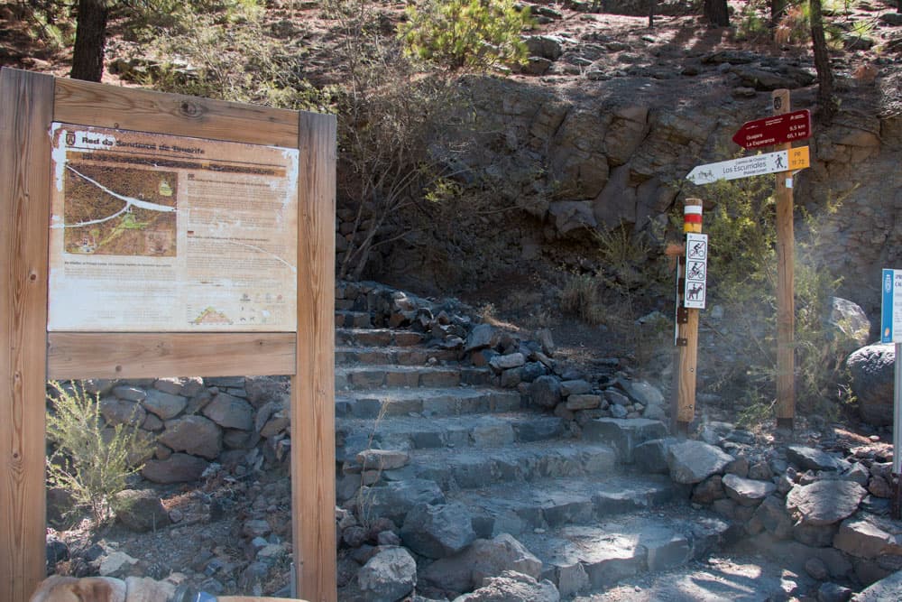
Entrance Paisaje Lunar forest driveway
Section of the route to the Paisaje Lunar entrance to the Casa Marrubial farmhouse
The entrance and the following circular path are well marked. It goes uphill with the path and after a short time the place comes where the path forks. Paisaje Lunar turns left or right for 3.6 and 3.7 kilometres respectively. You can choose. I go around to the left. It goes on wide well recognizable ways from time to time in wide serpentines and otherwise straight uphill.
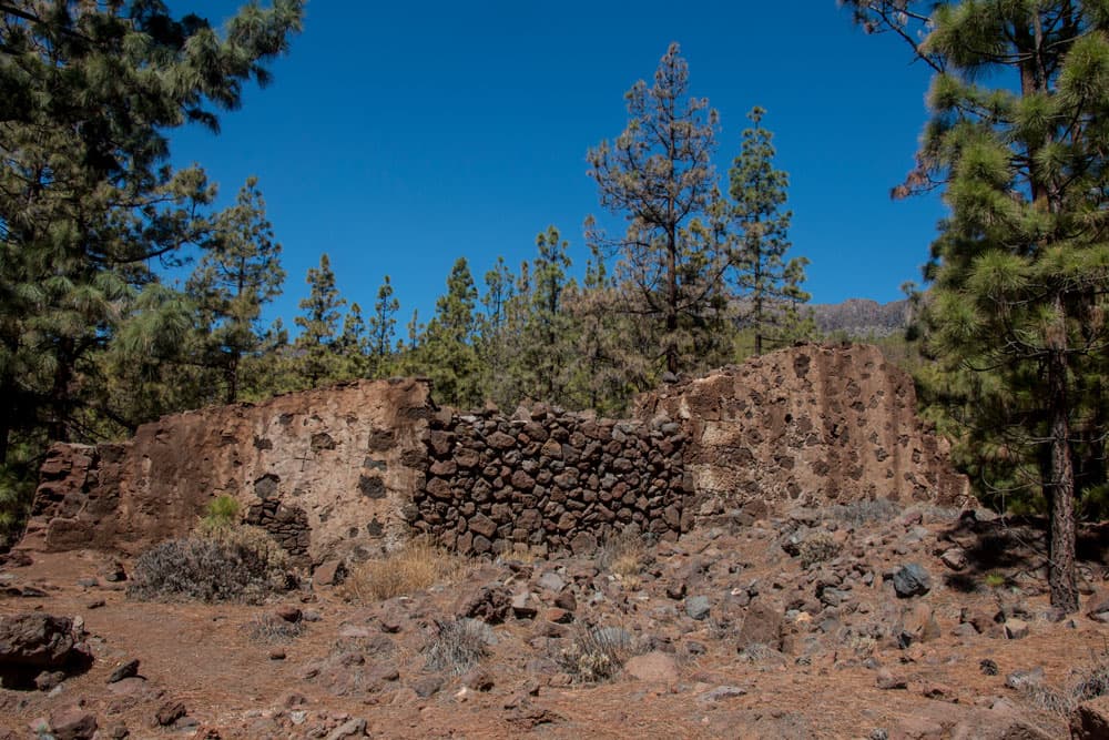
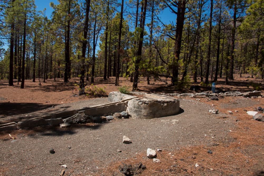
Ruin Casa Marrubial
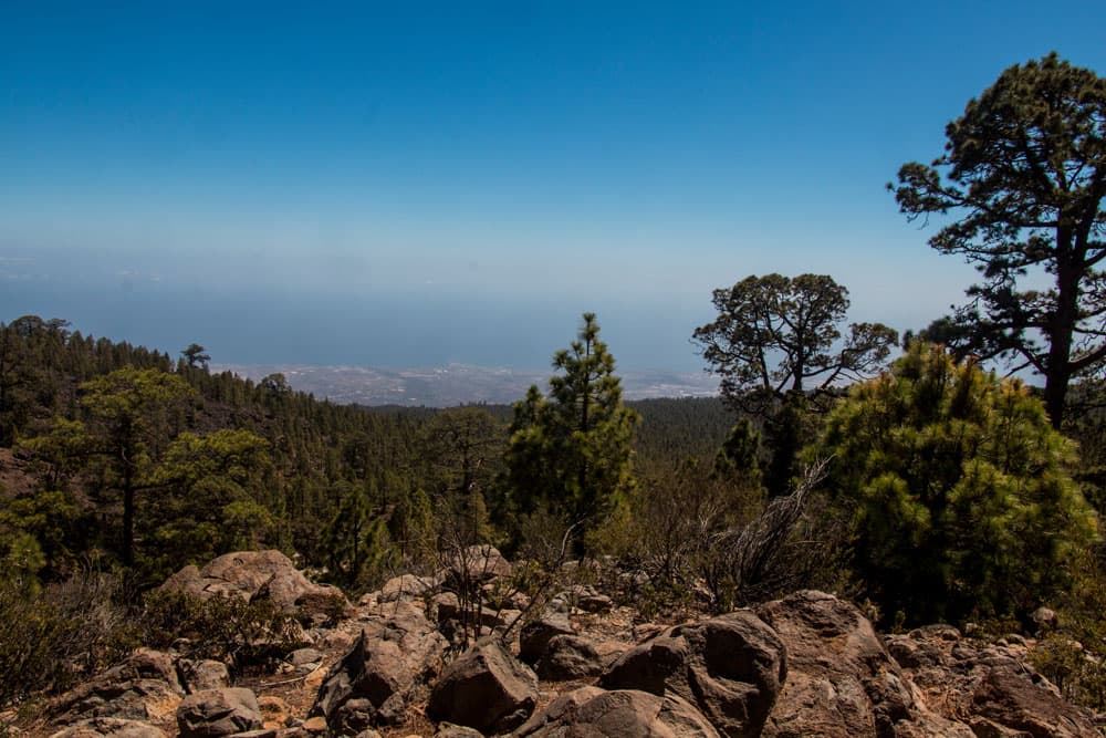
Unless you have caught a cloudy day, you can occasionally see the south coast behind you in the distance and the cañadas in front of you. After about half an hour you cross a road and go through a barrier on the other side of the road. After a short while you will pass ruins. On the left is the dilapidated Casa Marrubial. On this circular path you will pass further ruins.
View on the backside of the Cañadas with the Guajara
Section of the route Casa Marrubial farmstead up to the highest point of the hike (fork).
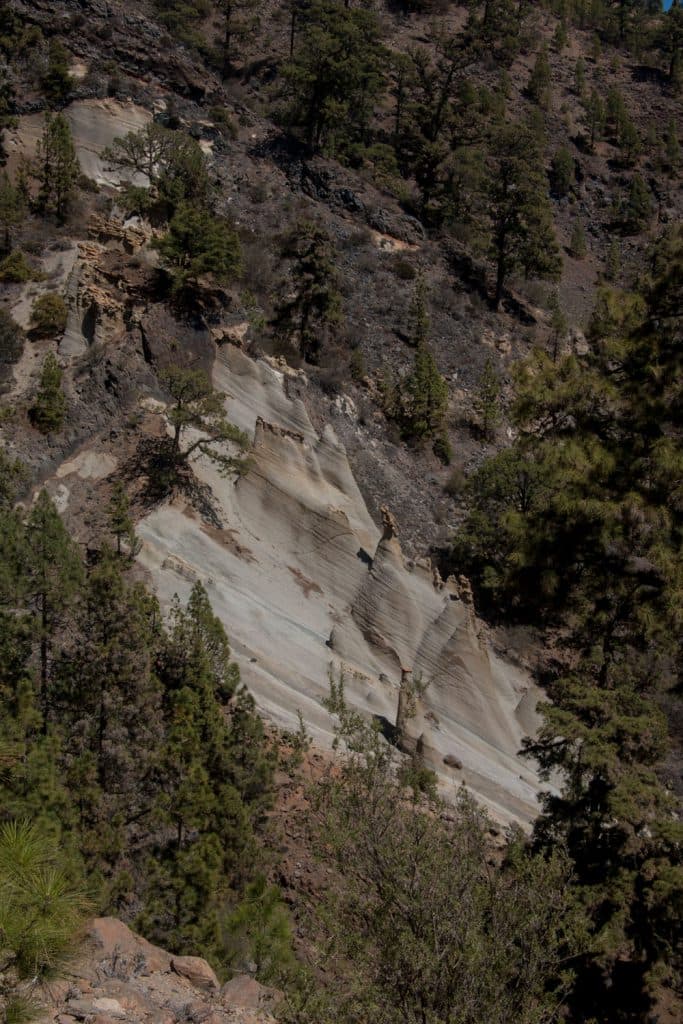
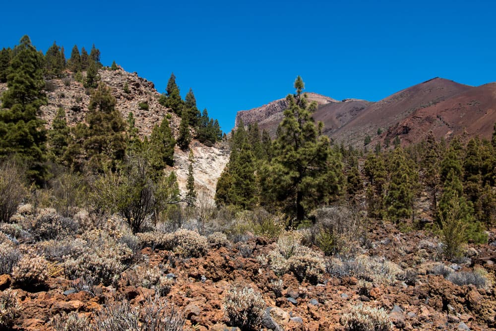
After you have passed the abandoned homestead, the path leads you up the slope to the right. After some time you will see the first „moon landscape“ on the right side in front of you. You pass directly at the foot of a large white rock formation. Along it the path leads you up to the next ridge. Up here you will also find some lava balls (huevos), which you can see even bigger in the Montaña Blanca under the Pico del Teide.
Paisaje Lunar - hiking route
You turn right on the path that continues to rise slowly. Now you can enjoy wonderful views of the Cañadas in front of and above you. The striking rock massif of Guajara is far above you. After some time you come to the junction, where a path leads up to the left into the Valle de Ucanca. A little later a path to Guajara branches off to the left. But Paisaje Lunar continues to the right. You cross an old water channel. And after a short time the path forks again. Here you have arrived at the highest point of the hike at 1,975 metres above sea level. The middle of the actual round tour Paisaje Lunar is reached.
Paisaje Lunar - old water channels
Route section Viewpoints Paisaje Lunar
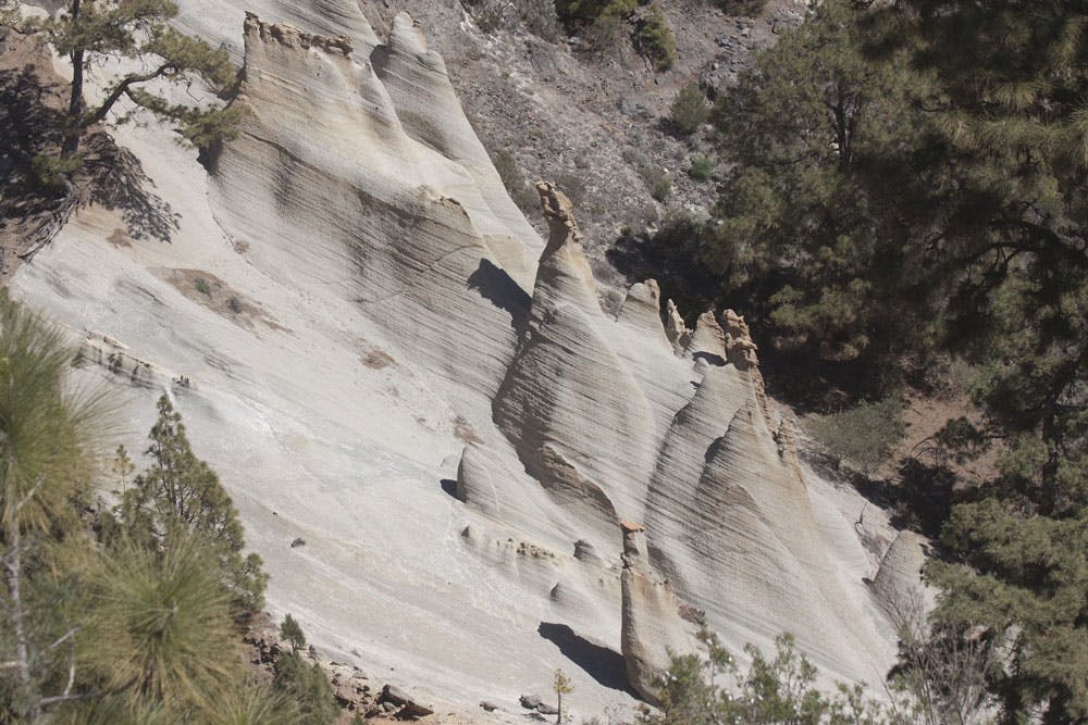
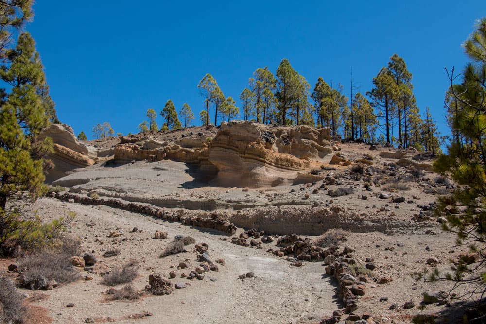
From the highest point of our hike it is now essentially only downhill. The path PR TF 72 is now only signposted in white and yellow. It leads you on small short serpentines in a short time to a vantage point on the actual Paisaje Lunar. A short time later, after a few more serpentines, you will reach another larger viewpoint. From both places there are wonderful views of the white volcanic rock with its tower-like formations.
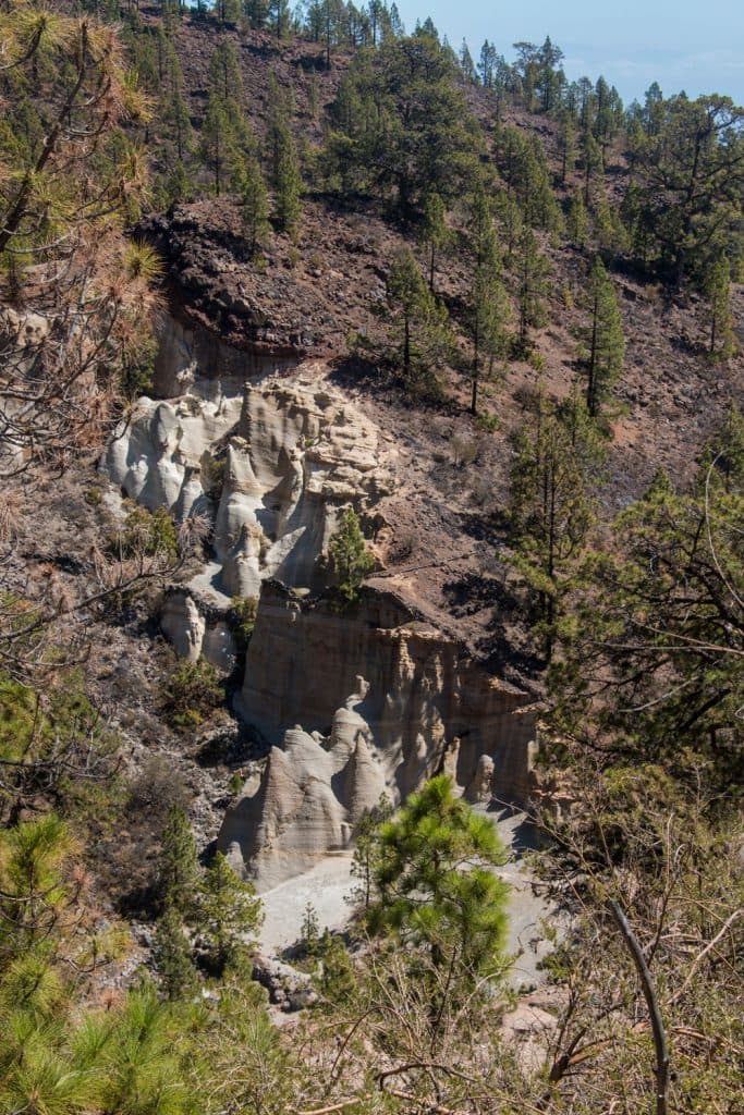
Paisaje Lunar - white rocks
The lower vantage point also offers shade with some trees. And due to the large stones surrounding it it is perfect for a picnic. For nature conservation reasons, you can’t get any closer to Paisaje Lunar. From here you also have a very good view of the whole southeast coast of Tenerife. In the distance you can discover the Canarian island Gran Canaria on the horizon.
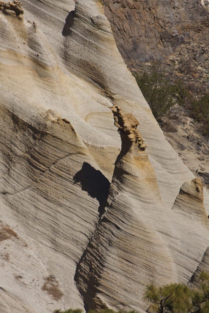
Paisaje Lunar - lunar landscape
Section of the route Viewpoint Paisaje Lunar to Vilaflor
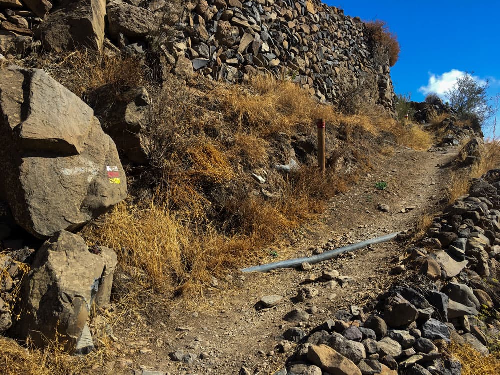
Also on the second half of the hike the way is not to be missed. Broadly and clearly marked it goes first in some serpentines downhill. Then you will hike up and down through the pine forest. After about half an hour your path crosses another hiking trail, the PR TF 83, which runs from Cruz de Tea to Los Escurriales. However, you just keep going straight. The trail now continues southwest along a long stone wall.
View from the hight to the southcoast
A short time later you meet the forest road again. The path always runs up and down along the wide road. Three times the hiking path leads back to the forest road and leads you back to the hiking path with unmissable post markings. If you like, you can also simply follow the road. On this way back to the entry path you pass an old stone house and also a small Barranco has to be crossed. Finally you are back at the starting point of Paisaje Lunar. From here go left down the path that you also came from Vilaflor. It should take you back to Vilaflor in about half an hour.
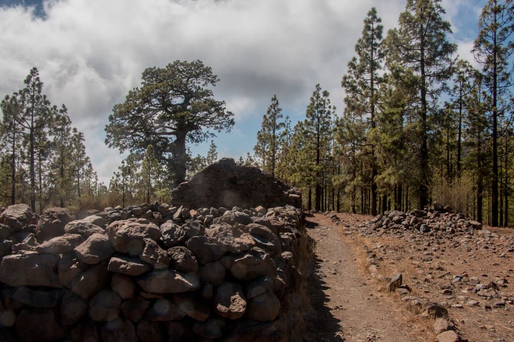
Ruinhouse at the hiking path
And finally
I hope you enjoyed this varied round trip.
So that you can really enjoy it and see a lot, please pay attention to the weather. However, if it rains or thick clouds hang on the mountains, the visibility can sometimes be close to zero. I got caught up there in the way once. The hiking went well on the wide paths nevertheless. But the visibility was a maximum of 10 meters. So neither the Cañadas nor the south and east side of the island were to be seen. And even the white volcanic rock formations that make up the Paisaje Lunar were almost blurred into shadows. Therefore I wish you much joy and the very best weather for your hike,
Dagmar von SiebenInseln
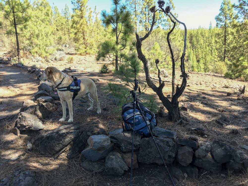
Hiking with dog Lasko