A contemplative circular hike via Granadilla to the Montaña de las Coloradas
Map
The hike to the Montaña de las Coloradas takes you to the southeastern side of the island of Tenerife. On the slopes, which are foothills of the mountains around the Teide, there are scenic walks. On this side of Tenerife the wind often refreshes.
Cruz de Tea
But because of this it is rarely too hot to hike even in the summer months. You can hike through pine forests, gorges and over mountains with magnificent views.
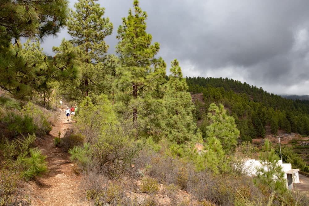
hiking path through the pine woods - Montaña de las Coloradas
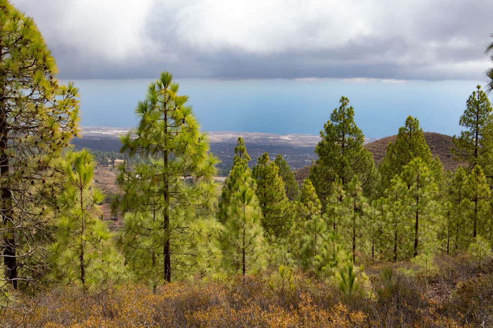
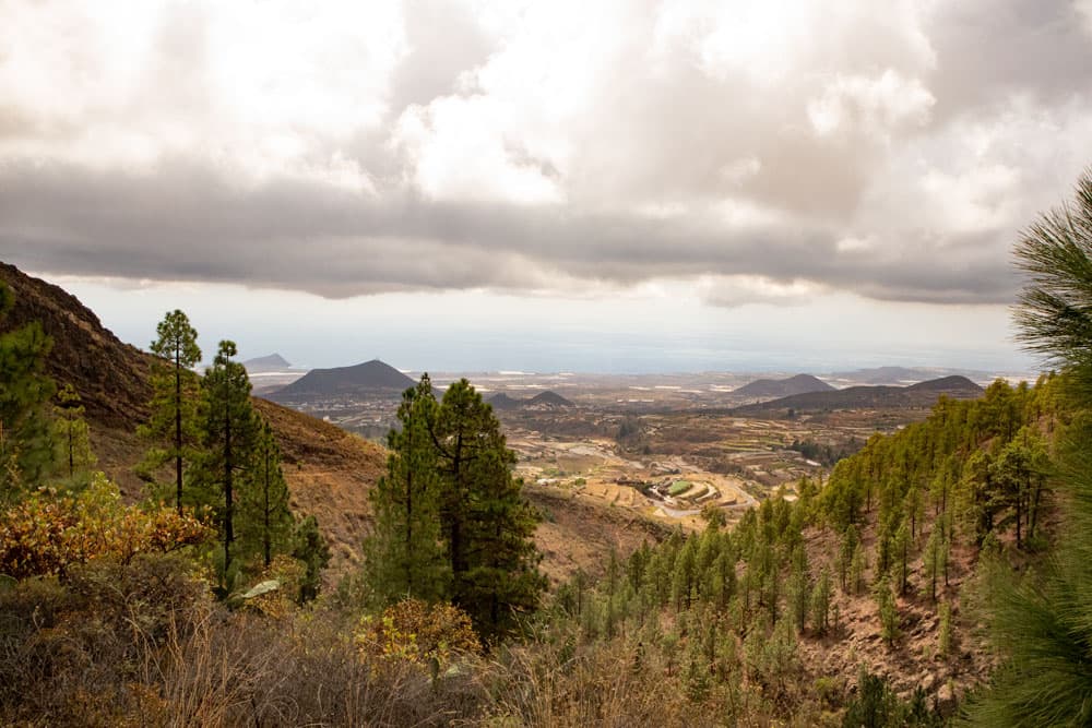
And so a good view of the east coast, the city of Granadilla and often the neighboring island of Gran Canaria you also have from the Montaña de las Coloradas. Anyway, you should have such a view, if not unexpected clouds – like on my last hike there – move in and take your view. But even without visibility you can enjoy the varied nature on this small hike and get to know the southeast side of the island of Tenerife.
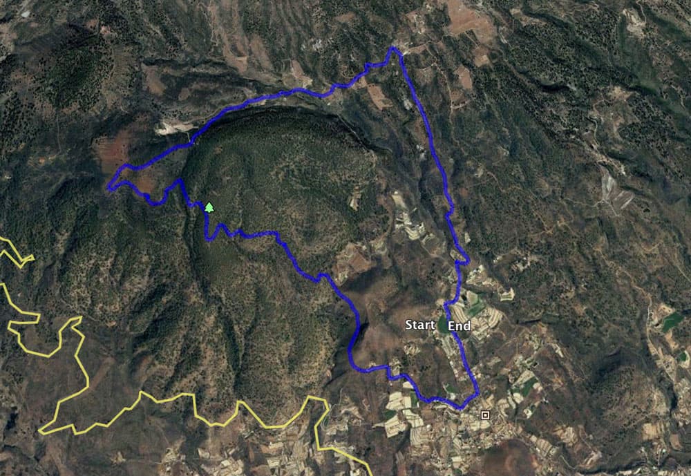
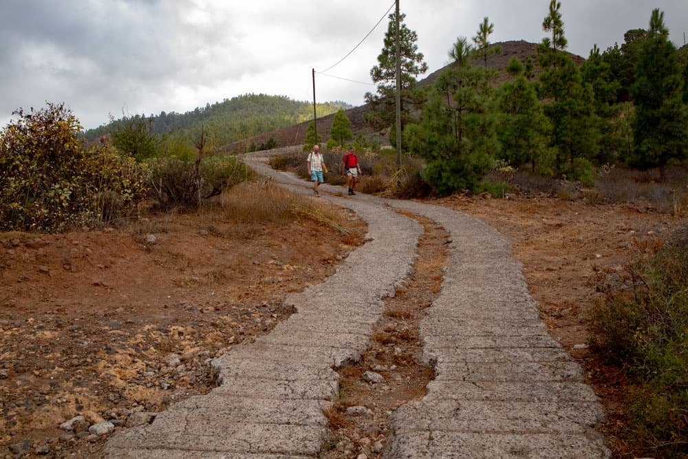
Track Montaña de las Coloradas
General information about the circular hike to the Montaña de las Coloradas
Starting point and approach
Starting point of this hike is the small village Cruz de Tea on the southeast side of Tenerife. You park in the Calle Virgen del Buen Viaje. Surely you will find some parking possibilities in this street yourself. We have parked on the left side just before the road makes an arc to the right. There is enough space for several vehicles.
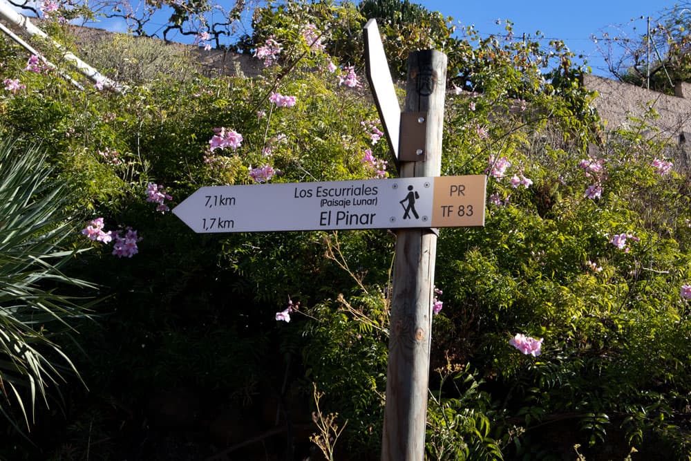
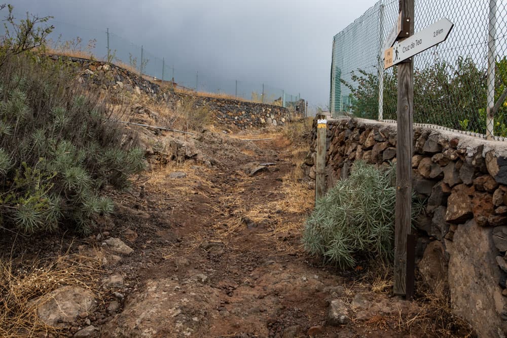
signpost PR TF 83
Approach by car
You come from the south or north on the motorway TF-1. You take the exit Granadilla/San Miguel TF-65 and drive first through San Miguel always straight ahead on the main road direction Granadilla. After some time turn right onto Carretera los Muros TF-647. At a roundabout take the second exit TF-64 towards Granadilla. In Granadilla turn left onto the TF-28 and then right onto the TF-21. Follow it for a while. Then turn right in the direction of Cruz de Tea. On the small Calle Zurrones you already drive through Cruz de Tea. At the next junction you will see a sign in front of you. There you will walk later (way back). But with the car you turn right and then the next street left. This is already Calle Virgen del Buen Viaje. Continue up this street and park at the side of the road.
Arrival by bus
To the small place Cruz de Tea the Titsa bus line number 475 goes from Granadilla to Arona. If you want to know the connecting buses and timetables, you can have a look at the Titsa homepage. Time
I don’t like to give general time information for hiking tours, because the times are very individual. For this tour we needed about three hours with an extensive summit picnic and some photo breaks.
Article summary and large selection of GPS hiking tracks
Sign up for my newsletter now and get exclusive access to my collected GPS tracks as well as all the brief information about my articles.
Sign up now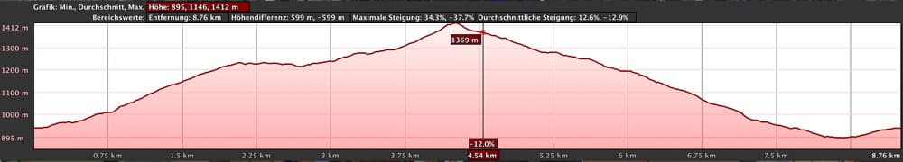
elevation profile Montaña de las Coloradas
Difference in altitude and distance
The difference in altitude is approx. 530 metres. You start at approx. 900 m altitude and go up to the summit of the Montaña las Coloradas up to 1,414 m altitude. The route is about 9 kilometers long.
Requirement
An easy and for everyone with a little physical condition well to master tour. Who is very sporty on the way, can manage this round also by far faster. And if you want to enjoy the wonderful views, you can take your time. The paths are good. From time to time the paths are a little overgrown, where the bushes can leave scratches on bare legs and arms. The way back runs along a path that is also used by mountain bikers. It is partly a little rough and steep, but still easy to walk on.
Refreshment
Besides Granadilla, there are only restaurants and bars at the starting point in Cruz de Tea. Therefore, take enough water and food with you on the hike.
Variants
This tour can be well combined with various other hiking and circular walks in the vicinity. Nearby, towards the north, you will find the Las Vegas circular walk. And above this round tour lies the famous village Vilaflor, to which you can continue from this round tour on the hiking trail TF-83. From there you can take the famous Paisaje Lunar (moon walk). 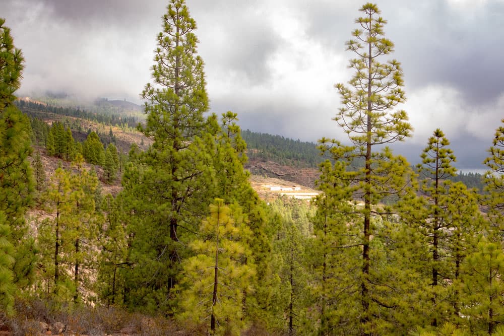
view through the pine woods - Montaña de las Coloradas
Hike to the Montaña de las Coloradas
Section Cruz de Tea to the Finca via Cruz de Tea
The road you parked on, you just walk straight ahead. The trail is the yellow and white TF-83, which also leads to Paisaje Lunar, about 7.2 kilometres from Cruz de Tea. There is very little traffic on the road. The road becomes Calle Canales Atlas. Continue straight on out of the small town of Cruz de Tea. The path takes you through fields, gardens and water reservoirs. At a fork in the road, turn right onto Calle Canales.
road at Cruz de Tea
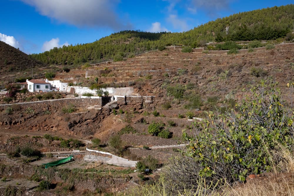
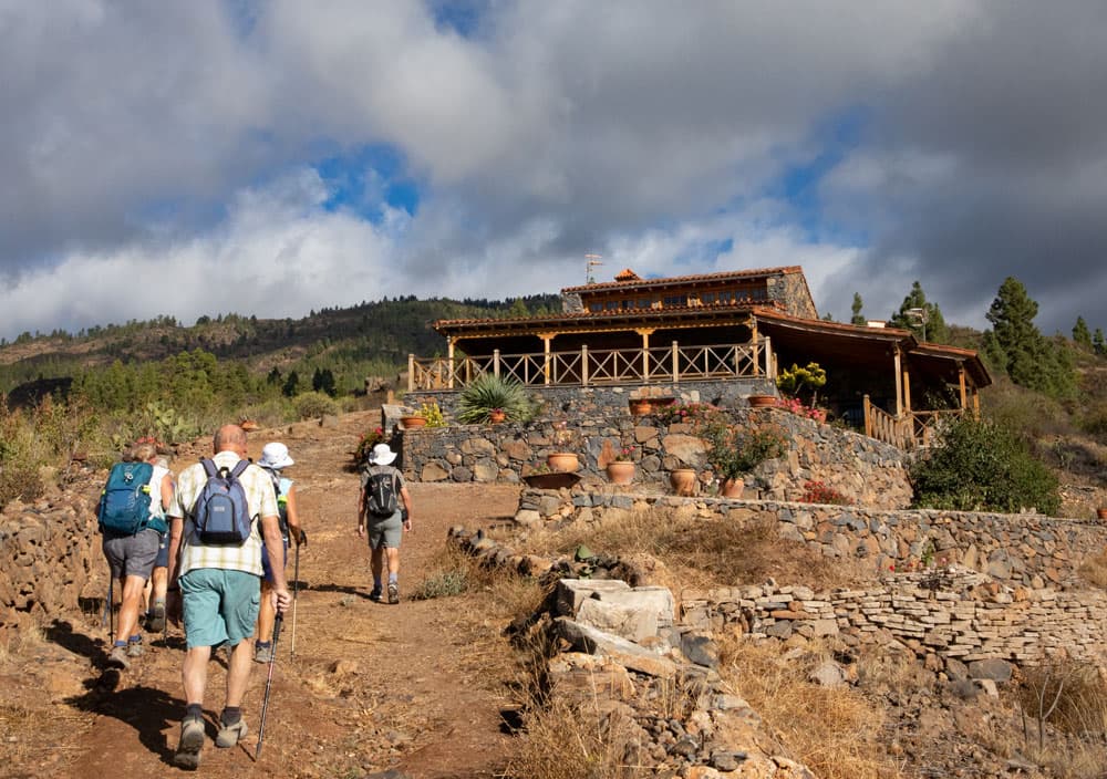
Shortly after the fork, the road makes a sharp right turn. Here you leave the road and go straight uphill with the footpath. The trail takes you in a large right loop around a finca estate. After you have passed the finca, you hike straight ahead uphill over a driveway. After a short time you’ll come across a road again, which you follow uphill on the left. Partly it’s quite steep now. Once the trail leaves the road to shorten a bend. Then you meet the road again, which you follow further uphill until you are in front of another finca estate.
hiking path with signpost - Montaña de las Coloradas
At this Finca over Cruz de Tea the hiking trail leads on the left ascending past. From now on you follow the path straight on. Now you don’t have to climb so steeply anymore and from time to time you even have to go downhill for short stretches. Back you have nice views to the east and south coast of Tenerife. On a clear day you can sometimes see Gran Canaria in the distance. In front of you you can see the wooded slopes of the mountains surrounding the caldera. You walk between fields and partially landscaped gardens.
hikingtrail passes a finca
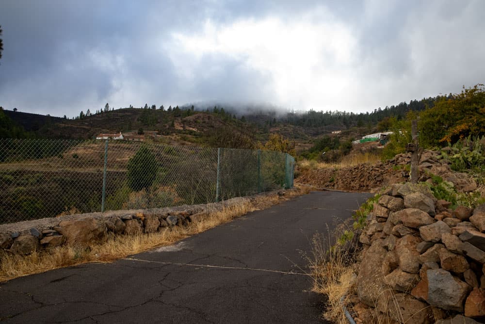
After a long time the path meets a small road. Follow it to the left. But don’t worry, there is hardly any traffic. Now you walk along this small road for a while, which will take you between big finca estates and fields. The road follows the landscape and takes you up the mountain in large arches. To the left and right you ignore small roads and driveways and keep straight on the road. Follow the road for quite a while until you can see a hiking trail on your left that will take you away from the road.
Article summary and large selection of GPS hiking tracks
Sign up for my newsletter now and get exclusive access to my collected GPS tracks as well as all the brief information about my articles.
Sign up now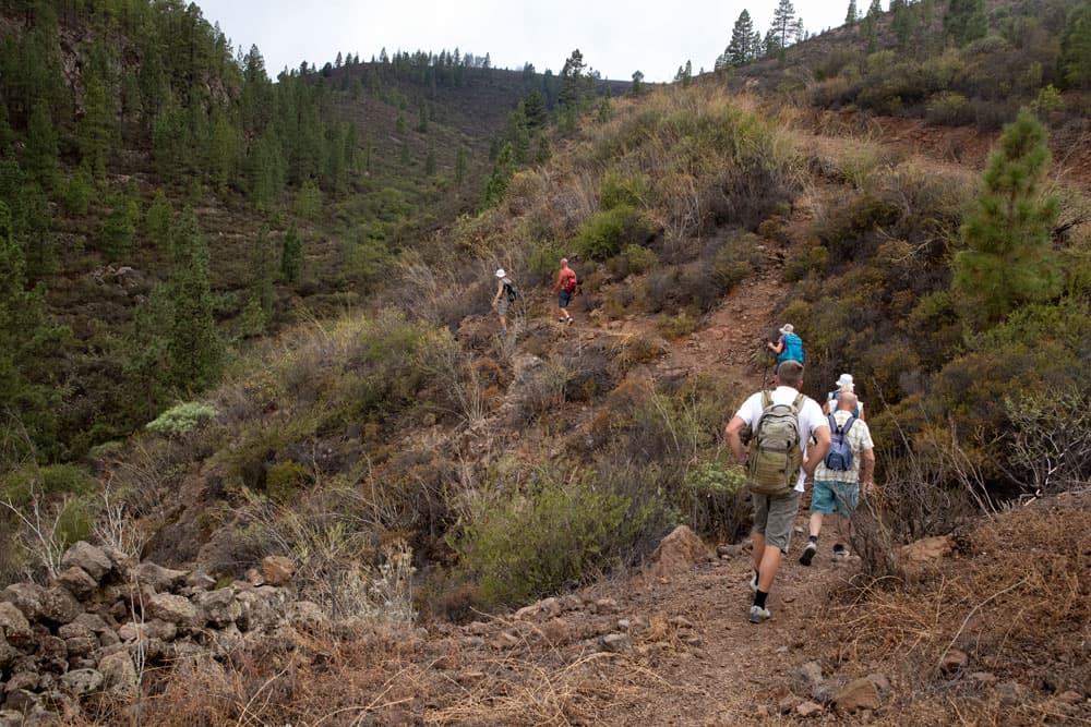
hiking trail into the Barranco
On the right side of the slope you go down through bushes into a Barranco. At the end of the path on the right side of the slope you cross the Barranco Grund and go uphill again on the left side. Now you come into a wooded area. First you walk along the edge of the pine forest. To the right below you can see a large bright cultivation area. Follow the path uphill until you reach a road that leads down to the cultivation area on the right.
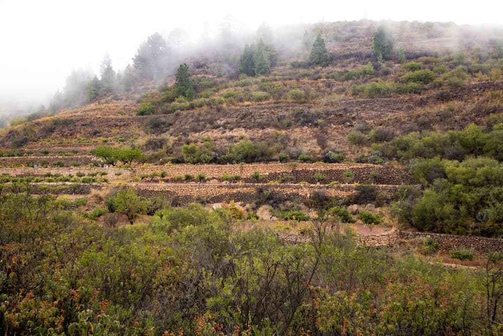
fields, terraces and bushes at the hiking trail - Montaña de las Coloradas
You cross the road and continue up the mountain on the opposite side with the small path. To get to the top of the Montaña de las Coloradas, climb the steep path again through the pine-covered area. For the last time for this hike, it becomes difficult and sometimes a little rough on the sandy ground. But then you have done it and reach the summit of the Montaña de las Coloradas. Here a rest on the summit with a view of the beautiful surroundings is worthwhile. Unfortunately this was taken from me during my last visit by an approaching cloud field.
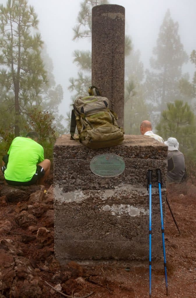
rest at the summit - Montaña de las Coloradas
Section summit Montaña de las Coloradas to way at the slope
From the top of the Montaña las Coloradas three paths lead down. The one you came on and another one to the right. However, you take the third path to the left of it. It’s now quite steep down the mountain. You walk on a narrow and rather stony path. After a short time the path makes a wide curve and continues along the edge of the forest. It leads you through a small gorge and then over a ridge.
view to the south east coast of Tenerife
Afterwards it goes on a way, which is also used by Mountain Bikes, sometimes more and sometimes less steeply down. But through the pine trees you will have a wonderful view of the east coast of Tenerife. After some time you can already see the first fields and cultivation areas of Cruz de Tea to your left. The path now leads you along the hillside of a long elevation for a while. It goes downhill on quite stony and rocky paths.
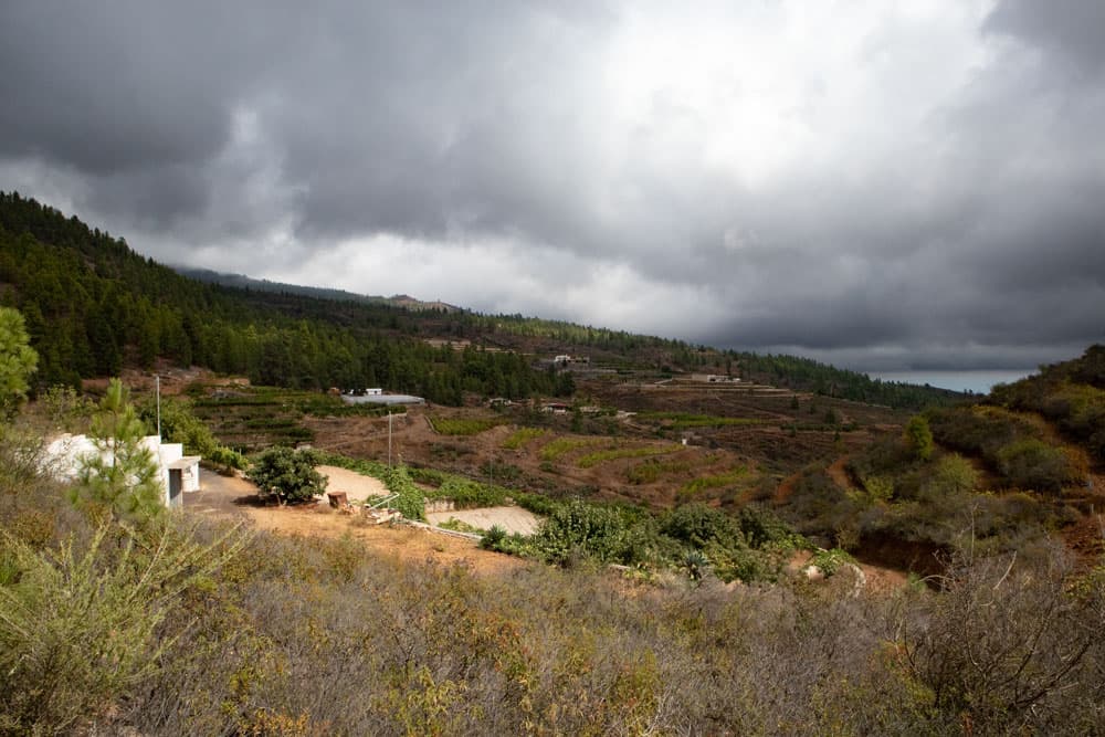
dark clouds over Cruz de Tea
Section of the path along the slope to the starting point of the car park
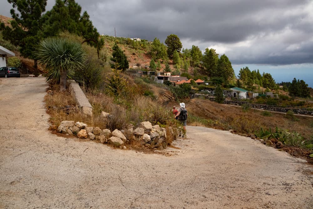
This path leads into a wide driveway, which you continue to follow. It will take you downhill past a number of estates and water reservoirs and past fields. Now go downhill on the opposite side of the slope. Finally, the small road at Cruz de Teja leads into Calle las Combritas. Turn left into this street and continue to the next junction. There you go up the small crossroad to the left. There you will also find the hiking sign with reference to the hiking trail TF-83.
road over Cruz de Tea
The crosswalk ends again at Calle Buen Viaje, where you can turn left and go back to the starting point.
road Montaña de las Coloradas
And finally
I hope you enjoyed this little circular walk. It is a good way to do a good round uphill and then downhill to get to know the landscape on the southeast side of Tenerife. Have fun hiking,
Dagmar von SiebenInseln