Gran Canaria Round Trip on the Cumbre High above Santa Lucia de Tirajana
This large circular hike from Santa Lucia de Tirajana has it all. With almost 18 kilometres and over 1,200 metres of altitude gain, there is something for the ambitious hiker to do. But in return, you will experience a varied and impressive landscape on the entire tour, in addition to wonderful views. You hike from Santa Lucia de Tirajana up to the Cruz del Siglo. From there you can already enjoy fantastic views of the entire surroundings. It is enough for a short hike up to here.
Map
View of Santa Lucia de Tirajana from the Cruz del Siglo
After crossing two gorges, the actual ascent on the Cumbre begins. Finally, you hike high above the Barranco Guayadeque along the Cumbre with impressive views of the island on all sides as far as the coast. The descent path along the steep face of the Cumbre high above Taidía also offers beautiful views of the valley around Santa Lucia de Tirajana.
View of Santa Lucia de Tirajana from the hiking trail
Santa Lucia de Tirajana – a good starting point for hikers
Santa Lucia de Tirajana is a small municipality with about 75,000 inhabitants. It is located on the eastern side of Gran Canaria. The municipal area extends down to the Atlantic Ocean. But the actual village with its historic centre is located in the mountains at an altitude of about 700 metres. It is a popular starting point for hikers. But a visit to the old village centre with its often lovingly restored Canarian wooden houses is also worthwhile.
Hiker on the descent from the Cumbre
From Santa Lucia de Tirajana you can hike down to the coast as well as further up over San Bartolomé to Cruz Grande. There is also a beautiful little circular walk over the Fortaleza and the Sorrueda reservoir. I myself will hopefully be able to spend more days in Santa Lucia de Tirajana, as there are indeed still so many beautiful tours to discover.
Track Santa Lucia de Tirajana- Cruz del Siglo - Cumbre Taidía Circuit Hike
General information about the round trip Santa Lucia de Tirajana – Cruz del Siglo – Cumbre
Starting point and approach
The starting point of the hike is Santa Lucia de Tirajana. You can start the hike anywhere in town. I myself started the track in the middle of the old town. It is important that you meet the GC-553 at a point in the town.
Signpost S-40 near Santa Lucia de Tirajana Cruz del Siglo and Agüimes
Arrival by car
You can get to Santa Lucia de Tirajana from the coast via the GC-1 motorway on the GC-65 or the GC-550. From the centre of the island you can get to Santa Lucia de Tirajana via the GC-60 and the GC-65. There is a car park on the main road below the church in front of the plaza. Otherwise, there are other parking possibilities in the streets of the town.
Arrival by bus
Buses 10 and 34 stop at Santa Lucia de Tirajana. You can find more details here.
Time
I don’t like to give general times for hiking tours because the times are very individual. I needed 5 hours and 15 minutes for this hike with an extensive rest once and almost 6 hours another time in bad weather.
Article summary and large selection of GPS hiking tracks
Sign up for my newsletter now and get exclusive access to my collected GPS tracks as well as all the brief information about my articles.
Altitude Profile Circular Hike Santa Lucia de Tirajana - Cruz del Siglo - Cumbre Taidía
Altitude difference and route length
The difference in altitude is about 1200 metres and the route is about 17.5 kilometres long.
Requirement
On the entire loop you walk on hiking trails or roads. However, due to the length of the route and the metres in altitude, a very good level of fitness is an absolute prerequisite. You should be sure-footed and free from vertigo on the descent. In bad weather, such as rain and storms, the paths are difficult to follow. In addition, you will have no views. Therefore, it is better to choose a day with good weather conditions for hiking on the Cumbre.
Refreshment
You will find restaurants and bars at the starting point in Santa Lucia de Tirajana, but not along the entire hiking route. Therefore, please take enough water and, if necessary, food with you for the round tour.
Variants
The hike can be connected, combined or modified with many hikes. One hike that runs parallel to this hike for a short distance on the Cumbre is the big circular hike in the Barranco de Guayadeque. If you are very fit, you can also continue on the Cumbre to Pico de las Nieves and possibly Cruz Grande.
If, on the other hand, this hike is too long for you, you can just do the first part and climb up to Cruz del Siglo from Santa Lucia de Tirajana. Another option is to do the first part of the hike. Then, however, do not continue up the Cumbre later, but take a cross path (see text) back to Santa Lucia de Tirajana.
Rainbow over Santa Lucia de Tirajana
Round trip Santa Lucia de Tirajana – Cruz del Siglo – Cumbrembre
Route section Santa Lucia de Tirajana to the start of the hiking trail below the mountain with the Cruz del Siglo
You start your circular walk in the old town of Santa Lucia de Tirajana. I started above Calle Leopoldo Matos. You can also start at the GC-553 junction from GC-65 and follow GC-553 for a while. It is important that you also meet the GC-553 when you leave the old town. Follow this road until it turns right. On the left, a path goes up to the Mirador de las Tederas. Follow this path until you reach the mirador.
Mirador over Santa Lucia de Tirajana on the way to Cruz del Siglo
Below the mirador, the path passes and then continues straight ahead on a small path. All the time you are climbing slightly uphill. The path leads to a track, which you follow to the right. At the foot of the mountain range, with the Cruz del Siglo visible from afar, the track turns left. However, you follow the trail S-40 to the right, which begins and is marked Cruz del Siglo.
Branch off from the S-40 trail to Cruz del Siglo
Section of trail below the mountain with the Cruz del Siglo to the Agüimes trail junction
Follow hiking trail S-40 uphill, which takes you up to the ridge in long serpentines. Your path continues uphill to the left. However, you should take a small detour to the right to Cruz del Siglo, which you will reach in about 200 metres. You can climb up the rocks to the cross. From up there you have a wonderful view in all directions down to the coast and over the entire valley. This view is definitely worth the small detour.
Hikers at the Cruz del Siglo
Afterwards, you return to the green and white marked hiking trail S-40, which takes you up the mountain for a short while with a view of the valley around Santa Lucia de Tirajana. After a short while, you will cross first one and then another barranco. You can’t miss the path, as you are on the main hiking trail to Agüimes. After crossing the second gorge, you will find yourself on a ridge. The S-40 trail to Agüimes down to the coast branches off to the right. However, keep left uphill.
View of green terraces on the hiking trail behind the Curz del Siglo towards Cumbre
Article summary and large selection of GPS hiking tracks
Sign up for my newsletter now and get exclusive access to my collected GPS tracks as well as all the brief information about my articles.
Route section from the Agüimes hiking trail junction to the ridge away above the Barranco Guayadeque
Now the hiking trail on the ridge takes you further and further up into the heights. If you don’t walk in the clouds – as I did once – you can enjoy wonderful views on both sides. After a while you come to a junction. Turn left to return to Santa Lucia de Tirajana. If you want to shorten the loop, you can do it here (see also note under variants). Otherwise, keep to the right and continue climbing up the Cumbre.
Hiker on the trail high above Santa Lucia de Tirajana up to the Cumbre
The path runs along the Cumbre. After a while you will come to a path that branches off to the right into the Barranco de Guayadeque. However, keep to the left. After a short but steep climb, you reach the ridge above the Barranco de Guayadeque. There you hike around on the path to the left. The trail now runs parallel for quite a while to the trail I described for the Guayadeque circular hike.
Wide driveway as a hiking trail above the Barranco Guayadeque on the Cumbre
Route section away from the ridge above the Barranco Guayadeque to the Santa Lucia de Tirajana junction
From here you hike straight ahead along the ridge trail. Part of the trail consists of wide tracks. Then again you walk on smaller hiking trails. But the wonderful views are always there – weather permitting. On the right you can also see the Caldera de Los Marteles, which I have described as a short circular walk.
View from the Cumbre to the Caldera de Martelas
Finally, the trail takes you past some farmsteads into the forest. You continue to hike uphill on the Cumbre in the forest. Finally, you come to a junction. On the right, you go downhill to the Caldera de Los Marteles. To the left, the S-43 trail leads you back towards Santa Lucia de Tirajana. You can continue straight up the Cumbre towards Pico de Las Nieves.
Hikers on the forest path on the Cumbre shortly before the turn-off towards Santa Lucia de Tirajana
Route section Santa Lucia de Tirajana junction on Cumbre to Taidía
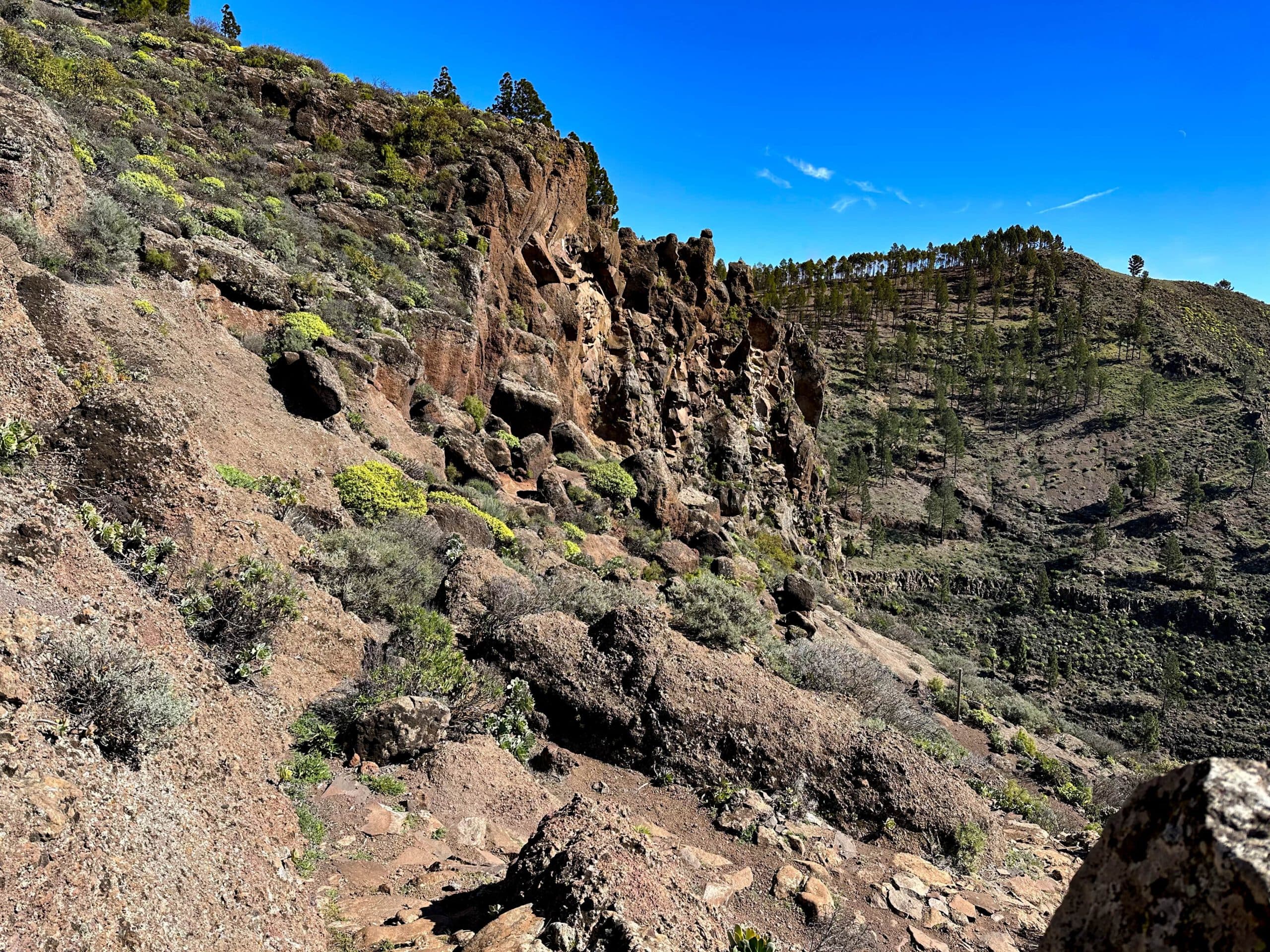
First, the trail continues to climb gently up the slope. This takes you to the other side of the Barranco de Cagarruta. Here you hike gently downhill for a while on a beautiful ridge path with a great view. Then the trail turns to the right. It leads you steeply downhill on serpentines on the side of the slope past impressive rock formations. The views from here of the valley and the entire Cumbre are stunning.
View from the descent path down into the valley
Finally, the path runs out on a long ridge above the Barranco Seco towards the small village of Taidía. You will eventually reach a small road in Taidía, where the trail joins. Turn left along the road. The road bends to the right and you continue down it. Halfway up, the path to Santa Lucia de Tirajana branches off to the left.
View of the Cumbre from the hiking trail
Taidía to Santa Lucia de Tirajana section
You walk along the narrow path below a finca. The small path leads to a road, which you follow to the left for quite a while. Finally, the hiking trail branches off to the left of the road. Now you cross a larger ravine on the path at the top of the slope. On the other side, the path brings you to the edge of a steep drop above the Barranco de Cagarruta. Below, you can already see Santa Lucia de Tirajana.
End of the hiking trail from the Cumbre at Taidía and start of the onward trail to Santa Lucia de Tirajana
Walk along the edge of the precipice. At the end of it, you will come to a small narrow path that will take you down to Santa Lucia de Tirajana in no time. This path is a little rough and rather uncomfortable to walk on, but doable. You come out close to the square and the GC-65, so you can return to your starting point in no time.
Hiker on the trail between Taidía and Santa Lucia de Tirajana
And finally
I hope you enjoyed this beautiful, varied and great walking tour in Gran Canaria. You can adjust the length to suit you. I will publish more hikes on Gran Canaria soon and hope that there is the right one for you. Have fun hiking,
Dagmar from Siebeninseln
Thank you for reading!
If you've found my hiking guides on SiebenInseln helpful for your Canary Islands adventures, please consider leaving a small tip. Your support is greatly appreciated and helps cover the costs of maintaining this blog.