Island crossing on the well-known hiking trails GR 131 und GR 132
The two well-known long-distance hiking trails GR 131 and GR 132 start on La Gomera in San Sebastian. So the GR 132 runs constantly up and down the steep coast around the entire island. The GR 131, on the other hand, starts on the east side of the island and heads straight for the centre. Over the highest point of the island, the Garajonay (1487 metres altitude), it then goes in a wide arc over the southwest of the island to Vallehermoso.
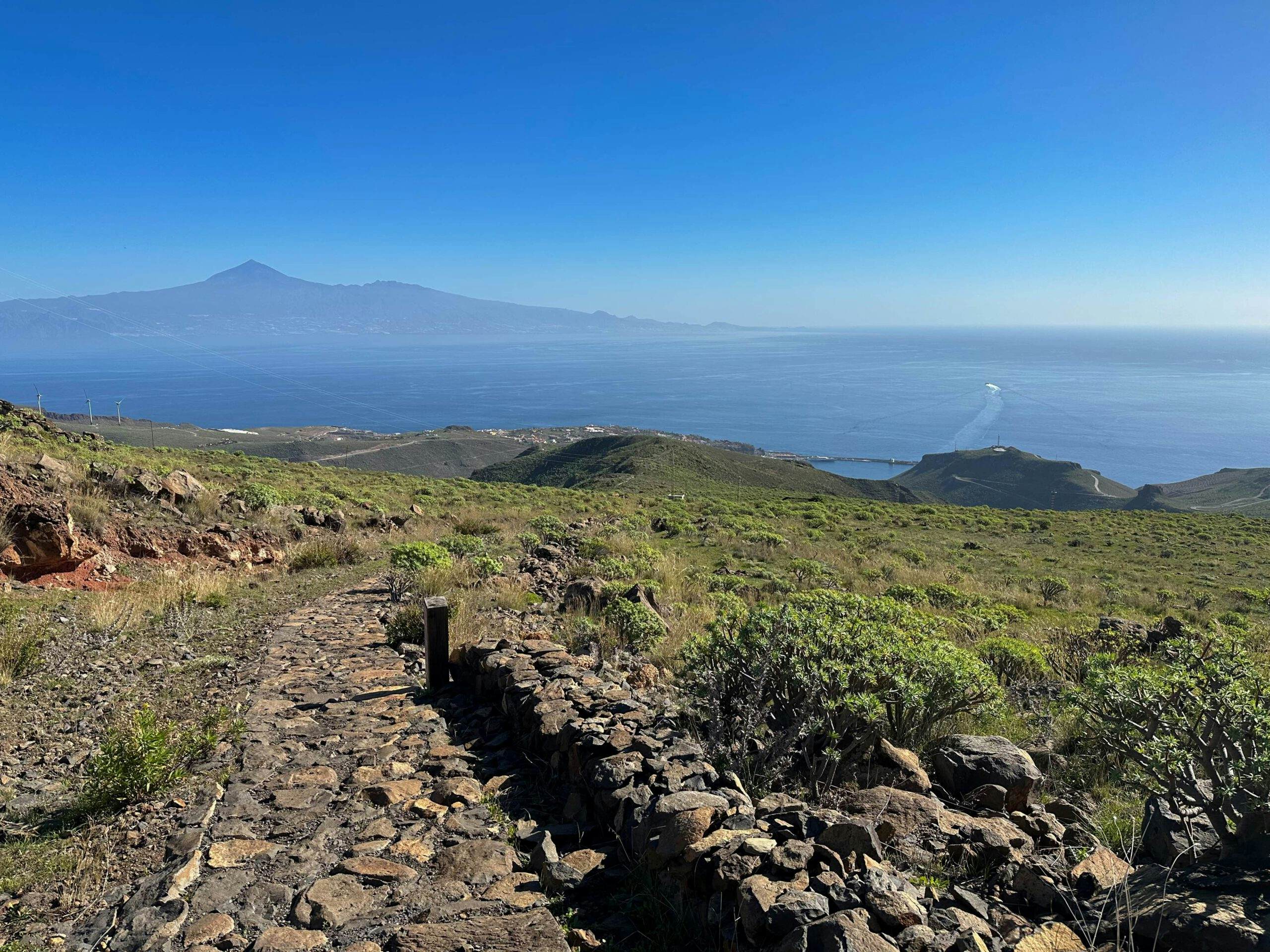
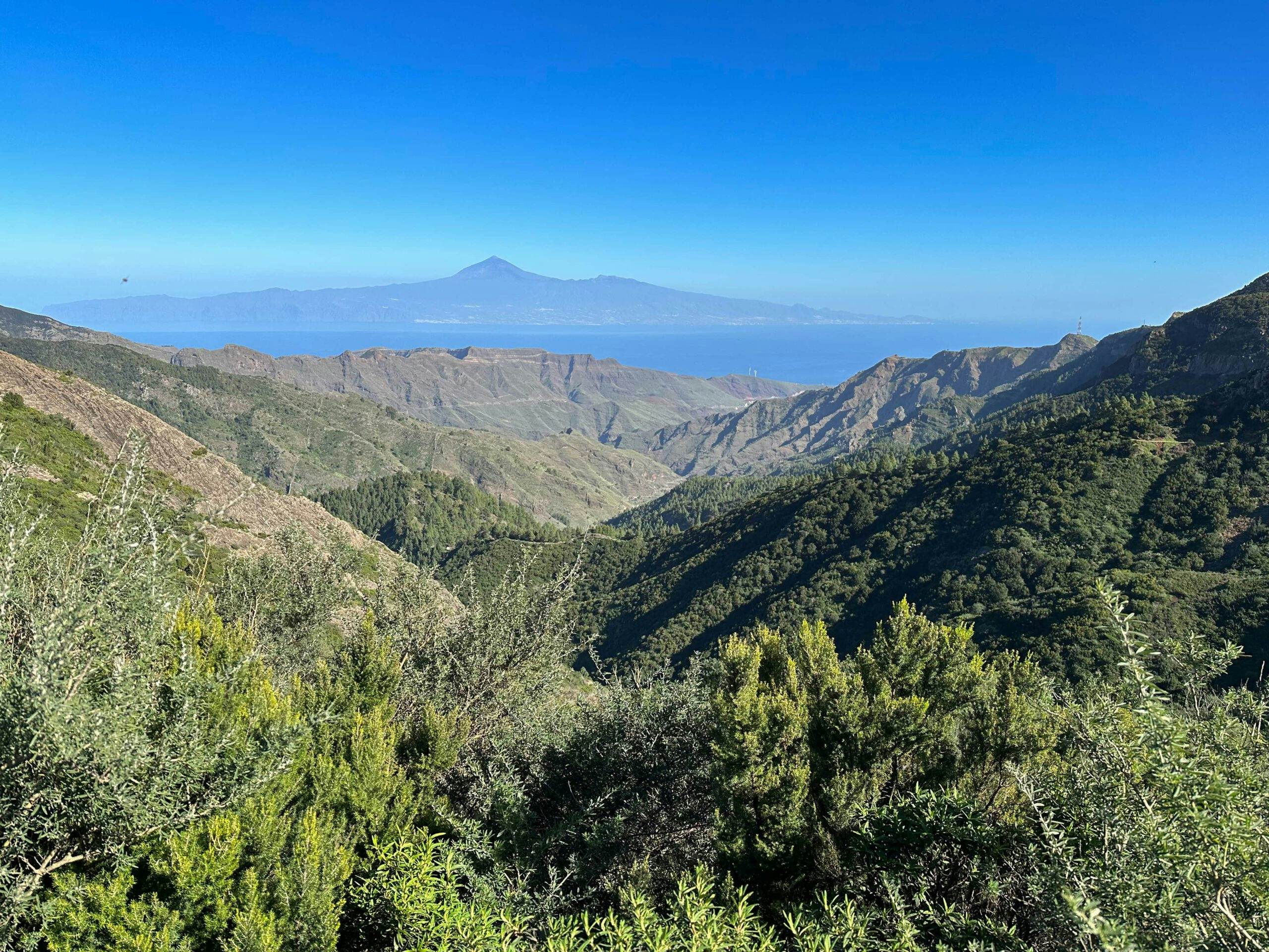
View of San Sebastian and Tenerife from the GR 131
I have already done several hikes on La Gomera that touch on both the GR 131 and the GR 132, but I have never walked the trails myself from start to finish. The hike described here is a combination of the GR 131 and the GR 132 to make an almost straight crossing of the island from east to west.
Map
Descent path into Valle Gran Rey
Impressive hike from San Sebastian to Valle Gran Rey on the GR 131 and GR 132
Most of this hike consists of the GR 131 long-distance trail, which you follow from San Sebastian to the high Degollada de Peraza. Then you continue on the GR 131 to the famous natural monument of Los Roques with the monumental rock Roque Agando and finally to Garajonay (1487 metres in altitude). After this ascent, you continue to follow the GR 131 downhill via Igualero and the Degollada Blanca to Chipude. There you will leave the GR 131 and continue to descend towards the west.
GR 131 - kilometre 23
After a short while you will meet the GR 132, which comes up from La Dama on the south coast. After an impressive barranco crossing from the Degollada del Cerrillal, you then make the steep descent into the Valle Gran Rey. I have divided this tour, which is well worth seeing, into two sections. Of course, you can do it differently. But this beautiful tour will delight every hiker who also enjoys longer hikes.
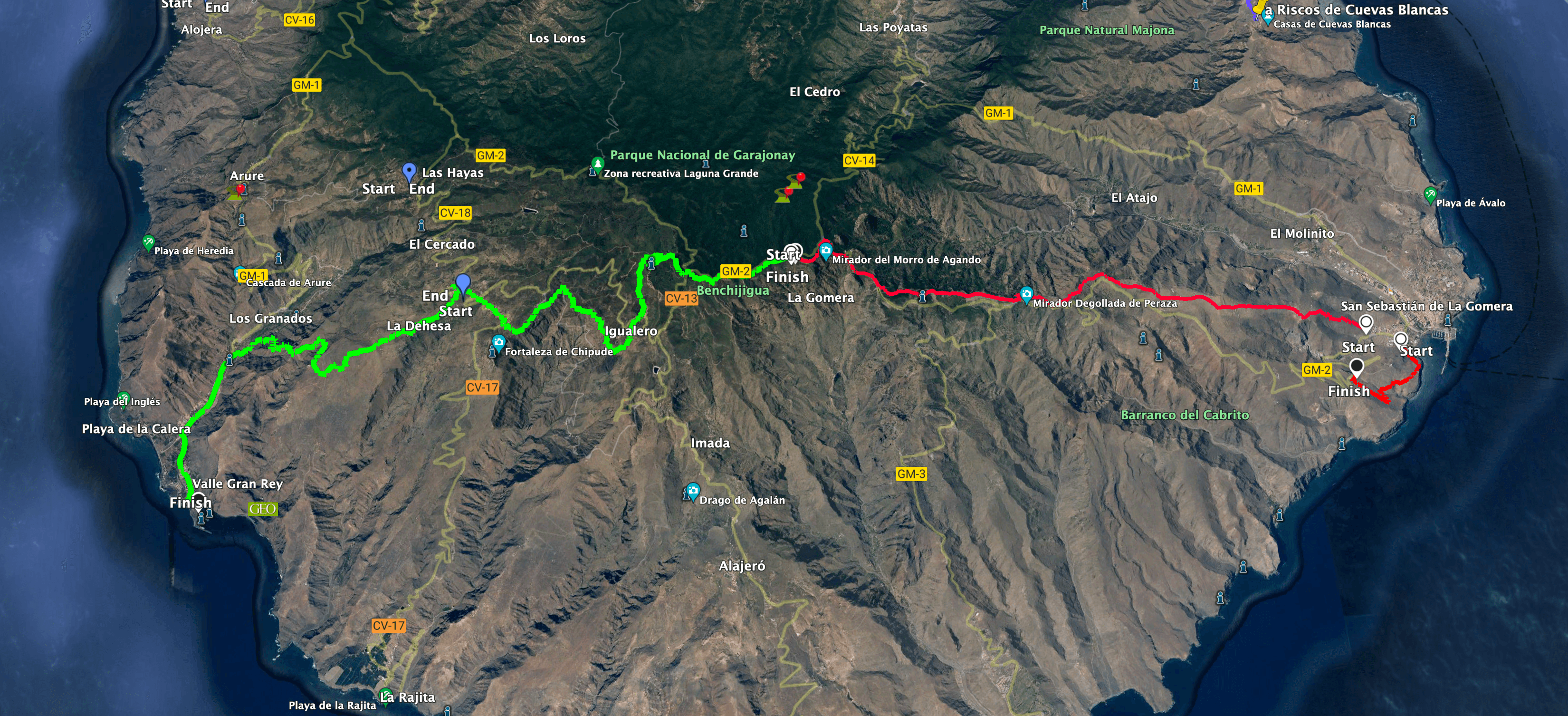
Track GR 131 - Part 1 La Gomera San Sebastian to via Los Roques (red) Part 2 via the GR 131 and the GR 132 to Valle Gran Rey (green)
General information about the San Sebastian – Valle Gran Rey hike on the GR 131 and GR 132 long-distance trails
Starting point and approach
The starting point of the walk is San Sebastian, at the end of the Avenida de Las Galanes road above the GM-2 road.
Approach by car
You can walk from the port or from any street in San Sebastian across the city to the starting point. If you come by car, you can turn right off the GM-2 at any possible road when leaving San Sebastian and then keep left uphill. The end point is always the starting point of the hike. If necessary, you can park your car at the side of the road.
Approach by bus
There are several bus lines from San Sebastian, such as line 1, which runs between San Sebastian and Valle Gran Rey. This can not only take you to the starting point (bus stop at GM-2 below the starting point), but also transport you back and forth between San Sebastian and Valle Gran Rey at many points along the hike. For more information, check the Guagua Gomera website. Time
I don’t like to give general times for hiking tours, because the times are very individual. For the first section from San Sebastian to Mirador de Tajaqué (14 kilometres) I needed about 4.5 hours with rest stops. The second section from Mirador de Tajaqué to Valle Gran Rey (24 kilometres) took me 6.5 hours, including rest times.
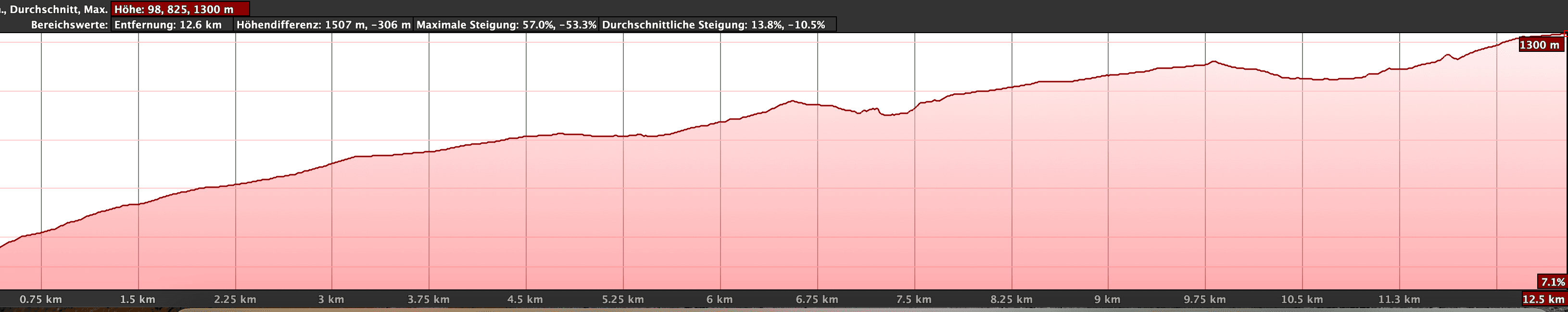
Altitude profile GR 131 - Part 1 La Gomera San Sebastian to Mirador de Tajaqué
Altitude difference and route length
The difference in altitude on the first stretch from San Sebastian to the Mirador de Tajaqué is 1,420 metres at 14 kilometres. From the Mirador de Tajaqué down to the Valle Gran Rey, there is still just over 550 metres of altitude difference over 24 kilometres.
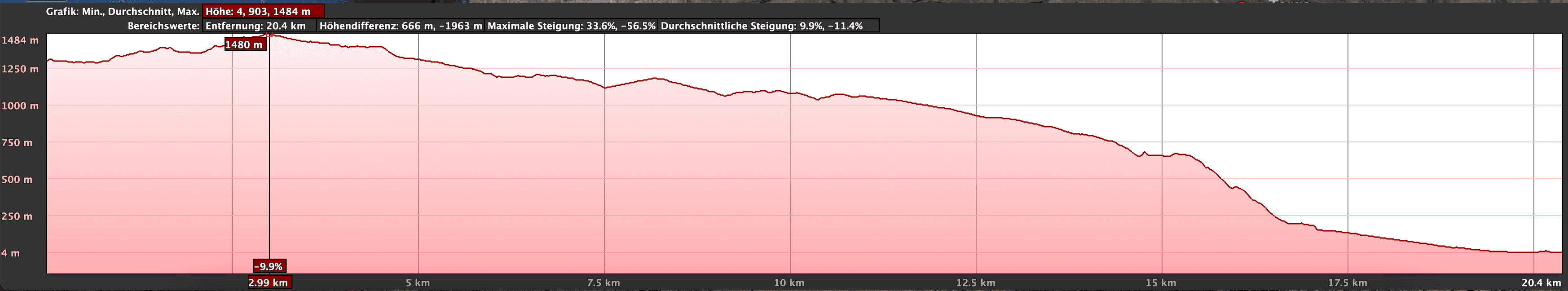
Elevation profile part 2 Mirador de Tajaqué via the GR 131 and the GR 132 into Valle Gran Rey (green)
Requirements
With the many kilometres of this tour, you need a good level of fitness. However, you can also divide the sections into smaller ones. And if you are in very good shape and start early, I think it is even possible to complete the tour in one day. By the way, you’ll mostly be walking on very well-maintained hiking trails (GR 131 and GR 132). However, for a few sections, such as the steep descent into Valle Gran Rey, you need to have a head for heights and be sure-footed.
Refreshment
You will find restaurants, bars and shops in several places along the way. Just look at the map to see approximately when you will be at which place. However, please take enough water with you for the walk.
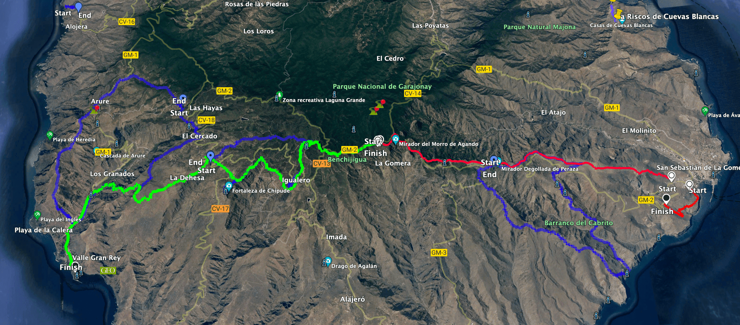
Track GR 131 - Part 1 La Gomera San Sebastian to via Los Roques (red) Part 2 via the GR 131 and the GR 132 into Valle Gran Rey (green) - other hikes touching the track (blue)
Variants
Article summary and large selection of GPS hiking tracks
Sign up for my newsletter now and get exclusive access to my collected GPS tracks as well as all the brief information about my articles.
Sign up nowYou can vary the route of this tour according to your needs. You can do it in one, two, three or more sections. Of course, you can also do it in both directions. You may prefer to follow the GR 131 from Chipude to Vallehermoso instead of the steep descent into Valle Gran Rey.
Here are some hikes that are part of this hike and that you will encounter during the course of this hike:
- 1.0
- 2.0
- 3.0
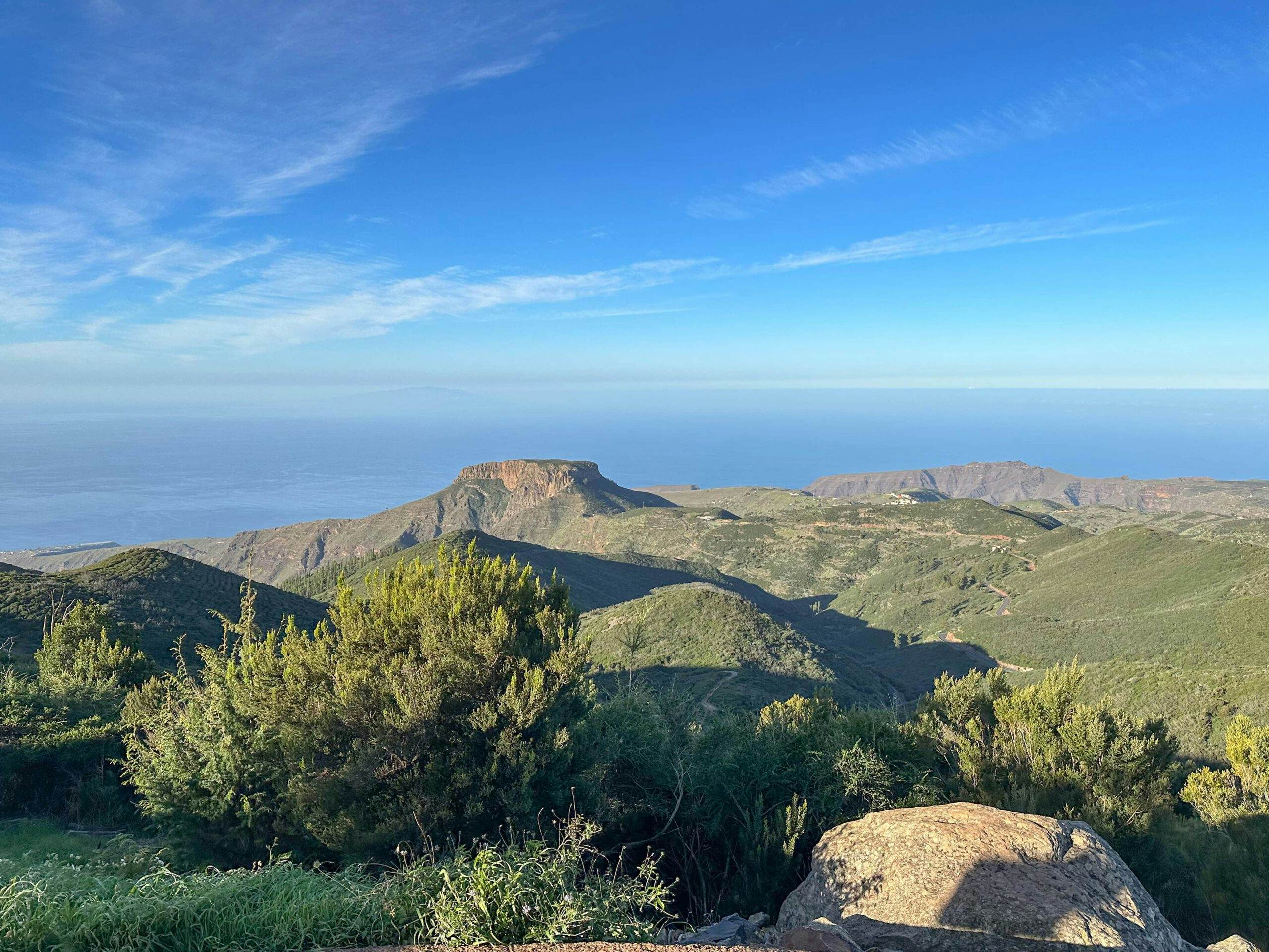
View from Garajonay to Fortaleza - Valle Gran Rey in the background
Hike GR 131 and GR 132 from San Sebastian to Valle Gran Rey
San Sebastian section to ridge trail over Barranco Hondo
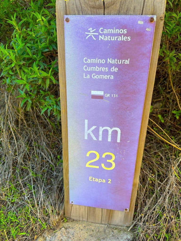
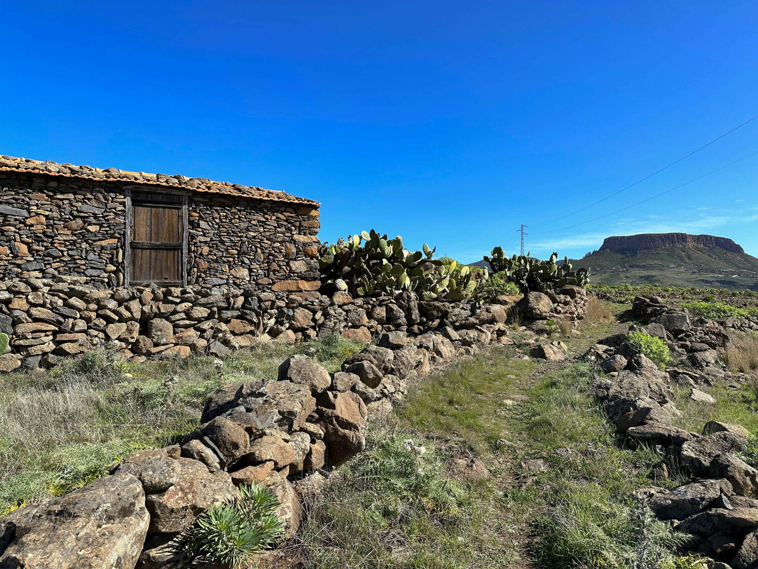
You start your hike in San Sebastian at the end of the street Avenida de Las Galanes. This is also where you will find the first of the many purple hiking signs that you will come across again and again during the course of the hike. The trail is marked GR 131. Often you will find kilometre indications for the next destinations or just the information on which kilometre of the path you are currently on. The old Camino, which is often covered with stones, first leads you up a long ridge path above the Barranco de Tajinastes.
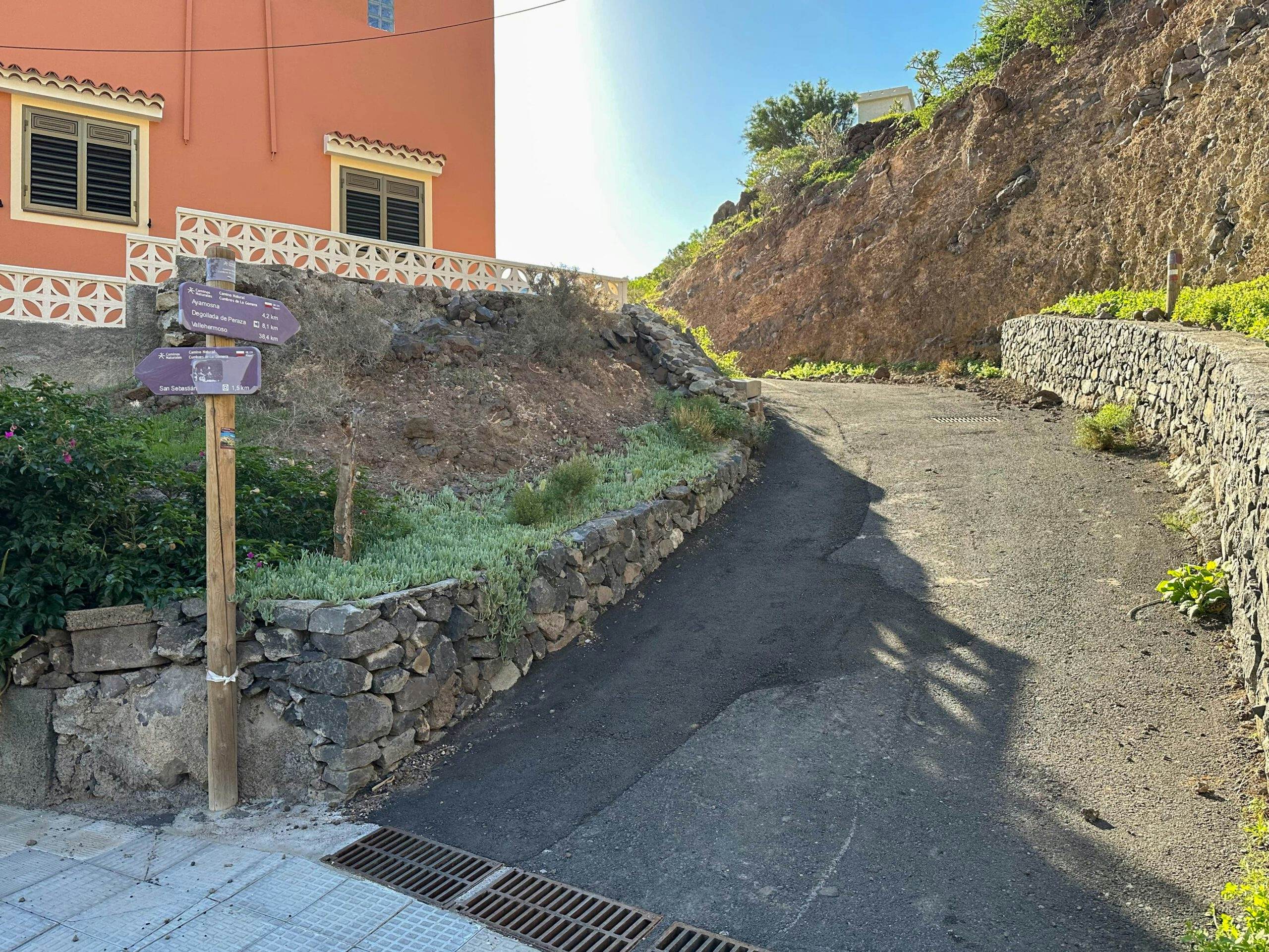
Starting point GR 131 in San Sebastian, La Gomera
From the path you have beautiful views back to San Sebastian and the harbour, as well as Tenerife in the distance. On the left, you look across to the elevations on the coast and the GM-2, which winds up in large serpentines to the centre of the island. After a while you will reach some houses that you have already seen from afar. Go past them on the hiking trail to the left up to another ridge above the Barranco Hondo.
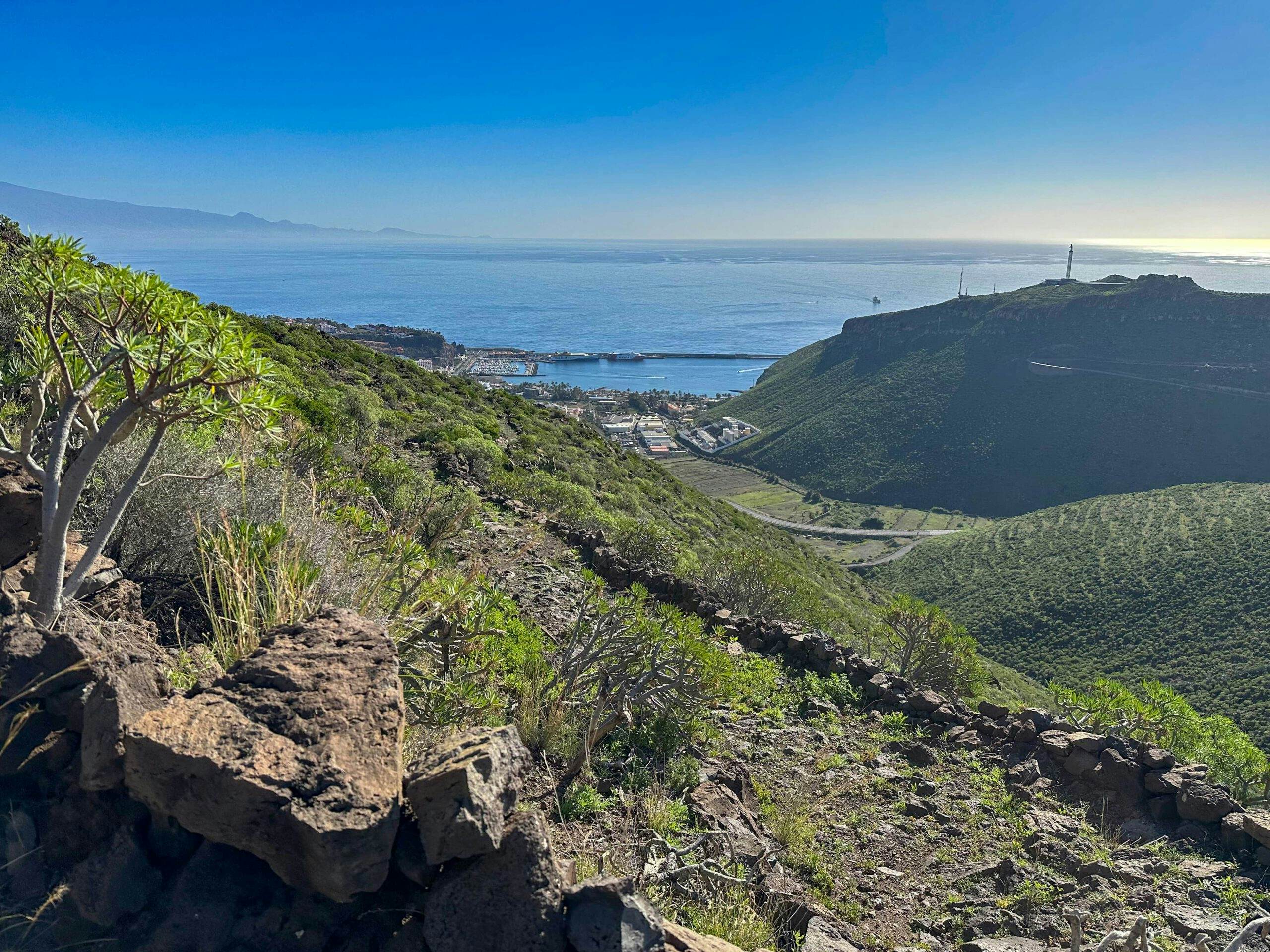
Hiking on the Camino with a view from the heights of San Sebastian with its harbour and Tenerife
Section of ridge trail via Barranco Hondo to ridge trail behind Ayamosna
This trail leads you steeply up the ridge. Every now and then you will come to a small road and the trail runs excellently on the road for a few hundred metres. Then it turns away from the road again. You also pass some large yellow halls. Here the path is particularly well paved. Finally, you pass the first small houses of the village of Ayamosna on the left. The trail makes a wide turn to the left. You come to the road in Ayamosna. This forks immediately afterwards. The path to the left downhill is part of the Playa Cabrito hike.
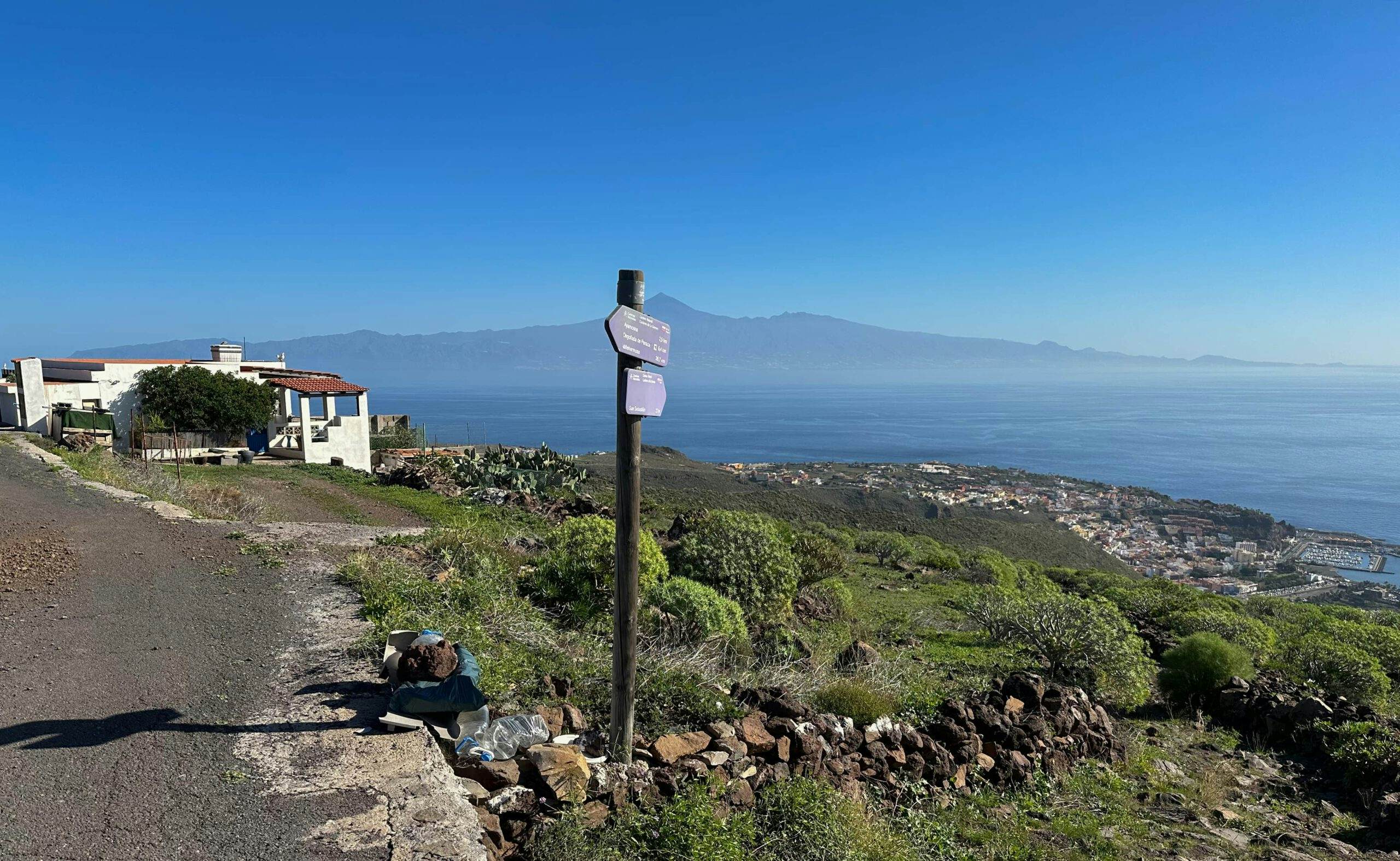
First ascent above San Sebastian completed - hiking trail joins a road
However, you keep to the right and continue uphill along the ridge. The path that continues to Degollada de Peraza is also part of the Playa Cabrito hike. To the left you have wonderful views into the Barranco del Cabrito. As the trail now often runs very close to the ridge, from time to time you can also look far into and over the gorge to your right. After some impressive rocks, the path turns a little downhill and continues high above the GM-2 on the left side of the slope. 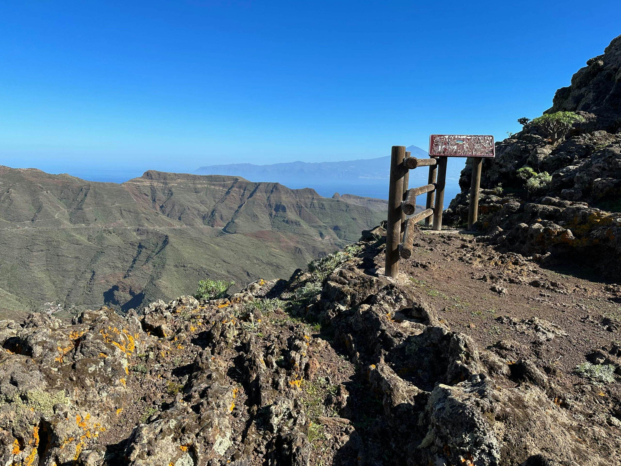
on the Cumbre - magnificent views in all directions
Section of ridge trail behind Ayamosna to Ermita de Nuestra Señora de Las Nieves
From here, the hiking trail climbs more and more on the left side of the slope. Finally, after a steep climb, you reach a mountain with a distinctive red and white mast that you can see from afar. From here, the path goes downhill again on the other side to the GM-2. When you have almost reached it, the path turns right downhill behind the mighty rocks of the Degollada de Peraza. An impressive climb with impressive views awaits you. In particularly steep places, however, the path is well secured with a wooden terrain.
View down into the Barranco de Cabrito
The path first takes you a little downhill and then uphill again behind the rocks to the Degollada de Peraza. From there, take a few steps to the right along the road. The trail then climbs uphill again to the right through the forest. Then you reach a wide road that leads you high above the GM-2 on a ridge further uphill. Ignore a path that branches off to the left. After following the wide path uphill for a long time, you reach the Ermita de Nuestra Señora de Las Nieves.
Hiking trail with gate - Degollada de Peraza
Route section Ermita de Nuestra Señora de Las Nieves to Mirador de los Roques
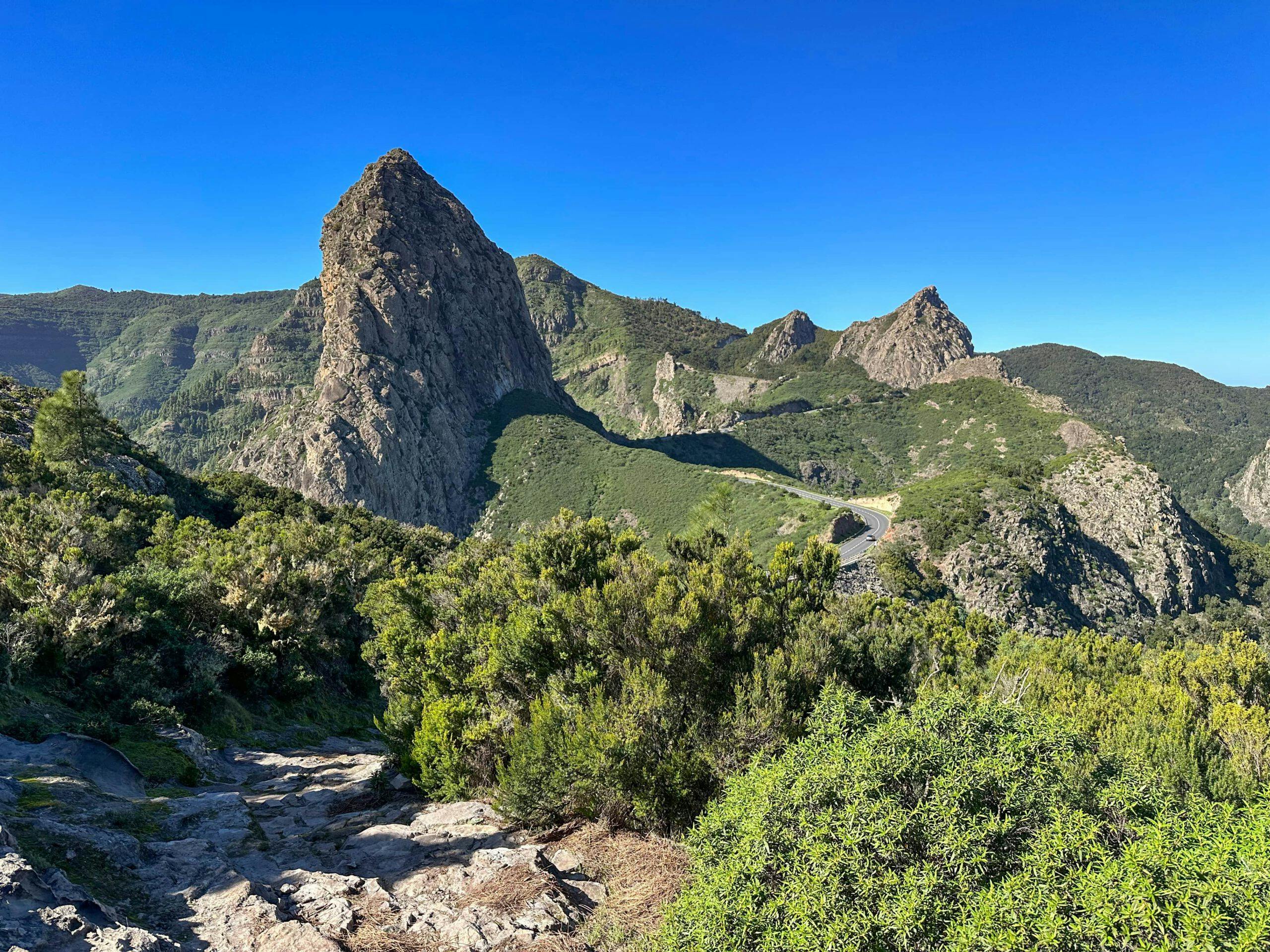
The Ermita de Nuestra Señora de Las Nieves not only offers good views from a viewing platform, but also an opportunity to rest at a rest area. Once you’ve seen everything and had enough rest, the trail takes you further along the ridge and through the cloud forest towards Los Roques. You can already see the famous rock monument with the impressive Roque Agando from a distance.
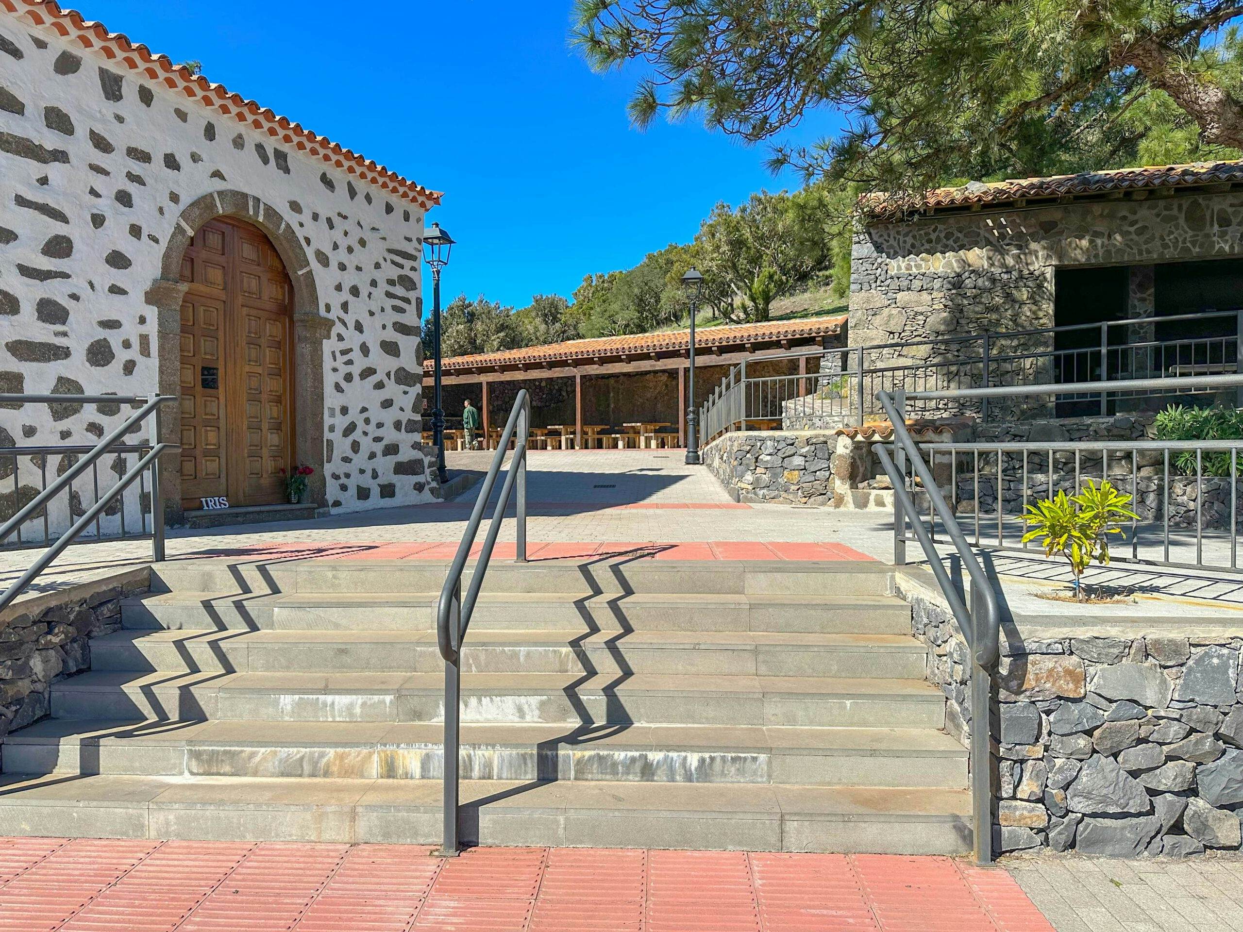
Ermita de Nuestra Señora de Las Nieves
On the ridge path you will get down to the GM-2 and walk along it for some time on a small hiking trail. You cross a bridge and finally come to the car park below Roque Agando. Cross the road here. The hiking trail continues on the other side of the road. It takes you further uphill through the forest until you reach the road at Mirador de los Roques.
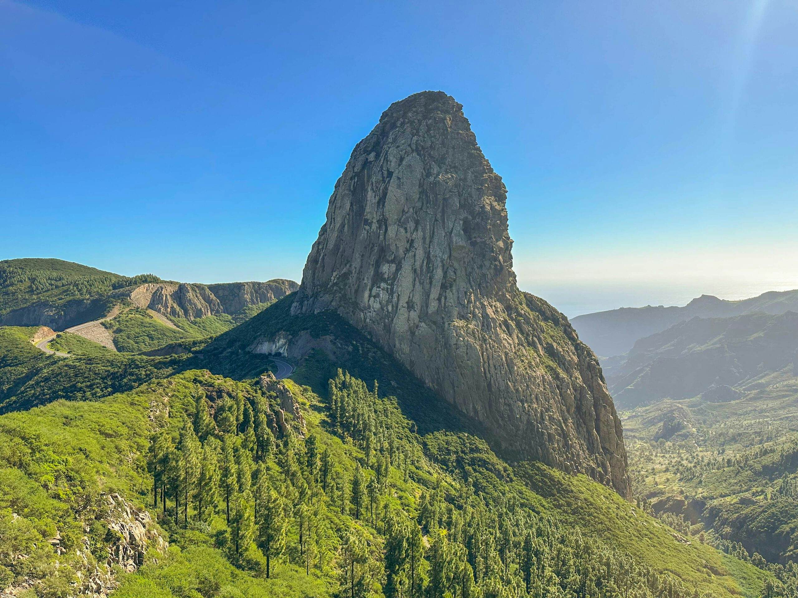
Roque Agando
Section Mirador de los Roques to Mirador de Tajaqué
Shortly after the Mirador de los Roques, cross the road to the right. You walk through the laurel forest high above the GM-2, crossing a hill after which the path descends again. You will reach the road again, which you will cross again. This time the climb through the laurel forest is on this side of the road. You walk up to a ridge in the Reserva Natural Integral de Benchijigua. Here you reach the Mirador del Morro de Agando.
View from the Mirador del Morro de Agando over the east of La Gomera and Tenerife
And from this place you can once again look down on the mighty Roque Agando. Afterwards, the ridge trail takes you further uphill. Once again you cross the GM-2, this time on a wooden bridge. On the other side, the path continues through the forest. Finally, at about kilometre 22 on the GM-2, you come to a park and lookout point, the Mirador de Tajaqué. This is where I finished my first stretch of the tour. From here, according to the signs, it is another 3 kilometres to Garajonay. Of course, you can also divide the route differently.
Article summary and large selection of GPS hiking tracks
Sign up for my newsletter now and get exclusive access to my collected GPS tracks as well as all the brief information about my articles.
Sign up now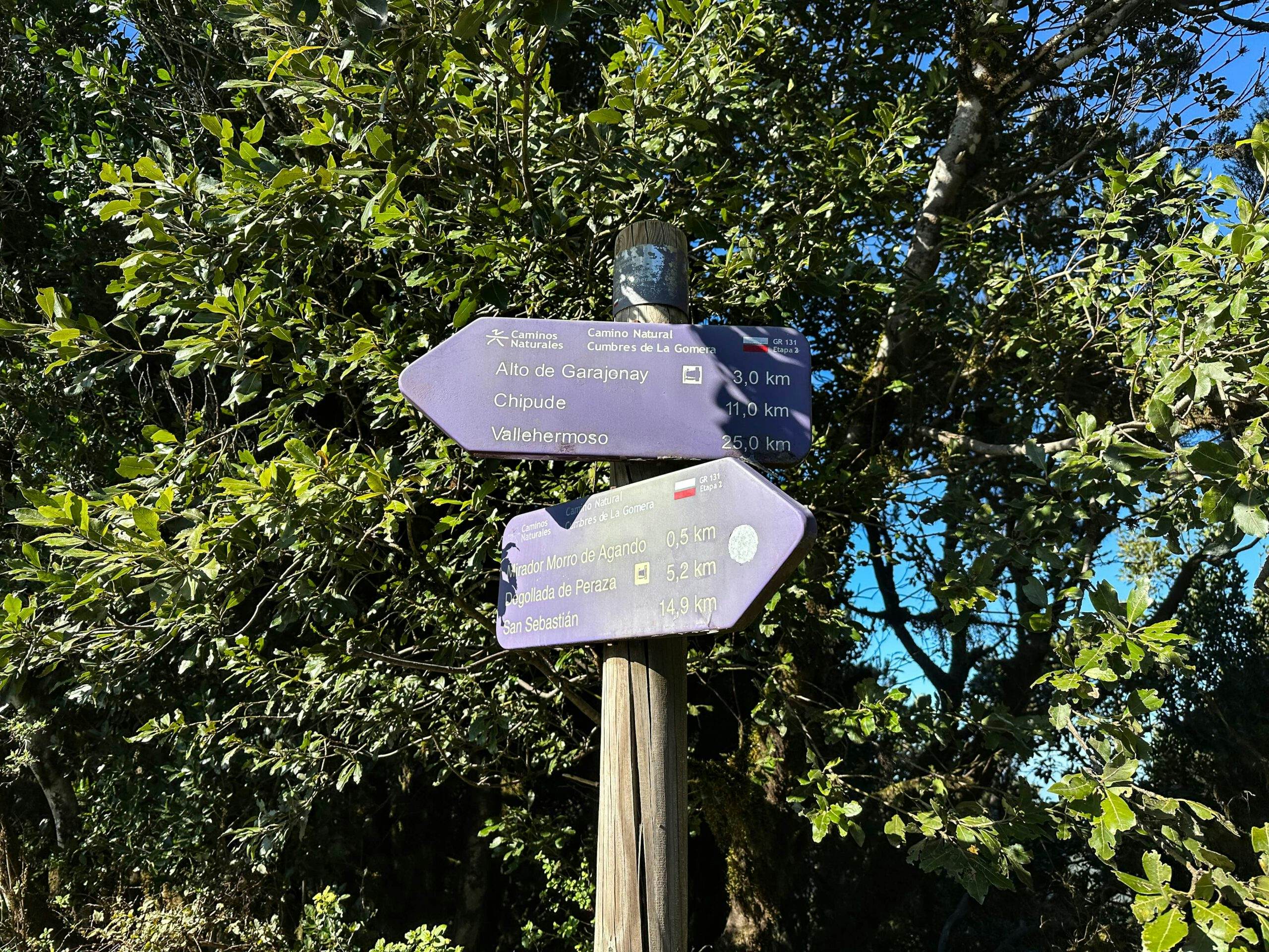
GR 131 - the trail crosses the GM-2 behind Benchijigua - after 15 km behind San Sebastian my first part of the hike ends at the Mirador de Tajaqué
Mirador de Tajaqué to Garajonay section
At Mirador de Tajaque, you cross the road on the GR 131. The trail runs mostly through the forest, slightly up and down, parallel to the road. Finally, you reach the Cruce de Pajarito car park. From here, the trail turns away from the GM-2. You hike steeply uphill again on the hiking trail and reach a ridge path, which you follow further through the forest. At the next major junction, keep left towards Alto Garajonay. Once again, the trail descends slightly and then climbs up to Garajonay (1487 metres).
View from the hiking trail to Garajonay
After you have enjoyed the view at the highest point of Gomera, you go downhill again on the other side on the wide road. After the first wide switchback, the path splits. On the right, it goes down immediately to Chipude. However, I continued on the GR 131 to include Igualero and the Degollada Blanca in the hike. Both paths to Chipude are also described in detail in the Fortaleza and Garajonay hike. 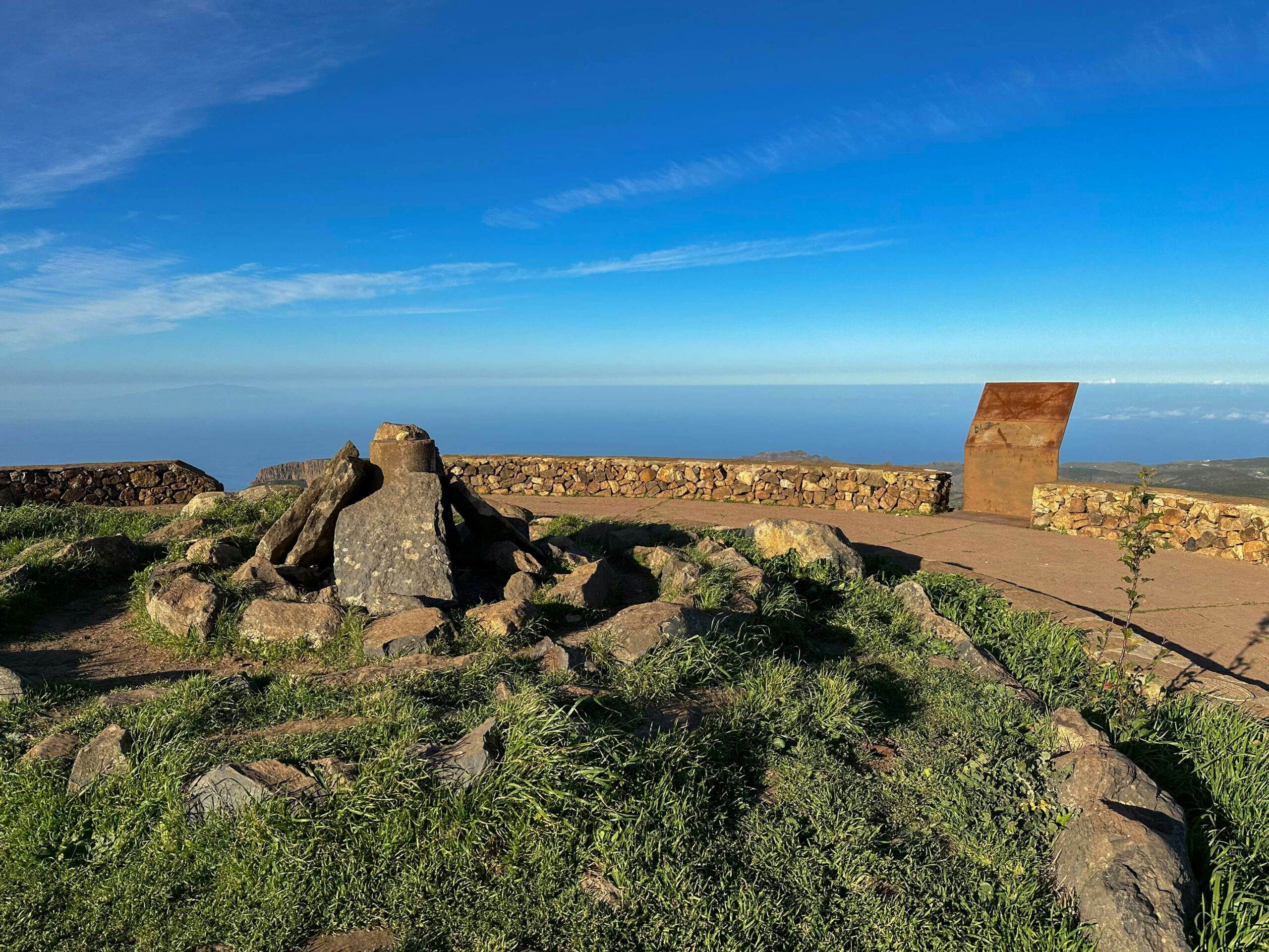
GR 131 - on the summit de Garajonay
Garajonay to Pavón section
In my description, I took this path in the opposite direction. Now you just follow the wide road along the slope, following the signs to Igualero. The road divides and you keep to the left and shortly afterwards climb downhill on a narrow path to Igualero. From there, the trail takes you below the village. Further below the village of Igualero, the path turns right. With magnificent views of the Fortaleza and the Barranco de Erque, you hike along the slope of the Degollada Blanca. 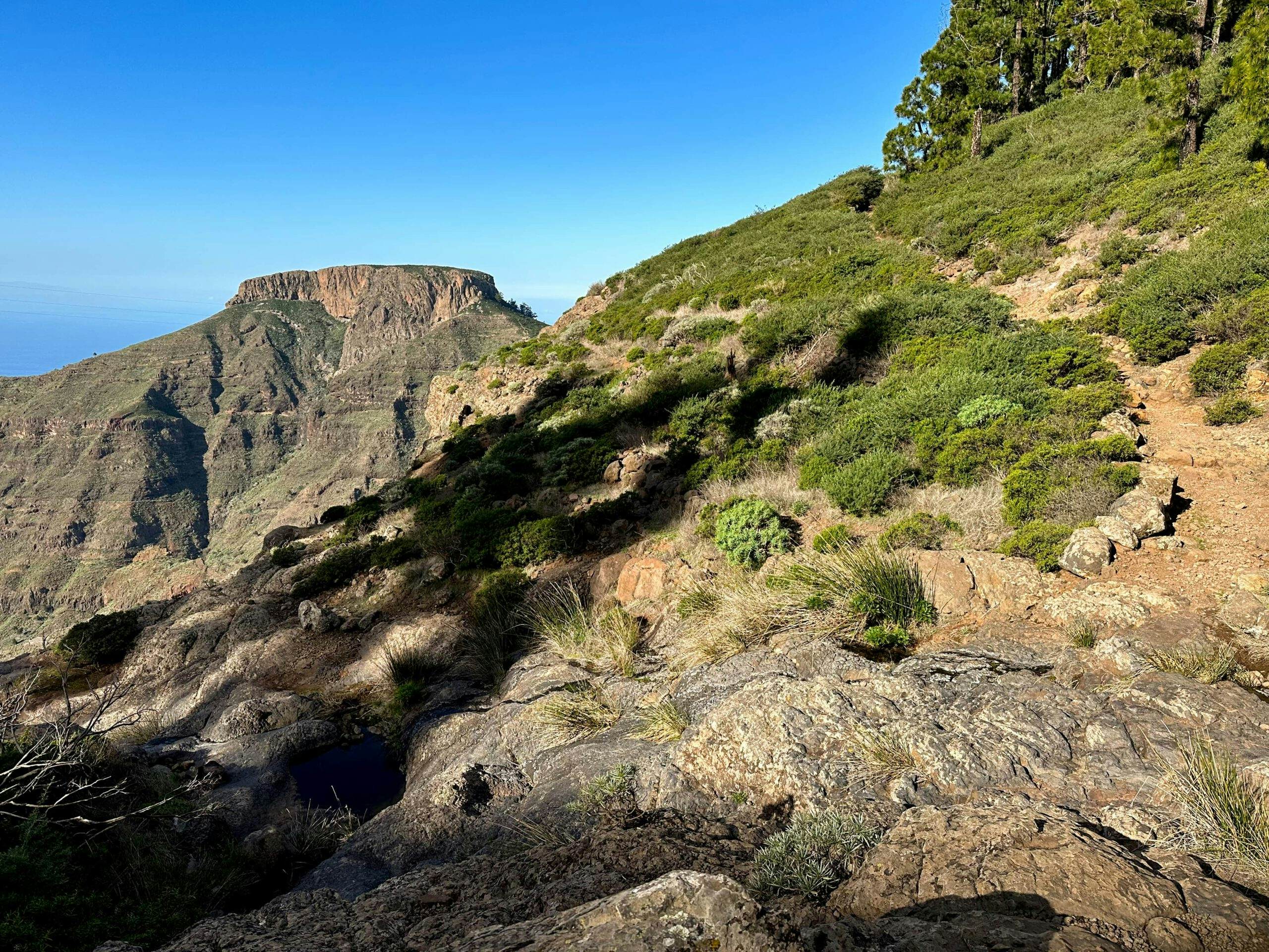
GR 131 - Crossing on the Degollada Blanca towards Pavon
Since the gorge below you is very large, the trail makes a number of turns to bridge the individual cuts. You will enjoy wonderful views until you finally reach the road to Erque. Now turn right and walk uphill on the road for a while. When the road turns right, follow the trail. It leaves the road to the left and runs along the slope of the Barranco de Erque towards the Fortaleza. At the point where you turn left uphill towards Fortaleza, go downhill to the right and after a short while you will reach the hamlet of Pavón. 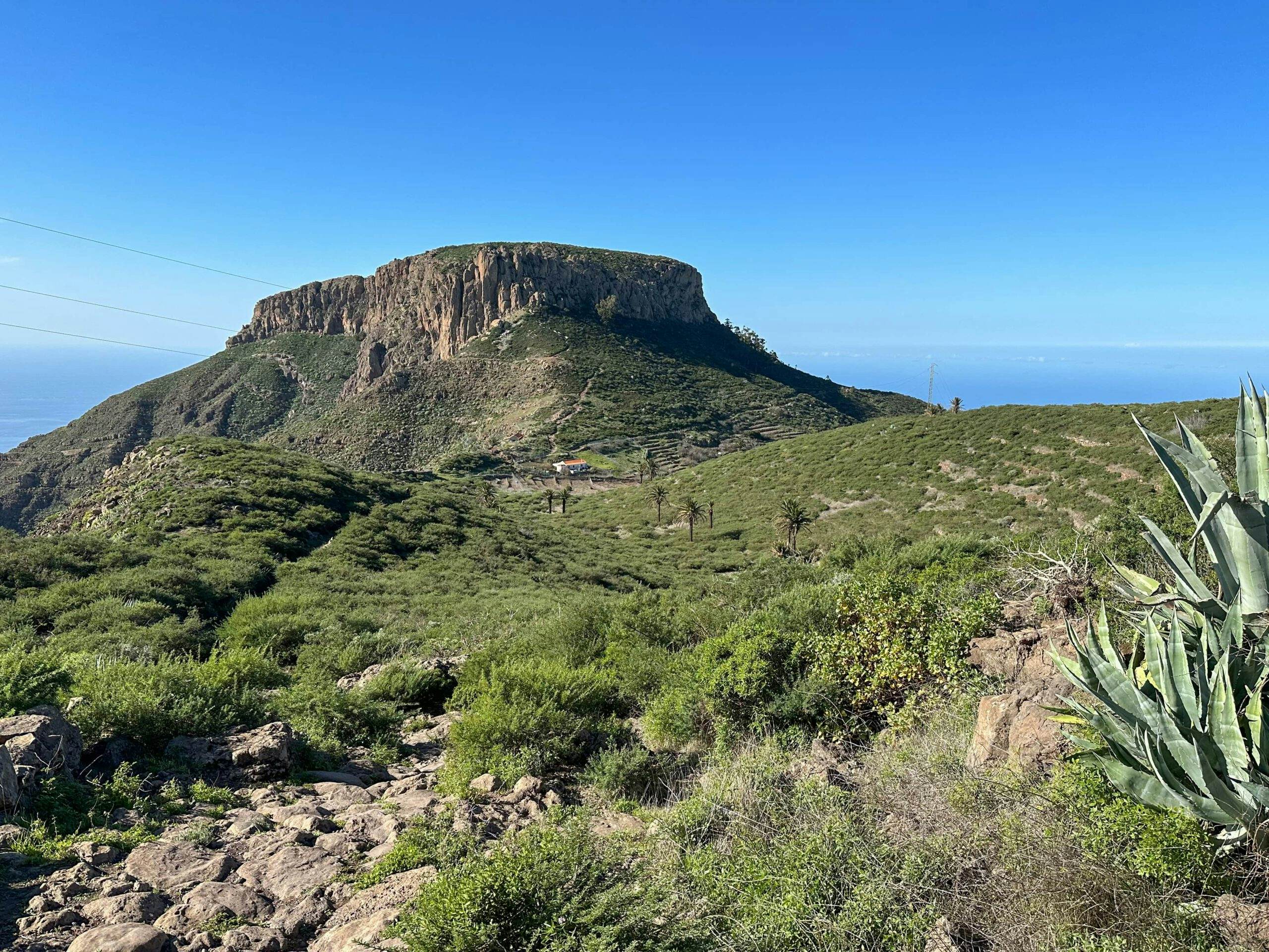
Pavón in front of the Fortaleza - GR 131
Pavón section to GR 132 long-distance trail
You walk along Calle de Pavón through Pavón and come to the CV-17 road, which you cross. The trail continues on the opposite side and then crosses a small ravine. You will rejoin the CV-17, which you follow to the left for a while through Chipude. Finally, the trail turns off the road to the right. You hike gently up and down, crossing the CV-17 and CV-18, towards the centre of Chipude.
GR 131 hiking road behind Chipude
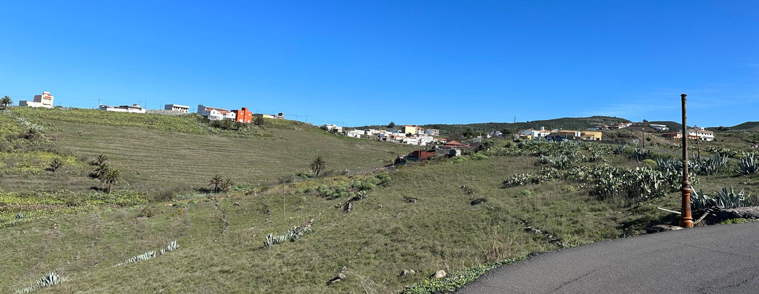
In Chipude, you will leave the GR 131, which turns north in a wide arc towards Vallehermoso. From the centre of the village, follow the main road CV-18 downhill a little and then take the first road on the left (Calle Verodal). This takes you slowly down a ridge towards Valle Gran Rey.
Hiking trail towards Gerian
From time to time, the trail follows the road, which is hardly used. Then it runs alongside it again, and finally, on a wide plateau, it diverges considerably from the road. After a final crossing of Calle Verodal, you will meet the GR 132 trail above the hamlet of Gerian and 3.3 kilometres below Chipude.
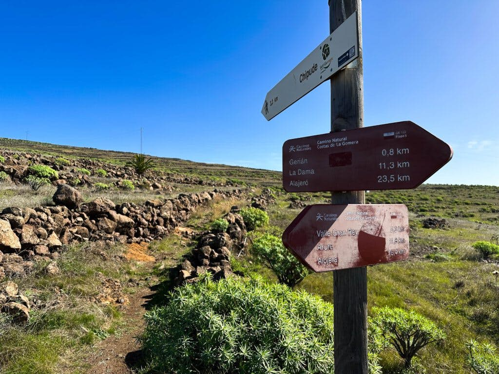
Hiking junction - from now on we continue on the GR 132
Long-distance trail section GR 132 to descent from Degollada Cerrillal
The long-distance trail comes up from the La Dama coast. Follow it to the right and shortly afterwards you will see the Ermita de Nuestra Señora de Guadalupe below you. From here, the path becomes a little steeper and more impassable. You should be free from vertigo and sure-footed. A small path leads down into a deep gorge. After a while you will come to a fork. On the right side of the mountain, the path continues uphill to El Cercado.
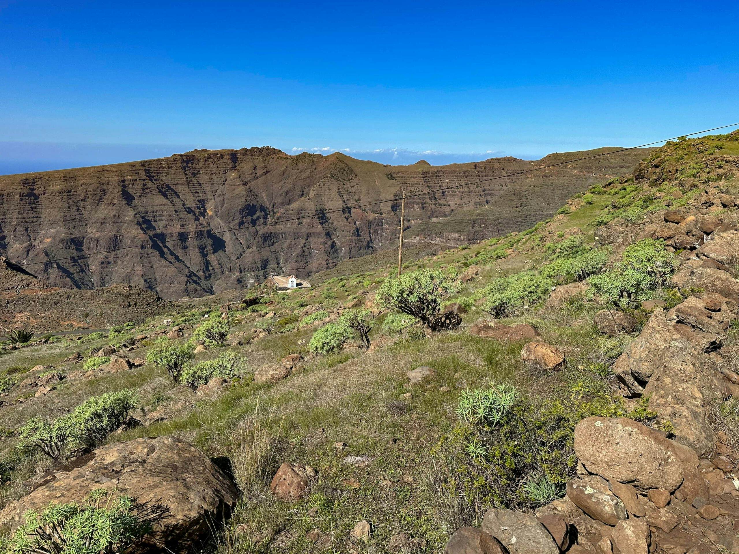
View from the hiking trail to the Ermita de Nuestra Señora de Guadalupe and the Valle Gran Rey
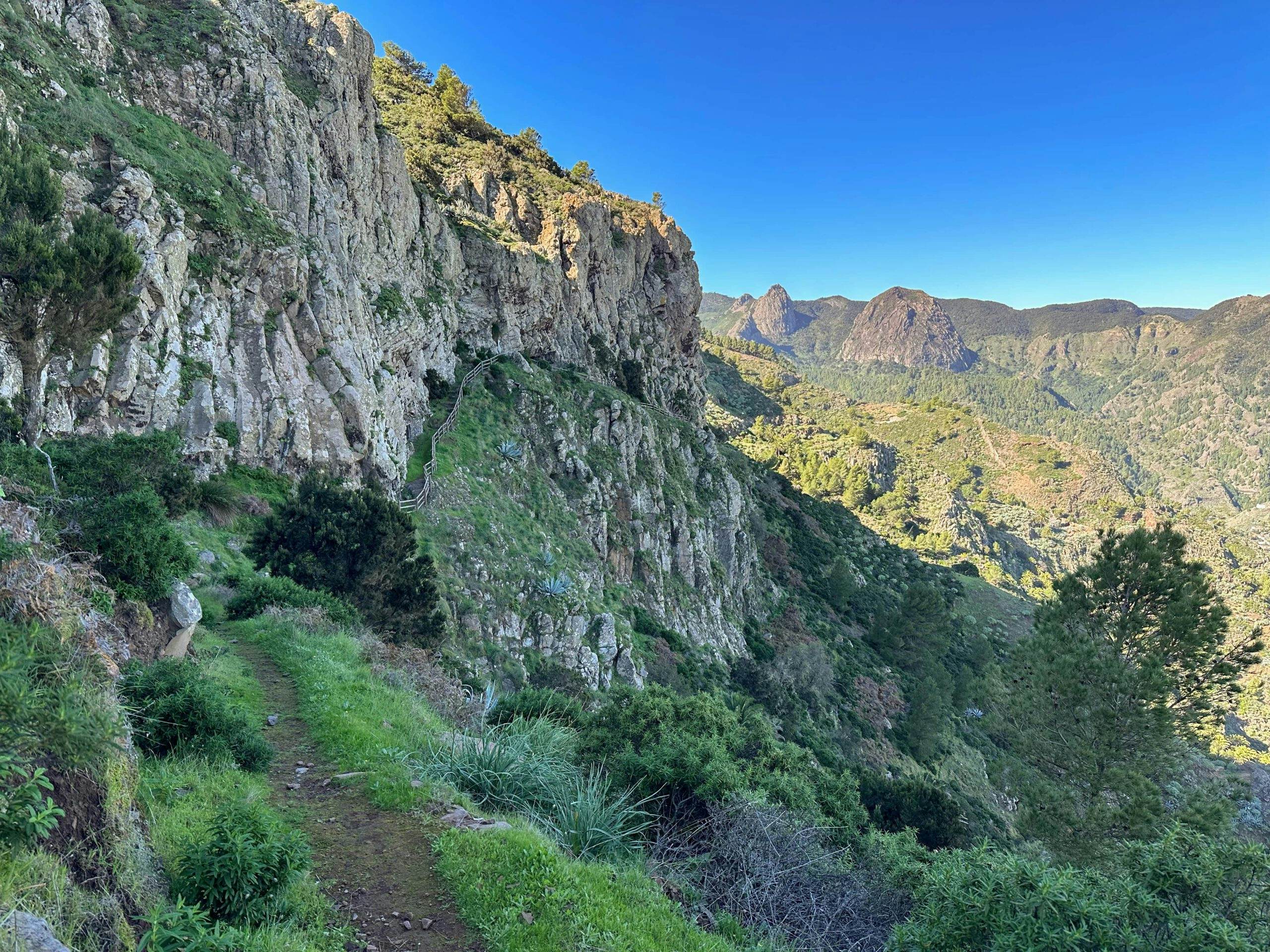
Both this path and the path you are now taking into the barranco are part of the Great Valle Gran Rey Circuit. At the bottom of the barranco, cross the gorge and climb up the other side of the slope to Degollada del Cerrillal. At this exposed ridge point high above the Valle Gran Rey, you have a fantastic view of the entire valley. From here you descend on a narrow ridge path with beautiful views into the valley. Provided you have a head for heights and are sure-footed, you will have great fun on the descent. 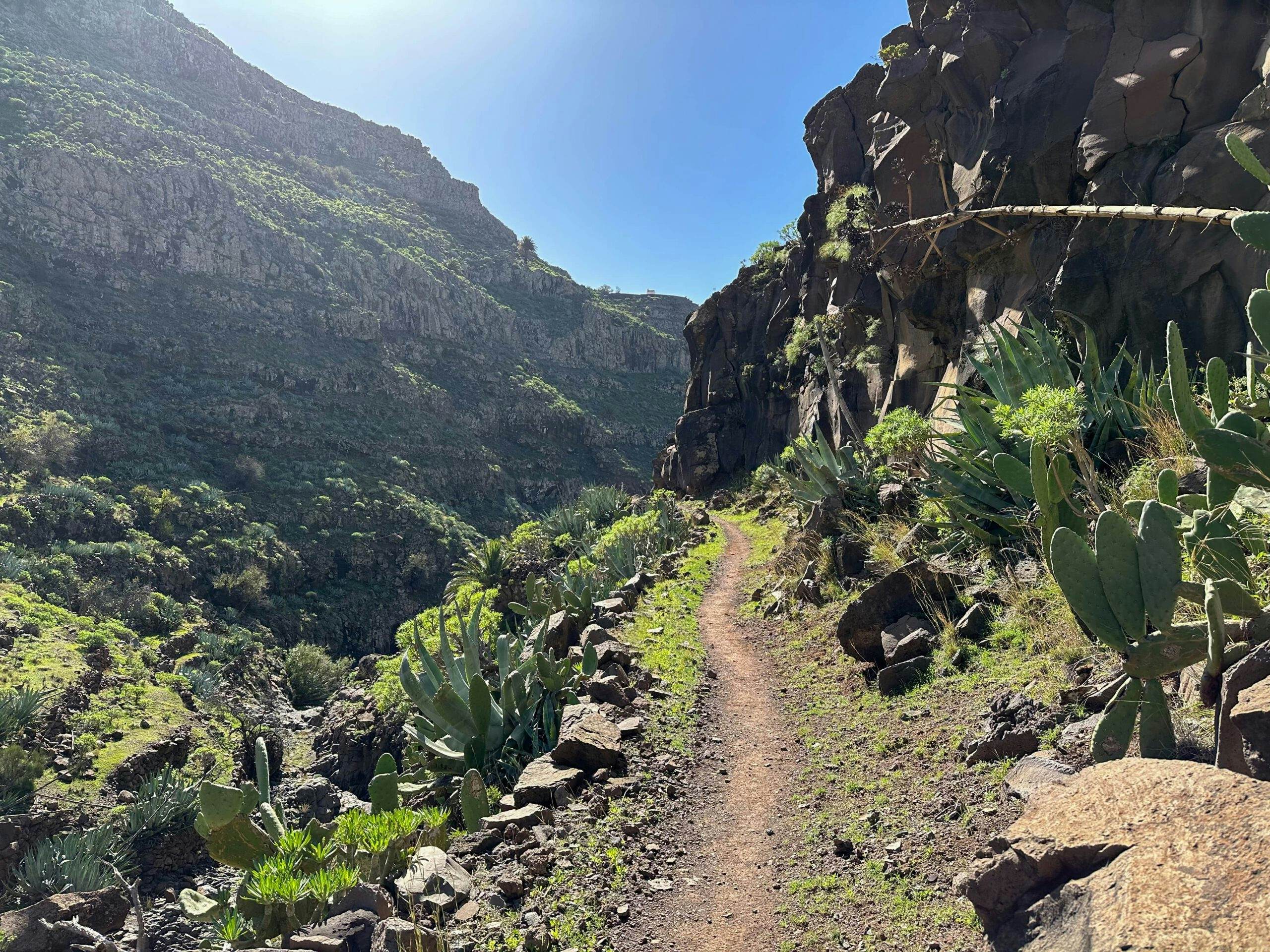
Ascent Barranco de Argaga to Degollada del Cerrillal
Descent from Degollada Cerrillal to Valle Gran Rey Vueltass
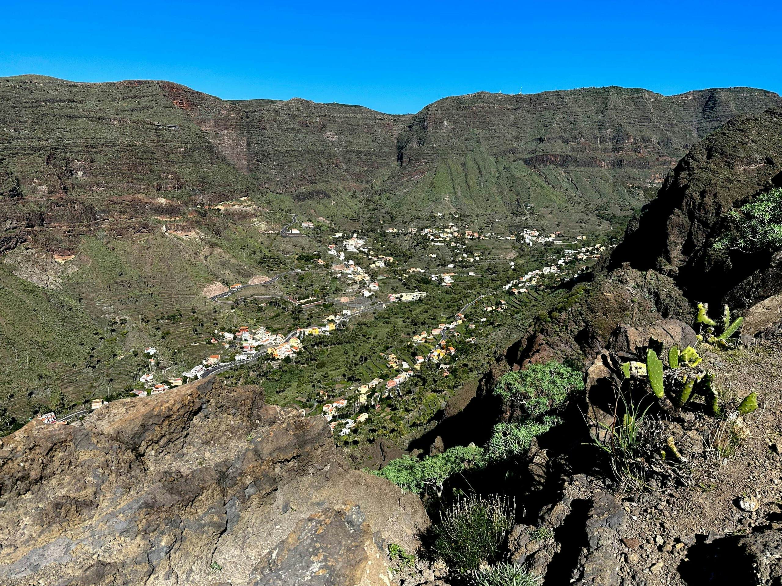
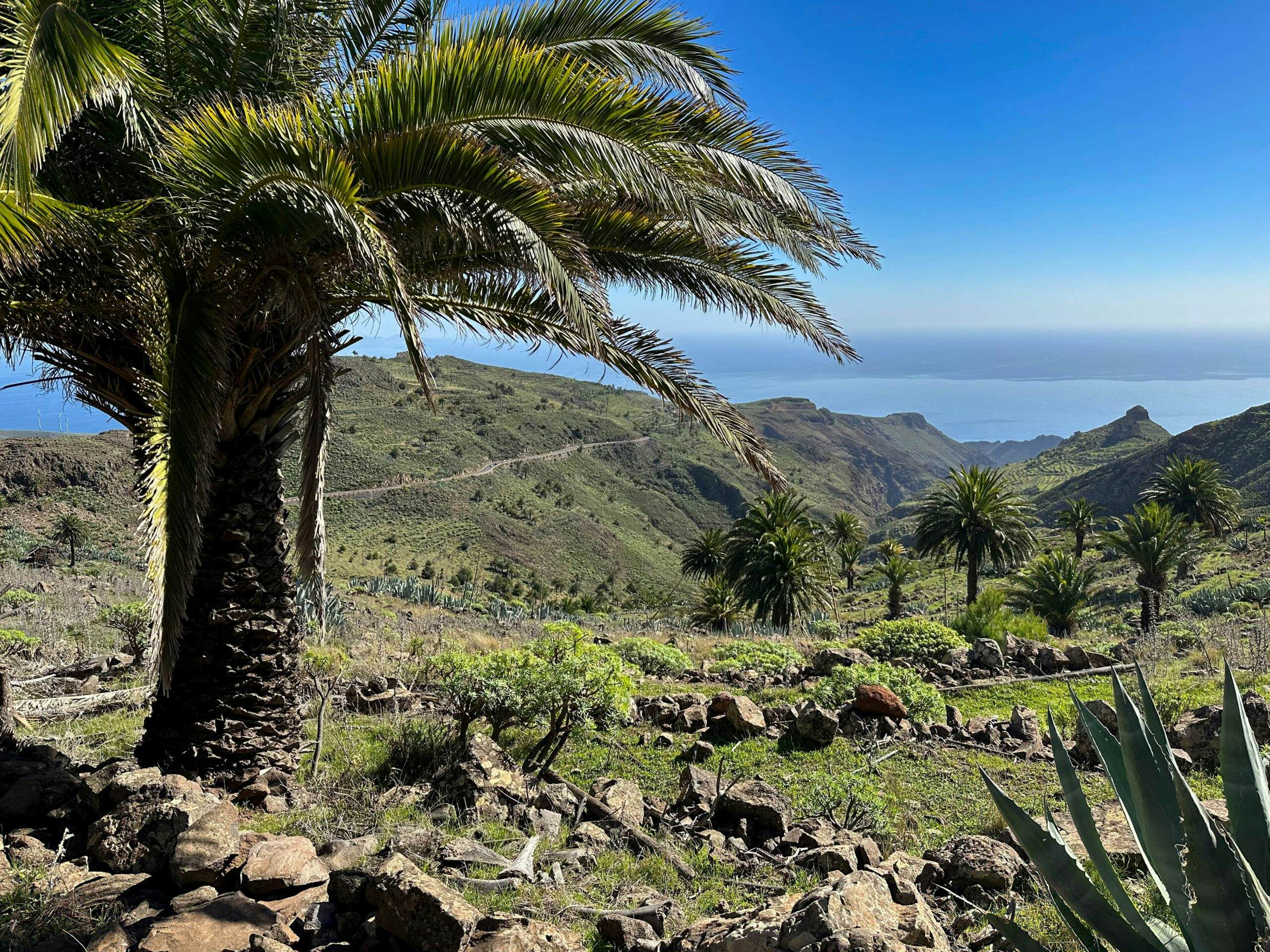
After the strenuous steep descent, you come out at some houses in El Guro in Valle Gran Rey. Keep left along the mountain on the well-maintained Camino los Reyes hiking trail. This will eventually take you to the Ermita de los Santos Reyes. From there you descend and cross the barranco on the same path over to the GM-1. From here it is another 1-3 kilometres down the road to the left.
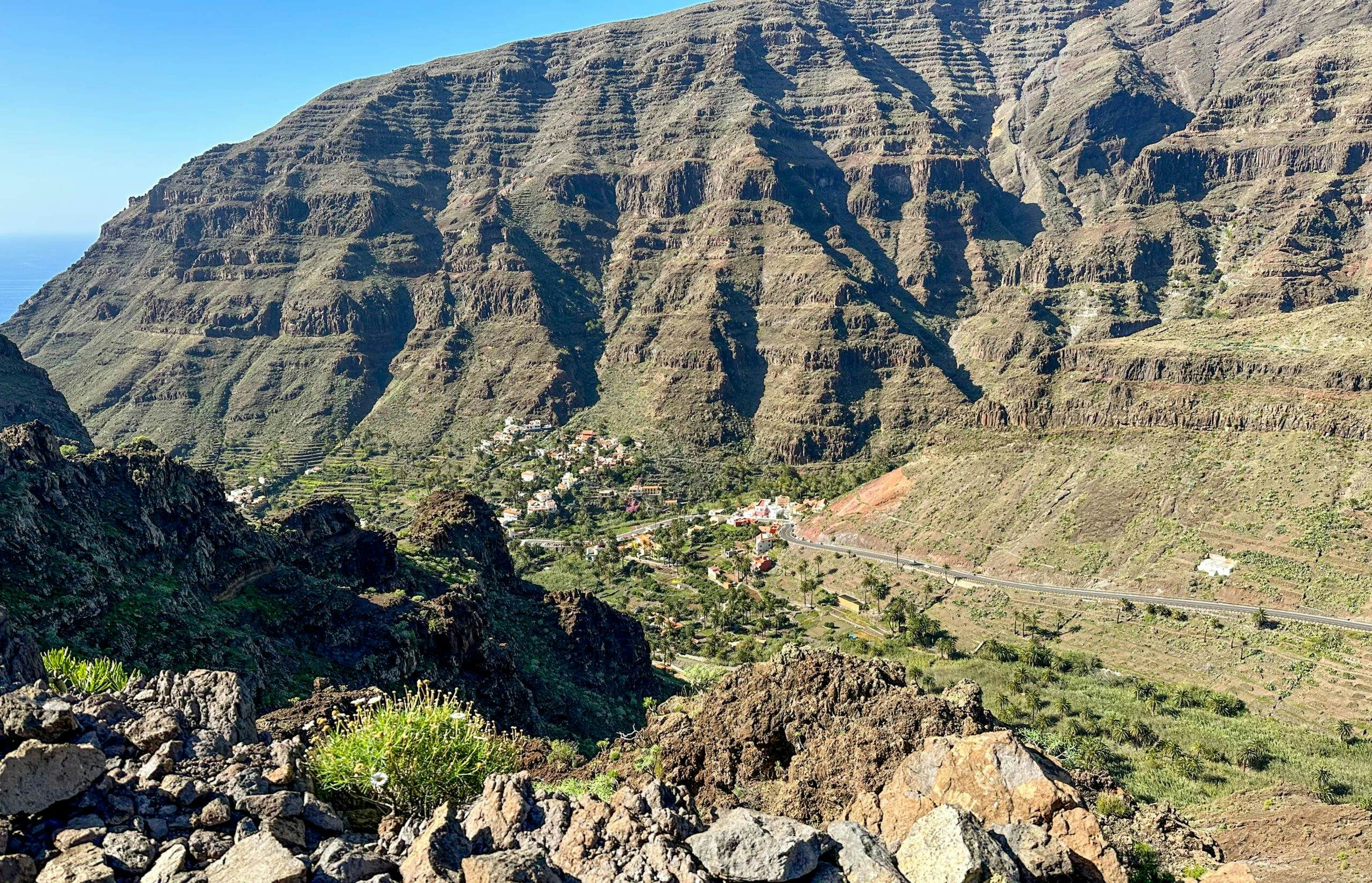
View into Valle Gran Rey from the descent path
It depends on where you want to go in Valle Gran Rey. My track takes you via the GM-1 and the CV-7 to the district of Vueltas and the harbour in Valle Gran Rey. At the end of the GM-1, you can also continue uphill to the right if you want to follow the Great Valle Gran Rey Circuit or even the circumnavigation of the island on the GR 132. 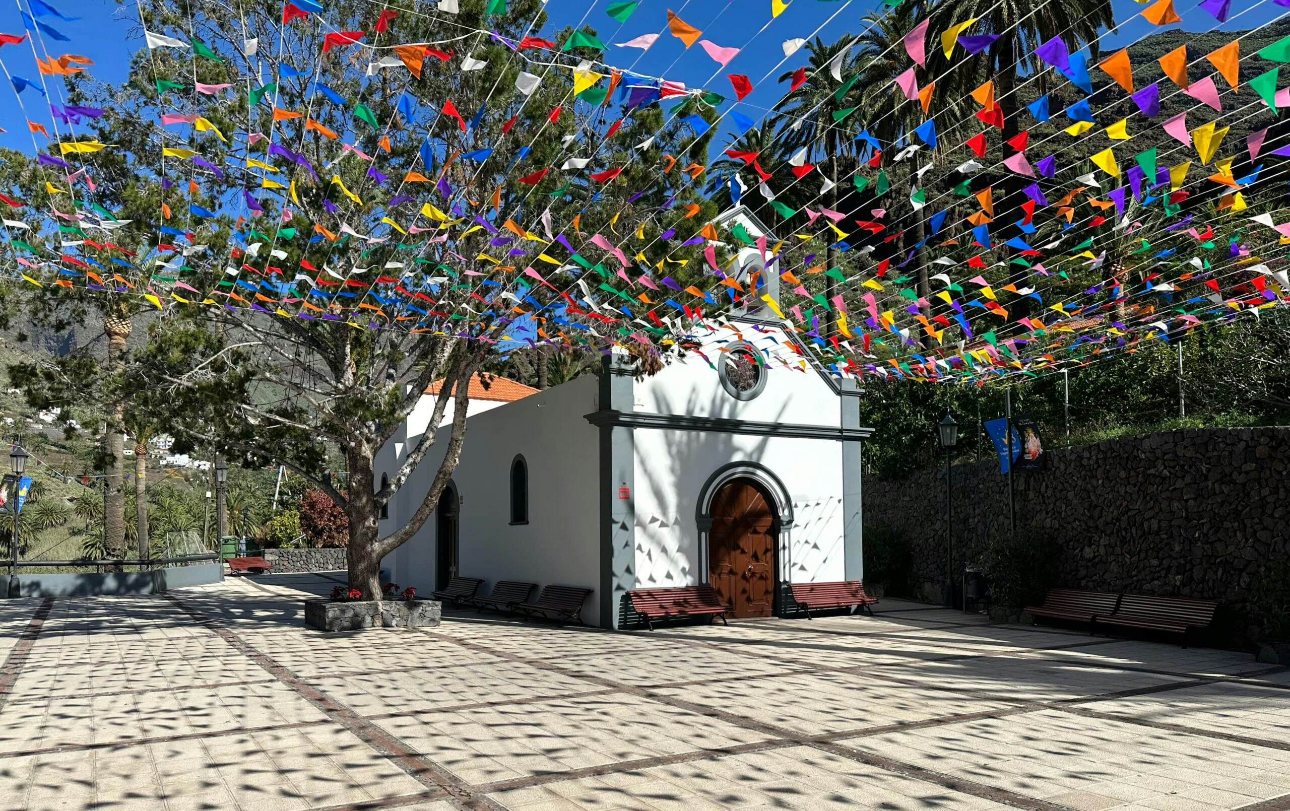
Ermita de los Santos Reyes in Valle Gran Rey
And finally
I hope you enjoyed this long hike across the island of La Gomera from east to west. I myself was really enthusiastic. And if I have the opportunity and time, I will definitely follow the GR 132 around the entire island of La Gomera. And who knows, maybe there will be other island crossings on other Canary Islands. I wish you safe hikes wherever you go,
Dagmar from Siebeninseln