The La Gomera Long Distance Hiking Trail GR-132 in Six Days
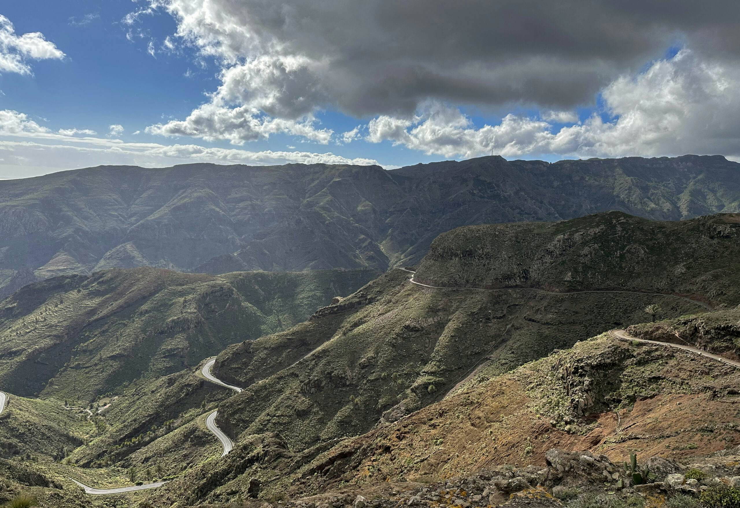
On the small Canary Island of La Gomera, there are two long-distance hiking trails, GR-131 and GR-132. While GR-131 traverses the island’s heights, GR-132 follows the coast, meandering through numerous gorges. I have described my hike on the GR-131 from San Sebastián over the heights of La Gomera to the Valle Gran Rey here. In a previous attempt to circumnavigate the island, I walked counterclockwise, describing Stage 8 from San Sebastian to Playa Santiago on SiebenInseln. Unfortunately, due to unforeseen circumstances, I had to abandon the circumnavigation after this stage in November 2023.
Map
La Gomera Fernwanderweg GR-132
Over Christmas 2023, a friend and I embarked on a new attempt, this time circumnavigating the island clockwise, following the official signage of the GR-132 trail. With combined female strength, we successfully completed the circumnavigation in six days. Having completed the journey, I must note that the infrastructure of this long-distance trail is not as developed as some other hiking trails.
GR-132 – A Long-Distance Trail of a Unique Kind
Along the GR-132, there are few accommodations, often no settlements, and consequently, limited food and water sources. However, with careful planning, you can navigate this trail effectively. Plan precisely what you need to bring, as a large backpack can become cumbersome over the extensive 8,000-plus meters of elevation. Accommodations are available in some places like Hermigua, Vallehermoso, and Valle Gran Rey, but since you only need them for one night, availability can be tight.
It may not always be possible to plan your evening location precisely. I will describe our experiences in the following articles. If you enjoy camping outdoors, that makes things simpler. In that case, include a lightweight sleeping bag and mat in your gear. Fortunately, we had both during our circumnavigation and had to rely on them once near La Dama, where there was no accommodation in the vicinity.
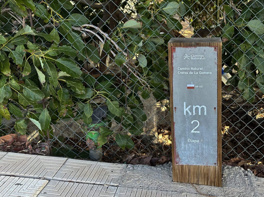
Signposting long-distance hiking trail GR-132 - Camino Natural Costas de La Gomera
Stages of the GR-132 Long Distance Hiking Trail
The GR-132 is officially divided into the following stages:
1.0
San Sebastian- Hermigua – approximately 26 kilometers
2.0
Hermigua – Vallehermoso – approximately 19 kilometers
3.0
Vallehermoso – Alojera
4.0
Alojera – Valle Gran Rey – combined approximately 22 kilometers (4 and 5)
5.0
Valle Gran Rey – La Dama – approximately 18 kilometers
6.0
La Dama – Alajeró
7.0
Alajeró – Playa de Santiago – combined approximately 23 kilometers (6 and 7)
8.0
Playa de Santiago – San Sebastian – approximately 23 kilometers
Regarding the distance information, it’s worth noting that you may find varying figures during online research. Even the official information on the red trail signs should be approached with caution. Occasionally, there are personal extensions, such as detours to overnight accommodations. However, you can roughly expect a minimum of 130 kilometers and over 8,000 meters of elevation gain for the entire circumnavigation.
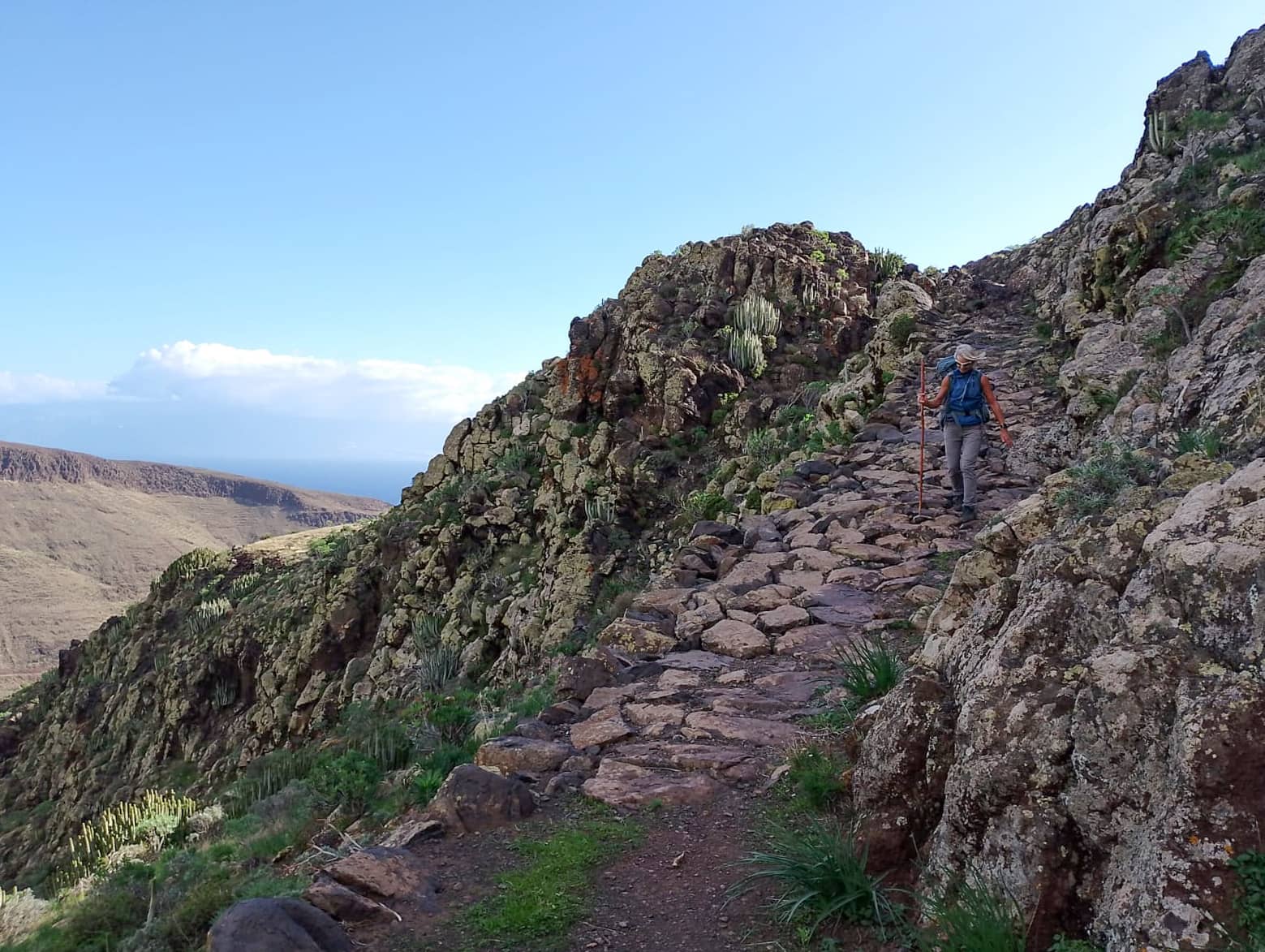
Well paved hiking trail along the ridge
You can plan your time according to your preferences. We combined Stages 3 and 4, as well as Stages 6 and 7, since we were feeling good and wanted to make progress. However, I’ve met other long-distance hikers who planned to take about 10-12 days for the entire trail. Officially, the GR-132 trail is divided into 8 stages, and you can find Stage 8 here. Now, let’s delve into the description of Stage 1 from San Sebastian to Hermigua.
Track of the hike on the long-distance hiking trail GR-132 San Sebastian - Hermigua
General Information about the GR-132 Long Distance Hiking Trail from San Sebastian to Hermigua
Starting Point and Arrival
The hike begins in San Sebastián de La Gomera. My track starts immediately after leaving the ferry at the port of San Sebastian. You can hike to the GR-132 trail from anywhere in the city.
Arrival by Car
Article summary and large selection of GPS hiking tracks
Sign up for my newsletter now and get exclusive access to my collected GPS tracks as well as all the brief information about my articles.
You can drive to the starting point from anywhere on the island, as most roads ultimately lead to San Sebastián. There are parking lots at the port and on the streets in San Sebastián.
Arrival by bus
If you want to travel from anywhere on La Gomera to San Sebastián by bus, you can find detailed information on bus lines and schedules on the GuaguaGomera website.
Time
I am reluctant to provide time estimates, as they can vary significantly between individuals and are influenced by different factors (weather, closures, etc.). This is especially true on a long-distance hiking trail with heavy backpacks. We took approximately 8.5 hours for this section, including breaks.
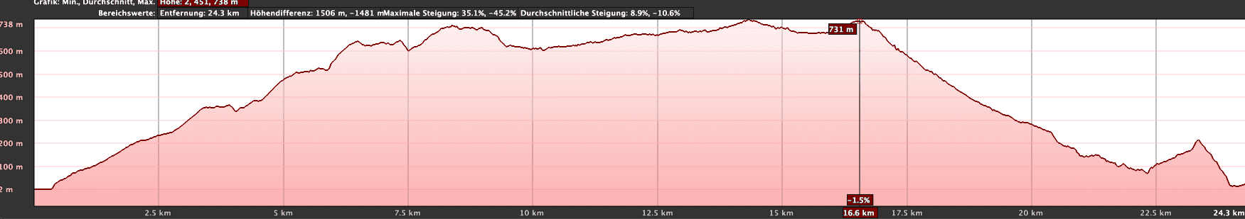
Elevation profile of the hike on the GR-132 San Sebastian - Hermigua long-distance hiking trail
Elevation Difference and Distance
The trail is a little over 26 kilometers long, with an elevation gain of around 1600 meters.
Requirements
The hike follows the well-established GR-132 long-distance trail, so generally, the paths are well-maintained. However, there are a few places where a head for heights and surefootedness are necessary. A high level of fitness is essential for this long and strenuous uphill section.
Well-secured section of the GR-132 coastal hiking trail
Refreshment
There are refreshment options only at the beginning of the tour in San Sebastian and at the destination in Hermigua. There are no food options in between, so be sure to bring enough water and provisions.
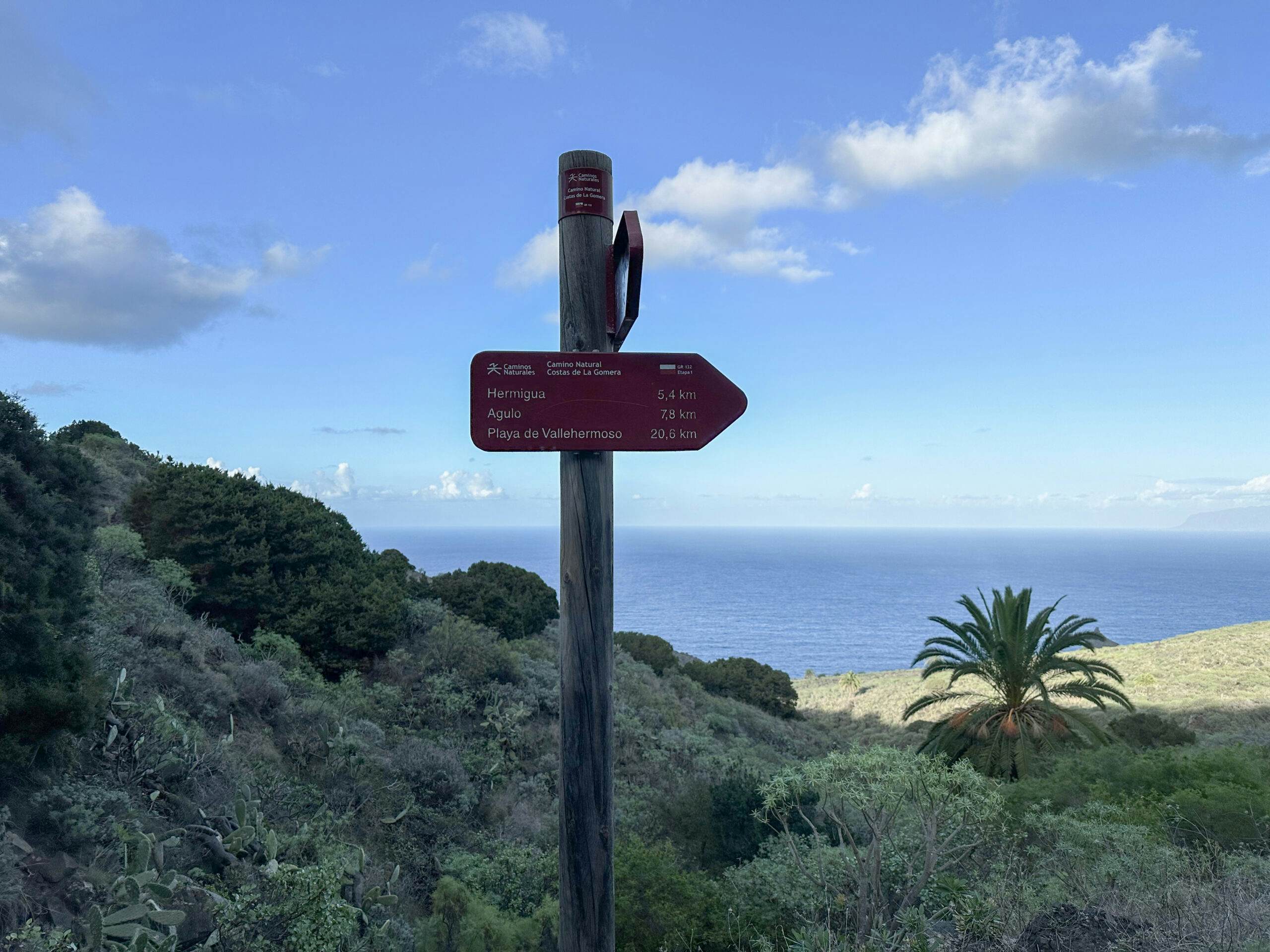
Signposting for the GR-132 long-distance hiking trail
Variants
For those who find this challenging and solitary section of the GR-132 long-distance trail daunting, there is an alternative: Hiking Trail 30 allows you to walk from San Sebastian to Hermigua in 13 kilometers on a relatively straight path, with an ascent and descent of about 800 meters. In contrast, the GR-132 trail makes a large loop to the coast through the impressive Parque Natural Majona, which you won’t see on Hiking Trail 30.
First view of Hermigua in the distance from a ridge
GR-132 Long Distance Hiking Trail – Etapa 1 San Sebastian – Hermigua
Trail Section: San Sebastian Port to Roundabout Beyond San Sebastian
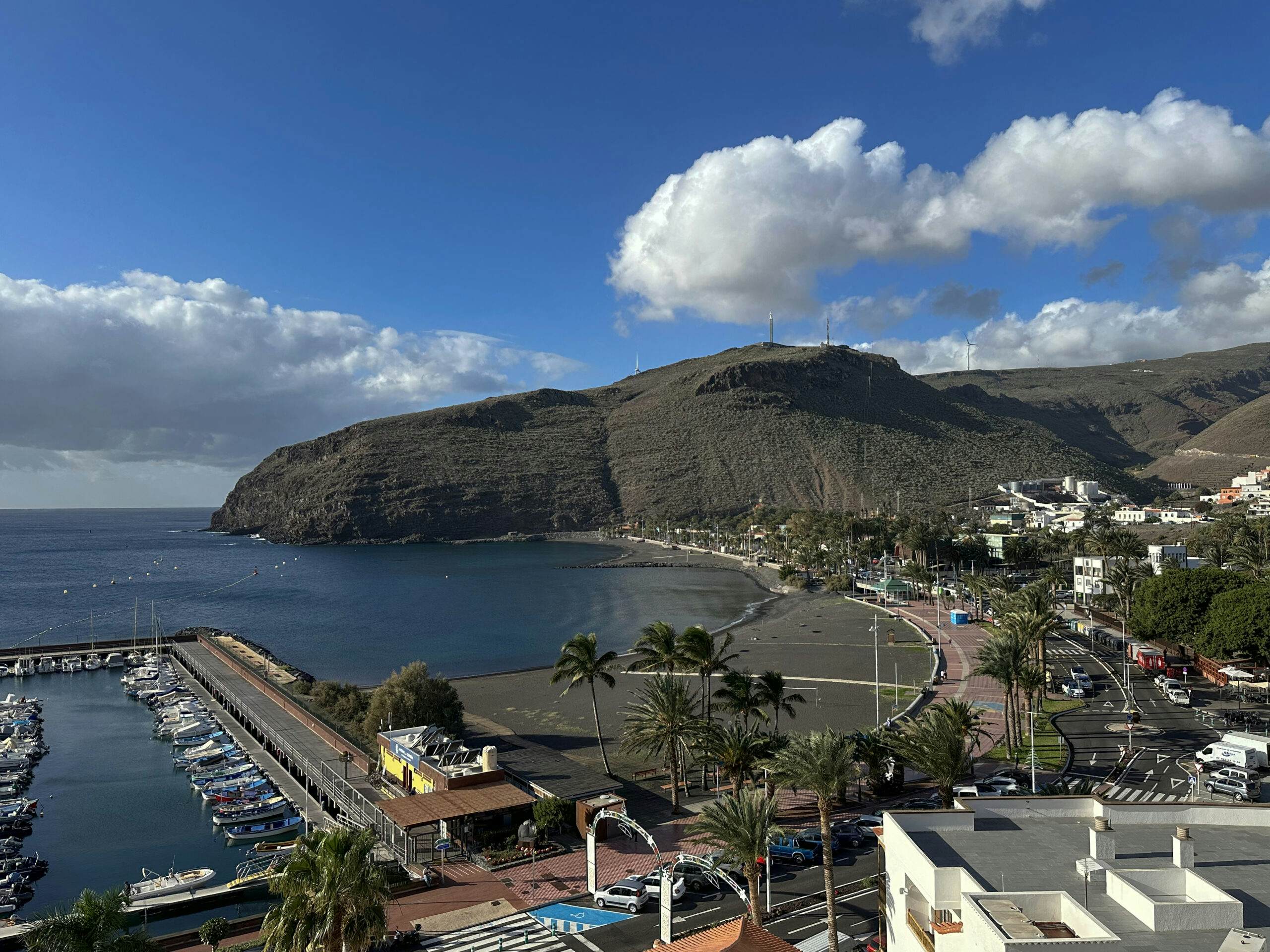
We started our hike at the port of San Sebastian and walked from the Fred Olsen Pier to Plaza de las Américas. From there, take the first set of stairs uphill on the right, reaching Calle la Hila. Turning right, you will soon reach a viewpoint. Follow the serpentine path of Calle la Pista uphill.
View of San Sebastian and the harbour from the GR-132 long-distance hiking trail - the GR-132 ends at the other end of the beach
At a major intersection, keep left on Calle de la Orilla del Llano, continuing uphill for a long stretch. As the buildings become sparser over time, you’ll walk past fields, leaving San Sebastian behind. Eventually, Calle merges into a roundabout. Here, the official GR-132 long-distance trail to Hermigua begins (signposted 24.2 km from this point).
Article summary and large selection of GPS hiking tracks
Sign up for my newsletter now and get exclusive access to my collected GPS tracks as well as all the brief information about my articles.
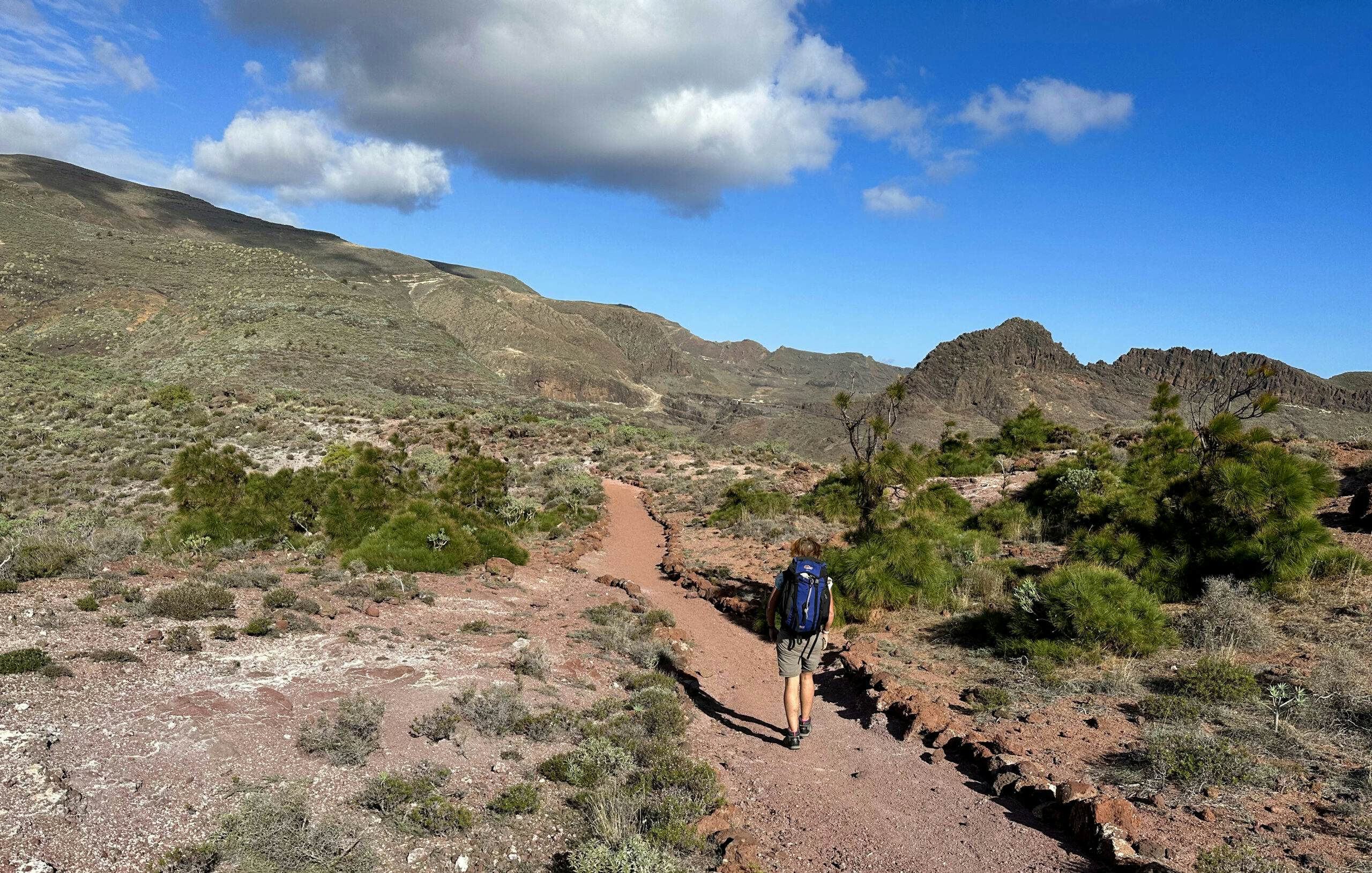
Hiker on the GR-132 long-distance hiking trail across La Gomera
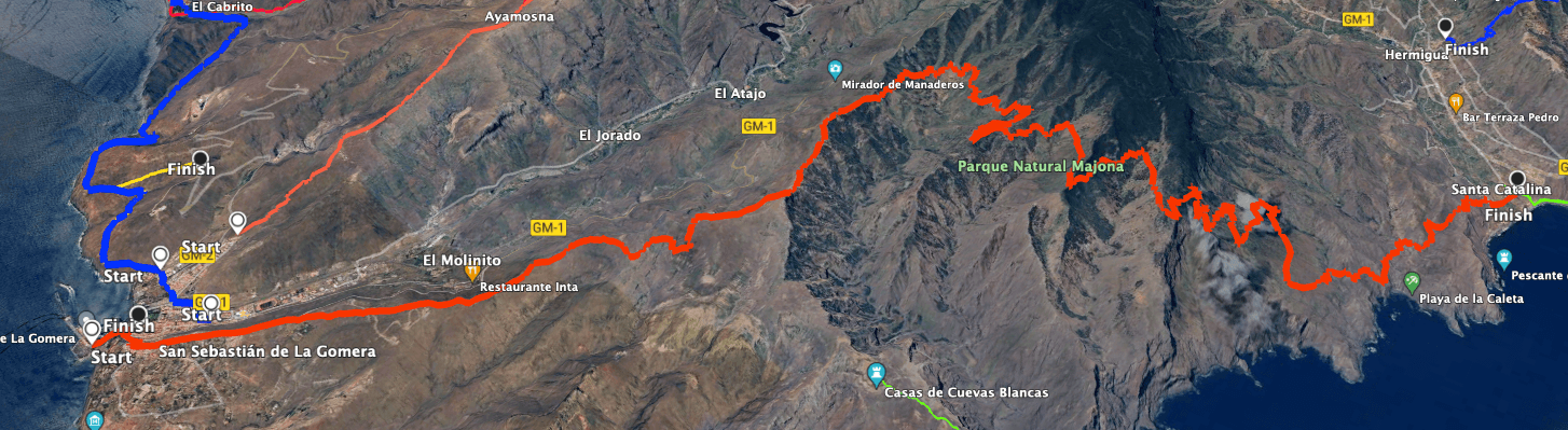
Trail Section: Roundabout Beyond San Sebastian to Enchereda
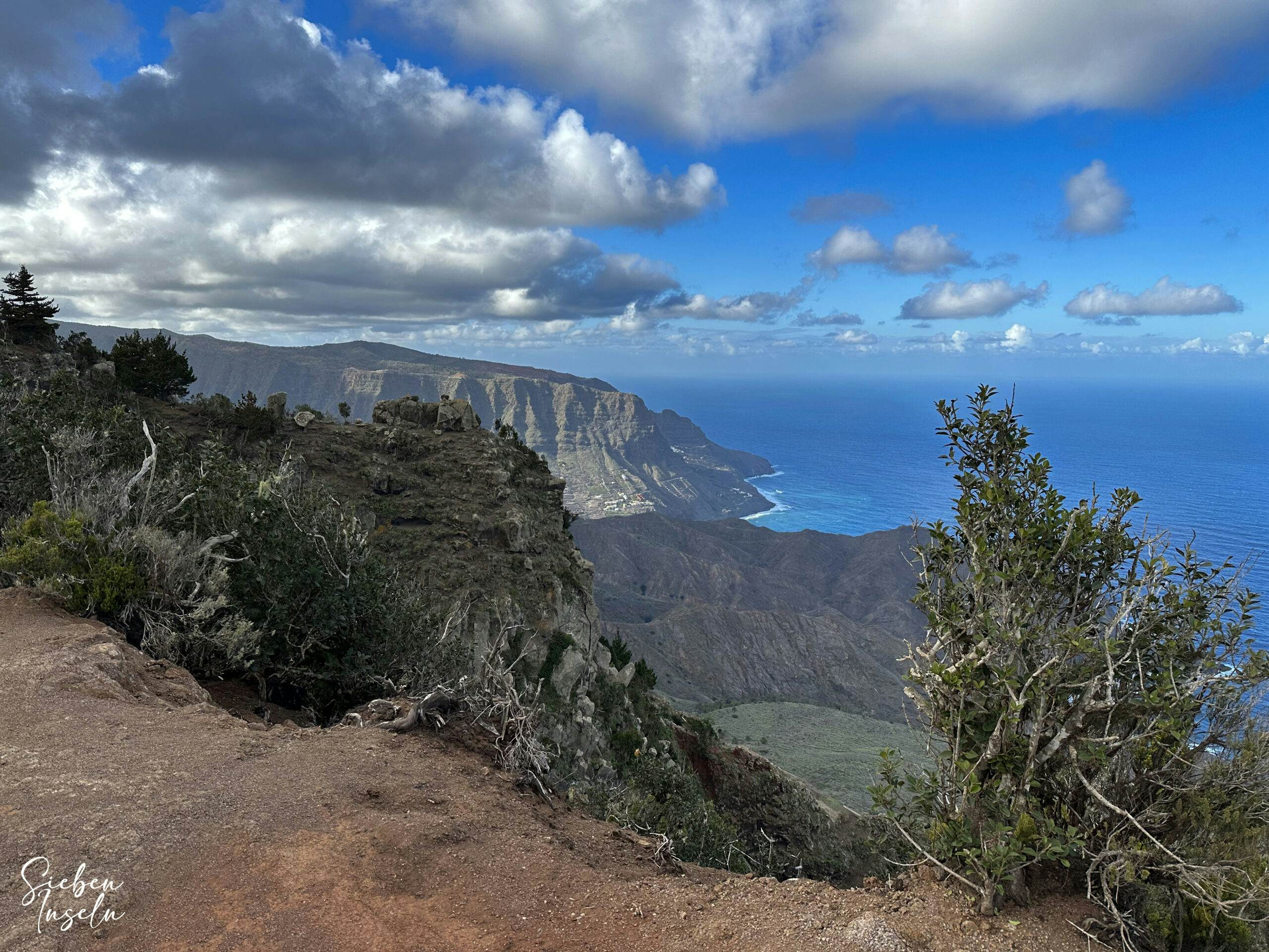
From the roundabout, you’ll hike for a long time on a pleasant and comfortable trail, steadily uphill. On your right, you can see Tenerife, and San Sebastian shrinks behind you. You’ll follow a mountain ridge, ascending and gaining elevation with beautiful views. Frequently, you’ll see the major island road GM-1 below on your left. On your right, you can now peer into the Parque Natural Majona.
View of the GM-1 from the ridge path
After circumventing several gorges along a visually stunning slope, a steep descent follows on the right side of the mountain. Along a visually striking but occasionally unclear path, you’ll head towards Parque Natural Majona. Eventually, you’ll reach a dirt road, which you follow to the left. The path descends into the secluded hamlet of Enchereda, where, at least during my visit, I saw no people.
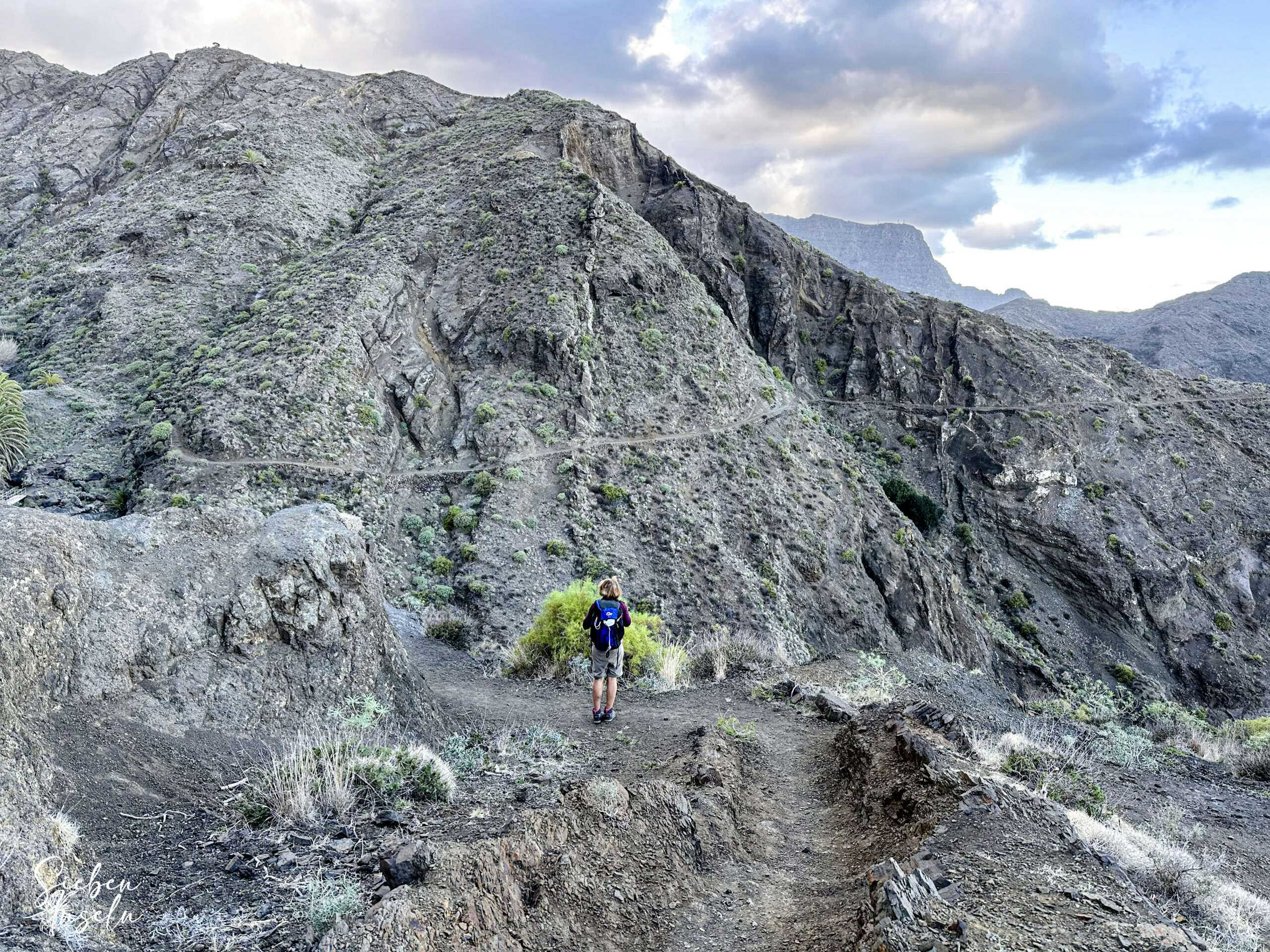
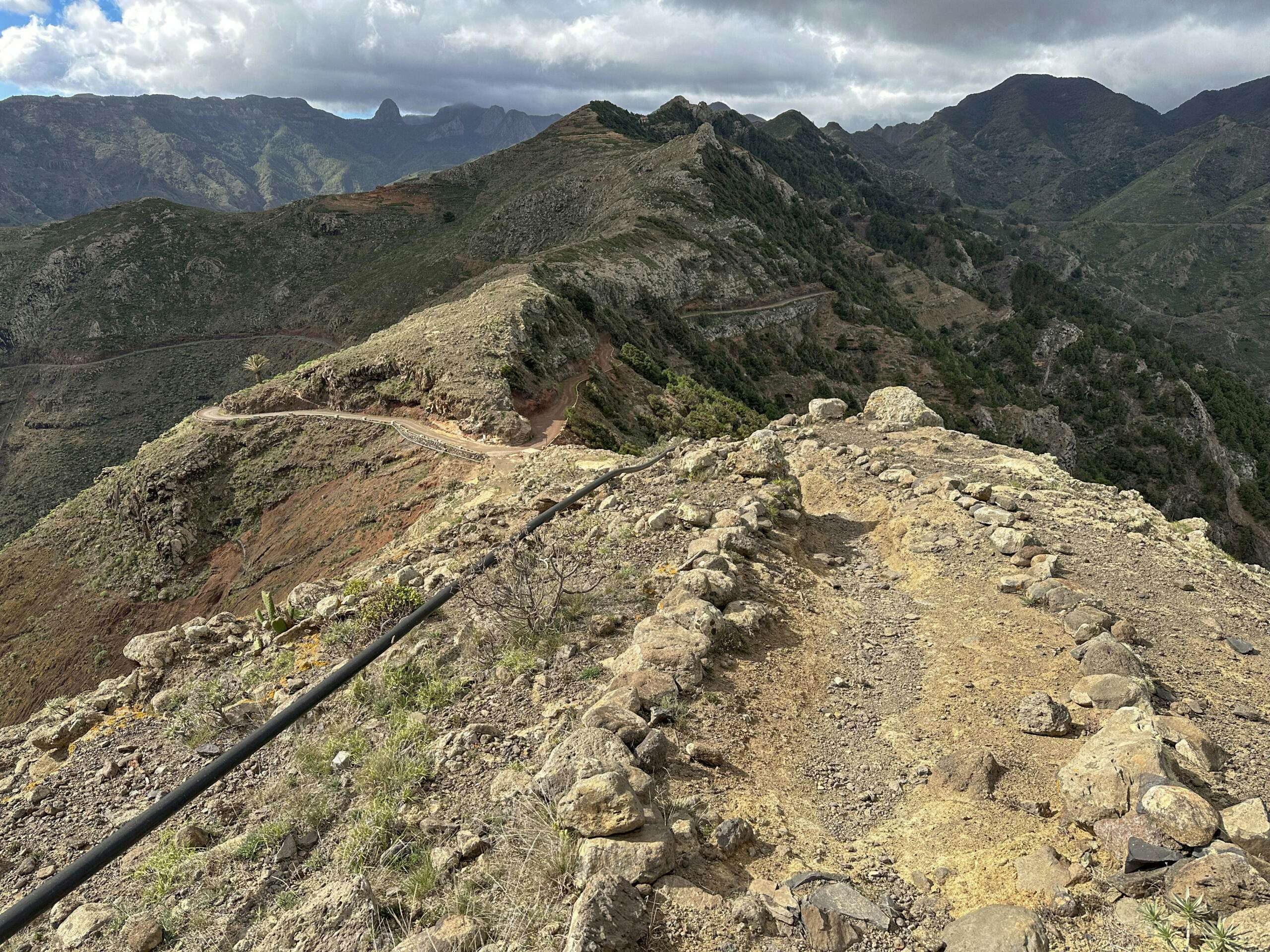
View from the highest point of the ridge path on the descent towards Parque Natural Majona
Trail Section: Enchereda to Cañada la Barraca
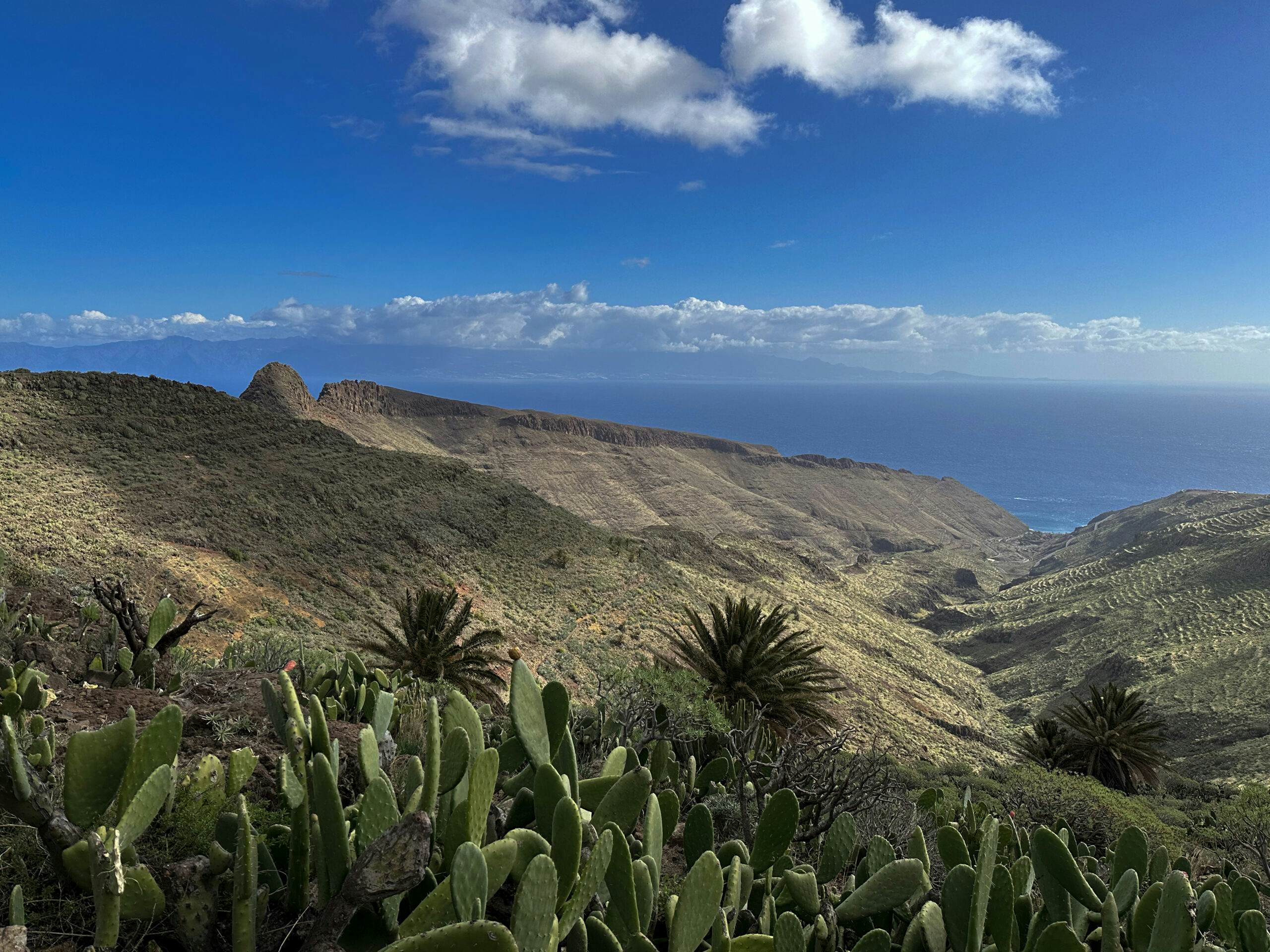
From Enchereda, stay on the broad dirt road for an extended period, winding through Majona Park towards the coast. This section allows you to cover kilometers easily, as the road is easy to traverse and ascends gradually. Eventually, you’ll reach a ridge, and on the other side, you’ll descend through lightly wooded terrain. You’ll bypass another large gorge along the slope and reach another ridge.
View from the hiking trail on the ridge over to Tenerife and down through the gorges to the Atlantic Ocean
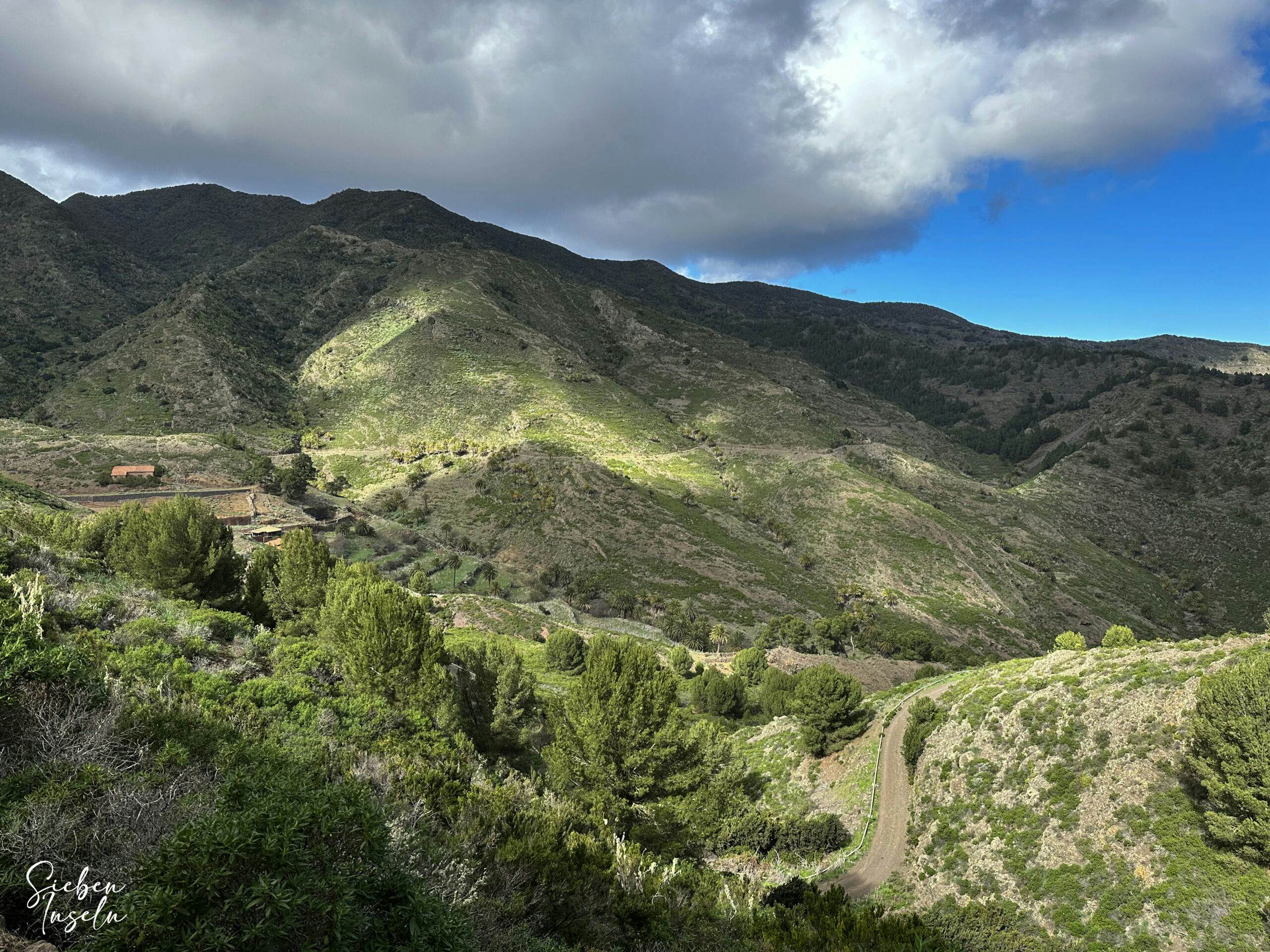
From there, you’ll descend through lightly wooded terrain and cross the large Barranco de Juel. From the next high ridge, you can already see Hermigua in the distance. The GR-132 trail now takes you steeply downhill towards the sea through steep and wide switchbacks. There are some forks, but the GR-132 trail is generally well signposted here. Above Cañada la Barraca, you’ll reach a fork where the GR-132 trail turns right.
View of the hamlet of Enchereda from the descent path
Trail Section: Cañada la Barraca to Hermigua
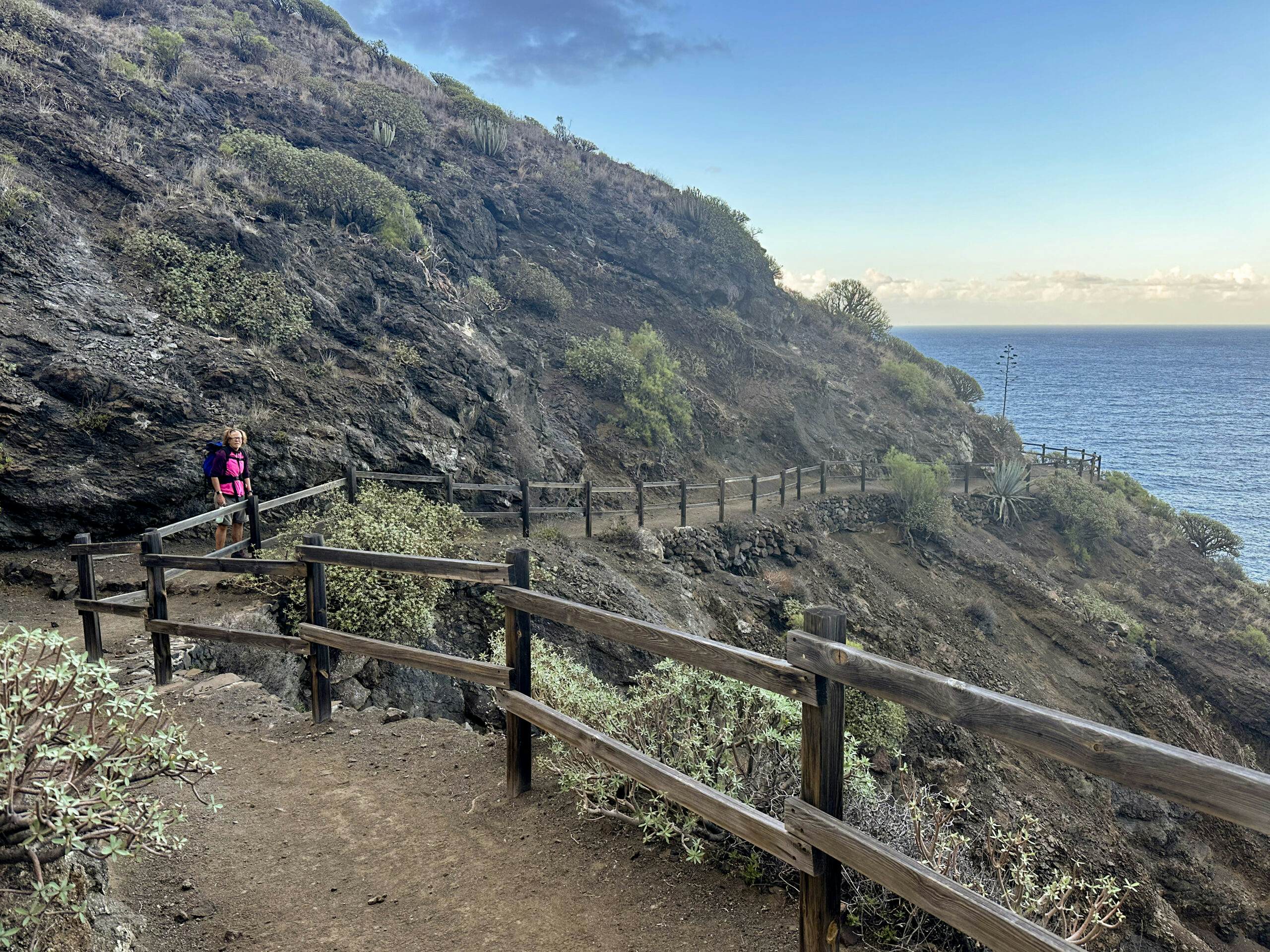
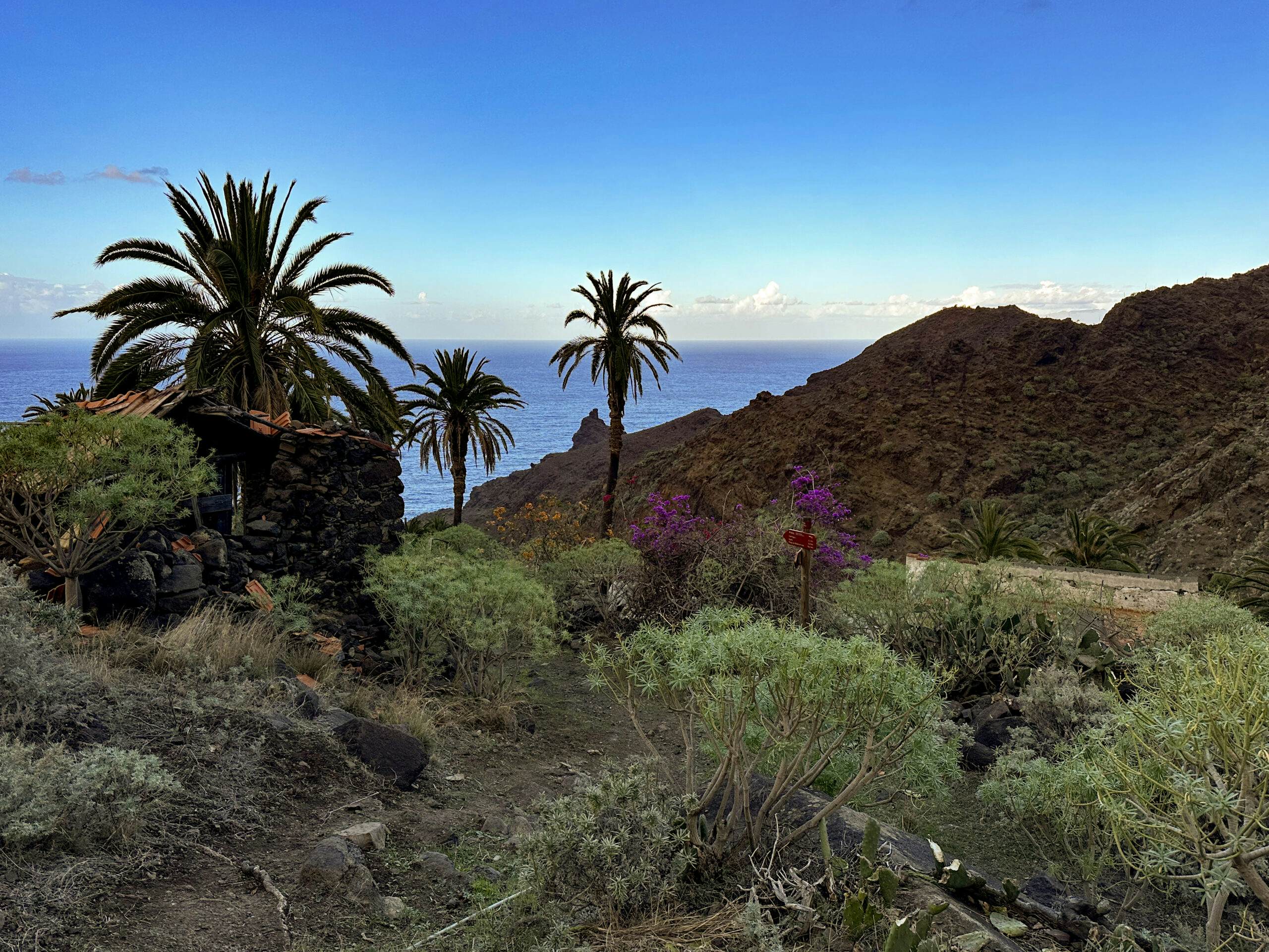
You walk past some abandoned houses. The path then descends past lots of vegetation and crosses the Cañada la Barraca before climbing up again on the other side. Then the hiking trail crosses another rocky bay. The Atlantic Ocean lies to your right and the rugged cliffs rise up to your left. You can see impressive gorges below you from the hiking trail, which is partially secured by good railings. Then, after another ridge crossing, you will see La Caleta and the Playa de La Caleta far below you. Continue along the left-hand side of the mountain parallel to the beach road, which you will finally reach after crossing a palm grove.
Coastal hiking trail past abandoned houses before La Caleta
Now, you’ll walk left for a while on the road uphill. At a point where the road turns right, the trail leads you straight up steeply to Mirador de la Orilla. Finally, you’ll see Hermigua below. On a partly stone-paved path, you’ll descend steeply for a while, zigzagging down to Hermigua. Eventually, you’ll reach a small ridge path near the first houses, leading you down to Hermigua over CV-3 to CV-4.
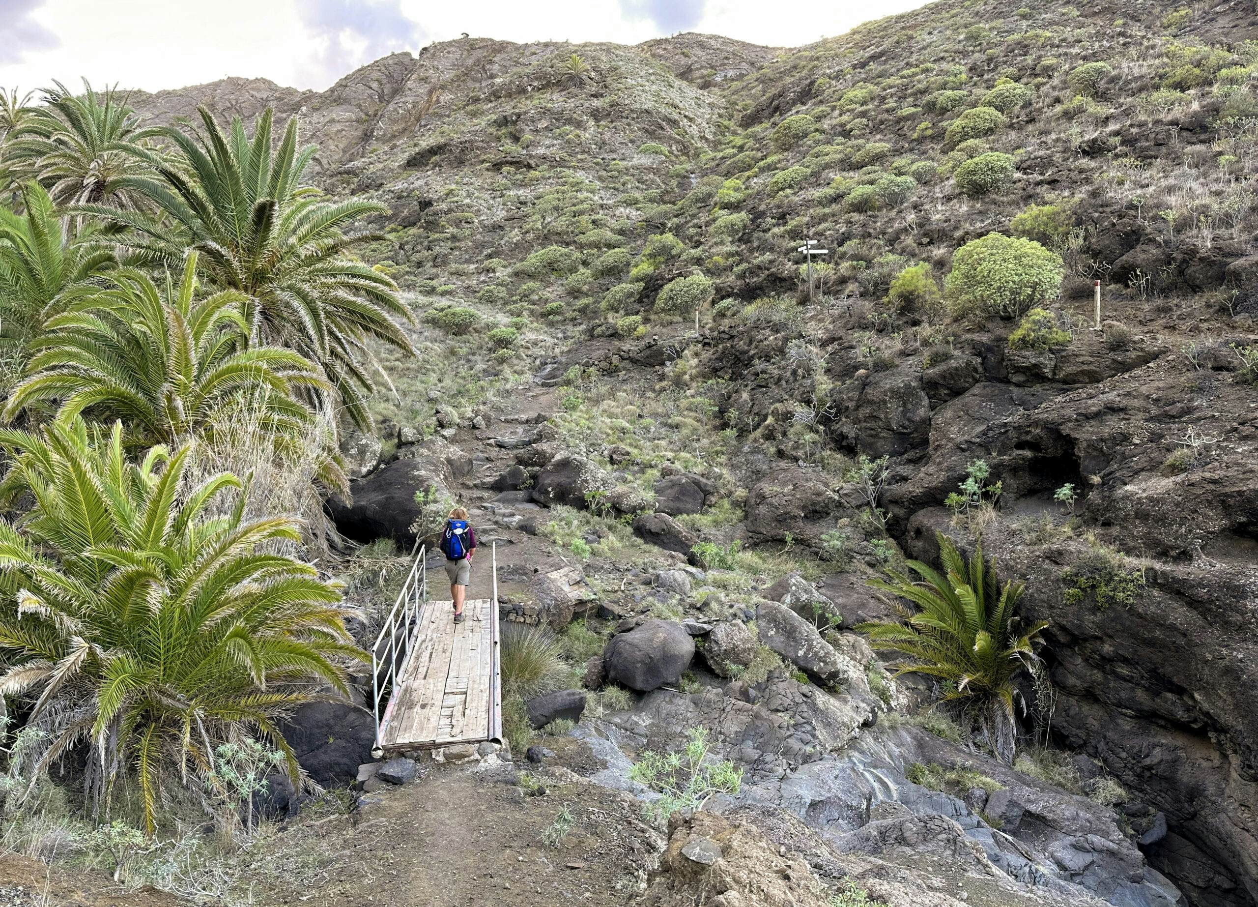
Hiker on the GR-132 long-distance hiking trail on a bridge on the coast off La Caleta
You’ll cross the ravine on a bridge and reach the first houses of Playa Hermigua on Calle Santa Catalina. Where the road turns left towards the town center, you’ve reached your stage destination. From here, you’ll continue to Vallehermoso on the next stage and the GR-132 trail. However, you’ll likely need to walk a few more steps, as we did, to reach your accommodation for the night.
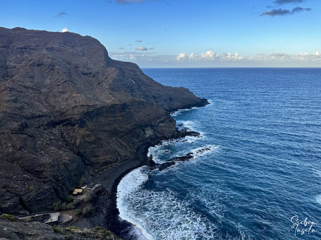
Playa La Caleta in the depths
And finally
I hope you enjoyed this Stage 1 of the GR-132 Coastal Hiking Trail on La Gomera from San Sebastian to Hermigua, and that you’re not too tired from the hike. Rest up, so you can tackle Stage 2 to Vallehermoso with fresh energy, which I’ll soon introduce here. Enjoy all your hikes!
Best wishes,
Dagmar from SiebenInseln
Thank you for reading!
If you've found my hiking guides on SiebenInseln helpful for your Canary Islands adventures, please consider leaving a small tip. Your support is greatly appreciated and helps cover the costs of maintaining this blog.