The Baracán, Teno Alto and Las Portelas in a comfortable hiking tour
Today’s circular walk will not only take you to the summit of Baracán in northwestern Tenerife. This varied hike takes you over a mountain ridge with fantastic views and the mountains and gorges of the Teno Mountains.

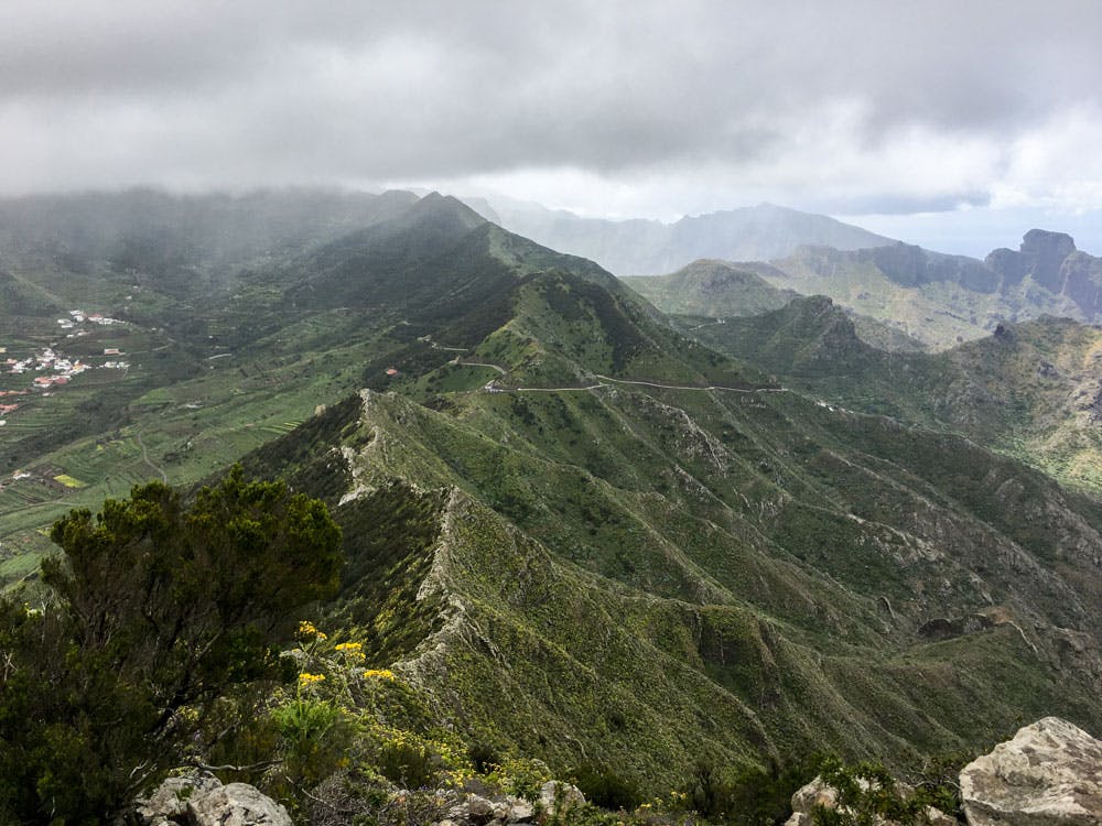
View on Las Portelas
Map
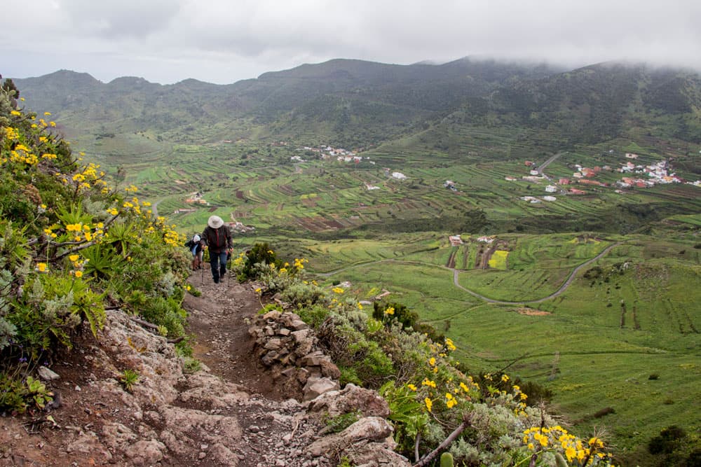
You hike via the idyllic village of Teno Alto, which is still very quiet, in the direction of Las Portelas. Variety is guaranteed in the landscape, in the ascent and descent and due to the northern location often also in the weather.

goats on the street of Teno Alto
Baracán and the tranquil village of Teno Alto
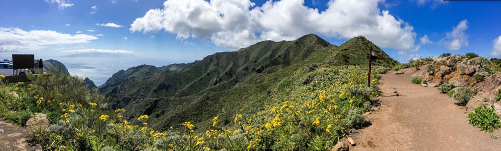
The Baracán is the highest peak on a long mountain ridge. This ridge stretches from the saddle between the two highest mountains in the Teno Mountains (Great Gala and Pico Verde) down to the southwest coast of Tenerife. From the hiking trail on this circular route, a small path branches off to the right, with which you can reach the summit of Baracán (1003 metres) in a short time.

Panorama Baracán
After climbing the Baracán, you will soon reach the small town of Teno Alto or Los Bailaderos. The village is lonely and only connected to civilization by a winding small road on a plateau in the Teno mountains. Here it is still really quiet and contemplative. A place of retreat for every quiet seeker. There are no 100 inhabitants in Teno Alto. Due to the seclusion of the place, many old customs have been kept there.
Beside many goats you can find old brick kilns and threshing places in Teno Alto. There are also still traditional houses with walls made of reddish rock, which you will walk over during your tour. Teno Alto, with its many hiking trails that run from the place in all directions, is a true El Dorado for fans of hiking.
General information on the Baracán Circular Hike
Starting point and approach
Small parking at Tabaiba Pass (Mirador) on TF 436 between Masca and El Palmar
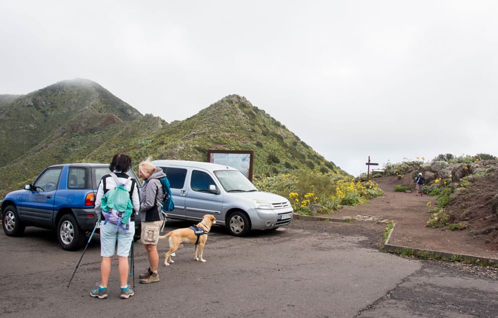
Starting point Mirador Cumbre de Baracán
Arrival by car
From the north, ou can reach the starting point via Buenavista del Norte on the TF 436 and from the south via Santiago del Teide and Masca on the TF 436 to the Tabaiba Pass. There at the Mirador, which is also a popular vantage point, there are plenty of parking spaces.
Arrival by bus
The Titsa bus lines 355 and 365 stop at the Tabaiba Pass. For more information on how to get there by bus, visit the Titsa Homepage. 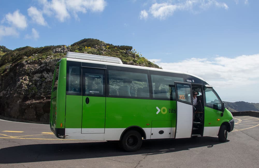
Titsa bus no 355 at the Mirador Cumbre de Baracán
Time
I don’t like to give general time information for hiking tours, because the times are very individual. But I needed for this tour with Barancán and break in Teno Alto approx. 4 hours.
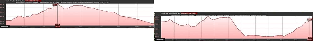
elevation profil Mirador - Baracán - Teno Alto
elevation profile Teno Alto via Las Portelas to the Mirador Cumbre de Baracán
Article summary and large selection of GPS hiking tracks
Sign up for my newsletter now and get exclusive access to my collected GPS tracks as well as all the brief information about my articles.
Sign up nowDifference in altitude and distance
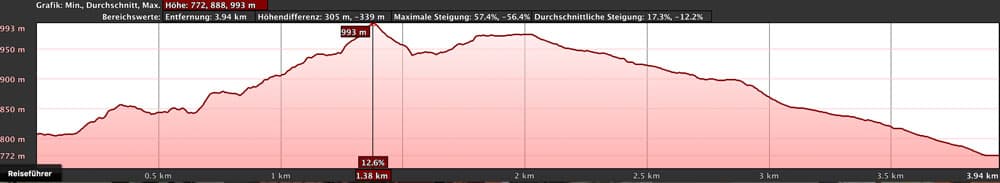
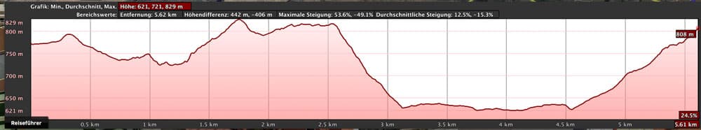
The difference in altitude on this hike is approximately 570 meters. And the hiking distance is 9,5 kilometres long.
elevation profile of the hike Cumbre de Baracán via Teno Alto and Las Portelas
Requirement
An easy and for everyone with a little physical condition well to master tour.

Bar Los Bailaderos in Teno Alto
Refreshment
There are restaurants and bars in Teno Alto and also in Las, Portelas, El Palmar (however, a small extension of the route is necessary, as Las Portelas and El Palmar are not directly on the hiking route).

hiking signposts in Teno Alto
Variants
This tour can be easily combined with various other hiking and circular walks in the vicinity. Combinations with the Risco Climb and the Challenging Circular Hike via Teno Alto and the Risco Climb described on Seven Islands are particularly suitable. From Teno Alto you can hike in all directions. And so instead of the round tour you can hike down to Punta de Teno or use the more than impressive Risco Steig as a descent. 
goats on the ridge close to the Baracán
Since this is a round trip, you can of course also start this tour at any other point or go in the other direction.
A very easy tour: You go the tour to Las Portelas and from there take the bus back to the Mirador. Then you don’t have to climb up.

the ridge of Baracán
Circular walk over the Baracán and Teno Alto

little path on the right side
Tabaiba Pass section to Baracán ascent
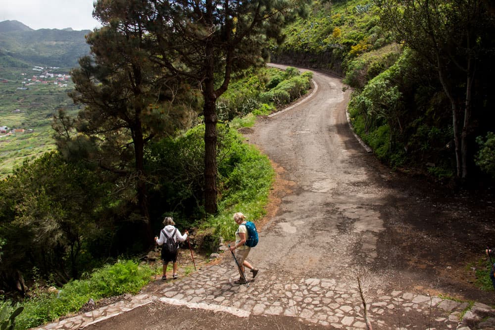
You start this circular walk at Tabaiba Pass. There you can’t miss the signposted trail PR TF-51 towards Punta de Teno. This will take you from the road along the ridge towards Teno Alto. Right at the beginning of the hike you can enjoy wonderful views over the Teno mountains in all directions from the Mirador. Deep below you is the Palmar Valley with El Palmar and Las Portelas. On the other side you look towards Carrizal and Masca. In good weather, the view extends far over the north and south coasts of Tenerife and La Gomera. But it should not be concealed that in this corner of the island there can be many grey clouds, if not rain showers.
hiking path close to Las Portelas
Hopefully you will get a clear day and can always enjoy the tour along the mountain ridge with fantastic views. On the way you can also meet some goats. You walk first on the left side and then on the right side of the mountain with a view of the Palmar valley. The paths are mostly narrow, but can be classified as good hiking trails along the ridge. The path goes through some wooded areas and bushes. In the constant up and down the path finally leads you back to the left side of the mountain. Here, after a while, you meet a small path on the right that leads to the top of Baracán.

hiking path in the cloud forest
Baracán section to the red rocky bottom after the heather forest.
Those who like to go to the summit of the Baracán should plan 15-20 minutes extra. You go on a small narrow path steeply up to the mountain ridge. There you keep to the right and follow the narrow path through bushes and over stones further uphill. The small detour is rewarded by wonderful views in all directions. You go on the same small path back to the hiking trail. Turn right and follow the path in the direction of Teno Alto.
Article summary and large selection of GPS hiking tracks
Sign up for my newsletter now and get exclusive access to my collected GPS tracks as well as all the brief information about my articles.
Sign up now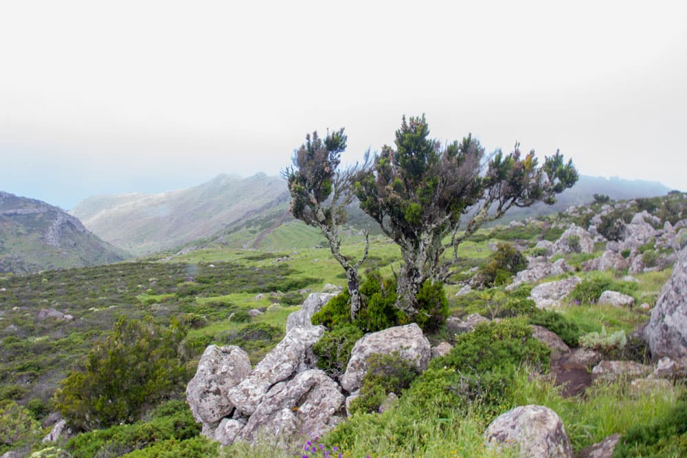
Green landscape close to Teno Alto in clouds
The path leads you alternately on the left and then again on the right side of the ridge, mostly uphill, in the direction of Teno Alto. You can enjoy views all the way to La Gomera on this stretch in good weather. After some time you will pass a plateau. Afterwards you dive into a small section with heather forest. When you come out of the forest, red rocky ground awaits you. A beautiful contrast to the surrounding landscape. Now you can see the wide plain around Teno Alto lying in front of you.

hiking through a red eroded rocky landscape
Section Red Rocks to Teno Alto
On the red rock bottom the trail continues straight downhill. Pass a house on the left. Shortly after you come to a wide driveway, which you follow to the right. You pass some houses. Then the path forks. If you don’t want to go to Teno Alto, but immediately into the Palma Valley, you can turn right here. This is the Carretera el Palmar, which will lead you down into the valley. Otherwise, follow the road to the left (Pista de Mesita) towards Teno Alto.

A splash of colour along the way
The road Pista de Mesita leads you past houses in some large arches in a short time down to Teno Alto or Los Bailaderos. For more information on Teno Alto, which is 780 metres above sea level, see above. Here, at the junction of many hikes, you can take a rest. Take a look around or have a coffee in one of the two cosy bars. From here you also have the possibility to do other hikes, such as the Risco Steig or the Punta de Teno. 
hiking path between Teno Alto and Las Portelas
Section Teno Alto to Las Portelas
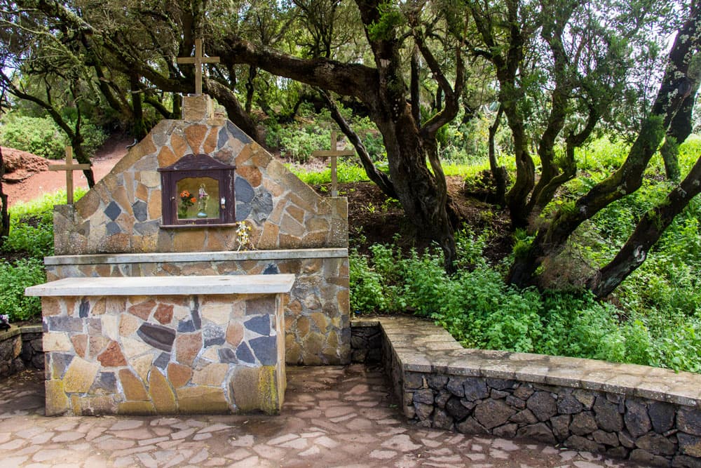
The centre of Teno Alto is the church square. All roads and footpaths converge there. You follow the path called PR TF-57 towards El Palmar. It goes along the main road of the village. Shortly after leaving the village of Teno Alto, the path leads you to the right of the main path. You will pass a small memorial. A new paved path leads you down onto a wide road. You cross this road and continue downhill. After some time you meet a road again. This is the Carretera el Palmar. If you have taken the shortcut described above and haven’t been to Teno Alto, you’ll come back to the footpath here.
on the way to Las Portelas
Now follow Carretera el Palmar to the left. Some time it goes on a small ridge along the forest. You will come across pastures and terrace fields. But after some time the path gets narrower and steeper and leads you down to the Palmar valley with wonderful views. You cross a Barranco. The trail continues on the right side of the slope. Several times you cross the road, which leads down the slope in serpentines. However, you go straight downhill. Above the village Las Portelas you meet the Carretera el Palmar again at the upper fields.

View from the height of the mining areas near Las Portelas
Section las Portelas up to the Tabaiba Pass
If you continue straight on from here, you will come through the fields to the main road TF-436 to Las Portelas. If you don’t want to do the last part of the hike and the ascent to the pass, you can take the bus up to the starting point, the Mirador. On the circular hike you will follow the Carretera el Palmar. This road takes you parallel to the village Las Portelas over meadows and past terraced fields towards El Palmar. From here you have a good view over the Palmar valley.
The hiking path to Las Portelas is crossing a little road
The path, which goes slightly downhill at the end, leads into a wide road coming from Las Portelas. Follow this road uphill to the right. At the next three junctions, continue along the main path. Then a wide path branches off to the right, which you can follow uphill in a wide loop. However, if you go a little further straight ahead on the road, a small hard to find path turns right from the main path. If you find it (see track), you can shorten the long loop.

little stone house on the way to the Mirador Baracán
With both options you will finally pass a building that you bypass on a path. The path leads you uphill. Once again it passes a building. Then the rest of the trail to Tabaiba Pass is clearly visible on the right side of the slope. You follow the path uphill and a few meters before the Tabaiba Pass you return after a short time to the hiking trail PR-TF 51.

hiking path at the sloop to Mirador Baracán
And finally:
I hope that you enjoyed the short round trip to Barancán and Teno Alto. If you want to do the hike, choose a clear sunny day so that you can really enjoy the view.
Hiking path from the Mirador direction Baracán
I wish you a lot of fun while hiking.
Dagmar von SiebenInseln