Circular walk through the Barranco de Chamorga and back via the lighthouse Faro de Anaga
Map
In the past I have already introduced a circular hike around Chamorga over the Tafada hills. Today there is a second circular hike, which you can combine with the other circular hike if necessary. 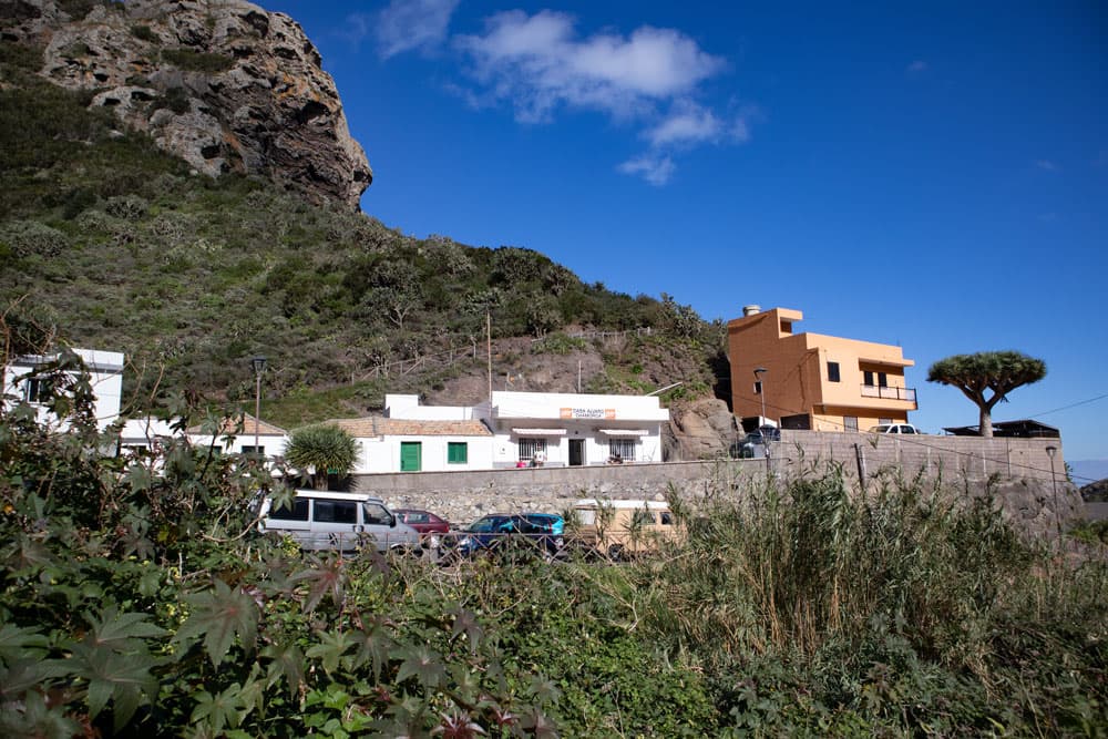
Chamorga with dragon tree
It also starts in the small village Chamorga, which is located at the end of the Anaga mountain road.
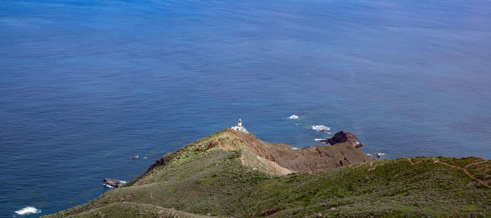
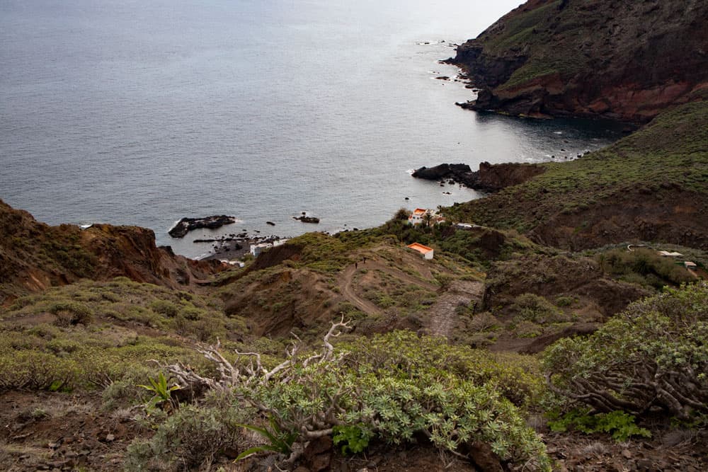
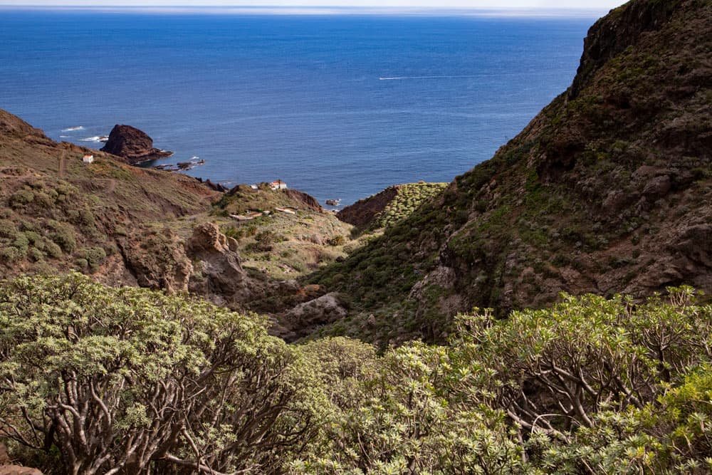
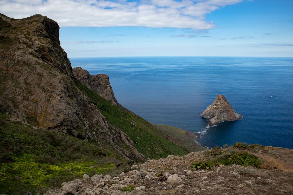
view on Roque Bermejo
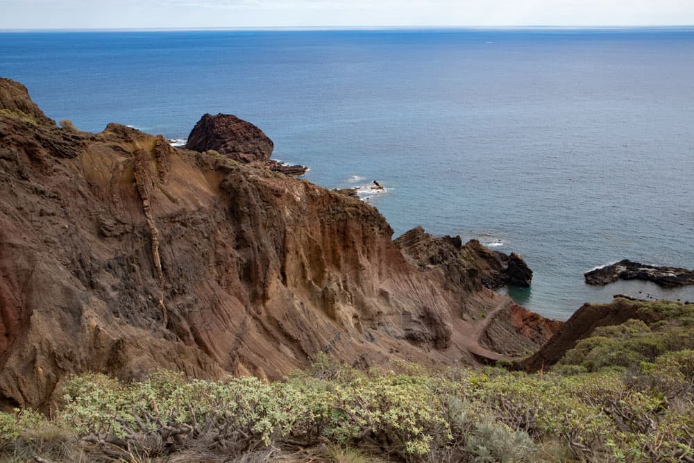
You walk through the Barranco de Chamorga, which is partly named Barranco de Bermejo after a small fishing village. The small village Roque de Bermejo and the rock of the same name are at the end of the path through the Barranco. There is no road leading there. The place can only be reached through the Barranco or by boat. Then it goes back steeply uphill to the lighthouse Faro de Anaga and further back over the height of the Anaga foothills.
view from the Barranco Chamorga to the lighthouse Faro de Anaga
Chamorga and Roque de Bermejo – away from the tourist hustle and bustle
If you go to Chamorga by car or bus, you will notice that the road to Chamorga takes a little longer. Chamorga is located at the very end of the Anaga mountain road. The road is quite narrow and winding from El Bailadero. But as you always drive quite close to the ridge for a long time, you can enjoy wonderful views of Santa Cruz de Tenerife on one side and the Anaga Gorges on the other.
view on the hiking trail and the little village Roque Bermejo
Chamorga itself is a small village with about 50 inhabitants and is situated at an altitude of about 500 metres. But some houses are up to 800 metres high on the steep slopes. In and around the village you can see many of the impressive dragon trees (Dracaena Draco). Once the Canarian natives, the Guanches, lived in the Barranco de Chamorga. At the end of the Barranco de Chamorga lies the fishing village of Roque de Bermejo, which is only inhabited in summer, at an altitude of just under 40 metres.
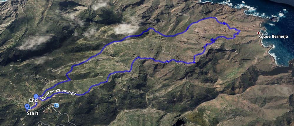
Track circular hike Chamorga - Roque Bermejo - Faro de Anaga
General information about the circular walk Barranco de Chamorga – Faro de Anaga
Starting point and approach
Small car park and bus stop at the entrance to Chamorga.
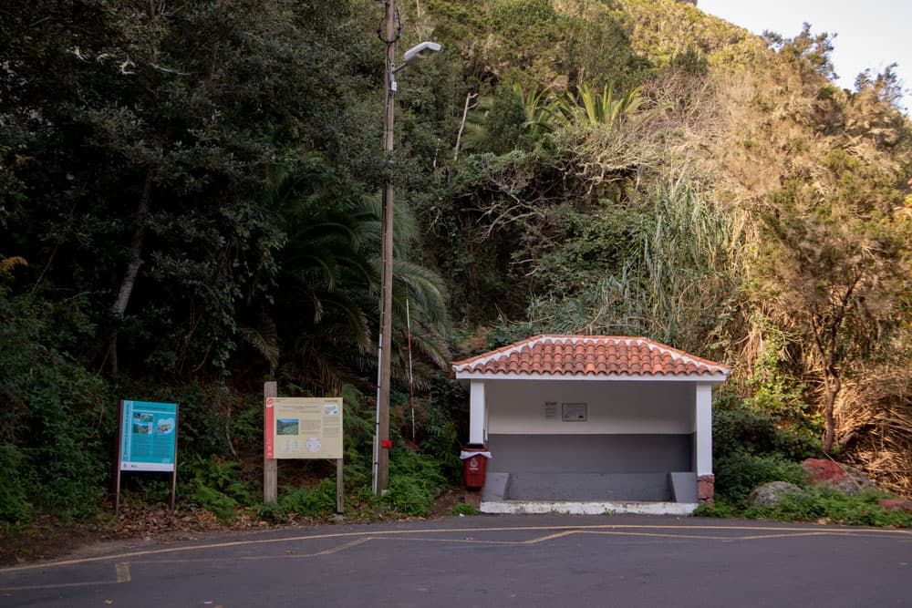
Starting point in Chamorga at the bus station
Arrival by car
Chamorga is the „end point“ of the Anaga mountain road TF-123 and therefore not to be missed. Even if it is only about 32 kilometres to Chamorga from La Laguna on the Carretera de Bailadero, the trip can take some time. The road is very narrow in the second part and winds up and down the mountain ranges in many serpentines. You should therefore plan at least an hour from La Laguna. Parking spaces are available at the entrance to the village (bus stop), on the roadside and on the village square in front of the Casa Alvaro bar.
Arrival by bus
Article summary and large selection of GPS hiking tracks
Sign up for my newsletter now and get exclusive access to my collected GPS tracks as well as all the brief information about my articles.
Sign up nowThere is only one bus connection with the Titsa bus line 947 from Santa Cruz de Tenerife to Chamorga. From there the bus takes between 1 hour 15 minutes and 1 hour 40 minutes. You can find the exact bus connections to and from Santa Cruz on the Titsa homepage. Time
I don’t like to give general time information for hiking tours, because the times are very individual. For this tour I needed 3.5 hours with extensive rest and photo stops.
hiking trail PR TF 6.1 Chamorga
Difference in altitude and distance
The difference in altitude is about 570 meters. The distance is approx. 7.5 kilometers long.
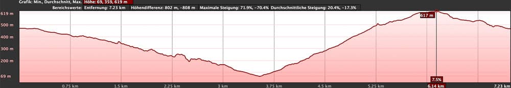
elevation profile circular hike Chamorga - Roque Bermejo - Faro de Anaga
Requirement
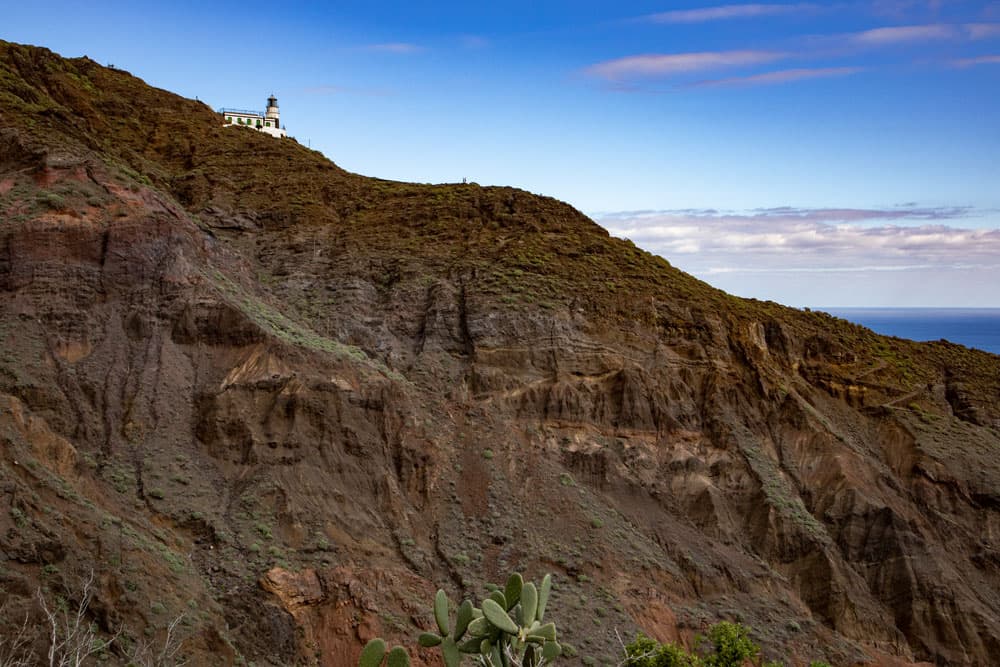
The way through the Barranco to Roque de Bermejo is well signposted, easy to find and generally easy to describe. Also the ascent to the lighthouse of Roque the Bermejo on the wide way is basically easy. But from the lighthouse up to the height, in addition to a good physical condition due to the steep ascent, sure-footedness and a head for heights are also required. The path often goes freely over the ridge or along the abyss (but always wide enough).
Refreshment
There is only one small bar (Casa Alvaro) in Chamorga, although it is not said that it is always open. Therefore take enough water and food with you.
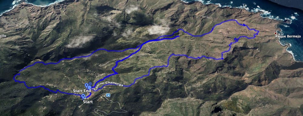
Track circular hike from Chamorga through the Barranco, Roque Bermejo and Faro de Anaga and Track Tefada
Variants
This tour can be combined well with various other hiking and circular walks in the vicinity. To mention here is the round tour from Chamorga over the Tafada. Both tours are identical in the last part from the mountain ridge down to Chamorga. If the tour is therefore too short for you, you can go up from the top of the ridge over the Tafada and return to Chamorga in a large arc. If the tour is too long for you, you can simply walk down the Barranco de Chamorga in the direction of Roque de Bermejo and take a look from above at the hamlet and the rock. Or you go from Chamorga directly to the entrance path of the lighthouse and walk down to the lighthouse. And if that’s too exhausting for you, you can hike up the ridge from Chamorga and enjoy the impressive view down to the coast.
In the picture below you can see the Tafada Tour and in yellow all the possible extensions nearby.
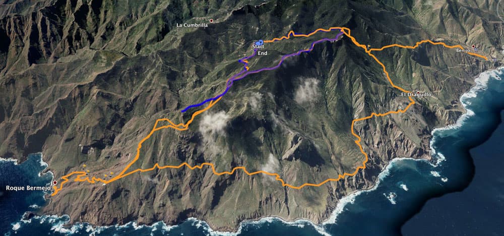
blue: described track
orange: variant tracks
And here is the big version: The big Anaga Tour. Circular walk Barranco de Chamorga – Faro de Anaga
hiking path to the lighthouse and view back to the Barranco of Chamorga
Section Chamorga to Barrancobett
Article summary and large selection of GPS hiking tracks
Sign up for my newsletter now and get exclusive access to my collected GPS tracks as well as all the brief information about my articles.
Sign up nowIf you drive into Chamorga, you can park your car in the shade at the bus stop and the big square right at the beginning of the village. Here at the bus stop you start the hike and walk along the road into the village. You get to the village square, where the small bar is located above. On the way back you will come down here from straight ahead. Now turn right into the Camino Chamorga with the PR TF 6 signposted hiking trail in the direction of Roque Bermejo.
view from the Barranco de Chamorga to Roque Bermejo
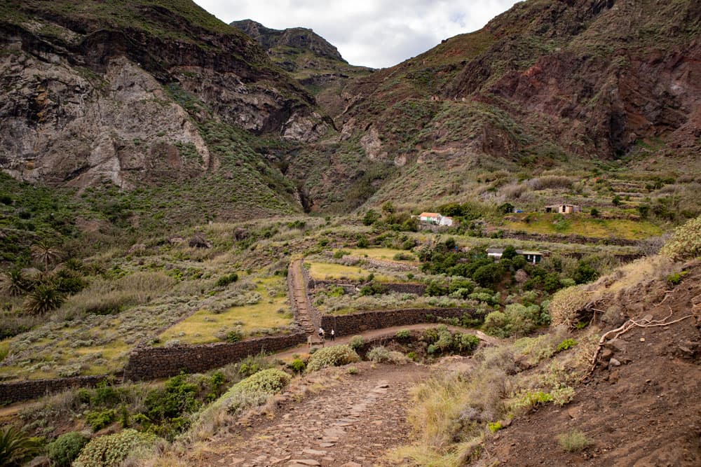
After a very short time you will leave this path on the right hand side down to the first paved hiking trail. This leads you parallel to the Camino Chamorga past the last houses of the village. You are now on the left side of the Barranco de Chamorga. Shortly after, the path joins the Camino de Chamorga again. On the not to be overlooked path you walk partly up and then again a little closer above the Barranco bed. The path climbs from time to time, but is mainly downhill. After some time you cross a small side gorge. You walk through the Barrancobett and climb up again on the other side of the gorge.
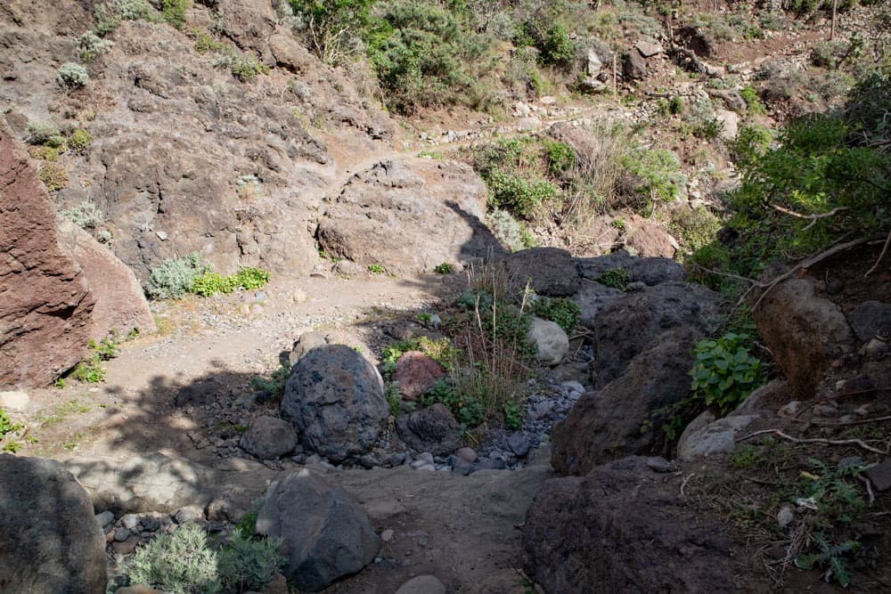
Crossing the Barranco de Chamorga
Section Barrancobett to Roque Bermejo
From Chamorga to Roque Bermejo it is 3.2 kilometres. You will lose 400 meters of altitude. During the entire walk through the Barranco you can enjoy wonderful views of the gorge and later also of the fishing village Roque Bermejo and the rock of the same name. Then the Barranco opens and widens. Now you can see the footpath far below you. You walk through terraced fields and gardens as well as first small houses. After some time you will see the lighthouse Faro de Anaga high above you on the left side.
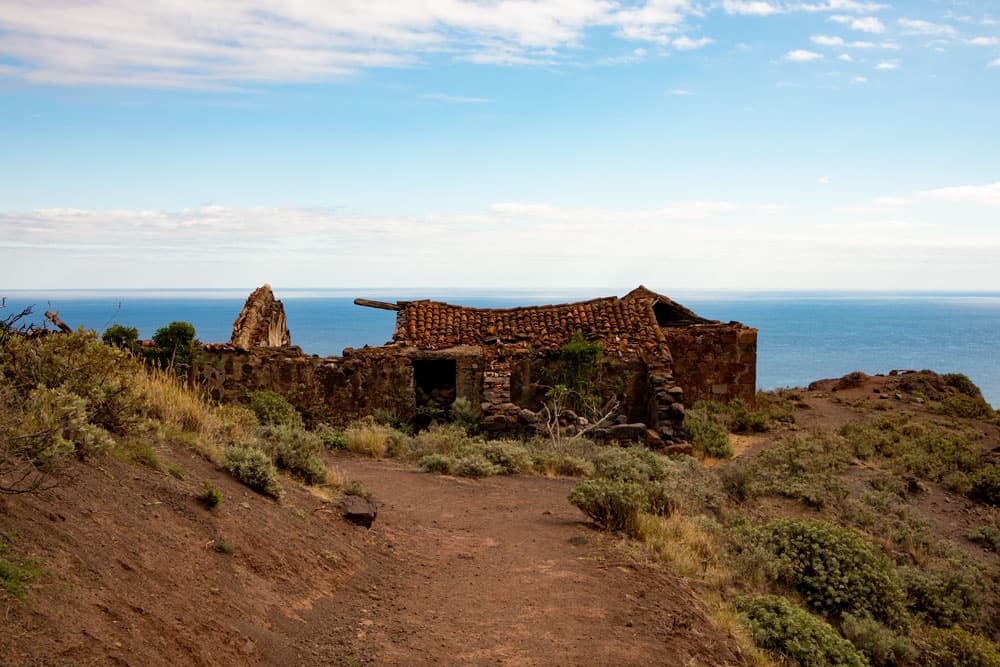
hiking path close to Roque Bermejo - abandoned house
You pass a ruined house and descend further. Then you reach a crossroads. From here it’s only a few hundred meters to the right to the fishing village Roque Bermejo and to the harbour with the rock of the same name which you can take a close look at down there. Otherwise (or after your detour) the round tour continues to the left. In a big arc you reach the other side of the slope, where the ascent to the lighthouse Faro de Anaga is waiting for you.

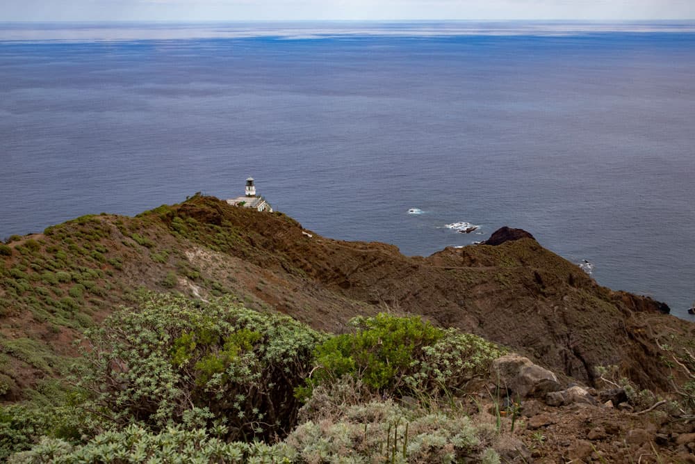
lighthouse Faro de Anaga
Roque Bermejo section to end of ridge path
On the other side of the slope, the hiking trail runs steeply up the mountain in large hairpin bends. You can look back again. The valley below you and the Barranco, into which you can now have a good look and follow your previous path, are at your feet. At an altitude of 240 metres you reach the lighthouse Faro de Anaga on the wide hiking trail, which is only a little narrow and steep in the last part. For me, the view from here was already a rest. But of course it gets better and better on the way up.
view down to the lighthouse Faro de Anaga
From the lighthouse it goes up a steep narrow path. Now you need your condition. Already after a short time you reach a fork. On the right the path leads more or less uphill to Las Palmas and El Draguillo. However, you continue to hike up to the left or straight ahead. After you have mastered the steep ridge path, the trail turns right. Now you can continue to climb and enjoy wonderful views of the cliffs and the slopes below you.
View from the hiking path to the coast with rocks
Section end of ridge path to Chamorga
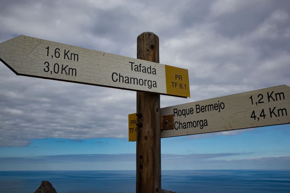
On the way you cross a small rock plateau at the end of the slope. The path continues uphill. Towards the end of the path, the trail finally leads you into the cloud forest. You walk for some time through the forest and at the end of the path suddenly stand free on the ridge path. To the left you can continue over the ridge to Montaña Tafada. However, your way back to Chamorga turns right. You walk over the ridge and after a short time you pass a hiking board and a ruin. 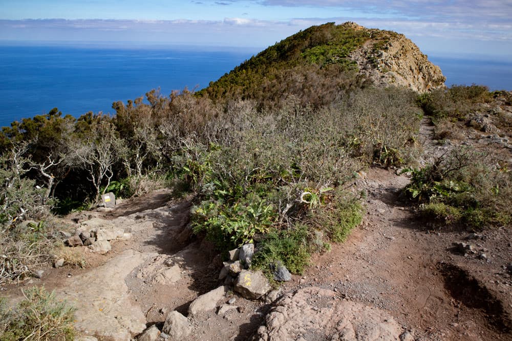
junction hiking path to the lighthouse (on the left)
Next to the ruin, the hiking trail leads up the slope on the left. After a short while you reach a fork and turn left with the PR TF 6.1 in the direction of Chamorga. On the mountain slope, you return to Chamorga on a beautiful high-level trail in less than half an hour. Shortly before you reach Chamorga, it’s worth stopping on a saddle with a striking rock nose. From here you have a great view of Chamorga and the Barranco as well as the surrounding Anaga mountains.
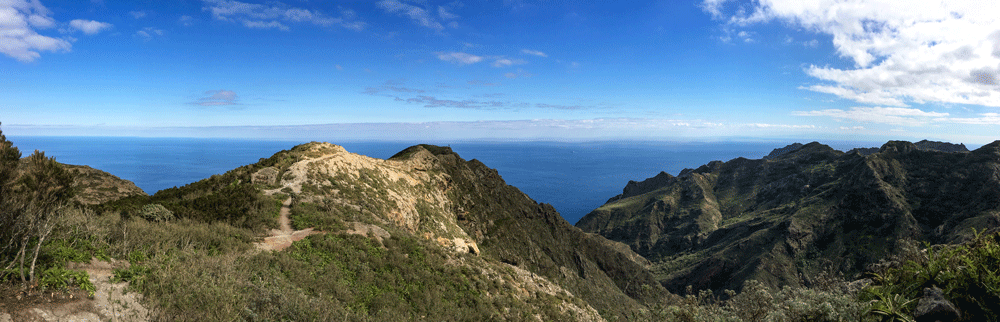
Panorama - mountain ranges around Chamorga
And finally
I hope you enjoyed this second walk around Chamorga as well. Since there are so many beautiful hiking trails around Chamorga, you can certainly put together your own individual tour from them. And maybe you’d like to try them all out. We wish you lots of fun hiking,
Dagmar von SiebenInseln