Circular hike around the Montaña de Chasogo, through gorges and along panoramic ridge paths.
On this hike, which starts at the Cañadas road TF-38, you will walk down from the impressive barren volcanic landscape in the Teide National Park through the pine forest on the western slopes of Tenerife. The trail takes you a little off the beaten track in the National Park.
Map
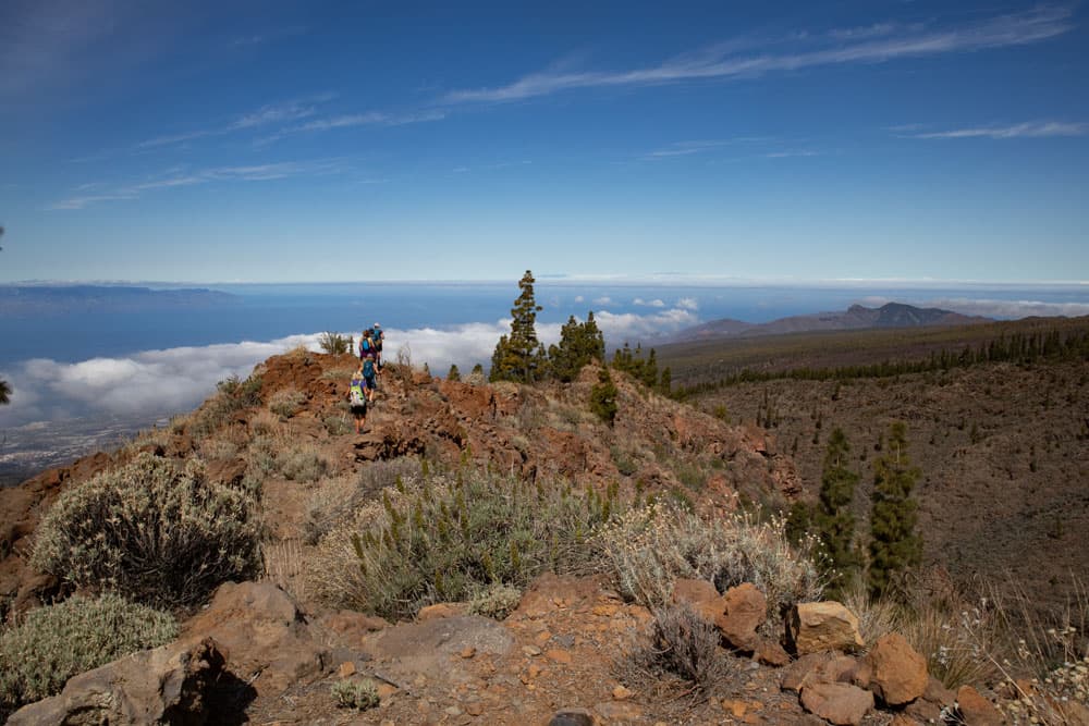
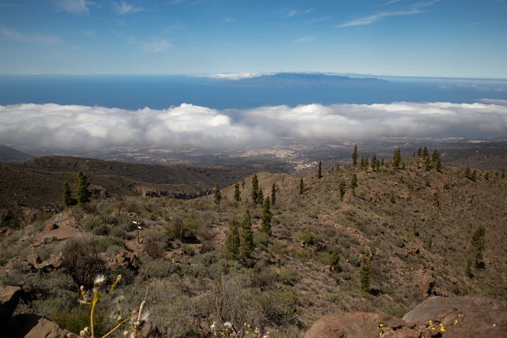
Lomo de la Fuente with views of La Gomera and El Hierro
You start at the parking lot from where you can also hike to Pico Viejo. But on the other side of the road you walk down around the Montaña de Chasogo on lonely paths towards Chirche.
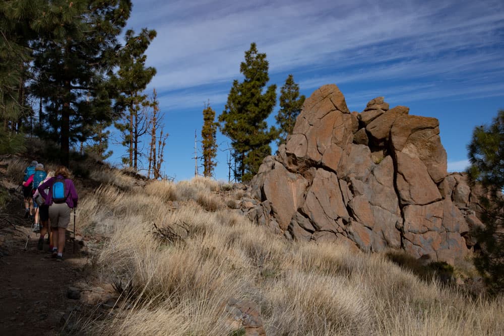
Hikers on footpaths - background La Gomera and El Hierro
In good weather you can see the neighbouring islands of Tenerife La Gomera and La Palma and sometimes even El Hierro at the beginning of the hike and from the ridge path. You’ll hike over barren lava flows and bizarre rocks. On the descent, which takes you in a wide arc around the Montaña de Chasogo, you walk through pine forest and pass deep gorges that you pass through and around. Finally, you hike along the Camino Lomo de las Vistas over a ridge with a magnificent view. At a hiking crossroads to Chirche you then start your way back over lonely gorges and ridges.

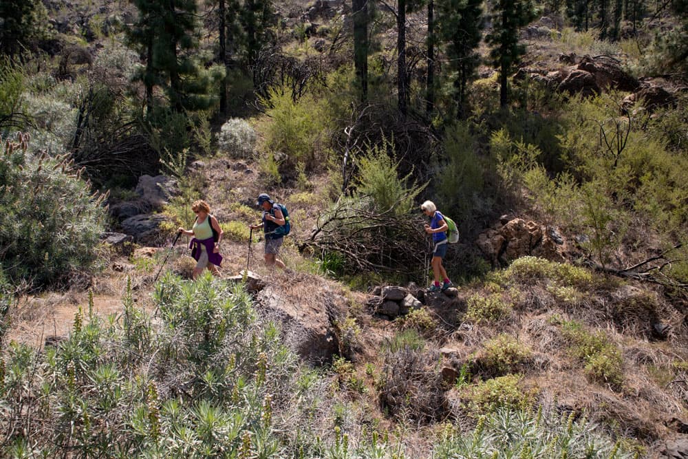
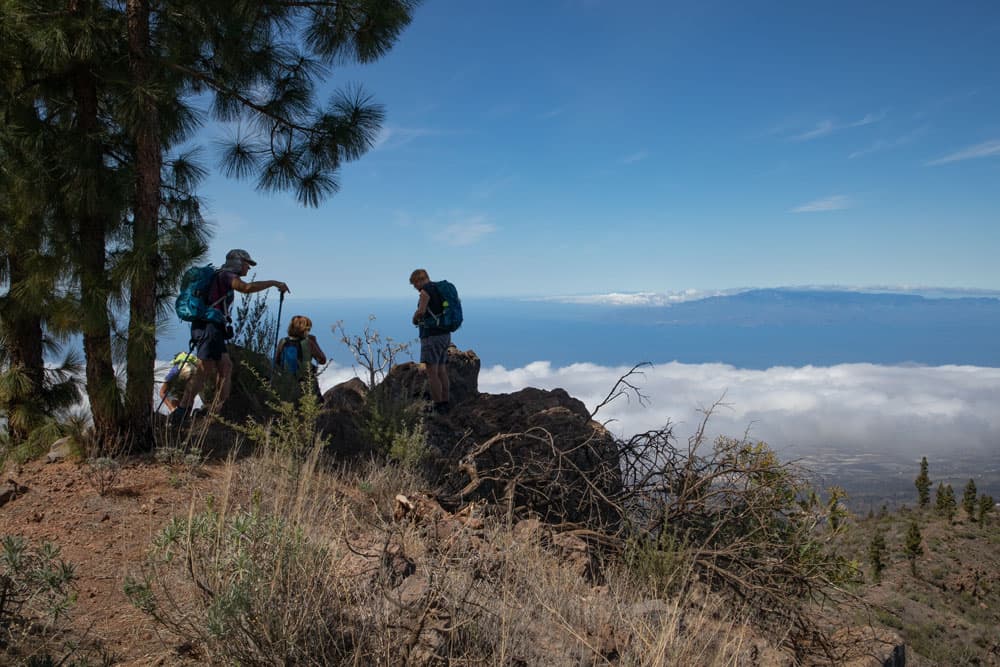
Hiking crossing Chirche - direction Montaña de Chasogo
Detour from the Montaña de Chasogo Circular Path to Chirche
If you like and can set this up technically with arrival and departure, you can hike back to the Montaña de Chasogo and also down to Chirche (lies at an altitude of approx. 800 metres) instead of a wide arc. Possibly the whole tour to Chirche and back is too strenuous. But maybe you want to hike in an extra tour from Chirche on this way and up the mountain ridge with the beautiful views. Chirche is definitely a visit and offers visitors and hikers a lot.

Hiking from Chirche towards Cañadas
In the small quiet village you will find picturesque houses built in the typical Canarian style. Many of them date back to the 18th and 19th centuries. Since 2008, the village of Chirche has been a cultural asset. The origin of Chirche goes back to the time of the Guanches. The village was later used for cattle breeding and dry farming since the 17th century. You can still see the typical terrace fields around Chirche today. From time to time you will also find old cisterns, wine presses, wine cellars and ovens as well as threshing floors.

Track of the hike around the Montaña de Chasogo
General information about the hike Montaña de Chasogo
Starting point and approach
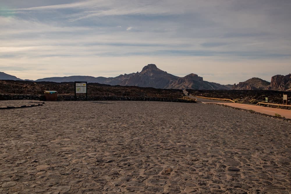
The car park Mirador de Chío (Narices del Teide) at the TF-38 (km 3,3) is the starting point. The final point of the hike is the TF-38 at kilometre 6, so you must either walk back 3 kilometres along the road to the car park (starting point). Or you have the possibility to drive in a group with two cars, so that a vehicle is parked before the tour at kilometer 6.
Circular hike Montaña Chasogo - starting point parking Narcisses del Teide
Arrival by car
If you are coming from the south of Tenerife or from the north on the TF-1 motorway, take the Guía de Isora or Chío exits. Then take the TF-38 towards Teide National Park. Those who come from the centre of the island via the Cañadas road TF-38 drive in the direction of Chío or Santiago del Teide. As the starting point is a parking place, parking places are of course available directly at the starting point of the hike. But if you are very late, it can get a little cramped with the parking lot because of the many tourist buses that stop there for a photo shoot.

Hiking crossroads - descent to Chirche TF 70
Arrival by bus
With the bus, you cannot get directly to the starting point, because there is no Titsa bus that drives this route. However, the Titsa bus line number 342 stops about 2.7 kilometres away at the Boca Tauce intersection. You could therefore walk to the starting point from Boca Tauce. However, this is not an option as you would have to walk an extra 6 kilometres along the road to get back.
Article summary and large selection of GPS hiking tracks
Sign up for my newsletter now and get exclusive access to my collected GPS tracks as well as all the brief information about my articles.
Sign up nowTime
I don’t like to give general time information for hiking tours, because the times are very individual. For this tour we needed with some breaks a little less than 6 hours. If you also want to walk to Chirche and back, you should plan at least another 3 hours. You can find out more about this and the different possibilities under the point Variants.
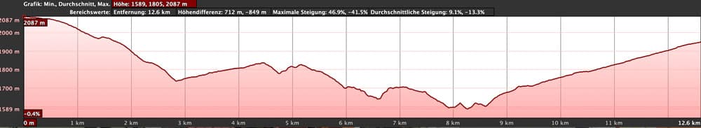
Elevation profile of the hike around the Montaña de Chasogo
Difference in altitude and distance
The difference in altitude is about 750 meters and the distance is about 13 kilometers long.
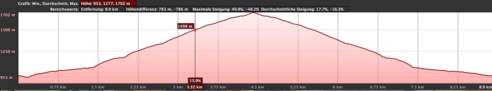
Elevation profile ascent from Chirche towards Cañadas and back
Requirement
For this quite long hike with some meters of altitude you need a good physical condition. The paths are often well signposted, developed as hiking trails and easy to walk. However, on the way back there are also some impassable places and paths at the Barranco crossings. In some places you also have to climb a bit.
Refreshment
There are no places to stop for refreshments either on the hiking trail or near the starting point. Therefore, make sure you take enough water and food with you.
Note
Since the track contains few shady sections, it is important to think about sun protection.

Track of the hike from Chirche up and track of the hike Montaña de Chasogo
Variants
This tour can be easily combined with various other hiking and circular walks in the vicinity. The tour to the Pico Viejo is worth mentioning, for example. The hike to the Montaña de la Cedro also starts at the starting point. On Seven Islands you will also find many other hiking tours that start near the Cañadas road. Furthermore, at the lowest point of the hike, you will find the PR TF-70 hiking trail to and from Chirche, from where you can also descend to Chirche in 4.8 kilometres. For the way (up and down) it took me about 2 hours each (with breaks). You have to climb another 750 meters. This variant is really only suitable for very „hardcore“ people. A one-way tour from Chirche to Cañadas Street or vice versa is more possible.
Descent from the ridge - below hiking junction towards Chirche
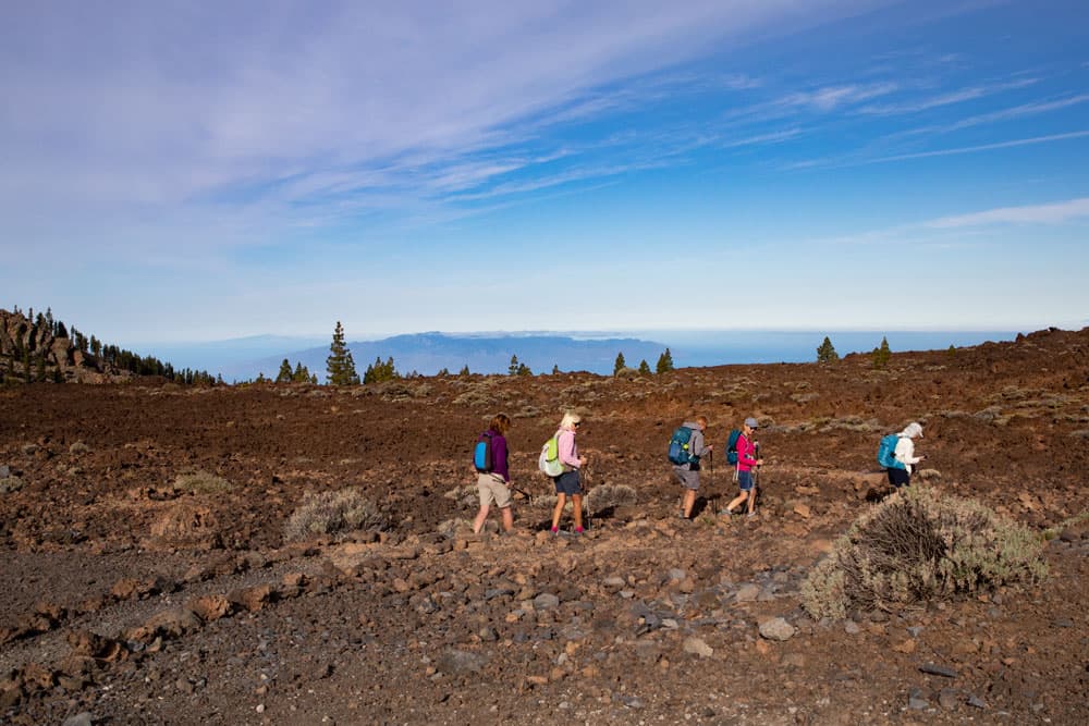
Hike around the Montaña de Chasogo
Section parking Narcises del Teide to pine forest
You start your hike at the Narcises del Teide car park and cross the road there. On the other side of the road, walk a few meters behind the guardrail. Then the path PR-TF 70 branches off to the left. First, the path is identical to the path to the Montaña de la Cedro. This leads you first a little to the right parallel to the road and yet slowly downhill from the road. The hike starts at approx. 2100 m above sea level. In a wide arc you walk towards the foothills of the Montaña el Cedro, towards the Cañadas del Cedro. 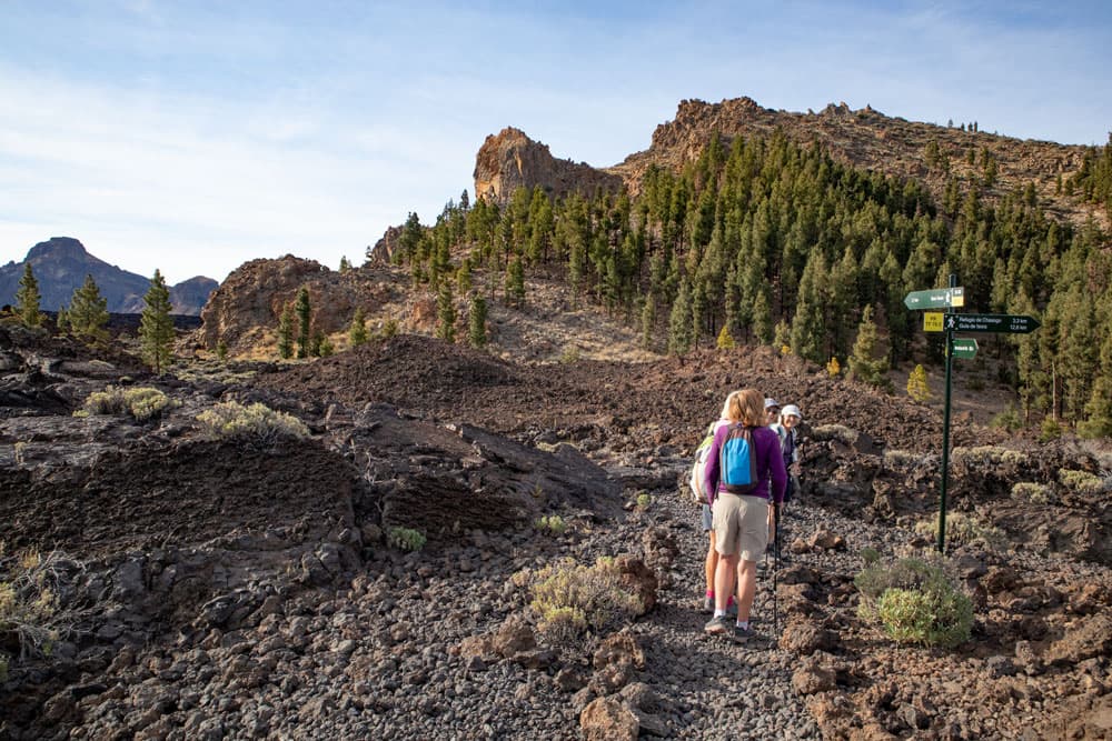
Hiking crossroads direction Cañadas and Chirche
You arrive at a hiking crossroads in a very short time. To the left, take the PR TF 70.3 towards Boca Tauce. On the other side the path leads to Guía de Isora. Follow this path further downhill. The path runs to the right of the foothills of Montaña el Cedro. To your right are the lava fields and to your left the wooded slopes. The walk takes you past bizarre rock formations. And you will always have a wonderful view of the neighbouring islands of La Gomera and La Palma, as well as El Hierro in good weather. After some time, the path will take you up to the left through the pine forest.
Rock formations on the wayside
Article summary and large selection of GPS hiking tracks
Sign up for my newsletter now and get exclusive access to my collected GPS tracks as well as all the brief information about my articles.
Sign up nowSection pine forest to Camino Lomo de las Vistas
You are on a wide partially wooded ridge. The hiking trail leads you over this ridge for a very long time. Finally the path leads into a wide driveway. This runs along the Barranco Tamuja. You follow the road to the left. After you have circumnavigated the Barranco on the way, the path passes over the Barranco Morro de Los Cedritos. Then you get to the great Barranco Mañoca. On the opposite side you can already see an impressive mountain ridge. There you will hike on the Camino Lomo de Las Vistas.
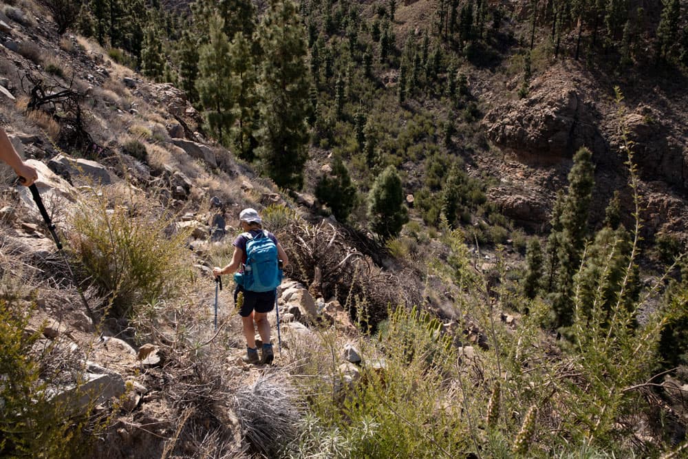
Descent into the Barranco Mañoca on narrow paths
But first you walk in a very large arc around the Barranco Mañoca. But in the upper part of the gorge, you can take a shortcut on a path. You walk down a small path to the right into the Barranco. You cross the Barranco ground in the upper part and walk uphill again on the other side. Now you cross a small ridge and go down again before you finally ascend to the main ridge on the other side. Now you are on the Camino Lomo de las Vistas.

Hiking trail over the Barranco de Los Cedritos
Section Lomo de las Vistas to hiking crossroads direction Chirche
The Camino Lomo de las Vistas is the most impressive part of this hike. On the quite narrow mountain ridge with absolutely fantastic views to all sides you walk slowly downhill. You will see some supposed abort edges in front of you and will ask yourself how you can go on there. But the path often runs left or right around the ridge and leads to the next lower ridge.

Hiking trail along the Camino Lomo de las Vistas ridge
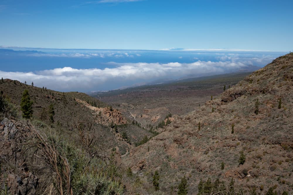
Up here you can take a rest. Deep below you can see the Barranco Mañao on the right and the Barranco de Tágara on the left. In front of you lies the south coast. And you can also see the town of Chirche deep below you. You go down steeply to the end of the ridge on the right. At an altitude of 1660 meters you finally reach a hiking crossroads. You are still on the PR TF-70, which you can follow from here downhill in 4.8 kilometres to Chirche (see also variants).
Hikers on the way back towards Montaña de Chasogo
Section of hiking crossroads to Barranco del Los Cedritos
If you don’t want to go straight down to Chirche, take the narrow path to the right downhill into Barranco Mañao. Follow the PR TF-70.3 in the direction of Refugio de Chasogo. After a short time, the path will take you down to the Barranco Grund, which you cross. On the other side, the steep climb begins. You first ascend steeply and then walk along the ridge to the left. When you have reached the front of the ridge, walk to the other side.

Ascent Camino Lomo de las Vistas
There it goes down into the Barranquillo del Lomo Corto. Then you climb again to a small ridge. As you can see on the track, it was a bit difficult for us to find the way down to the Barranco Morro de los Cedritos. At first we walked a little on the right side of the ridge. But the somewhat hidden path actually leads down on the other side of the ridge. When you have crossed the Barranco Grund, it goes uphill again on the other side and along the slope to the left.

Rufigio de Chasogo
Section Barranco de Los Cedritos to kilometer 6 at the TF-38
Once again you come to a path that leads down to the left in the direction of Chirche. But for you it’s now only uphill to the right. On the ridge Lomo de la Fuente you climb partly steep, partly leisurely. To your right is the Barranco de Los Cedritos. Finally, the path meets a driveway. This is the same road you used before. But now you are two serpentines below the point where you walked left on the way there. Also now you walk around to the left and follow the road.
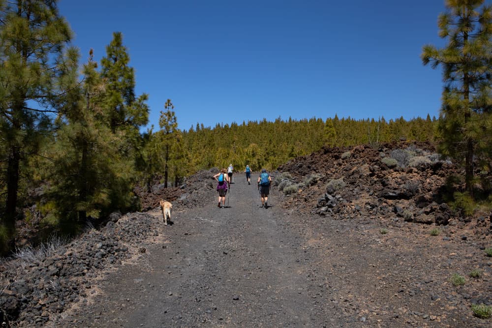
Way back on a wide track
This leads you along the south side of the Montaña de Chasogo (2010 meters). Occasionally you hike through pine forest. After some time you pass the closed Refugio de Chasogo, which is located at the foot of the Montaña de Chasogo. You can’t miss the path. It is a very long way uphill on the road. Often there is no shade and it can get very hot in sunshine. After a long uphill hike you finally get out at kilometre 6 of the Cañadas road TF-38. From here you return to the starting point at the road in 3 kilometres (better by car).
Peak rest with view
And finally
I hope you enjoyed this great hike on the southwest slopes of Tenerife. You probably won’t meet many other hikers on this path. The views – especially from the Camino Lomo de las Vistas ridge – are magnificent. I wish you a lot of fun while hiking,
Dagmar von SiebenInseln