Montaña el Cedro – a rugged summit in the Cañadas
Map
The Montaña el Cedro is a small rugged peak in a chain of mountains, the Cañadas. These mountains frame the caldera, the crater rim of the huge primeval volcano that was in the middle of the island millions of years ago.

view down to the Cañadas and the hiking path from the Montaña el Cedro
There are beautiful walks over the Cañadas with views of the Teide and the Pico Viejo. So you can do a tightrope walk over the whole Cañadas.
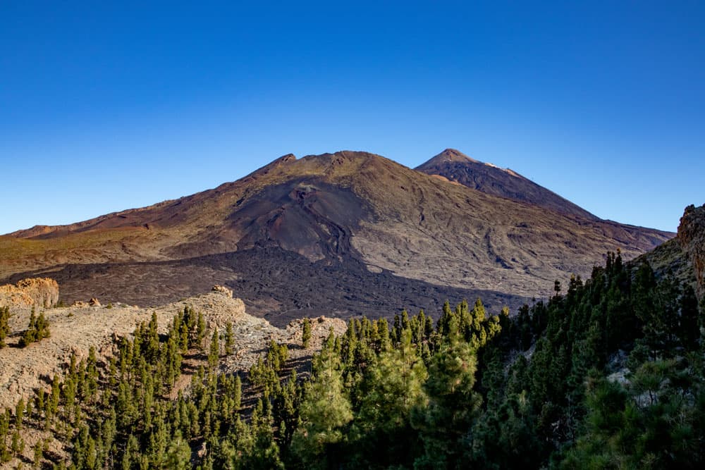
view to Mount Teide and Pico Viejo from the Montaña el Cedro
But the Cañadas can also be conquered bit by bit. I have described the two (1 and 2) hikes to the Guajara and the hike to the Sombrero de Chasna on seven islands so far. Today the hike on the Montaña el Cedro is added. And since this is a relatively small hike, I have extended it by a round on the back of the slopes of the Cañadas towards El Jaral. 
Track Montaña el Cedro with circular hike on the sloops of the Cañadas
General information about the circular hike Montaña el Cedro
Starting point and approach
The starting point of the hike is the Mirador de Chío (Narices del Teide) car park on the TF-38 (km 3.3). From here you can also climb Pico Viejo.

Parking starting point Montaña el Cedro
Access by car
If you are coming from the south of Tenerife or from the north on the TF-1 motorway, you can take the Guía de Isora or Chío exits. Then take the TF-38 towards Teide National Park. If you come from the centre of the island via the Cañadas road TF-38, drive in the direction of Chío or Santiago del Teide. Since the starting point is a parking lot, parking spaces are available. But if you are very late, it can become too narrow with the parking lot because of the many tourist buses that stop there for a photo shoot.

signposts at a crossing for hikers
Arrival by bus
With the bus you can not get directly to the starting point, because there is no Titsa bus that drives this route. However, the Titsa bus line number 342 stops about 2.7 kilometres away at the Boca Tauce intersection. You could therefore walk to the starting point from Boca Tauce. You can find more information on the Titsa Homepage. Time
I don’t like to give general time information for hiking tours, because the times are very individual. For this hike we needed about 5 hours for the last time with an extensive rest.

elevation profile circular hike Montaña el Cedro
Difference in altitude and distance
Article summary and large selection of GPS hiking tracks
Sign up for my newsletter now and get exclusive access to my collected GPS tracks as well as all the brief information about my articles.
Sign up nowThe difference in altitude is approx. 670 metres. However, the difference in altitude is not due to the ascent of the Montaña el Cedro (just over 100 metres), but to the extension of the tour with a large descent and ascent towards El Jaral. The route is almost 12 kilometres long.
Requirement
With a little physical condition, everybody can manage this tour well. Those who only want to get to know the Montaña el Cedro, but don’t want to take on the meters of altitude of the descent and ascent, this hike can almost become a „walk“ for them.
Refreshment
There are no places to stop for refreshments. Therefore take enough water and food with you.

Tracks in the surroundings of Montaña el Cedro
Variants
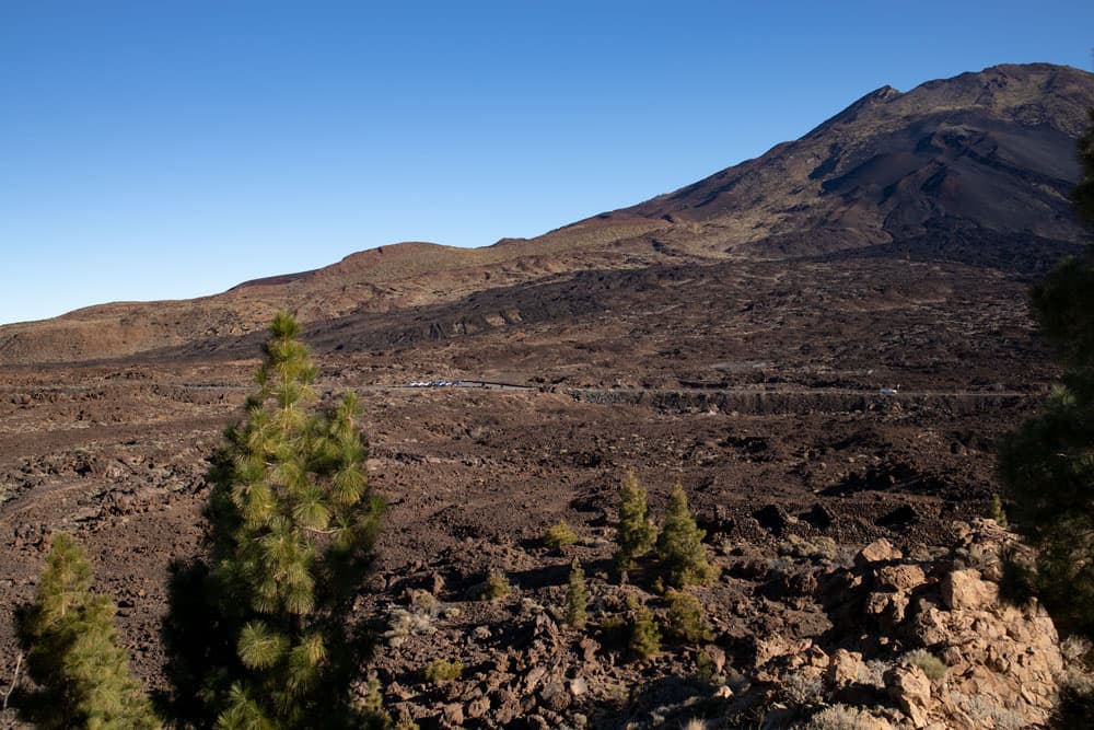
This tour can be combined well with various other hiking and circular walks in the vicinity. The largest hike leads from the starting point to Pico Viejo. But there are also smaller hikes in the vicinity, such as around the Montaña Samara or the hike to the Montaña de las Cuevitas and Montaña Chasogo. As you can see on the track picture, at the lowest point of this hike you can descend even further to El Jaral or direction Chirche. This is where you will find the main El Jaral/Chirche road to Boca Tauce.
The hike is also easy to reduce in size. You simply skip the second round of the descent. Then you have a small round with less vertical meters over the Montaña el Cedro.

view from Pico Viejo - Montaña el Cedro
Hike around the Montaña el Cedro
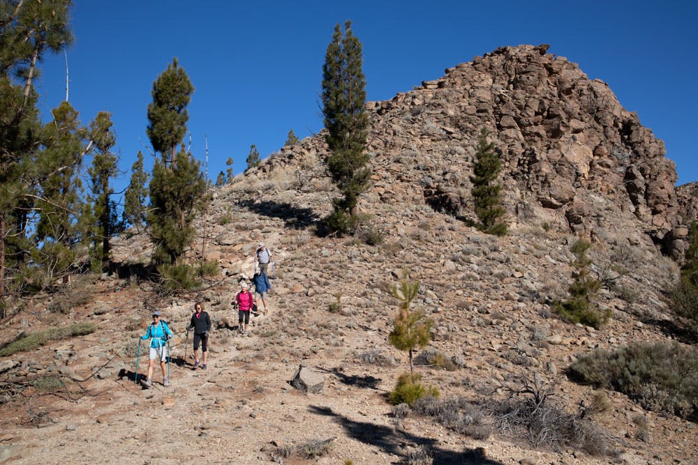
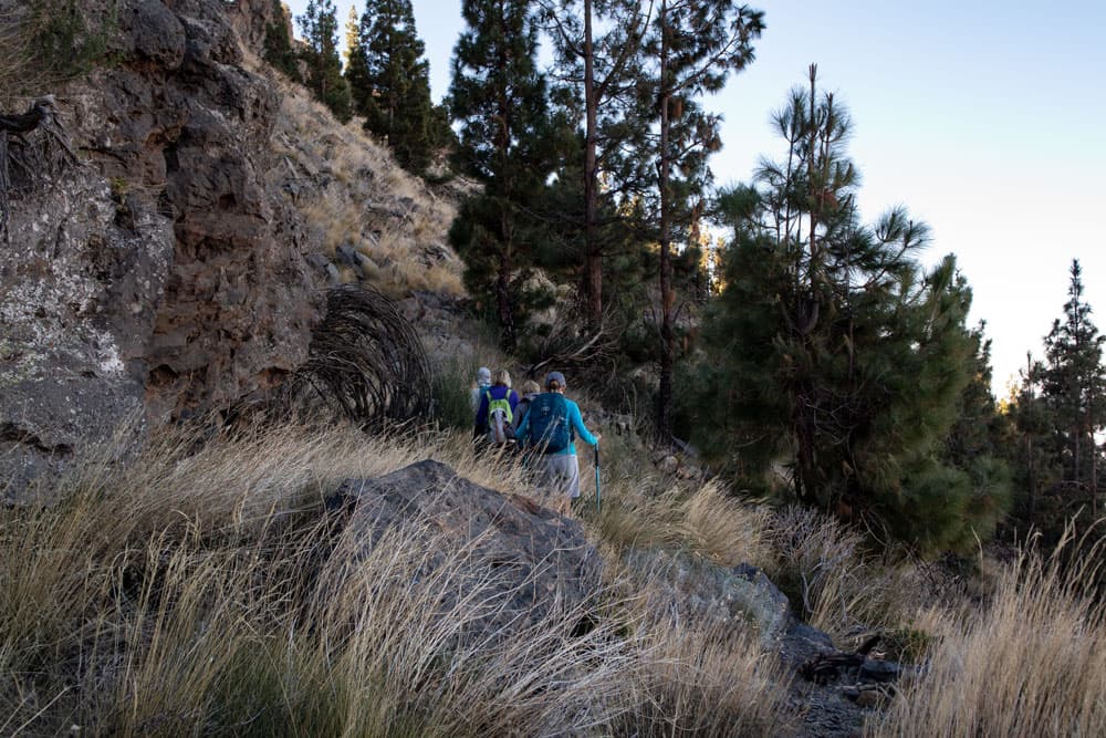
You start the hike to the Montaña el Cedro at the Narices del Teide car park on the TF-38 at km 3.3. But while you stay on the street side of the car park for the hike to the Pico Viejo, for the hike to the Montaña el Cedro you have to cross the road. On the opposite side of the road you will find the PR-TF 70 trail, which takes you a little to the right, parallel to the road, yet slowly downhill.
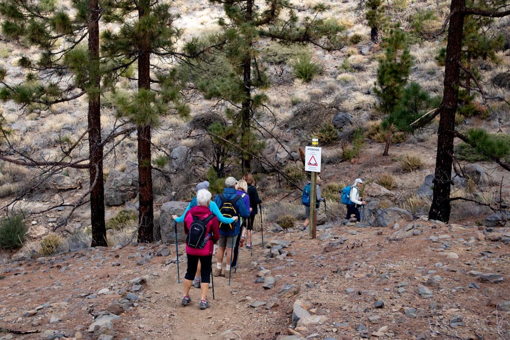
hiking group on the path - Montaña el Cedro
The hike starts at almost 2100 m altitude. From there you go downhill to the foot of the Montaña el Cedro for 100 meters. In a wide arc you walk towards the foothills of the Montaña el Cedro, towards the Cañadas del Cedro. Before the path leads through sparse pine forest, you come to a crossroads. To the left, take the PR TF 70.3 to Boca Tauce. On the other side, the path leads to Guía de Isora. But you follow a smaller path straight through the pine forest.
Montaña el Cedro - parking starting point Pico Viejo
In the following section we will do a little climbing. On the small path you climb partially over rocks and otherwise over small serpentine paths. In between the path leads you along the back of the slope. Slowly it goes uphill. You will pass a small cave decorated with flowers and other utensils. When you’re around the hillside, it’s uphill. If the weather is good and there are no clouds blocking your view, you can now enjoy wonderful views over the last few metres to the summit of Montaña el Cedro (about 2200 metres above sea level).

rugged rock - Montaña el Cedro
Opposite you are the Teide and the Pico Viejo. Below you can see your way back at the foot of the mountain and the road up to Boca Tauce. On the other hand, if the weather is good, you can see the southwest coast of the island and the near Barbarian islands of La Gomera, El Hierro and La Palma. The way leads you over the rugged rocky ridge with good views. Slowly the ridge descends again. Then there is a small steep descent before the hiking trail leads over a rock plateau to the back of the slope.

small cave with decoration next to the hiking trail
Article summary and large selection of GPS hiking tracks
Sign up for my newsletter now and get exclusive access to my collected GPS tracks as well as all the brief information about my articles.
Sign up nowSection rockplateau to Fire tower with hiking crossroads.
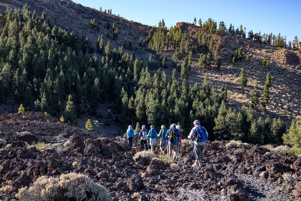
From there you walk along the back of the slope of the Cañadas for quite a while on a good hiking trail through pine forest. From time to time the forest thins out a little and you can enjoy beautiful views. To your right are the Barranco Mañaco and the Barranco de Tágara. The trail passes both gorges on the ridge. After a while you will see a fire tower lying in front of you. Here you can climb up on the rocks and enjoy the view or take a rest.
hiking trail at the sloop - Montaña el Cedro
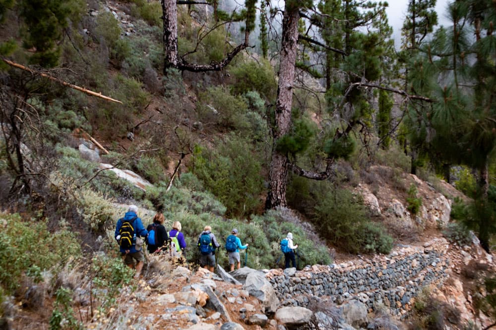
Who wants to go the short round, follows here already the PR TF 70 direction Boca Tauce at the big hiking crossroads. This is also our way back later for the big round, because the hike is like an 8 and therefore consists of two rounds lying next to each other. The big hike follows the PR TF 70.1 towards El Jaral and Refugio de Tágara. During my last hike there suddenly dense clouds came up. There was almost no visibility. Therefore I cannot present really good sunny pictures. But I know from earlier hikes that the weather there can also be sunny and cloudless.
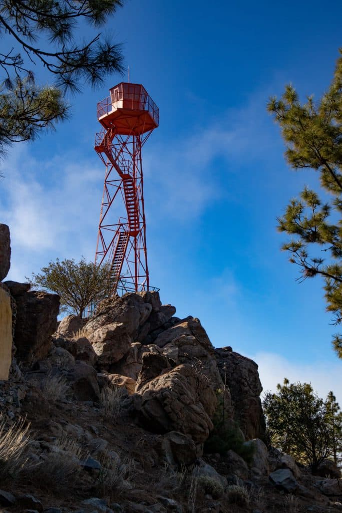
fire tower - Montaña el Cedro
Fire tower section with crossroads to Barranco del Achacay
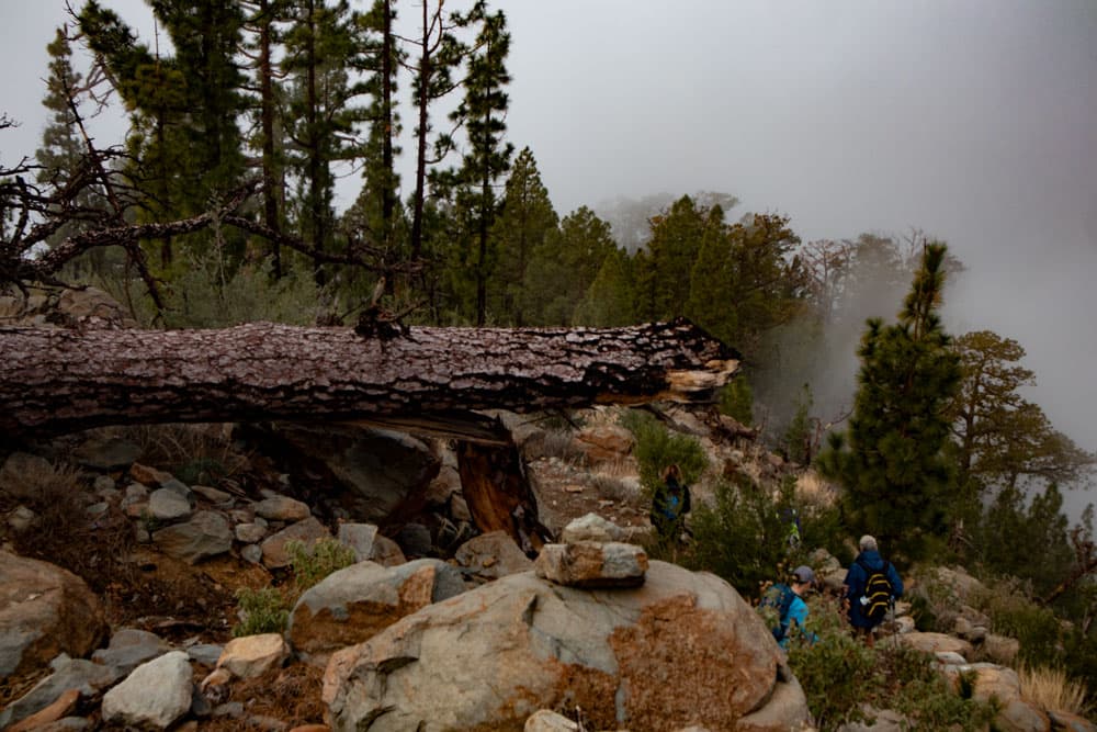
The hiking trail PR TF 70.1 leads you downhill for quite a while now. First you go in the direction of Barranco de Tágara. On the way you will see many trees lying on the ground due to storms, thunderstorms and fire. From time to time you will have to find your way around these trees (as of the beginning of 2019). While the first part of the path is still relatively long and straight, it then goes down on steep little hairpin bends towards Barranco.

hiking over the clouds - Montaña el Cedro
You descend to about 1750 meters altitude. The PR TF 70.1 continues downhill towards El Jaral. On the left, a narrow path branches off from the main path, which is marked with a cross crossed in white and yellow. This is the Camino de La Madre. It climbs along a narrow path above the Barranco del Achacay. Deep below you can see the wide driveway as you walk uphill on the hillside. Sometimes you have to scramble around trees or over rocks. But otherwise the path is easy to find.

hiking path through the pine forests
Section Barranco del Achacay to Fire tower
Sometimes you step down again briefly. But then it goes in long hairpin bends steeply up the wall of the mountain slope until you have reached over 1800 meters of altitude again. When you reach the top, the hiking trail leads you a short time later onto a wide road, which you follow to the left for a while. You could also continue here and finally return to the hiking route. But the ascent on the hiking path is nicer. After a short time it turns left from the path.
hiking trail passes rocks and trees, that block the way
There it goes again steeply on the PR TF 70.1 through forest up the mountain. You climb on serpentines over the ridge up to approx. 2100 m altitude. Then you meet your way out/descent path. Now keep right and after some time you will reach the main path again near the fire tower. Then you have completed the second round. From there you follow the signs PR TF 70 direction Boca Tauce to the right. From here the description also applies to those who only walked the first round around the Montaña el Cedro.
hiking group on the path
Section Fire tower to starting point parking lot
The PR TF 70 towards Boca Tauce takes you in a wide arc around the Montaña el Cedro down to the front of the mountain. There you will meet again the road you already walked before the ascent to the Fire Tower. This track, which you follow around to the left at this point, will take you along the front side of the mountain. In this way you will actually circle the entire mountain massif of the Montaña el Cedro. Here you also have beautiful views of the Teide and the Pico Viejo.

way back on a small path back to the height
Finally you come to a fork at the end of the mountain massif. If you go straight ahead, after some time you will meet the way that led you up the mountain. Then you can go back the same way. I went right at the fork. Through lava fields you get back to the TF-38 after some time. Around to the left you are back at the parking lot in no time.
descent on the backside of Montaña el Cedro
And finally
I hope you enjoyed this hike in the Cañadas. By the way, if you like seven islands, you can also follow me on Instagram or Facebook. I wish you good hiking at all times, Dagmar von Siebeninseln