Hiking trail from Punta del Hidalgo to Chinamada with magnificent views
Map
In the description round tour about the mountain ranges around Chinamada I already described a hike in the Anaga mountains to Chinamada (600 altitude meters). 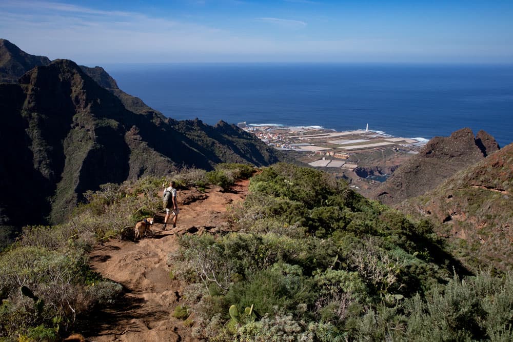
hiker on the hiking trail
This tour, which starts at Cruz del Carmen and goes to Chinamada and Las Carboneras, can be combined wonderfully with this tour. But later on under the point variants.
Hiking trail under the rocks along
The hike starts on the coast in Punta del Hidalgo and takes you up a really varied path. On the way there are many opportunities to enjoy impressive views in all directions. You hike high above the Barranco del Río. You look at the neighbouring mountain ranges. On the other side you have the rough Atlantic cliffs, which you can see at close range.
church in Chinamada
The Anaga Mountains and the village Chinamada
Chinamada is a small still inhabited cave village belonging to the municipality of La Laguna. There you can see for yourself how the houses were once beaten into the rocks. The few inhabitants still live in these well-tempered rooms amidst the Anaga rocks. They are mostly active in agriculture and cultivate their fields up there. The word Chinamada is said to come from the language of the Guanches, the natives of Tenerife.
view to the first houses of Chinamada close to the mirador
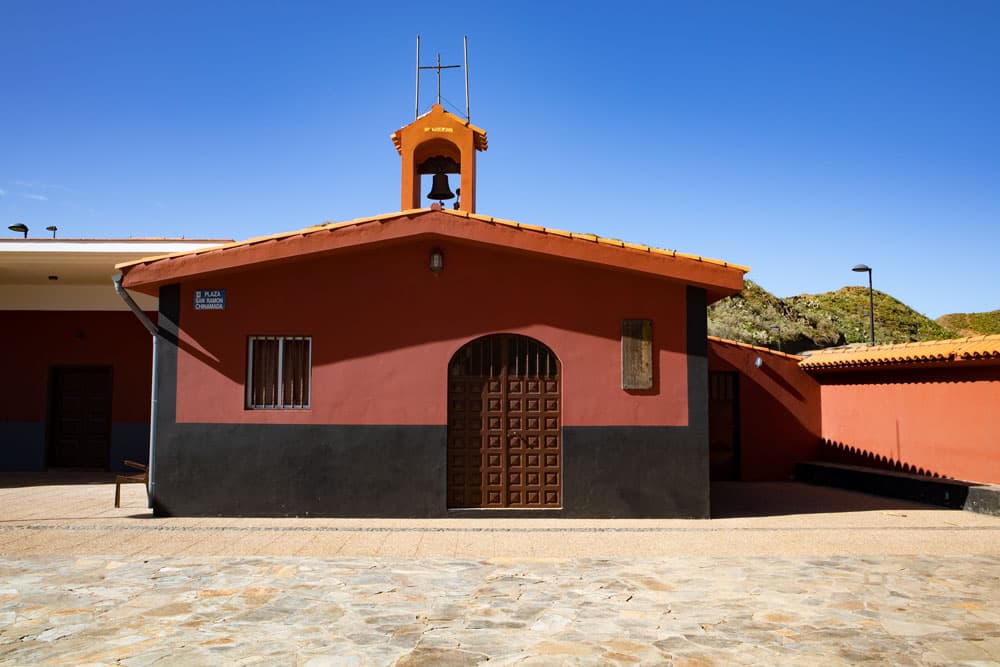
Chinamada has a small hermitage dedicated to San Ramón Nonato and a restaurant. The hermitage was built at the end of the 80s of the previous century. The area around Chinamada has been inhabited since the time of the Guanches. At the end of the 15th century, the area was mainly inhabited by Gomeros, who ran livestock. The once large settlement emptied itself in the great emigration years 1950-1980. In 1994, the entire area around Chinamada was included in the protected Anaga Nature Park.
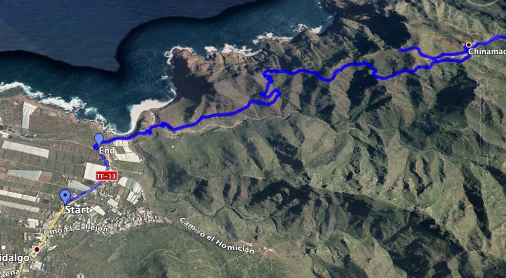
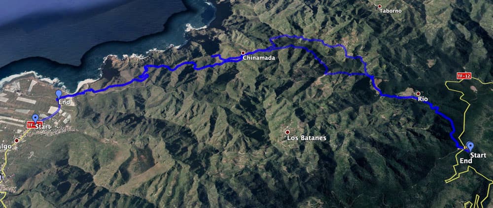
Track of the hike Punta del Hidalgo to Chinamada
General information about the circular hike from Punta del Hidalgo to Chinamada
Starting point and approach
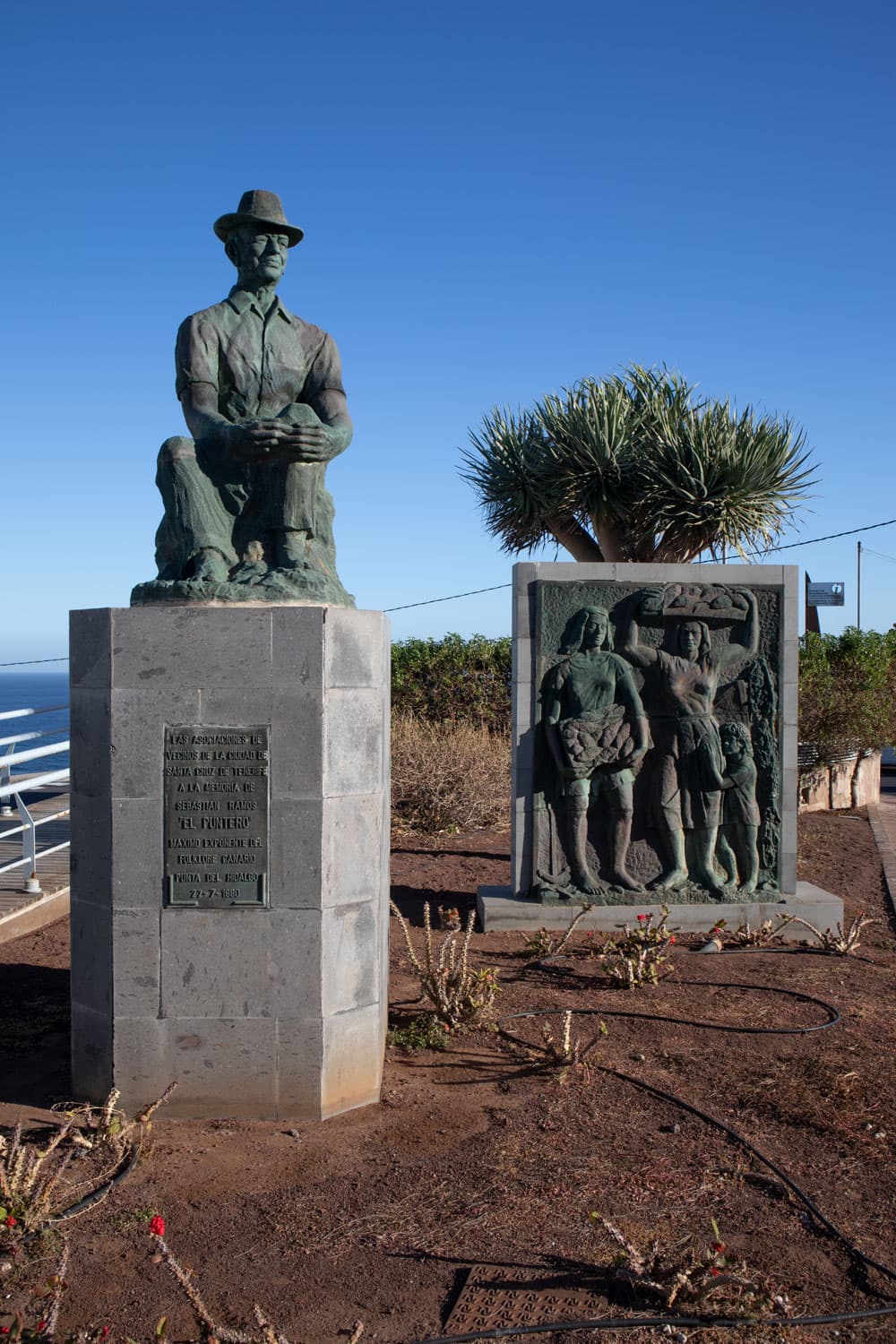
Starting point of this hike is the main road TF-13 in Punta del Hidalgo. The track starts in the middle of the village. You can also continue the road until you reach a place with a monument (man). Here at the coast is a good starting point.
little mirador in Punta del Hidalgo - start of the hiking trail
Approach by car
Article summary and large selection of GPS hiking tracks
Sign up for my newsletter now and get exclusive access to my collected GPS tracks as well as all the brief information about my articles.
Sign up nowYou reach Punta del Hidalgo via the TF-5. From the motorway you can either take the TF-13 or the TF-16 to Tegueste, depending on the direction. From there you drive via Bajamar on the TF-13 to Punta del Hidalgo. You drive through the town on the main road for a while. Parking is available all the way to the roundabout on the coast along the main road.
Arrival by bus
The Titsa bus lines 050 and 105 stop in Punta del Hidalgo. You can find out more about the exact times on the Titsa homepage. Time
I don’t like to give general times for hiking tours, because the times are very individual. For this tour we needed a little more than 4 hours (with an extensive rest in Chinamada).
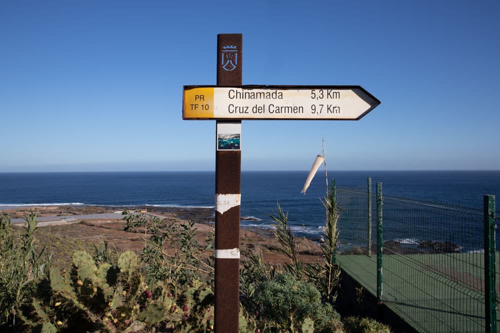
postsign to Chinamada
Difference in altitude and distance
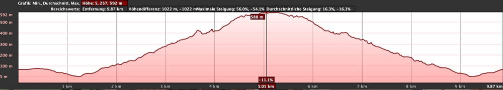
elevation profile hike Punta del Hidalgo to Chinamada
The difference in altitude is approx. 680 metres. The distance is about 10 kilometers long.
Requirement
You need a good physical condition for the ascent. But by the way it is an easy and easy tour for everyone.
Refreshment
There are restaurants, bars and shops at the starting point, Punta Hidalgo. There is also a restaurant bar in Chinamada, but it is not always open. Therefore take enough water and food with you.
Track of the hike Punta del Hidalgo - Chinamada and from there to Cruz del Carmen
Variants
This tour can be combined well with various other hiking and circular walks in the vicinity. Worth mentioning is the tour from Cruz del Carmen to Chinamada. So you can also go up to the Cruz del Carmen in Chinamada. If you still want to make a bow, you can go over the tranquil little village Las Carboneras. This long tour can also be done in the other direction. If you don’t want to go back, take the bus. 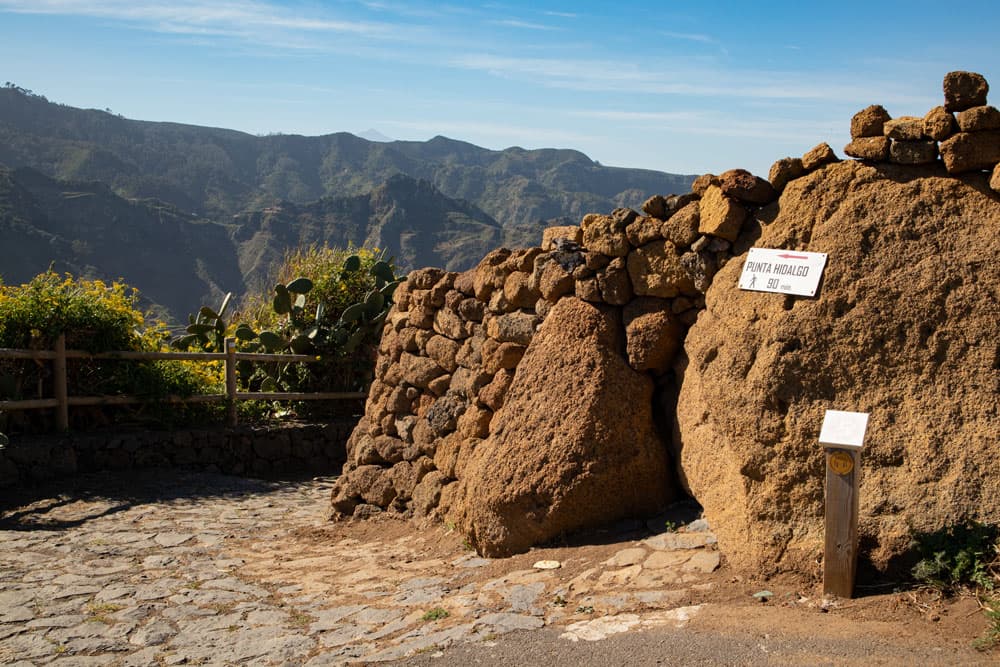
hiking trail from Chinamada to Punta del Hidalgo and to the Mirador
It is also possible that you descend from Chinamada to El Batán. However, the path has slipped in some places and is not recommended for everyone. If you descend to El Batán, you can combine this tour with a canal and gorge hike. You can also descend from El Batán to Cruz del Carmen on or to Punta del Hidalgo. A big descent would be over the canal. The direct way through the Barranco Seco would be easier. But this one is quite steep and almost alpine in some places. Thus not to be recommended for everyone. 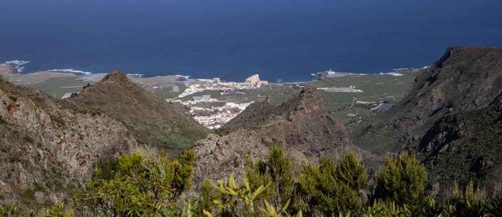
Panorama - view down to Punta del Hidalgo
Article summary and large selection of GPS hiking tracks
Sign up for my newsletter now and get exclusive access to my collected GPS tracks as well as all the brief information about my articles.
Sign up nowHike Punta del Hidalgo to Chinamada
Section Punta del Hidalgo Rondell to Barranco del Río Ascent
You have parked at the street TF-13, in the village or directly at the roundabout. From there you follow the main road for a few steps. Then a road goes down to the right. This is marked yellow white after Chinamada (PR TF 10). This will take you to a banana plantation along the coast. Then it goes right past a small estate. You go around a barrier. In front of you lies the striking rock Dos Hermanos (Two Brothers).
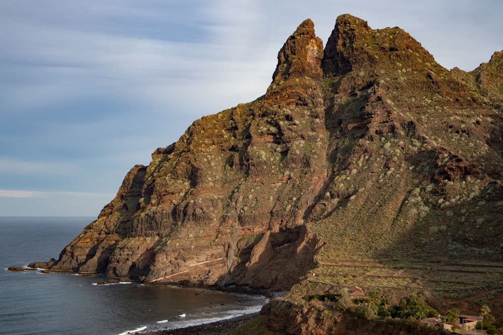
Roques Dos Hermanos at the coast
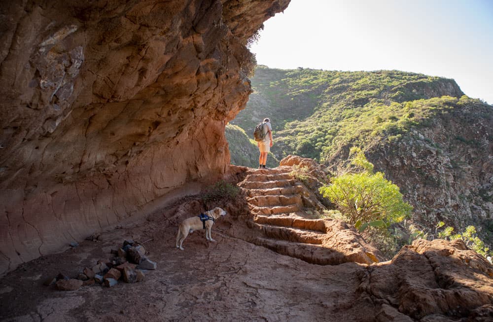
At an abandoned building that you avoid on the footpath, you go down into the Barranco del Río. Once you have reached the Barranco bed, you can make a small detour to Playa de los Troches on the left. The path will take you back up on the opposite side. You first walk through reeds and then on a very well laid out stone staircase. From now on you go up over the Barranco del Río into the valley.
hiking trail at the sloop and under the rocks
Barranco del Río section Climb to viewpoints on the steep coast
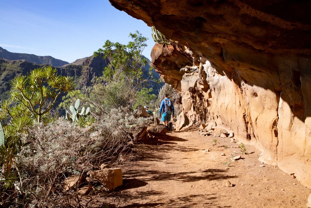
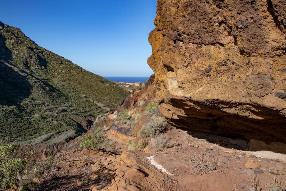
The hiking trail is not to be missed. It leads you further along the slope and steadily uphill. After some time you will reach an impressive rock overhang, under which you will walk through. A short time later the path changes into some large serpentines and later small serpentines. Here it goes steeply uphill. At the top you are quite close to the steep coast and can look over the Atlantic Ocean.
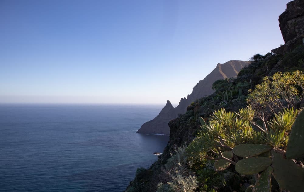
view on the coastline
Up here is a first magnificent viewpoint. You can look in all directions. Perhaps time for a first rest? But you will still find some of these wonderful places on the way. Already after a short time you will find two more fantastic vantage points on your way along the steep coast. Now you have already climbed almost 300 metres.
stonesteps on the hikingtrail
Section Viewpoints on the steep coast to Chinamada
After some time, the path turns away from the cliffs and goes back to the right side of the rocks. It climbs steeply. Then the path becomes a little flatter for a while. Above you lies a huge rock arch. After some time a path leads up to it on the left side. The path continues straight ahead.
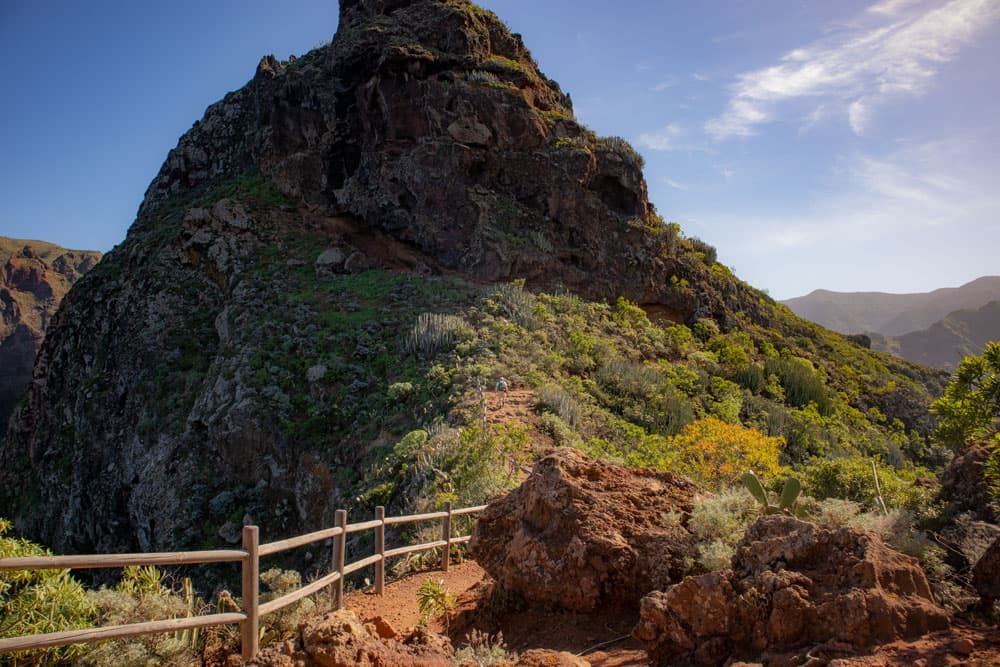
viewpoint and hiking trail to Chinamada
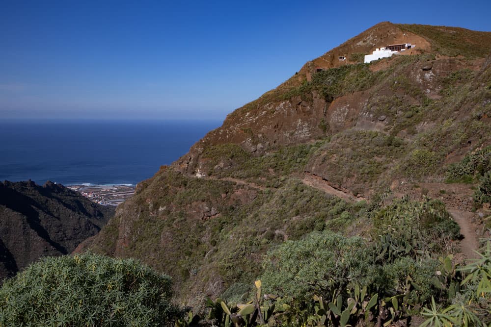
You go to the right. Then you climb steeply over rocks to reach the next ridge. From now on the path runs along the hillside high above the Barranco with magnificent views in the direction of Chinamada. Before you reach the village, you can make a detour to the Mirador Aguaide on the left. The way from Chinamada to Aguaide I described here. Shortly after you reach the first houses of Chinamada. 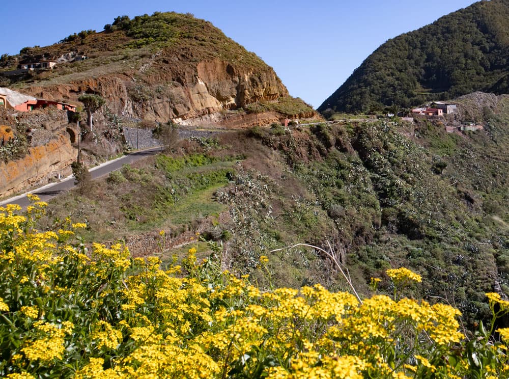
view on Chinamada
And finally
I hope you enjoyed this walk from Punta del Hidalgo to Chinamada. It will be really interesting if you combine it with the other tours as described under variants. Whatever you decide, I wish you lots of fun on your hikes,
Dagmar von SiebenInseln

