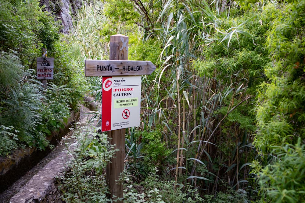
As I explained in the article, the canal path is closed and should not be walked on because of the danger.
El Batán, Bejia and two extraordinary gorges
Tenerife Anaga – Canal and Gorge Hike around El Batán
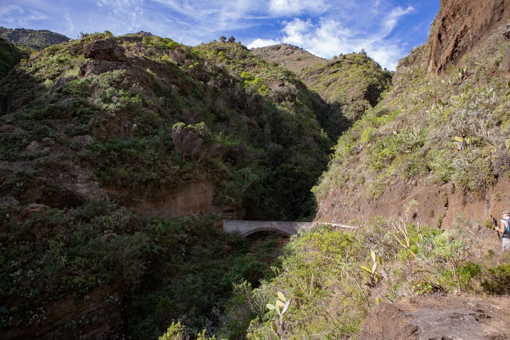
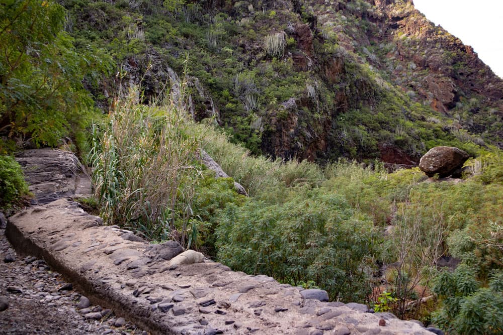
bridge over the channel in Barranco Seco
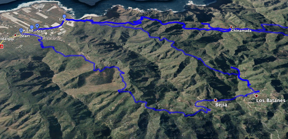
Map
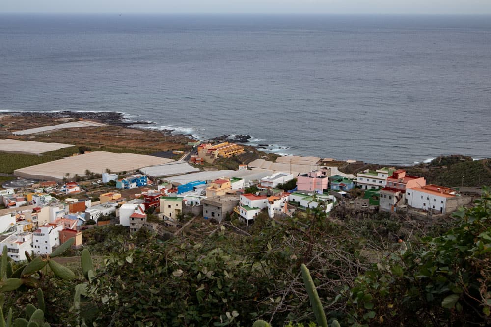
Today’s circular walk around the small town of El Batán in the Anaga Mountains on Tenerife starts at the coast in Punta del Hidalgo. From there you can hike up towards Cruz del Carmen.
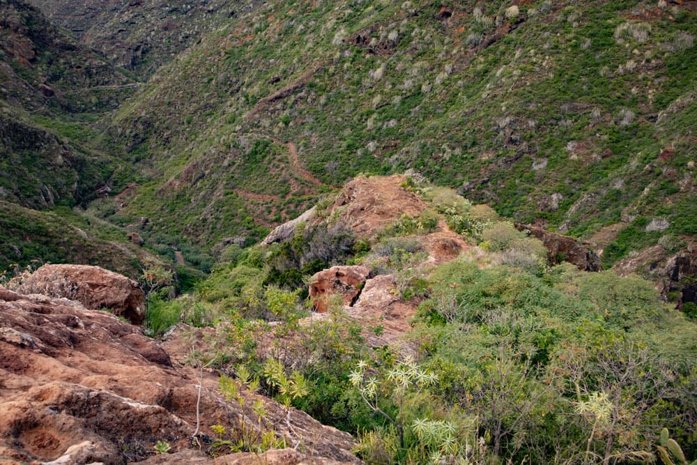
Half way you reach the beautiful mountain village El Batán. For the more adventurous, who don’t want to stay on the normal trail, the hike leads through a long channel high above the Barranco Seco.
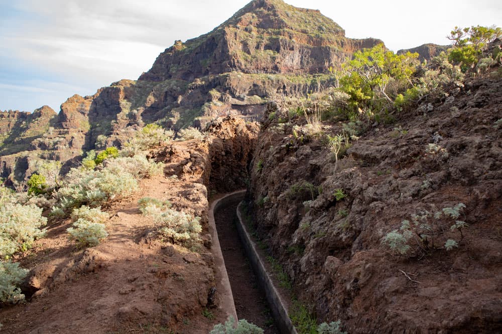
channel way Barranco Seco
Later you will descend via the small hamlet of Bejia to El Batán. Then you can go back through the Barranco del Rio or via Chinamada. Also through the Barranco del Rio a canal way leads. So you have many possibilities to get from El Batán back to Punta del Hidalgo.
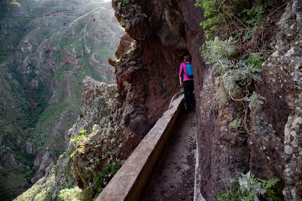
hikers on the channel - circular hike El Batán
Canal hikes around El Batán
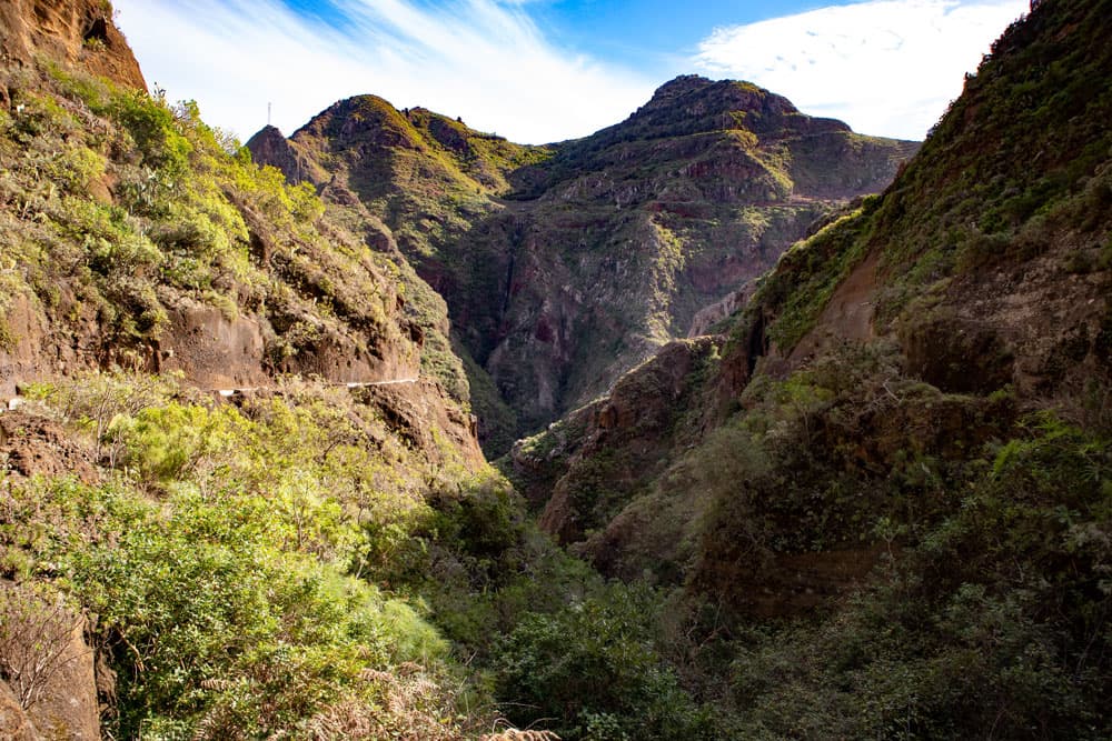
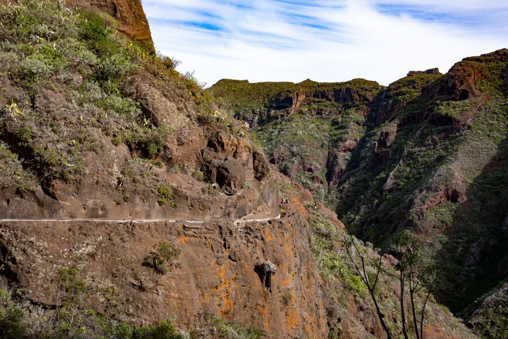
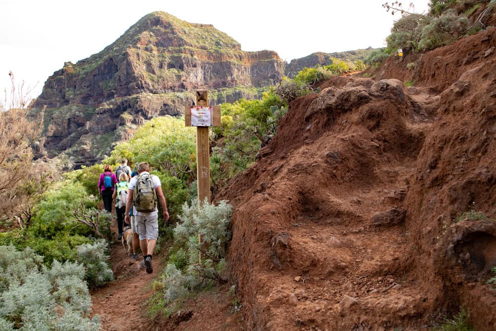
On this hike you hike up through the Barranco Seco and down again through the Barranco del Rio. If you want to experience something special while hiking, then the routes via the water channels are an alternative to the normal hiking trail. An experience of a special kind. But all channels are provided with warning signs. Nevertheless, at least in the well-preserved water channel above the Barranco Seco, there should be no danger in good weather. It is wide and in a really good condition, so that you can hike safely and well protected at any time. The prerequisite, however, is absolute freedom from vertigo, as the views from the canal are fantastic.
Start Channel Tour Barranco Seco
I only entered the canal in the Barranco del Rio in parts. It didn’t look very well preserved to me. Partly also rock pieces make it difficult to get through. But also there I saw hikers walking. Since I did not walk the way myself, but preferred the normal way through the Barranco del Rio, I unfortunately cannot give an exact description here. Maybe someone of you has collected experiences in the water channel. If this is so, I would be very happy about a comment or an addition to it.
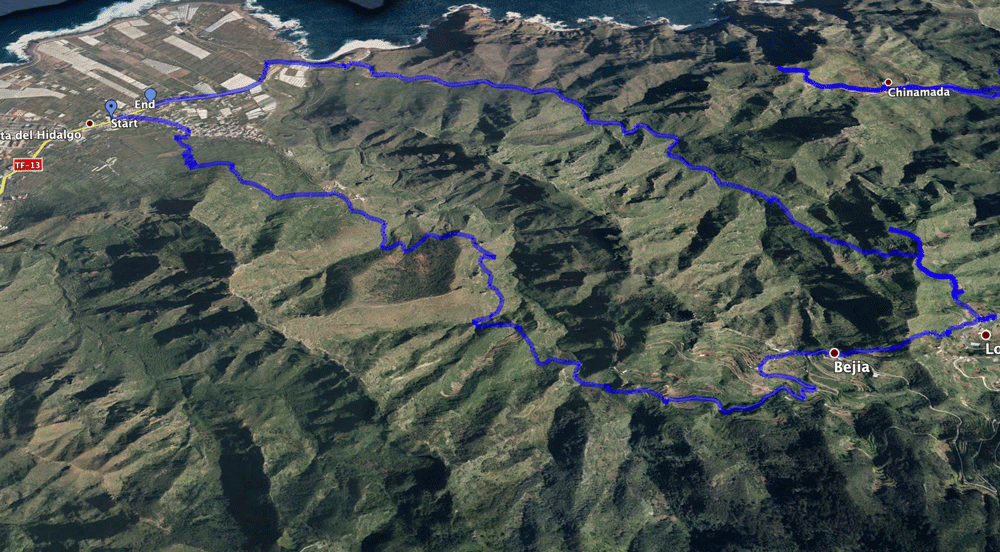
Track circular hike - Punta del Hidalgo - Bejia - El Batán - Barranco del Rio
General information about the round hike around El Batán
Starting point and approach
Starting point of this hike is the church in Punta del Hidalgo on the TF-13.
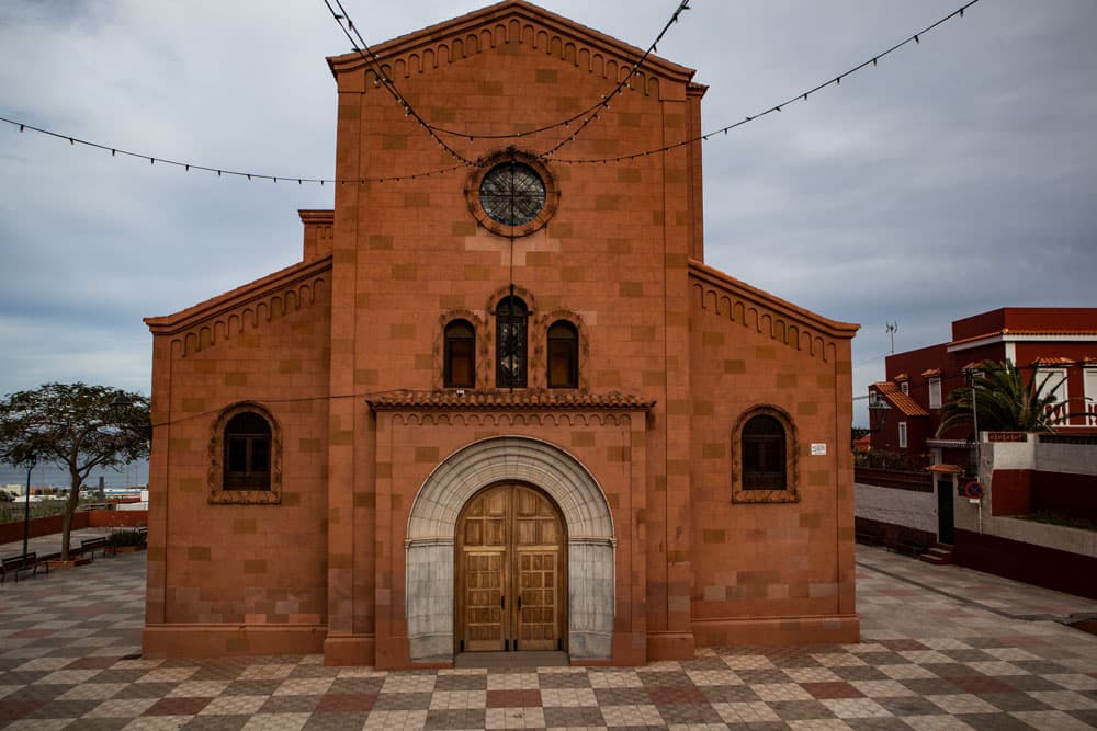
Starting point - church in Punta del Hidalgo
Arrival by car
You will reach Punta del Hidalgo via the TF-5. From the motorway you can either take the TF-13 or the TF-16 in the direction of Tegueste. From there you drive via Bajamar on the TF-13 to Punta del Hidalgo. You drive through the town on the main road for a while. The church is on the left side of the road. Parking is available all along the main road.
Arrival by bus
The Titsa bus lines 050 and 105 stop in Punta del Hidalgo almost immediately in front of the church. You can find out more about the exact times on the Titsa homepage. Time
I don’t like to give general time information for hiking tours, because the times are very individual. We needed about 7 hours for the hike. However, there were very long photo stays in the canal and in El Batán as well as some „side trips“. The pure hiking time is about 5 hours.
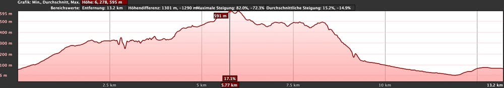
elevation profile circular hike Punta del Hidalgo - El Batán - Barranco del Rio
Article summary and large selection of GPS hiking tracks
Sign up for my newsletter now and get exclusive access to my collected GPS tracks as well as all the brief information about my articles.
Sign up nowDifference in altitude and distance
The difference in altitude in the ascent and descent is about 720 meters. As we have made some small detours in El Batán, it can be around 670 metres without a detour. The distance is almost 13 kilometres long.
Requirement
I would like to call this tour normal in the first part up to El Batán. You need fitness and a head for heights if you want to hike through the canal. Otherwise the part to El Batán runs on well marked hiking trails. However, the descent from El Batán to the Barranco del Rio is more difficult. You hike on paths that are not used much and are partly overgrown. The path is also not easy to find. Some passages in the descent are quite narrow and steep. Therefore absolute freedom from vertigo and surefootedness are necessary.
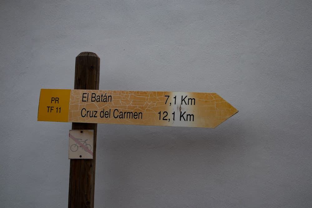
postsign El Batán in Punta del Hidalgo PR TF 11
If you want to walk through the canals, you should take a flashlight or headlamp with you, even if the tunnels are only short.
Refreshment
There are restaurants and bars at the starting point Punta del Hidalgo and in El Batán. There is a waterhole near the church square of El Batán. Therefore take enough water and food with you for the way.
Track circular hike and the track Punta del Hidalgo via Chinamada to Cruz del Carmen
Variants
This tour can be combined well with many other hiking and circular walks in the vicinity. To mention is the hiking tour from Punta del Hidalgo to Chinamada. You don’t go from El Batán to the Barranco del Río, but cross the same one and climb up to Chinamada. From there you go back to Punta del Hidalgo. You can also continue your hike upwards from El Batán towards Cruz del Carmen. And from Cruz del Carmen descend via Chinamada (very long hike). Or you can take the bus back from Cruz del Carmen to Punta del Hidalgo. Of course you can also do this tour in the other direction. You can – but don’t have to – walk the sections through the canal.
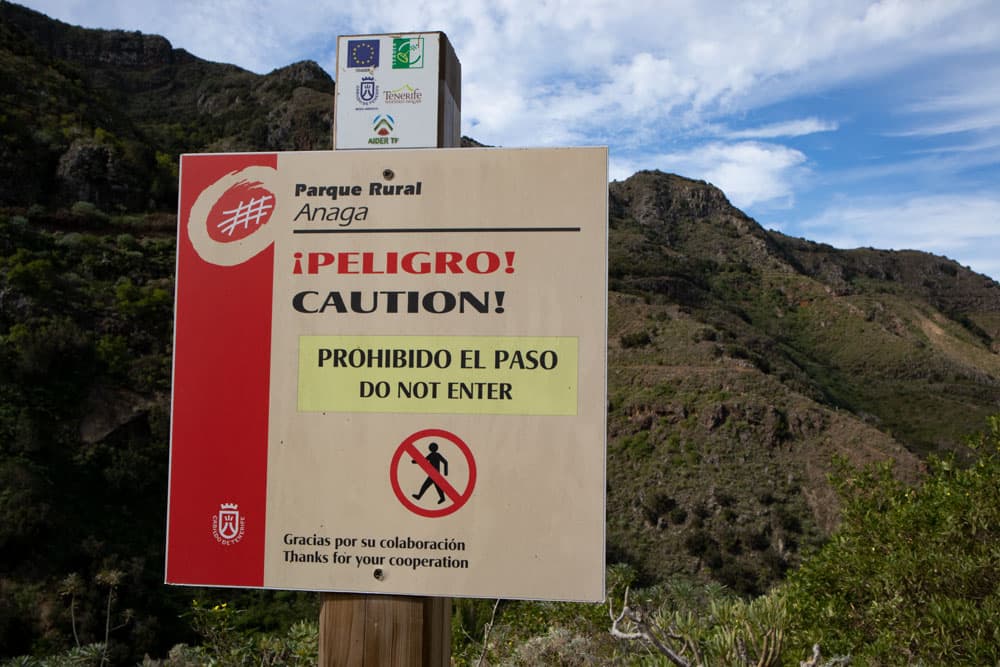
Caution sign - you may not use the channel way
And if all this is too long for you, you can only walk to El Batán and from there take the bus (Titsa 274) back.
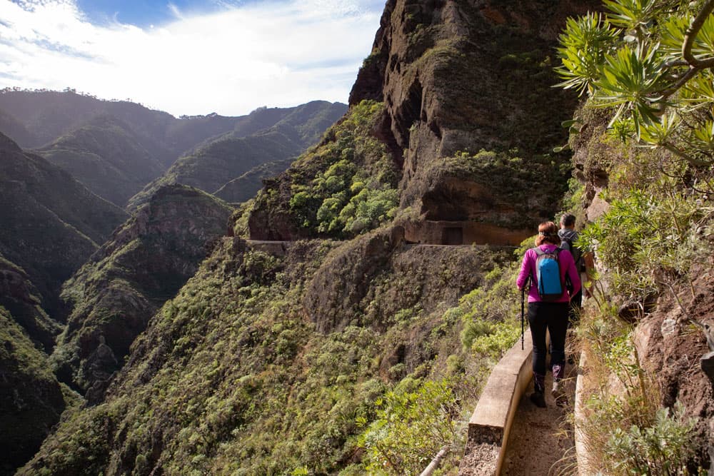
hikers in the channel
Circular hike Punta del Hidalgo – Barranco Seco – Canal – Bejia – El Batán – Barranco del Río
Section Punta del Hidalgo to farms at the end of the Camino el Homicían
You start your walk at the TF-13 opposite the church in Punta del Hidalgo. The signposted PR TF 11 trail begins diagonally opposite the church, towards El Batán and Cruz del Carmen. You walk uphill on the Camino de Callejón road. At the end of the road, the path forks. Turn right onto the Camino El Bucio. You can also turn left and follow the Camino el Homicían straight ahead (shorter but not as scenic as the path).
view to Punta del Hidalgo
The hiking trail along the Camino El Bucio will get you out of the village in no time at all. On a wide path you now hike uphill in serpentines, quickly leaving the village of Punta del Hidalgo below you. You hike through meadows and terraced fields and already have some good views over Punta del Hidalgo. Later the trail meets the Camino el Homicían at some farmsteads. You turn right on the gravel path and follow the path marked white and yellow.
junction hiking trail Cruz del Carmen and on the left side channel way
Section of road from farmsteads at the end of the Camino el Homicían to Barranco Seco water channel
For a while the path that turns into a path leads you straight ahead. Then you come to a fork. Continue straight ahead along the normal PR TF 11 path towards El Batán. Since I haven’t walked this section yet, I can’t write anything about it at the moment. But before Bejia it meets the canal again. At the fork on the left there is the path that takes you to the entrance to the canal.
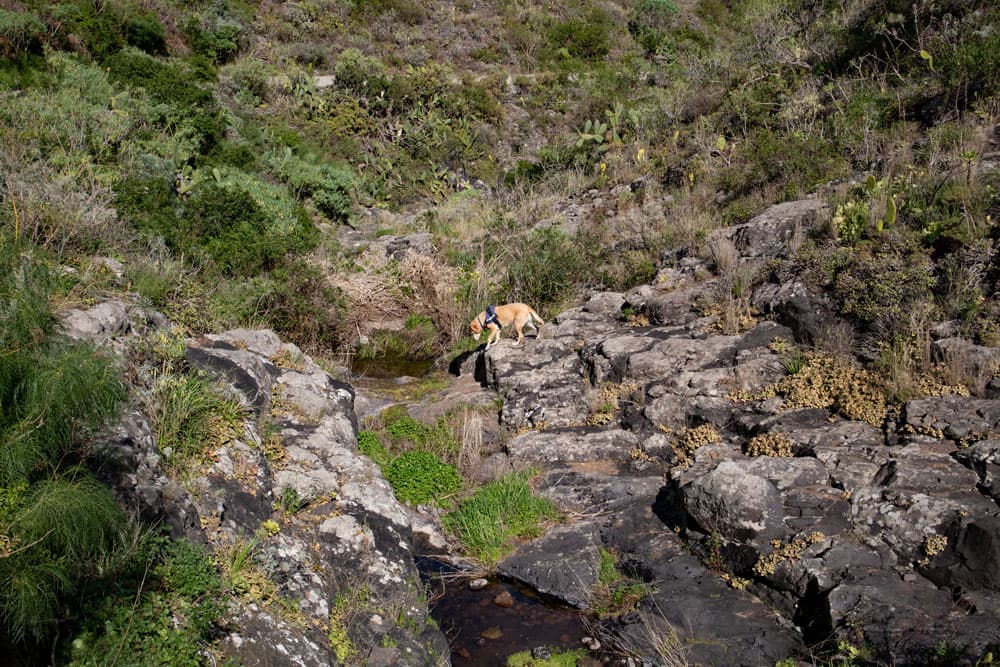
my hiking dog Laso in the Barranco Seco
Article summary and large selection of GPS hiking tracks
Sign up for my newsletter now and get exclusive access to my collected GPS tracks as well as all the brief information about my articles.
Sign up nowYou follow the path first straight and then downhill and cross a side valley. Then you stand in front of the canal. From now on the canal will lead the way. It is wide and deep enough so that you are well secured. From time to time you have to pass some rock ledges. There is room – even if sometimes you have to go into the „draught“. You pass through short tunnels, galleries and have an impressive view into the Barranco Seco (not to be confused with the Barranco Seco in the Teno mountains).
hikers in the Barranco Seco
Section Barranco Seco to Bejia
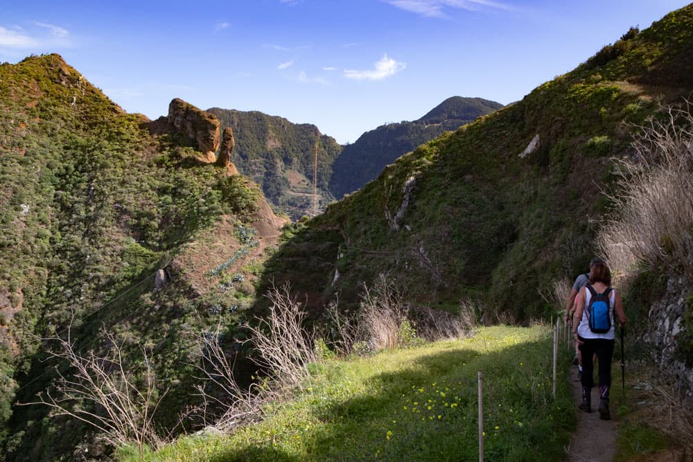
You follow the water channel over a bridge and through a 100 meter long tunnel. The canal trail ends in the upper part of the Barranco Seco in the Barranco bed. From here a steep path takes you up in serpentines and around a rock. When you reach the top, you have a wonderful view back over the canal hiking trail, which now lies deep below you. You go up a little further and then meet a road.
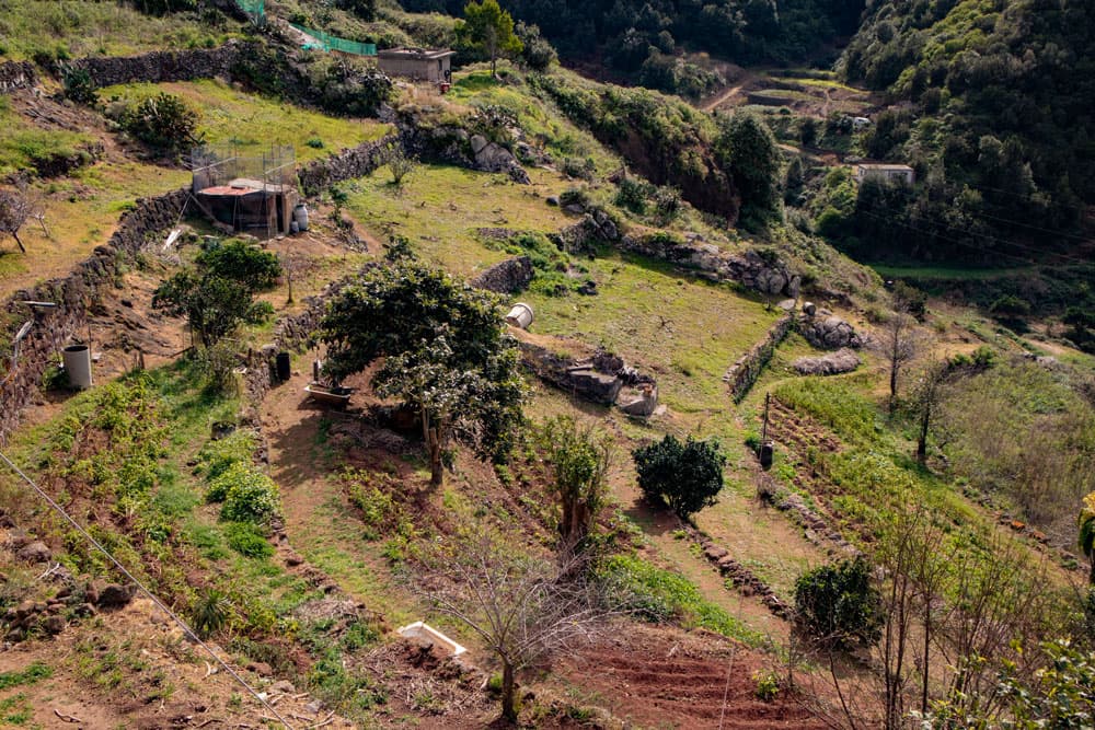
gardens and fields around Bejia
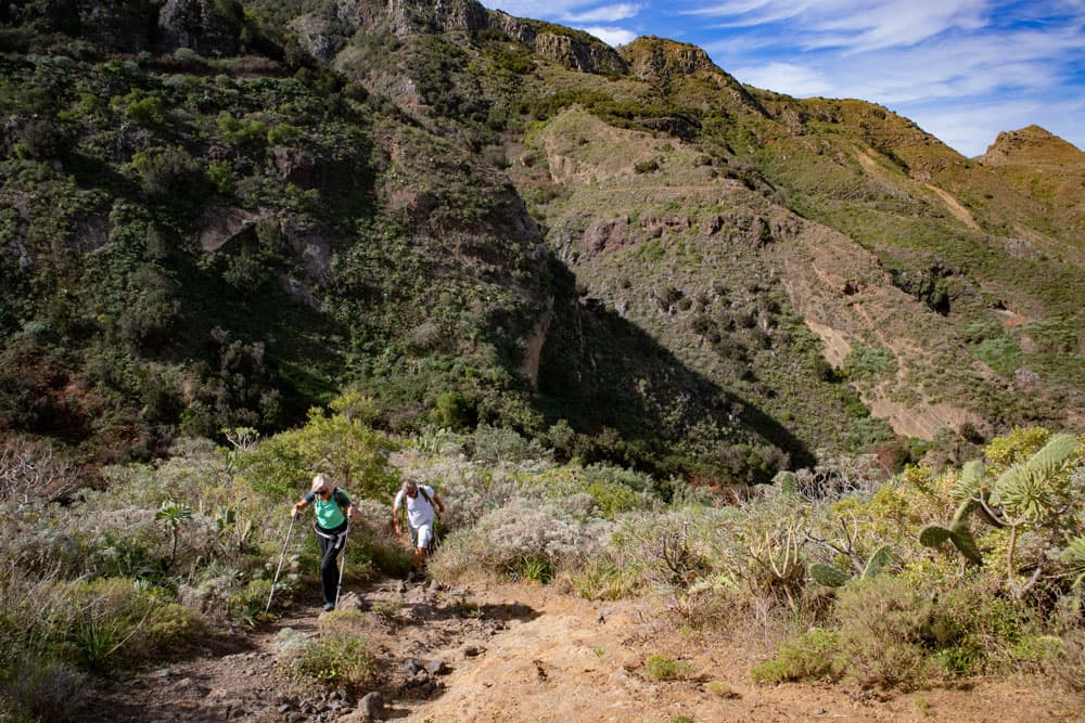
This is where the PR TF 11 hiking trail joins, which from now on joins the described trail again. You are already in Bejia and walk along the road for a while. Then the footpath turns left off the road. It goes up to the higher houses of Bejia on a sometimes railing secured path. At the top, you have reached the highest point of the hike. From here you have a good view into the Barranco Seco behind you and the Barranco del Rio in front of you.
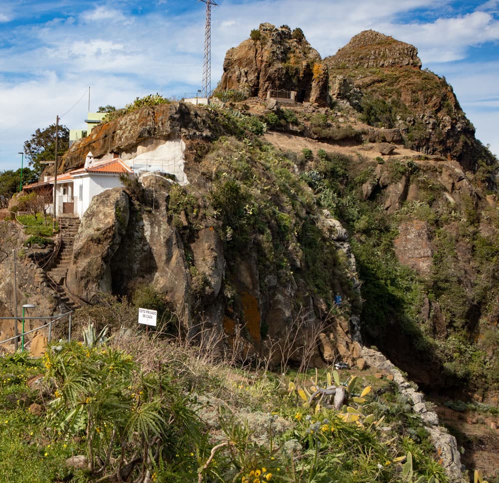
the little village of Bejia
Section Bejia to El Batán
In Bejia follow the hiking trail to the summit. From the ridge you can see the hamlet of Bejia with its gardens and fields. The path leads into a road, which you follow to the left. Then the footpath to the left of the road takes you along the left side of the mountain slope. You come over a small saddle, from where the trail descends steeply in small serpentines to the village of El Batán. On the way down you can see the Barranco del Rio and El Batán. The path passes a nice picnic area with tables and benches.
hiking path in Bejia
In El Batán you finally get out via stairs close to the church square. The place is pretty and worth a short stay. From the church square you can look into the Barranco del Rio and Chinamada. There is also a waterhole here, so that you can fill up your water supplies if necessary. From El Batán there are hiking trails to Chinamada and Cruz del Carmen. But here I present a route through the Barranco del Rio back to Punta del Hidalgo.
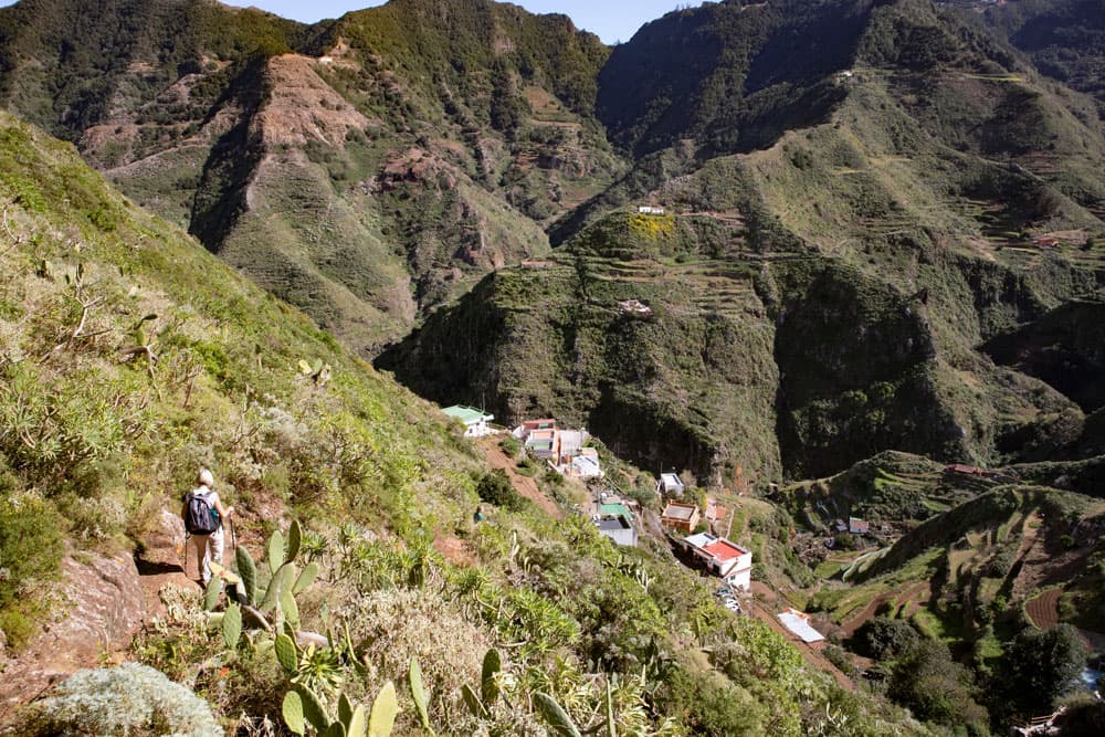
descent to El Batán
Section El Batán to Barranco del Rio (Barrancobett)
If you go back a bit from the church square, on the right of the main path there is a signposting for a footpath to Punta del Hidalgo. This is a very old path that is sometimes difficult to find. If you look at my track, we started by walking back and forth a few times. The background was also a small detour to a hill from where we hoped to have a better view of the path. At the first fork keep left and walk along a slope up a ridge. Right at the beginning of the ridge, the path descends sharply to the left.
Steep descent over a ridge into the Barranco del Rio
The path is very steep, partly overgrown and the branch is not easy to find. For the steep descent into the Barranco del Rio you need absolute surefootedness and a head for heights. The path is narrow and often leads directly along the abyss. After you have hiked out of the bushes and terraces, a passage runs freely and steeply over a mountain ridge. It remains difficult for some time. Under no circumstances should you choose this route if the weather is bad. Extreme caution is advised. But since the path is very steep and therefore brings you quickly downhill, you will also be in the bed of the Barranco del Rio after a short time.
Barranco del Rio - Start point second channel
Section Barranco del Rio to Punta del Hidalgo
When you arrive at the bottom of the Barrancobett between bushes and boulders, the path leads you very quickly to a wall where the canal path begins on the left. At first you can easily walk in the canal. Then there is a sign that the canal path is dangerous and not to be walked on. In fact, after a short time you will come across a rock that can hardly be bypassed. It is only possible to follow the normal path through the Barranco first and then climb up to the canal again later. We didn’t do it and followed the way through the Barranco del Rio.
junction hiking trail - second channel
The path leads you along small waterholes and over rocks. Sometimes it runs through bushes, then again on the left or right Barranco side. From time to time the path is a little hard to find, but you can’t get lost because the Barranco gives the way. It feels like this stretch is very long, as you follow the meanders of the gorge further and further. But at the end you arrive exactly at the point where the hiking trail to Chinamada from Punta Hidalgo climbs. You follow the main path with a view of the coast up to the TF-13 road. At the big square keep left and follow the road back to the starting point church.
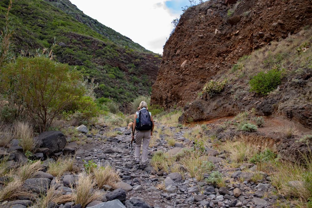
hiking through the Barranco del Rio
And finally
I hope that you also enjoyed this beautiful circular hike in the Anaga mountains around El Batán. Be careful on the canal paths and the descent from El Batán. And if you have your own experiences on this tour, I am looking forward to your comments and additions. Have fun hiking,
Dagmar von SiebenInseln