Montaña Cascajo – Hiking below Teide
With the hike around the Montaña Cascajo and to the summit of the Montaña Corredera I would like to introduce another hike at the foothills of the western slopes of the mighty Teide.
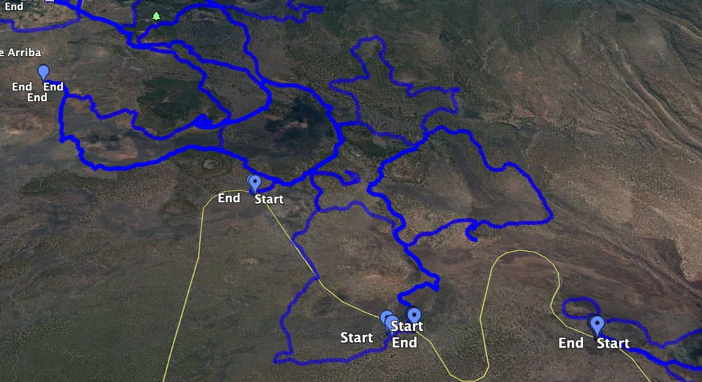
Map
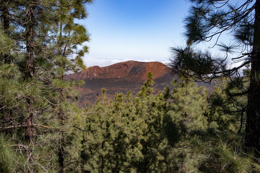
View of the Chinyero
This big circular hike leads you first into the volcanic landscape below the TF-38. After a big curve you will cross the road and now climb further on the other side of the pine-covered slopes.
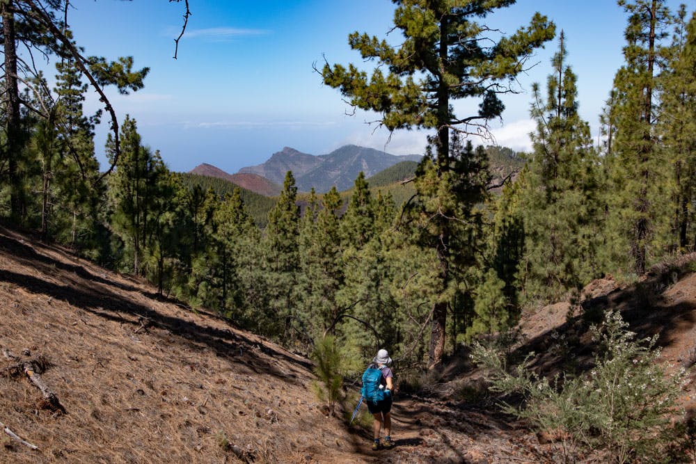
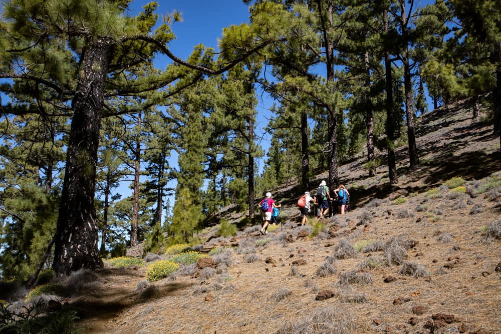
Hikers on the way around the Montaña Cascaja
After you have started to circumnavigate the Montaña Cascajo, which you will continue later on, the highlight of this hike is the ascent to the Montaña Corredera. In this beautiful volcanic landscape below the Teide I have already introduced some hikes here on seven islands. Thus, a hike leads around the Montaña Corredera and up to the Montaña de las Cuevitas. Further combination possibilities with the hike Montaña Cascajo can be found below under the point variants. 
Track of the hike around the Montaña Cascajo and to the Montaña Corredera
General information about the circular hike Montaña Cascajo
Starting point and approach
The tour around the Montaña Cascajo starts at the TF-38 (between Chío and Boca Tauce) shortly before kilometre 12. There is an obvious turn off to a picnic area Zona Recreativa de Chío. Follow this path for a few hundred meters and you will find yourself in a car park at the picnic area. 
Montaña Cascajo - starting point parking lot
Arrival by car
If you are coming from the south of Tenerife and also from the north on the island motorway TF-1, take the motorway exits Guía de Isora or Chío. Then take the TF-38 towards Teide National Park. If you come from the centre of the island via the Cañadas road TF-38, drive in the direction of Chío or Santiago del Teide. The first one turns right, the last one left from the road to the Zona Recreativa de Chío.
Arrival by bus
Unfortunately there is no bus line that runs here on the TF-38 between Chio and Boca Tauche. Therefore it is only possible to get there by car.
Time
I do not like to give general time indications for hiking tours, as the times are very individual. We needed for this tour with an extensive picnic a little more than 4.5 hours.

Elevation profile of the hike around the Montaña Cascajo and on the Montaña Corredero
Difference in altitude and distance
The difference in altitude is about 500 meters. The distance is almost exactly 13 kilometres long.
Requirement
Article summary and large selection of GPS hiking tracks
Sign up for my newsletter now and get exclusive access to my collected GPS tracks as well as all the brief information about my articles.
Sign up nowAn easy tour that can be mastered by everyone with good physical condition.
Refreshment
There are no restaurants and bars. Therefore take enough water and food with you.
Tracks of circular hikes that can be easily combined with the circular hike around the Montaña Cascajo
Variants
This tour can be combined well with many other hiking and circular walks in the vicinity.
Worth mentioning are in particular:
Steep up to the Montaña Corredera
Hike around the Montaña Cascajo and on the Montaña Corredera
Section picnic area Zona Recreativa de Chío to TF-38
You start your circular walk at the parking lot of the picnic area Zona Recreativa de Chío. From there you cross the picnic area downwards to the west. Follow the signs to Chío on the hiking trail. From the picnic area it is 6.7 kilometres to Chío. You walk through an impressive dark volcanic landscape.

Hiking sign direction Chío
If the weather plays along, you will have a fantastic view of the south coast, the Teno mountains, the Teide and the Pico Viejo. After you have walked about 1.5 kilometres downhill and have already lost 200 metres of altitude, you leave the hiking trail to Chío. Turn right from the path onto a small path. Now you walk in a wide arc past big rocks and volcanic rocks back to the road TF-38.

Montaña Cascajo - Rocks along the way
Section of road TF-38 to Montaña de la Corredera
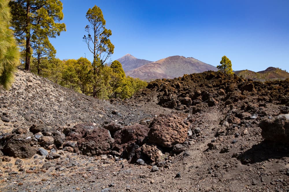
You cross the TF-38 and the trail continues on the opposite side. Follow it around to the left up the slope. To the left of you on the other side of the road is the Montaña de Los Guirres (1507 m) and diagonally behind you the Montaña Cascajo, which you start to circle from here. The wide path runs parallel to the road for a while.
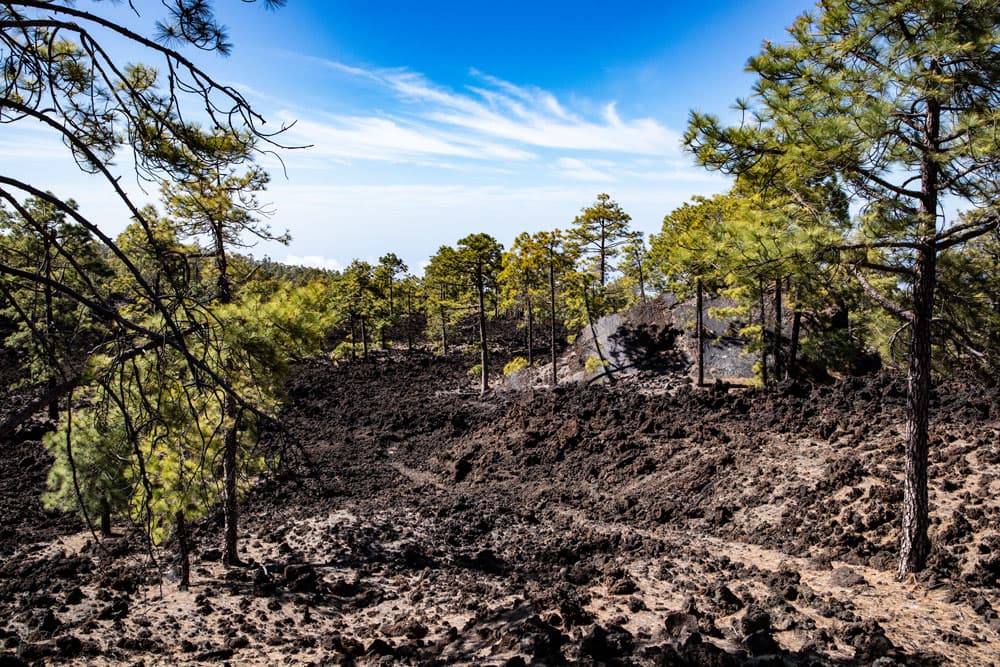
barren volcanic landscape with pine trees
Then it takes you right around from the road up the mountains. First you pass lonely dark volcanic landscapes. But then you slowly get a bit green and the first pines along the way. After some time they become more and more dense. You leave the Montaña Cascajo behind you and walk on the left side of the Montaña de la Corredera. It goes up the slope between pine trees.

Black volcanic landscape, green pines and blue sky
Article summary and large selection of GPS hiking tracks
Sign up for my newsletter now and get exclusive access to my collected GPS tracks as well as all the brief information about my articles.
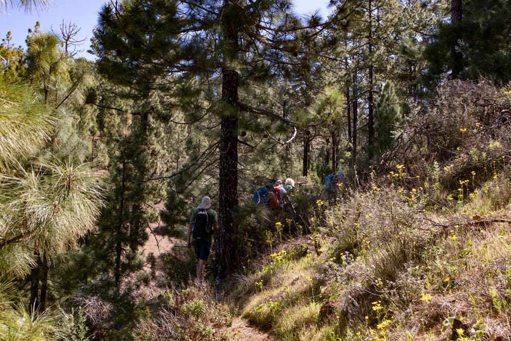
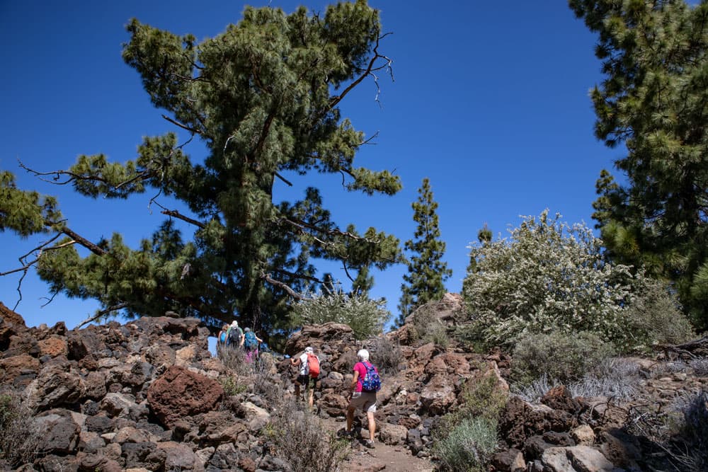
Sign up nowYou are on a narrow path on a slope in the pine forest. From time to time it may be necessary to avoid obstacles such as fallen tree trunks. After some time a steep path branches off to the right. You follow this path. It will take you further up the left side of the slope. From time to time you have a good view of the surrounding mountains through the pines.
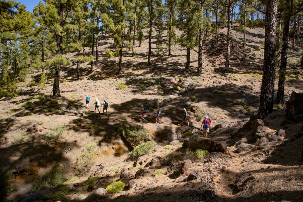
Hiking trail through the pine forest to the Montaña Corredera
Finally the path leads you through a wide valley incision. On the other side it’s very steep again. And then you made it. You are on the summit plateau of the Montaña de la Corredera and thus approx. 1640 height meters high. On the summit plateau you can do a big round and enjoy the wonderful view in all directions. A rest on the summit is also an ideal option.
Hiking trail downhill through a lot of green
Section of the summit of the Montaña de la Corredera to the fork in the road Chinyero circular trail
When you have enjoyed the summit long enough, you go back on the same path you took to the summit. You go this way until you are back on the path through the pine forest. Now follow it around to the right. After a very short time this path will bring you to the Circular de Chinyero. Now you are on the circular path around the volcano Chinyero. 
Montaña Chinyero
Now follow this path for some time. To your left there are wonderful views of the Chinyero volcano. You climb further on the circular path. For a short time the path leads you downhill again. To the right of you is the pine forest and to the left the Chinyero and a very barren volcanic landscape. At a fork in the road, the circular path around the Chinyero continues to the left. But you keep to the right.
View on the Teide and Pico Viejo
Section of the road forking Chinyero round road to wide road from Arenas Negra
The trail now leads you uphill along a wooded side of the slope. Then the forest thins out. You pass through a very wide valley incision. After you’ve climbed up a little again, you’ll come to a wide road coming from Arenas Negra. Turn right into it. It will take you uphill along the right side of the slope. Once again you can enjoy beautiful views.

Hiking through lonely landscapes
Finally you reach the highest point of the hike with approx. 1680 m altitude. You are now close to the summit of the Montaña Corredera again, on which you can easily look down from the driveway. From now on you only go downhill again. On the wide road you can’t miss the path. It runs in wide arches along the slope side.
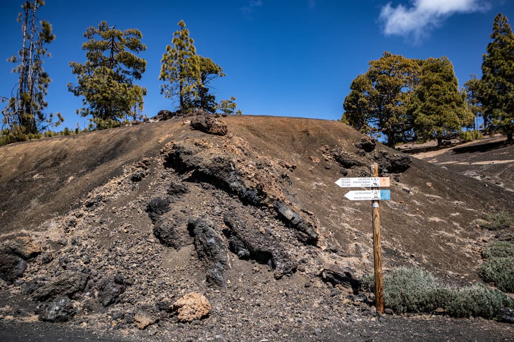
Signpost at the TF-38
Section of wide road from Arena Negras to Zona Recreativa de Chío
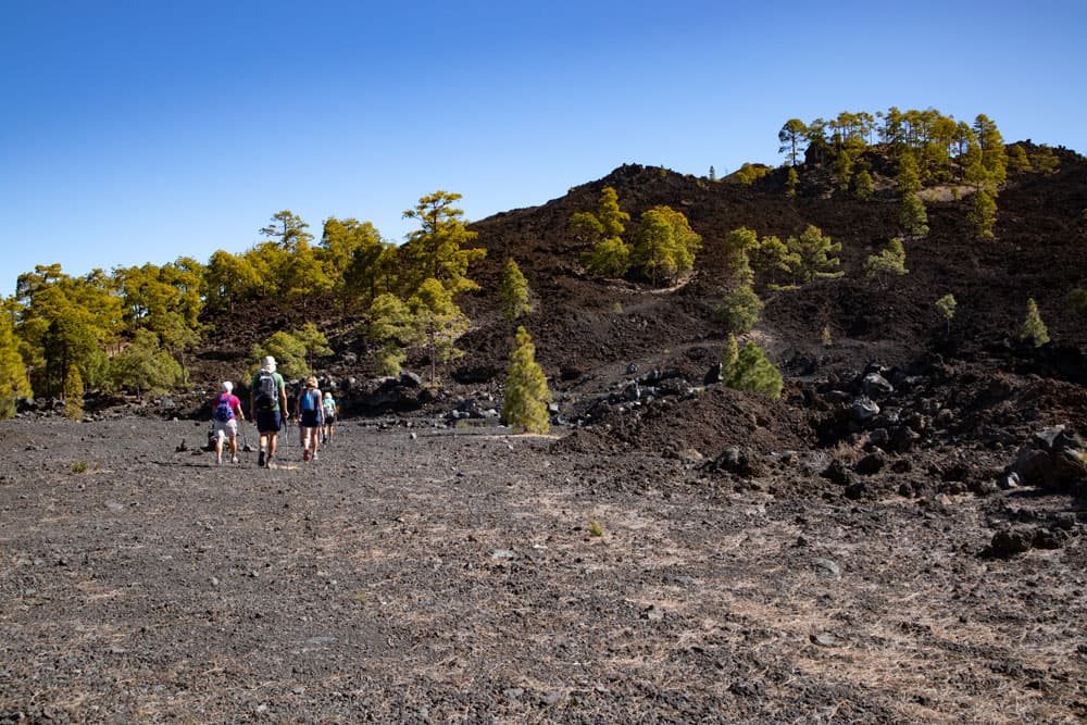
Follow this wide road straight ahead for a very long time. This is the long-distance hiking trail BC 1 and at the same time the road to the picnic area Arenas Negra as well as to the place La Montañeta. After some time you get back to the Montaña Cascajo. It is now right next to you. On the way you walk along its left side. At one point the path makes a small junction around a branch of the Montaña Cascajo.
Hiking trail passes the Circular Chinyero
When you have reached the front of the mountain, the path descends through lava fields. After a short time you will meet the TF-38 again at km 12 at 1625 m altitude. There is a small parking lot here. You cross the road. On the other side of the road you can take a small path back to the starting point, the Zona Recreativa de Chío.

Wonderful view from the top to the Teno Mountains
And finally
I hope you enjoyed this circular walk. The big advantage is that it can be combined with many other hikes you can find here on Seven Islands. Whichever route you choose, I wish you lots of fun hiking,
Dagmar von SiebenInseln