Taganana – an idyllic place and hiking hub in the Anaga Mountains
In the Anaga mountains there are endless beautiful hikes. But a real hiking hub is the remote village of Taganana. Taganana is located at the northern tip of the island of Tenerife and can be reached via a winding, narrow serpentine road. The village itself is built on a steep rocky ridge. The picturesque houses and alleys can be explored almost exclusively on foot.
Map

Starting point Taganana Plaza
Everything in and around Taganana with its winding alleys seems cosy, natural and still untouched. Since I have a long drive to the Anaga mountains myself, I prefer to stay a few days a year and then hike around the area. In February 2020 I was allowed to spend a hiking holiday week in Taganana. I liked the old settlement, the simple accommodation and the untouched nature so much that it was certainly not my last stay there.

Bridge over the Barranco in Taganana
In the village centre there are cosy bars and restaurants and the small church Nuestra Señora de las Nieves y San Blas, which dates back to the 16th century. In front of the church there is the central plaza that is the meeting point of the villagers every evening. But what I specially liked was the little food shop at the other side of the Barranco. It is hidden and inconspicuous at the roadside. In the small shop there are, beside the daily needs and fresh bread, fruits and a lot of fresh vegetables of the region.
Hiking in Taganana

Hiking trail along the church
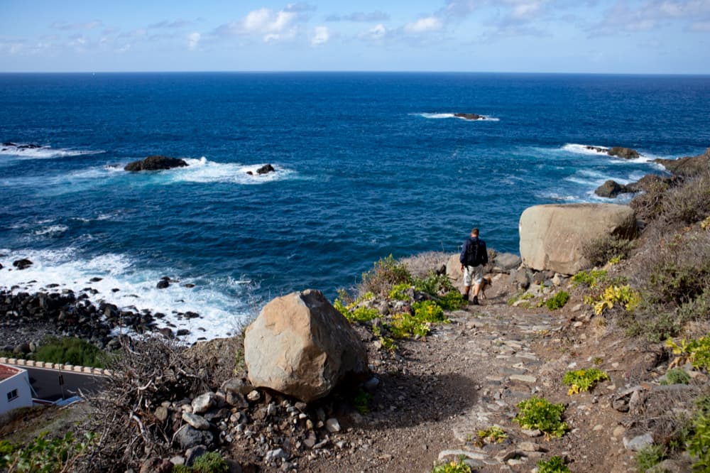
For hikers, this area is a real El Dorado, which meets all requirements. It ranges from the old donkey path „Llano de los Loro“, which used to be the only access path to the village and which is now used for hiking, to the rugged slopes for high demands of experienced climbers. The sea, bathing beaches and idyllically situated fish restaurants by the sea also invite you to stay. Taganana is a place you should not miss when you are hiking in the Anaga mountains.
Hiking tours around Taganana
On Seven Islands I had already presented the big round trip from Afur via Taganana. And also the Great Anaga Hike starts very close to Taganana. Also the round tour into the Valle Brosque borders on today’s tour. And finally there is another round tour from Taganana via La Cumbrecilla up to Bailadero and back via Gollada Abicore. 
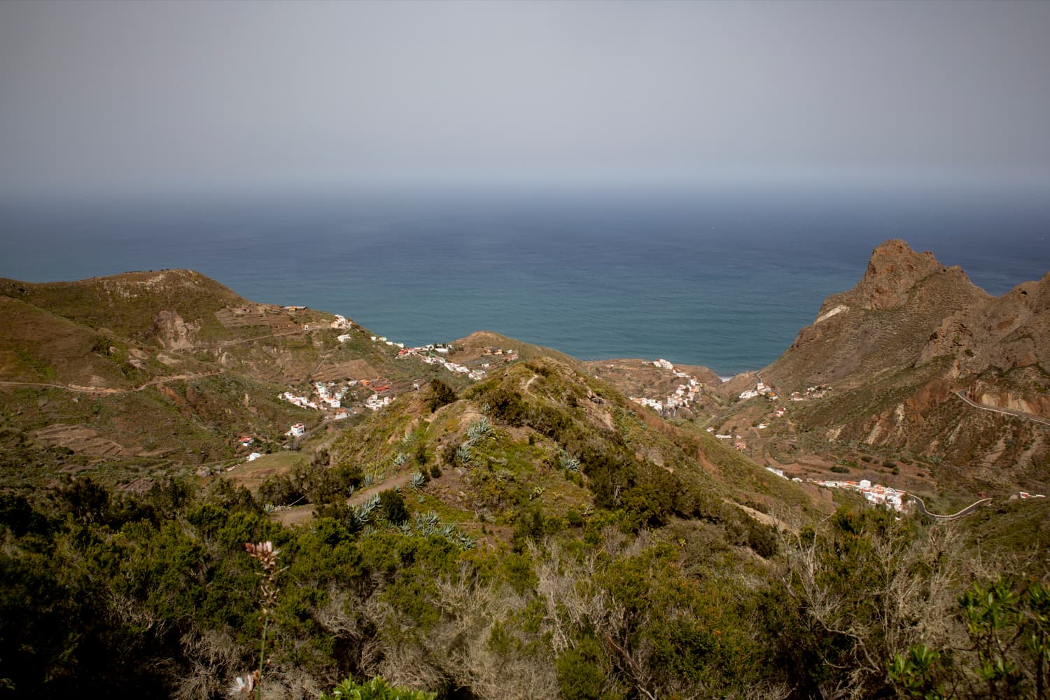
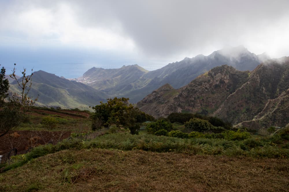
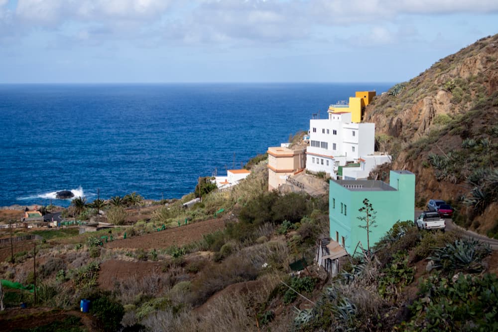
View of Taganana, the coastal villages and the mountain ranges
Today’s tour starts in the center of Taganana at an altitude of about 160 meters. From there you will climb up a steep path to the Casa Forestal de Anaga at 832 meters altitude. Afterwards you will walk parallel to the Anaga height through cloud forests and past lonely farmsteads. Finally, you descend in a large arc and reach the sea at the impressive rocks high above Taganana near Almácige and the Roque de las Bodegas. From there, you follow the coast back to Taganana. A really diversified hiking tour. But during the ascent, first some thick clowds and also a little rain accompanied us. You can see that in the pictures. But later the weather cleared up and even the sun showed up. Rain and clouds are quite common in the Anaga mountains. But you can also find an overwhelming green nature in the north.
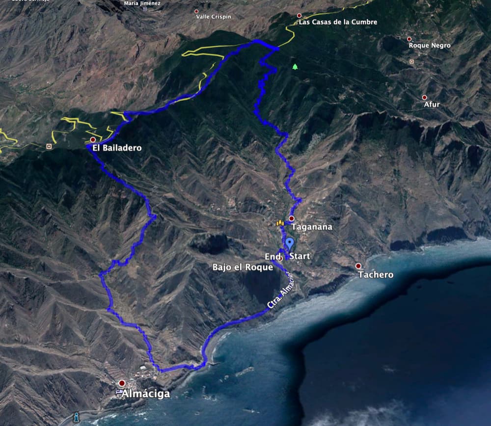
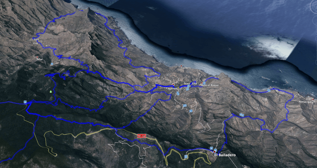
Track of the circular walk Taganana - Casas Forestal - El Bailadero - Almáciga
General information about the circular hiking tour Taganana – Casa Forestal – Roque de las Bodegas
Starting point and approach
You start your walk in the centre of Taganana on the small plaza in front of the church. You cannot go there by car. Cars stay in a small parking lot outside the village on the main road Camino la Cuestilla in a sharp right turn or at the roadside. From the small car park, go up the stairs to the village, keep left on the path and after a small steep climb you are already in the village square.
Access by car
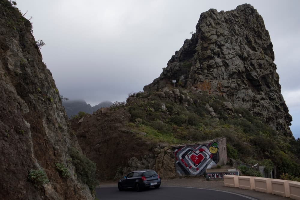
You can reach the village by TF 13 and TF 12 via La Laguna or from the south side by TF 11 and TF 12 from San Andrés. Shortly before El Bailadero the road splits and you turn off on the TF-134 towards Taganana. The road leads through a tunnel and then in many serpentines down into the village.
Approach by bus
Titsa bus line 946 goes to Taganana. It stops at the main road near the centre of the village. There are more stops at the bottom of the coastal road, so you can get on there on your way back and shorten the walk a little. If you only want to walk halfway, you can also get on or off the bus in El Bailadero. The bus lines 946, 947 and 77 stop there, details can be found on the Titsa homepage . Article summary and large selection of GPS hiking tracks
Sign up for my newsletter now and get exclusive access to my collected GPS tracks as well as all the brief information about my articles.
Sign up nowTime
I do not like to give general time indications for hiking tours, as the times are very individual. We needed 6,5 hours for this quite big hiking tour with some long breaks.
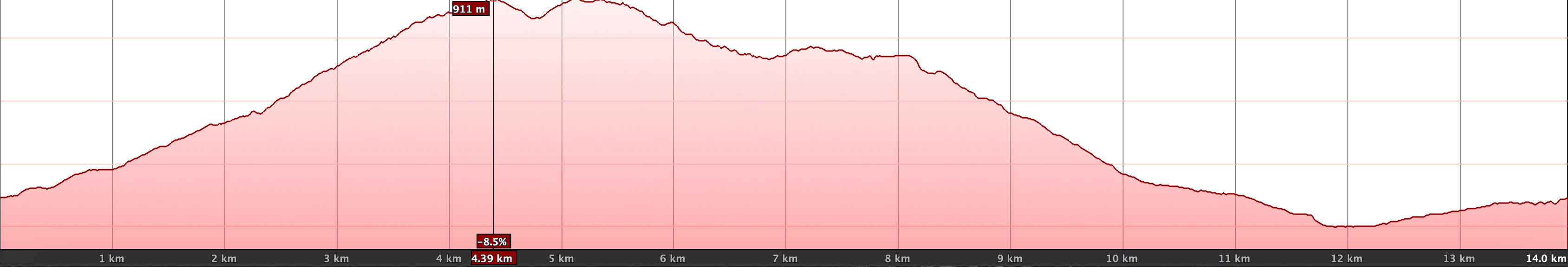
Elevation profile of the hike Taganana - Casa Forestal - Almácige - Roques de la Bodega
Height difference and distance
The difference in altitude is about 1100 meters and the route is a little over 14 kilometers long.
Requirement
A long and strenuous hike for which a good physical condition is necessary. But the hiking trails themselves are well maintained and easy to find.
Refreshment
Restaurants, bars and shops can be found in Taganana and on the coast. But be sure to take enough water with you.
Variations and other circular walks near Taganana
Variants
If this tour is too long for you, you can also split it in two parts (ascent, descent) and go back by bus. This way you could start or end the hike in El Bailadero or in Almáciga. There is another possibility to shorten the tour on the way back. On the descent, you do not walk all the way down to the sea, but halfway up you branch off to the PR TF-4 path to the left, which takes you back to Taganana (described in the text).
There are also many other hiking trails in the Taganana area. On Seven Islands I had already introduced the big round trip from Afur via Taganana. And also the Great Anaga Hike starts very close to Taganana. Also the round tour into the Valle Brosque borders on today’s tour. And finally there is another round trip from Taganana via La Cumbrecilla up to Bailadero and back via Gollada Abicore. 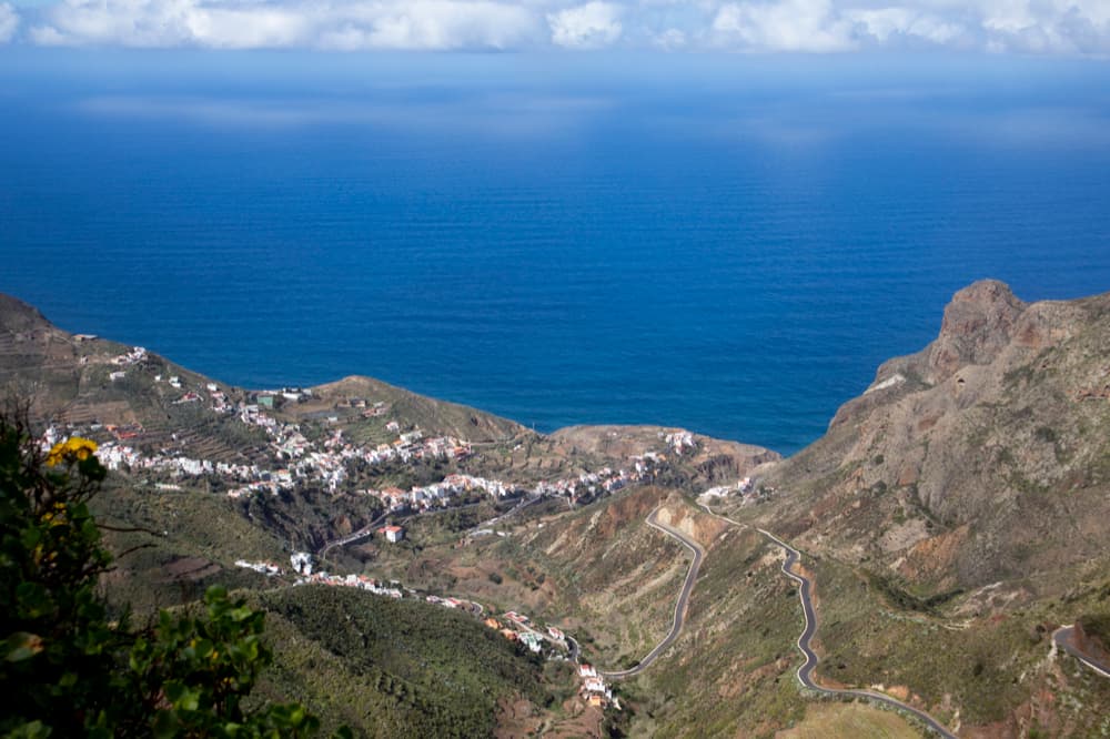
View from the height (Bailadero) on Taganana and the sea
Big round trip Taganana – Casa Forestal – Roque de las Bodegas
Route section Taganana village square to start of cloud forest
You start your walk on the village square in front of the church in Taganana. There is a paved path, the Camino Cruz de Limera, which you follow to the left (along the church). Don’t be irritated by my track, which starts a little further down the road, because that’s where I used to live. You pass a nice water cooler and descend into the Barranco, which you cross over a bridge. Then a big dragon tree comes up and you take the first road to the left. The trail is marked yellow and white. This is the Camino Portugal, which takes you a little bit steep up to the district Portugal. At the top, the road leads into a kind of small square or wide road (Caserio Portugal).
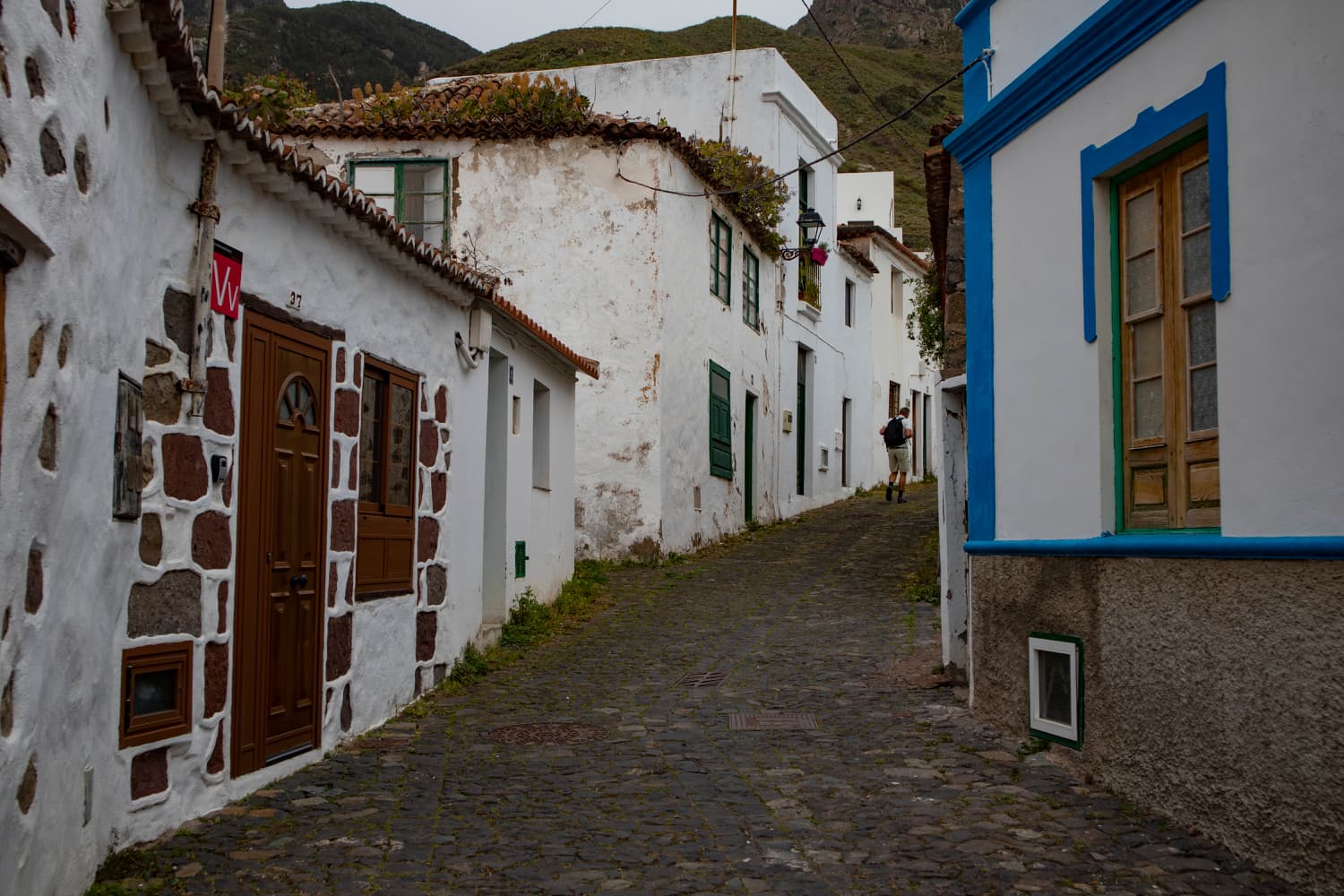
Alley and hiking trail through Taganana
From there you turn left onto the road Caserio Los Naranjos. After a short time, the PR TF-8 hiking trail to Casa Forestal branches off on the right-hand side, signposted. This path, partly paved with stones, climbs steeply between fields and planted terraces. After a short time the trail branches off to the right to Afur. Here it goes to Cumbrecilla (see tour here). But keep left and after a while you will reach the cloud forest. 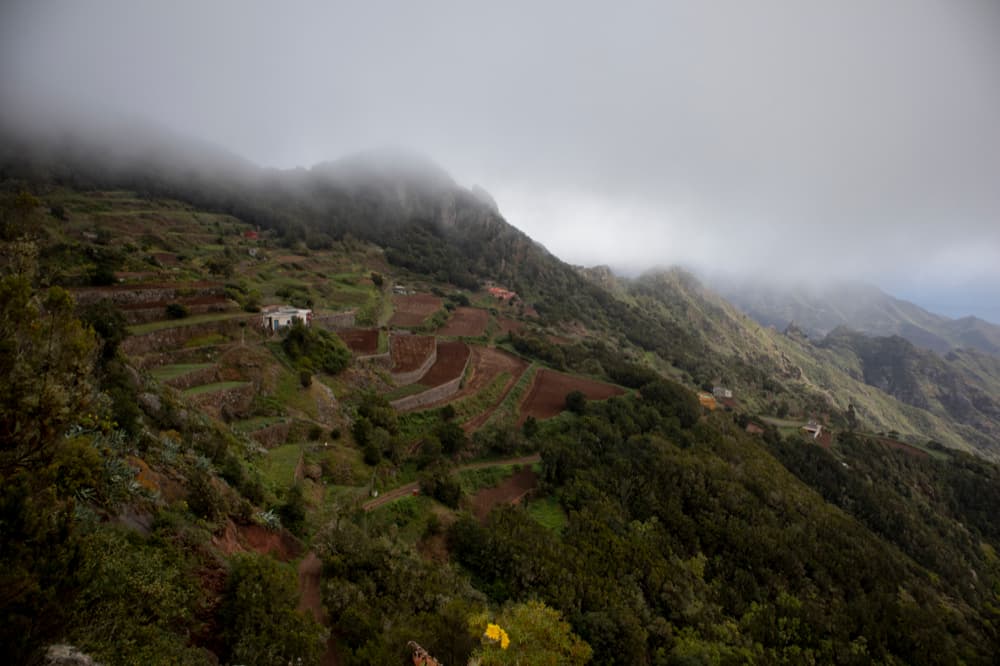
terraced fields on the mountain slopes
Section cloud forest to the Gollada Abicore
Now it gets a little more exhausting. Because it feels like the path is winding up the mountain slope in very steep serpentines. Unfortunately we had rain and no visibility on the last ascent. The ascent takes about one hour. Then you come to a fork in the path at a brick cave. You pass this fork on the hike Valle Brosque . If you don’t know Casa Forestal (today also Policía Local), you can go down to the right in 5 minutes and walk to the Anaga High Street. Otherwise you go straight ahead on the same way you come back on the Valle Brosque tour. Article summary and large selection of GPS hiking tracks
Sign up for my newsletter now and get exclusive access to my collected GPS tracks as well as all the brief information about my articles.
Sign up now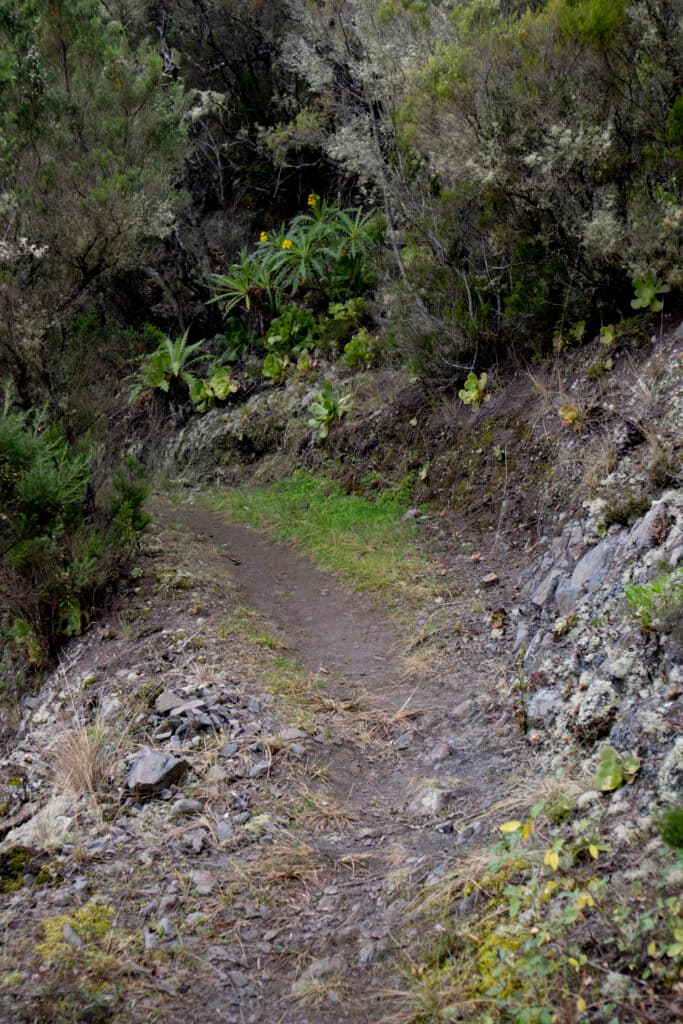
Hiking trail up to the Casa Forestal
The path climbs slightly uphill and after a while goes downhill. You reach a fork in the path. Straight ahead you continue with the PR TF-3 into Valle Brosque. But you go uphill on the narrow path on the left. From here, you follow a narrow path along the slope of Roque de los Pasos, always slightly downhill. You hike parallel high above the high altitude road TF-12. From time to time you can now have a look at the other Anaga side towards Santa Cruz de Tenerife. Finally you reach the TF-12 at Gollada Abicore, where the descent begins on the left via the Abicore hiking trail to Taganana. I will describe this path in the next article. You can combine both tours wonderfully. But on this big hiking tour you cross the road and continue your way on the other side on a small concrete path.
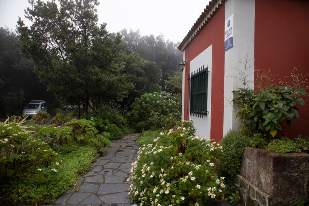
Casa Forestal - today Policía Local
Section Gollada Abicore to El Bailadero
You walk down the concrete path a little. When it makes a sharp right turn, you go straight ahead on the hiking trail. Now you are on the east side of Anaga Height and walk along the slope below the road. During our hike it had cleared up and we could enjoy wonderful views under the clouds to Santa Cruz de Tenerife and the Atlantic coast. You walk past a large cave. Then further over terraced fields on small dirt roads and past lonely farms. When you come back into the forest, you will be back on the road in a short time after a small climb.
View to the east side of the island with Santa Cruz de Tenerife
You cross the road and after a short time, walking along the road, you will come to a fork on the left. This small trail shortens the path a little high above the road. Shortly before El Bailadero it leads you back onto the road. You walk along the road and past the Mirador Bailadero. There, from a height of 680 metres, you can enjoy a fantastic view of the western Anaga side over the valleys and mountain ranges around Taganana to the coast. You go on and reach El Bailadero. If you have hiked enough here, you can get on the bus. For the big hiking tour the descent begins now.
Hiking trail along the Anaga Hight Road
Route section El Bailadero to lonely farmsteads
After the last house of El Bailadero, the TF-4 trail, marked in white and yellow, branches off to the left. You are now in the cloud forest and hike down steep serpentines on the mountainside. From time to time you can also see Taganana and the access road deep below you through the trees. Then you step out of the forest and can enjoy the views into the depths and onto the rock Peña Friolera. Continue along the ridge path parallel to the road until you finally reach the TF-134. On the other side of the road, you can now take a shortcut to get off the PR TF-4 immediately after Taganana.
Road crossing on the way back high above Taganana - hiking way down to the coast on the right hand side
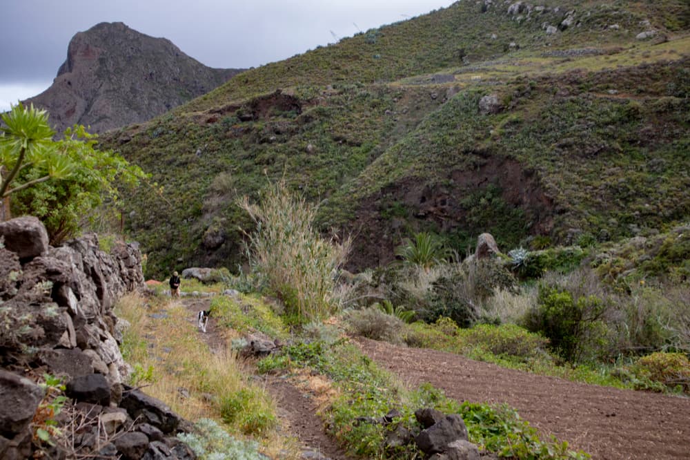
The big circuit, however, takes you further along the road to the Mirador Amogoje. At the next sharp bend to the left of the road, the path in front of and under the large rock (Roques de Enmedio and behind it Roques de las Ánimas) on the right-hand side leads you downhill. The hiking trail PR TF-4.1 is now signposted, which is again marked in white and yellow. At the first small turn-off, keep to the right and go downhill over the large ridge in front of you. Further down the path forks and you turn right. At lonely farmsteads you will come back to a slope after a steep descent.
Hiking road - way to Almáciga
Section of the route lonely farmsteads to Taganana
You follow the slope to the left. It goes straight downhill between fields and reeds. In the distance you will see further lonely farmsteads. After about half an hour you reach Almáciga. Just before you reach the village, you can leave the road again and take a shortcut along a large serpentine road on a hiking trail that leaves the road to the left. Then you are really at the Atlantic Ocean in the hamlet Roque de las Bodegas on the Carretera Almáciga. Here you can go to the beach or to one of the small restaurants. If you have had enough of hiking, you can also get on and off the bus here.
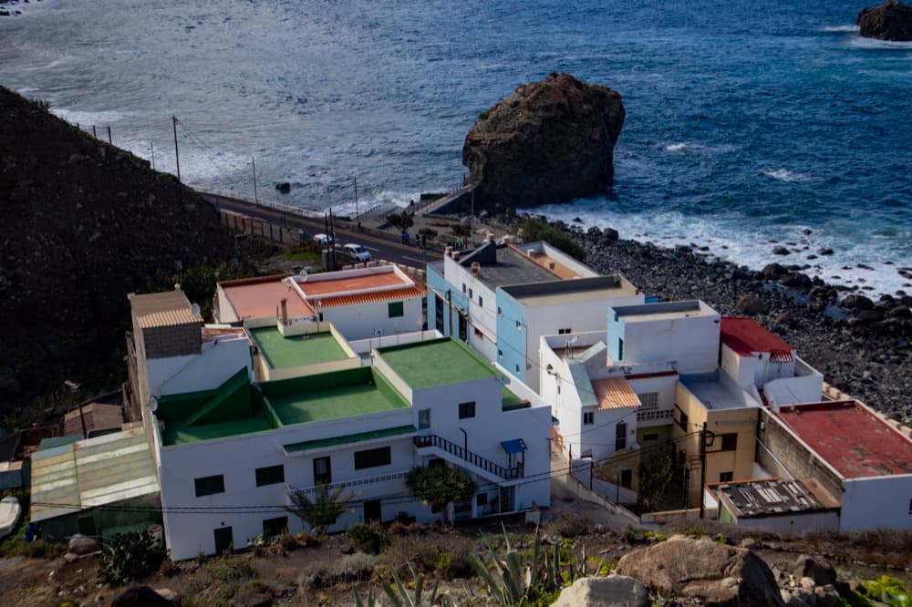
the hamlet Almáciga with many small fish restaurants and the Roque de Bodega
At the end of the big round trip you hike back to Taganana along the road with a view of the mountains and the Atlantic Ocean next to you. You cannot miss the path. You always walk along the road and slightly uphill. Now it depends on where you left your car or if you want to go to the bus stop or back to the centre of the village to eat fish. You will find every path easily.
and again at the sea at the coastal road
And finally
I hope you enjoyed this rather large round of hiking around Taganana. If you read carefully, you can walk it in many variations and in different sizes and lengths. My dear walking dog and Lasko, who is 12 years old by now, has still mastered this big trail with us in February 2020. For this and for his company on hundreds of kilometers of hiking I would like to thank him very much. Since we are unfortunately still not allowed to hike on Tenerife at the moment (as of 22 May 2020) due to the state of alarm, Lasko can rest a little at the moment.
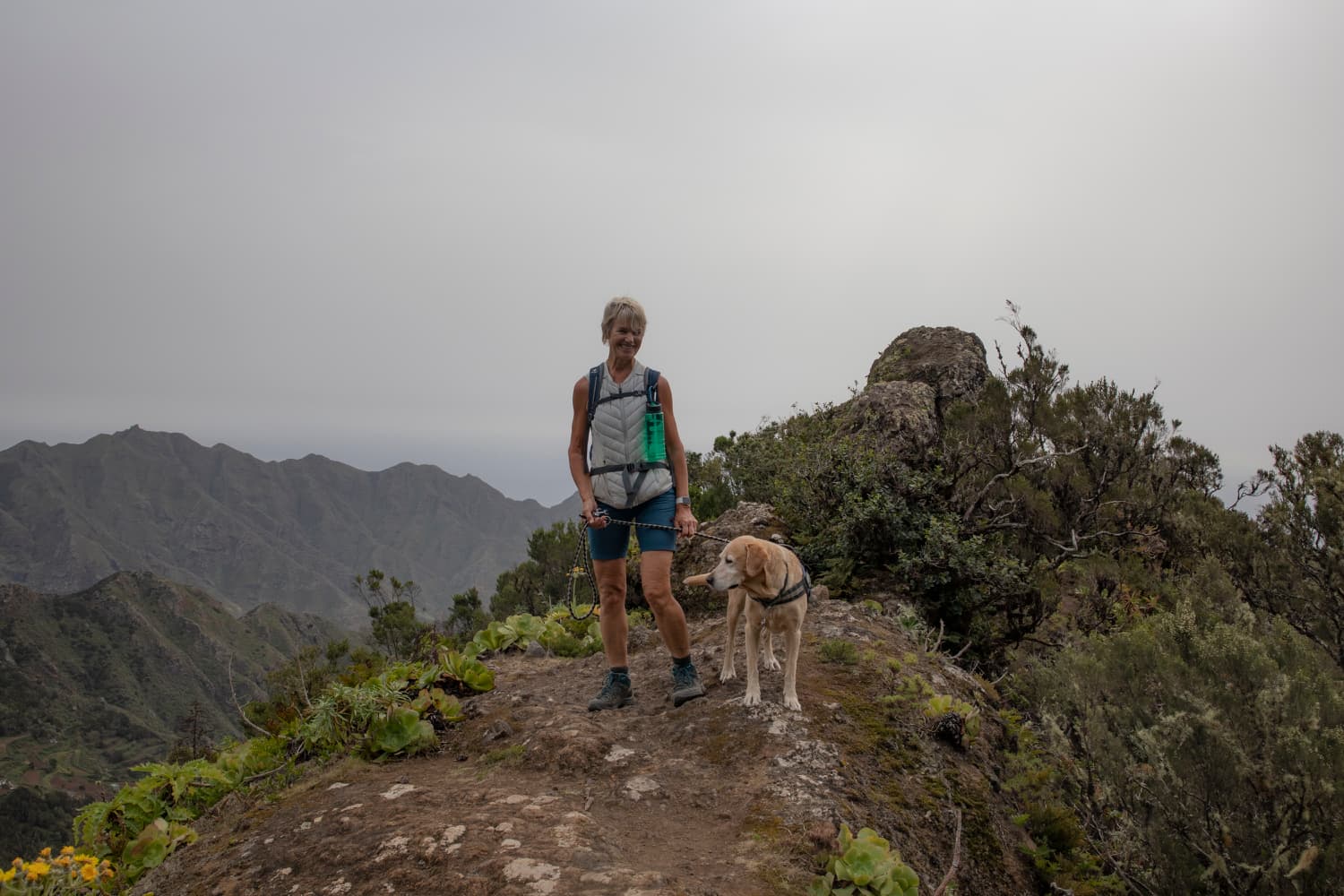
also Lasko with his 12 years of age can still go hiking
I wish you and me that we can go out into the beautiful nature of this island again soon. Whichever way you choose, I wish you good walks,
Dagmar of SiebenInseln