On the Talavera circular hike, in addition to beautiful views and impressive nature, you will also pass through old hamlets. Firstly, after a strenuous climb up a mountain ridge, you will reach the small ruined hamlet of Talavera. Today you can visit the ruins and the nearby springs, which were once vital for the inhabitants. A threshing floor and overgrown terraced fields can still be seen. The hamlet owes its name to a Spanish conquistador from the 15th century. Pedro de Talavera once owned the land around this small, remote village.
According to the municipality of Los Silos, only 2 houses in Talavera were inhabited at the time. The remaining buildings were used as stables and farm buildings. The terraced fields around Talavera were mainly used to grow potatoes, beans and flax. A hard life, considering that the nearest villages were Los Silos and El Palmar, which can only be reached via very steep ascents and descents.
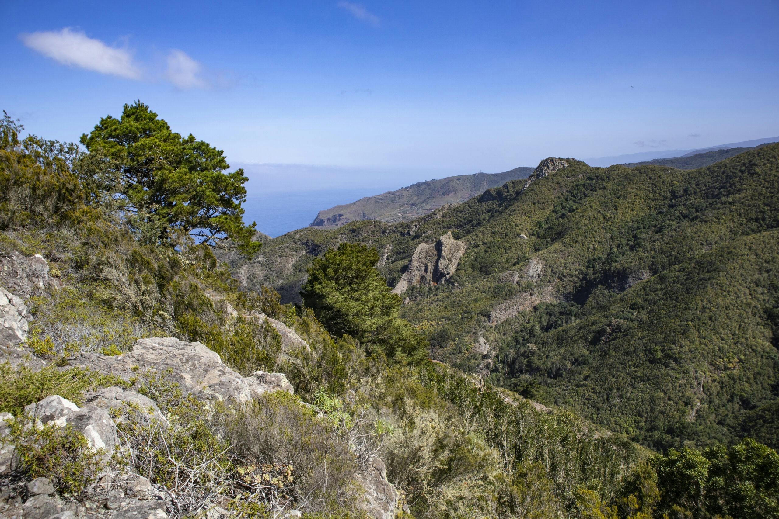
View of Las Moradas and the north coast near Los Silos
Las Moradas – another hamlet on the Talavera circular hike
Your hike first takes you steeply uphill from Los Silos via Talavera to a ridge high above El Palmar. The route then takes you in a wide arc towards Monte del Agua. Finally, the hiking trail leads you high above the Barranco de Los Chochinos back down towards Los Silos. You will pass the old farmsteads of Las Moradas along the way. Like Talavera, Las Moradas is now considered a prime example of traditional Canarian architecture.
On the way, you will pass Las Moradas Arriba (above) and Las Moradas de Bajo (below). You can still recognise the houses, barns and storehouses of both farms. There is also a kiln for firing roof tiles. There are terraced fields all around the farmsteads. They show that the entire area was once used for agriculture and livestock farming.
Track of the Talavera hike (red)
General information about the hike
Starting point and approach
You start your hike in Los Silos at the TF-42 junction Camino la Cruzada.
Arrival by car
From the north, take the TF-42 coastal road to Los Silos. And from the south, you can take the TF-1 motorway to Santiago del Teide. From there, continue towards El Tanque on the TF-82 motorway. After El Tanque, turn left onto the TF-421, which will take you down to the TF-42 coastal road. From there, turn left to Los Silos. Parking is available from time to time in the large square near the church and otherwise along the TF-42.
Arrival by bus
The Titsa 363 bus line stops in Los Silos. You can find more information about the bus connections on the Titsa homepage.
Time
Article summary and large selection of GPS hiking tracks
Sign up for my newsletter now and get exclusive access to my collected GPS tracks as well as all the brief information about my articles.
I don’t like to give general times for hiking tours, as the times are very individual. It took us 4.5 hours to complete the long Talavera circular walk, including a long rest and visits to the hamlets of Talavera and Las Moradas.
Elevation profile of the Talavera hike
Height difference and route length
The difference in altitude on the long circular tour is around 900 metres. The route is just under 14 kilometres long.
Requirements
You walk the entire time on well signposted and marked hiking trails. However, you should be in good physical condition due to the length and the metres in altitude.
Refreshments
During the entire tour, there are only refreshment stops at the starting point of Los Silos.
Variant blue, yellow, red from El Palmar to Talavera (top right in the picture)
Variants
The return route to Los Silos on this hike is partly identical to the descent route of the Cuevas Negras hike, meaning that the two hikes are linked. The Barranco de Los Cochinos hike also starts in Los Silos. You hike back via this barranco on this tour.
View from the height down to El Palmar
If the entire circular tour is too long for you, there is also the option of taking a signposted hiking trail from El Palmar to Talavera. This hike is then just under 8 kilometres long and you only have around 300 metres of ascent to contend with.
Hiking trails TF 52.1 and TF-55 cross high above El Palmar
Another alternative in the area is an approx. 12-kilometre hike over 500 metres in altitude, which also starts in El Palmar and initially takes you over the ridge towards Talavera. But then you descend again via Las Lagunetas. This variant is marked in yellow. However, if you make the detour to Talavera on this variant, you have even more kilometres to cover than on the basic variant.
Hikers on the ascent path behind the El Palmar junction to the summit path
Talavera Circular Hike
Los Silos to Talavera section
You start the long circular hike at the TF-42 in Los Silos. From there, you hike along the Camino la Cruzada towards the Teno mountains. For a while, the path leads past fields and houses. But then the signposted hiking trail to Talavera PR-TF 55 branches off to the right uphill. Now comes the hardest part of the hike. A steep serpentine path leads uphill.
Hikers on the ascent path to Talavera
Article summary and large selection of GPS hiking tracks
Sign up for my newsletter now and get exclusive access to my collected GPS tracks as well as all the brief information about my articles.
After a while you will pass a pumping station, a water house and then another building, which you can already see from Los Silos high up on the hillside. After the station, the path turns left and continues quite steeply up the mountainside. You gain metres in altitude and can already enjoy wonderful views of the Atlantic and the coast around Los Silos from the ascent path. And after a few more climbs, you finally reach Talavera via the Lomo de los Cardones.
Hiking trail past a water pumping station and buildings in the background, which you can already see from a distance on the slope
Talavera section to the El Palmar junction
You can take a leisurely look at the deserted hamlet of Talavera with its surrounding terraced fields. The ascent then continues along the ridge. You walk through areas covered with tall bushes and pine trees. On your right is the Barranco Tostado. Then continue uphill to the left on a ridge in front of the Montaña Talavera.
Talavera - abandoned houses along the way
Finally, before a high peak, the path slopes downhill through the forest. You come to a fork in the path. The PR TF-55 branches off to the right and takes you down to El Palmar in 2 kilometres (see variants). But for the full loop, continue straight ahead on the PR TF-52.1 towards Monte del Agua.
Hiker on the ridge high above El Palmar
Route section El Palmar junction to hiking trail PR-TF 52
After the junction, the trail climbs again for quite a while. A steep ascent awaits you at the beginning. But then the route becomes more moderate along the ridge path high above El Palmar. From up here you can enjoy marvellous views all the way to the coast – if you are not walking in clouds. Finally, you reach the Carretera Monte del Agua forest path, which you follow to the left. The path now climbs only moderately in wide, winding hairpin bends.
Hiking trail between high rocks
You follow this path for a very long time. Eventually the path forks and you continue along the path to the left to Monte del Agua. Then the signposted hiking trail to Las Moradas and Los Silos branches off to the left of the path. Walk down a small path through the forest and after a while you will reach the signposted PR TF-52 hiking trail to Los Silos. As a former trade route, parts of the path are still very well paved with stones; a very well-maintained and pleasant hiking trail.
View from above back to the Atlantic Ocean and the north coast of Tenerife
Section of hiking trail PR-TF 52 to Los Silos
With beautiful views of the coast and the Barranco de Los Cochinos on the right, you walk leisurely down towards Los Silos. After a while, you will pass the hamlet of Las Moradas Arriba and shortly afterwards the hamlet of Las Moradas Bajo. A short detour to explore is always worthwhile. I have already written more information at the beginning of this article. Not far from Las Moradas you will also find an old stone channel.
Hiker at Las Moradas
When you have seen enough, continue down the hiking trail towards Los Silos. The hiking trail finally ends in the Barranco de Bucarón. The hiking trail turns into a path that takes you past houses and fields and onto Calle Susana. Follow this to the left for a short while and you will return to the main road TF- 42 and thus to the starting point of your hike.
Hikers on the descent to Los Silos above the Barranco de los Cochinos
And finally
I hope you enjoyed this long round trip to Talavera and back via Las Moradas. I think it’s nice that you can really do this hiking tour in so many different ways. Whichever tour you choose, I hope you enjoy your hike,
Dagmar from SiebenInseln
Thank you for reading!
If you've found my hiking guides on SiebenInseln helpful for your Canary Islands adventures, please consider leaving a small tip. Your support is greatly appreciated and helps cover the costs of maintaining this blog.
Thank you for your support!
SSL secured
Comments
Volodymyr - 11/12/23, 06:46 PM
That climb from Los Silos to Talavera was real „heart attack“. ~600m altitude in 3km. The rest of the path you will be relaxing comparing to the first part. Did in 3h 27min (time in movement 3h10min). Thanks for the track.