Anaga round with view
Today’s circular hike in the Anaga mountains on Tenerife is really a pure pleasure tour. At the beginning of the hike there are some meters of altitude to overcome. But otherwise it goes in the outermost tip of the Anaga mountains quite comfortably along the height.
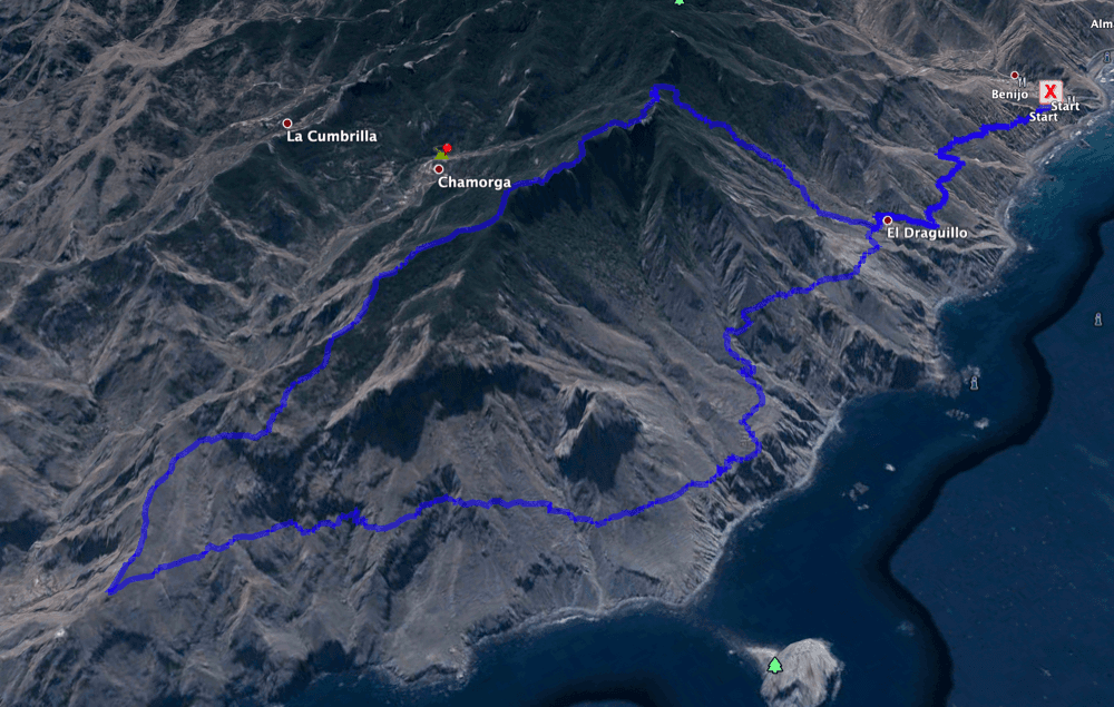
Map
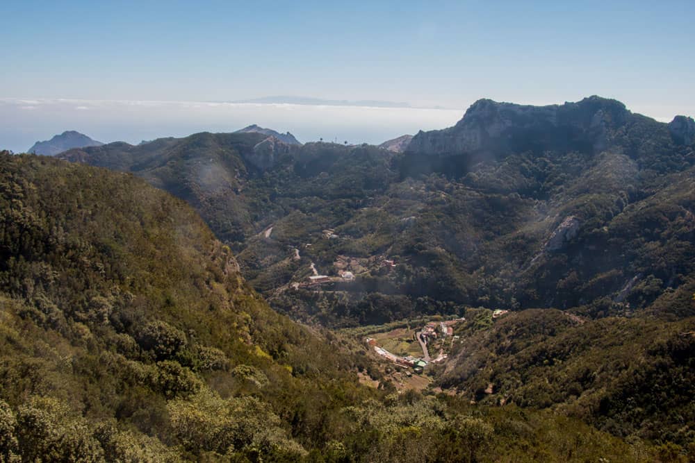
View from the hight direction El Draguillo
The hike leads through impressive nature. You see the cloud forest, laurel trees and huge ferns. And during the whole tour you can enjoy wonderful views of the steep coast of Anaga up to the neighbouring island Gran Canaria.
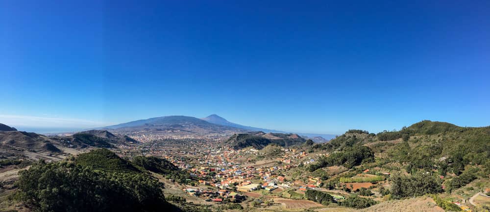
Anaga: view from the mirador to La Laguna and Teide
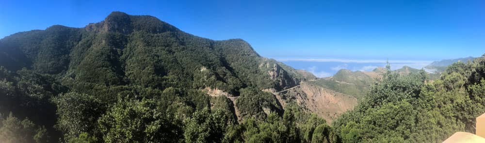
The Anaga Mountains – deep gorges and cloud forest
Of the three mountain areas on Tenerife, the Anaga Mountains are the geologically oldest part of the island. Its peaks are not as high as those of the Teno Mountains. And they do not reach the peaks of the Teide region. At the main ridge, the mountain range of the Anaga only reaches 1000 height meters. But as there are many deeply incised Barrancos, sharp ridges and steep cliffs in the Anaga, the often rugged rocks and mountain ranges impress in a very special way.
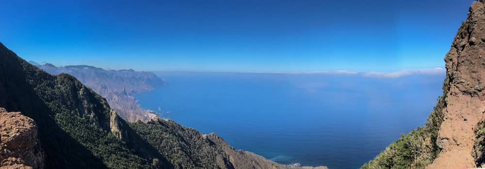
Panorama view Anaga
Apart from Bajamar and Punta del Hidalgo, there are no tourist places in the Anaga region. An El Dorado for hikers. Accordingly, the Anaga region offers countless possibilities for hiking. Many villages are connected by old roads (today hiking trails). In the Mercedes forest and in the other forests of Anaga there are countless endemic plants to admire while hiking.
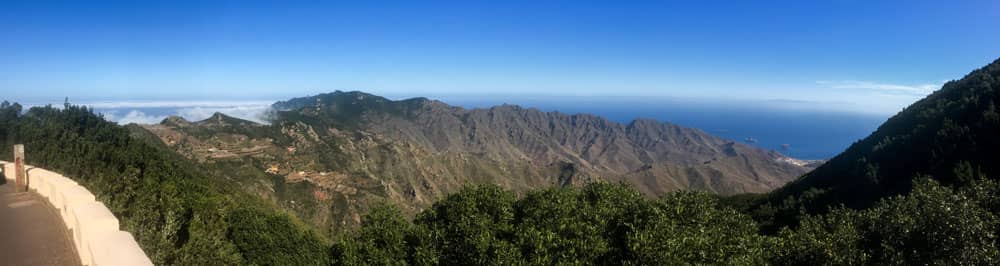
Panorama Anaga with view on the main ridge
Attention – Hiking in Anaga – be sure to note
Those who want to hike in the Anaga mountains should note, however, that they need a permit for some hiking trails. And this permit must be applied for at the Environmental Authority Area de Medio Ambiente y Paisaje, Pabellón Insular Santiago Martín, Los Majuelos C./Las Macetas, s/n, 38108 La Laguna, Tel. +34 922239062, Central de Reservas. This is justified on the grounds of visitor regulation and nature conservation. 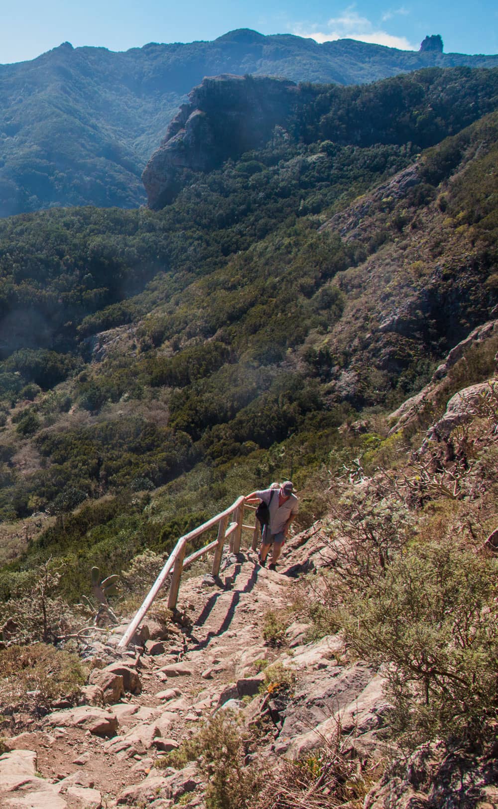
Hiking path above the village of Chamorga
And this applies for example to the hiking trail from El Bailadero to Ensillada or from Ensillada to Chinobre as well as from Llomo de Bodegas to the beach of Anosma.
The tours described in this article do not require special permission.
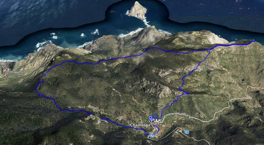
Track Anaga Chamorga circular
General information on the circular hike
Starting point and approach
Village square of Chamorga in the Anaga Mountains
Arrival by car
Chamorga is the „end point“ of the Anaga mountain road TF-123 and therefore not to be missed. Even if it is only about 32 kilometres to Chamorga from La Laguna on the Carretera de Bailadero, the trip can take some time. The road is very narrow in the second part and winds up and down the mountain ranges in many serpentines. Therefore you should plan a good hour from La Laguna. Parking is available in Chamorga at the roadside and on the village square in front of the Casa Alvaro bar.
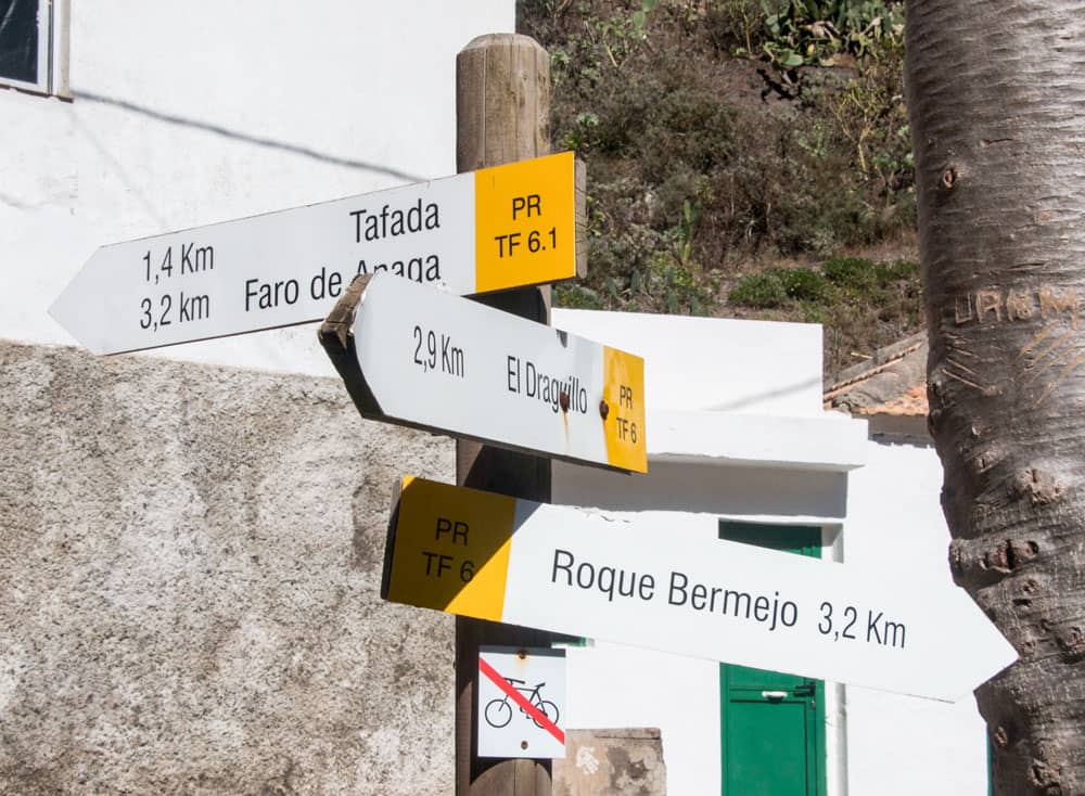
signposts in Chamorga
Article summary and large selection of GPS hiking tracks
Sign up for my newsletter now and get exclusive access to my collected GPS tracks as well as all the brief information about my articles.
Sign up nowArrival by bus
There is only one bus connection with the Titsa bus line 947 from Santa Cruz de Tenerife. From there the bus takes between 1 hour 15 minutes and 1 hour 40 minutes. You can find bus connections to Santa Cruz on the Titsa homepage. 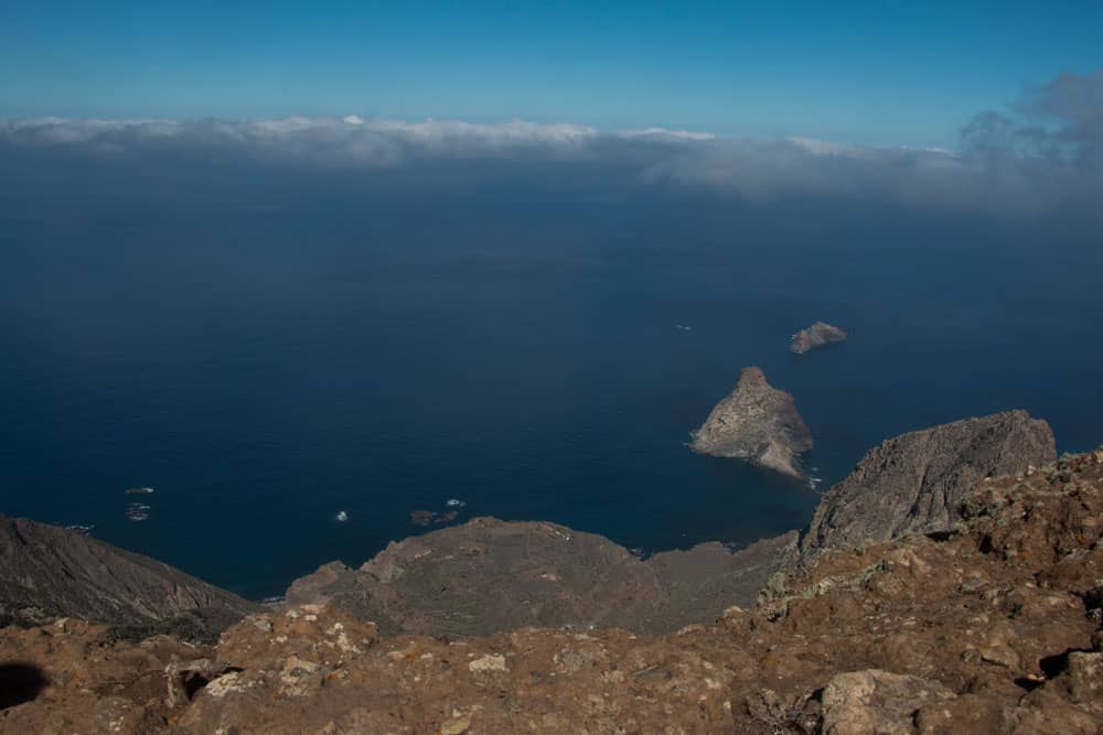
view on the Roques de Anaga
Time
I don’t like to give general time information for hiking tours, because the times are very individual. Hiking should bring relaxation and be fun. And also I need for each tour sometimes more and sometimes a little less time. During this tour I took a lot of time and also photographed a lot, so that I was about 2.5 hours on the way. If you want to run the course, you can certainly do it faster.

elevation profile of the circular Anaga Chamorga
Difference in altitude and distance
The difference in altitude is about 210 meters. Through hiking up and down, then about 330 altitude meters come together. The distance is not quite 6 kilometers long.
Requirement
An easy and for everyone with a bit of condition well to be mastered tour. Mostly you will hike on good paths. In some places above the mountain ridge and on the steep coast, a little surefootedness and a head for heights are required.
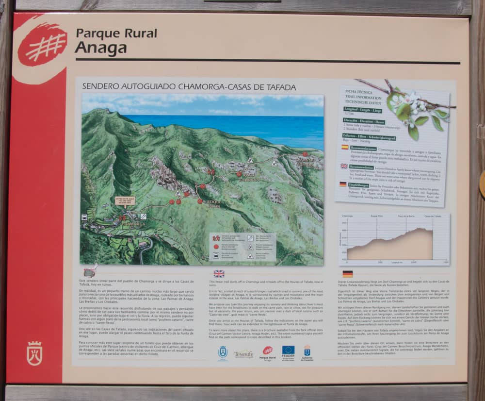
Hiking board at the wayside
Refreshment
There is only one small bar (Casa Alvaro) in Chamorga, although it is not said that it is always open. Therefore take enough water and food with you.
View over Chamorga with Gran Canaria in the background
Variants
This tour is really a small round trip to get to know the outermost tip of Anaga and to enjoy the wonderful views. But even if you want more, Chamorga is the right place for you. This tour can be perfectly combined with various other hiking and circular tours in the vicinity of Chamorga. I marked the variant paths orange in the track picture.
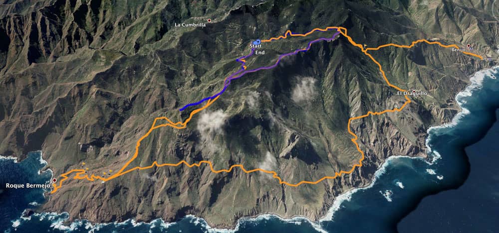
different tracks around Chamorga
Great Anaga Hike - Track - Variant 5
- 1.0
Once you have reached Montaña Tafada, you can descend to the Faro de Anaga lighthouse on the PR TF 6.1 trail. It takes about an hour each way. The lighthouse is at an altitude of 240 metres, so you have an extra 300 metres of ascent and descent.
2. If you want even more, you can turn left shortly before the lighthouse onto the PR TF 6 hiking trail and hike via Las Palmas to El Draguillo. From the lighthouse, which is at an altitude of 240 metres, you descend about 100 metres to Las Palmas and then continue up and down to the village of El Draguillo (170 metres). If you don’t want to go back then, you can climb up again and return to the circular route. However, you will then have to climb 658 metres in altitude to reach the pass.
3. Alternatively, you can do the same as 2. and then continue towards the coast to Benijo.
4. Another beautiful circular walk through the Chamorga Barranco via the small hamlet of Roque Bermejo and then to the Faro de Anaga lighthouse can be found here. Both circular walks can be easily combined. Article summary and large selection of GPS hiking tracks
Sign up for my newsletter now and get exclusive access to my collected GPS tracks as well as all the brief information about my articles.
Sign up now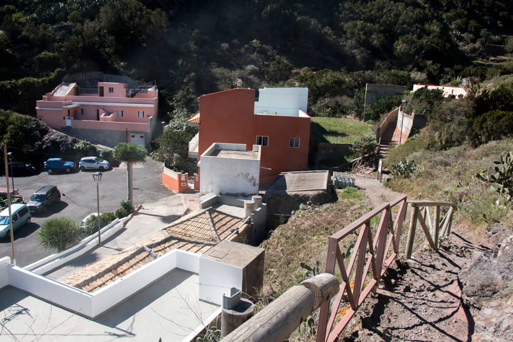
The little village of Chamorga at the end of the Anaga mountain road
Anaga – Hike from Chamorga to the Montaña Tafada
Section Chamorga to ascent path
When you have parked at the roadside or on the village square of Chamorga, go back the road a little towards the village outward. After a short time you will pass the small church of Chamorga. There the path starts on the right side of the road opposite. Take the PR TF 6 and follow the signs for El Draguillo and you will come to a small green high valley.
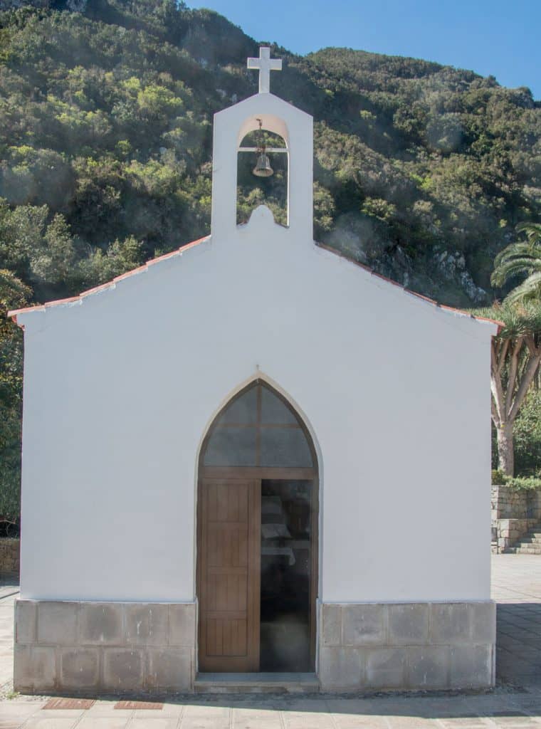
Chamorga chirch
In this high valley you climb slightly on a clearly visible hiking trail. Some paths, such as the PR TF 5 from La Cumbrilla, lead into the path. However, you stay on the main path and continue straight ahead. After some time you will reach a wooded area. You are in the laurel forest. The path becomes steeper and climbs first in hairpin bends on the left side of the valley.
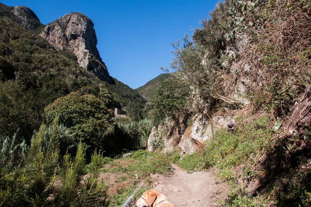
Hiking path PR TF 6 through the valley
Section of the ascent path – Roque Icoso
From the ascent, this section of the hike is also already the greatest effort. You cross the stream in the valley and then climb up on the right side of the valley. You are surrounded by laurel trees, heather and large ferns. After climbing from 480 to 658 metres from Chamorga, you reach a crossroads. To the left, the path for Cabezo del Tejo branches off. Straight ahead it goes steeply downhill towards El Draguillo. Thus, those who want to do a bigger hike with many metres of altitude can hike down here and then later hike up again to the Montaña Tafada.
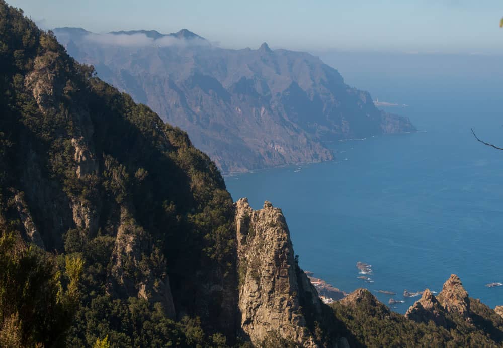
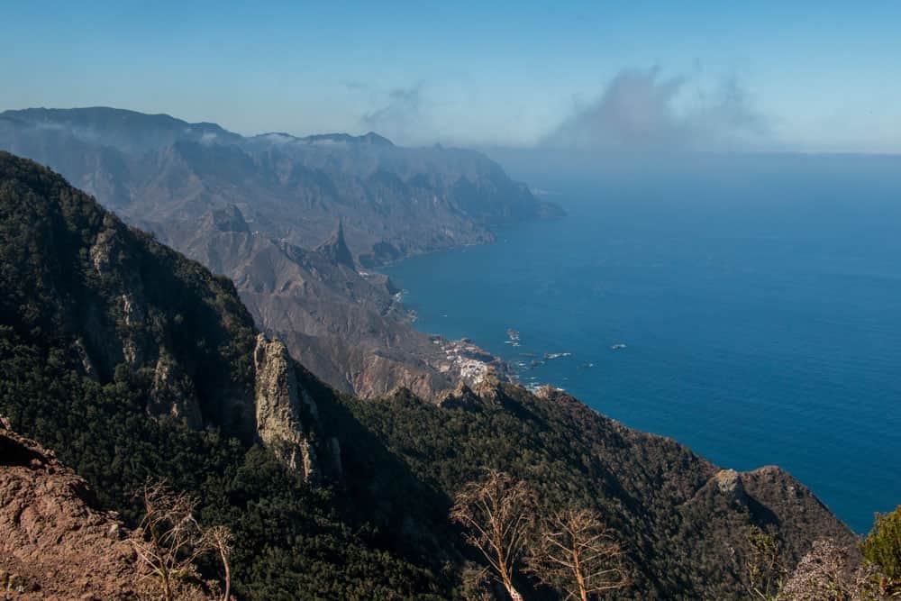
Fantastic views to the coast between El Draguillo and Almáciga
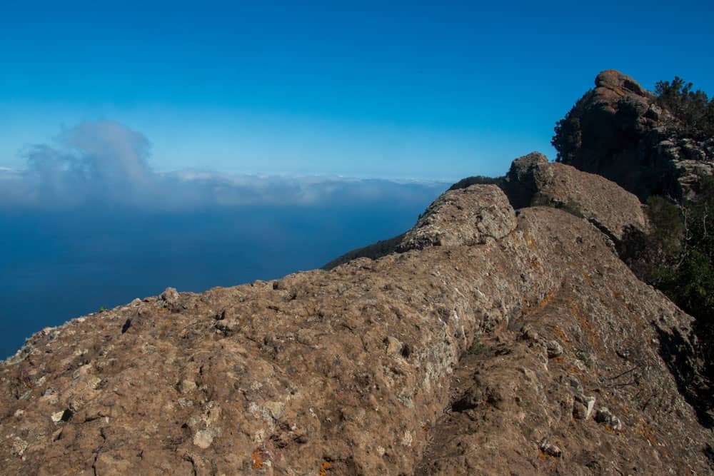
But the round tour continues to the right. From here, you are always on or at least close to the ridge until you reach the Montaña Tafada. Therefore great views are guaranteed. The path still climbs quite steeply. On the left side you can already see far over the Atlantic Ocean to offshore islands. From time to time the whole coast between El Draguillo and Almáciga is at your feet. Then you reach the highest point of the hike, the striking Roque Icoso rock at 692 metres above sea level. If you walk a few meters away from the path and look over the edge of the rocks, you can enjoy fascinating „deep views“. Below you are the bizarre gorges of Anaga and the small town of Las Palmas.
Section Roque Icoso – Montaña Tafada
Roque Icoso
In the easy up and down you now hike on at altitude. From time to time it goes through the laurel forest in hairpin bends. To your right you can see Chamorga lying deep down in the basin. After about half an hour you see a saddle with a ruin in front of you. Shortly before you reach the abandoned property, the hiking trail number PR TF 6.1 from Chamorga comes from the right on the slope. Here you can go back later.
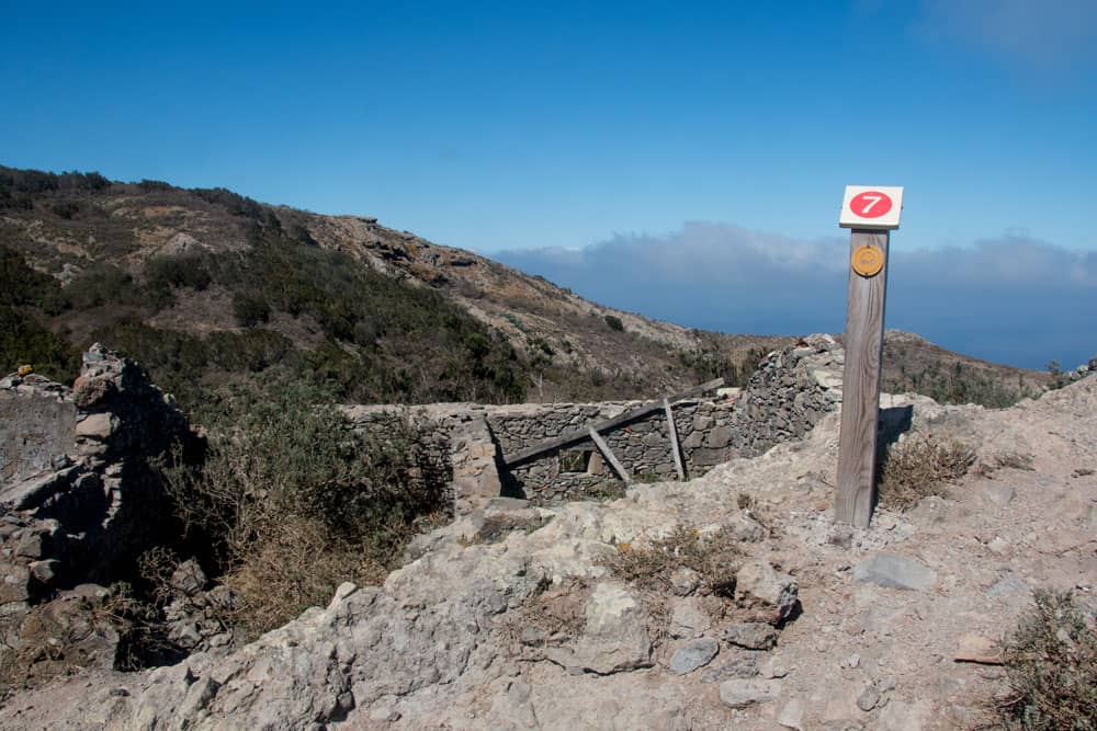
Way down to the Montaña Tafada with the ruined house
But first you pass the ruin house on the right. You will find an information board and continue straight ahead on the ridge. After a short time the PR TF 6.1. branches left down to the lighthouse. If you want to enlarge your round later, you can go down here and also back over the Barranco de Roque Bermejo (see variants). But first you go over rocks on the ridge to the Montaña Tafada (610 meters altitude).
Section Montaña Tafada – Chamorga
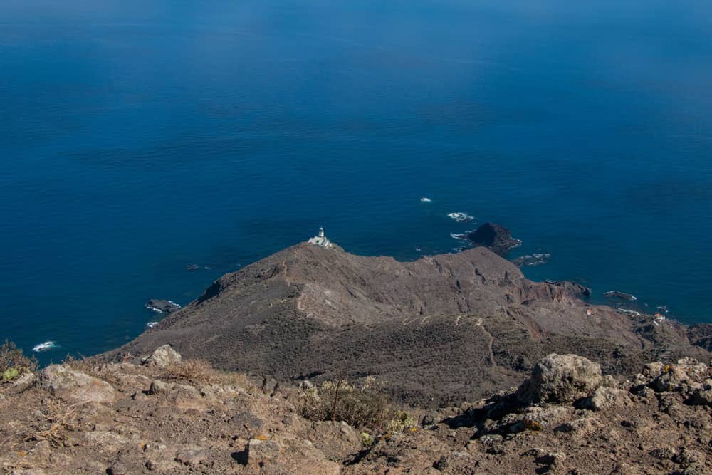
View from Montaña Tafada to the lighthouse Faro de Anaga
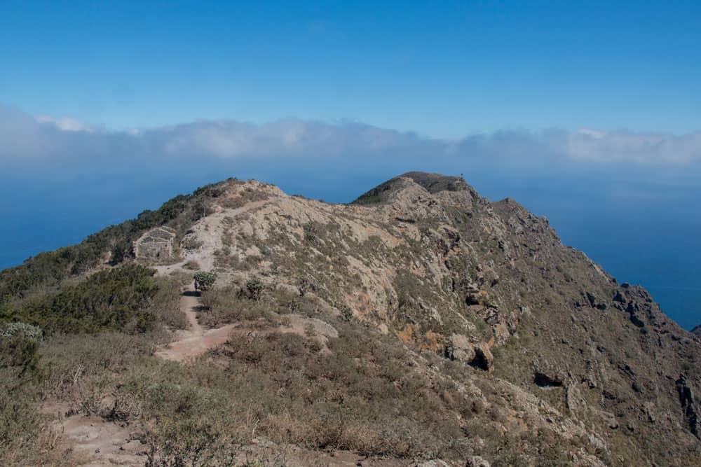
On the Montaña Tafada with its steep eastern side plunging into the sea you have fascinating views of the Atlantic Ocean and the surrounding rocks. Deep below you can see the Faro de Anaga (lighthouse), the Roque Bermejo and the Roques de Anaga. The small hamlet of Bermejo can only be reached by boat or footpath. Up here on the rock plateau it is also worth taking a rest. In strong sunshine, a single palm tree on the crest offers some shade.
Old house at the path to Montaña Tafada
If you like, you can now hike back down to the right to Faro and Roque Bermejo. The little round tour goes past the ruin house on the left up the slope. After a short time, take the PR TF 6.1 and turn left towards Chamorga. On the mountain slope, you return to Chamorga on a beautiful high-level trail in less than half an hour. Shortly before you reach Chamorga, it’s worth stopping on a saddle with a striking rocky outcrop. From here you have a great view of Chamorga, the Barranco de Roque Bermejo and the surrounding Anaga mountains.
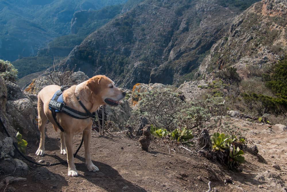
Hiking dog Lasko in Anaga
And finally
This little round tour is really worth seeing. But those who want to hike more should start with the variants. The round tour through the Barranco Chamorga to the hamlet Bermejo and to the lighthouse Faro de Anaga can be especially well combined with this tour. I hope that there is also the right hike for you. I wish you lots of fun hiking around Chamorga,
Dagmar von SiebenInseln